View on map
© MapLibre | OpenStreetMap contributors
1%
2%
4%
6%
8%
10%
12%
15%
20%

Pico Veleta / Alto de la Sierra Nevada from Cenes de la Vega via Pradollano

4.0
2 reviews | Elevation profile | 10 photos
This climb is partly on a gravel surface, but can be ridden with a road bike.
Tips nearby
Pico Veleta / Alto de la Sierra Nevada from Cenes de la Vega via Pradollano
Your achievable time
Calculating based on your best performances...
Relaxed
Maximum
W/kg
W/kg
W/kg
Analyse your climbing performance
Detailed insight into your climbing performance & automatically check off climbs
Based on your best performances.
Your best attempt:
Number of attempts:
Elevation profile Pico Veleta / Alto de la Sierra Nevada from Cenes de la Vega via Pradollano
paved
gravel

Statistics

Difficulty points 1810
Length 42.4 km
Average gradient 6.2%
Steepest 100 metres 11.6%
Total ascent 2636 m

Short recap

Famous climb
34 hairpin turns
Gravel
#70 toughest climb of World
#21 most elevation gain of World
#21 longest climb of Europe
#17 average steepest climb of Sierra Nevada
Feedback about this climb?
Show climbs nearby Export to GPS device

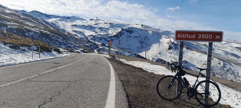
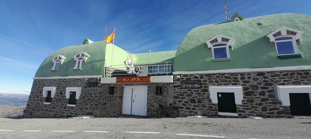
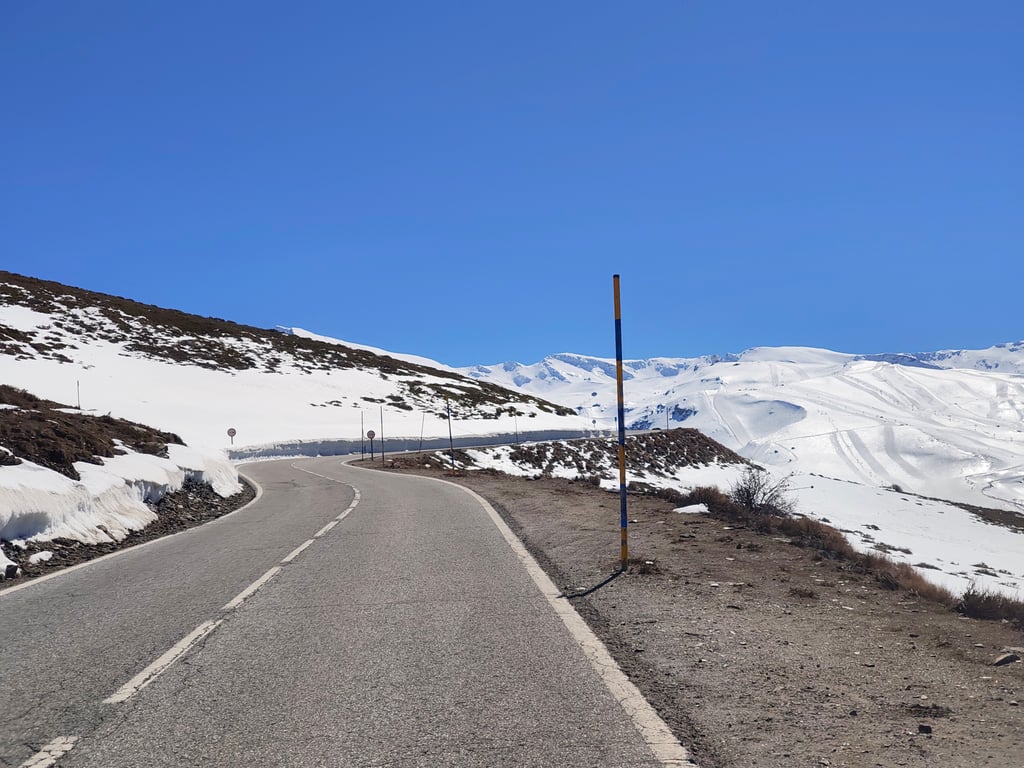
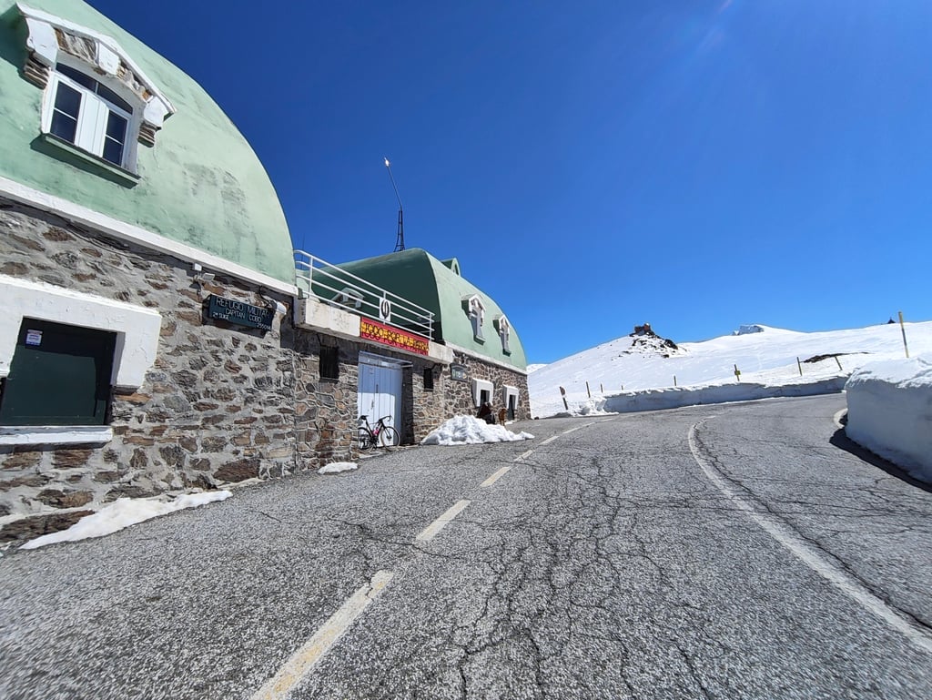
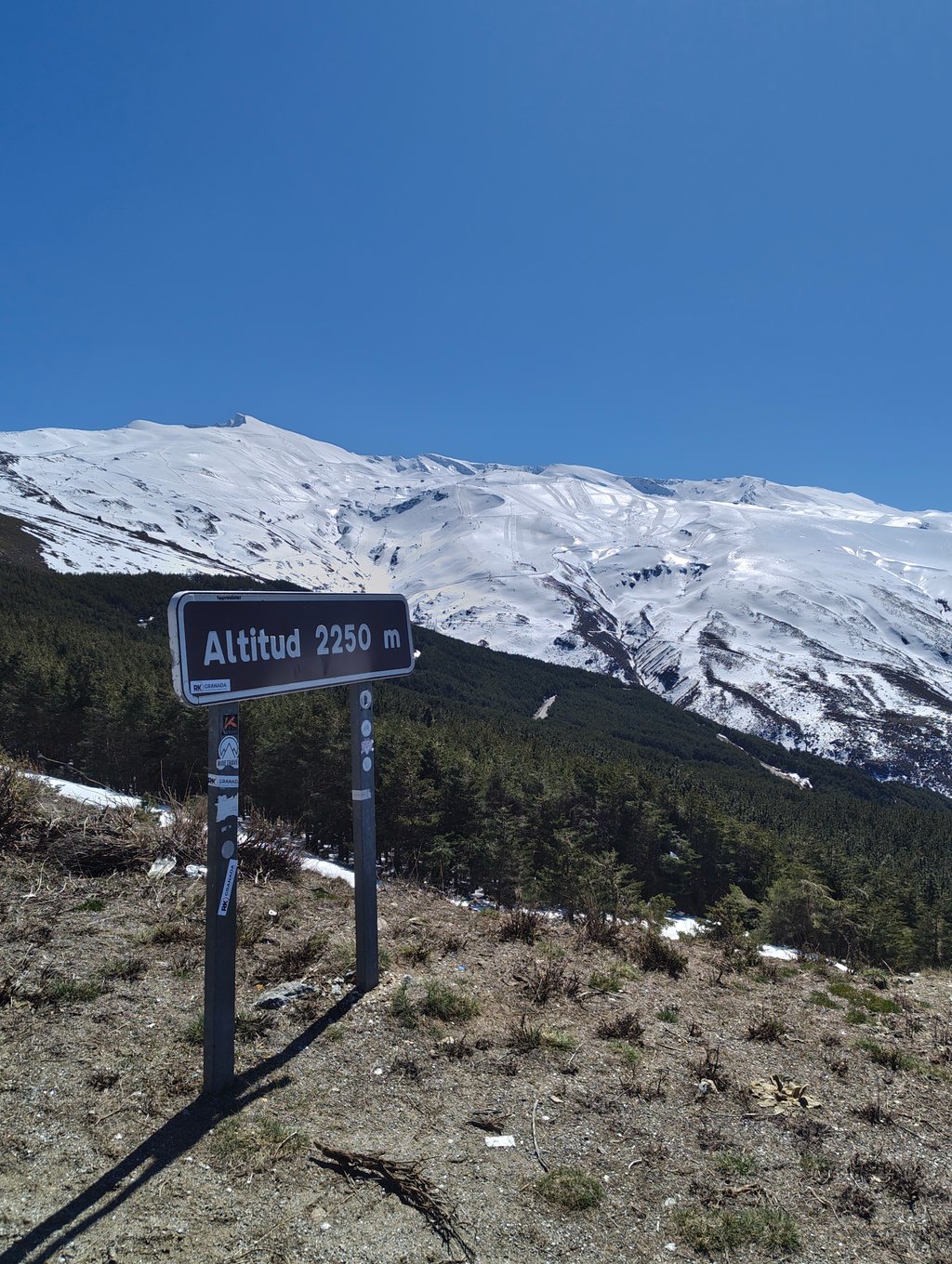
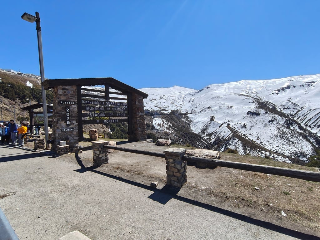
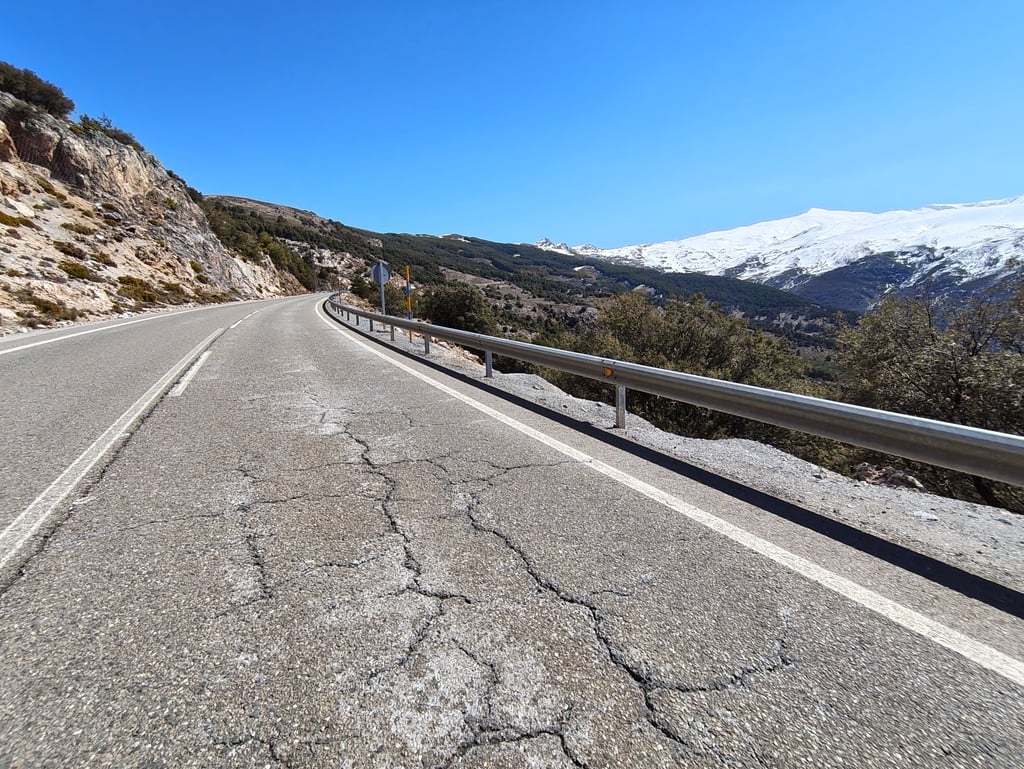
Pico Veleta / Alto de la Sierra Nevada from Cenes de la Vega via Pradollano is a climb in the region Sierra Nevada. It is 42.4 km long and bridges 2636 m of vertical ascent with an average gradient of 6.2%, resulting in a difficulty score of 1810. The top of the ascent is located at 3376 m above sea level. Climbfinder users shared 2 reviews of this climb and uploaded 10 photos.

Road names: Paseo Fuente de la Bicha, Carretera de Granada a Sierra Nevada, Carretera de Granada a Sierra Nevada & GR-420a

3.0 by aqcycling
This is an automatic translation, the original language is: Dutch.
Descended this side long ago after going up from Pampaneira - an alternative not mentioned here. The climb from Pampaneira is almost entirely unpaved and in poor condition, but I still managed to get a randonneur with 20kg of luggage up it. So it can be done, with some perseverance. The descent towards Granada is a tight asphalt track, nice and fast, but not spectacular. Worthwhile from a sporting point of view, but not otherwise scenic.... read more

Photos (10)

Pico Veleta / Alto de la Sierra Nevada from Cenes de la Vega via Pradollano
transparant thumb
transparant thumb

Your uploads (max 4)

Welcome! Please activate your account if you would like to share something. Look for the verification email in your inbox.

If you want to upload your photos, you need to create an account. It only takes 1 minute and it's completely free.

  • Receive free climbfinder goodies for your reviews & photos.
  • Create a bucket list and check off conquered climbs.
  • Add missing climbs.
Continue with GoogleContinue with Google Continue with FacebookContinue with Facebook Continue with AppleContinue with Apple Sign up with email
By signing up you agree to our terms of service and confirm that you have read our privacy & content policy.

Reviews (2)

5.0
4.0
3.0
2.0
1.0
aqcycling
1 y 3.0
This is an automatic translation, the original language is: Dutch. Show original

Descended this side long ago after going up from Pampaneira - an alternative not mentioned here. The climb from Pampaneira is almost entirely unpaved and in poor condition, but I still managed to get a randonneur with 20kg of luggage up it. So it can be done, with some perseverance. The descent towards Granada is a tight asphalt track, nice and fast, but not spectacular. Worthwhile from a sporting point of view, but not otherwise scenic.

Lang geleden aan deze kant afgedaald nadat ik vanuit Pampaneira naar boven was gegaan - een alternatief dat hier niet vermeld wordt. De klim van Pampaneira is bijna geheel onverhard en in slechte staat, maar ik kreeg er toch een randonneur met 20kg bagage omhoog. Het kan dus wel, met enige volharding. De afdaling richting Granada is een strakke asfaltbaan, lekker snel, maar niet spectaculair. Vanuit sportief oogpunt de moeite waard, maar landschappelijk verder niet.

Dashboard
joseafonso98
3 y 5.0

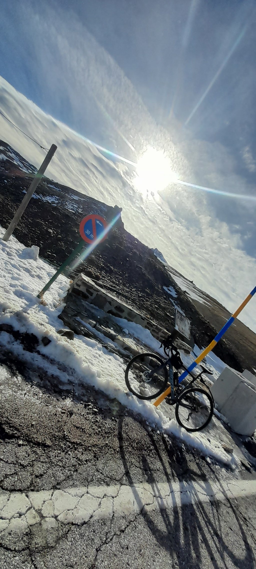
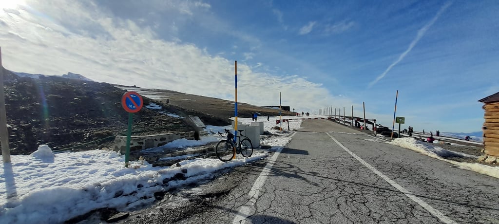
Climbed with the road bike until 3200m after that is better to have a gravel or mtb.
Amazing road surface until Hoya de la Mora, beautiful scenery.
It's easy to climb until Hoya de la Mora, after that it is punishing, with the slopes coming up and the bad road surface.
Definitely worth climbing.

Dashboard

Climbing times

7 km/h 06:03:50
11 km/h 03:51:32
15 km/h 02:49:47
19 km/h 02:14:02

Road surface condition

80% 20% 0%
Based on 5 votes
Share your knowledge. What was the road condition during your ascent?

Traffic

80% 0% 20%
Based on 5 votes
Your experience counts. How much traffic did you encounter during the climb?

Frequently Asked Questions

The Pico Veleta / Alto de la Sierra Nevada from Cenes de la Vega via Pradollano is extremely hard. We recommend that you choose the lightest possible gearing, such as a 34-tooth or smaller chainring, combined with a 34-tooth rear cog. Otherwise, there's a good chance you'll need to put a foot down sooner or later. If you think you need to go even lighter, you could consider using a gravel or mountain bike, or installing a gravel or mountain bike derailleur with a rear cog of more than 40 teeth. Good luck!

Pico Veleta / Alto de la Sierra Nevada from Cenes de la Vega via Pradollano falls into the Super Hors Catégorie, the absolute top category. These are the most extreme climbs that exist. Even with excellent fitness, there is a chance you will have to put a foot down. Only the strongest make it to the top without any problems.

Pico Veleta / Alto de la Sierra Nevada from Cenes de la Vega via Pradollano is 42.4 km long.

The average gradient of Pico Veleta / Alto de la Sierra Nevada from Cenes de la Vega via Pradollano is 6.2%.

Pico Veleta / Alto de la Sierra Nevada from Cenes de la Vega via Pradollano has a steepest segment with an average gradient of 11.6%.

The summit of Pico Veleta / Alto de la Sierra Nevada from Cenes de la Vega via Pradollano is at 3376 m.

At a slow pace of 7 km/h, it takes about 06:03:50 to climb Pico Veleta / Alto de la Sierra Nevada from Cenes de la Vega via Pradollano. At 11 km/h the time is 03:51:32, and at 15 km/h 02:49:47. For the fastest cyclists, 02:14:02 is an achievable time.

Pico Veleta / Alto de la Sierra Nevada from Cenes de la Vega via Pradollano is located in the region Andalusia in Spain.

This page is better in the app

Climbfinder app
Climbfinder
(Free)
Open