Tips nearby


| Beautiful scenery |
| Hidden gem |
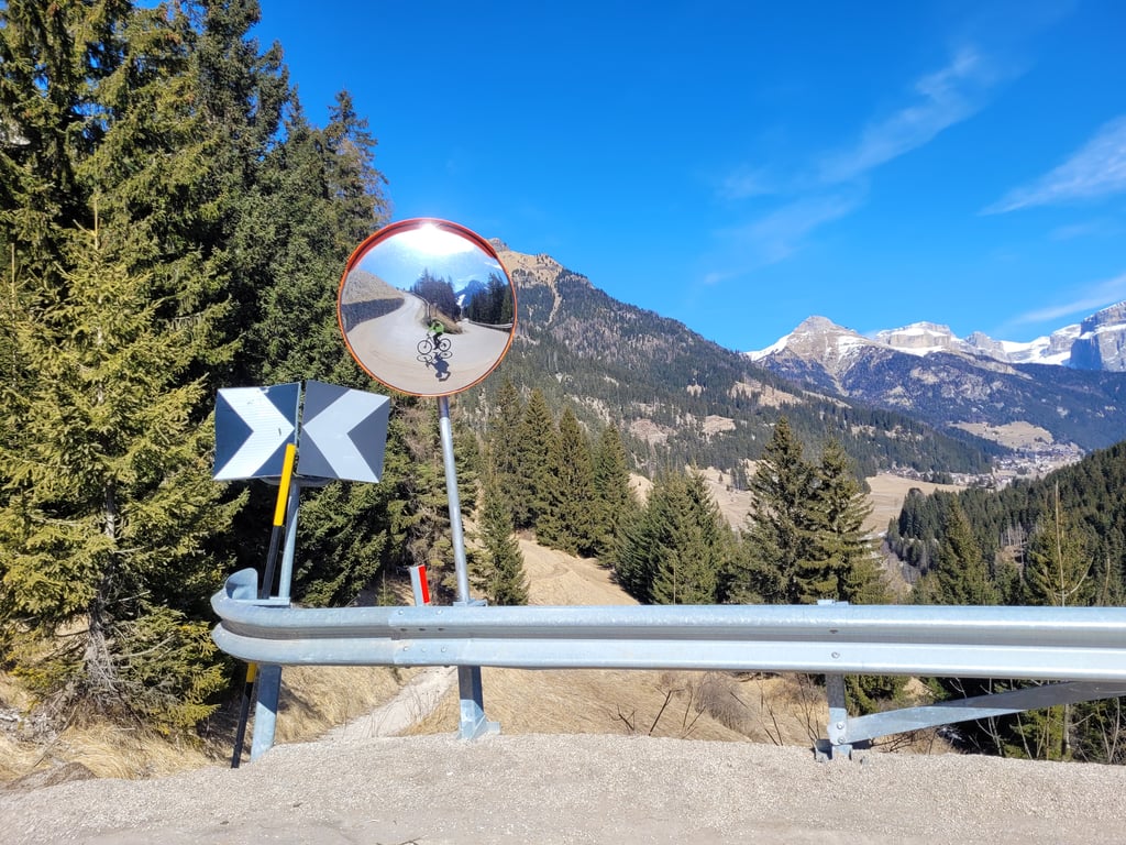
| 3 hairpin turns |
| #94 toughest climb of Trento |
| #85 most elevation gain of Dolomites |
| #97 average steepest climb of Trentino-South Tyrol |
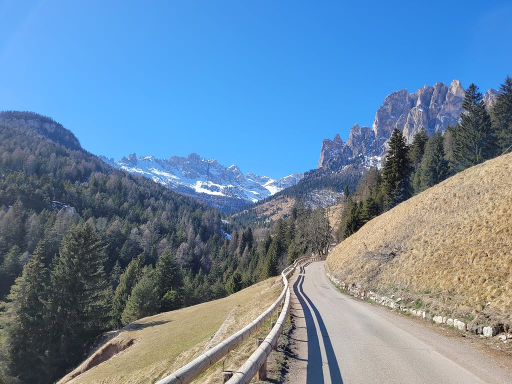
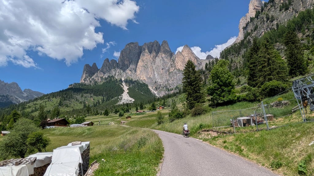
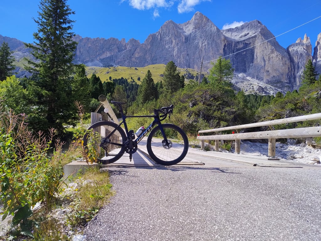
Gardeccia from Pera is a climb in the region Dolomites. It is 6.1 km long and bridges 610 m of vertical ascent with an average gradient of 10%, resulting in a difficulty score of 717. The top of the ascent is located at 1948 m above sea level. Climbfinder users shared 6 reviews of this climb and uploaded 23 photos.
Road names: Strada de Gardecia & SP238
5.0 by PaoloI decided to attempt this on my third cycling day in Val di Fassa. That morning I already went up the Passo Pordoi and Passo Sella, and intrigued by the Giro monument at the start of the road I decided to venture up. One of my mistakes was not to load the climb profile on my Garmin, so it was a challenge to pace myself by just relying on the road signs that mark the climb progress. This is one of the most brutal climbs I have attempted to date, and one that would have been better to try with ... read more
Welcome! Please activate your account if you would like to share something. Look for the verification email in your inbox.
If you want to upload your photos, you need to create an account. It only takes 1 minute and it's completely free.
A little gem that gradually reveals itself after a tough climb.
Un petit bijou qui se révèle petit a petit au prix d' une dure montée.
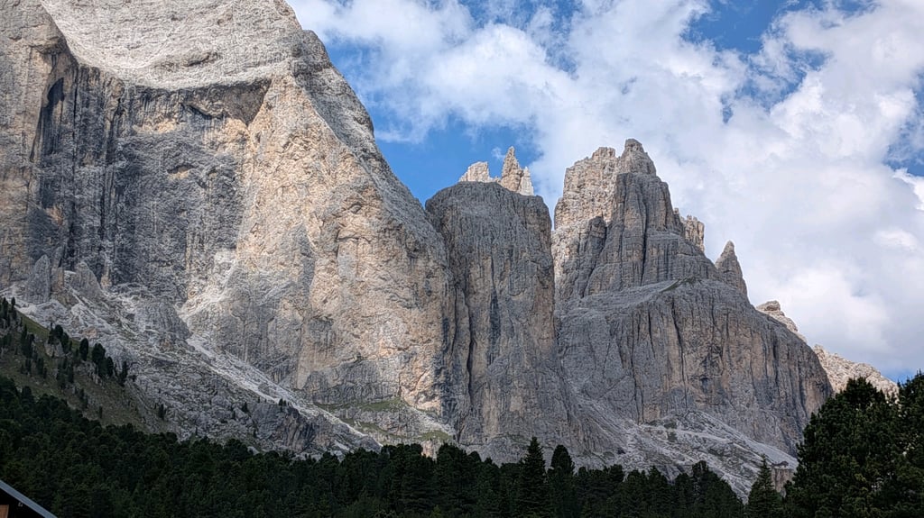
Splendid views, an irregular and varied profile. At the start there is a wall with two towers, in the village you can breathe a little, then there is a forest path. The finish is a very gratifying wall. You arrive under the torri del Vajolet. No cars on the final section
Panorami splendidi, profilo irregolare e divertente. All'inizio è un muro con due tornanti, al villaggio si respira un po', poi diventa un sentiero nella foresta. Il finale è un muro, molto gratificante. Si arriva sotto le torri del Vajolet. Nessuna auto sulla parte finale
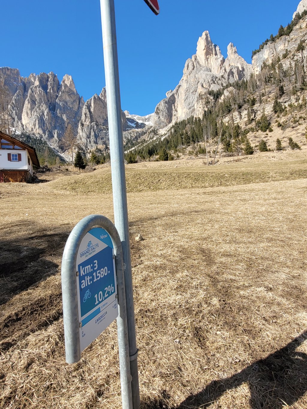
Epic climb with beautiful views. After an initial steep stretch, the click softens a bit and you can enjoy the views. Once in the forest, the climbing percentages rise considerably again and so it is a struggle. Fortunately, there are posts every kilometre that also indicate how far you are from the summit at the Rifugio. Beware: in mid-March there is still snow on the last kilometres; the road os not free of snow until mid-April.
Epische klim met prachtige uitzichten. Na een eerste steile stuk zwakt de klik wat af en kun je van het uitzicht genieten. Eenmaal in het bos stijgen de klimpercentages weer aanzienlijk en worst het dus buffelen. Gelukkig staan er elke kilometer wel paaltjes die ook aangeven hoever je nog van de top bij de Rifugio verwijderd bent. Pas op: half maart ligt er nog sneeuw op de laatste kilometers; de weg os pas sneeuwvrij vanaf half april.
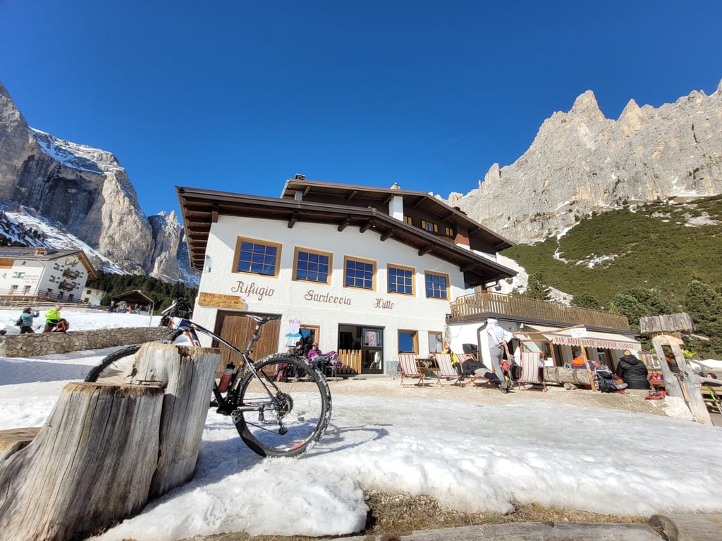
Rifugio Gardeccia taken during my Sella Ronda in 2020. The profile of the climb (which you can find at the start of the climb) basically says it all. In a blazing sun, with little or no shade, it was raking to the last metre. The closing kilometres in particular stuck with me. These seemed endless. Nevertheless, enjoyed the spectacular views immensely. At the summit you will find a nice 'rifugio', where it is swarming with hikers.
Rifugio Gardeccia meegenomen tijdens mijn Sella Ronda in 2020. Het profiel van de klim (wat je kan vinden bij aanvang van de klim) zegt in feite alles. In een brandende zon, met weinig of geen schaduw was het harken tot de laatste meter. Vooral de slotkilometers zijn me bijgebleven. Deze leken eindeloos. Desondanks enorm genoten van de spectaculaire uitzichten. Op de top vind je een leuke 'rifugio', waar het zwermt van wandelaars.
I decided to attempt this on my third cycling day in Val di Fassa. That morning I already went up the Passo Pordoi and Passo Sella, and intrigued by the Giro monument at the start of the road I decided to venture up. One of my mistakes was not to load the climb profile on my Garmin, so it was a challenge to pace myself by just relying on the road signs that mark the climb progress.
This is one of the most brutal climbs I have attempted to date, and one that would have been better to try with fresher legs to begin with! Anyway, slowly but surely I trudged on the road, in company of many hikers headed for the Rifugio.
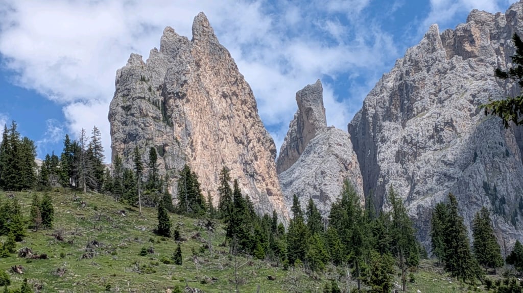
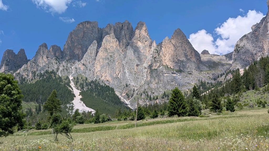
The climb is spectacular, you are heading into a secluded valley with the Catinaccio and Torri del Vajolet towering over you as you climb. In the last two kilometers I was pushing hard, and at some point I stopped a few seconds to regain my breath, then as I restarted I found out that I had paused just 400m before the end of the climb! haha!
The panorama and landscapes itself are well worth a visit!
The fact that in the Giro of 2011 on the final climb to Gardeccia the follow cars did not go up says it all !
If you come from Canazei the climb (signpost Gardeccia) starts on the roundabout, with Giro monument, of the main road just before the village of Pera di Fassa. The first kilometers you will be treated to a wall of +12% average via 2 hairpin bends to climb out of the Fassa valley. Passing through the village of Muncion is a flat relief for a while and then, without traffic, on a narrow road with good tarmac, you climb continuously above 10% the side valley, following the river, with the impressive Catinaccio massif on the right side.
The last steep kilometre of +14% made me squeeze completely between my frame despite the cheers for Contador and Nibali on the tarmac.
The road ends at a nice big mountain hut (food & drinks) which is a base for mountain hikers.
After Muncion no motorized traffic allowed except for the taxi shuttles that bring hikers up and down from the valley.
Beastly Giro final climb, short and sweet!!!!
Het feit dat in de Giro van 2011 op de slotklim naar Gardeccia de volgwagens niet mee naar boven reden zegt al veel !
Als je komt vanuit Canazei start de klim (wegwijzer Gardeccia) op het rondpunt, met Giro monument, van de grote rijksweg net voor het dorpje Pera di Fassa. Eerste kilometers word je direct via 2 haarspeldbochten getrakteerd op een muur van gemiddeld +12% om het Fassa dal uit te klimmen. Doortocht door dorpje Muncion is even een vlakke verademing om nadien zonder verkeer op een smalle weg met prima asfalt continu boven de 10% het zijdal, de rivier volgend, op te klimmen met het indrukwekkende Catinaccio massief aan rechter zijde.
De laatste steile kilometer van +14% deed mij volledig tussen mijn fietsframe plooien de aanmoedigingen voor Contador en Nibali op het asfalt ten spijt.
Weg loopt dood aan mooie grote berghut (eten & drinken) die uitvalbasis is voor bergwandelaars.
Na Muncion is er geen gemotoriseerd verkeer toegelaten op uitzondering van de taxi-pendelbusjes die wandelaars vanuit het dal op en af brengen.
Beestige Giro slotklim, kort en krachtig!!!!
| 7 km/h | 00:52:02 |
| 11 km/h | 00:33:07 |
| 15 km/h | 00:24:17 |
| 19 km/h | 00:19:10 |
This page is better in the app