Tips nearby


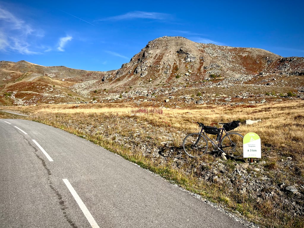
Col de Tougnète from Moutiers via D96 is a climb in the region Savoie. It is 30 km long and bridges 1958 m of vertical ascent with an average gradient of 6.5%, resulting in a difficulty score of 1672. The top of the ascent is located at 2403 m above sea level. Climbfinder users shared 8 reviews of this climb and uploaded 38 photos.
Road names: Route de Saint-Laurent, Route du Fayet, Route des Fées, Route des Ménuires & Avenue de la Croisette
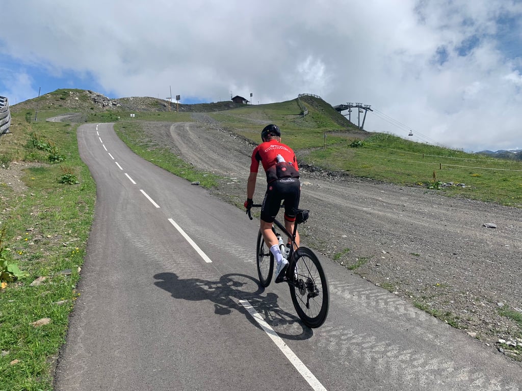
5.0 by CycloWorldThis is an automatic translation, the original language is: Dutch.Fabulous climb. The route via the D96 is definitely worthwhile. This is a quiet little road with occasional tough sections. St Martin halfway i a cosy village where you can drop down and refill your water bottle. From Les Menuires starts the car-free climb to the Col de Tougnète. Beautiful, open climb with great views. The lack of car traffic makes it breathtakingly quiet. The road is uneven, sometimes sections of 15%, to a descent. The last 600 metres are epically steep.... read more
Welcome! Please activate your account if you would like to share something. Look for the verification email in your inbox.
If you want to upload your photos, you need to create an account. It only takes 1 minute and it's completely free.
The climb up the Saint Laurent road is superb, peaceful and car-free. The second section, up to the start of the cycle path, is the least enjoyable. Apart from the stop at Notre Dame de la Vie at 1,500 metres, just outside Saint Martin de Belleville before the flat section. The final section is gruelling. The signposts indicate that the next kilometre has a gradient of over 10 per cent… but with variations in the gradient… And what can one say about the final 600 metres (an average gradient of 15 per cent according to Strava), with variations in gradient and, on the descent, warning signs for a 22 per cent gradient!
La montée par la route de Saint Laurent est superbe, tranquille, sans voiture. La deuxième section jusqu'au départ de la piste cyclable est la moins sympa. A part la pause à Notre Dame de la Vie a 1500m en sortie de Saint Martin de Belleville avant le replat. La dernière section est brutale. Les bornes annoncent un prochain kilomètre à plus de 10 % ... mais avec des ruptures de pentes... Et que dire des 600 derniers mètres (15% de moyenne d'après Strava) mais avec des ruptures de pente et a la descente des panneaux dangers pente a 22%!
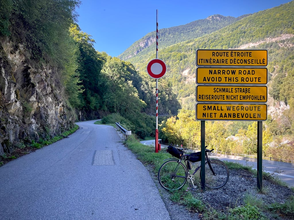
Done on gravel as it descends to Meribel on footpaths. From Moutier to Les Menuires, manage your effort well because after...
Fait en gravel car redescende sur meribel par les chemins. Depuis Moutier jusqu'aux Menuires, bien gérer son effort car après...
"A beautiful piece of shit!
That's how the newspaper Le Parisien described the Col de Tougnète!
Yes, it's true: it's one hell of a climb!
A long first section that patiently wears you down for 23km, all the way to Les Ménuires. And a terrible finish that finishes it off!
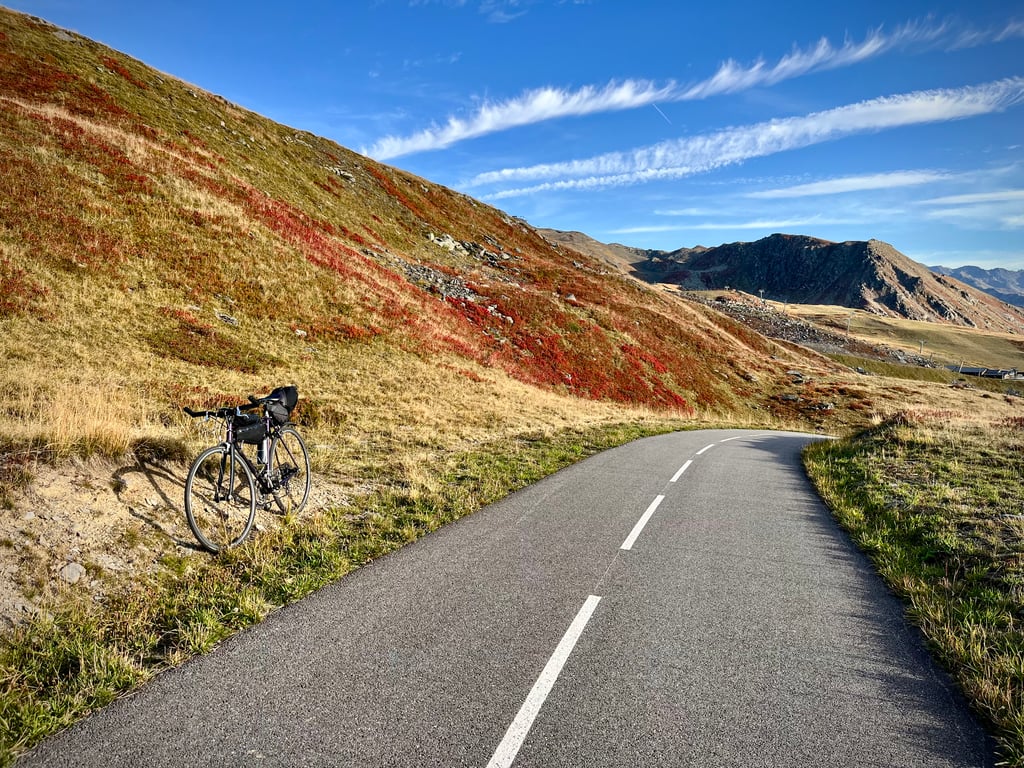
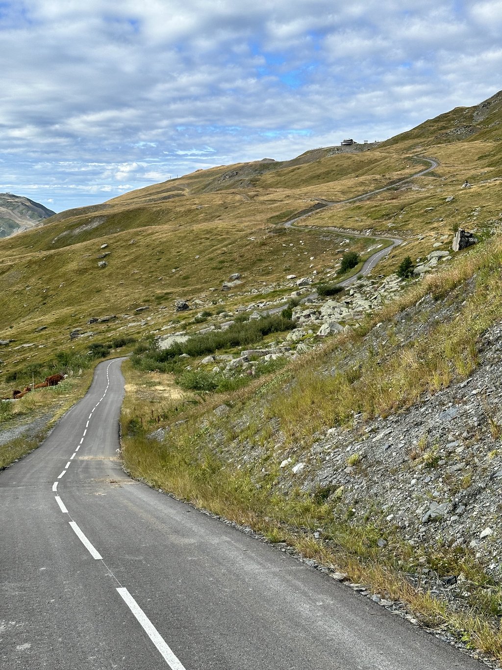
The D96 is extremely pleasant. It winds gently through soothing countryside. The gradients are gentle, but irregular, and there are even two downhill sections.
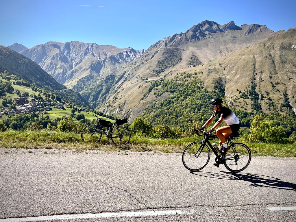
We continue on the D117, which is also in generally good condition. Very little traffic. Pleasant road and scenery. It's long, but you don't get bored.
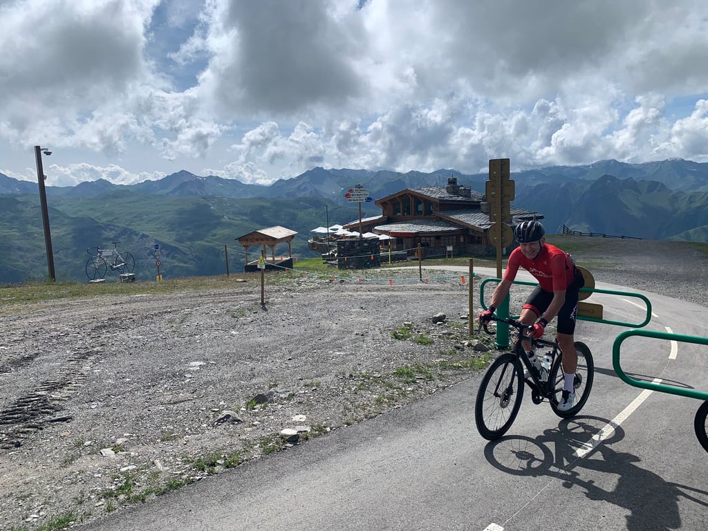
And here we are at an altitude of 1807m! From Moutiers, that's 1,300m of ascent.
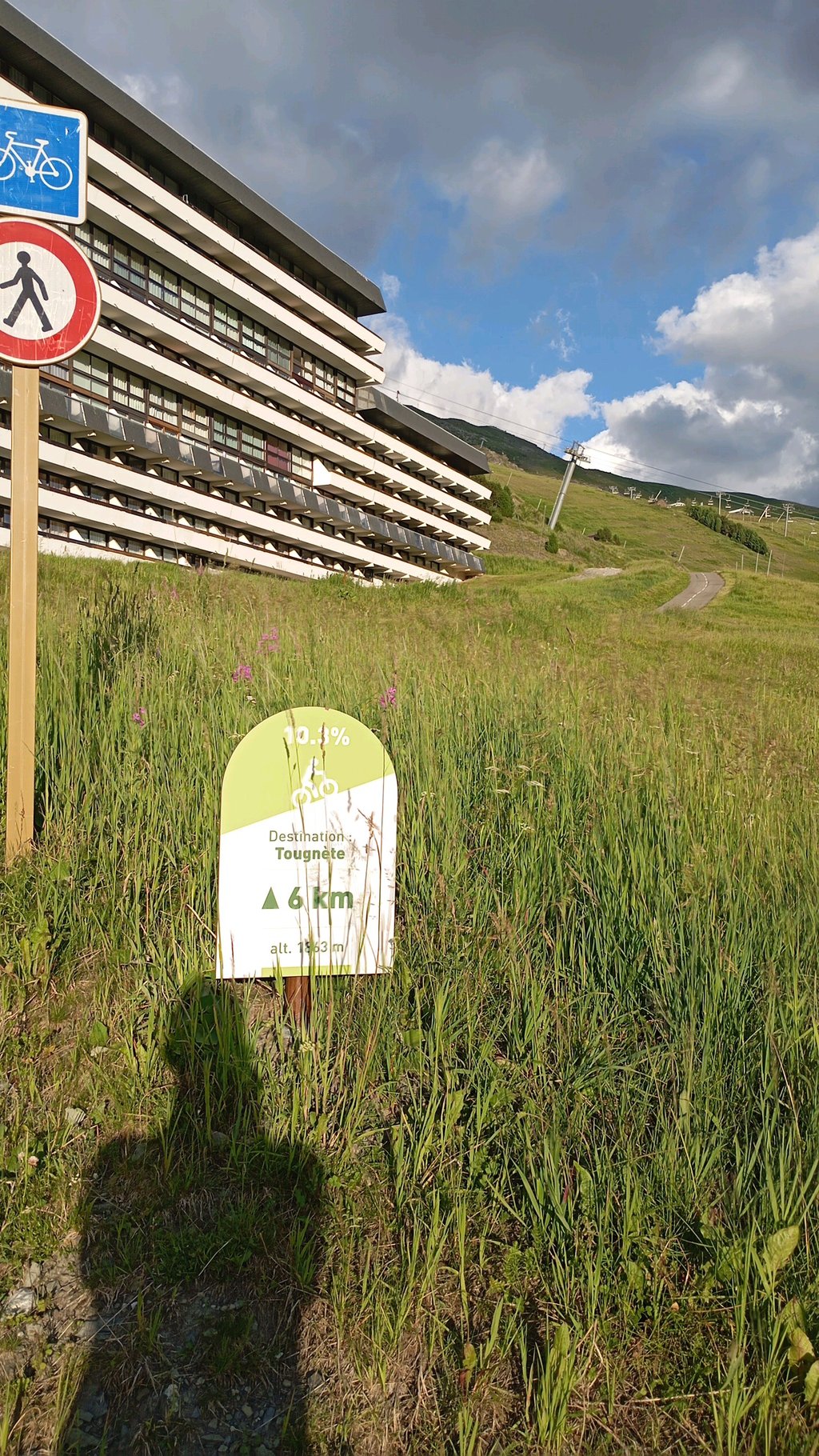
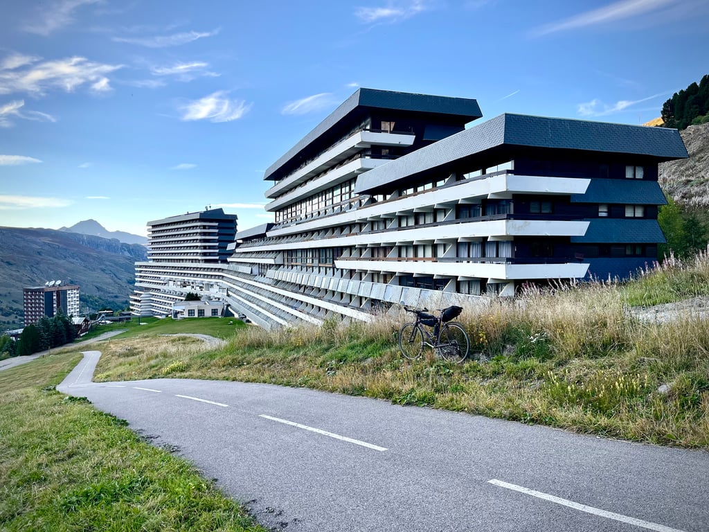
The resort of Les Ménuires is lined with huge, arrogant buildings that are undoubtedly very profitable...
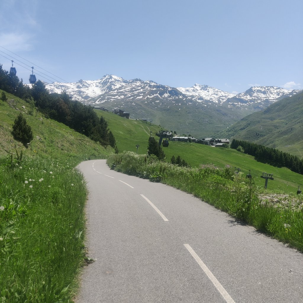
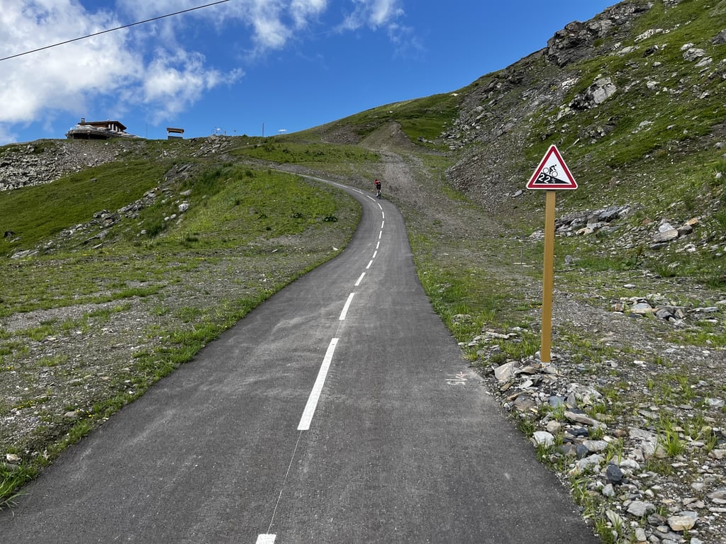
Come on, that's what we're here for: we attack this curious, brand new, impeccably maintained cycle path.
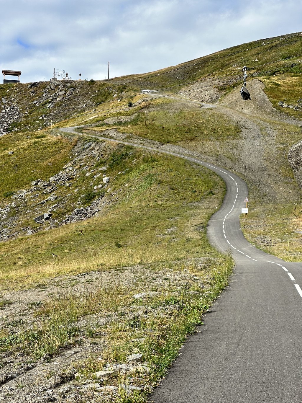
It climbs steeply from the start and that's just the beginning of the trouble... The gradients are totally irrational and irregular!
Slopes break every 100 metres!
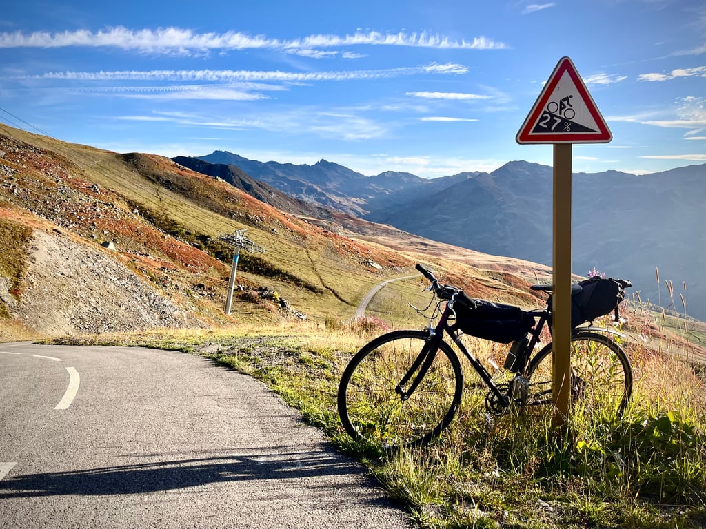
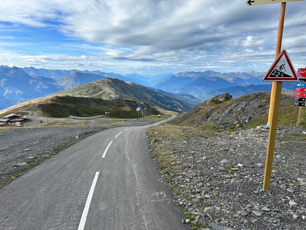
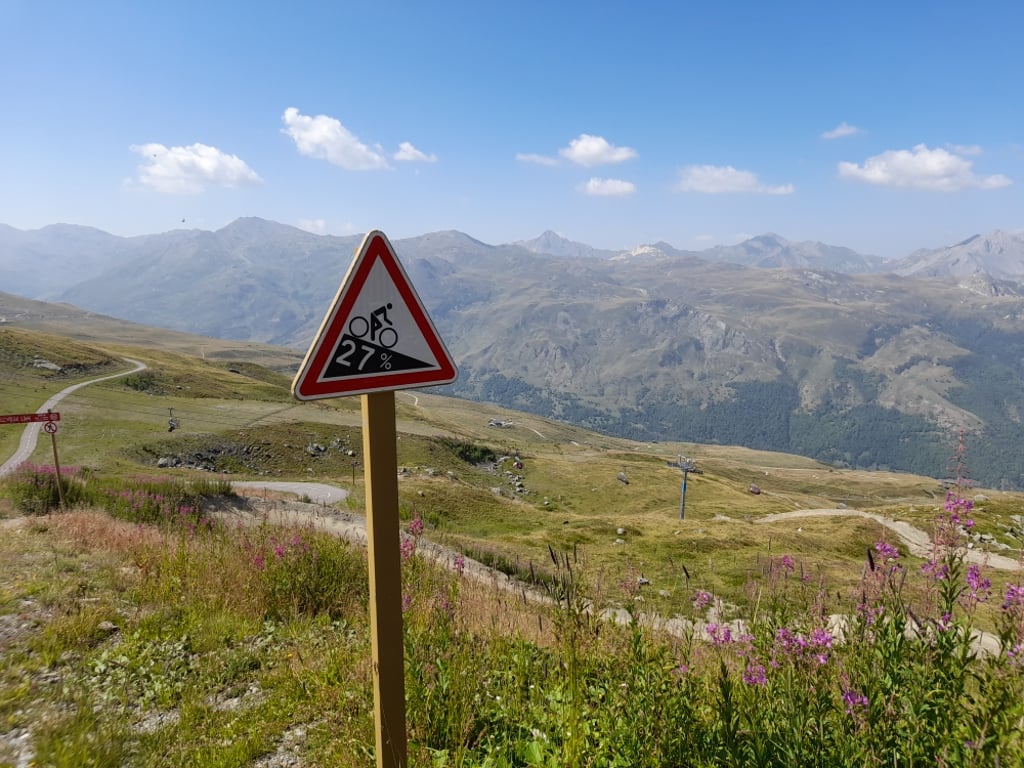
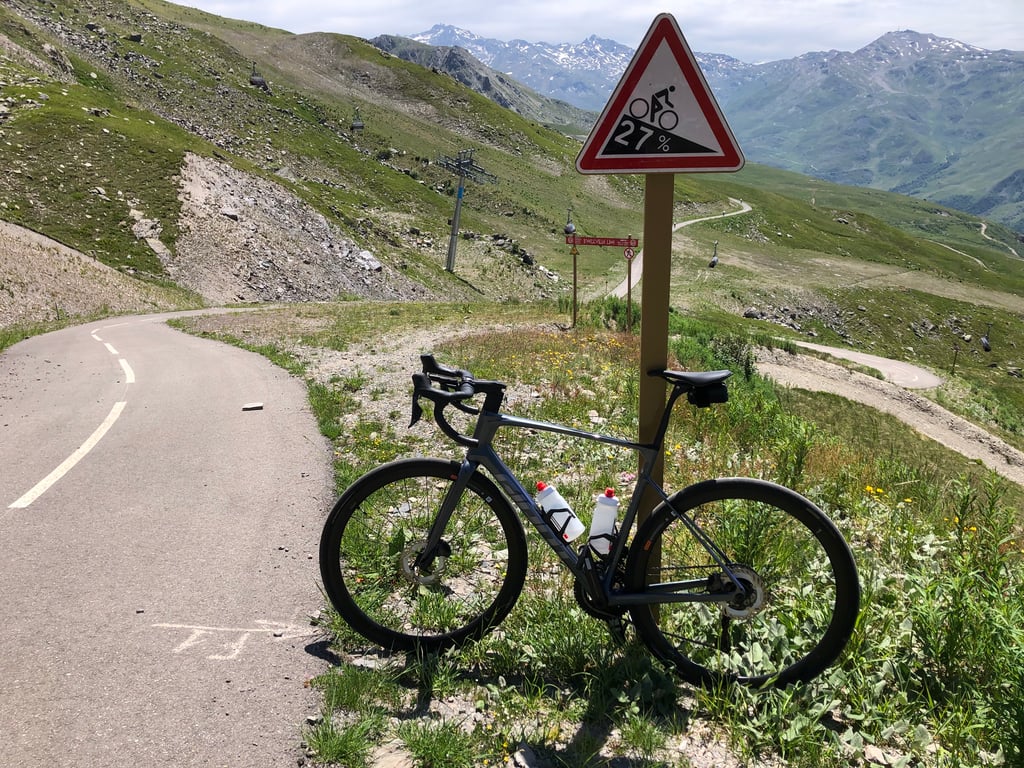
The end is just terrible! One of the signs on the descent announces 27%!
This is what the journalist from Le Parisien wrote:
"Walking is cheating, the summit is in sight!" On the side of the road leading to the Col de Tougnète, above the Les Menuires ski resort, a surreal sign warns the poor cyclists of the difficulties ahead. We're not on the toughest pass in France for nothing...".
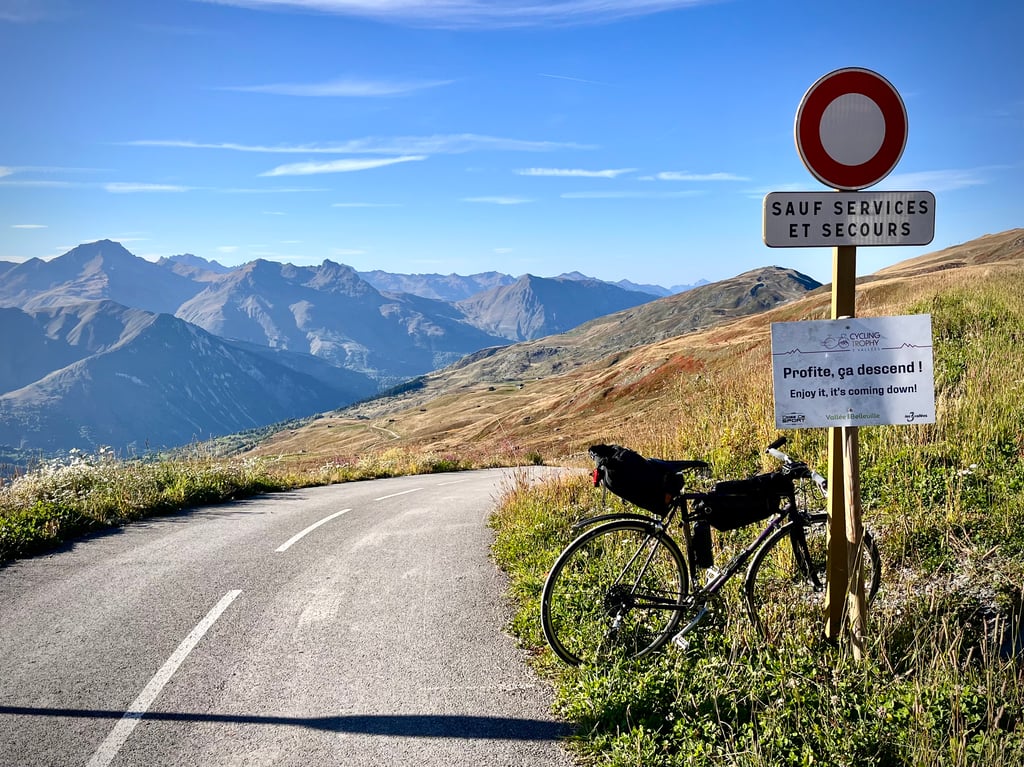
The signs are indeed hilarious: "take advantage, it's going downhill" or "all the way to the left, if you haven't already done so"...
And there are marmots everywhere!
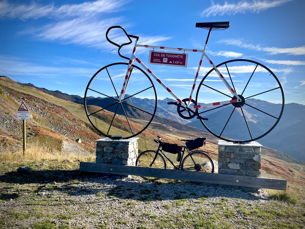
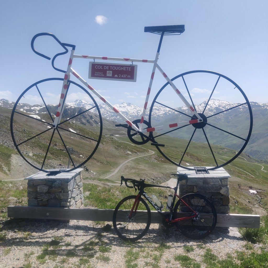
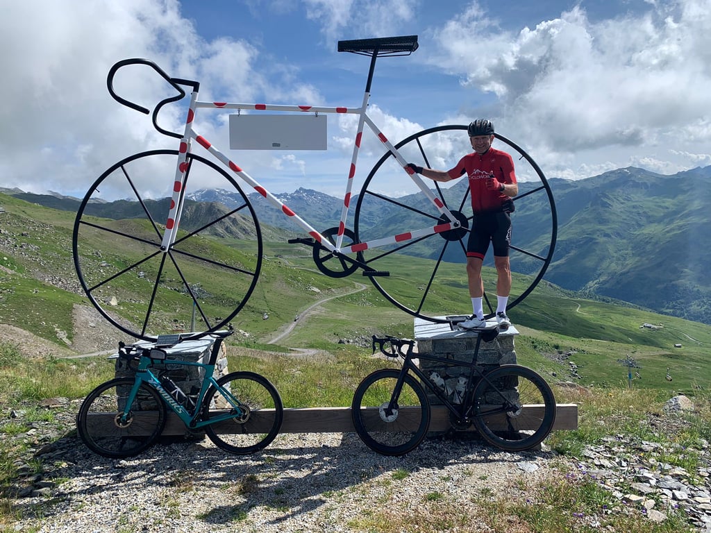
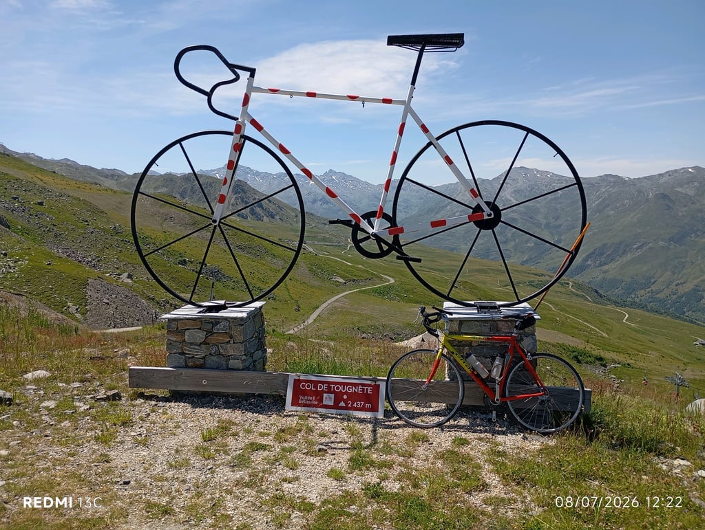
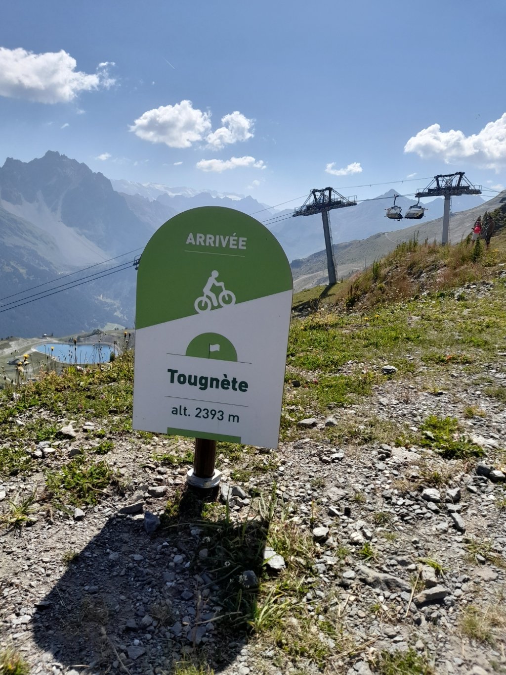
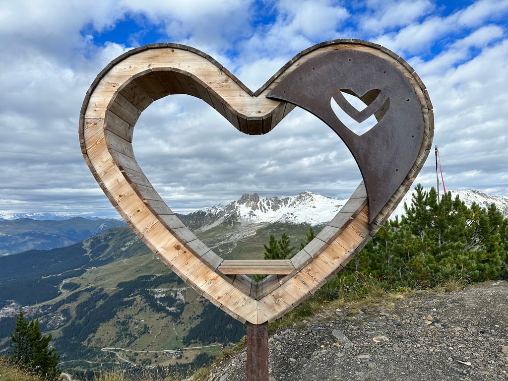
The large bike that marks the finish is very sober and successful.
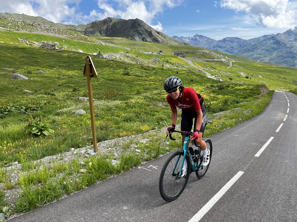
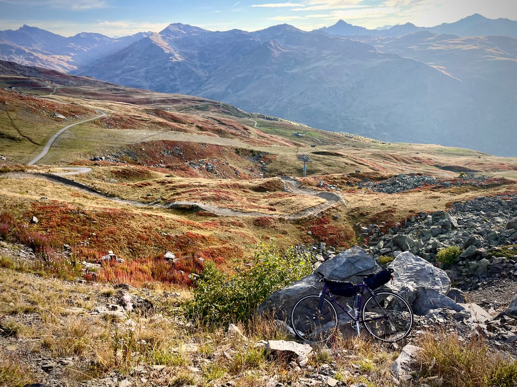
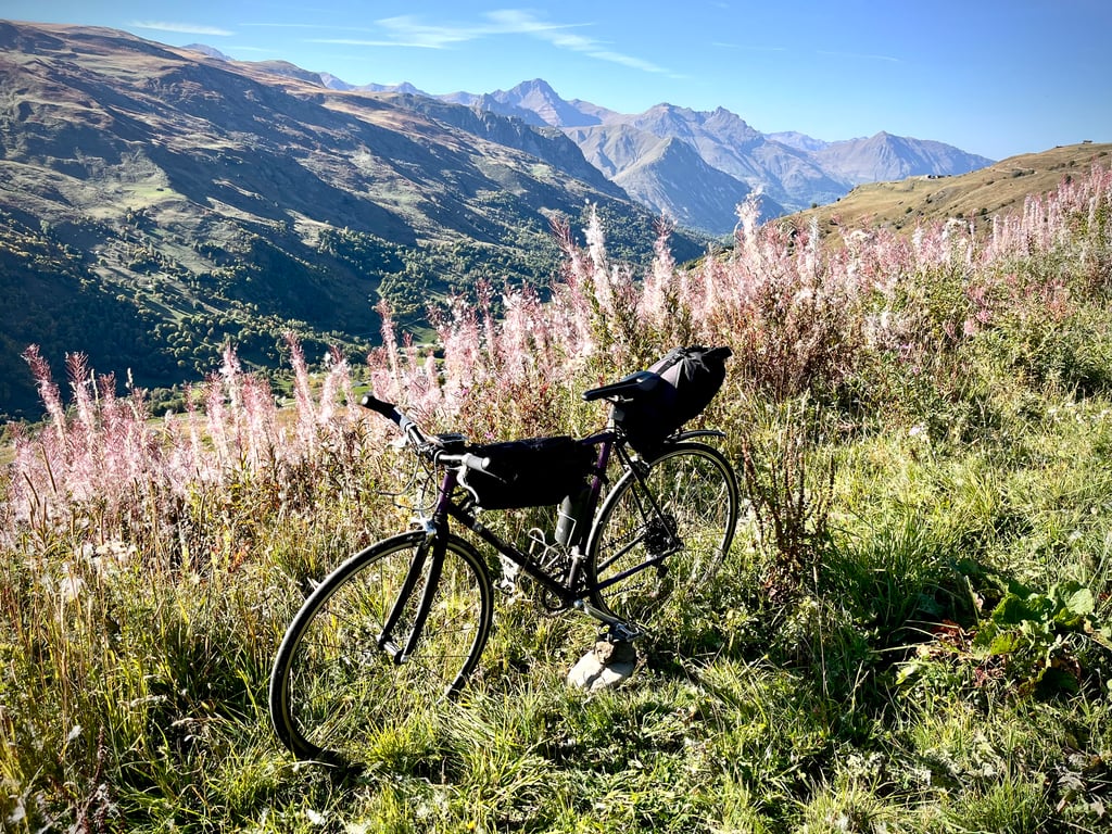
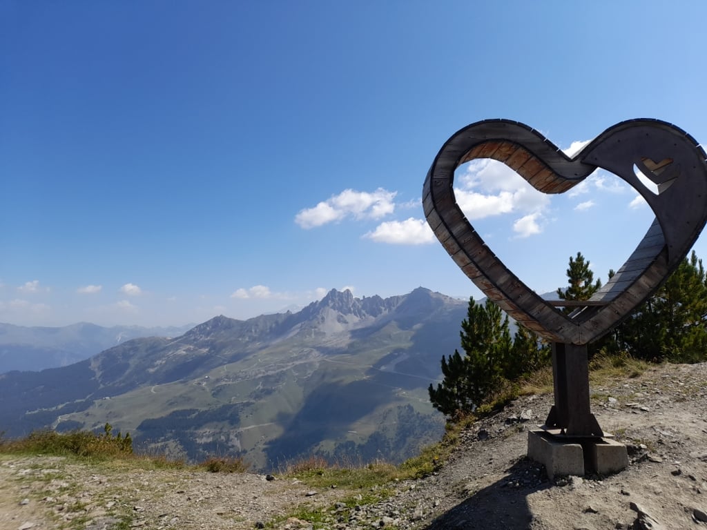
All along this strange cycle path, the scenery is extremely elegant.
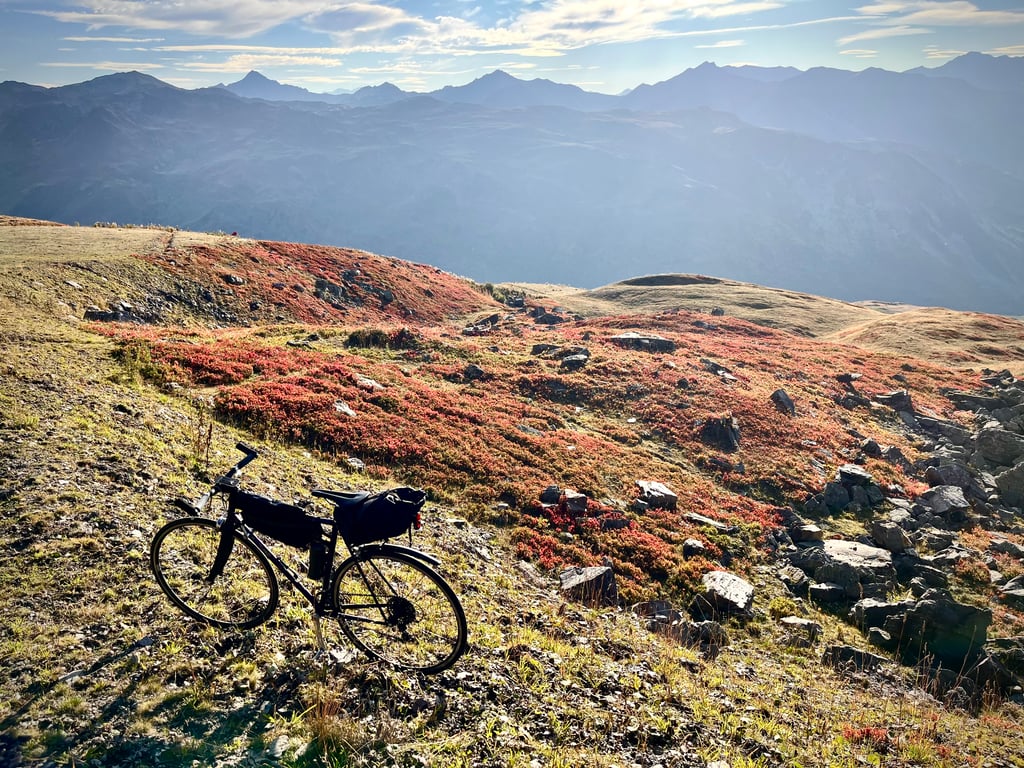
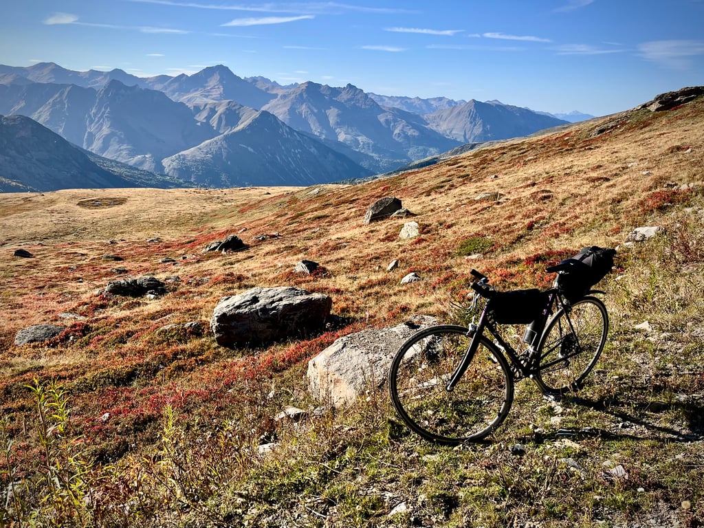
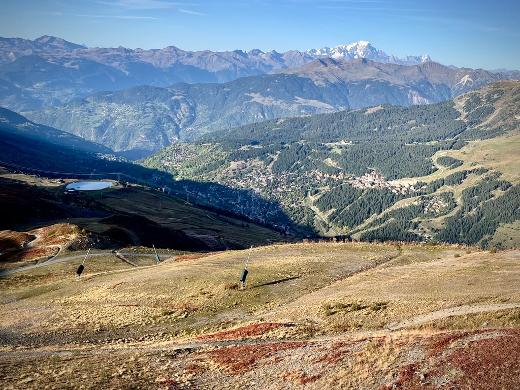
The views from the top are quite majestic. On a clear day, you can see Mont Blanc.
An unusual and fantastic climb!
Quite a challenge!
Definitely worth doing.
« Une belle saloperie ! »
C’est dans ces termes que le journal Le Parisien décrit le col de Tougnète !
Oui, c’est vrai : c’est un sacré morceau !
Une longue première partie qui use patiemment le bonhomme pendant 23km, jusqu’aux Ménuires. Et une fin terrible qui l’achève !
La D96 est extrêmement plaisante. Elle serpente délicatement à travers des paysages apaisants. Les pourcentages sont plutôt doux, mais irréguliers et on a même droit à deux tronçons qui redescendent.
On poursuit sur la D117 qui, elle aussi, est globalement en bel état. Peu de circulation. Route et paysages plaisants. C’est long, mais on ne s’ennuie pas.
Et mine de rien, nous voilà déjà à 1807m d’altitude ! Depuis Moutiers, ça représente déjà 1300m de dénivelé positif.
La station des Ménuires est garnie d’immenses immeubles arrogants mais sans doute très rentables…
Allez, on est là pour ça : on attaque cette curieuse piste cyclable toute récente et impeccable.
Ça grimpe fort dès le début et ce n’est que le début des ennuis… Les pourcentages sont totalement irrationnels et irréguliers !
Des ruptures de pentes tous les 100 mètres !
La fin est juste terrible ! Un des panneaux de la descente annonce 27% !
Voilà ce qu’écrit le journaliste du Parisien :
« « Marcher c’est tricher, le sommet est en vue ! » Sur le bord de la route menant au col de Tougnète, au-dessus de la station de ski des Menuires, une pancarte surréaliste prévient les pauvres cyclistes des difficultés qui les attendent. Nous ne sommes pas dans le col le plus dur de France pour rien… »
Les panneaux sont effectivement désopilants : « profite, ça descend » ou « tout à gauche, si ce n’est pas encore fait »…
Et puis, des marmottes partout !
Attention à elles dans la descente !
Le grand vélo qui matérialise l’arrivée est très sobre et réussi.
Tout au long de cette étrange piste cyclable, les paysages sont extrêmement élégants.
Là-haut, les vues sont assez majestueuses. Par temps clair, le Mont-Blanc.
Une ascension atypique et formidable !
Un sacré défi !
À faire, sans aucun doute.
The first 21 km are shared with the climb to Val Thorens. The safest thing to do is to manage this long "warm-up" and keep your pedal to the metal for the last 7 km...
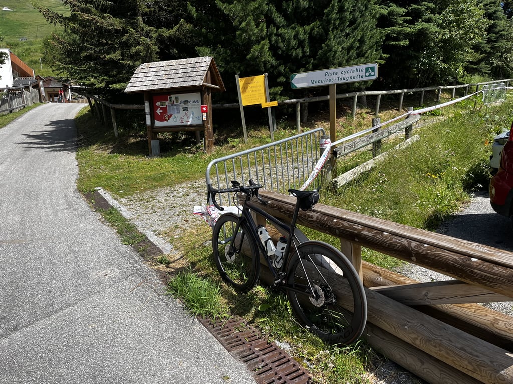
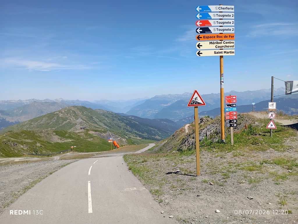
You then cross Les Ménuires. Then turn left towards the exit from the resort centre: a sign indicates the cycle path.
As the gradients on this path are very irregular, the cheapest thing to do is to let go on the easy sections. It's not very complicated for the first 6 km. There are several steep (> 15%), but short, climbs. On the other hand, the last 600 metres are the hardest: passages of more than 20%, 22% and even 27% near the hostel and the big bike... which almost gives you the illusion that it's the end... but no, there's still the last final rise, which really hurts at 2400m. That said, I found this climb less difficult (everything is relative) than the Col de la Loze via the Méribel piste, which has more very steep switchbacks. As for the Tougnète, once you know what you're in for, you just need to keep your breath and your legs for the final effort.
The first few metres of the descent are impressive. But the piste is good and if you take it easy, you'll get the hang of it.
Les 21 premiers km sont communs avec la Montée vers Val Thorens. Le plus prudent est de gérer ce long "échauffement" et en garder sous la pédale pour les 7 derniers km...
On traverse ensuite les Ménuires. Prendre ensuite à gauche vers la sortie du centre de la station : un panonceau indique la piste cyclable.
Comme cette piste présente des pourcentages très irréguliers, le plus économique consiste à lâcher prise dans les parties faciles. Ce n'est pas très compliqué pour les 6 premiers km. On franchit plusieurs ressauts, certes très raides (> 15%), mais courts. En revanche les 600 derniers mètres sont les plus durs : passages à plus de 20%, 22% et même 27% à proximité de l'auberge et du grand vélo... qui vous donne presque l'illusion que c'est la fin... mais non, il reste de dernier ressaut final, qui fait bien mal à 2400m. Cela dit, j'ai trouvé cette ascension moins difficile (tout est relatif) que le col de la Loze par la piste de Méribel, qui présente plus de ressauts très raides. Pour la Tougnète, quand on sait ce qui nous attend, il suffit de conserver du souffle et des jambes pour l'effort final.
Les premiers mètres de la descente impressionnent. Mais la piste est bonne et en se lançant doucement, ça passe bien.
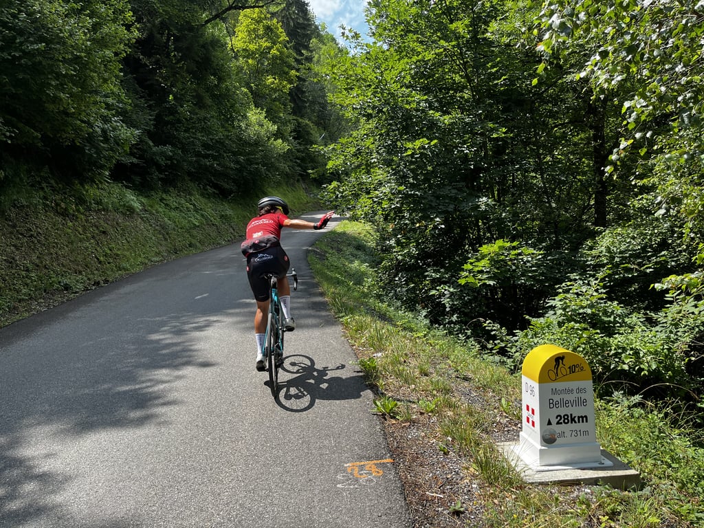
Start via the D96 where immediately a sign indicates that the 'Montée de Belleville' is still 31km, not very motivating. Initially curling through small villages on ok tarmac (12/06/25 some typical French gravel - no very uphill). A little later you get onto the bigger track towards Les Menuires, as in my case on a hot day quite puffing. Through the ski village small street to the left, the gateway to heaven/hell. From then on, irregularity trumps pentes, albeit in a stunning setting. Save some for the last kilometre as you will be put to the test with sections up to 27%. Magnificent climb - watch out for stones on the descent!
Start via de D96 waar direct een bordje aangeeft dat de 'Montée de Belleville' nog 31km duurt, niet erg motiverend. Initieel krinkelend via kleine dorpjes op ok asfalt (12/06/25 wat typisch Frans grind - geen erg bergop). Even later kom je op de grotere baan richting Les Menuires, zoals bij mij op een warme dag best puffen geblazen. Doorheen het skidorp klein straatje links in, de poort tot de hemel/hel. Vanaf dan onregelmatigheid troef qua pentes, weliswaar in een schitterend decor. Houd wat over voor de laatste kilometer want daar zal je nog gruwelijk op de proef gesteld worden met stukken tot 27%. Magnifieke klim - opgelet voor steentjes in de afdaling!
Fantastic climb! Unknown little brother of the Col de la Loze. For me, the Tougnète is just the bit you cycle from the valley when you're on your way to Val Thorens. That stretch is specially built for cyclists and you have fantastic views! There are very tough and steep sections in between (especially the end), but that makes it fun too! Even more fun if it is connected to the other side of the mountain, which is what is planned one day. Then you can descend to Meribel via this road and it connects nicely with the Col de la Loze. Now you still have to descend back :)
Fantastische klim! Onbekende broertje van de Col de la Loze. Voor mij is de Tougnète enkel het stuk wat je vanuit het dal fietst als je op weg bent naar Val Thorens. Dat stuk is speciaal voor fietsers aangelegd en je hebt fantastisch uitzicht! Er zitten hele heftige en steile stukken tussen (zeker het einde), maar dat maakt het ook leuk! Helemaal tof als het is aangesloten aan de andere kant vd berg wat wel ooit de bedoeling is. Dan kun je via deze weg naar Meribel afdalen en sluit het mooi aan op de Col de la Loze. Nu moet je nog ff terug afdalen :)
Fabulous climb. The route via the D96 is definitely worthwhile. This is a quiet little road with occasional tough sections. St Martin halfway i a cosy village where you can drop down and refill your water bottle. From Les Menuires starts the car-free climb to the Col de Tougnète. Beautiful, open climb with great views. The lack of car traffic makes it breathtakingly quiet. The road is uneven, sometimes sections of 15%, to a descent. The last 600 metres are epically steep.
Fabelachtige klim. De route via de D96 is absoluut de moeite waard. Dit is een rustig weggetje met af en toe stevige passages. St Martin halverwege i een gezellig dorp waar je neer kunt ploffen en bidon kan bijvullen. Vanaf Les Menuires begint de autovrije klim naar de Col de Tougnète. Prachtige, open klim met mooie uitzichten. Door het ontbreken van autoverkeer is het adembenemend rustig. De weg is onregelmatig, soms stukken van 15%, om een afdaling. De laatste 600 meter zijn episch steil.
| 7 km/h | 04:16:44 |
| 11 km/h | 02:43:23 |
| 15 km/h | 01:59:48 |
| 19 km/h | 01:34:35 |
This page is better in the app