Tips nearby


| Beautiful scenery |
| Hidden gem |
| 3 hairpin turns |
| #67 toughest climb of Annecy |
| #81 most elevation gain of Annecy |
| #57 average steepest climb of Haute Savoie |
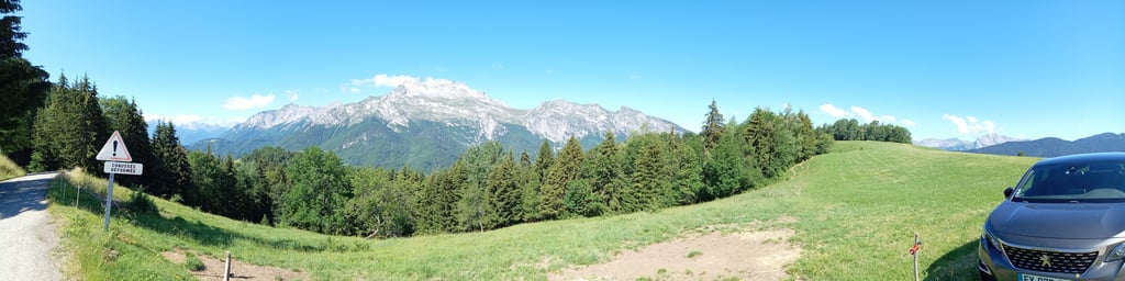
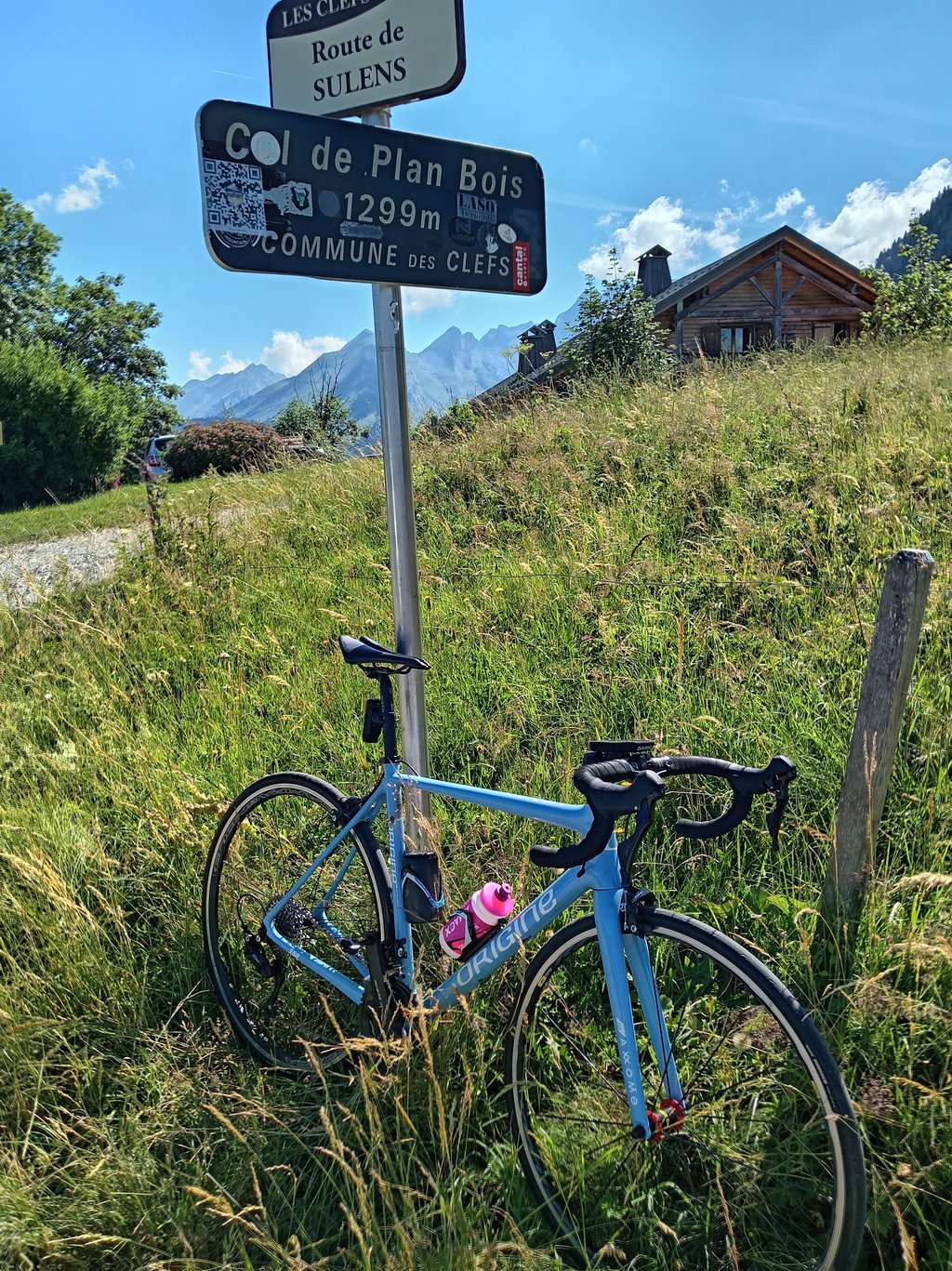
Col de Plan Bois from Manigod is a climb in the region Annecy. It is 4.9 km long and bridges 448 m of vertical ascent with an average gradient of 9.1%, resulting in a difficulty score of 430. The top of the ascent is located at 1297 m above sea level. Climbfinder users shared 2 reviews of this climb and uploaded 12 photos.
Road names: Chemin Rural dit l'Envers
4.0 by sergenavetatThis is an automatic translation, the original language is: French.Magnificent, very beautiful and also very hard. The profile is wrong because at the beginning of Manigod there is a good steep descent for 2Km until the bridge over the Fier. Then the climb starts in the woods with severe percentages, I found only 2 short lulls until the top, otherwise the slope is sustained, harder than the profile, many sectors at 10-12-14 and even more than 15 % in places. The route is not bad despite some cracks and care will be needed when descending the same slope. A... read more
Welcome! Please activate your account if you would like to share something. Look for the verification email in your inbox.
If you want to upload your photos, you need to create an account. It only takes 1 minute and it's completely free.
The climb from Manigod begins with a descent, which distorts the profile! But once it's uphill, it's uphill all the way!
The road is superb, narrow and totally quiet in the middle of the pastures. There's a mountain pasture restaurant at the top for a tart. The descent to Les Clefs requires some attention, as cars climb up this side to get to the restaurant. It is also steep. So be careful!
La montée depuis Manigod commence par une descente ce qui fausse le profil ! Mais une fois que ça monte, ça monte sec !!
La route est superbe, étroite et totalement tranquille au milieu des pâturages. Un restaurant d'alpage au sommet pour une tarte. La descente sur les Clefs demande de l'attention car des voitures montent par ce côté pour aller au restaurant. De plus elle est raide.. Prudence donc !
Magnificent, very beautiful and also very hard.
The profile is wrong because at the beginning of Manigod there is a good steep descent for 2Km until the bridge over the Fier.
Then the climb starts in the woods with severe percentages, I found only 2 short lulls until the top, otherwise the slope is sustained, harder than the profile, many sectors at 10-12-14 and even more than 15 % in places.
The route is not bad despite some cracks and care will be needed when descending the same slope.
Alternating passages in the shade and in the heat especially the final.
Note that ClimbFinder indicates an alternative route via Les Clefs, but there is another one, also via Les Clefs, with exactly the same start, but instead of going via Veuillet and Lachat, you have to go straight through the woods. This route joins the one from Manigod to Praz Riond.
Have a good trip and be careful
Magnifique, Très beau et aussi très dur.
Le profil est faux car au départ de Manigod il y a une bonne descente très pentue sur 2Km jusqu’au pont qui enjambe le Fier.
Ensuite la montée commence dans les bois avec des pourcentages sévères, j’ai trouvé seulement 2 courtes accalmies jusqu’au sommet, sinon la pente est soutenue, plus dur que le profil, de nombreux secteurs à 10-12-14 et même plus de 15 % par endroits.
La route n’est pas mauvaise malgré quelques fissures et il faudra être prudent en cas de descente par le même versant.
Alternance de passages à l’ombre et en plein cagnard surtout le final.
A signaler que ClimbFinder signal une alternative par les Clefs alors qu’il y en a une autre, aussi par les Clefs avec exactement le même départ mais au lieu de passer par Veuillet et Lachat, il faut filer tout droit dans les bois, cet itinéraire rejoint celui de Manigod à Praz Riond.
Bonne route et Prudence
| 7 km/h | 00:41:59 |
| 11 km/h | 00:26:43 |
| 15 km/h | 00:19:35 |
| 19 km/h | 00:15:28 |
This page is better in the app