| Famous climb |
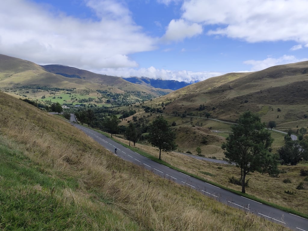
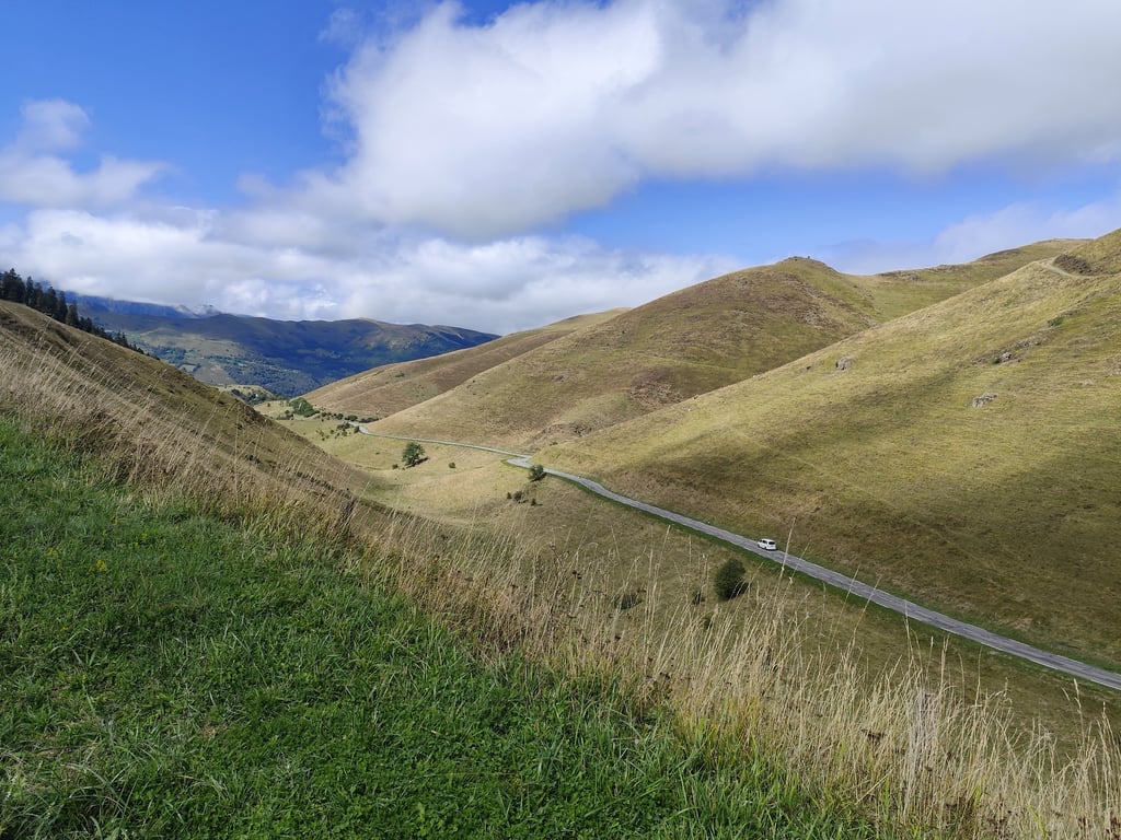
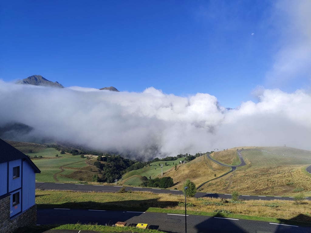
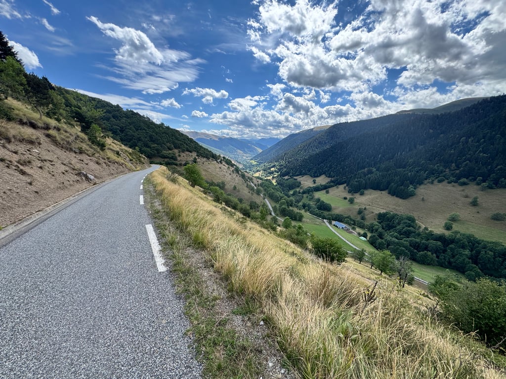
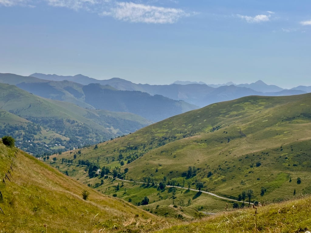
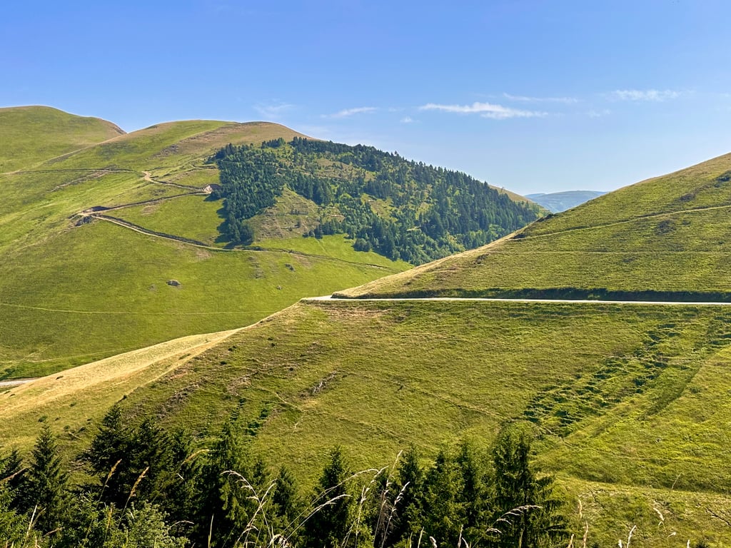
| Beautiful scenery |
| 6 hairpin turns |
| #67 toughest climb of Occitania |
| #75 most elevation gain of Occitania |
| #6 longest climb of Haute-Garonne |
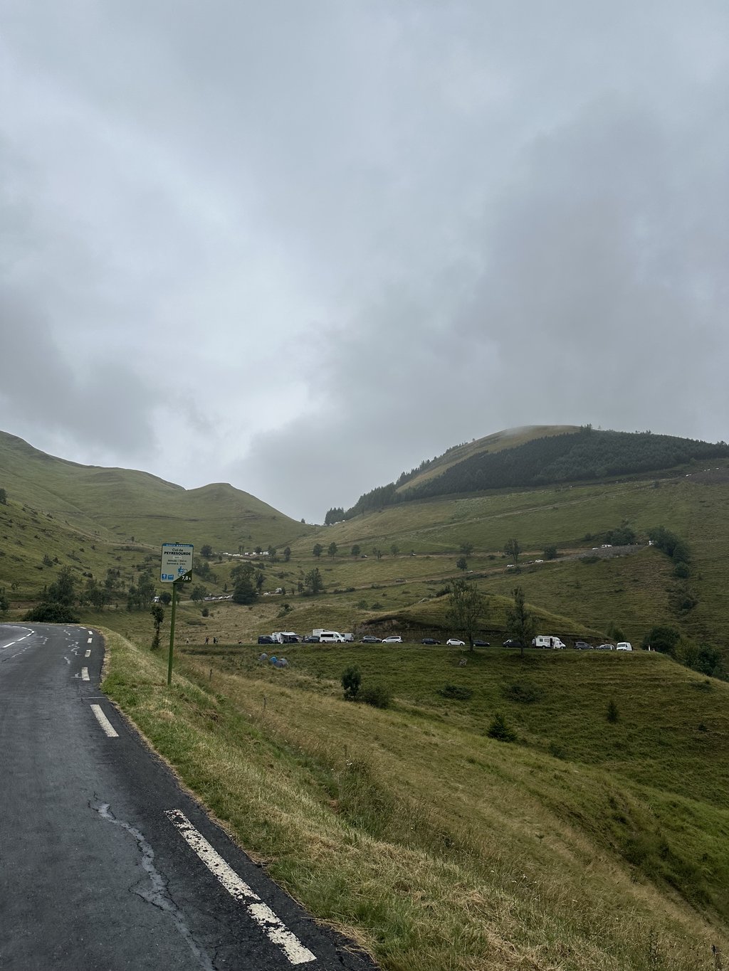
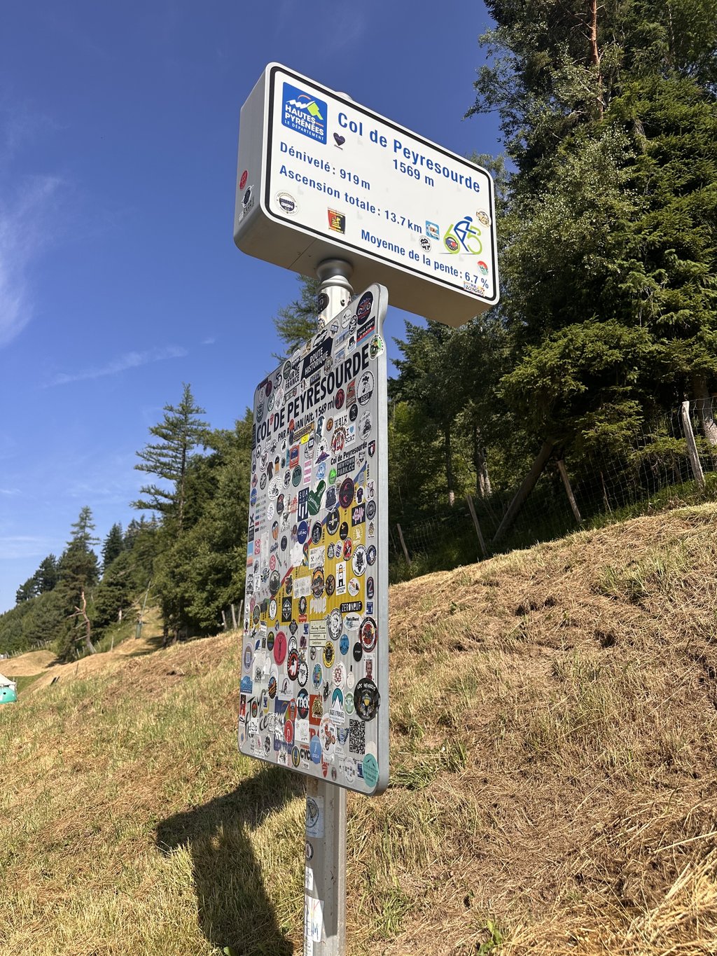
Col de Peyresourde is a climb in the region Haute-Garonne. It is 13.9 km long and bridges 928 m of vertical ascent with an average gradient of 6.7%, resulting in a difficulty score of 716. The top of the ascent is located at 1569 m above sea level. Climbfinder users shared 14 reviews of this climb and uploaded 26 photos.
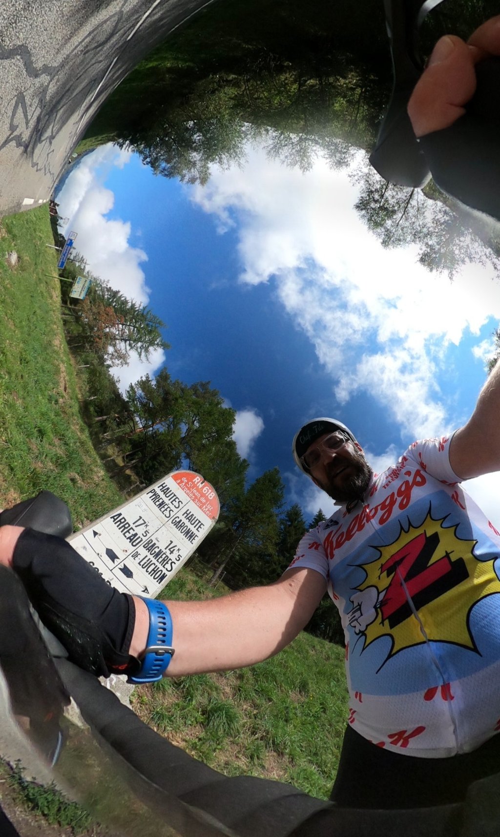
Road name: D618
4.0 by patrickbaertThis is an automatic translation, the original language is: Dutch.Cycled up an important col in the history of the Tour and so also got the time to have a look, while climbing, at what Froome had gotten under his wheels that year (2016) with his stunt descent towards Luchon! Wide road with unfortunately sometimes busy traffic, although this was not so bad in the early morning. Route is not to be underestimated. Not because of extreme percentages but because of its rather irregular climbing course with some short steep passages, some plateaus and even descendi... read more
Welcome! Please activate your account if you would like to share something. Look for the verification email in your inbox.
If you want to upload your photos, you need to create an account. It only takes 1 minute and it's completely free.
Rode early morning in July. Much quieter traffic than I expected , fab scenery throughout.
Took another reviewers suggestion to stop on the last bend , made all the effort worthwhile.
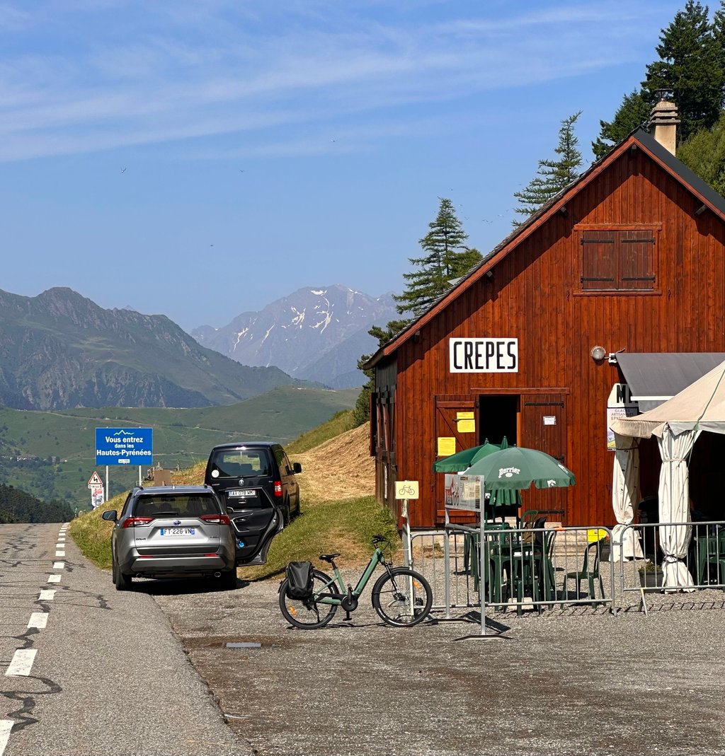
Excellent crepes at the hut at the top, merci beaucoup !
Col climbed from Bagnères de Luchon on a weekday morning in September. If you want to avoid too much traffic, avoid weekends and holidays. Avoid summer too if you're worried about the heat. I got hot when it was only 20°C. This is one of the passes whose name you've heard since you were a kid, and it's worth doing for the historical aspect. Don't be afraid of the twists and turns in front of you at the end, it's easier than what you've just done.
Col monté depuis Bagnères de Luchon un matin de semaine en septembre. Si vous voulez éviter une circulation trop importante, évitez les weekends et les vacances. Évitez l'été aussi si vous craignez la chaleur. J'ai eu chaud alors qu'il ne faisait que 20°C. Un des cols dont on entend le nom depuis tout petit, à faire pour le côté historique. N'ayez pas peur des lacets qui se dressent face à vous à la fin, c'est plus facile que ce que vous venez de faire.
Rain rain rain but beautiful climb and spectacular views
Col assez difficile, peu de virages, beaucoup de trafic. Paysages magnifiques, et superbe descente vers Arreau.
Great climb from Luchon. The descent is just as beautiful, with some good areas to pick up speed.
Super montée depuis Luchon. La descente est aussi belle avec de bonnes zones pour prendre de la vitesse
Nice long spirited climb. You really go uphill and I noticed that in my panting. The lighter gears were also used quite a lot.
Mooie lange pittige klim. Je gaat echt de hoogte in en dat merkte ik aan mijn gehijg. Ook de lichtere verzetten werden flink gebruikt.
I did this one after the Superbagneres, and I must say, it did take effort. The fact that you ride the whole climb in the sun also matters enormously, of course. I was really bothered by the heat and luckily, about 5 km from the summit, I found a source where the water was ok. It's a very nice climb, but gets quite steep at the end. Still have some left!
Deze deed ik na de Superbagneres, en ik moet zeggen, dat koste wel moeite. Het feit dat je de hele klim in de zon rijdt doet er natuurlijk ook enorm toe. Ik had echt last van de warmte en gelukkig vond ik op een 5tal km van de top een bronnetje waar het water ok van was. Daar wat kunnen bijtanken en rusten en door naar de top. het is een heel mooie beklimming, maar wordt op het einde toch flink steil. Hou nog wat over!
Part of the Tour's history. The preceding Port de Balès had already worn me out a bit - I went down to Bagnères-de-Luchon and was met by 8% stretches from where I turned. This is pretty much what you get almost all the time, just some relief going through a village. Nice little restaurant and souvenir shop at the summit, whit great crêpes. Fantastic descend towards Arreau.
This is a good route to take if you like the tour. The traffic is heavy. The end is beautiful but does it justify the trip? Not sure... afterwards, go down to Peyragude!
Route à faire si vous aimez le tour. Le traffic y est important. La fin est belle mais justifie-t-elle le déplacement? Pas sûr… après en descendant, enchaînez avec Peyragude!
Nice, not too difficult climb with beautiful views in the second part. Nice running downhill.
Mooie, niet al te moeilijke klim met prachtige vergezichten in het tweede deel. Lekker lopende afdaling.
Cycled up an important col in the history of the Tour and so also got the time to have a look, while climbing, at what Froome had gotten under his wheels that year (2016) with his stunt descent towards Luchon!
Wide road with unfortunately sometimes busy traffic, although this was not so bad in the early morning. Route is not to be underestimated. Not because of extreme percentages but because of its rather irregular climbing course with some short steep passages, some plateaus and even descending parts through the various villages.
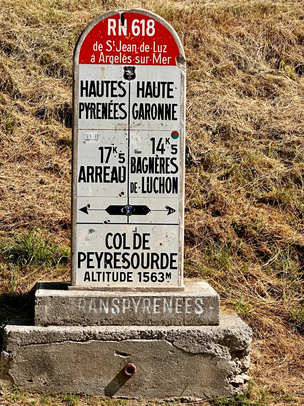
There are a few hairpin bends in the first part and a steep Z-shaped final section to the pass crossing, which can already be seen from afar in the green mountain landscape. At the summit there's a mountain hut for supplies and one of the most photographed border poles in cycling which marks the summit and the separation between the departments of Haute Garonne and Haute Pyrénées. It even made it to the cover of the Flemish cycling magazine "Bahamontes".
Contrary to the other side, there are no cycling info signs every kilometer.
Climb that you have to do if you want to keep your appointment with the tour history!
Belangrijke col uit de Tour historie op gefietst en zo ook de tijd gekregen om al klimmend eens te bekijken wat Froome dat jaar (2016) met zijn stuntafdaling richting Luchon onder de wielen had gekregen!
Brede weg met spijtig soms druk verkeer, alhoewel dit in de vroege ochtend best meeviel. Route is niet te onderschatten. Niet vanwege extreme percentages maar door zijn vrij onregelmatig klimverloop met enkele korte steile passages,enkele plateaus en zelfs dalende stukjes door de verschillende dorpjes.
Er zijn een paar haarspeldbochten in het eerste deel en een pittige Z- achtige slotserie naar de pasovergang, dewelke reeds van ver opvalt in het groene bergweidelandschap. Op de top is er een berghut voor bevoorrading en één van de meest gefotografeerde grenspalen in wielermilieus die de top aangeeft en de scheiding tussen de departementen Haute Garonne en Haute Pyrénées. Hij bracht het zelfs tot de cover van Vlaams wielermagazine "Bahamontes".
In tegenstelling met de andere zijde hier geen fiets-infobordjes elke kilometer.
Klim die je zeker moet doen als je je afspraak met de tour geschiedenis wil nakomen!
Runs beautifully, beautiful climb. We had bad luck with hail, rain and thunderstorms but environment is beautiful and climb is beautiful.
Loopt mooi, prachtige klim. Wij hadden pech met hagel, regen en onweer maar omgeving is mooi en klim loopt mooi.
Very nice even climb with from the last hairpin turn a beautiful view towards the valley.Ideal for a super fast descent because of long stretches straight ahead where the last 3km can be hard pedaled here are the bends spacious and clear.A must is le Lac d'Oo a beautiful piece of nature!
Zeer mooie gelijkmatige klim met vanaf de laatste haarspeldbocht een mooi zicht richting vallei.Ideaal voor een supersnelle afdaling vanwege lange stukken rechtdoor waarbij de laatste 3km flink bijgetrapt kan worden hier zijn de bochten ruim en overzichtelijk.Een aanrader is le Lac d'Oo een prachtig stukje natuur!
Cheap pancakes when you get to the top. I think it is not really a nice col. Is not very difficult, but only the last 6 km really a col, with some quieter roads.
Goedkoop pannenkoeken eten als je boven bent. Ik vind het niet echt een leuke col. Is niet heel moeilijk, maar pas de laatste 6 km echt een col, met wat rustiger wegen.
| 7 km/h | 01:58:46 |
| 11 km/h | 01:15:35 |
| 15 km/h | 00:55:25 |
| 19 km/h | 00:43:45 |
This page is better in the app