Tips nearby


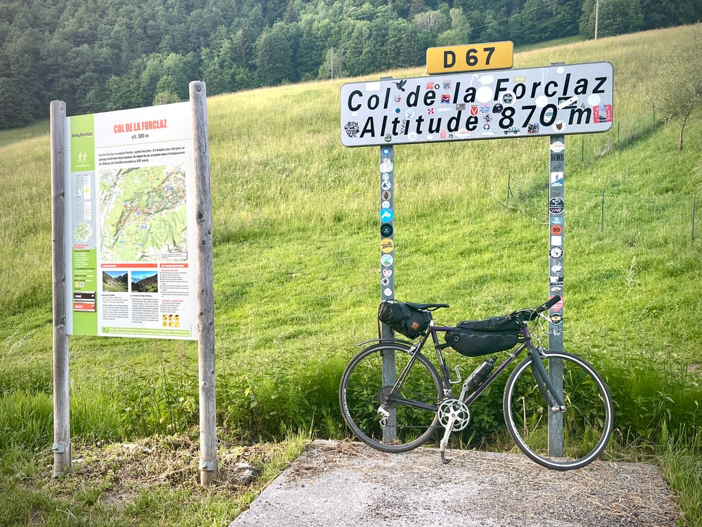
Col de la Forclaz is a climb in the region Annecy. It is 5.6 km long and bridges 445 m of vertical ascent with an average gradient of 8%, resulting in a difficulty score of 470. The top of the ascent is located at 881 m above sea level. Climbfinder users shared 4 reviews of this climb and uploaded 5 photos.
Road names: D71 & D67
2.0 by CromagnonThis is an automatic translation, the original language is: French.Too many Forclaz passes! We crossed this Forclaz pass off our list. Another one pops up. A forclaz would be a geological shape, a wide passage narrowing into a Y shape... Well... So, these Forclaz are to be found to the south of Annecy, to the north of Albertville, in the Swiss Valais and also at Décathlon. This Forclaz is the lowest. It's the shortest. But it's not the least steep. An average of 8% with a serious age gradient well above that. It's short, but solid. A road in... read more
Welcome! Please activate your account if you would like to share something. Look for the verification email in your inbox.
If you want to upload your photos, you need to create an account. It only takes 1 minute and it's completely free.
Too many Forclaz passes! We crossed this Forclaz pass off our list. Another one pops up.
A forclaz would be a geological shape, a wide passage narrowing into a Y shape... Well... So, these Forclaz are to be found to the south of Annecy, to the north of Albertville, in the Swiss Valais and also at Décathlon.
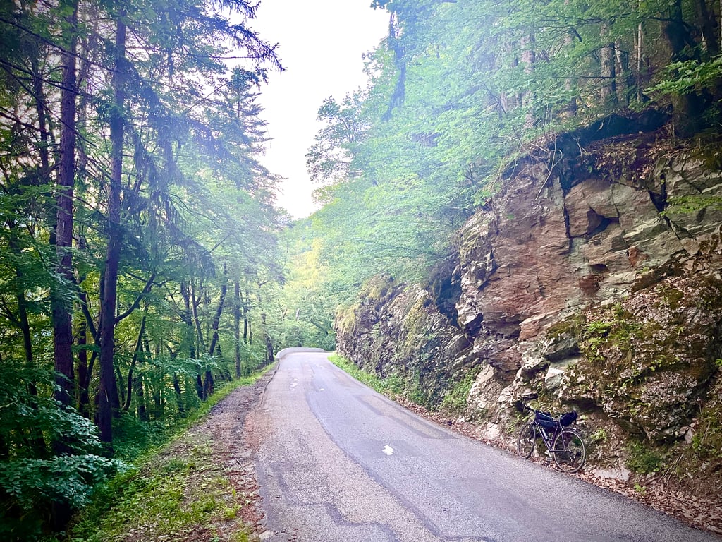
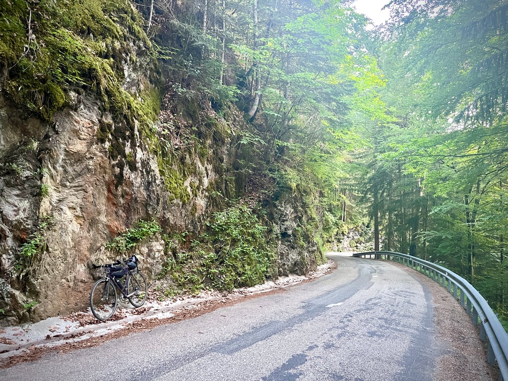
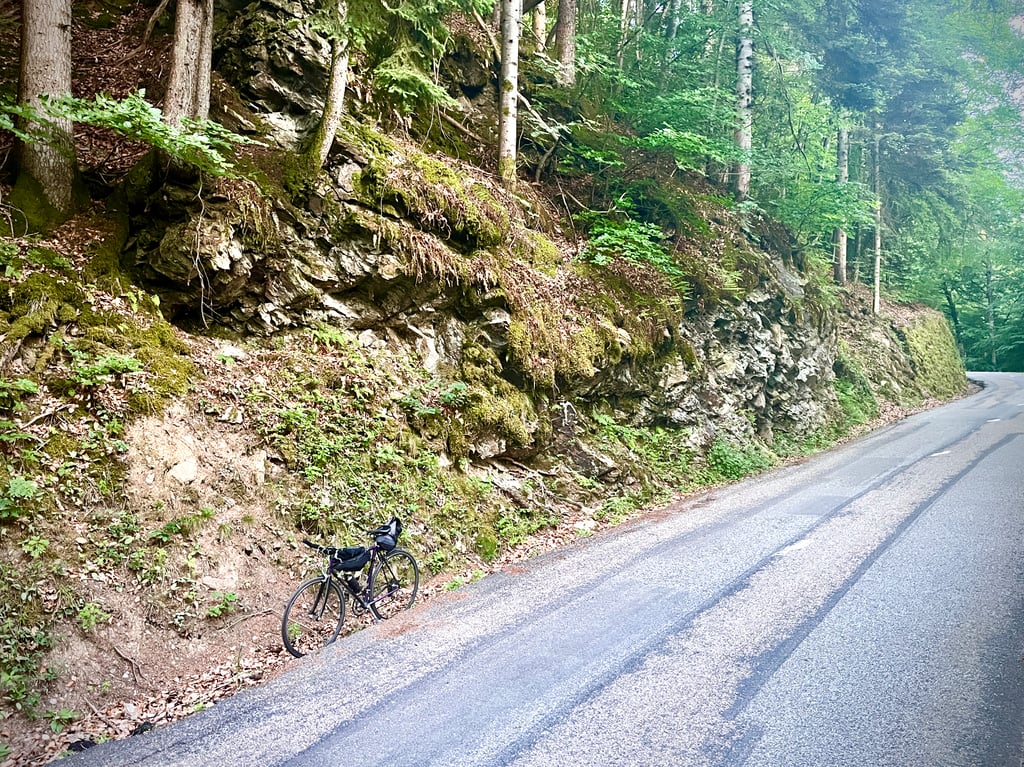
This Forclaz is the lowest. It's the shortest. But it's not the least steep. An average of 8% with a serious age gradient well above that. It's short, but solid. A road in decent condition. Well patched in places. Not much traffic.
A few pleasant rocks accompany us through the forest, but nothing magical. Nothing to see at the summit.
Beaucoup de trop cols de la Forclaz ! On le barre de sa liste, ce col de la Forclaz. Un autre surgit.
Un forclaz serait une forme géologique, un passage large se rétrécissant en forme de Y… Bien… Alors, ces Forclaz se trouvent au sud d’Annecy, au nord d’Albertville, dans le Valais suisse et aussi chez Décathlon.
Ce Forclaz là, c’est le moins haut. C’est le plus court. Mais, ce n’est pas le moins pentu. 8% de moyenne avec un passtout de même age sérieux bien au delà. C’est court, mais solide. Une route dans un état correct. Bien rapiécée par endroits. Peu de circulation.
Quelques roches plaisantes nous accompagnent dans la forêt, mais rien de magique. Rien à voir au sommet.
This was the very first climb on our Alps trip. Found it hard and began to question that if I found this tough how was I going to do the bigger climbs. It’s all in the head 🤯
A classic for local cyclists, I sometimes do it several times a year and despite its short length it is not to be taken lightly as there are some significant gradients.
This road allows you to join the Beaufort road at the exit of Queige, a pass climbed by the Tour de France riders in 2016.
View on the valley linking Albertville to Ugine and on the Massif des Bauges on the other side of the road.
Un classique pour les cyclistes du coin, je le fait parfois plusieurs fois par an et malgré sa faible longueur il ne faut pas le prendre à la légère car ils y a des pourcentages non négligeables.
Cette route permet de rejoindre celle de Beaufort à la sortie de Queige, col monté par les coureurs du Tour de France en 2016.
Vue sur la vallée reliant Albertville à Ugine et sur le Massif des Bauges de l'autre coté de la voie rapide.
| 7 km/h | 00:47:53 |
| 11 km/h | 00:30:28 |
| 15 km/h | 00:22:21 |
| 19 km/h | 00:17:38 |
This page is better in the app