Tips nearby


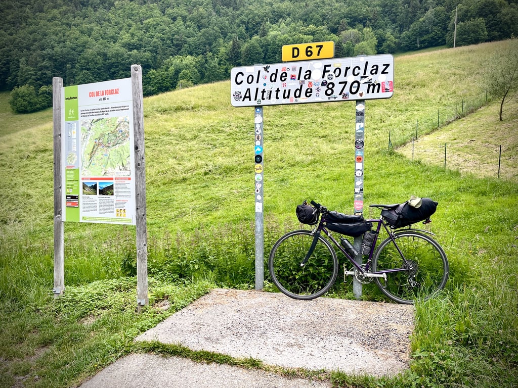
Col de La Forclaz from Queige via Col de Montessuit is a climb in the region Annecy. It is 8.9 km long and bridges 578 m of vertical ascent with an average gradient of 6.5%, resulting in a difficulty score of 479. The top of the ascent is located at 873 m above sea level. Climbfinder users shared 2 reviews of this climb and uploaded 17 photos.
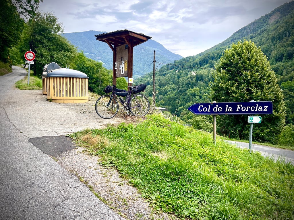
Road names: Route du Villaret & Route de la Forclaz
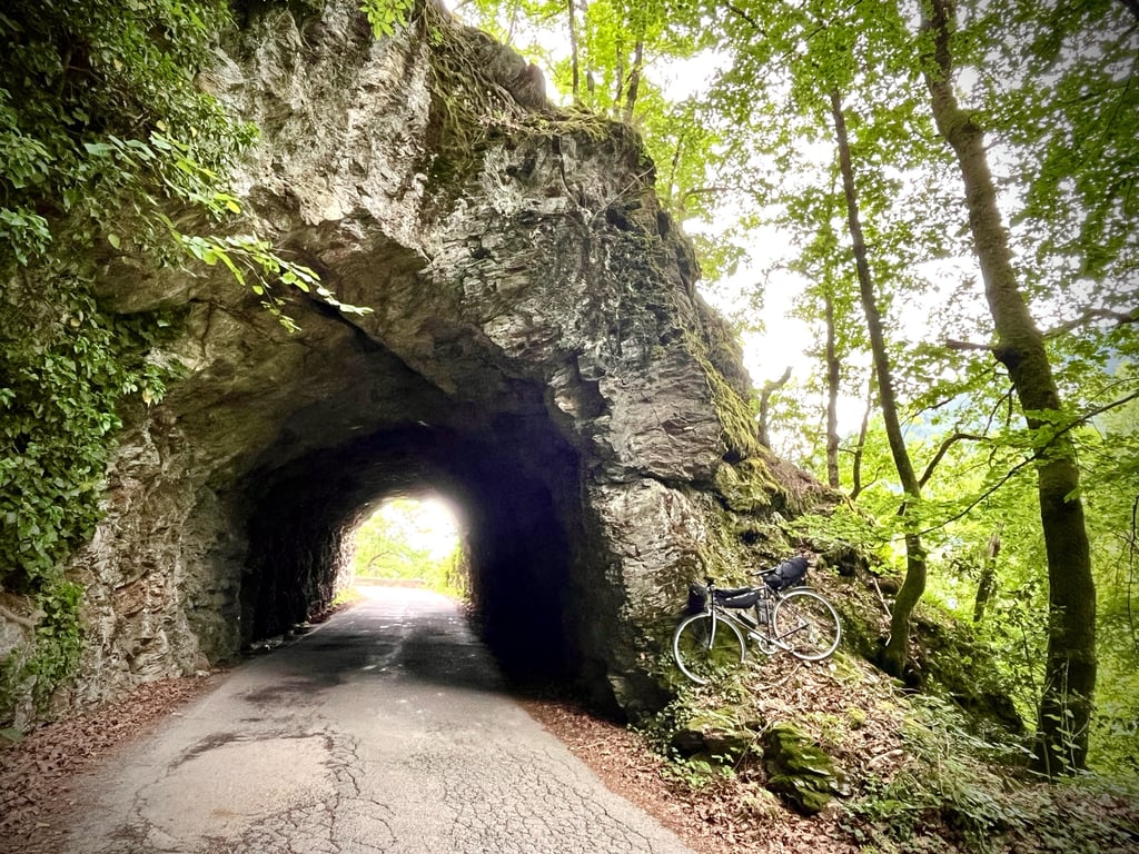
4.0 by sergenavetatThis is an automatic translation, the original language is: French.The longest of the variants and also the one with the most difference in altitude as there is a slight loss of altitude after the passage of the Montessuit pass. There are some nice views and a nice little road after Arechettaz with a tunnel cut in the rock. If you are staying near Albertville, this climb is worth a diversion.... read more

Welcome! Please activate your account if you would like to share something. Look for the verification email in your inbox.
If you want to upload your photos, you need to create an account. It only takes 1 minute and it's completely free.
One of the pleasant routes from Albertville to Beaufort. We start with the Col de Montessuit, which I wrote about 6 months ago. Some fairly solid sections. The road deteriorates a little after Césarches.
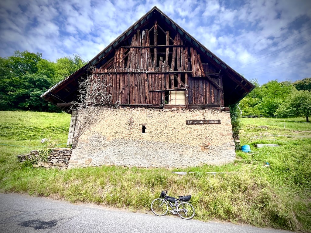
A fairly pleasant climb that leads to quite a descent after the first pass. Worth seeing: "la Grange à Robert" and a cute little tunnel. Some pleasant views. Not much traffic. A random and uneven surface. The road authorities have had the good sense to throw astronomical amounts of gravel everywhere. Be careful on your way back down to Queige.
The second ascent to La Forclaz is easier than the Col de Montessuit.
The finish at the col is a little disappointing.
All in all, a quiet and pleasant climb, but there are much better things to do around Albertville.
Une des routes agréables pour aller d’Albertville à Beaufort. On commence par le col de Montessuit sur lequel j’avais laissé quelques mots il y a 6 mois. Quelques passages assez solides. Une route qui se dégrade un peu après Césarches.
Une montée plutôt agréable qui nous offre une sacrée descente après le premier col. À voir : « la Grange à Robert » et un petit tunnel tout mignon. Quelques vues plaisantes. Peu de circulation. Un revêtement aléatoire et inégal. La voirie a eu la bonne idée de jeter des quantités astronomiques de gravillons partout. Attention, si vous redescendez sur Queige.
La seconde montée vers La Forclaz est plus facile que le col de Montessuit.
L’arrivée au col est un peu décevante.
En résumé, une ascension calme et sympathique, mais, il y a bien mieux dans les environs d’Albertville.
The longest of the variants and also the one with the most difference in altitude as there is a slight loss of altitude after the passage of the Montessuit pass.
There are some nice views and a nice little road after Arechettaz with a tunnel cut in the rock.
If you are staying near Albertville, this climb is worth a diversion.
La plus longue de variantes et aussi celles qui a le plus de dénivelé car il y a une légère perte d'altitude après le passage du col de Montessuit .
Des jolies points de vues et une petite route sympa après Arechettaz avec le passage d'un tunnel taillé dans la roche.
Si vous venez séjourné du côté d'Albertville, cette ascension mérite un détour.
Le départ se situe à la Biolletta, direction Césarches, c'est à la sortie de la piste cyclable venant du camping d'Albertville en direction d'Ugine.
| 7 km/h | 01:16:38 |
| 11 km/h | 00:48:46 |
| 15 km/h | 00:35:45 |
| 19 km/h | 00:28:14 |
This page is better in the app