| Beautiful scenery |
| 13 hairpin turns |
| #12 toughest climb of Vaud |
| #60 most elevation gain of Switzerland |
| #46 longest climb of Switzerland |
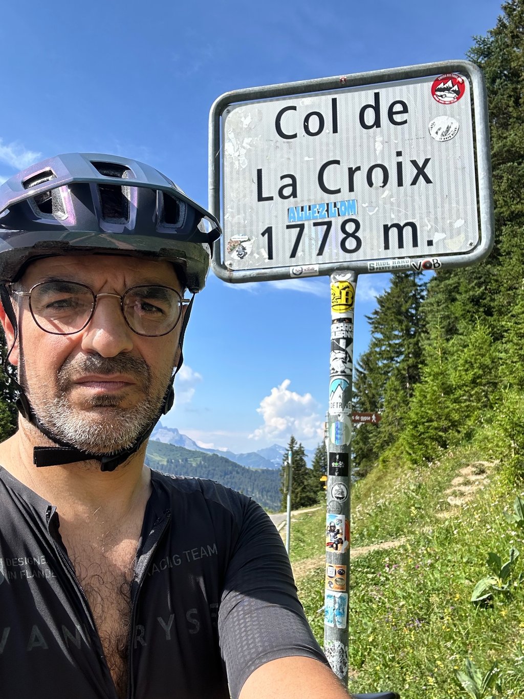
Col de la Croix from Bex is a climb in the region Vaud. It is 21.5 km long and bridges 1296 m of vertical ascent with an average gradient of 6%, resulting in a difficulty score of 990. The top of the ascent is located at 1778 m above sea level. Climbfinder users shared 5 reviews of this climb and uploaded 0 photos.
Road name: Route du Col de la Croix
3.0 by Vinch76This is an automatic translation, the original language is: French.Hard, easy and hard climb..road under construction so no traffic at the start... For me, as a beginner, the 10% are lethal...but I managed it without putting my feet down... read more

Welcome! Please activate your account if you would like to share something. Look for the verification email in your inbox.
If you want to upload your photos, you need to create an account. It only takes 1 minute and it's completely free.
A beautiful climb – long but fairly steady, at least as far as Gryon; after that, it flattens out all the way to Villars, and from there the final 7 km begin. These are easy going until three kilometres from the pass, where the gradients reach almost 10 per cent; and after 20 km of climbing, I can assure you they really take their toll.
Bellissima salita, lunga ma abbastanza regolare almeno fino a Gryon, dopo spiana fino a Villars e da lì partono i 7 km finali, facili fini a tre dal colle dove si trovano pendenze quasi al 10 per cento, e dopo 20 km di salita vi assicuro che si fanno sentire
Quite a tough two-part climb (especially km 3 to 6 and the last 3) but a few km of recovery in between😊
Montée en deux parties assez difficiles (notamment les km 3 à 6 et les 3 derniers) mais quelques km de recup entre deux😊
A really recommendable alternative if you want to approach the pass from the south and avoid the heavy traffic on the ascent from Aigle. The construction work has now finished and you can make good progress again. Up to Gryon, it is a little arduous but never particularly steep. After that it flattens out as far as Villars. From there, the final stretch is the same as if you were coming up from Aigle. Whether ascending or descending, caution is advised due to the railway tracks, some of which run through the asphalt in the middle of the road and are not safe for cyclists.
Eine wirklich empfehlenswerte Alternative, wenn man den Pass von Süden anfahren will und den starken Verkehr auf der Auffahrt ab Aigle vermeiden will. Inzwischen sind die Bauarbeiten beendet und man kommt wieder gut voran. Bis Gryon ist es etwas mühselig aber nie besonders steil. Danach wird des flacher bis nach Villars. Von dort dieselbe Endstrecke als käme man von Aigle hoch. Egal ob Auffahrt oder Abfahrt, Vorsicht ist geboten aufgrund der Bahngleise, die zum Teil mitten auf der Straße im Asphalt verlaufen, für Radfahrer nicht ungefährlich.
Hard, easy and hard climb..road under construction so no traffic at the start...
For me, as a beginner, the 10% are lethal...but I managed it without putting my feet down
Montee dure, facile et redure..route en travaux donc pas de circulation au debut..
Pour moi debutant les 10% sont mortels...mais reussi sans poser pieds a terre
Beautiful climb. Very long, it helps if you divide it into pieces. Until after Gryon it is steep, sometimes very steep. After that, it's offside until Villars, after which it goes up to double digits again. Then a few kilometres flat (or let it be 1%) and you have to work hard for the last 4 kilometres before this rascal gives in. Once on top of the climb, you see... nothing. A gravel parking lot with a small coffee shop that is closed most of the day. I found it a nice col, but just a bit too long for fun. Nice and varied climbing.
Prachtige klim. Wel heel lang, het helpt als je hem in stukjes opdeelt. Tot na Gryon is het steil, soms heel erg steil. Daarna is het tot Villars buitenblad, waarna het weer de dubbele stijgingscijfers in gaat. Dan komt er een paar kilometer vlak (of laat het 1% zijn) en mag je de laatste 4 kilometer nog even flink ploeteren voordat deze rakker zich gewonnen geeft. Eenmaal boven op de col zie je... niets. Een grindparkeerplaats met een klein koffietentje dat het grootste gedeelte van de dag dicht is. Ik vond het een mooie col, maar net iets te lang voor de leuk. Wel lekker afwisselend klimmen.
| 7 km/h | 03:03:51 |
| 11 km/h | 01:57:00 |
| 15 km/h | 01:25:48 |
| 19 km/h | 01:07:44 |
This page is better in the app