| Gravel |
| #72 toughest climb of Switzerland |
| #33 most elevation gain of Switzerland |
| #23 longest climb of Switzerland |
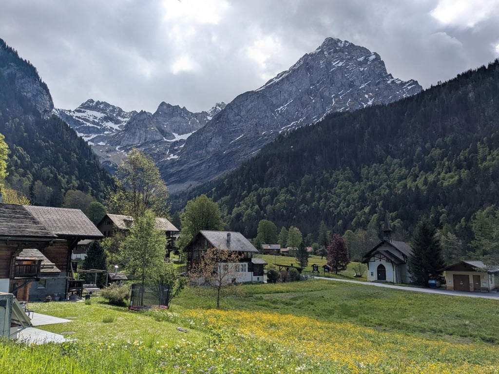
Col de la Croix from Bex via Les Plans sur Bex is a climb in the region Vaud. It is 25.5 km long and bridges 1404 m of vertical ascent with an average gradient of 5.5%, resulting in a difficulty score of 1135. The top of the ascent is located at 1774 m above sea level. Climbfinder users shared 3 reviews of this climb and uploaded 1 photo.
Road names: Route de Gryon, Route de Sublin, Route des Plans, Route des Torneresses, Route des Pars, Chemin de la Rote, Route des Frasses, Route de Sodoleuvre & Route du Col de la Croix
3.0 by PHILIPPEM95This is an automatic translation, the original language is: French.The Gravel section is clearly impassable with a road bike... read more
Welcome! Please activate your account if you would like to share something. Look for the verification email in your inbox.
If you want to upload your photos, you need to create an account. It only takes 1 minute and it's completely free.
The Gravel section is clearly impassable with a road bike
La fraction Gravel est clairement impraticable avec un vélo de route
The first part up to the Plans-sur-Bex is on a small road in bad conditions, very dirty but doable with a road bike. No traffic, plus there are nice views in Plans-sur-Bex. Then it joins the usual climb to Villars/Col de la Croix from Gryon. A nice alternative to the two other ascents to the Col de la Croix!
Despite the steep gradients at the start, it's a relatively easy climb. Lots of rest between the ramps, some of which are quite steep. I had to walk about 300 m because the stones on the road were too big, but the view and the peace and quiet are worth it if you're not looking for performance!
Malgré les pourcentages du début, c'est une montée relativement facile. Beaucoup de moment se repos entre les rampes qui sont pour certaines assez raide. J ai du marcher sur environ 300 m car les cailloux de la route était trop gros mais la vue et la tranquillité valent la peine si on cherche pas la performance !
| 7 km/h | 03:38:45 |
| 11 km/h | 02:19:12 |
| 15 km/h | 01:42:05 |
| 19 km/h | 01:20:35 |
This page is better in the app