Tips nearby


| Famous climb |
| Beautiful scenery |
| 13 hairpin turns |
| #97 toughest climb of Haute Savoie |
| #51 most elevation gain of Haute Savoie |
| #38 longest climb of Haute Savoie |
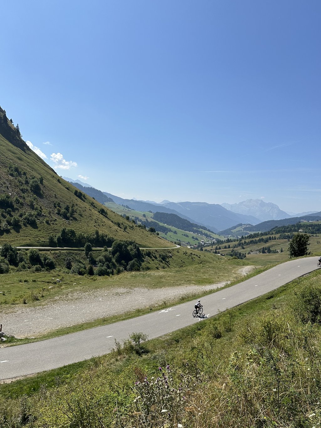
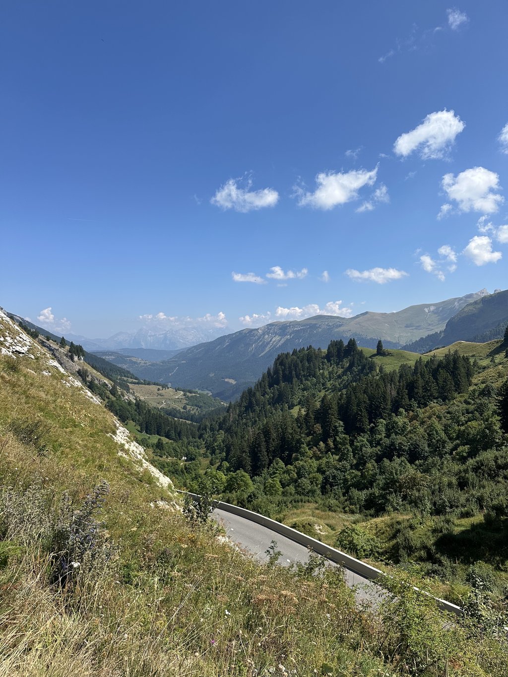
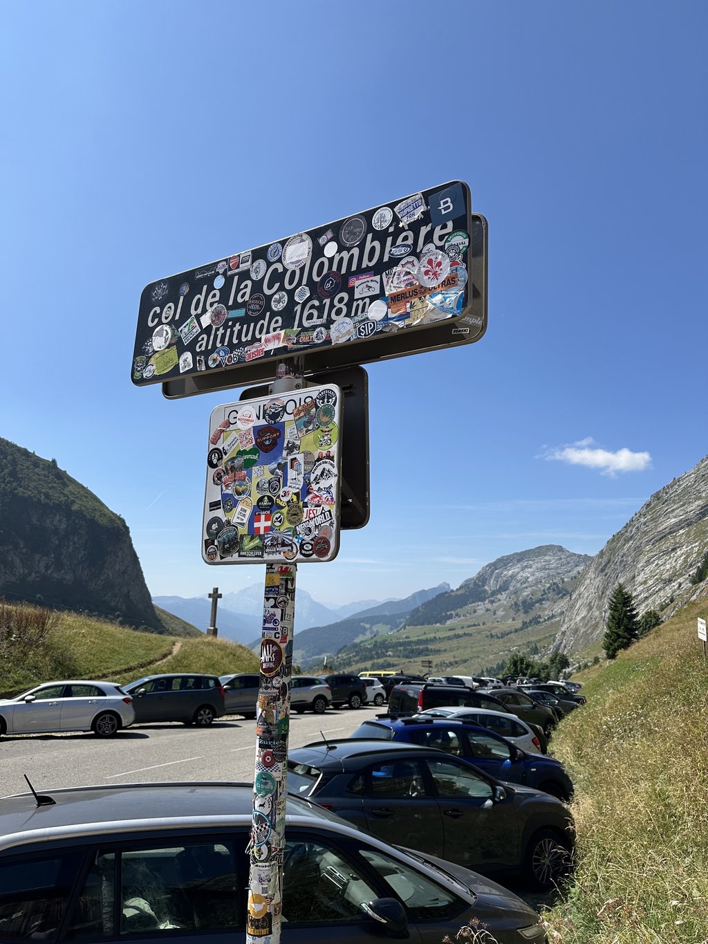
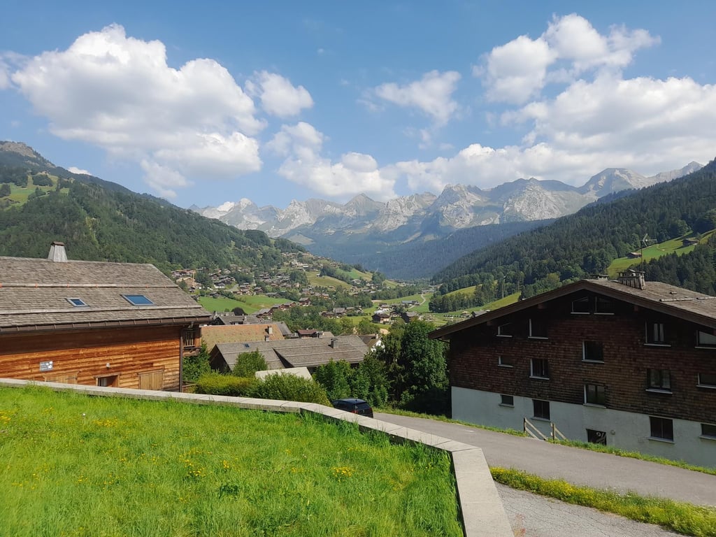
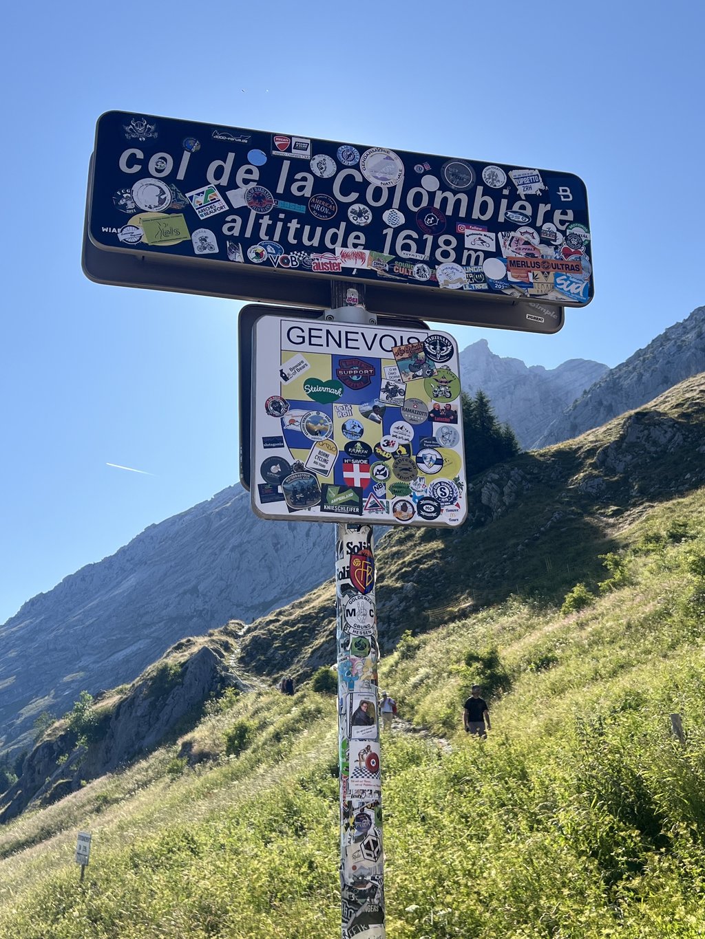
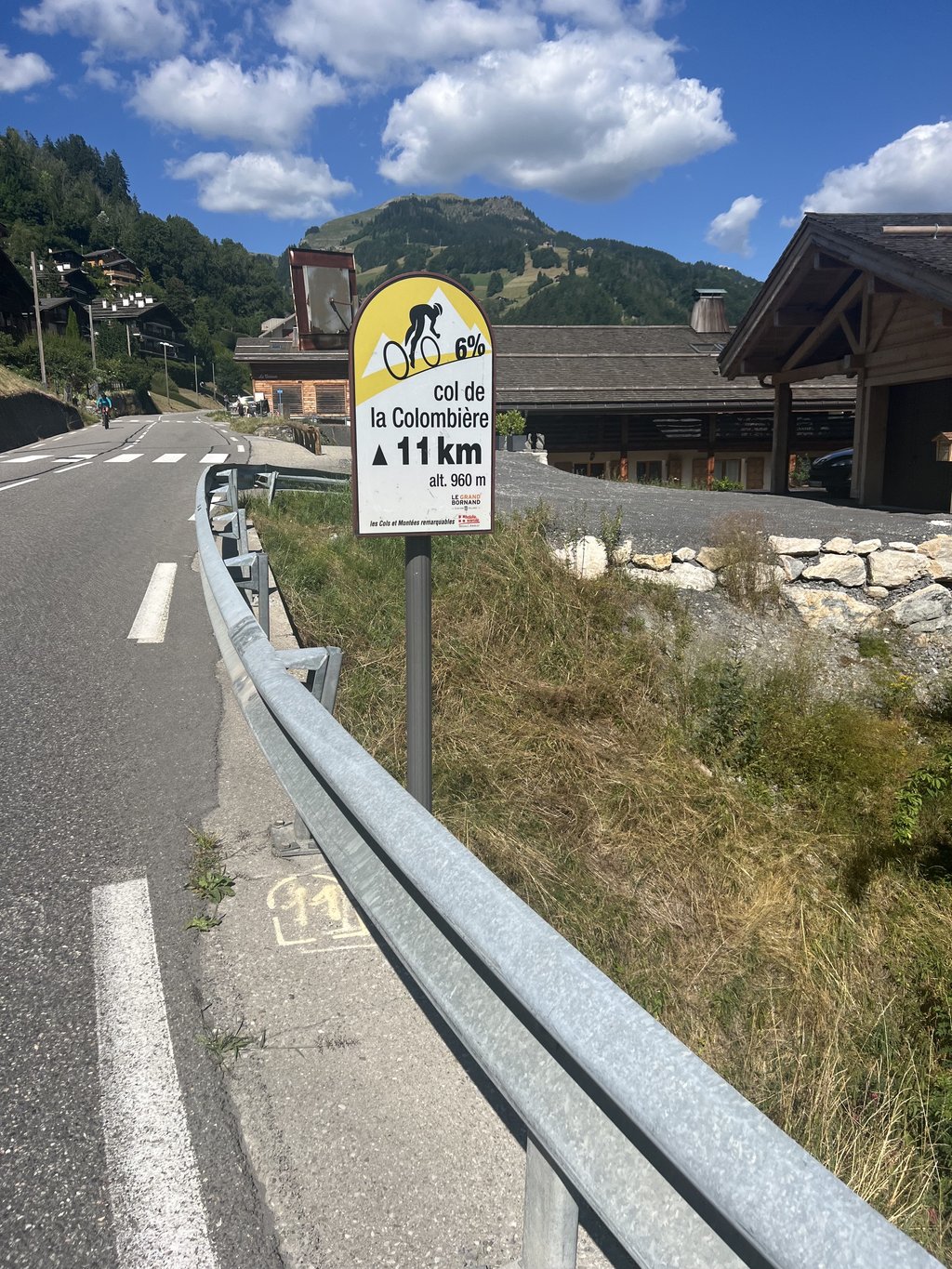
Col de la Colombière from Le Grand Bornand is a climb in the region Annecy. It is 11.8 km long and bridges 693 m of vertical ascent with an average gradient of 5.9%, resulting in a difficulty score of 452. The top of the ascent is located at 1605 m above sea level. Climbfinder users shared 20 reviews of this climb and uploaded 39 photos.
Road names: D4 & Route de Chinaillon
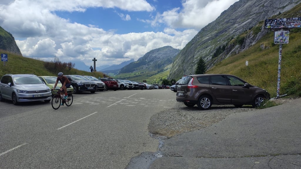
5.0 by FazThis is an automatic translation, the original language is: French.Mounted from Le Grand-Bornand, on 6/08/22 As in all the remarkable passes, the only real drawback is the overabundance of motorbikes. Apart from this unfortunate popularity, the Colombière is a must-have in the amateur climber's palmares! The first few kilometres are pleasant (despite more traffic than on the rest of the route), and there is a relative resting place before tackling the last few bends, which are the most beautiful, but also the most difficult. I strongly recommend doin... read more
Welcome! Please activate your account if you would like to share something. Look for the verification email in your inbox.
If you want to upload your photos, you need to create an account. It only takes 1 minute and it's completely free.
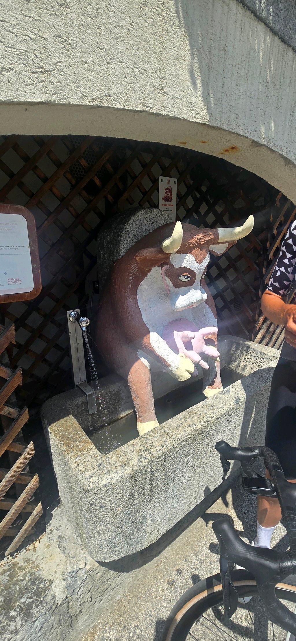
Beautiful climb, great views, quite a few motorbikes. Great patisserie at the bottom in grand bornand and a novelty vache drinking water fountain 😎
Super nice climb, easy to do. Definitely must have done. Wonderful how the pass runs beautifully through the villages
Super mooie beklimming, goed te doen. Moet je zeker gedaan hebben. Schitterend hoe de pas mooi door de dorpjes loopt
Nice fairly easy climb. No very high %. However, lots of traffic which makes the climb less enjoyable. Once past the last village before the summit, it's much quieter.
Belle montée assez facile. Pas de % très élevés. Par contre, beaucoup de circulation qui rend la montée moins agréable. Une fois passé le dernier village avant le sommet, c’est beaucoup plus calme.
A very nice pass, fairly easy to ride, with no extreme gradients, and very interesting to do. Often clear, but beware of the heavy traffic on summer weekends.
Un très beau col, assez roulant, sans pourcentage extrême, très intéressant à faire. Souvent dégagé, attention les week-end d'été la circulation y est très importante.
This was my first ever Col, done whilst holidaying in nearby Saint Jean de Sixt. Done on on a very warm day in July. Was an absolutely stunning ride, certainly longer than any climbs I have done previously in the UK (Fred Whitton been the hardest), but at a steady 11km at 6-8% almost all the way up to the top, was very pleasant. Traffic was decent, very respectful of riders and relatively quiet. I would definitely recommend it.
Nice climb. Nice views on the way left with mighty rocky outcrops. A bit trickier at the end.
Leuke klim. Mooie uitzichten onderweg naar links met machtige rotspartijen. Aan het einde wat lastiger.
Did this one after col de Glieres, it’s a soft continuous climb, does get very hard anywhere, so pleasant. Descent into La Giettaz and then to Megeve is absolutely gorgeous
Beautiful climb with nice views, with good tarmac. Start a bit irregular, with sections where you can catch your breath again, last section is the spiciest.
Nice climb to combine with other climbs nearby. Options abound.
Mooie klim met mooie uitzichten, met goed asfalt. Begin beetje onregelmatig, met stukken waar je weer goed op adem kunt komen, laatste stuk is het pittigst.
Leuke klim om te combineren met andere beklimmingen in de buurt. Opties in overvloed.
Nice climb to have done. The first stretch you ride from village to village. The last stretch is more open and also gets steeper. Don't forget to enjoy the views of the whole valley here.
Leuke klim om gedaan te hebben. Het eerste stuk rijd je van dorp naar dorp. Het laatste stuk is meer opener en wordt ook steiler. Vergeet hier niet om te genieten over het uitzicht van de gehele vallei.
Climb done on 19 May'23. Started at Lake Annecy. Cycled via col de Bluffy towards Thônes and from there first rode up the Col de La Croix Fry. Then took the descent to Le Grand Bornand to climb the Col de la Colombière from there. The weather was cloudy. It was not too warm (around 19 degrees). The climb in itself is easy to do even if you have climbed 2 other cols. Little or no traffic. Very occasional cars and the cyclists I encountered could be counted on one hand. You pass a few villages where you can catch your breath. The last stretch to the top is a bit steeper. Once at the top, you can enjoy stunning views. Unfortunately, there was nothing open at the summit where you could drink and/or eat something. So back down to find a terrace in Le Grand Bornand. Nice descent. Only it started to rain slightly. Definitely worth a ride.
Klim gedaan op 19 mei’23. Vertrokken aan het meer van Annecy. Via col de Bluffy richting Thônes gefietst en van daar eerst de Col de La Croix Fry opgereden. Vervolgens de afdaling naar Le Grand Bornand genomen om van daaruit de Col de la Colombière te beklimmen. Het weer was bewolkt. Het was niet al te warm (rond de 19 graden). De klim op zich is gerust te doen ook al heb je 2 andere cols beklommen. Weinig of geen verkeer. Heel af en toe een auto en de fietsers die ik tegenkwam, kon je op 1 hand tellen. Je passeert enkele dorpen waar je gerust op adem kan komen. Het laatste stuk tot aan de top is iets steiler. Eenmaal boven kan je genieten van een prachtig uitzicht. Jammer genoeg was er op de top niks open waar je iets kon drinken en/of eten. Dan maar terug naar beneden om in Le Grand Bornand een terrasje op te zoeken. Leuke afdaling. Alleen begon het lichtjes te regenen. Zeker wel de moeite om eens op te fietsen.
Very nice, fairly steady climb to finish with 7/7 and 9%. Leave early to avoid the traffic! Note the pleasure of alternately admiring the Pointe Percée and the Tournette! Bar open at the top from 09h00!!!
Effectuée le 8 aout 2022
Très belle montée assez régulière pour finir par 7/7 et 9%. Partir tôt pour éviter la circulation! A noter le plaisir d admirer alternativement la pointe percée et la Tournette! Bar ouvert au sommet à partir de 09h00!!!
Mounted from Le Grand-Bornand, on 6/08/22
As in all the remarkable passes, the only real drawback is the overabundance of motorbikes.
Apart from this unfortunate popularity, the Colombière is a must-have in the amateur climber's palmares! The first few kilometres are pleasant (despite more traffic than on the rest of the route), and there is a relative resting place before tackling the last few bends, which are the most beautiful, but also the most difficult.
I strongly recommend doing the climb in the cooler weather, adapting your departure according to the time you expect to arrive at the pass: every metre is exposed to the sun.
The descent by the same side is very pleasant, with very good tarmac (except at Chinaillon) and very accessible curves for those who have a minimum of control of their trajectories and brakes.
I also recommend, from my own experience, an alternative for the more sporty: leave Thônes in the direction of Manigod to climb the Croix-Fry, as a bonus! A quiet descent to La Clusaz and then Saint-Jean-de-Sixt (watch out for the traffic in the streets: it is not unusual to put your foot down several times), to finally switch to Le Grand-Bornand and attack La Colombière with momentum!
Monté depuis le Grand-Bornand, le 6/08/22
Comme dans tous les cols remarquables, le seul vrai bémol sera la surabondance de motos.
Outre cette malheureuse popularité, la Colombière est un must-have dans le palmarès du grimpeur amateur ! Des premiers kilomètres agréables (malgré la circulation plus importante que sur la suite), un replat de récup' relative pour attaquer les derniers lacets, qui sont les plus beaux, mais aussi les plus difficiles.
Je recommande grandement d'effectuer la montée à la fraîche, adaptez votre départ en fonction d'à quelle heure vous pensez arriver au col : chaque mètre est exposé au soleil.
La redescente par ce même côté est très agréable, avec un très bon goudron (mis à part au Chinaillon) et des courbes très abordables pour qui maitrise un minimum ses trajectoires et ses freins.
Je recommande également, de ma propre expérience, une alternative pour les plus sportifs : partez de Thônes en direction de Manigod afin de monter la Croix-Fry, en bonus ! Redescente tranquille sur la Clusaz puis Saint-Jean-de-Sixt (attention à la circulation dans les rues : il n'est pas rare de poser pied à terre plusieurs fois), pour enfin basculer sur le Grand-Bornand et attaquer la Colombière avec de l'élan !
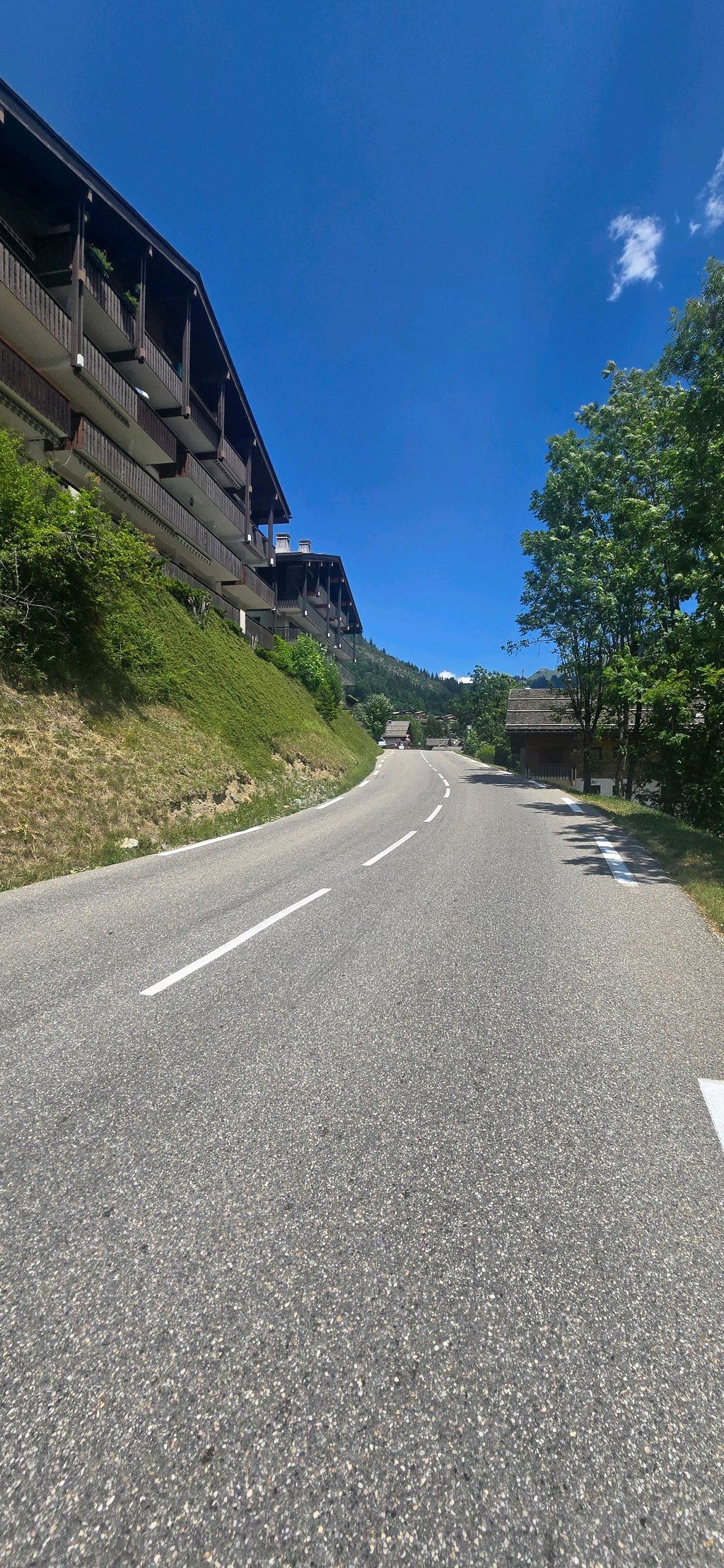
It can be quite busy in the first half of this climb. But as soon as you pass the last houses and cross the calmer landscape, it is quieter. You have beautiful views and especially the part that follows the relief of the flank of the mountain is beautiful. Never very steep and always a wide road that looks perfect.
Het kan in de eerste helft van deze beklimming toch wel druk zijn. Maar vanaf je de laatste huizen voorbij gaat en het kalere landschap doorkruist is het rustiger. Je hebt hier mooie uitzichten en vooral het deel dat het reliëf van de flank van de berg meevolgt is mooi. Nooit echt heel steil en altijd een brede weg die er perfect bijligt.
A very good memory of this climb. Accessible percentages, beautiful landscapes, especially at the end with this very beautiful panorama on the reliefs located after Cluses. There is a small raidar at 16 % at the entrance to chinaillon and be careful on the descent, there is a roundabout in chinaillon so be careful especially as there can be many people in this area.
Un très bon souvenir de cette montée. Des pourcentages accessibles, des beaux paysages, surtout à la fin avec ce très beau panorama sur les reliefs situés après Cluses. Il y a un petit raidar à 16 % à l 'entrée de chinaillon et attention dans la descente, il y a un rond-point dans chinaillon qui arrive assez vite donc soyez vigilants et ne vous laissez pas trop griser par la descente, surtout qu'il peut y avoir du monde dans ce coin. Bon revêtement.
The ascent to the Colombière pass by its southern side is not very difficult, 13 km long with a difference in height of 698 m, the average slope is only 5.4 %, the starting point is at the bridge over the Chinaillon at the bottom of the descent from St Jean de Sixt.
Only the last 3 kilometers are around 7 to 8 %
Note that on the entire climb there are no shady areas, in the middle of summer it's sunny from start to finish.
As for the water points, I didn't see any during the climb, I filled up with mineral water in St Jean de Sixt, welcome to those who can point out some.
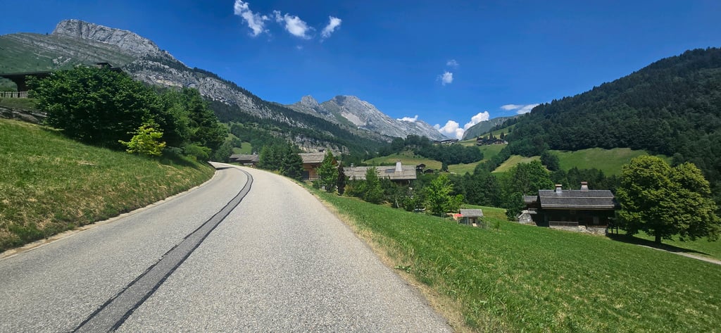
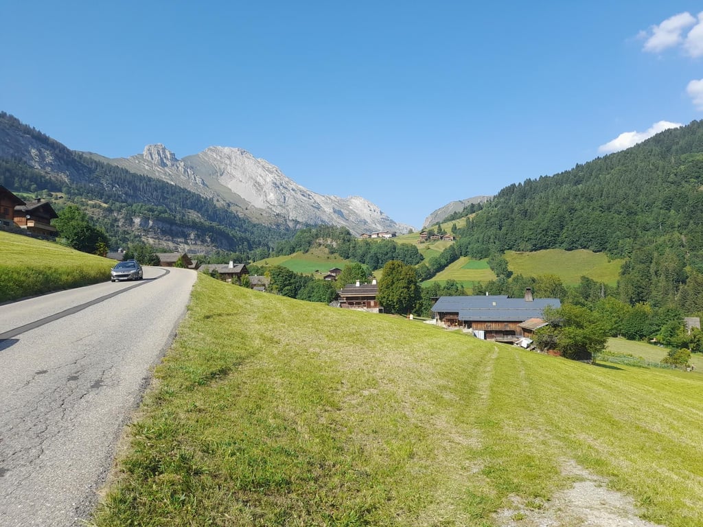
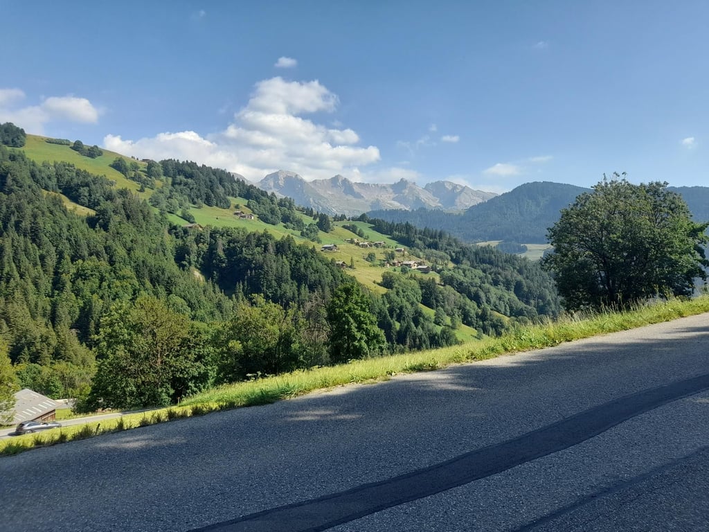
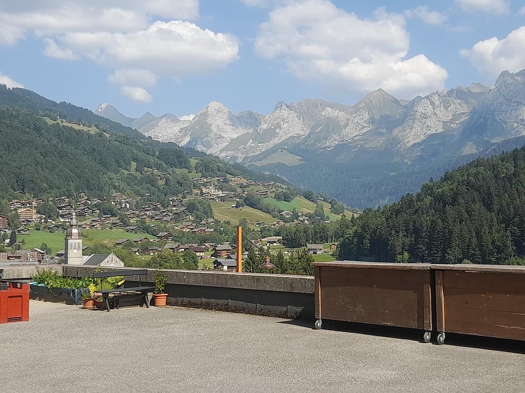
As for the landscape, we are in the heart of the Aravis massif, lots of mountain pastures, and above all the magnificent chalets (which have nothing to envy to those of our Swiss neighbours) above Grand-Bornand and at Chinaillon, at the top of the pass, a view of the other side of the valley on the Cluses side.
La montée au col de la Colombière par son versant Sud n'est pas d'une grande difficulté, d'une lg de 13Kms pour une dénivellation de 698M, la pente moyenne est seulement de 5,4 %, le départ point bas se situe au pont sur le Chinaillon en bas de la descente de St Jean de Sixt.
Seulement les 3 derniers kilomètres avoisinent les 7 à 8 %
A noter que sur l'intégralité de l'ascension il n'y a pas de zone d'ombre, en plein été c'est soleil du début à la fin.
Pour les points d'eau je n'en ai pas aperçu pendant la montée, j'ai fait le plein en eau minérale à St Jean de Sixt, bienvenue à ceux qui peuvent en signaler.
Coté paysage, nous sommes au cœur du massif des Aravis, beaucoup d'alpages, et surtout les magnifiques chalets ( qui n'ont rien n'a envier à ceux de nos voisins suisses ) au dessus du Grand- Bornand et au Chinaillon, au sommet du col, vue sur l'autre coté de la vallée coté Cluses.
Nice climb, not too difficult.
You cycle through alpine meadows and ski villages.
View is beautiful!
Definitely a must.
Asphalt good
Mooi beklimming, niet al te moeilijk.
Je fietst door alpenweiden en skidorpen.
Uitzicht is mooi!!!
Zeker een aanrader.
Asfalt goed
Once done from Annecy via the Forclaz towards Aravis and from there via Cluses up the Colombière with mn Bustraan Rih with 48/52 and behind max 6 I thought, stunning views of Mont Blanc and Lake Annecy perhaps, 2km before the summit an emergency stop by a flock of sheep, earned me a nice piece of sheep's cheese for the delay.
Nice conversation with the sheep herder who seemed to have passed the 4/20/10, more fun than a safari and then downhill in one piece to Annecy to surf for another hour before we went for dinner in quaint vieux Annecy feeling like you'd lost another 3kg. Swimming in the morning, then cycling and surfing/sailing, needn't have cost much, 1200fl budget for 3 weeks when there were giro payment cards and not had a puncture.
Climb time no idea, we counted our revolutions, 180 was about a km.
Ooit gedaan vanaf Annecy via de Forclaz richting Aravis en vandaar via Cluses de Colombière op met mn Bustraan Rih met 48/52 en achter max 6 dacht ik, schitterende vergezichten op Mont Blanc en Meer Annecy wellicht, 2km voor de top een noodstop door een kudde schapen, leverde me een leuke stukje schapenkaas op voor het oponthoud.
Leuk onderhoud met de schapenhoedster die de 4/20/10 al gepasseerd leek, leuker dan een safari en daarna aan een stuk afdalen naar Annecy om nog een uurtje te surfen voor we ging eten in het schilderachtige vieux Annecy met t gevoel alsof je weer 3kg kwijt was. 's ochtends zwemmen, daarna fietsen en surfen/zeilen, hoeft niet veel te kosten, 1200fl budget voor 3 weken toen er nog giro betaalkaarten waren en geen lekke band gehad.
Klimtijd geen idee, we telden onze omwentelingen, 180 was ca een km.
Certainly not the toughest, but absolutely one of the most beautiful climbs I have done: from St. Jean de Sixt it is enjoyable from the first kilometer. Nowhere really steep, perfect tarmac and beautiful views. Highly recommended!
Zeker niet de zwaarste, maar absoluut één van de mooiste beklimmingen die ik gedaan heb: vanaf St. Jean de Sixt is het vanaf de eerste kilometer genieten. Nergens echt stijl, perfect asfalt en schitterende vergezichten. Aanrader!
| 7 km/h | 01:41:28 |
| 11 km/h | 01:04:34 |
| 15 km/h | 00:47:21 |
| 19 km/h | 00:37:22 |
This page is better in the app