| Beautiful scenery |
| Hidden gem |
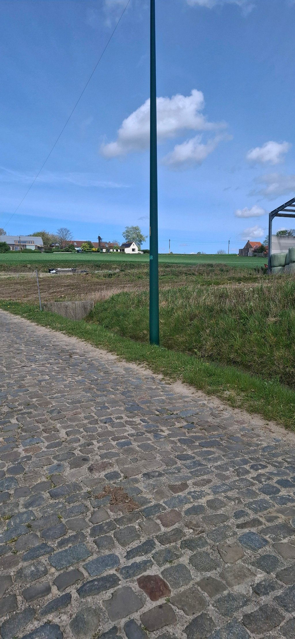
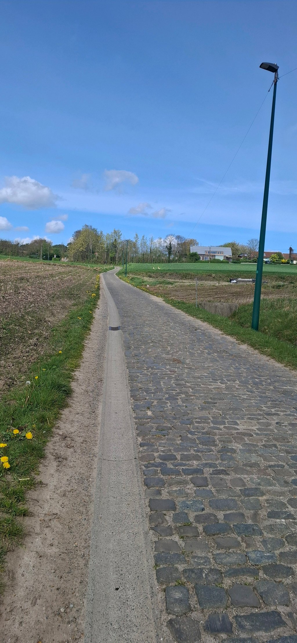
| Cobbles |
| #5 toughest climb of Schelde-Durme |
| #7 most elevation gain of Schelde-Durme |
| #19 longest climb of Schelde-Durme |
| #17 average steepest climb of Schelde-Durme |
Asselkouter from Heet is a climb in the region Oost-Vlaamse bloemenstreek. It is 0.7 km long and bridges 23 m of vertical ascent with an average gradient of 3.5%, resulting in a difficulty score of 13. The top of the ascent is located at 47 m above sea level. Climbfinder users shared 7 reviews of this climb and uploaded 3 photos.
Road name: Asselkouter
3.0 by SDVThis is an automatic translation, the original language is: Dutch.The cobbles can be bypassed at (for most of the climb) via the gully - not that steep, but the cobbles might make it tricky. Only very short so before you know it you're at the top.... read more
Welcome! Please activate your account if you would like to share something. Look for the verification email in your inbox.
If you want to upload your photos, you need to create an account. It only takes 1 minute and it's completely free.
Nice climb, Flemish Ardennes feel, not too long but found it steeper than expected and the cobbles are typical of the area.
Leuke klim, Vlaamse Ardennen gevoel, niet te lang maar vond het steiler dan verwacht en de kasseien zijn typisch voor de buurt.
Downhill is doable via the gully. Uphill is a different story. The climb starts on false flat asphalt and continues in cobbles. These are good on their own, but don't mistake the percentages on the app. It feels much steeper in reality and you will have to stand up when riding on the cobbles anyway (like a true flandrien). The spur is really not that steep and doesn't really count.
Bergaf is de klim te doen via het gootje. Omhoog is het een ander verhaal. De klim start op valsplat asfalt en gaat verder in kasseien. Deze liggen opzich goed, maar mispak je niet aan de percentages op de app. Het voelt in werkelijkheid veel steiler aan en je zal toch eens moeten gaan rechtstaan als je op de kasseien rijdt (zoals een echte flandrien). De uitloper is echt niet zo steil en telt eigenlijk niet mee.
Not so steep in itself but there is a rotten section of cobbles on it. Even downhill, this one is annoying to ride.
Op zich niet zo steil maar er ligt een rotstukje kasseien op. Zelfs bergaf is deze ambetant te rijden.
As you round the bend, you see the cobbles in front of you, and they look pretty bad. Then a small bend and you are at the top. But with the view afterwards, it is definitely worth it!
Als je de bocht om gaat zie je de kasseien pal voor je liggen en die liggen er best slecht bij. Daarna nog een klein knikje en je bent boven. Maar met het uitzicht erna is het zeker de moeite waard!
From the 'nothing' you suddenly see the cobblestone strip. No problem he starts 'quiet'. But halfway you get a little kink ... And then the cobblestones stop, you can go left and it gets even steeper. Delicious! Fortunately not so long.
Vanuit het 'niets' zie je ineens de kasseistrook liggen. Geen probleem hij begint 'rustig'. Maar halverwege krijg je een klein knikje... en dan stoppen de kasseitjes mag je naar links en wordt even nog steiler. Heerlijk! Gelukkig allemaal niet zo lang.
Cobblestones aren't in such good shape, but there is a gutter.
Nice for when you're in the neighborhood.
The view at the top is nice though.
Kasseien liggen er niet zo goed bij, maar er is een gootje.
Leuk voor als je in de buurt bent.
Het uitzicht boven is wel leuk meegenomen.
The cobbles can be bypassed at (for most of the climb) via the gully - not that steep, but the cobbles might make it tricky. Only very short so before you know it you're at the top.
De kasseien omzeilen kan bij (voor het grootste stuk van de klim) via het gootje - niet zo steil, maar de kasseien maken het misschien lastig. Slechts heel kort dus voor je het weet ben je boven.
| 7 km/h | 00:05:36 |
| 11 km/h | 00:03:34 |
| 15 km/h | 00:02:36 |
| 19 km/h | 00:02:03 |
This page is better in the app