View on map
© MapLibre | OpenStreetMap contributors
1%
2%
4%
6%
8%
10%
12%
15%
20%

Sophiaweg from Heilig Landstichting

3.0
2 reviews | Elevation profile | 5 photos
Tips nearby
Sophiaweg from Heilig Landstichting
transparant thumb
transparant thumb
transparant thumb
Your achievable time
Calculating based on your best performances...
Relaxed
Maximum
W/kg
W/kg
W/kg
Analyze your climbing performance
Detailed insight into your climbing performance & automatically check off climbs
Based on your best performances.
Your best attempt:
Number of attempts:
Elevation profile Sophiaweg from Heilig Landstichting

Statistics

Difficulty points 9
Length 0.7 mi
Average gradient 2.4%
Steepest segment 5.9%
Total ascent 85 ft
Feedback about this climb?
Show climbs nearby Export to GPS device

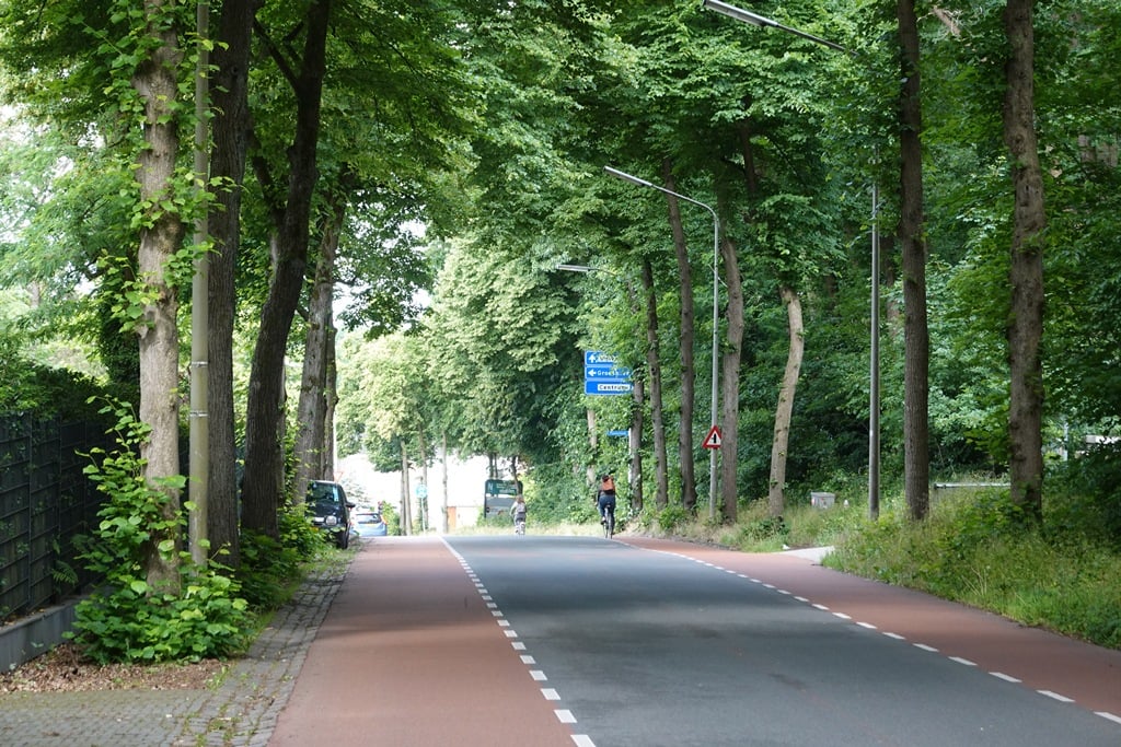
Sophiaweg from Heilig Landstichting is a climb in the region Rijk van Nijmegen. It is 0.7 mi long and bridges 85 ft of vertical ascent with an average gradient of 2.4%, resulting in a difficulty score of 9. The top of the ascent is located at 217 ft above sea level. Climbfinder users shared 2 reviews of this climb and uploaded 5 photos.

Road name: Sophiaweg
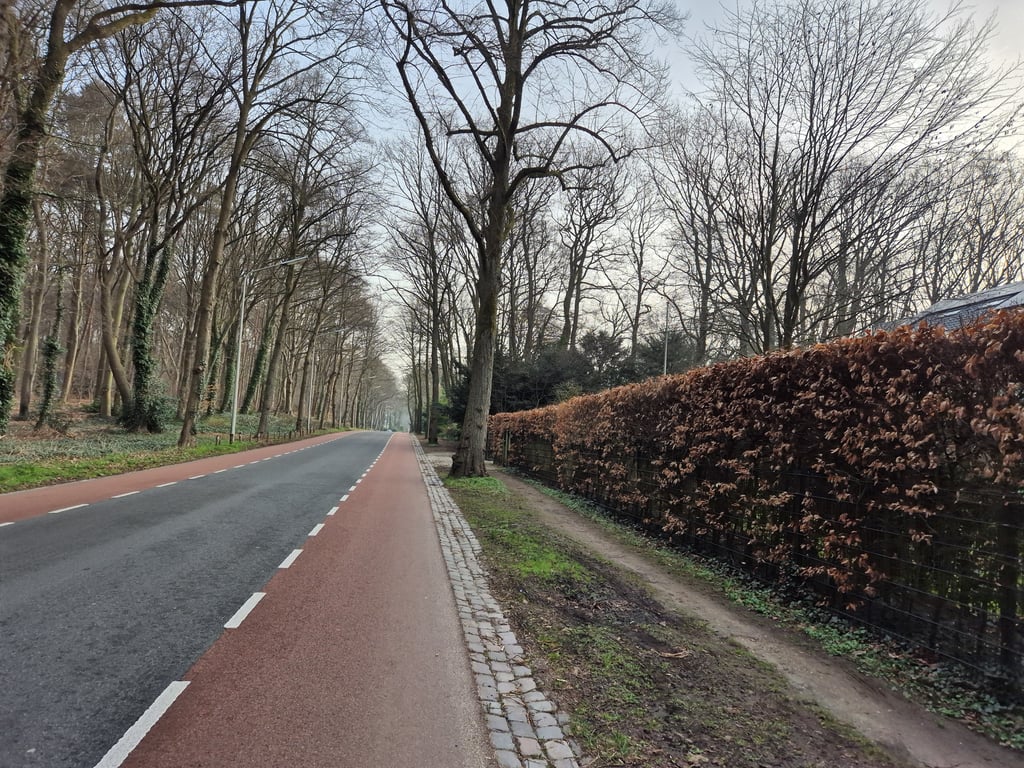
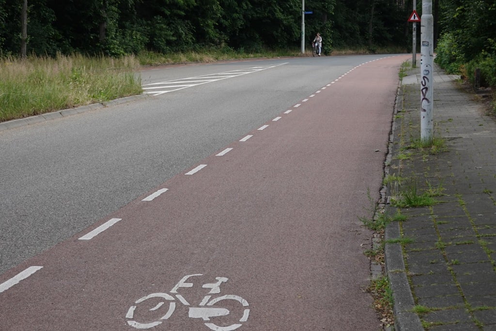
3.0 by Fedor
This is an automatic translation, the original language is: Dutch.
Runs nice for a while at the beginning but then flattens out and then it is soon cycling out. Wide and good road with a nice bike lane which does come in handy as it can be busy in terms of car traffic. Good connecting route so you quickly pick it up if you are in the area.... read more

Photos (5)

Sophiaweg from Heilig Landstichting
transparant thumb

Your uploads (max 4)

Welcome! Please activate your account if you would like to share something. Look for the verification email in your inbox.

If you want to upload your photos, you need to create an account. It only takes 1 minute and it's completely free.

  • Receive free climbfinder goodies for your reviews & photos.
  • Create a bucket list and check off conquered climbs.
  • Add missing climbs.
Continue with GoogleContinue with Google Continue with FacebookContinue with Facebook Continue with AppleContinue with Apple Sign up with email
By signing up you agree to our terms of service and confirm that you have read our privacy & content policy.

Reviews (2)

5.0
4.0
3.0
2.0
1.0
Fedor
3 Mo 3.0
This is an automatic translation, the original language is: Dutch. Show original

Runs nice for a while at the beginning but then flattens out and then it is soon cycling out. Wide and good road with a nice bike lane which does come in handy as it can be busy in terms of car traffic. Good connecting route so you quickly pick it up if you are in the area.

Loopt in het begin even leuk op maar vlakt daarna af en dan is het al snel uitfietsen. Brede en goede weg met een mooie fietsstrook die wel handig is, want het kan druk zijn qua autoverkeer. Goede verbindingsroute dus je pakt hem al snel mee als je in de buurt bent.

Dashboard
RobertS
3 Mo 3.0 via the Climbfinder app
This is an automatic translation, the original language is: Dutch. Show original

The finish line of the 2026 NK! The Sophiaweg always reminds me of something foreign: slight slope, big houses with lots of gardens in a forest. But the bike lane betrays that we are in NL. You start with a short sprint pustule that is easy to attack but the rest of the road is filthy false flat. It can be fairly busy but because of the lane and the fine asphalt it is not so bad.

De finish van het NK 2026! De Sophiaweg doet me altijd wat buitenlands aan: lichte helling, grote huizen met veel tuin in een bos. Maar de fietsstrook verraadt dat we in NL zijn. Je begint met een korte sprintpuist die makkelijk aan te vallen is maar de rest van de weg is smerig vals plat. Het kan redelijk druk zijn maar door de strook en het prima asfalt is dat niet zo erg.

Sophiaweg from Heilig Landstichting
Dashboard

Climbing times

5 mph 00:08:06
7 mph 00:05:44
9 mph 00:04:28
12 mph 00:03:21

Road surface condition

100% 0% 0%
Based on 1 vote
Share your knowledge. What was the road condition during your ascent?

Traffic

0% 100% 0%
Based on 1 vote
Your experience counts. How much traffic did you encounter during the climb?

Frequently Asked Questions

You don't need special gearing for Sophiaweg from Heilig Landstichting. The slope isn't long or steep enough to require much shifting down. You can conquer this climb on power alone. However, a compact gearing system with a smallest front chainring of 34 and largest rear sprocket of 28 or 30 is always nice if you enjoy cycling uphill. This helps maintain a smooth cadence.

Sophiaweg from Heilig Landstichting is not tough enough to be assigned a mountain category. This means that even untrained cyclists can reach the top without any problems on this climb.

Sophiaweg from Heilig Landstichting is 0.7 mi long.

The average gradient of Sophiaweg from Heilig Landstichting is 2.4%.

Sophiaweg from Heilig Landstichting has a steepest segment with an average gradient of 5.9%.

The summit of Sophiaweg from Heilig Landstichting is at 217 ft.

At a slow pace of 5 mph, it takes about 00:08:06 to climb Sophiaweg from Heilig Landstichting. At 7 mph the time is 00:05:44, and at 9 mph 00:04:28. For the fastest cyclists, 00:03:21 is an achievable time.

Sophiaweg from Heilig Landstichting is located in the region Rijk van Nijmegen in Netherlands.

This page is better in the app

Climbfinder app
Climbfinder
(Free)
Open