View on map
© MapLibre | OpenStreetMap contributors
1%
2%
4%
6%
8%
10%
12%
15%
20%

Roeselberg from Houwaart

2.3
3 reviews | Elevation profile | 6 photos
Tips nearby
Roeselberg from Houwaart
transparant thumb
transparant thumb
Your achievable time
Calculating based on your best performances...
Relaxed
Maximum
W/kg
W/kg
W/kg
Analyze your climbing performance
Detailed insight into your climbing performance & automatically check off climbs
Based on your best performances.
Your best attempt:
Number of attempts:
Elevation profile Roeselberg from Houwaart

Statistics

Difficulty points 27
Length 0.8 mi
Average gradient 4%
Steepest segment 9.2%
Total ascent 174 ft

Short recap

#30 toughest climb of Hageland
#7 most elevation gain of Hageland
#64 longest climb of Hageland
Feedback about this climb?
Show climbs nearby Export to GPS device

Roeselberg from Houwaart is a climb in the region Hageland. It is 0.8 mi long and bridges 174 ft of vertical ascent with an average gradient of 4%, resulting in a difficulty score of 27. The top of the ascent is located at 253 ft above sea level. Climbfinder users shared 3 reviews of this climb and uploaded 6 photos.

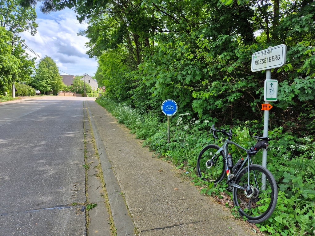
Road names: Kriebekestraat, Roeselberg & Stokskesstraat
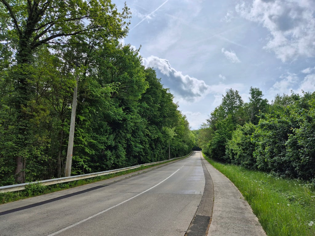
This is an automatic translation, the original language is: French.
The second part of this climb (after the left turn) is part of the Sven Nys Cycling Route. This is the most interesting part. The first part runs parallel to a very busy road and is itself quite busy.... read more

Photos (6)

Roeselberg from Houwaart

Your uploads (max 4)

Welcome! Please activate your account if you would like to share something. Look for the verification email in your inbox.

If you want to upload your photos, you need to create an account. It only takes 1 minute and it's completely free.

  • Receive free climbfinder goodies for your reviews & photos.
  • Create a bucket list and check off conquered climbs.
  • Add missing climbs.
Continue with GoogleContinue with Google Continue with FacebookContinue with Facebook Continue with AppleContinue with Apple Sign up with email
By signing up you agree to our terms of service and confirm that you have read our privacy & content policy.

Reviews (3)

5.0
4.0
3.0
2.0
1.0
Franck_Pastor
4 y 2.0
This is an automatic translation, the original language is: French. Show original

The second part of this climb (after the left turn) is part of the Sven Nys Cycling Route. This is the most interesting part. The first part runs parallel to a very busy road and is itself quite busy.

La deuxième partie de cette côte (après son virage à gauche) fait partie de la Sven Nys Cycling Route. C'est, de fait la partie la plus intéressante. La première partie est parallèle à une route à très grande circulation et est elle-même assez fréquentée.

Dashboard
Robbe_Buls
4 y 2.0
This is an automatic translation, the original language is: Dutch. Show original

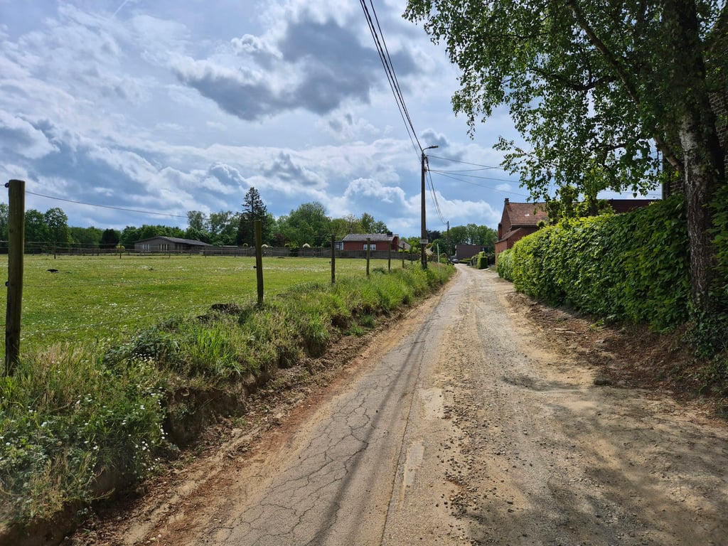
Nasty little thing. The asphalt doesn't go anywhere. It doesn't look steep, and yet you don't go forward one meter. Once you cross the road it gets visibly steeper. And then you feel less guilty than putting it on the little one, lol ;)

Vervelend dingetje. De asfalt loopt voor geen meter. Hij ziet er niet steil uit, en toch ga je geen meter vooruit. Eenmaal je de weg bent overgestoken wordt het ook zichtbaar steiler. En dan voel je je toch minder schuldig dan je hem op de kleine legt, hé ;)

Dashboard
Andre
5 y 3.0 00:04:35 (10.7 mph)
This is an automatic translation, the original language is: Dutch. Show original

Nice if you're in the neighborhood but the road is largely busy and does not look very nice. It is a calf biter in stairs though.

Leuk als je in de buurt bent maar de weg is grotendeels druk en oogt niet echt mooi. Het is wel een kuitenbijter in trappen.

Dashboard

Climbing times

5 mph 00:09:50
7 mph 00:06:57
9 mph 00:05:25
12 mph 00:04:04

Road surface condition

33% 33% 33%
Based on 3 votes
Share your knowledge. What was the road condition during your ascent?

Traffic

75% 25% 0%
Based on 4 votes
Your experience counts. How much traffic did you encounter during the climb?

Frequently Asked Questions

Roeselberg can be cycled from 5 sides. Roeselberg from Houwaart is the most popular side, but the summit can also be reached via Oude Aarschotsebaan from Sint-Joris-Winge, Troostembergbos from Luttelkolen, Troostembergbos from Sint-Joris-Winge & Bensberg from Vareveld.

You don't need special gearing for Roeselberg from Houwaart. The slope isn't long or steep enough to require much shifting down. You can conquer this climb on power alone. However, a compact gearing system with a smallest front chainring of 34 and largest rear sprocket of 28 or 30 is always nice if you enjoy cycling uphill. This helps maintain a smooth cadence.

Roeselberg from Houwaart falls into the 5th category. With good fitness, you can ride it up with speed and power. If you have less training, shift down and climb smoothly.

Roeselberg from Houwaart is 0.8 mi long.

The average gradient of Roeselberg from Houwaart is 4%.

Roeselberg from Houwaart has a steepest segment with an average gradient of 9.2%.

The summit of Roeselberg from Houwaart is at 253 ft.

At a slow pace of 5 mph, it takes about 00:09:50 to climb Roeselberg from Houwaart. At 7 mph the time is 00:06:57, and at 9 mph 00:05:25. For the fastest cyclists, 00:04:04 is an achievable time.

Roeselberg from Houwaart is located in the region Flemish Brabant in Belgium.

This page is better in the app

Climbfinder app
Climbfinder
(Free)
Open