Plein d'Cyr from Ahin is a climb in the region Valleys of the Meuse, Sambre and Orneau. It is 0.9 mi long and bridges 361 ft of vertical ascent with an average gradient of 7.6%, resulting in a difficulty score of 91. The top of the ascent is located at 617 ft above sea level. Climbfinder users shared 2 reviews of this climb and uploaded 3 photos.
This is an automatic translation, the original language is: Dutch.
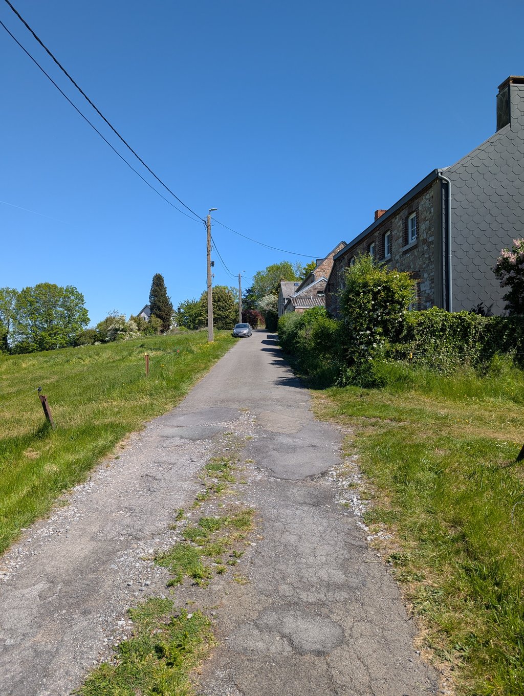
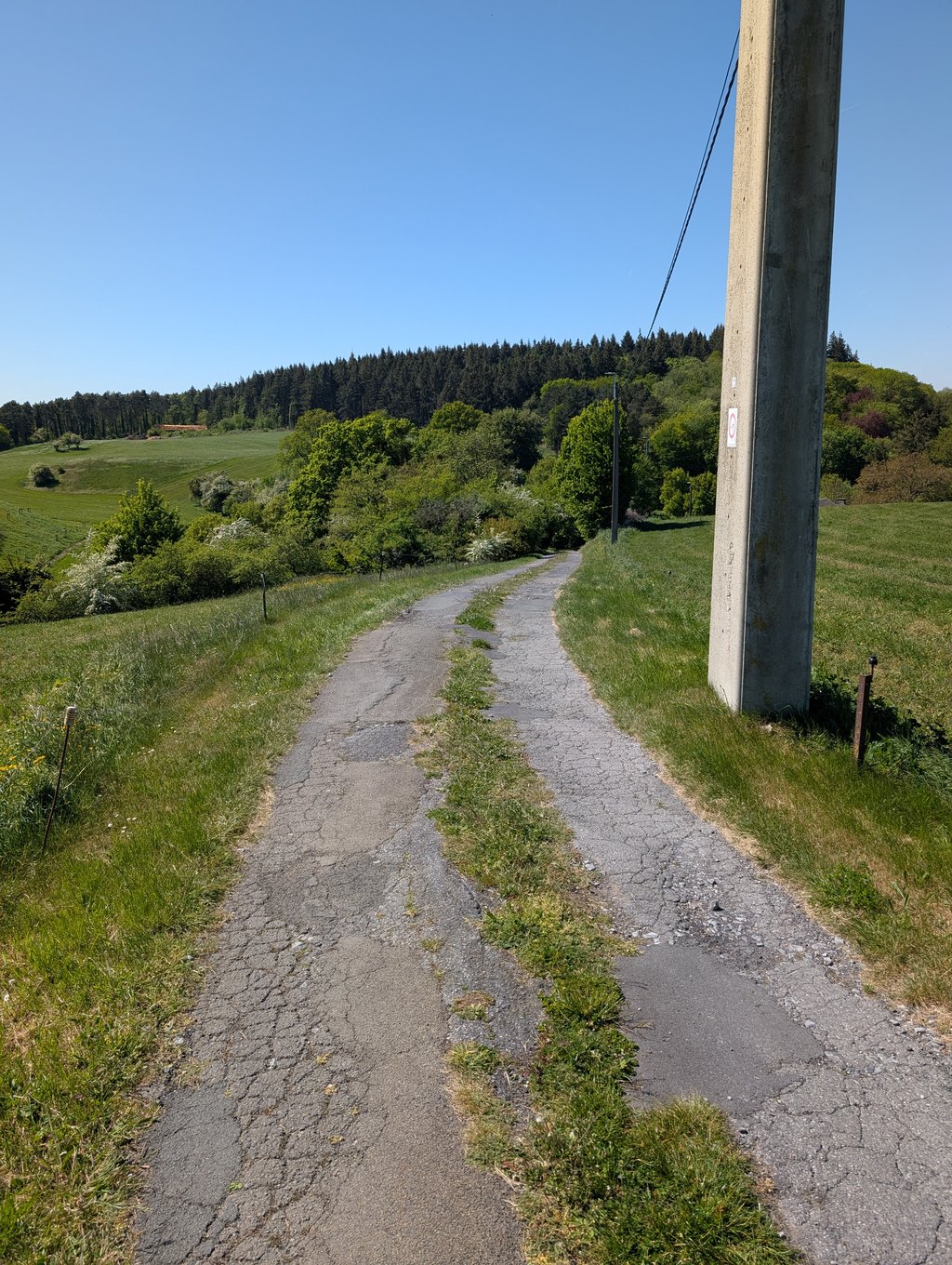
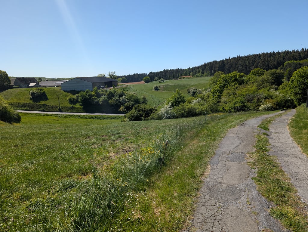
The Ben Ahin used to be climbed as a regular prick in the Flèche Wallonne. But with the search for alternatives to the sprint on the Muur van Hoei and thus the entry of the Cherave. The Ben Ahin has grown into oblivion. This climb is actually an alternative to the Ben. From the moment you turn onto the main road, the road surface is really bad. Since it is also quite steep, this is not an obvious one to do by road bike. The bad road surface is only really bad for a few hundred meters. At the to...read more
Photos (3)
Welcome! Please activate your account if you would like to share something. Look for the verification email in your inbox.
This is an automatic translation, the original language is: Dutch.
Show original
The Ben Ahin used to be climbed as a regular prick in the Flèche Wallonne. But with the search for alternatives to the sprint on the Muur van Hoei and thus the entry of the Cherave. The Ben Ahin has grown into oblivion. This climb is actually an alternative to the Ben. From the moment you turn onto the main road, the road surface is really bad. Since it is also quite steep, this is not an obvious one to do by road bike. The bad road surface is only really bad for a few hundred meters. At the top there are some very nice authentic Ardennes cottages. I would like one of those. But even that doesn't really justify why you would turn off the main road to catch this part of the climb.... Just to check off so....
Vroeger werd de Ben Ahin als vaste prik beklommen in de Waalse Pijl. Maar met de zoektocht naar alternatieven voor de spurt op de Muur van Hoei en aldus de intrede van de Cherave. Is de Ben Ahin in de vergetelheid gegroeid. Deze klim is eigenlijk een alternatief voor de Ben. Vanaf je op de hoofdbaan afslaat is het wegdek echt slecht. Omdat het ook best steil is, is dit geen evidentie om met de racefiets te doen. Het slechte wegdek is maar enkele honderden meters echt slecht. Op de top staan er enkele zeer mooie authentieke ardeense huisjes. Zo wil ik er wel eentje. Maar zelfs dat rechtvaardigt niet echt waarom je van de hoofdbaan zou afslaan om dit stuk van de klim mee te pikken... Enkel om af te vinken dus...
This is an automatic translation, the original language is: Dutch.
Show original
Climb starts nicely, but where it turns left onto the goat path is inadvisable. +- 300m: lots of deep potholes, loose boulders so grip is gone (and it's steeper anyway +-12%), grass in the middle of the road. who is not practised, stay away anyway, chances are you will have to dismount, if in doubt: check google maps, it's 07/24 much worse than in 2010. With MTB doable. With road bike: stay on the main road, the goat path eventually ends up back on the main road. (3 stars because you can skip the bad part)
Klim begint mooi, maar daar waar het linksaf het geitenpad opdraait is af te raden. +- 300m: veel diepe putten, losliggende keien waardoor grip weg is (en het is sowieso al steiler +-12%), gras in het midden van de weg. wie niet geoefend is, sowieso wegblijven, kans is groot dat je moet afstappen, bij twijfel: check google maps, het is 07/24 veel erger als in 2010. Met MTB wel te doen. Met racefiets: op de hoofdbaan blijven, het geitepad komt uiteindelijk terug op de hoofdbaan uit. (3 sterren omdat je het slechte stuk kan skippen)
You don't need special gearing for Plein d'Cyr from Ahin. The slope isn't long or steep enough to require much shifting down. You can conquer this climb on power alone. However, a compact gearing system with a smallest front chainring of 34 and largest rear sprocket of 28 or 30 is always nice if you enjoy cycling uphill. This helps maintain a smooth cadence.
Plein d'Cyr from Ahin is a 4th-category climb. A sprint to the top is usually not an option, and untrained riders will definitely feel it in their legs. For trained cyclists, it is a great training climb.
Plein d'Cyr from Ahin is 0.9 mi long.
The average gradient of Plein d'Cyr from Ahin is 7.6%.
Plein d'Cyr from Ahin has a steepest segment with an average gradient of 13.2%.
The summit of Plein d'Cyr from Ahin is at 617 ft.
At a slow pace of 5 mph, it takes about 00:10:52 to climb Plein d'Cyr from Ahin. At 7 mph the time is 00:07:42, and at 9 mph 00:06:00. For the fastest cyclists, 00:04:30 is an achievable time.