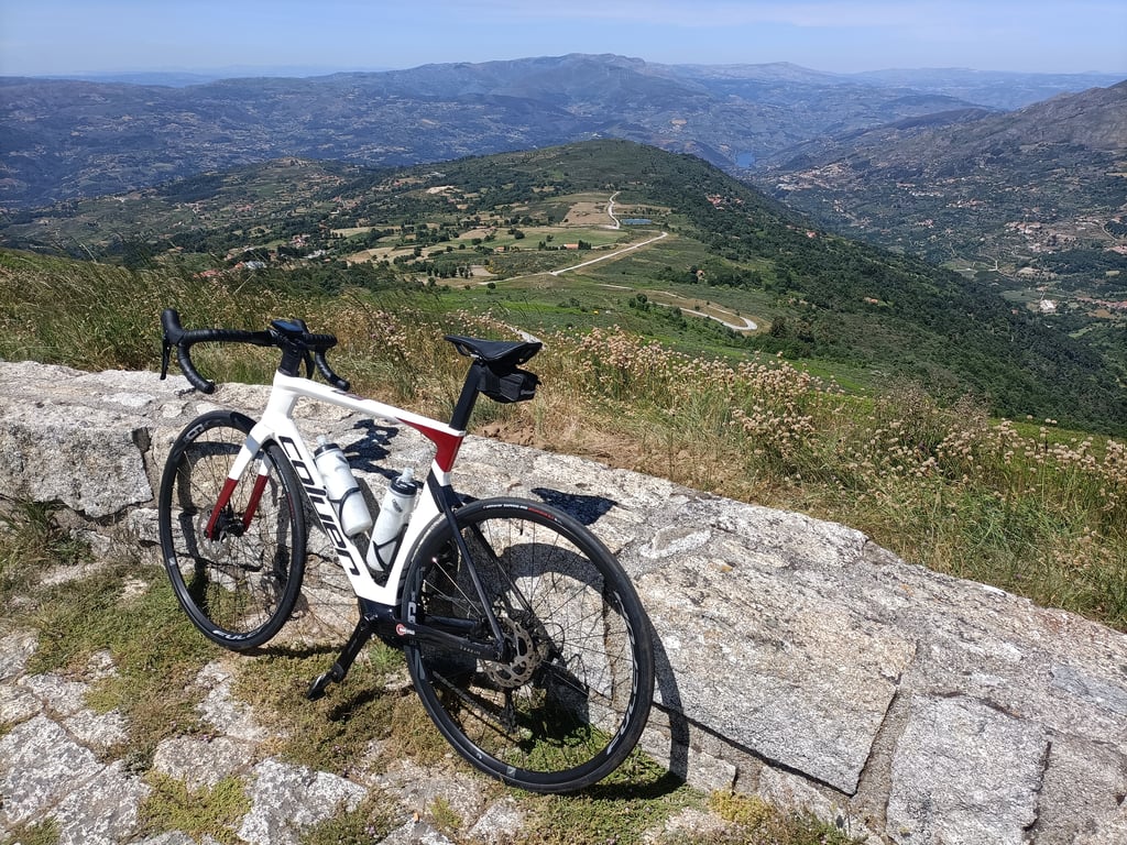
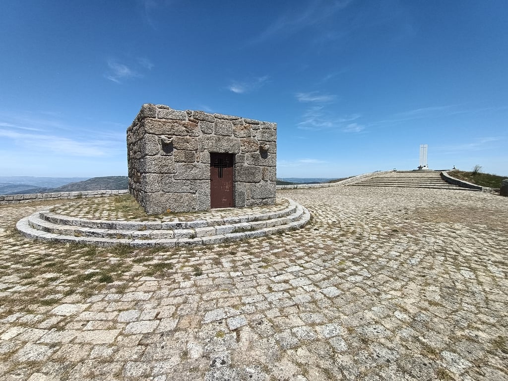
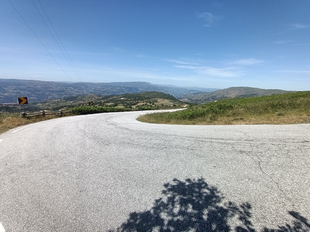
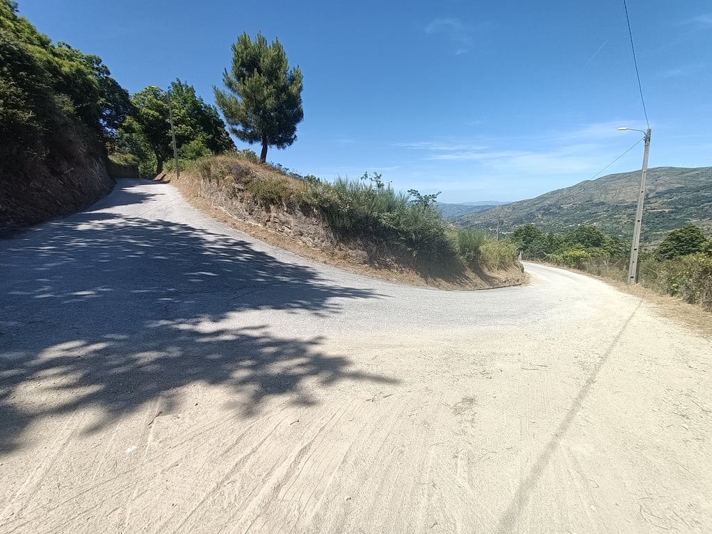
A climb in stages; first, starting from the river, there’s a pretty challenging 3.5-kilometer ascent. Because the road is somewhat irregular, with flatter sections alternating with steeper ones, you’ll often encounter sections with double-digit gradients here. So don’t start out too fast, especially since it can get quite warm and there’s not much shade. After 3.5 km, there’s a 1-kilometer descent, and then, after crossing a bridge, you start climbing again and follow the sign to Paus. From there, it’s a 2-kilometer stretch with a fairly constant gradient of around 7 percent. Then you’ll have a chance to catch your breath for 1.5 kilometers until you reach the sharp right-hand turn toward Moumis. The road here becomes steep and is in very poor condition. It’s a mix of asphalt and small, rough stones. It feels like the cobblestones in Flanders. On the way to Moumis, there are some very steep sections, and combined with the poor road conditions, it’s a challenge to keep cycling here. Some short stretches are slightly less steep, but expect at least 3–3.5 km averaging 10.5 percent, with occasional much steeper sections. After the village of Moumis, the ride becomes a bit easier. The road then joins the route from Resende, and you’ll be cycling on a wider, better road. But don’t let your guard down, because you’re not there yet—the final 1.6 km are consistently steep and very tough. Expect a 11–12% grade, and it stays that way the whole time. No more breaks until you reach the top. Once you’re at the top, you’ve reached the highest point on the main road, but be sure to turn around and take the side road to Capela de São Cristóvão, because there’s a beautiful little chapel and a cross there. Plus, this is where you’ll find the most stunning view.
Een klim in delen; eerst vanaf de Rivier best een pittig stuk omhoog van 3,5 kilometer. Omdat de weg wat grillig is met vlakker stukken en steilere stukken afgewisseld, kom je al best vaak stukken in de dubbele cijfers tegen hier. Start dus niet te hard, ook omdat het best warm kan zijn en de beschutting tegen valt. Na 3,5 km is er 1 kilometer afdaling en dan na een brug ga je weer omhoog en volg je het bord naar Paus. Hier is het dan 2 kilometer redelijk constant rond de 7 procent. Dan is het even om adem komen voor 1,5 kilometer tot dat je bij de scherpe bocht naar rechts komt richting Moumis. De weg wordt hier steil en van erg slechte kwaliteit. Het is een mix van asfalt en kleine ruwe steentjes. Het voelt aan als de kasseien in Vlaanderen. Op weg naar Moumis zitten soms hele steile stukken en in combinatie met de slechte weg is het een uitdaging om hier te blijven fietsen. Kleine stukjes zijn iets minder steil, maar reken op zeker 3-3,5 km aan gemiddeld 10,5 procent met af en toe veel steilere stukken. Na het dorp Moumis wordt het iets beter te doen. Dan komt de weg samen met de variant vanuit Resende en fiets je op een grotere, betere weg. Maar laat je bedonderen, want je bent er nog niet, de laatste 1,6 km zijn constant en erg zwaar. Reken op 11-12%, maar dan ook de hele tijd. Geen adempauze meer tot je boven bent. Ben je boven dan is het hoogste punt op de doorgaande weg, maar draai zeker om en rijdt de zijweg naar Capela de Sao Cristovao in, want hier staat een mooi kappeletje en kruis. Daarnaast heb je hier ook het mooiste uitzicht.