| Hidden gem |
| #32 toughest climb of Belgian Luxembourg |
| #80 most elevation gain of Belgian Luxembourg |
| #26 longest climb of Semois Valley |
| #27 average steepest climb of Semois Valley |
Mont de Zatrou via Les Hayons is a climb in the region Semois Valley. It is 2.1 mi long and bridges 597 ft of vertical ascent with an average gradient of 5.3%, resulting in a difficulty score of 152. The top of the ascent is located at 1368 ft above sea level. Climbfinder users shared 7 reviews of this climb and uploaded 7 photos.
Road names: Mont de Zatrou, Rue de la Semois & Rue des Brulins
4.0 by LarsG13This is an automatic translation, the original language is: Dutch.A very long climb; the beginning is incredibly tough, and after that section, it’s not too hard but very long.... read more
Welcome! Please activate your account if you would like to share something. Look for the verification email in your inbox.
If you want to upload your photos, you need to create an account. It only takes 1 minute and it's completely free.
A very long climb; the beginning is incredibly tough, and after that section, it’s not too hard but very long.
Heel lange klim, het begin is ontzettend zwaar, na dit deel niet te zwaar maar wel zeer lang.
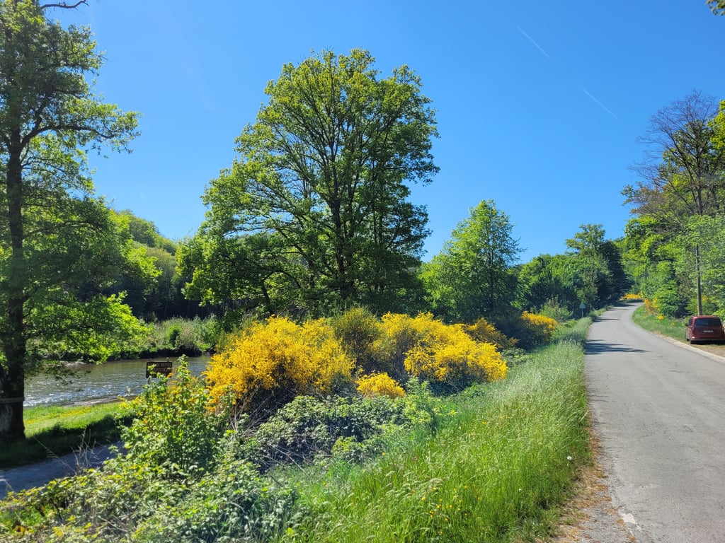
A beautiful and varied climb in the Semois Valley, where the road from Les Hayons immediately starts out firm with a steep and rougher first forest section. Then the landscape opens up towards rolling fields with beautiful views over the valley, while the profile gradually flattens out towards the summit.
Een prachtige en afwisselende klim in de Semoisvallei, waar de weg vanuit Les Hayons meteen stevig begint met een steil en ruwer eerste bosstuk. Daarna opent het landschap zich richting glooiende velden met mooie vergezichten over de vallei, terwijl het profiel geleidelijk afvlakt richting de top.
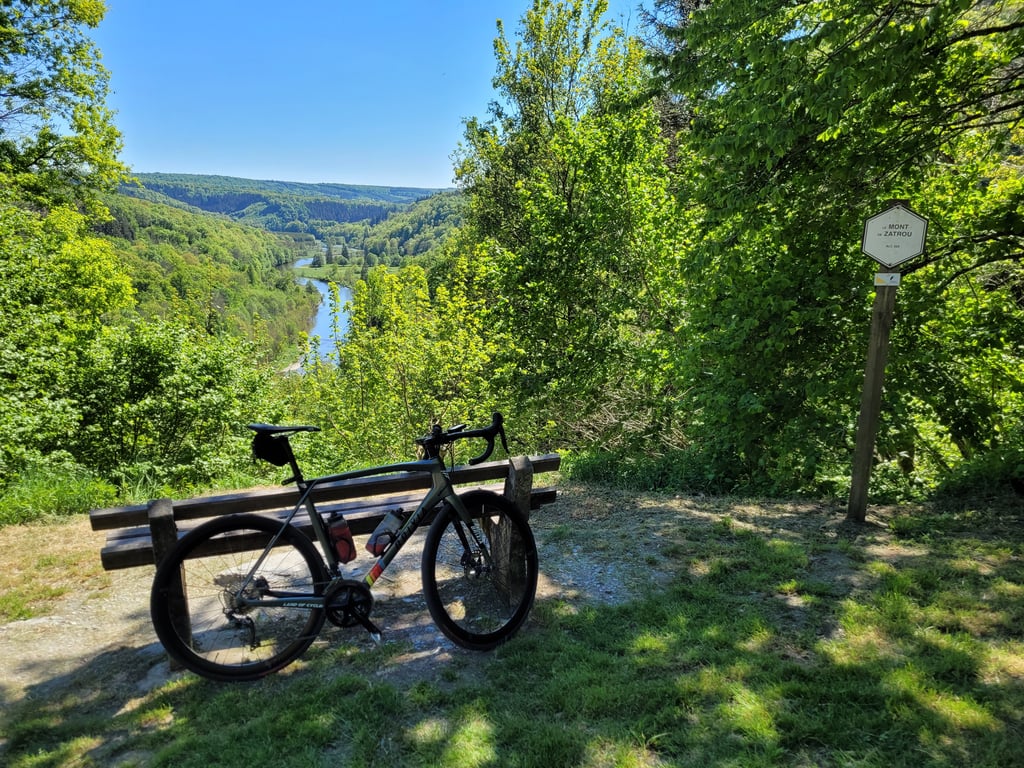
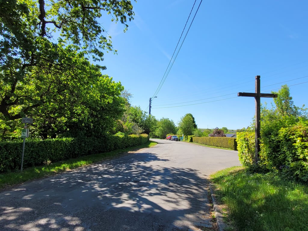
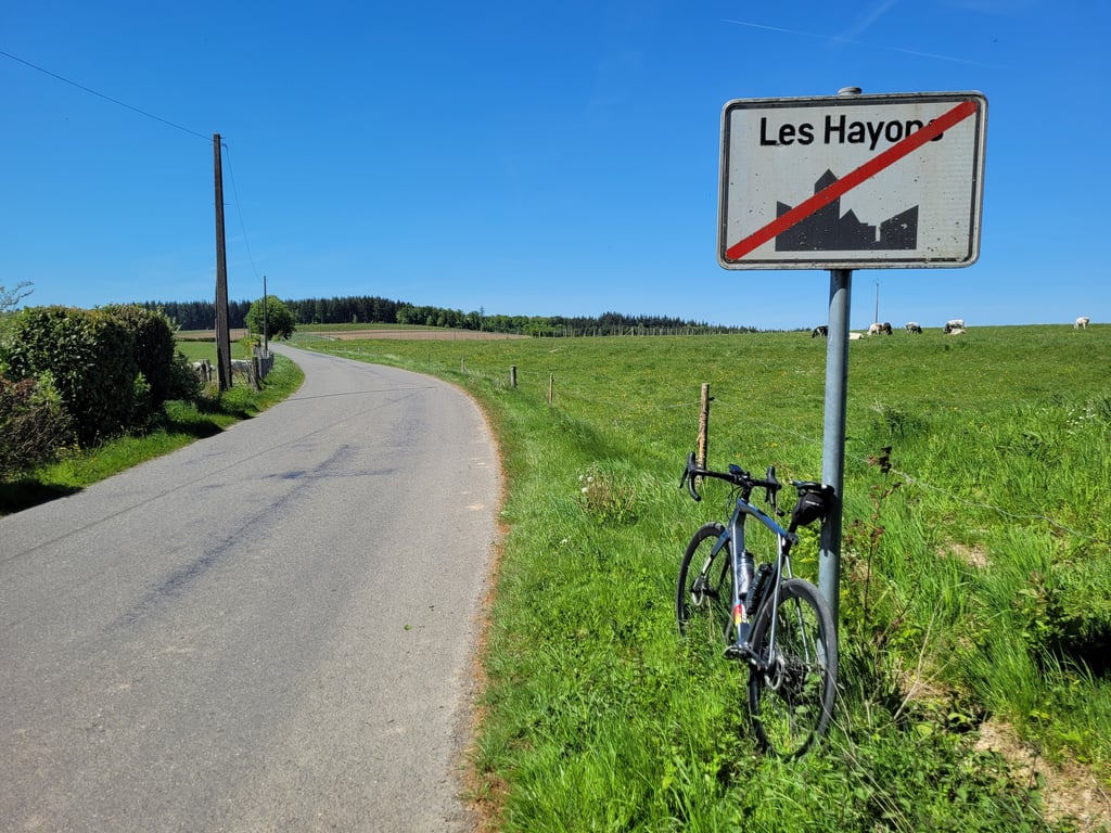
A climb with two faces: the first 500 metres are incredibly tough, also because of the poor road surface, which means you have to look ahead with concentration. After about 500 metres, you have a beautiful view of the Semoin on your left that you should definitely not miss; there you also see immediately how ridiculously fast you have climbed a lot. As the road turns right, the gradient becomes more gentle and you reach the to as soon as you pass a wooden cross on your right. Then, according to Climfinder, the fun isn't over yet, however, and after a stretch of false flat until you reach a chapel, you can keep re hts and continue climbing for a bit until you leave the village of Les Hayons. All in all, a climb not to be sneezed at!
Een klim met twee gezichten: de eerste 500 meter zijn ontzettend taai, ook vanwege het matige wegdek waardoor je geconcentreerd voor je uit moet kijken. Na zo'n 500 meter heb je aan je linkerhand een prachtig uitzicht over de Semoin dat je zeker niet missen mag; daar zie je ook direct hoe belachelijk snel je een stuk hoger bent gekomen. Als de weg naar rechts draait wordt de stijgingspercentages gemoedelijker en bereik je de to zodra je aan je rechterhand een houten kruis passeert. Dan is volgens Climfinder de lol echter nog niet voor ij en mag je na een stuk vals plat tot aan een kapel re hts aanhouden en nog een stukje doorklimmen totdat je het dorpje Les Hayons verlaat. Al met al een niet te versmaden klim!
There is a lot to say about this climb. Normally it comes right after a fairly long descent (where you have to be careful because there are a lot of potholes and there can be traffic in the village). Immediately after the descent, you have to get going for the first steeper section. If you already have some kilometres in your legs, this can hurt. The first part is steep through a forest. After the village it gets much easier and if you have energy to spare you could ride on the outer leaf. There is not much traffic but on weekends you will often come across motards. The asphalt in the first part is not super.
Er valt veel te zeggen over deze klim. Normaal komt ie direct na een vrij lange afdaling (waarbij je best oplet want veel putten en in het dorp kan er verkeer zijn). Direct na de afdaling moet je direct aan de bak voor het eerste steilere gedeelte. Als je al wat kilometers in de benen hebt kan dit pijn doen. Het eerste gedeelte is steil door een bos. Na het dorpje wordt het veel makkelijker en zou je als je energie over hebt op je buitenblad kunnen rijden. Er is niet veel verkeer maar in het weekend kom je er wel vaak motards tegen. Het asfalt in het eerste stuk is niet super.
I did this climb for the first time during a reconnaissance for the Herbeumont hill climb.
This climb starts violently with a wall at around 14% then it climbs steadily all the way to the village and the end is fairly easy on a false flat climb.
J'ai fait cette montée pour la première fois lors d'une reconnaissance pour la course de côtes d'Herbeumont.
Cette côte démarre violemment avec un mur à environ 14% puis ça monte régulièrement jusqu'au village et la fin est plutôt facile en faux plat montant
I did this climb from the camping Maka to Dohan (so not the whole segment but the steep part). The road surface is bad which is especially problematic in the descent where you have to continuously apply the brakes.
Normally there is not much traffic but there is some risk on campers, motorcyclists ... what makes it dangerous.
Halfway the steepest part there is a nice view over the Semois with a bench.
Heb deze klim gedaan vanaf de camping Maka richting Dohan (dus niet het volledige segment maar wel het steile stuk). Het wegdek ligt slecht wat vooral problematisch is in de afdaling waarbij je continu in de remmen moet.
Er is normaal weinig verkeer maar wel wat risico op campers, motorrijders... wat het wel gevaarlijk maakt.
Er is halverwege het steilste stuk een mooi uitzicht over de Semois met een bankje.
Climb not quite done came out of Dohan and then you ride the last part of this climb. The steepest part is already over and you continue with an easy pace upwards. You cycle through an open area, all fields around you. The last part of the slope is in front of you and you see that you have to push a little bit, on the pedals and you enter a forest where the climb ends.
Klim niet helemaal gedaan kwam uit Dohan en dan rijdt je het laatste stuk van deze klim. Het steilste deel is al voorbij en je gaat met een makkelijke tred door naar boven. Je fietst door open gebied, allemaal akkers en velden om je heen. Het laatste deel van de helling ligt voor je en je ziet dat je even moet aanzetten, op de trappers en je gaat een bos in waar de klim eindigt.
| 5 mph | 00:25:50 |
| 7 mph | 00:18:17 |
| 9 mph | 00:14:15 |
| 12 mph | 00:10:42 |
This page is better in the app