Maximiner Wald from Tobiashaus is a climb in the region Hunsrück. It is 1.1 mi long and bridges 328 ft of vertical ascent with an average gradient of 5.7%, resulting in a difficulty score of 67. The top of the ascent is located at 886 ft above sea level. Climbfinder users shared 2 reviews of this climb and uploaded 13 photos.
Road name: L 137
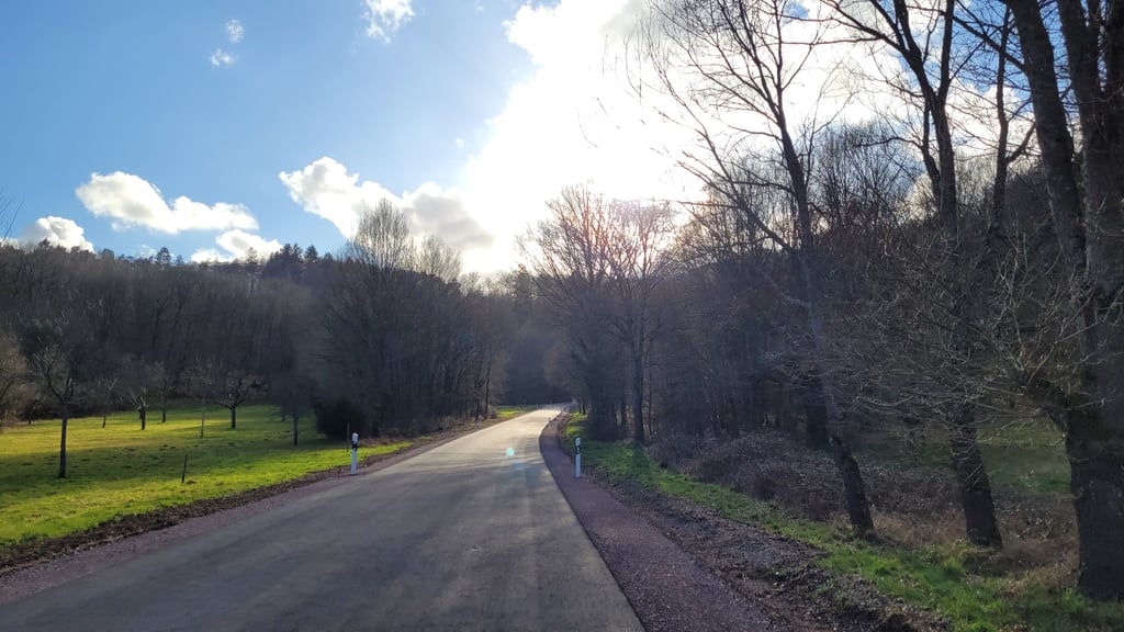
3.0 by elbowboyThis is an automatic translation, the original language is: German.The climb was closed to car traffic for years and is now open again. However, the road surface has now been renewed and is excellent throughout, but of course there is now car traffic again. The volume of traffic is bearable. It is advisable to approach via Wawern and avoid the B51. The ascent begins moderately and only becomes a little steeper in the middle after the hairpin bends. However, the gradient remains uncomplicated. The road is wooded and mostly shady. At the top, you can turn right t... read more

Welcome! Please activate your account if you would like to share something. Look for the verification email in your inbox.
If you want to upload your photos, you need to create an account. It only takes 1 minute and it's completely free.
The climb was closed to car traffic for years and is now open again. However, the road surface has now been renewed and is excellent throughout, but of course there is now car traffic again. The volume of traffic is bearable. It is advisable to approach via Wawern and avoid the B51. The ascent begins moderately and only becomes a little steeper in the middle after the hairpin bends. However, the gradient remains uncomplicated. The road is wooded and mostly shady. At the top, you can turn right to Mannebach / Saargau, where you will find beautiful routes, left to Saarburg, including the northern approach to Warsberg.
Der Anstieg war jahrelang für den Autoverkehr gesperrt und ist nun wieder offen. Allerdings ist der Straßenbelag jetzt erneuert und durchgehend hervorragend, nun gibt es aber natürlich wieder Autoverkehr. Das Verkehrsaufkommen ist erträglich. Empfehlenswert ist es, über Wawern anzufahren und die B51 zu meiden. Der Anstieg beginnt moderat und wird erst in der Mitte ab den "Serpentinen" etwas steiler. Die Steigung bleibt aber unkompliziert. Die Straße ist bewaldet, meist schattig. Oben angekommen kann man rechts nach Mannebach / in den Saargau abfahren, wo schöne Strecken zu finden sind, links nach Saarburg, inklusive der nördlichen Anfahrt zum Warsberg.
An intriguing climb. This is because the road has been closed to through traffic for 4 (!) years due to the poor road surface in the second section. The road surface is certainly bad in a few places but as a cyclist it is perfectly possible to ride past the potholes in the climb (in the descent, you have to be really careful). Incidentally, there is apparently just enough traffic to keep the road clean but the chances of meeting anyone are minimal.
And that on such a wonderful route that runs beautifully through the woods because ha a relaxed start, the percentages are slower but not extremely high at the first twists and turns and then you are literally riding curve after curve until you reach the T-junction. Combined with the tranquillity, it's great fun.
Incidentally - after protests from residents of several villages - there are now plans to tackle the road anyway. Maybe then the peace and quiet will be a bit less - although it will never really get busy - but then with new asphalt you would still keep all the bends.
Een intrigerende klim. Dit omdat de weg al 4 (!) jaar voor het doorgaande verkeer is afgesloten vanwege het slechte wegdek in het tweede gedeelte. Het wegdek is op enkele plaatsen zeker slecht (de rest is goed te doen) maar als fietser is het in de klim prima mogelijk om langs de gaten te rijden (in de afdaling is het wel echt opletten). Overigens rijdt er blijkbaar net voldoende verkeer om de weg wel schoon te houden maar de kans dat je iemand tegenkomt is minimaal.
En dat op zo'n wonderschoon traject wat mooi door de bossen loopt want na een relaxed begin gaan bij de eerste slingers de percentages lekker maar niet extreem omhoog en ben je daarna letterlijk bocht na bocht aan het rijden tot je op de T-splitsing uitkomt. gecombineerd met de rust is het heerlijk genieten.
Overigens komen er - na protesten van de inwoners van verschillende dorpen - nu wel plannen om de weg toch eens aan te pakken. Misschien wordt de rust dan wat minder - al zal het nooit echt druk worden - maar dan zou je met nieuw asfalt nog steeds alle bochten houden.
| 5 mph | 00:13:01 |
| 7 mph | 00:09:13 |
| 9 mph | 00:07:11 |
| 12 mph | 00:05:23 |
This page is better in the app