Tips nearby


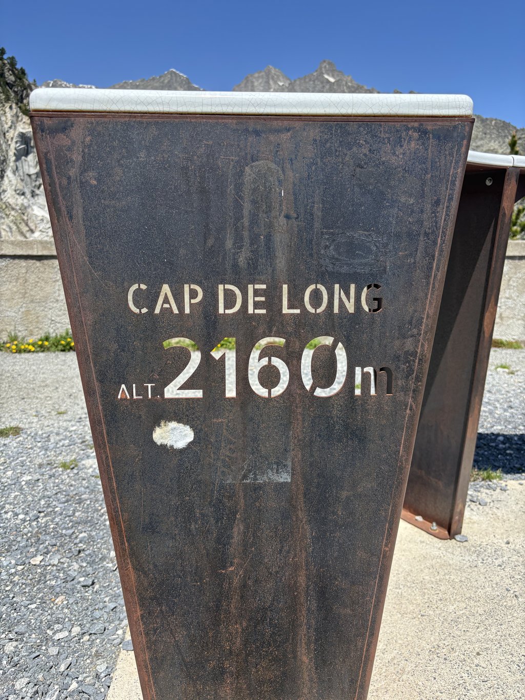
Lac de Cap-de-Long from Saint-Lary-Soulan is a climb in the region Hautes-Pyrénées. It is 13.8 mi long and bridges 4324 ft of vertical ascent with an average gradient of 6%, resulting in a difficulty score of 958. The top of the ascent is located at 7093 ft above sea level. Climbfinder users shared 11 reviews of this climb and uploaded 34 photos.
Road name: D929
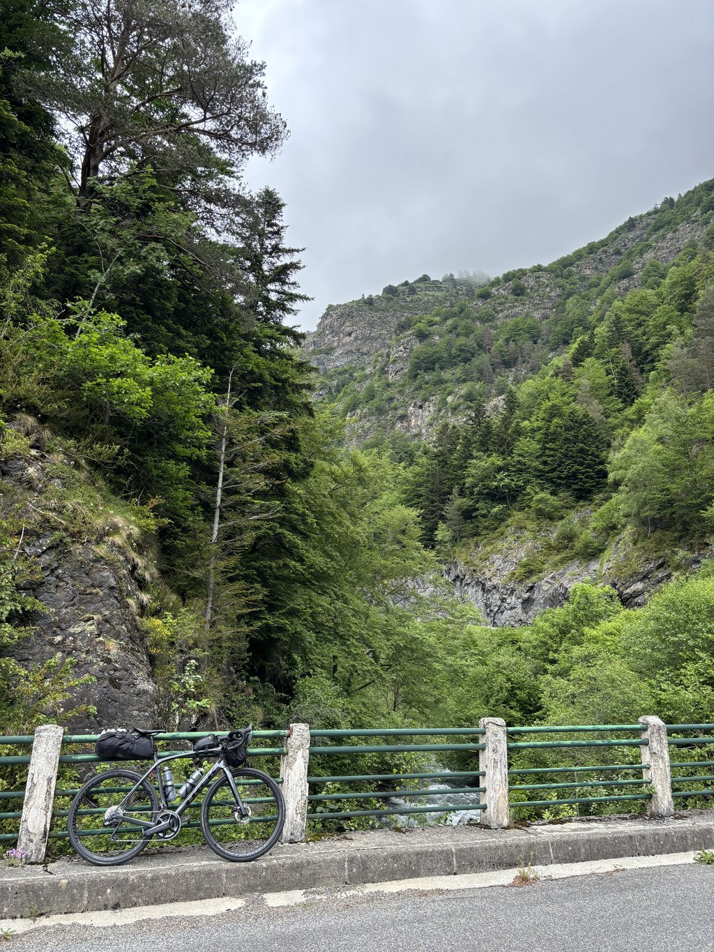
5.0 by christineThis is an automatic translation, the original language is: English.Beautiful climb, from Fabian, on narrow, quiet road. initially through a gorge with rushing river and multiple little cascades alongside. spectacular views as you continue to climb up past the first lake (lac d’Oredon). the gradient then becomes steep in last 3km 10-12%, where the hairpins start, on the way up to the dam (Cap-de-Long). hard work the day we went due to intermittent rain, headwind and biting cold (3C) but the views are stunning. definitely worthwhile going the extra 5 k to se... read more
Welcome! Please activate your account if you would like to share something. Look for the verification email in your inbox.
If you want to upload your photos, you need to create an account. It only takes 1 minute and it's completely free.
Very beautiful! We were at a campsite near Fabian, so we didn't have the annoyingly busy stretch from Saint Lary to do.
Big luck with the weather too. In the first stretch, we were surprised by an Isard (Pyrenean version of chamois, slightly smaller and browner). From the junction the road was closed to cars's due to roadworks, so wonderfully quiet.
Heel mooi! We stonden op een camping bij Fabian en hadden dus niet het vervelende drukke stuk vanaf Saint Lary te doen.
Grote mazzel ook met het weer. In het eerste stuk werden we verrast door een Isard (Pyreneen versie van de gems, iets kleiner en bruiner). Vanaf de splitsing was de weg afgesloten voor auto's wegens wegwerkzaamheden, dus heerlijk rustig.
Perhaps the most beautiful climb of many I have done in the Pyrenees. Long climb through the gorge of the river that takes you into an increasingly exciting landscape. At the fork 4 km below the summit, it becomes breathtaking. At the top at the reservoir, you have stunning views of the wider area.
Misschien wel de mooiste beklimming van velen die ik heb gedaan in de Pyreneeën. Lange klim door de kloof van de rivier die je in een steeds spannender landschap brengt. Bij de splitsing 4 km onder de top wordt het adembenemend. Boven bij het stuwmeer heb je een schitterend uitzicht op de wijde omgeving.
Really beautiful climb on quiet roads. Some great old Roman switchbacks and the whole area is a nature reserve. A nice cafe at the top/resovoir. A hidden gem and must do in French Pyrenees.
Beautiful climb, from Fabian, on narrow, quiet road. initially through a gorge with rushing river and multiple little cascades alongside. spectacular views as you continue to climb up past the first lake (lac d’Oredon). the gradient then becomes steep in last 3km 10-12%, where the hairpins start, on the way up to the dam (Cap-de-Long). hard work the day we went due to intermittent rain, headwind and biting cold (3C) but the views are stunning. definitely worthwhile going the extra 5 k to see the other 2 lakes. bad 10-12% ramp just before the last 2k to lac d’Aumar, then you descend slightly to the furthest lake (lac d’Aubert). no km/ gradient sign to help but it’s a regular climb.
Ascent from Guchen on 11/08/23.
First climb of the day (before Aumar/Aubert and Portet to finish), long but fairly regular and not very difficult. It's obvious that the feeling is different between a first climb in the cool and a last climb in the heat... It's all relative!
Magnificent overall view, particularly of Lac d'Orédon.
Montée depuis Guchen réalisée le 11/08/23.
Première ascension du jour (avant Aumar/Aubert et Portet pour finir), longue mais assez régulière et sans grande difficulté. Il est bien évident que le ressenti est différent entre une première montée, au frais et une dernière ascension en pleine chaleur... Tout est relatif !
Magnifique vue d'ensemble et notamment sur le Lac d'Orédon.
Either fork - to the twin lakes or the dam lake - is worth it. The graphs do not make a lot of sense, but as a French guy said - on another climb - "Welcome to France". There's a sharp downhill on the way to the twin lake - this one has spectacular series of hairpins in the last kilometer or so. Further down, so before the fork, there's a similar series.
The first part is on a busy through road, which fortunately is quite wide. Here the climb also runs very well. At one point you turn right and the road becomes narrow and steep. From then on it is work though I found the climb more manageable than, say, the Tourmalet. The asphalt is of moderate quality though which makes the descent challenging. However, the views repay much, if not all. What natural beauty all around you. We did the climb in the high season so there were also quite a lot of cars's on the last part but that is basically not problematic. Meanwhile, at the summit is a café, mind you a coke is 4 euros (summer 2023) and you can only pay with cash.
Het eerste deel is op een drukke doorgaande weg die gelukkig wel vrij breed is. Hier loopt de klim ook nog erg goed. Op een gegeven moment sla je af naar rechts en wordt de weg smal en steil. Vanaf dat moment is het werken al vond ik de klim beter te doen dan bijvoorbeeld de Tourmalet. Het asfalt is wel van matige kwaliteit wat ervoor zorgt dat de afdaling uitdagend is. De uitzichten vergoeden echter veel, zo niet alles. Wat een natuurschoon om je heen. Wij hebben de klim gedaan in het hoogseizoen waardoor er ook nog vrij veel auto's op het laatste deel zaten maar dat is in principe niet problematisch. Op de top is inmiddels een café, let wel een cola is 4 euro (zomer 2023) en je kan alleen met cash betalen.
Absolute must if you are in the area. The approach is very busy and can be a bit annoying but once you leave the main road, you find yourself in a cycling paradise. Magnificent climb!
Absolute must als je in de streek bent. De aanloop is zeer druk en kan wat vervelend zijn maar eens je de grote baan verlaat, begeef je je in een fietsparadijs. Prachtige klim!
I have already ridden many of the well-known climbs in this area such as Aspin, Peyresourde, Tourmalet, etc.. From my memory, this was the hardest climb I have ever ridden. I rode a relatively heavy gravel bike with appropriate tyres and 4bar air pressure and a small backpack, it was 32° Celsius at the bottom. I can't say how much of a difference that made.
The gradient percentages given in the graph are definitely not correct from km 10 onwards. There are no kilometre sections with 4% from then on. Up to the dam wall, the gradient on my Garmin Edge 530 very rarely dropped below 8%, but there were regular 10%, 12% and at the peak briefly 14% on the clock. I didn't descend, but at the top I was completely exhausted!
The route itself is scenically a blast and definitely worth it ! Very little traffic and very few other cyclists on this day. The descent is not without its problems, as the surface is often bad, wavy and cracked. So better not risk too much ...
Ich bin bereits viele der bekannten Anstiege in dieser Gegend wie Aspin, Peyresourde, Tourmalet, etc. gefahren. Dies war aus meiner Erinnerung der härteste Anstieg, den ich je gefahren habe. Ich bin mit einem relativ schweren Gravelbike mit entsprechender Bereifung und 4bar Luftdruck und kleinem Rucksack gefahren, es waren unten 32° Celsius. Wieviel das ausgemacht hat, kann ich nicht sagen.
Die in der Grafik angegebenen Steigungsprozente sind ab km 10 definitiv nicht korrekt. Es gibt ab da keine Kilometerabschnitte mit 4%. Bis zur Staumauer fiel auf meinem Garmin Edge 530 die Steigung ganz selten unter 8%, dafür aber standen regelmäßig 10%, 12% und in der Spitze kurzzeitig 14% auf der Uhr. Ich bin nicht abgestiegen, aber oben war ich restlos ausgepumpt !
Die Strecke selber ist landschaftlich der Knaller und lohnt sich definitiv ! Sehr wenig Verkehr und nur ganz wenige andere Radler an diesem Tag. Die Abfahrt ist nicht ohne, da der Belag oft schlecht, wellig und rissig ist. Also lieber nicht zu viel riskieren ...
By far the most beautiful I have climbed in the Pyrenees. And even though the last 8 km are heavy enough, enjoy the world around you. A climb that makes you silent!
Met afstand de mooiste die ik in de Pyreneeën heb beklommen. En ook al zijn de laatste 8 kilometer zwaar genoeg, geniet vooral de wereld om je heen. Een klim waar je stil van wordt!
Lac de Cap de Long is one of the wonderful mountain lakes, located in the nature reserve Néouvielle, to which you can cycle along the "Route des Lacs".
Starting in St. Lary Soulan on a wide road, following the river upstream, is a relative "warming up"run.
After turning right off the main road in village Fabian, the rest of the uninhabited route is narrow road with bumpy tarmac, hardly any traffic and no distance indication.
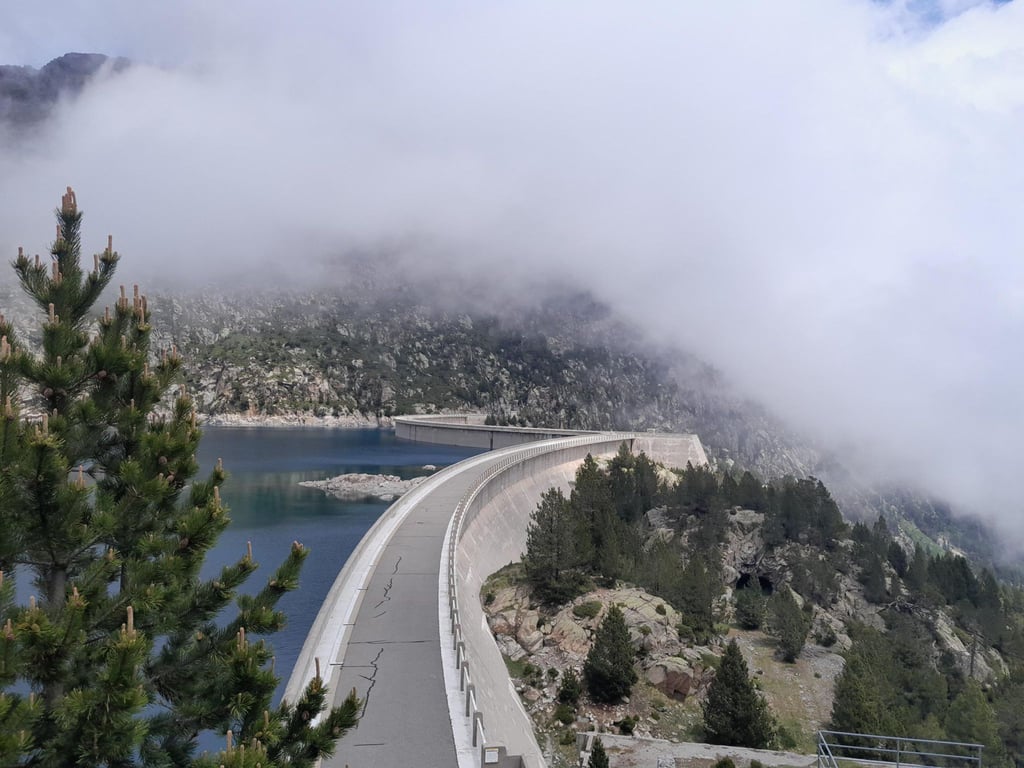
From then on it's pushing on the pedals but mainly enjoying the natural beauty of the high mountains with waterfalls and an abundance of flora and fauna changing with the altitude. Nowhere do buildings, ski lifts, cable cars, crash barriers or large tourist facilities spoil the natural scenery. Already from far above you can see the end point (dam of the lake). But then there is still a nice piece to climb on slightly twisting road with occasionally piled up hairpin bends that the past cycled Lac d' Orédon let sink even deeper.
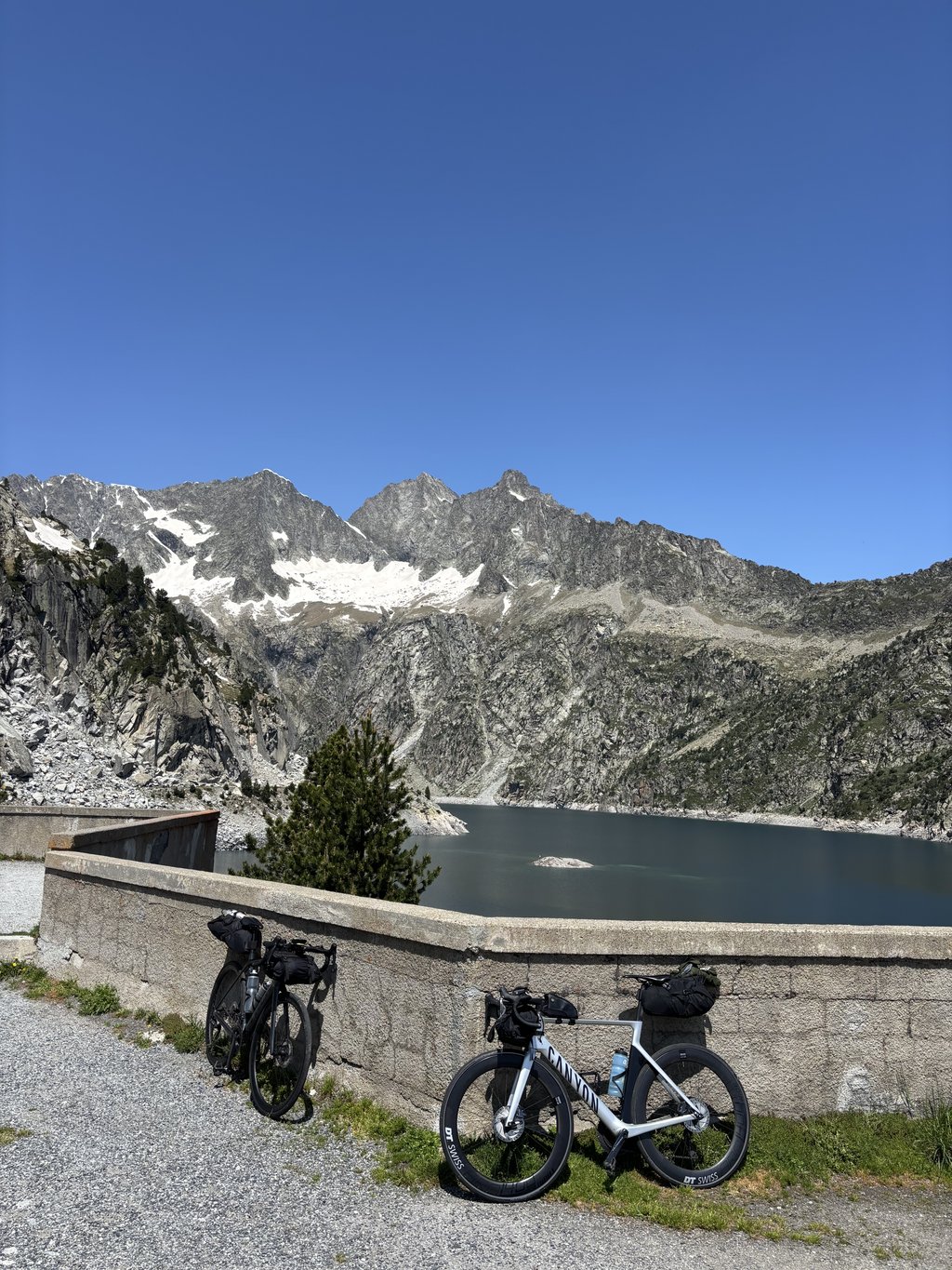
End point is green-blue lake surrounded by high Pyrenean peaks and with a café / restaurant.
This hidden unknown gem is a must for any mountain cyclist (put at the top of your bucket list!!!).
For myself one of the MOST beautiful routes ever cycled.
Thanks to its protected status as a reserve, the Tour stays away so the anonymity is preserved as well as the unspoiled natural beauty of the area.
Tip: Definitely combine with the climb to the slightly higher located Lac d'Aumar (exit left after 4 km. descent).
Lac de Cap de Long is één van de wondermooie bergmeren, gelegen in het natuurreservaat Néouvielle, naar waar je kan fietsen langs de "Route des Lacs".
Vertrekkend in St. Lary Soulan op brede weg, stroomopwaarts de rivier volgend, is een relatief "warming up"aanloop.
Na het rechts afdraaien van de grote weg in dorpje Fabian is de rest van de onbewoonde route smalle weg met hobbelig asfalt, amper verkeer en geen enkele afstandsaanduiding.
Vanaf dan is het duwen op de trappers maar vooral genieten van de natuurpracht van het hooggebergte met watervallen en overvloed aan flora en fauna veranderend met de hoogte. Nergens ontsieren gebouwen, skiliften, kabelbanen, vangrails of grote toeristische voorzieningen het natuurdécor. Reeds van ver, is boven je, het eindpunt (dam van het stuwmeer) te zien. Maar er valt dan nog een aardig stuk te klimmen over licht draaiende weg met af en toe opgestapelde haarspeldbochten die het voorbij gefietste Lac d' Orédon nog dieper laat wegzinken.
Eindpunt is groenblauw stuwmeer omgeven door hoge Pyreneeën pieken en met een café /restaurant.
Deze verborgen onbekende parel is een must voor elke bergfietser (zet bovenaan je bucket list!!!).
Voor mijzelf één van de MOOISTE routes ooit gefietst.
Dankzij zijn beschermd statuut als reservaat blijft de Tour hier weg zodat de anonimiteit bewaart blijft alsook de ongerepte natuurpracht van het gebied.
Tip: Zeker combineren met de klim naar het nog iets hoger gelegen Lac d'Aumar (afslag links na 4 km. afdaling).
| 5 mph | 02:46:08 |
| 7 mph | 01:57:37 |
| 9 mph | 01:31:39 |
| 12 mph | 01:08:51 |
This page is better in the app