Tips nearby


| 15 hairpin turns |
| #43 toughest climb of La Maurienne |
| #34 most elevation gain of La Maurienne |
| #27 longest climb of La Maurienne |
| #62 average steepest climb of La Maurienne |
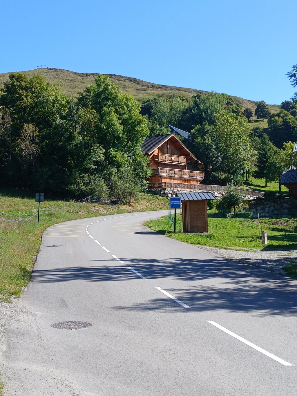
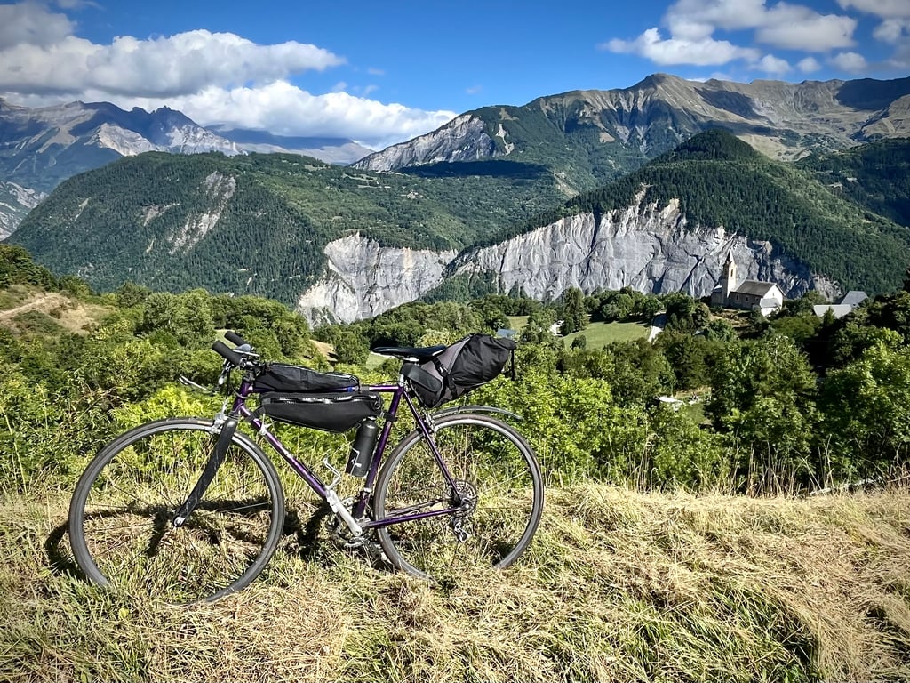
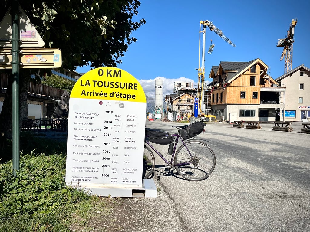
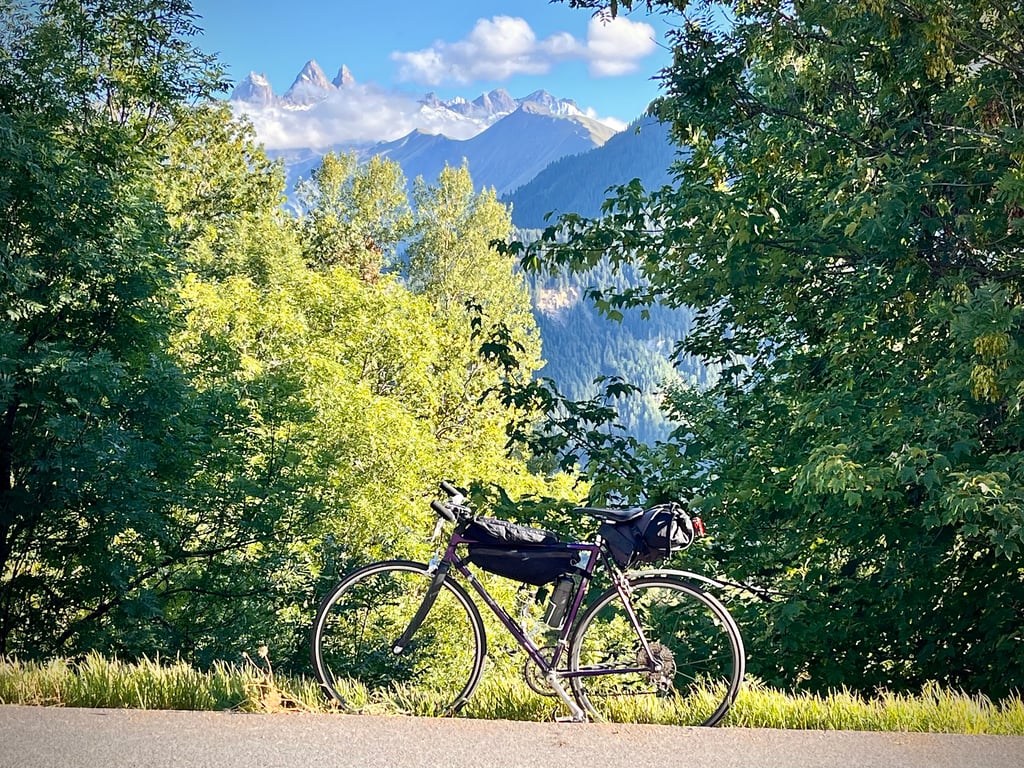
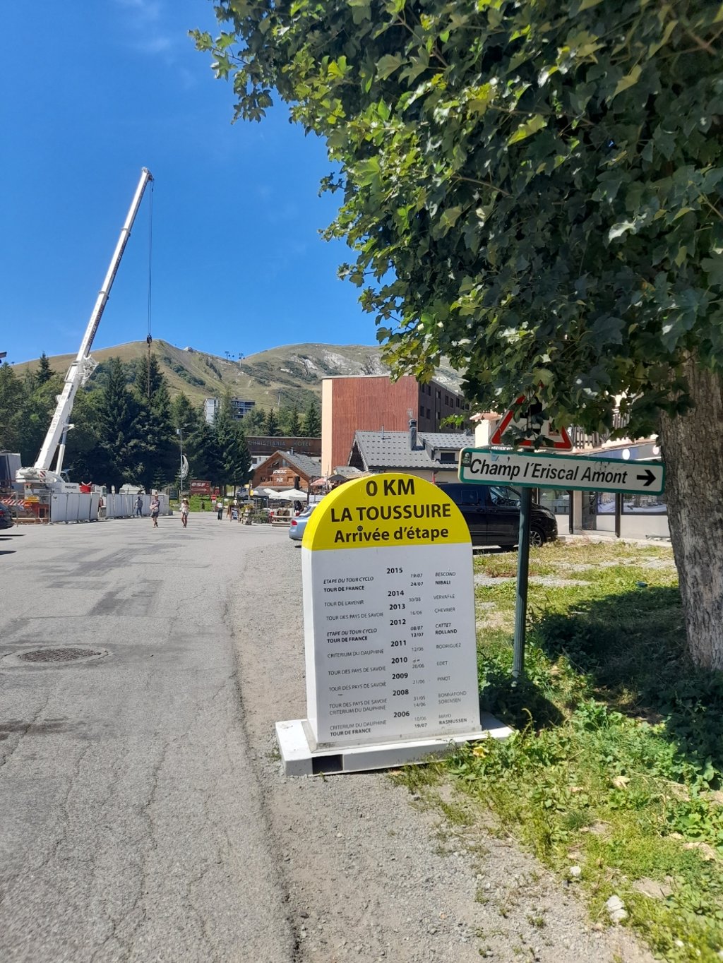
La Toussuire is a climb in the region La Maurienne. It is 7.8 mi long and bridges 2789 ft of vertical ascent with an average gradient of 6.8%, resulting in a difficulty score of 618. The top of the ascent is located at 5597 ft above sea level. Climbfinder users shared 10 reviews of this climb and uploaded 31 photos.
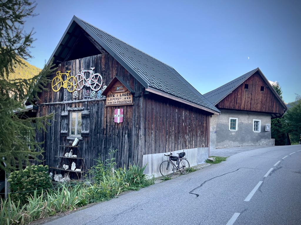
Road name: D78
5.0 by Pieter394This is an automatic translation, the original language is: Dutch.I did this climb on 22/8/25, leaving at 7am. Great to do: while the sun is rising and everything is waking up. I was lucky that on the climb itself it got very sunny, while in the valley and other climbs there was some fog - great images. Otherwise beautiful scenery, fairly solid climb, very quiet (logical at this early hour). Started from Saint-Jean-de-Maurienne, so you've actually already climbed 3.5km, with almost 300 altimeters before the real climb starts.... read more
Welcome! Please activate your account if you would like to share something. Look for the verification email in your inbox.
If you want to upload your photos, you need to create an account. It only takes 1 minute and it's completely free.
I did this climb on 22/8/25, leaving at 7am. Great to do: while the sun is rising and everything is waking up. I was lucky that on the climb itself it got very sunny, while in the valley and other climbs there was some fog - great images. Otherwise beautiful scenery, fairly solid climb, very quiet (logical at this early hour). Started from Saint-Jean-de-Maurienne, so you've actually already climbed 3.5km, with almost 300 altimeters before the real climb starts.
Ik heb deze beklimming gedaan op 22/8/25, vertrokken om 7u. Geweldig om te doen: terwijl de zon opkomt en alles wakker wordt. Ik had geluk dat het op de klim zelf zeer zonnig werd, terwijl in het dal en andere klimmen toch wat mist ging - geweldige beelden. Verder een mooi landschap, redelijk stevige klim, zeer rustig (logisch op dit vroege uur). Vertrokken vanuit Saint-Jean-de-Maurienne, dus je hebt eigenlijk al 3,5km geklommen, met bijna 300 hoogtemeters voor de echte klim begint.
I wasn't really seduced by this climb.
The road is good, the gradients are respectable and the traffic is acceptable.
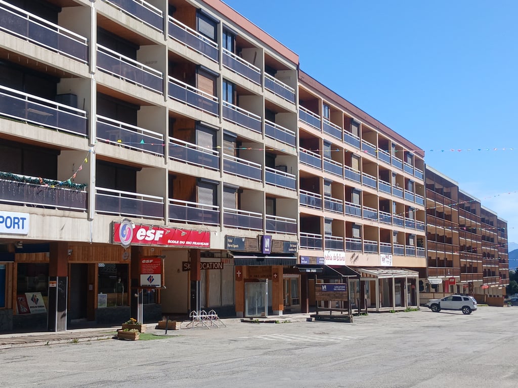
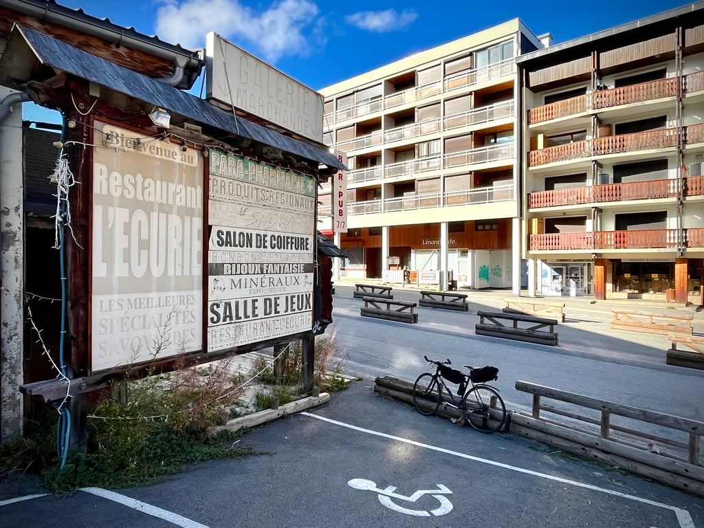
La Toussuire struck me as a pretty awful resort! It must be said that it was the first day of the holidays for all those who work up there: everything was closed and the village was deserted.
Above all, the buildings are particularly ugly. Many of the buildings could be transposed to Seine-Saint-Denis! Well done to the architects!
Paradoxically, the climb is revealed on the way down!
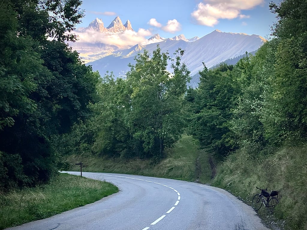
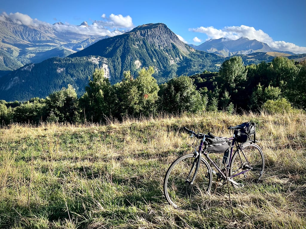
The views of the elegant Aiguilles d'Arves are breathtaking.
From a cycling point of view, the descent is particularly enjoyable thanks to the variety of bends.
Note that the ascent from Saint-Jean de Maurienne town centre is 17km long.
3 stars for the needles and the descent.
Je n’ai pas été franchement séduit par cette ascension.
La route est bonne, les pourcentages sont honorables et la circulation est acceptable.
La Toussuire m’est apparue comme une station assez horrible ! Il faut dire que c’était le premier jour des vacances pour tous ceux qui travaillent là-haut : tout était fermé et le village était désert.
Mais surtout, le bâti est particulièrement laid. De nombreux immeubles pourraient être transposés en Seine-Saint-Denis ! Bravo aux architectes !
Paradoxalement, cette montée se dévoile lors de la descente !
Les vues sur les élégantes aiguilles d’Arves sont belles.
D’un point de vue cycliste, la descente est agréable notamment grâce à la diversité des formes des virages.
A noter qu’en partant du centre ville de Saint-Jean de Maurienne, la montée fait 17km.
3 étoiles pour les aiguilles et la descente.
A nice, steady climb.
The road is wide and in good condition, with moderate traffic.
Very little shade. At the height of summer, in the middle of the day, the sun is beating down hard.
The descent is easy and the scenery beautiful.
Belle montée, bien régulière.
La route est large et en bon état, modérément fréquentée.
Très peu d'ombre. En pleine été, en milieu de journée, le soleil tape fort.
La descente est facile et le paysage est très beau.
Climbed 12 August 2022. A stunning cycling area. This (the classic route) climb is a nice warm-up for the Croix de Fer or Glandon. Nice wide road to this ski village , part of Les Sybelles. Arrival in the middle of the village, so plenty of facilities there. Chose a descent via Le Corbier myself. Which is also listed as a climbing variant on this website.
Beklommen 12 augustus 2022. Een schitterend fietsgebied. Deze (de klassieke route) klim is een mooie opwarmer voor de Croix de Fer of Glandon. Mooie brede weg naar dit skidorp , onderdeel van Les Sybelles. Aankomst midden in het dorp, dus aldaar ruim voldoende faciliteiten. Koos zelf voor een afdaling via Le Corbier. Die ook als klimvariant op deze website staat.
A stunning climb that has you looking at the scenery rather than the road all the way up. Not too punishing if you can find a nice rhythm and the promise of a coffee at the top keeps the motivation going. Fairly light traffic is nice to have and you can admire the views and ski runs while climbing.
Good climb, but certainly not a must. The view is nice, but not spectacular. Good tarmac, pleasant percentages and a good length to train for the real giants in this area!
Prima klim, maar zeker geen must. Het uitzicht is mooi, maar niet spectaculair. Goed asfalt, prettige percentages en een goede lengte om te trainen voor de echte reuzen in dit gebied!
Knowing well this Station, I advise the version by St Pancrace, prettier, calmer, shadier but also more difficult than the direct road, this version begins like the others on the road of the Iron cross then quickly forks to the right.
You have to take the D78C at the quarry.
The percentages are relatively high between St Pancrace and les Bottières, sometimes flirting with 11 and 12% in the shade of the trees.
After les Bottières it calms down until the D78 junction where you find again difficult slopes but also the big traffic until la Toussuire.
To be done in the morning in the middle of summer because it is really hot.
Good road and be careful.
I have attached the map with the above version highlighted in yellow
Connaissant bien cette Station, je conseille la version par St Pancrace, plus jolie, Plus calme, Plus ombragée mais aussi plus difficile que la route directe, cette version commence comme les autres sur la route de la croix de Fer puis bifurque rapidement à droite.
Il faut emprunter la D78C au niveau de la carrière.
Les pourcentages sont relativement élevés entre St Pancrace et les Bottières, on flirte parfois avec 11 et 12% à l'ombre des arbres.
Après les Bottières ça se calme jusqu'au croisement de la D78 où l'on retrouve des pentes difficiles mais aussi la grande circulation jusqu'à la Toussuire.
A Faire le matin en plein été car il y fait vraiment très chaud.
Bonne route et soyez prudents.
Je vous ai joint la carte avec la version ci-dessus surlignée en jaune
Here I added the climb: https://climbfinder.com/nl/beklimmingen/la-toussuire-saint-pancrace
Voila j'ai ajouté la montée: https://climbfinder.com/nl/beklimmingen/la-toussuire-saint-pancrace
Nice climb, but there is some traffic if you start from Saint-Jean-de-Vaurienne (D926 especially). Pleasant and very beautiful view (on a clear day ^^) once you arrive at the top.
Belle montée, à noter quand même un peu de circulation notamment si vous commencez depuis Saint-Jean-de-Vaurienne (D926 surtout). Agréable et très belle vue (par temps dégagé ^^) une fois arrivé en haut.
La Toussuire visited in a round trip st jean - Glandon - mollard - st jean - La Toussuire - st jean. It is a wide good road to a summer deserted ski village. The descent can therefore be driven at very high speed. There is little traffic. However, some easy on the village with a few narrow passages. Above you have a nice view but if you come from the Glandon is a bit paltry.
La Toussuire bezocht in een rondje st jean - Glandon - mollard - st jean - La Toussuire - st jean. Het is een Breede goede weg naar een in de zomer verlaten ski dorp. De afdaling kan je dan ook met zeer hoge snelheid rijden. Er is weinig verkeer. Wel even rustig aan door het dorpje met een paar smalle doorgangen. Boven heb je een aardig uitzicht maar als je van de Glandon af komt valt het een beetje in het niet.
| 5 mph | 01:33:38 |
| 7 mph | 01:06:17 |
| 9 mph | 00:51:39 |
| 12 mph | 00:38:48 |
This page is better in the app