View on map
© MapLibre | OpenStreetMap contributors
1%
2%
4%
6%
8%
10%
12%
15%
20%

La Toussuire from Saint Pancrace

4.0
3 reviews | Elevation profile | 6 photos
Tips nearby
La Toussuire from Saint Pancrace
transparant thumb
transparant thumb
Your achievable time
Calculating based on your best performances...
Relaxed
Maximum
W/kg
W/kg
W/kg
Analyze your climbing performance
Detailed insight into your climbing performance & automatically check off climbs
Based on your best performances.
Your best attempt:
Number of attempts:
Elevation profile La Toussuire from Saint Pancrace
paved
gravel
paved

Statistics

Difficulty points 892
Length 10.2 mi
Average gradient 6.8%
Steepest segment 10.7%
Total ascent 3698 ft

Short recap

21 hairpin turns
#62 toughest climb of Savoie
#96 most elevation gain of Auvergne-Rhône-Alpes
#58 longest climb of Savoie
#65 average steepest climb of La Maurienne
Feedback about this climb?
Show climbs nearby Export to GPS device

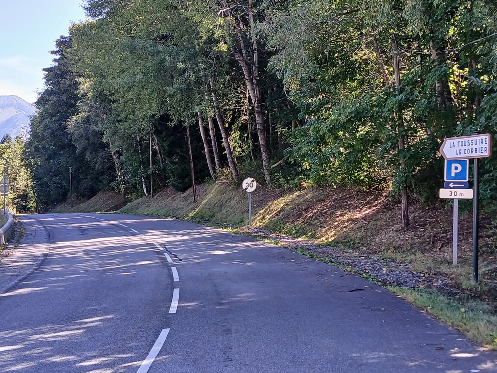
La Toussuire from Saint Pancrace is a climb in the region La Maurienne. It is 10.2 mi long and bridges 3698 ft of vertical ascent with an average gradient of 6.8%, resulting in a difficulty score of 892. The top of the ascent is located at 5594 ft above sea level. Climbfinder users shared 3 reviews of this climb and uploaded 6 photos.

Road names: D78C & D78

4.0 by GB44
This is an automatic translation, the original language is: French.
Quite a tough climb on the first part to the bottieres, with a number of woodland sections to keep you cool.... read more

Photos (6)

La Toussuire from Saint Pancrace

Your uploads (max 4)

Welcome! Please activate your account if you would like to share something. Look for the verification email in your inbox.

If you want to upload your photos, you need to create an account. It only takes 1 minute and it's completely free.

  • Receive free climbfinder goodies for your reviews & photos.
  • Create a bucket list and check off conquered climbs.
  • Add missing climbs.
Continue with GoogleContinue with Google Continue with FacebookContinue with Facebook Continue with AppleContinue with Apple Sign up with email
By signing up you agree to our terms of service and confirm that you have read our privacy & content policy.

Reviews (3)

5.0
4.0
3.0
2.0
1.0
GB44
1 y 4.0
This is an automatic translation, the original language is: French. Show original

Quite a tough climb on the first part to the bottieres, with a number of woodland sections to keep you cool.

Montée assez difficile sur la première partie pour aller jusqu'aux bottieres, avec de nombreux passages en forêt qui permet d'avoir un peu de fraîcheur.

Dashboard
Dobbe
2 y 4.0 01:20:00 (7.7 mph)
This is an automatic translation, the original language is: Dutch. Show original

Nice climb on less tarmac but certainly not rotten bad but it is in the sun a lot in high temperatures like mine it is difficult it is from Saint Jean de maurienne via pancrace 16.9 and not 13.9 km as it says here but it is a nice climb

Mooie klim op een minder asfalt maar zeker niet rot slecht maar het ligt wel veel in de zon bij hoge temperaturen zoals bij mij is het lastig het is vanuit Saint Jean de maurienne via pancrace 16,9 en geen 13,9 km zoals hier staat maar het is wel een mooie klim

Dashboard
Fioolewj
3 y 4.0 01:00:00 (10.2 mph)
This is an automatic translation, the original language is: Dutch. Show original

Because this side of the climb has more climbing points than the more popular route, I took this side. More than worth it! Nice climb, much quieter (considering the descent I did via the alternative), good road surface... I like riding alone through the woods and hear nothing but my own plodding, birds and silence. For the rest, just a tough climb, but because of the easy middle part very doable. On top of La Toussiere, the village is bustling, a nice lunch and onwards again...

Doordat deze kant van de klim meer klimpunten heeft dan de populairdere route deze kant genomen. Meer dan de moeite waard! Leuke klim, stuk rustiger (gezien de afdaling die ik via het alternatief heb gedaan), prima wegdek... Ik hou er wel van om alleen door de bossen te rijden en niets anders te horen dan mijn eigen geploeter, vogels en stilte. Verder gewoon een pittige klim, maar door het makkelijke middenstuk heel goed te doen. Bovenop La Toussiere bruist het dorpje, leuk lunchen en weer door dus...

Dashboard

Climbing times

5 mph 02:03:39
7 mph 01:27:32
9 mph 01:08:13
12 mph 00:51:15

Road surface condition

33% 67% 0%
Based on 3 votes
Share your knowledge. What was the road condition during your ascent?

Traffic

100% 0% 0%
Based on 3 votes
Your experience counts. How much traffic did you encounter during the climb?

Frequently Asked Questions

La Toussuire can be cycled from 4 sides. La Toussuire is the most popular side, but the summit can also be reached via La Toussuire from Saint Pancrace, La Toussuire from Pierrepin via Le Corbier & La Toussuire from Saint-Jean-de-Maurienne.

La Toussuire from Saint Pancrace is a challenging ascent. For this type of climbing, we recommend mountain gearing, specifically a compact system. This means a small front chainring of 34 teeth, combined with a rear cassette where, depending on your level, strength, and experience, you choose a sprocket with 30, 32, or even 34 teeth. Remember that a smooth cadence is always more efficient!

La Toussuire from Saint Pancrace is a first-category climb: long and tough. Do not underestimate this climb. Many famous Tour de France cols fall into this category. Prepare for a long, challenging ride. Only well-trained riders will reach the top smoothly. Make sure you have a road bike with climbing gears and enough training; otherwise, it will be a struggle.

La Toussuire from Saint Pancrace is 10.2 mi long.

The average gradient of La Toussuire from Saint Pancrace is 6.8%.

La Toussuire from Saint Pancrace has a steepest segment with an average gradient of 10.7%.

The summit of La Toussuire from Saint Pancrace is at 5594 ft.

At a slow pace of 5 mph, it takes about 02:03:39 to climb La Toussuire from Saint Pancrace. At 7 mph the time is 01:27:32, and at 9 mph 01:08:13. For the fastest cyclists, 00:51:15 is an achievable time.

La Toussuire from Saint Pancrace is located in the region Savoie in France.

This page is better in the app

Climbfinder app
Climbfinder
(Free)
Open