Tips nearby


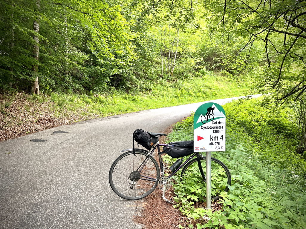
Col des Cyclotouristes from Albertville is a climb in the region Annecy. It is 7.8 mi long and bridges 3150 ft of vertical ascent with an average gradient of 7.7%, resulting in a difficulty score of 770. The top of the ascent is located at 4272 ft above sea level. Climbfinder users shared 3 reviews of this climb and uploaded 22 photos.
Road name: Route du fort du mont
2.0 by CyclopaatThis is an automatic translation, the original language is: English.As mentioned, the road condition is deteriorated after you pass the Fort. However, going down the other end is not without risk as the tarmac is completely gone is some places. I've taken two screenshots from my recording to demonstrate.... read more
Welcome! Please activate your account if you would like to share something. Look for the verification email in your inbox.
If you want to upload your photos, you need to create an account. It only takes 1 minute and it's completely free.
I was already put off by the name...
And yet, a cyclotourist is just what I am! A cyclogrimpeur? Today, we say that l'in does bike-packing, it sounds better...
And then I ran into a local cyclist who warmly recommended this misnamed pass.
And then I wanted to find out more.
And that's when I discovered its amazing and unique story. The struggle of one man, a cyclist, to have this false pass (geographically speaking) recognized as a real cycling pass. Read more about it on the Alpes4ever website.
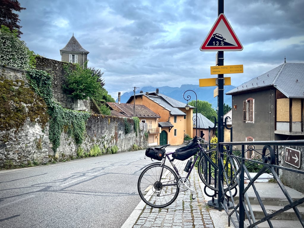
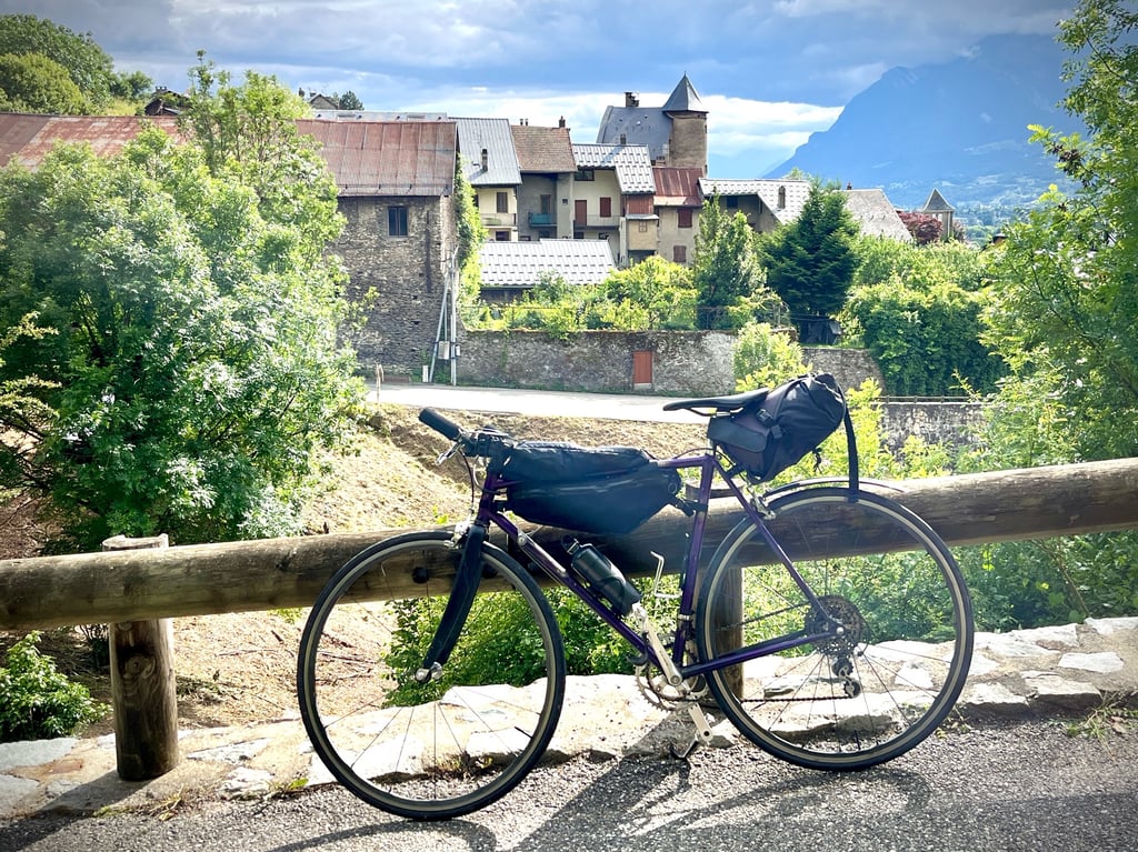
It starts off with a bang in the heart of Albertville, with a 600-metre dry gradient reaching 13% to take us to the medieval town of Conflans.
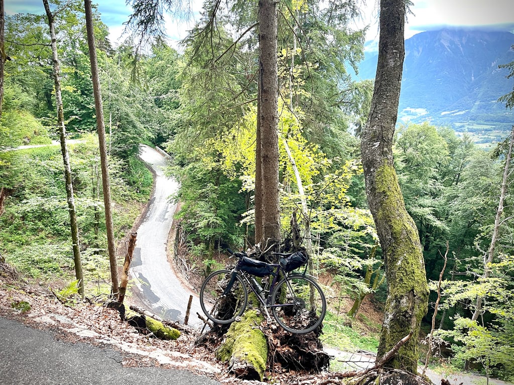
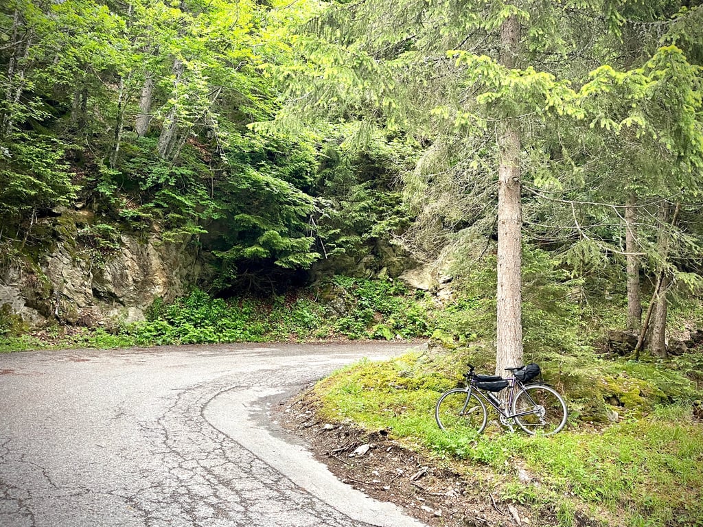
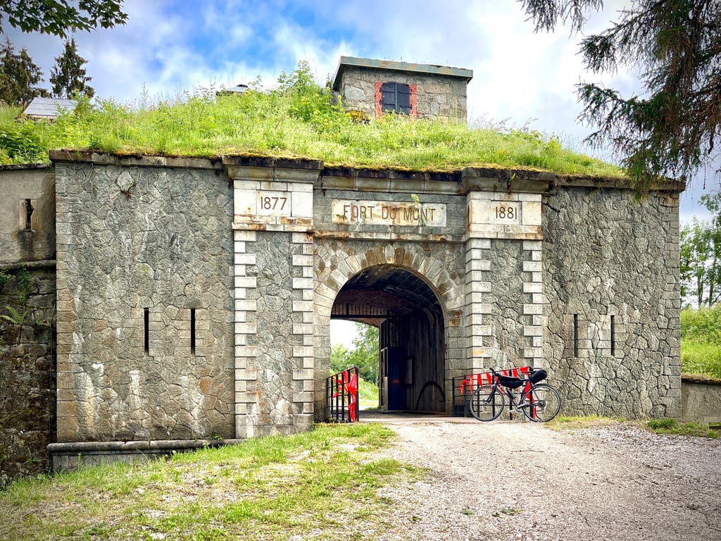
Then it's on to the beautiful, wild forest and the Fort du Mont, which has never seen a single soldier, but is used as a maturing cellar for local cheeses...
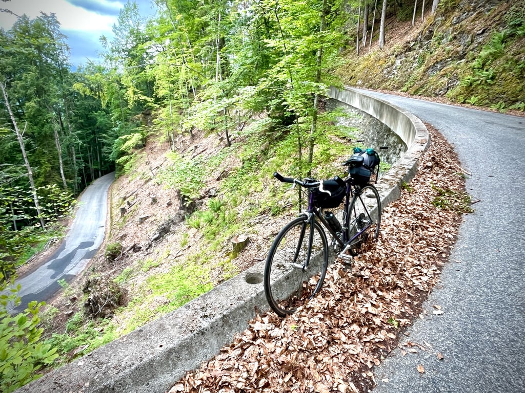
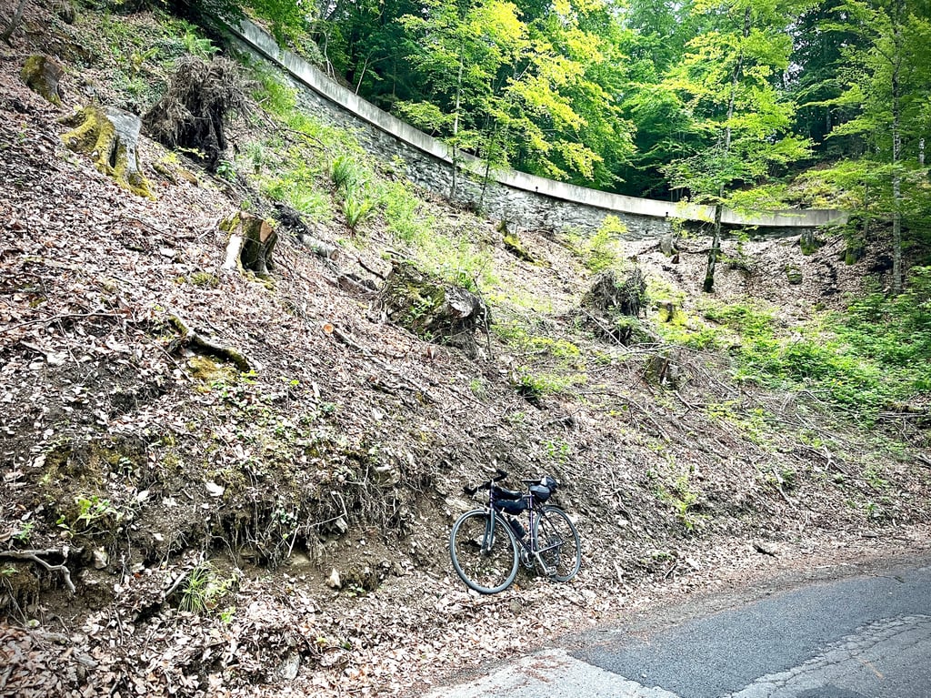
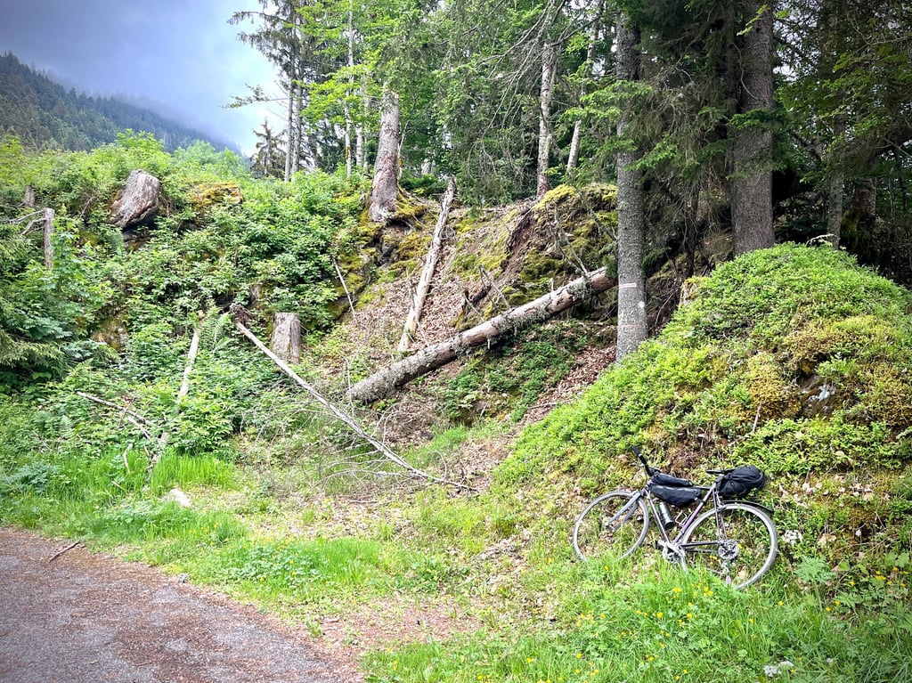
The road is fine up to here, but the forest and the twists and turns make you forget about it. The end is pretty solid.
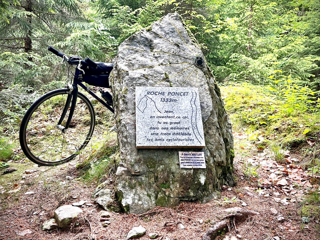
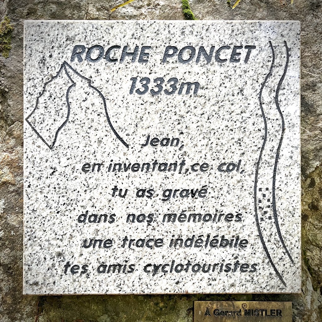
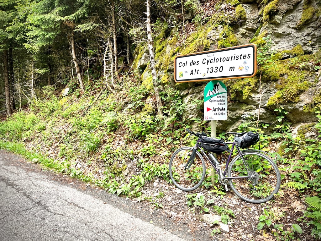
Up here, there's no viewpoint. A stele pays tribute to this curious fellow who fought for years to have this pass recognized. He won his case, and the official milestones bear witness to this.
In the end, I really liked this pass.
Am I really just a bicycle tourist?
I'll have to live with that.
Don't let the name put you off.
It's far more interesting than the Col de Tamié.
4 stars for the calm, for the forest, for the winding roads, for the birdsong and for Jean Poncet's fight.
Son nom déjà me rebutait…
Et pourtant, cyclotouriste, c’est un peu ce que je suis ! Un cyclogrimpeur ? Aujourd’hui, on dit que l’in fait du bike-packing, ça sonne mieux…
Et puis, j’ai croisé un cycliste local qui m’a chaudement recommandé ce col mal nommé.
Et puis, j’ai voulu en apprendre plus.
Et là, j’ai découvert sa formidable et unique histoire. Le combat d’un homme, un cycliste, pour faire reconnaître ce faux col (du point de vue géographique) comme un vrai col cycliste. Le site Alpes4ever vous en dira plus.
Ça démarre tambour battant au cœur d’Albertville avec une rampe sèche de 600 mètres qui atteint les 13% pour nous mener à la cité médiévale de Conflans.
Puis, de beaux lacets, la forêt, belle, sauvage et le fort du Mont qui n’a jamais vu un seul militaire, mais sert de cave d’affinage pour les fromages locaux…
La route correcte jusque là se dégrade mais la forêt et les lacets font oublier ça. La fin est assez solide.
Là-haut, pas de point de vue. Une stèle qui rend hommage à ce curieux bonhomme qui s’est battu des années pour faire reconnaître ce col. Il a obtenu gain de cause et les bornes kilométriques officielles en témoignent.
Finalement, je l’ai bien aimé, ce col.
Je ne serais vraiment qu’un cyclotouriste ?
Je vais devoir l’assumer.
Ne vous laissez pas rebuter par son nom.
Il est bien plus intéressant que le col de Tamié.
4 étoiles pour le calme, pour la forêt, pour les lacets, pour le chant des oiseaux et pour le combat de Jean Poncet.
The col des cyclotouristes is located at the North-East exit of Albertville, it is not considered as a real road col, but with nearly 1000M of difference in altitude for approximately 13Kms of Ascent, the slope is rough, The beginning of the col is very breakneck,indeed at the approach of Conflans in the 1st km of the passages has 13% ,what to put us immediately in the heart of the subject.Then until Fort du mont (km 10,2),the climb is quite regular with some more difficult passages.To note the last 2 km are a bit harder.
The road is relatively good except on the last 3 km after the Fort du Mont. The views over the Albertville valley and the Bauges massif are magnificent. As you climb, you can see the Tarentaise valley and the massif of the same name, and on a clear day, the Chartreuse massif and some summits of the Vanoise park with its eternal snows. For those who want to make the loop, the road goes down on the other side (not in very good condition) to join the D925 Albertville-Beaufort. Total about 30-35Kms for 1000 to 1100M of difference in altitude. For the beginners, go well warmed up because I climbed many times this pass and I never succeeded in managing the ascent, for reason I started at 500M of the foot.
Bonne Balade et soyez prudents L'histoire Farfelue du col Ici : https://urlz.fr/fAAW
Le col des cyclotouristes est situé à la sortie Nord-Est d’Albertville, il n’est pas considéré comme un vrai col routier, mais avec près de 1000M de dénivellation pour environ 13Kms d’Ascension, la pente est rude, Le début du col est très casse-pattes,en effet au abord de Conflans dans le 1er km des passages a 13% ,de quoi nous mettre tout de suite dans le vif du sujet.Ensuite jusqu’au Fort du mont (km 10,2),la montée est assez régulière avec quelques passages plus difficile.A noter les 2 derniers km sont un peu plus durs.
La route est relativement bonne à part sur les 3 derniers kilomètres après le Fort du Mont. Les vues sur la vallée albertvilloise et sur le massif des bauges sont magnifiques. Au fil de l’Ascension, on embrasse du regard, la vallée de la Tarentaise et le massif du même nom, et par temps clair le massif de la chartreuse et quelques sommets du parc de la Vanoise avec les neiges éternelles. Pour ceux qui veulent faire la boucle, la route descend de l’autre coté ( pas en très bon état ) pour rejoindre la D925 Albertville-Beaufort. Total environ 30-35Kms pour 1000 à 1100M de dénivellation. Pour les débutants, partez bien échauffés car j’ai escaladé de nombreuses fois ce col et je n’ai jamais réussi à gérer la montée, pour cause je démarrais à 500M du pied.
Bonne Balade et soyez prudents L’histoire Farfelue du col Ici : https://urlz.fr/fAAW
| 5 mph | 01:33:43 |
| 7 mph | 01:06:21 |
| 9 mph | 00:51:42 |
| 12 mph | 00:38:50 |
This page is better in the app