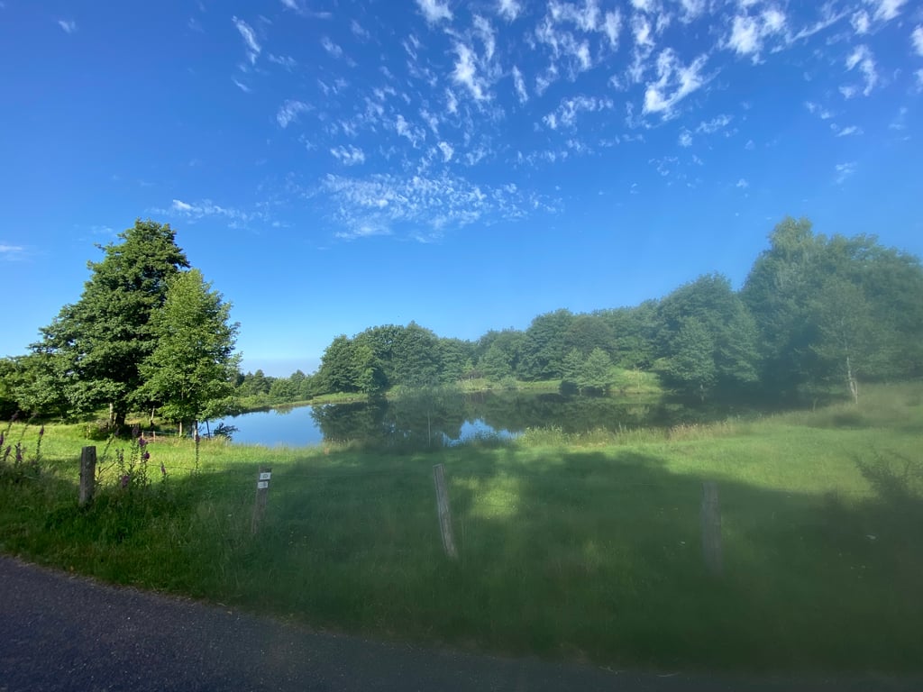
| Beautiful scenery |
| Hidden gem |
| 5 hairpin turns |
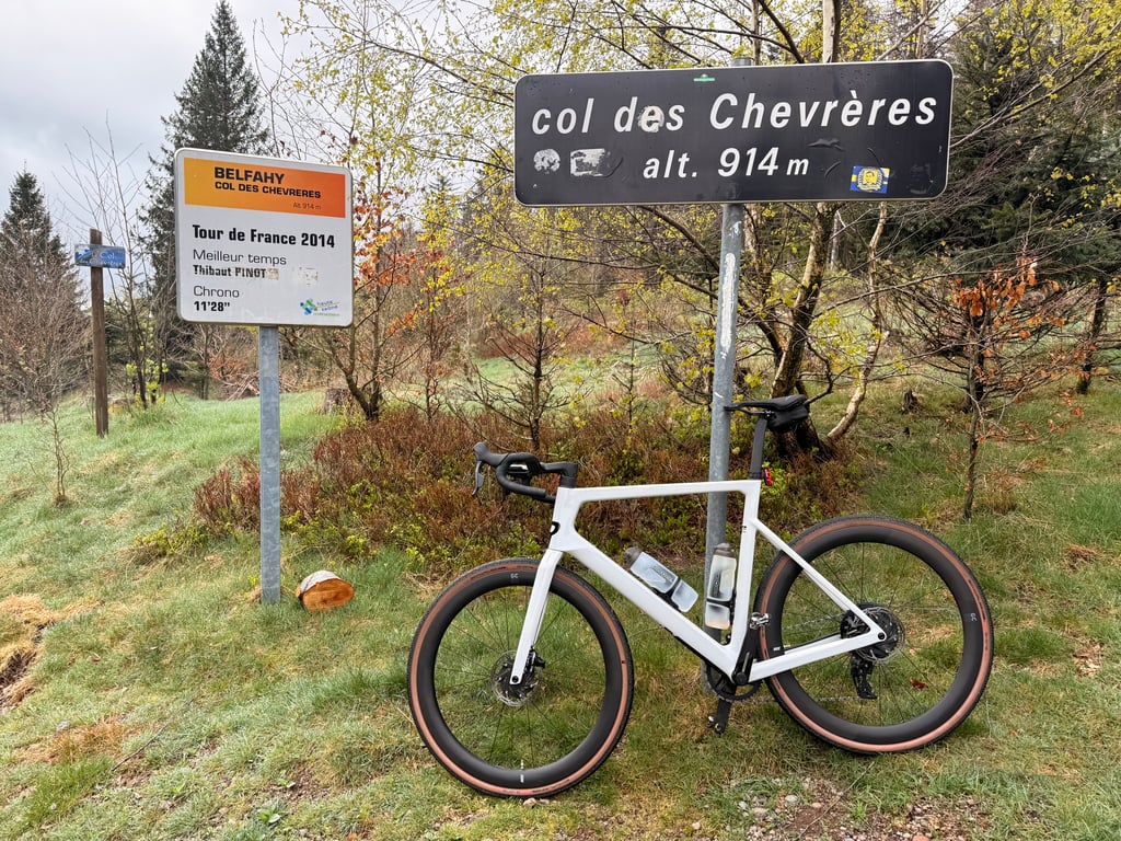
| #10 toughest climb of Burgundy-Franche-Comté |
| #22 most elevation gain of Burgundy-Franche-Comté |
| #82 longest climb of Burgundy-Franche-Comté |
| #26 average steepest climb of Haute-Saône |
Col des Chevrères via Belfahy is a climb in the region Haute-Saône. It is 5.2 mi long and bridges 1716 ft of vertical ascent with an average gradient of 6.3%, resulting in a difficulty score of 498. The top of the ascent is located at 3015 ft above sea level. Climbfinder users shared 5 reviews of this climb and uploaded 7 photos.
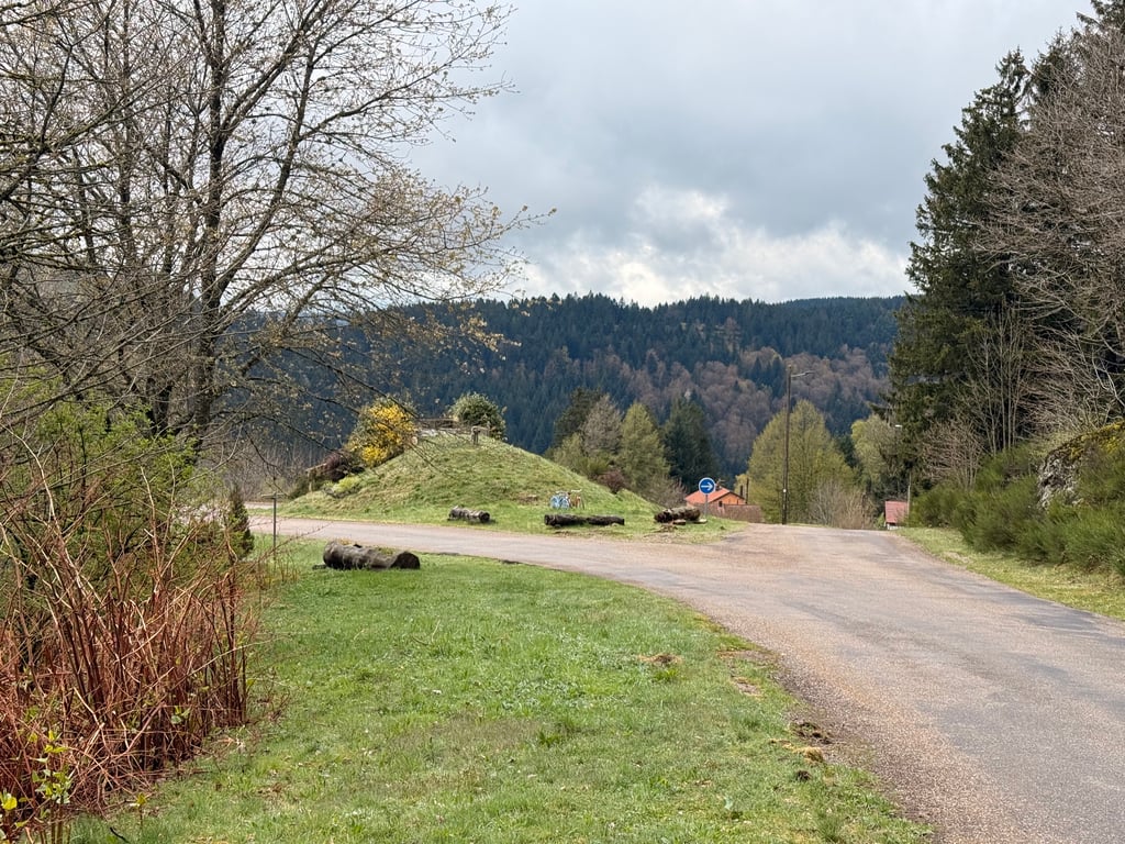
Road names: D133 & Le Droit Miellenot
4.0 by MarksWonderBenenThis is an automatic translation, the original language is: Dutch.I hope you have good legs on the day you want to ride this climb. Especially on the three kilometres between the little bridge and Belfahy, I found out that I didn't have all my strength after 4 days of playing mountain goat. The climb is very irregular which also makes it difficult to get into a rhythm. The altitude profile does not do justice to the severity of this stretch. Percentages on the Garmin regularly exceed 15% and even 20% for a few tens of metres is no rarity. The steepest... read more
Welcome! Please activate your account if you would like to share something. Look for the verification email in your inbox.
If you want to upload your photos, you need to create an account. It only takes 1 minute and it's completely free.
Tough calf bite, with poor road surface and a small dog halfway up the climb who fancies himself a wolf and runs after you.
The climb felt like a big win because of z'n high gradients. Saw many people ascending this climb with bike in hand.
Stevige kuitenbijter, met slecht wegdek en een klein hondje halverwege de klim die zichzelf een wolf waant en achter je aan loopt.
De klim voelde als een grote overwinning door z'n hoge stijgingspercentages. Veel mensen deze beklimming met de fiets aan de hand zien op stappen.
Beautiful scenery with lovely lakes. Slopes are short and steep and persist which makes the climb tough. Road surface is moderate. Descent with gravel. Road is narrow
Mooi landschap met prachtige meertjes. Hellingen zijn kort en steil en blijven maar aanhouden wat de klim zwaar maakt. Wegdek is matig. Afdaling met grint. Weg is smal
Nice climb with a nasty ramp just before the summit. However, the descent to Miellin is very dangerous due to the poor road surface and the much steeper gradient. Nevertheless, highly recommended
Schöner Anstieg mit einer bösen Rampe kurz vor dem Gipfel. Die Abfahrt nach Miellin ist jedoch wegen des schlechten Straßenbelags und der deutlich härteren Steigung sehr gefährlich. Trotzdem sehr zu empfehlen
I hope you have good legs on the day you want to ride this climb. Especially on the three kilometres between the little bridge and Belfahy, I found out that I didn't have all my strength after 4 days of playing mountain goat. The climb is very irregular which also makes it difficult to get into a rhythm. The altitude profile does not do justice to the severity of this stretch. Percentages on the Garmin regularly exceed 15% and even 20% for a few tens of metres is no rarity. The steepest hairpin was given a percentage of 26% on Strava. Occasionally it levels off, allowing you to recover for a while, but the next steep section is quickly in sight each time. This does make it a nice climb to challenge yourself with.
The asphalt is not everywhere as good as it used to be. Some loose gravel here and there, so I will not recommend this route as a descent. In the descent to the Planche de belles Filles I unfortunately punctured on a sharp gravel, so I could not test how this climb acts as a warm-up for this famous Tour de France climb, but after this percentage it can only be better. Walking back with the bike on my shoulder, I did manage to get a lift to Servence from a kind French villager.
Ik hoop dat u goede benen heeft op de dag dat u deze beklimming wilt rijden. Vooral op de drie kilometer tussen het bruggetje en Belfahy kwam ik er achter dat ik na 4 dagen bergeitje spelen niet meer al mijn krachten had. De klim is zeer onregelmatig waardoor het ook lastig is om in een ritme te komen. Het hoogteprofiel doet geen eer aan de zwaarte van dit stuk. Percentages op de Garmin komen geregeld boven de 15% en ook de 20% is voor enkele tientallen meters geen zeldzaamheid. De steilste haarspeldbocht kreeg op Strava een percentage van 26% mee. Af en toe vlakt het af, waardoor je even bij kan komen, maar het volgende steile stuk is telkens snel weer in zicht. Daardoor is het wel een mooie klim om de uitdaging met jezelf aan te gaan.
Het asfalt ligt er niet overal even goed meer bij. Hier en daar wat losliggend grind, waardoor ik deze route niet als afdaling aan zal aanraden. In de afdaling naar de Planche de belles Filles helaas lek gereden op een scherpe kiezel en dus niet kunnen testen hoe deze klim fungeert als opwarmer voor deze bekende Tour de France klim, maar na deze percentage kan dat alleen maar meevallen. Lopend terug met de fiets op de schouder wel nog van een lieve Franse dorpsbewoner een lift naar Servence kunnen krijgen.
This is a particularly nasty climb if you come from Servance via the main road you turn left, in the beginning it is easy cycling with low gradients. You know you are in the right place because it says kruijswijk on the road. As soon as you see a small bridge on your right you have to cross it! Then the real climbing starts. 3.5 km average 10% with the last km 12%
Fortunately, it is a goat road, so you can navigate if you have to. After this you can descend towards plancher les mines and then directly to the planche de bel filles or the ballon de servance!
Dit is een bijzonder gemene klim als je vanuit servance komt via de hoofdweg sla je linksaf, in het begin is het gemakkelijk fietsen met lage stijgingspercentages. Je weet dat je goed zit want er staat kruijswijk op de weg geschilderd. Zodra je een bruggetje ziet rechts moet je die oversteken! Dan begint het echte klimmen. 3.5 km gemiddeld 10% met de laatste km 12%
Gelukkig is het een geitenweg waardoor je kan laveren als het moet. Je kan hierna afdalen richting plancher les mines en dan direct door naar de planche de bel filles of de ballon de servance!
| 5 mph | 01:02:40 |
| 7 mph | 00:44:22 |
| 9 mph | 00:34:34 |
| 12 mph | 00:25:58 |
This page is better in the app