Tips nearby


| Beautiful scenery |
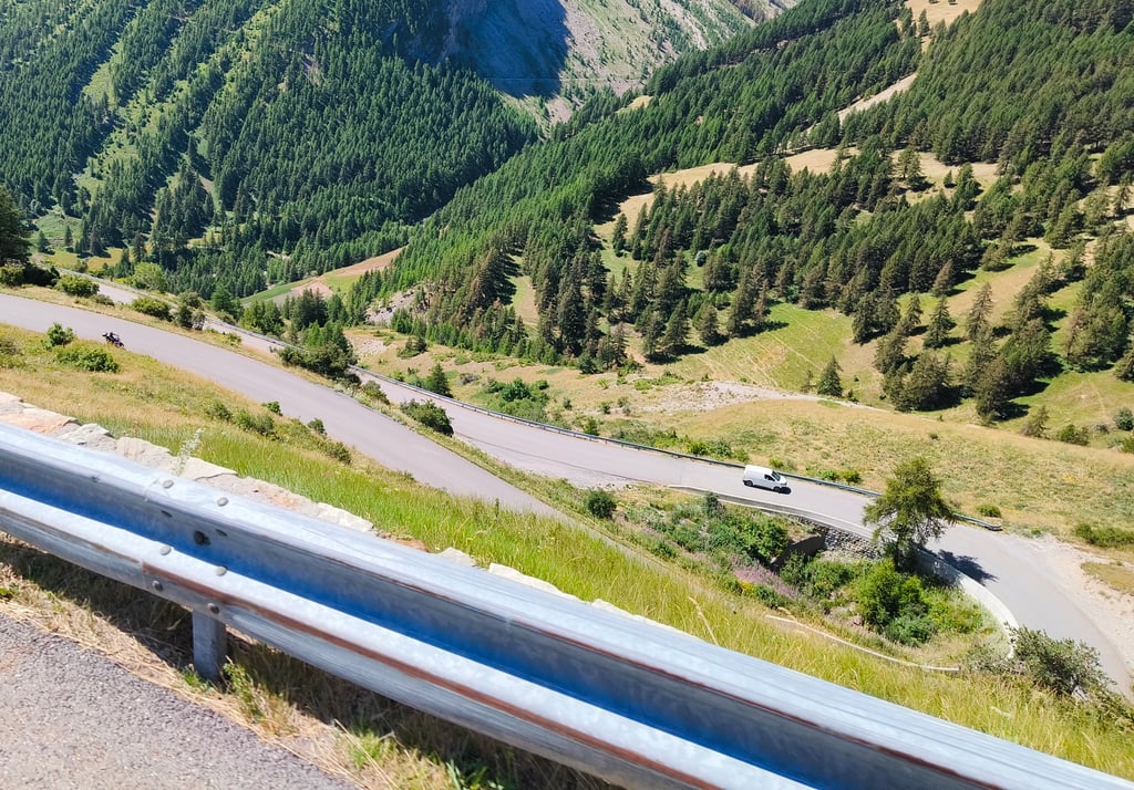
| 7 hairpin turns |
| #69 toughest climb of Provence-Alpes-Côte d'Azur |
| #75 most elevation gain of Provence-Alpes-Côte d'Azur |
| #77 longest climb of Provence-Alpes-Côte d'Azur |
| #83 average steepest climb of Alpes-de-Haute-Provence |
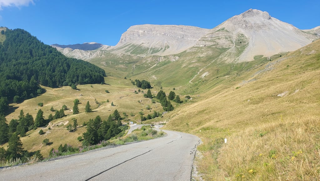
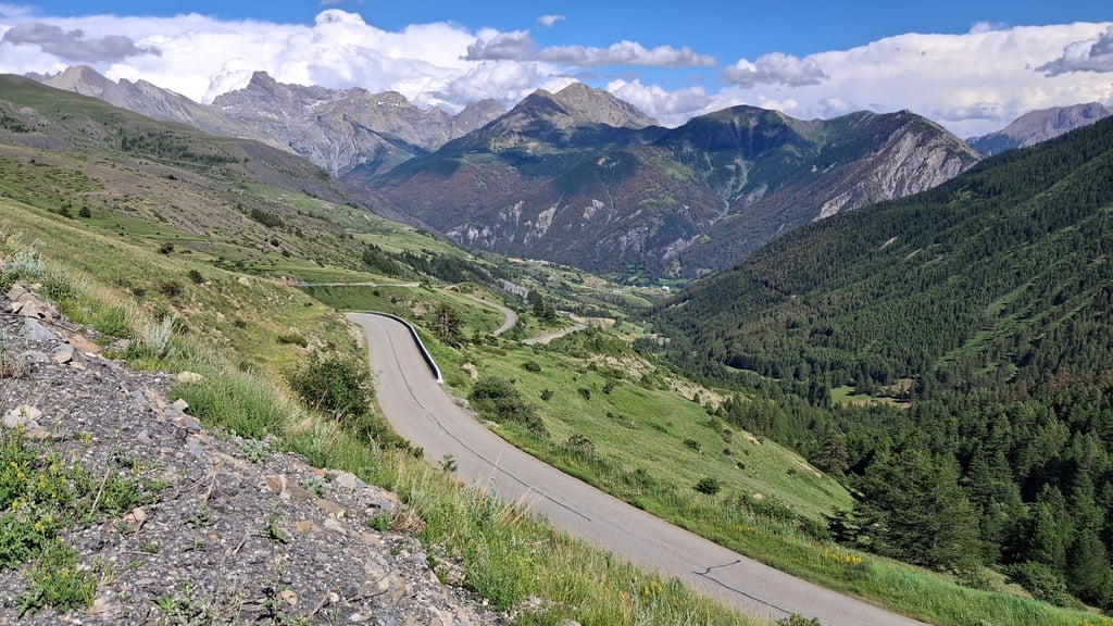
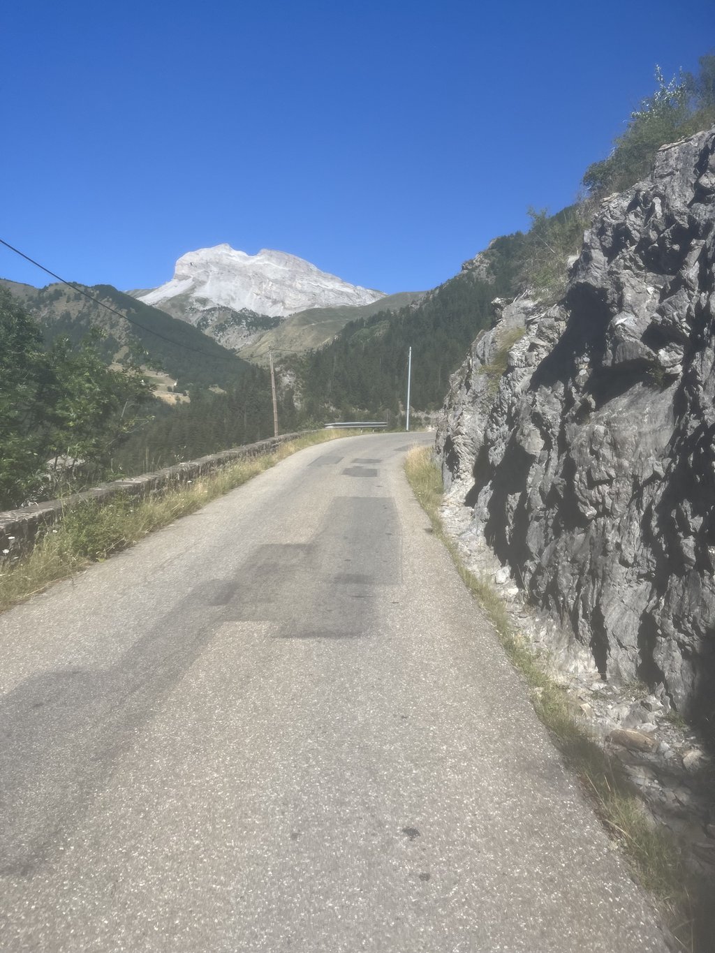
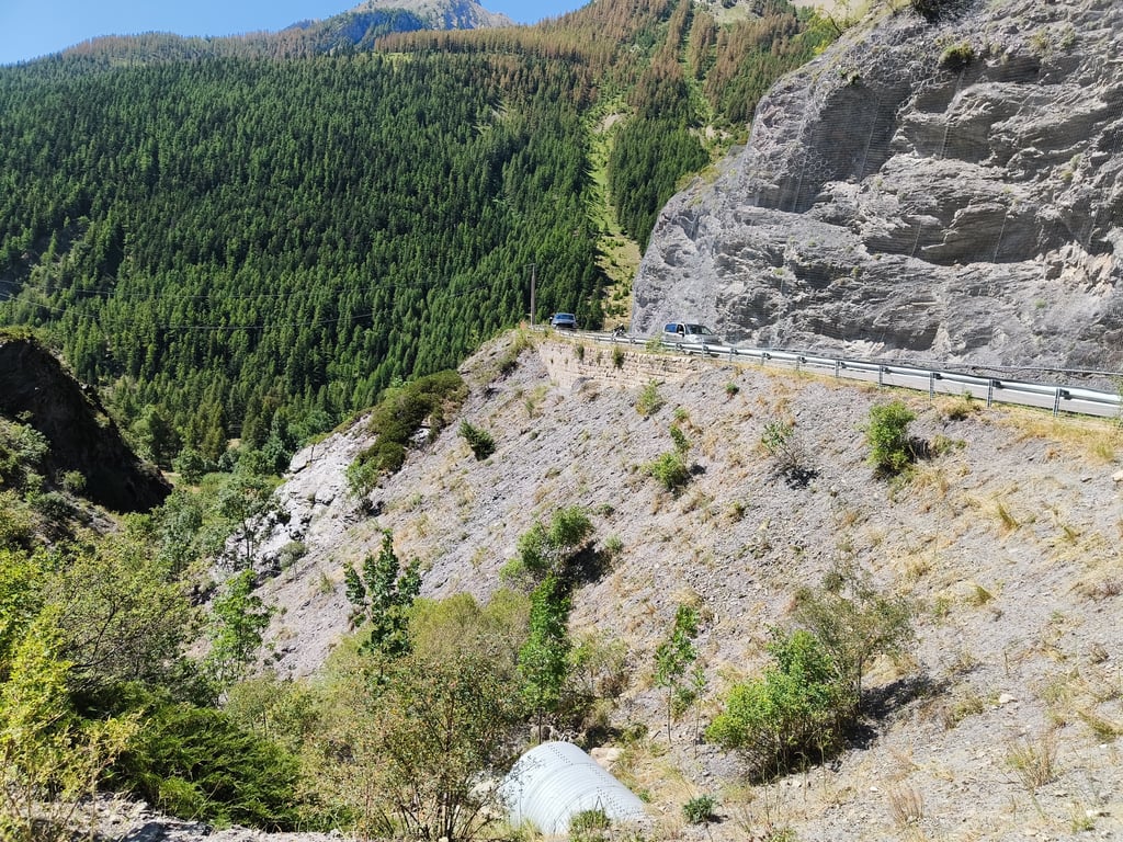
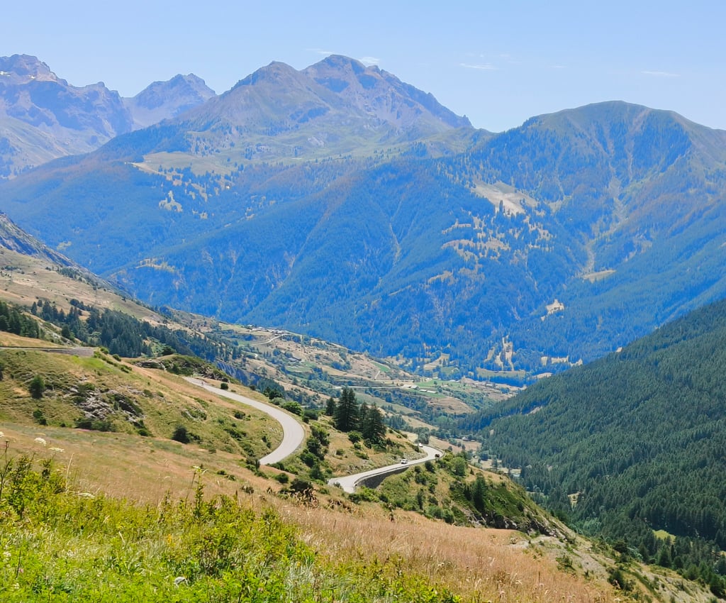
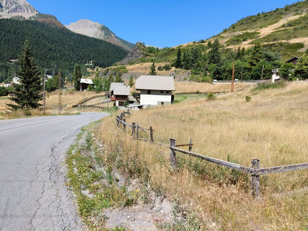
Col de Vars from Les Gleizolles is a climb in the region Serre Ponçon. It is 9.1 mi long and bridges 2680 ft of vertical ascent with an average gradient of 5.6%, resulting in a difficulty score of 642. The top of the ascent is located at 6919 ft above sea level. Climbfinder users shared 17 reviews of this climb and uploaded 47 photos.
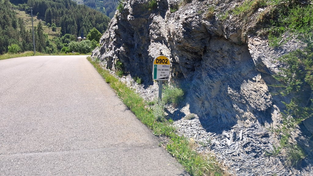
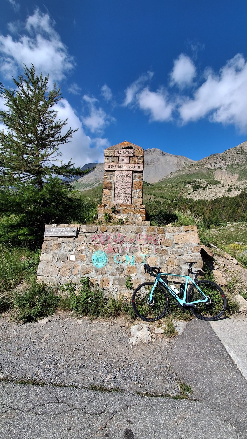
Road name: D902
5.0 by patrickbaertThis is an automatic translation, the original language is: Dutch.Cycled this Col de Vars, known from the Tour, along the southern flank starting in Barcelonnette, then the starting point of my hiking & biking holiday. Long false flat approach brings you via Jausiers to the foot of the climb in Les Gleizolles where you turn left on the big busy road. First slightly upwards through the valley of the river l'Ubaye with 2 short tunnels to Saint-Paul to start the real climbing. The surprise is at the end because, after the village of Le Mélezen, you cycle ... read more
Welcome! Please activate your account if you would like to share something. Look for the verification email in your inbox.
If you want to upload your photos, you need to create an account. It only takes 1 minute and it's completely free.
Start iz Jauziera, prva polovica enostavna, nato pa kar konkretne strmine. Klanec ni dolg, 1uro do 1.5 ure je dovolj. Cesta je v odličnem stanju, pregledna in je spust za užitek in varen. Prometa je bilo na soboto zmerno, precej predvsem motoristov. Sicer pa glede razgledov, okolice in trase ni primerljiv z južnimi sosedi( Bonette, Cayolle, Allos).
---
Start from Jauziers, the first half is easy, then some quite steep sections follow. The climb is not long; 1 to 1.5 hours is enough. The road is in excellent condition, with good visibility, and the descent is enjoyable and safe. On Saturday the traffic was moderate, mostly motorcyclists. As for the views, surroundings, and route, however, it's not comparable to its southern neighbors (Bonette, Cayolle, Allos).
Start iz Jauziera, prva polovica enostavna, nato pa kar konkretne strmine. Klanec ni dolg, 1uro do 1.5 ure je dovolj. Cesta je v odličnem stanju, pregledna in je spust za užitek in varen. Prometa je bilo na soboto zmerno, precej predvsem motoristov. Sicer pa glede razgledov, okolice in trase ni primerljiv z južnimi sosedi( Bonette, Cayolle, Allos).
---
Start from Jauziers, the first half is easy, then some quite steep sections follow. The climb is not long; 1 to 1.5 hours is enough. The road is in excellent condition, with good visibility, and the descent is enjoyable and safe. On Saturday the traffic was moderate, mostly motorcyclists. As for the views, surroundings, and route, however, it’s not comparable to its southern neighbors (Bonette, Cayolle, Allos).
Not long, not very tough and although not an ugly area, other climbs nearby (such as Bonette, Allos and Cayolle) are much nicer, longer and/or more challenging
Niet lang, niet heel zwaar en hoewel het geen lelijke omgeving is zijn andere klims in de buurt (zoals Bonette, Allos en Cayolle) veel mooier, langer en/of uutdagender
Nice climb, after which you can descend particularly long and hard towards Guillestre.
Leuke klim, waarna je vooral ook heel erg lang en hard kan afdalen richting Guillestre.
Nice climb, not the prettiest in the area. Starts quietly towards the end yet spicy!
Leuke klim, niet de mooiste uit de buurt. Begint rustig naar het einde toe toch wel even pittig!
Beautiful climb done on 21/08/24, the hard part being the final kilometres after Saint Paul. Recommended for the little traffic, the excellent asphalt and the truly incredible views.
Bellissima salita fatta il 21/08/24, la parte dura sono i km finali dopo Saint Paul. Consigliabile per il poco traffico, l’asfalto ottimo ed i panorami veramente incredibili.
Magnificent climb through superb scenery.
Road in excellent condition.
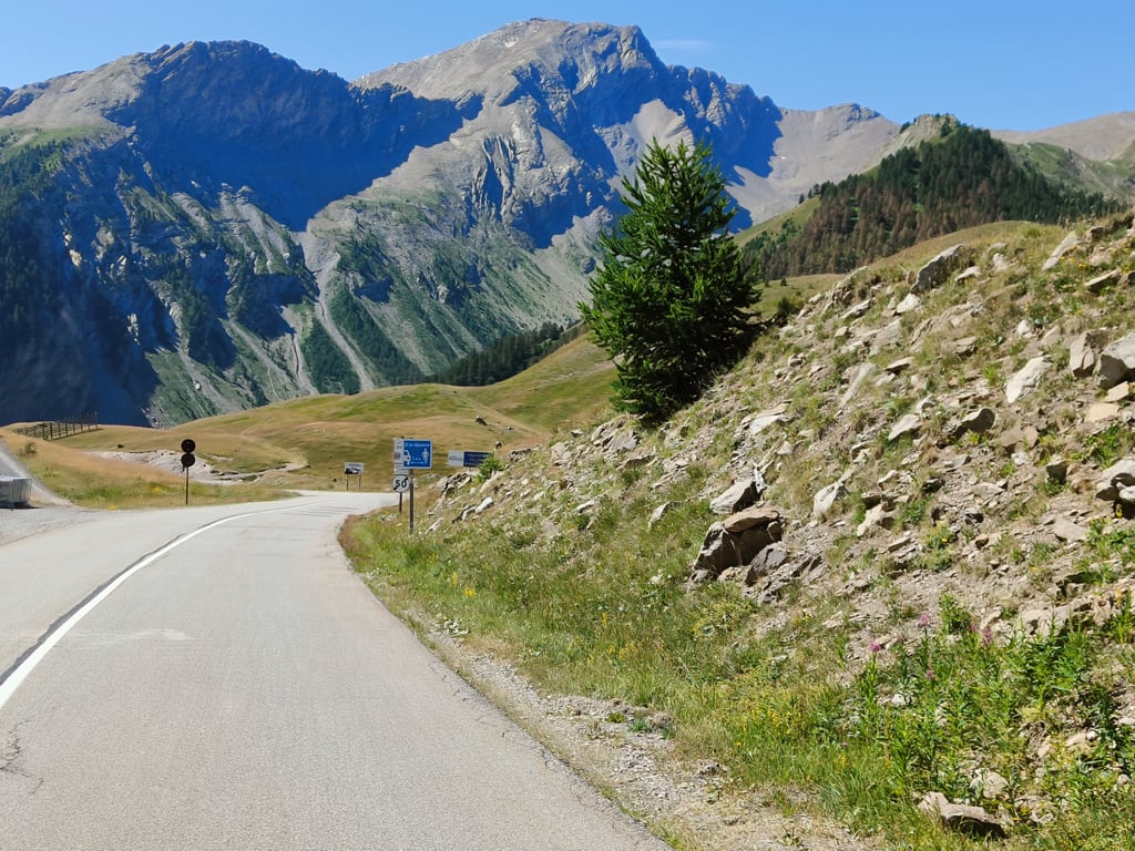
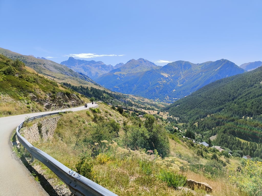
The last 5 km after Saint-Paul-Sur-Ubaye are the most beautiful and steepest of the climb (8 to 10%). The views are unobstructed and the road is quiet.
A must-do if you're in the area. (For me, a return trip from Guillestre-Vars-Jausiers-Vars-Guillestre).
Montée magnifique dans des paysages superbes.
Route en excellent état.
Les 5 derniers km après Saint-Paul-Sur-Ubaye sont les plus beaux et les plus raides de l'ascension (8 à10%). La vue est dégagée et la route est calme.
A faire absolument si vous êtes dans la région. (Pour ma part en aller-retour Guillestre-Vars-Jausiers-Vars-Guillestre).
Climbed today thinking it wasn't going to be that tough, I was wrong! The last 5km is really tough with percentages around 9%, not much to see at the top unfortunately....
Vandaag beklommen om dat ik dacht dat hij niet zo zwaar ging zijn, had ik dat even mis! De laatste 5km is echt zwoegen met percentages rond de 9%, op te top niet zoveel te zien helaas..
We got to Barcelonnette and found that Cayolle, Bonette, and d’Allos were closed for one reason or another, so we headed up to Col de Vars and weren’t disappointed. Great Alpine views and plenty of Marmottes too!
climbed this from barcelonette via les gleizolles this morning 28/5/2024. surprisingly quiet roads the whole way from barcelonette to top of col de vars. almost flat-ish first 10km and last 5km is really 10% with flat ends at hairpins into wind. marmottes at 2000vm were fantastic to see!
A climb with a long run-up, making breaking in not necessary. When riding out of Saint-Paul you can already test your climbing legs for a while, then recuperate on the flatter sections, before starting the steep last 5 kilometres. These are also really steep, but well-digestible due to the limited length. It is a used connecting road between two valleys, but I was pleasantly surprised by the little traffic.
Een klim met een lange aanloop, waardoor inrijden niet nodig is. Bij het buitenrijden van Saint-Paul kan je al even je klimbenen testen, daarna nog even recupereren op de vlakkere stroken, vooraleer je aan de steile laatste 5 kilometer begint. Die zijn ook wel echt steil, maar door de beperkte lengte goed te verteren. Het is een gebruikte verbindingsweg tussen twee valleien, maar ik was aangenaam verrast door het weinige verkeer.
A nice climb with an 'easy' approach of 7 kilometres. From Saint Paul it gets trickier, with the devil really in the tail. From Saint Paul it is no longer forested and you have beautiful views. However, this is a popular motorbike route, so you often breeze past.
Een mooie klim met een 'makkelijke' aanloop van 7 kilometer. Vanaf Saint Paul wordt het lastiger, met het venijn echt in de staart. Vanaf Saint Paul is het niet meer bebost en heb je prachtige vergezichten. Wel is dit een populaire motorroute, die je dus vaak voorbij stuiven.
Nice runner through a beautiful landscape. The devil is clearly in the tail here.
Watch out when descending, you are going very fast!
Lekkere loper door een prachtig landschap. Venijn zit hem hier duidelijk in de staart.
Kijk uit met afdalen, je gaat heel gauw heel snel!
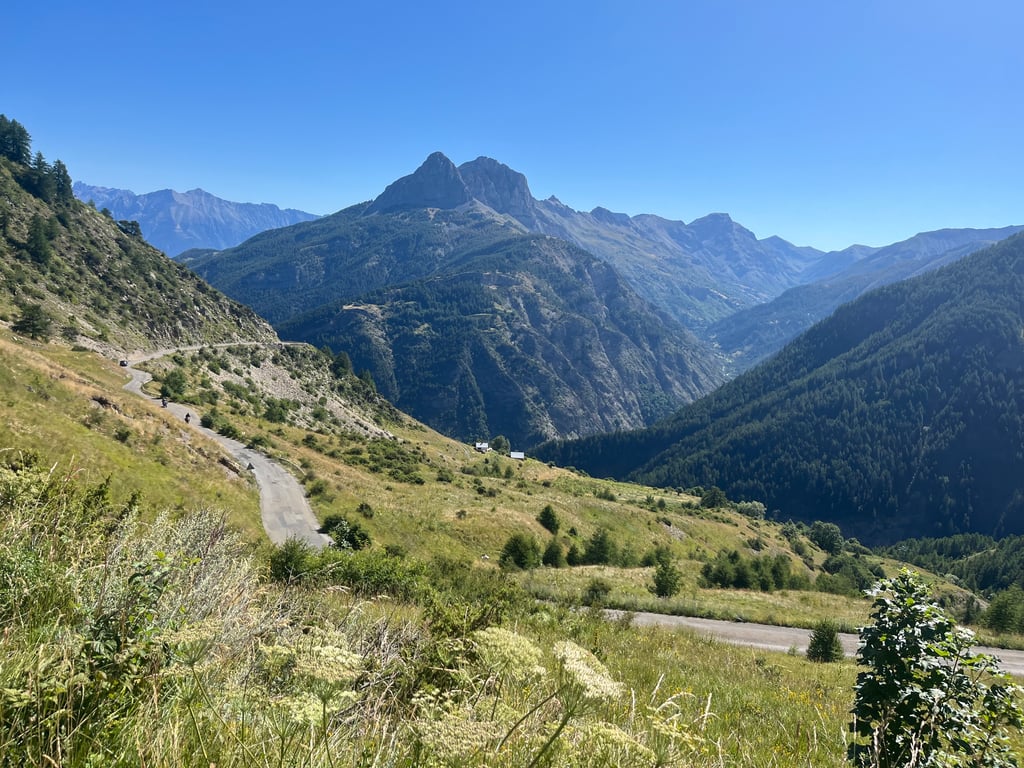
Very nice pass ! Beautiful landscapes and splendid gradients from Saint Paul sur Ubaye. Despite a very easy first part along the Ubaye river, this pass is very very intense. Eight kilometers from the summit at the exit of Saint Paul, you can see (already!) the summit of the pass culminating far above you at 2109 meters ... You just have to be patient and climb at your own pace to the top.
Très beau col ! Magnifiques paysages et splendides pourcentages à partir de Saint Paul sur Ubaye. Malgré une première partie très facile le long de l'Ubaye, ce col reste très très intense. A huit kilomètres du sommet à la sortie de Saint Paul, on peut voir (déjà !) le sommet du col culminant loin au dessus de vous à 2109 mètres...Il ne vous reste plus qu'a être patient et de monter à votre rythme jusqu'en haut.
Side I prefer to do downhill: it is much less challenging than the other one so I find it pretty cool to use the 10% slopes to go hard!
Versant que je préfère faire en descente : il est bien moins challengeant que l'autre donc je trouve plutôt cool d'utiliser les pentes à 10% pour aller à fond !
Cycled this Col de Vars, known from the Tour, along the southern flank starting in Barcelonnette, then the starting point of my hiking & biking holiday.
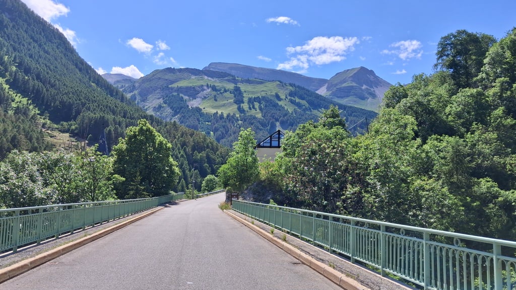
Long false flat approach brings you via Jausiers to the foot of the climb in Les Gleizolles where you turn left on the big busy road. First slightly upwards through the valley of the river l'Ubaye with 2 short tunnels to Saint-Paul to start the real climbing. The surprise is at the end because, after the village of Le Mélezen, you cycle the last 5 km. through pure nature high mountains with an average of 9% up to the top.
At the top of the pass, there is a possibility to get supplies as well as at the start.
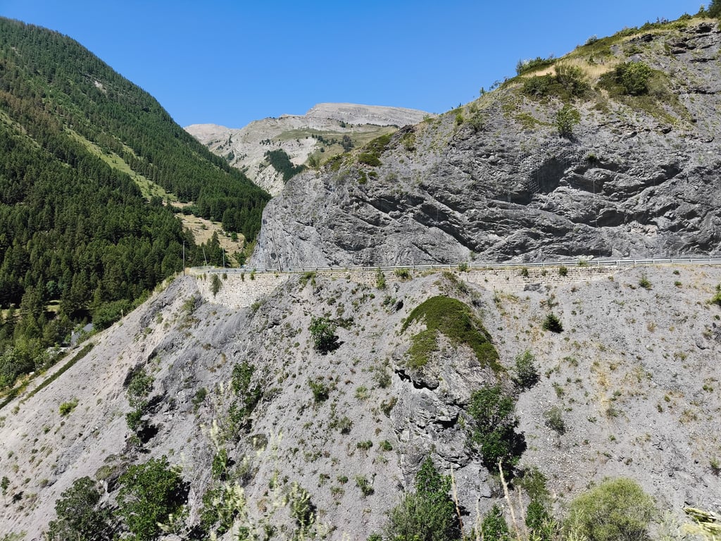
The passage of the Tour that year (2017) had not only provided new asphalt that had already been seriously reworked with supporter paint. But I suspect cycling fans took the last 4 cycling info signs before the summit as a souvenir because suddenly they had disappeared so I had a hard time estimating my progress.
Partly because of the little traffic, this is a particularly beautiful climb that you should definitely have done.
Deze uit de Tour bekende Col de Vars langs de zuidflank op gefietst vertrekkend in Barcelonnette, toen de uitvalsbasis van mijn wandel & fietsvakantie.
Lange vals plat aanloop brengt je via Jausiers tot de voet van de klim in Les Gleizolles alwaar je de grote drukke weg links afdraait. Eerst licht omhoog door het dal van de rivier l'Ubaye met 2 korte tunnels tot Saint-Paul om nadien het echte klimwerk aan te vatten. De verrassing is voor het einde want, na dorpje Le Mélezen, fiets je de laatste 5 km. door puur natuur hooggebergte met een gemiddelde van 9% tot de top.
Op pashoogte is er bevoorrading mogelijk alsook bij de start.
De doortocht van de Tour dat jaar (2017) had niet alleen gezorgd voor nieuw asfalt dat al serieus bewerkt was met supportersverf. Maar ik vermoed dat wielerfans de laatste 4 fietsinfobordjes voor de top meenamen als souvenir want plots waren ze verdwenen zodat ik mijn vorderingen moeilijk kon inschatten.
Mede door het weinig verkeer is dit een bijzonder mooie klim die je zeker moet gedaan hebben.
A part of the road surface has been resurfaced, so the bad stretches are history (for a while).
wegdek is voor een gedeelte opnieuw geasfalteerd waardoor de slechte stukken verleden tijd zijn (voor een poos).
Climbed from Guillestre and descended towards Jausiers and then climbed back to Guilestre. A nice challenge and easy to do. This way you can experience the absolute differences of this col. I find the climb from Jausiers the most beautiful and the most varied. The descent to Guillestre is tight.
Beklommen vanuit Guillestre en afgedaald richting Jausiers om vervolgens weer terug te klimmen naar Guilestre. Een mooie uitdaging en goed te doen. Op deze wijze kun je de absolute verschillen van deze col ervaren. Ik vind de klim vanaf Jausiers het mooist en het meest gevarieerd. De afdaling vervolgens naar Guillestre is strak.
| 5 mph | 01:49:18 |
| 7 mph | 01:17:23 |
| 9 mph | 01:00:18 |
| 12 mph | 00:45:18 |
This page is better in the app