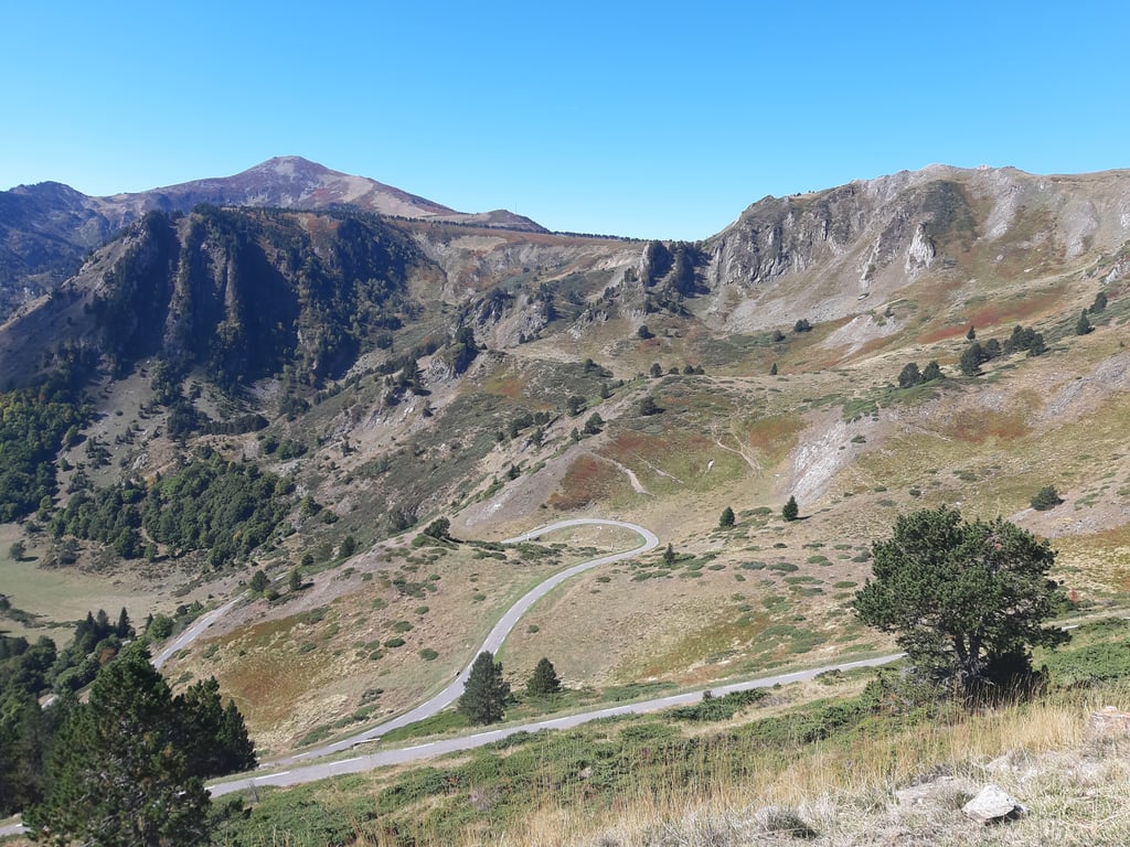
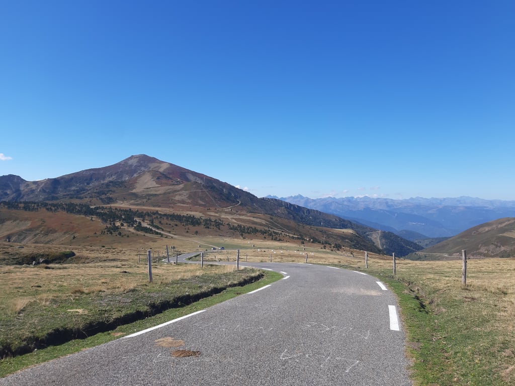
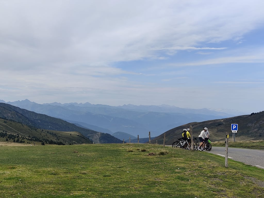
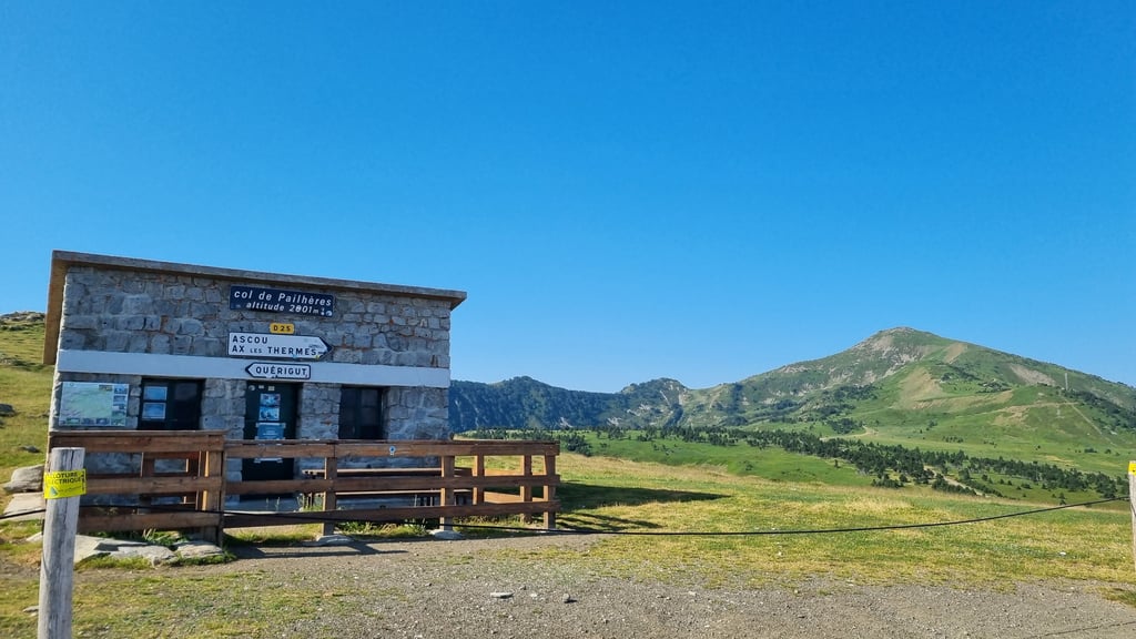
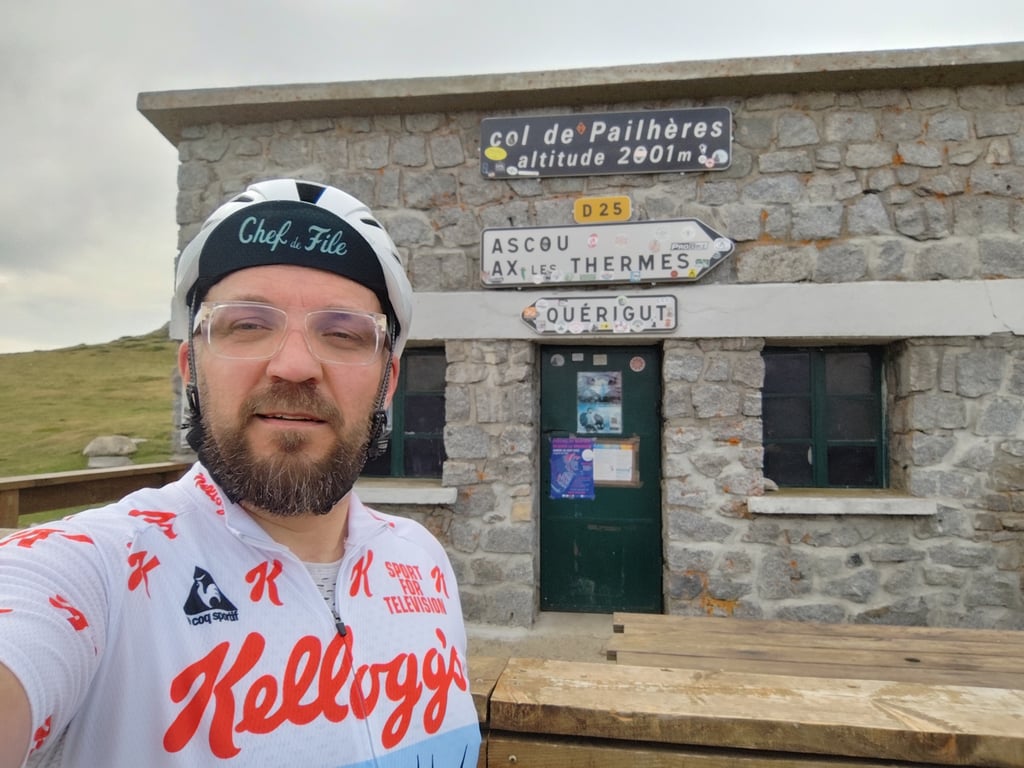
Col de Pailhères from Ax-les-Thermes is a climb in the region Ariège. It is 11.7 mi long and bridges 4193 ft of vertical ascent with an average gradient of 6.8%, resulting in a difficulty score of 1007. The top of the ascent is located at 6565 ft above sea level. Climbfinder users shared 19 reviews of this climb and uploaded 29 photos.
Road names: D613 & D25
4.0 by wamukkThis is an automatic translation, the original language is: German.I started from the junction where the D25 starts, just below Ascou. The first part of the climb is fairly flat with a few ramps, however things pick up after about 2km and the road is a fairly constant 8-10% until the last of the first set of hairpins. You'll get some time to rest your legs over about 200m, after which the road is consistently steep until the car park just 300m from the top, after which it flattens a bit. The road is quite exposed and there are often thunderstorms with ra... read more
Welcome! Please activate your account if you would like to share something. Look for the verification email in your inbox.
If you want to upload your photos, you need to create an account. It only takes 1 minute and it's completely free.
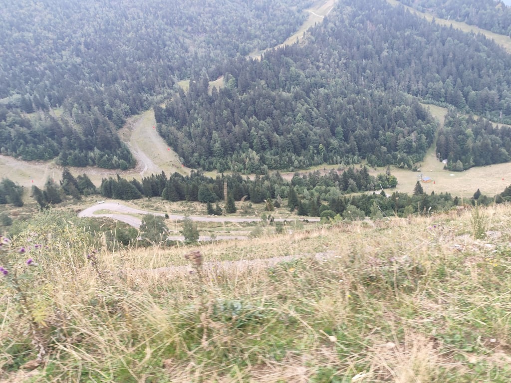
A major mountain pass in the Pyrenees. The climb begins right after leaving Ax-les-Thermes, with slopes that remain manageable. Everyone can set their own pace. A flat stretch near the village of Ascou gives you a chance to catch your breath. The next few kilometers are tough, and reaching the small ski resort is a welcome relief. But the respite is short-lived. The final kilometers of this pass are the hardest. The steep gradients and the effects of altitude require careful pacing. The final straight stretch just below the summit is truly grueling. But all that is forgotten upon arrival—the scenery is simply breathtaking!
Un grand col des Pyrénées. L'ascension commence dès la sortie d'Ax les Thermes avec des pentes qui restent accessibles. Chacun peut y prendre son rythme. Un replat permet de souffler un bon coup vers le village d'Ascou. Les kilomètres suivants sont difficiles et l'arrivée de la petite station de ski est la bienvenue. Le répit est de courte durée. Les derniers kilomètres de ce col sont les plus difficiles. Les forts pourcentages et les effets de l'altitude demandent une bonne gestion de l'effort. La ligne droite terminale sous le sommet est vraiment difficile. Mais tout est oublié en arrivant tant le cadre est somptueux !
The start from Ax-les-Thermes isn't too difficult, with a 2-kilometer stretch in the middle to catch your breath, but the last 6 kilometers are grueling and monotonous.
Le début depuis Ax les Thermes n est pas trop dur, avec 2km au milieu pour récupérer, par contre les 6 derniers km sont éprouvant et monotones.
Very nice climb, especially the stretch after the ski station summit is highest in the area so in hot weather with a chance of heat thunderstorms pay close attention
Zeer mooie klim, vooral het stuk na het skistation top is hoogste in de omgeving dus bij warm weer met kans op warmteonweer goed opletten
Climbed on a Monday around 8:00 am at the end of August. Fair to very good surface depending on the place. I was overtaken by quite a few cars, but almost all at the same time, so the rest of the climb was easy. My first pass at over 1000 points. Keep your strength up, it gets tougher at the end!
Montée effectuée un lundi vers 8h00 fin août. Revêtement correct ou très bon selon les endroits. Je me suis fait doubler par pas mal d'autos, mais presque toutes en même temps, le reste de la montée fût tranquille. Mon premier col à plus de 1000 points. Gardez des forces, à la fin ça se corse !
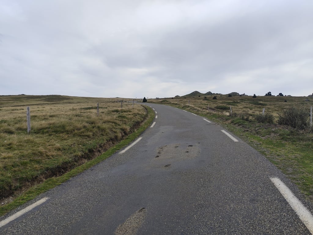
A climb that increases in difficulty as you approach the summit. The first few kilometres are fairly easy'this is the part with the most traffic, but cars rarely continue to the summit. Once you pass Ascou station, that's when things get tricky, but you're nearly there!
Une ascension dont la difficulté augmente à mesure que vous approchez du sommet. Les premiers kilomètres sont assez faciles, c'est la partie avec le plus de circulation, mais les voitures poursuivent rarement jusqu'au sommet. Une fois que vous passez la station d'Ascou, c'est là que les choses se compliquent, mais vous y êtes presque !
At first I wanted to write: A real insider tip, but there are already too many reviews here :-) I really enjoyed the climb, even though it's not easy to find your rhythm and the whole thing drags on towards the top. It feels lonely in a nice way, even if you are not alone. No refreshment stops at the top. Fantastic ascent on a small road.
Erst wollte ich schreiben: Ein echter Geheimtipp; dafür gibt es aber hier schon zu viele Bewertungen :-) Ich habe den Anstieg sehr genossen, auch wenn es nicht einfach ist, seinen Rhythmus zu finden und sich das ganze nach oben hin zieht. Es fühlt sich in schöner Weise einsam an, auch wenn man nicht alleine ist. Oben keine Einkehrmöglichkeit. Traumhafte Afahrt auf kleiner Straße.
After all the stories, a somewhat disappointing climb. Definitely a tough climb but the stretch around the ski station was a letdown. The last 3 km seems to have no end. Especially as you think you can see the top. Once there, you are surprised with another 500 metres. The descent was stunning. So that makes the climb from the other side the much nicer side to climb.
Na alle verhalen een wat tegenvallende klim. Zeker een pittige klim maar het stuk rondom het skistation was een tegenvaller. De laatste 3 km lijkt geen einde aan te komen. Met name omdat je denkt dat je de top ziet liggen. Daar aangekomen wordt je verrast met nog een extra 500 meter. De afdaling was schitterend. Dat maakt de beklimming van de andere kant dan ook de veel mooiere kant om te beklimmen.
Difficult, long and pleasant climb with superb views. The last 5 kilometres are terrible. Be careful in the heat, too, as the tarmac increases the effect of the "heat". Very little traffic on this road
Montée difficile, longue et agréable avec de superbes vues. Les 5 derniers kilomètres sont terribles. Attention aussi avec la chaleur car le goudron augmente l'effet de "chaud". Route très peu fréquentée par les voitures
I started from the junction where the D25 starts, just below Ascou. The first part of the climb is fairly flat with a few ramps, however things pick up after about 2km and the road is a fairly constant 8-10% until the last of the first set of hairpins. You'll get some time to rest your legs over about 200m, after which the road is consistently steep until the car park just 300m from the top, after which it flattens a bit. The road is quite exposed and there are often thunderstorms with rain. Bring a raincoat, especially for the descent. There are very few side roads on the way down, so enjoy the ride down!
I started from the junction where the D25 starts, just below Ascou. The first part of the climb is fairly flat with a few ramps, however things pick up after about 2km and the road is a fairly constant 8-10% until the last of the first set of hairpins. You’ll get some time to rest your legs over about 200m, after which the road is consistently steep until the car park just 300m from the top, after which it flattens a bit. The road is quite exposed and there are often thunderstorms with rain. Bring a raincoat, especially for the descent. There are very few side roads on the way down, so enjoy the ride down!
I did this as a training for the Mont Ventoux. This was a week before and my first col ever. It was hard work because it was hot and there was little shade. But the view at the top is worldly.
Ik heb deze gedaan als training voor de Mont Ventoux. Dit was een week van tevoren en tevens mijn eerste col ooit. Het was afzien vooral doordat het heet was en er weinig schaduw was. Maar het uitzicht op de top is werelds.
Beautiful climb, but last piece is really tough especially if temperature rises. We did climb with 35 degrees end of August, views really beautiful!
Prachtige klim, maar laatste stuk is echt zwaar zeker als temperatuur oploopt. Wij deden klim met 35 graden eind augustus, uitzichten echt prachtig!
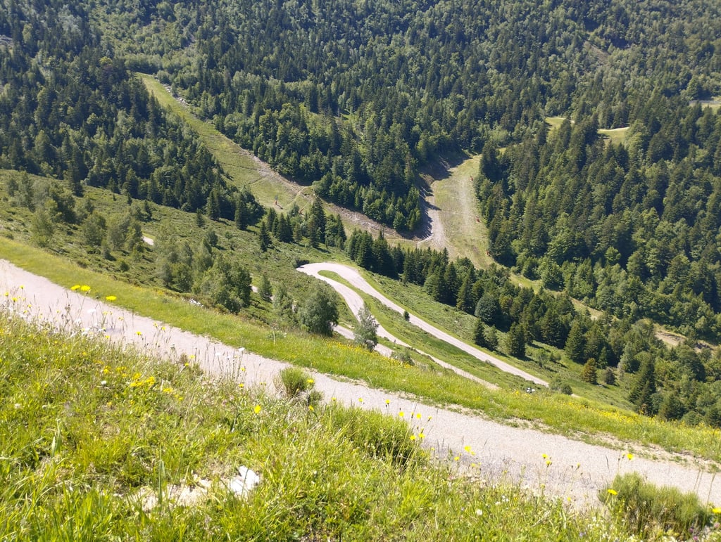
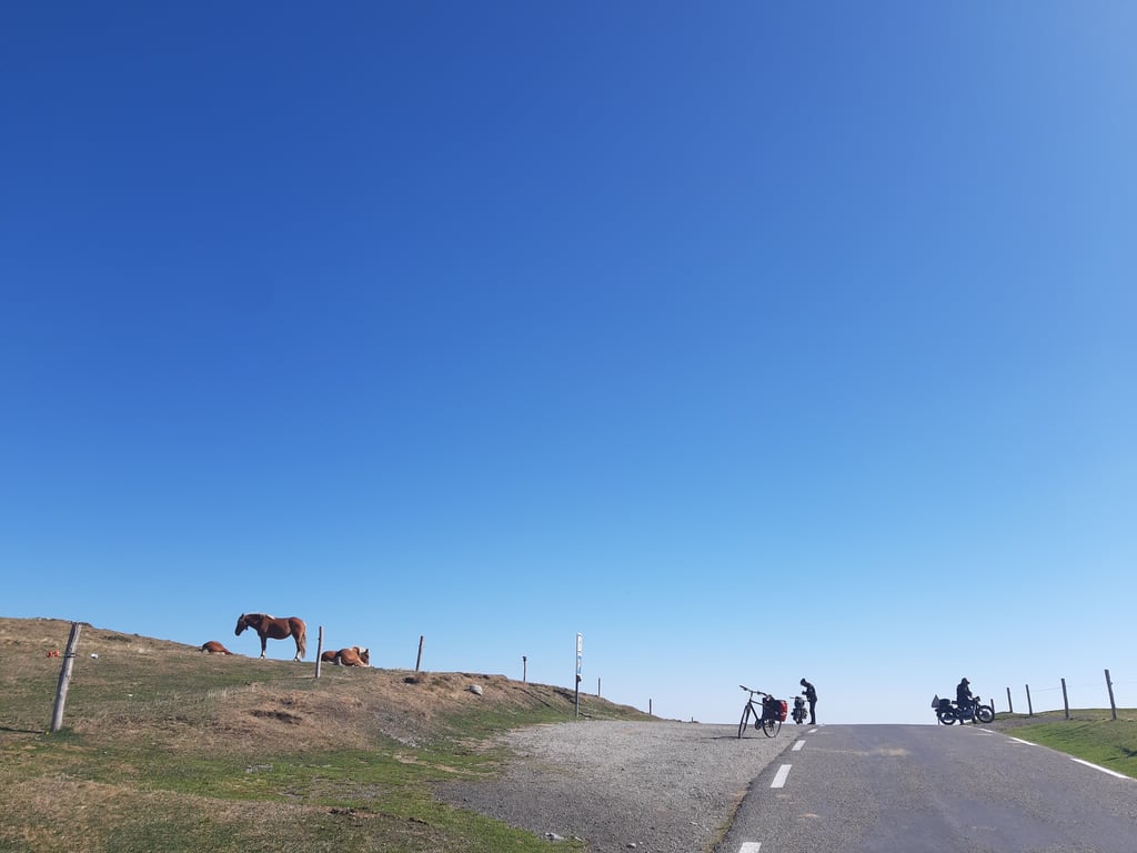
Climbed 8-8-20 from Axat. Until the start of the col, you can warm up your legs on the road along the river 'Aude'. Beautiful road between girges and forests, but beware: it goes up already a few % meters. Then, after the start of the climb, a 10% piece of road slams into it. The route makes up for this: nice woody parts alternate with parts where you have to ride in the sun. The temperature changes a lot: from 21 to 39 and back again to 30 degrees. Halfway through the trip the sounds of cow bells ringing are heard, and further on, after a few nice hairpins, some goats are relaxing in the shade. I can't relax yet, I still have a few miles to go to the top. It is not equally steep everywhere (between 6.5 and 10%), but there are few places where you can give your legs a rest; this makes it a difficult climb. My legs are almost exhausted now. Near the top, the gradient is very steep and the last few hundred meters are about 10% mint. At the top, a few groups of horses are waiting for you (they don't like to get in the way of cars, haha) and you can enjoy a beautiful view. In total, the ride came to 1460 altimeters.
8-8-20 beklommen vanuit Axat. Tot het begin van de col kun je de benen lekker warm draaien op de weg die langs de rivier de 'Aude' loopt. Prachtige weg tussen girges en bossen, maar pas op: het gaat op dit stuk ook al een paar % omhoog. Dan klapt na de start van de beklimming een stuk van 10% er onverbiddelijk in. De route maakt veel goed: mooie bosrijke stukken afgewisseld met gedeeltes waar je vol in de zon rijdt. De temperatuur wisselt dan ook sterk en gaat van 21 naar 39 en weer terug naar 30 graden. Zo halverwege komen de geluiden van klingelende koebellen je tegemoet en verderop, na een paar mooie haarspeldbochten, liggen een aantal geiten in de schaduw te relaxen. Ik kan nog niet relaxen, ik moet nog een paar kilometer naar de top. Het is niet overal even steil (tussen 6,5 en10%), maar er zijn weinig plekken waar je je benen even rust kunt gunnen; dit maakt het een lastige beklimming. Mijn benen zijn nu bijna op. Bijna boven gaat het heel even ras omlaag om de laatste paar honderd meter de laatste jus uit je benen te trappen op ongeveer 10% . Op de top wachten een paar groepjes paarden je op (ze gaan niet graag voor auto's aan de kant, haha) en kun je van een prachtig uitzicht genieten. Totaal kwam de rit op 1460 hoogtemeters.
From Axat is first 25 km gradual climb to the foot of the mountain. Ascent is good to do. Good road surface. At the top is only a horse hut. Unfortunately no restaurant for a nice piece of cake. You cycle wonderfully on your own. Hairpin bends are beautiful.
Vanuit Axat is het eerst 25 km geleidelijk klimmen naar de voet van de berg. Beklimming is goed te doen. Prima wegdek. Op de top staat alleen een paardenhutje. Helaas geen restaurant voor een lekker stuk taart. Je fietst wel heerlijk in je eentje. Haarspeldbochten zijn mooi.
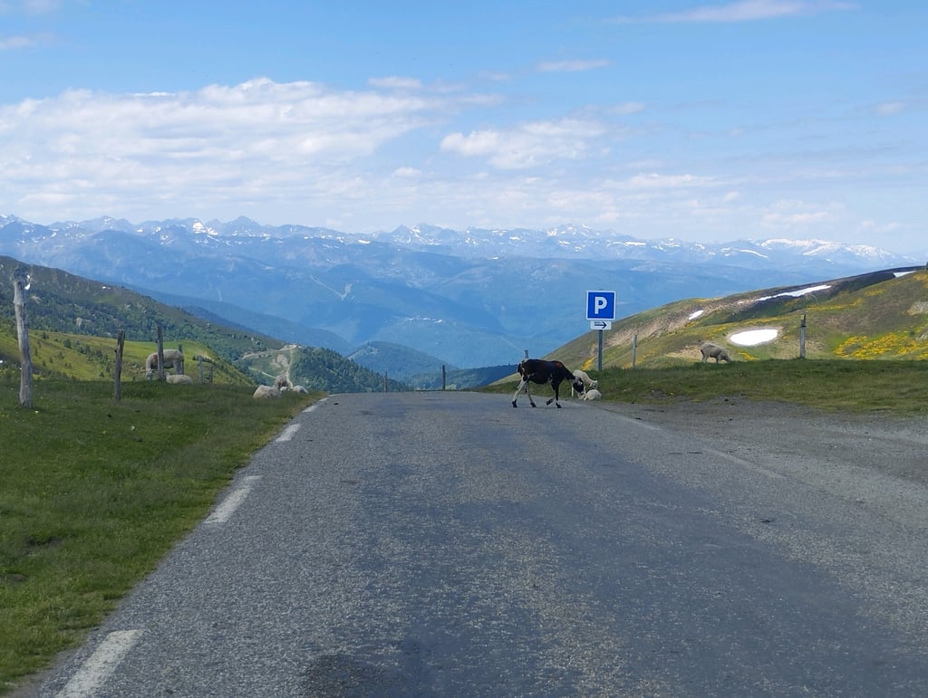
07-08-2018 Departed with a threat of thunderstorms from Ax-les-Thermes. Not an easy col, but not extremely difficult either. The devil is in the tail. The last 6 km at 9% is a bit of a struggle. At the top the clouds increased a lot so we quickly turned around for the descent. I avoided stray cows on the road but not the rain. At Ascou it started to rain and we returned to Ax soaking wet. The water in Ax today comes from above and below.
07-08-2018 Vertrokken met onweersdreiging vanuit Ax-les-Thermes. Geen gemakkelijke col, maar ook niet extreem moeilijk. Het venijn zit in de staart. De laatste 6 km á 9% is even afzien. Boven gekomen bleek de bewolking zwaar toegenomen en daarom snel omgekeerd voor de afdaling. Loslopende koeien op de weg ontweken, maar de regen niet. Bij Ascou begon het te plenzen en drijfnat weer in Ax teruggekeerd. Het water komt in Ax vandaag vanonder en vanboven.
Not to be underestimated climb. I suffered a lot on this one but that was also due to the weather conditions. It was extremely hot, in the valley up to 40 degrees. I thought this would improve by climbing but that was not the case. The climb is very nice but offers little shade because there are hardly any trees around after the first 6km. The steepness increases with altitude. Hard work so... But the top makes us forget the suffering. Magnificent views with horses and cows roaming freely!
Niet te onderschatten klim. Heb hier zwaar op afgezien maar dat lag ook aan de weercondities. Het was extreem warm, in het dal tot wel 40 graden. Ik dacht dat dit ging beteren door te stijgen maar dat viel maar wat tegen. De klim is zeer mooi maar biedt weinig schaduw want er zijn amper bomen in de buurt na de eerste 6km. De steiltegraad stijgt met de hoogte. Afzien dus.. Maar de top doet het afzien zo vergeten. Prachtige uitzichten met paarden en koeien die vrij rondlopen!
From Axat, super nice climb with nice hairpin turns at the end. And a herd of horses at the top
Vanuit Axat, super mooie klim met mooie haarspeld bochten op het einde. En een kudden paarden op de top
In 2009 I cycled from the camping Ascou la Forge (1100 m) up the Pailheres with a Rohloff bike. I was 67 at the time and had only been riding in the mountains for a year. I found it quite tough. It was then for me a test case to later cycle up the Ventoux. This happened a few weeks later from Sault.
In 2009 vanaf de camping Ascou la Forge (1100 m) de Pailheres opgefietst met een Rohloff fiets. Ik was toen 67 jaar en reed pas een jaar in de bergen. Ik vond het behoorlijk pittig. Het was toen voor mij een testcase om later de Ventoux op te fietsen. Dit is een paar weken nadien gebeurd vanuit Sault.
Nice climb with good visibility and also meteorologically interesting. On October 5th in Ax-les-Thermes it was 19 degrees Celsius. I brought a jacket because I have to return to Montsegur where earlier that morning it was wet and only 12 degrees. But strangely, the higher I climb the Col de Pailhères the warmer it gets. At 1700 meters it is the warmest: 30 degrees! Right where the climb is steepest. The rest of the climb I cycle at 7 km per hour on the lowest gear. Phew. At the top it is still 26 degrees Celsius. In the descent to Usson-les-Bains the temperature drops when I dive into the clouds, to only 12 degrees Celsius indeed. Brrr.
Mooie klim met ruim zicht en ook meteorologisch boeiend. Op 5 oktober was het in Ax-les-Thermes 19 graden. Jasje mee, want ik moet nog terug naar Montsegur en daar was het eerder die morgen nat en maar 12 graden. Maar vreemd, naarmate ik hoger kom op de Col de Pailhères wordt het niet kouder, maar warmer. Op 1700 meter het warmst: 30 graden! Juist waar de klim het steilst is. Ik ga de rest van de klim op het kleinste verzetje net 7 kilometer per uur. Pfff. Helemaal op de top nog steeds 26 graden. In de afdaling naar Usson-les-Bains duikelt de temperatuur als ik de wolken in duik, naar inderdaad uiteindelijk nog maar 12 graden. Brrr.
super sleazy rotten thing
super sleil rot ding
| 5 mph | 02:21:08 |
| 7 mph | 01:39:55 |
| 9 mph | 01:17:52 |
| 12 mph | 00:58:30 |
This page is better in the app