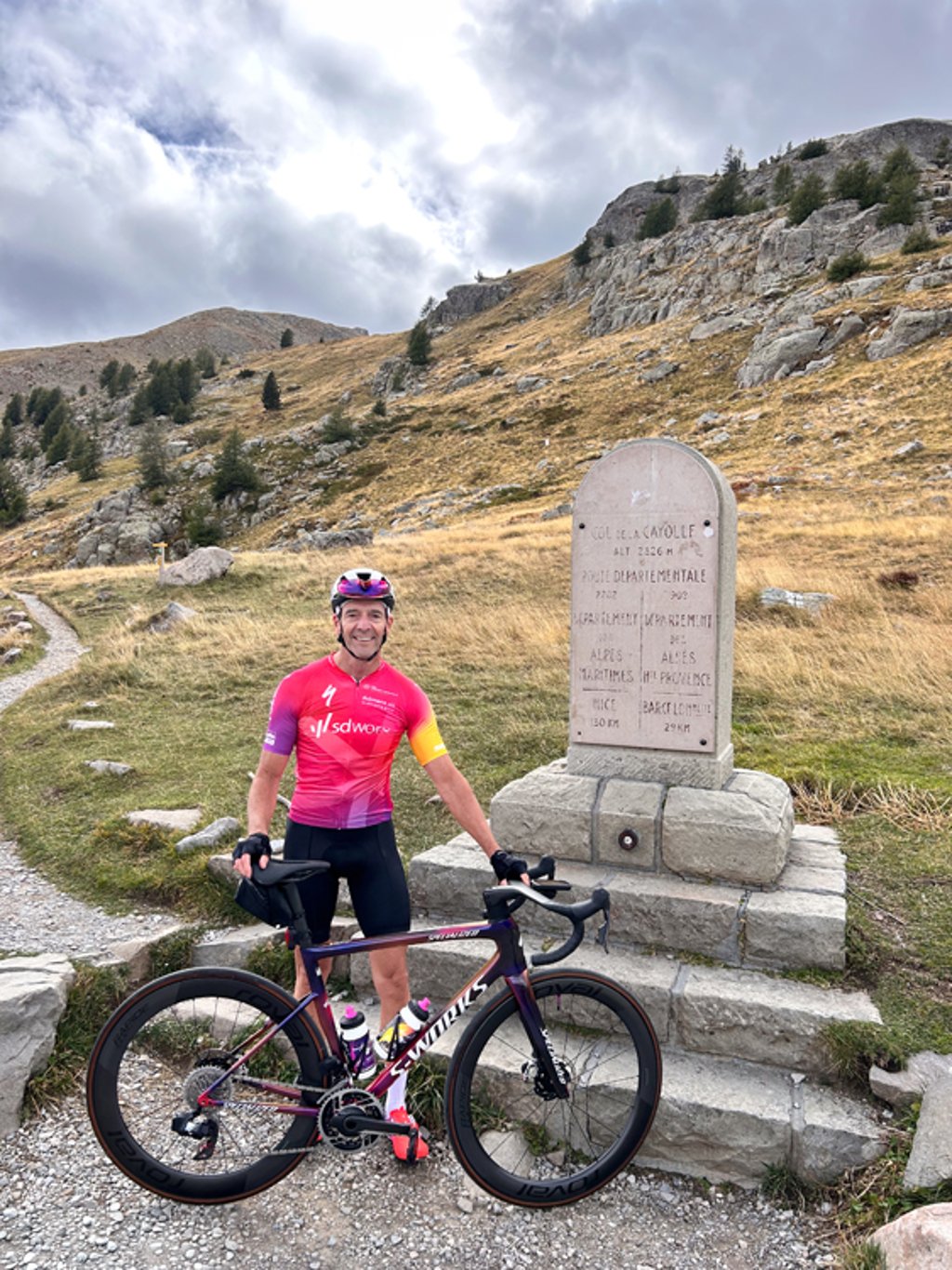
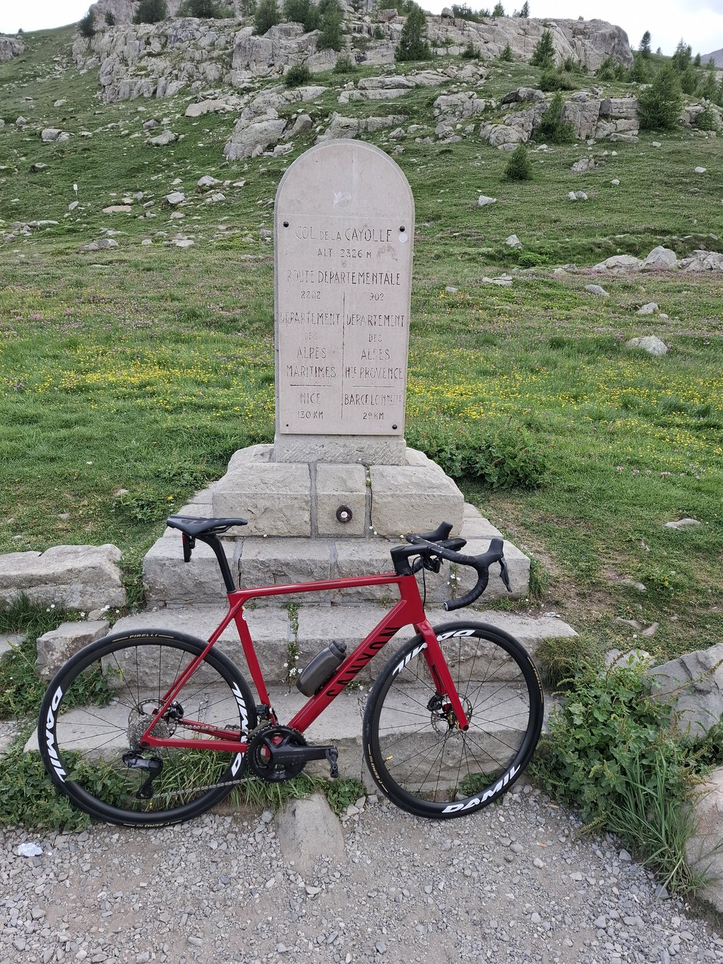
Col de la Cayolle is a climb in the region Serre Ponçon. It is 12.6 mi long and bridges 4206 ft of vertical ascent with an average gradient of 6.3%, resulting in a difficulty score of 894. The top of the ascent is located at 7631 ft above sea level. Climbfinder users shared 15 reviews of this climb and uploaded 46 photos.
This is an automatic translation, the original language is: Dutch.
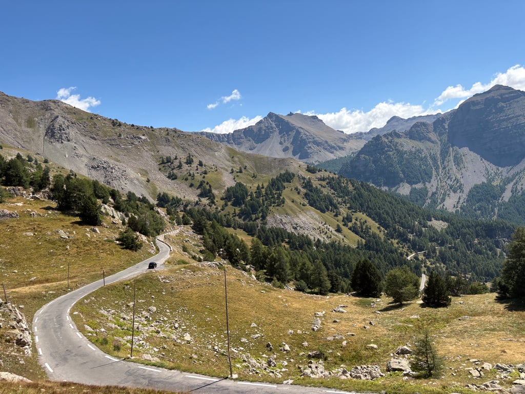
If you follow the cycle route "les 3 Cols" (counter clockwise) starting from Barcelonnette, the south face of the Col de la Cayolle is the final climb on your three course menu.
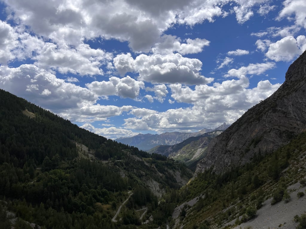
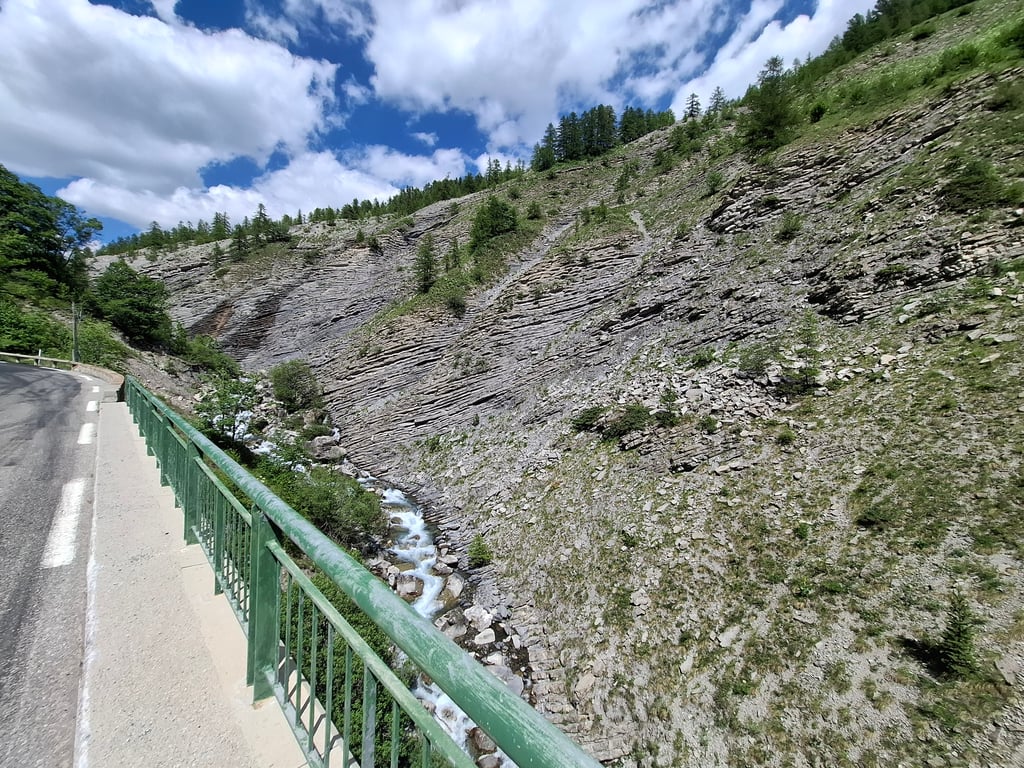
The first 6 km. from St. Martin are a slightly uphill warming up because just outside Entraumes the real climb starts (+8) with some hairpin turns through black grooved mountain walls. You cycle through the sublime setting of the Mercantour National Park following the course of the river Var upstream to its so...read more
Photos (46)
Welcome! Please activate your account if you would like to share something. Look for the verification email in your inbox.
This is an automatic translation, the original language is: Dutch.
Show original
Just like several reviews tell you, this one was the last climb for me from the classic "Les 3 Cols". And luckily I had energy left for this one because it is one that can count in terms of difficulty. Percentages don't seem all that bad on the graph but with 2 cols (Allos and Champs) and 2000 altimeters in the legs already, it was tough. The first kilometres count down smoothly at a 3-4% but after that it's continuous climbing at 7-10%. Whereas in valley mid-September 2025 it was still nice and warm, at the top of the col there was a freezing wind, so always bring a windbreaker and warm clothes !
Net zoals meerdere reviews vertellen was ook deze voor mij de laatste beklimming uit de klassieker "Les 3 Cols". En gelukkig hield ik energie over voor deze want het is er eentje die kan tellen kwa moeilijkheid. Percentages lijken op de grafiek allemaal wel mee te vallen maar met reeds 2 cols (Allos en Champs) en 2000 hoogtemeters in de benen was het pittig. De eerste kilometers tellen vlotjes af aan een 3-4% maar daarna is het continu aan 7-10% klimmen. Waar het in dal half september 2025 nog lekker warm was stond er boven aan de col een ijskoude wind, dus neem altijd een windjack en warme kledij mee !
This is an automatic translation, the original language is: Dutch.
Show original
Climbed Cayolle from this side for the first time. Second of the Trois Cols. It's a long climb, with the beginning being fine. After that, I found it quite tough. At least harder than the other side. View is phenomenal
Voor het eerst de Cayolle van deze kant beklommen. Als tweede van de Trois Cols. Het is een lange klim, waarbij het begin prima te doen is. Daarna vond ik hem best pittig. In ieder geval lastiger dan de andere kant. Uitzicht is fenomenaal
This is an automatic translation, the original language is: Dutch.
Show original
The climb is very doable. Because it starts out less steep, you get the first few kilometres as a gift. Towards the end it gets tougher, but provided some dancing on the pedals, not as destructive as many other giants of the region.
De klim is zeer goed te doen. Doordat hij minder steil begint, krijg je de eerste kilometers cadeau. Naar het einde toe wordt hij zwaarder, maar mits wat danswerk op de pedalen, niet even vernietigend als vele andere reuzen uit de regio.
This is an automatic translation, the original language is: Dutch.
Show original
The Cayolle was quite disappointing to me, in terms of heaviness. Perhaps because it was the third in my tour, but also because of its length and altitude, it must be tough. Still starts on a wide well-run road with nice cycling through but after the village it gets serious and seriously long. Found the supply opportunities moderate, bad luck that one of the restaurants was closed while I was thirsty (and empty water bottles). Crazy that this one is so (relatively) unknown, as I found it definitely worthwhile. At the top fairly busy with cars because of (I think) the many hiking opportunities. Descent long, not too hard so kept on pedalling.....
De Cayolle viel me best tegen, qua zwaarte. Wellicht omdat het de derde in mijn rondje was, maar ook vanwege de lengte en hoogte zal het toch pittig zijn. Begint nog op een brede goed lopende weg met lekker doorfietsen maar na het dorp wordt het serieus en serieus lang. Vond de bevoorradingskansen matig, pech dat een van de restaurants dicht was terwijl ik wel dorst had (en lege bidons). Gek dat deze zo (relatief) onbekend is, want ik vond hem zeker de moeite waard. Bovenop redelijk druk met auto’s vanwege (denk ik) de vele wandelmogelijkheden. Afdaling lang, niet al te hard dus blijven bijtrappen…
This is an automatic translation, the original language is: Dutch.
Show original
Did the 3rd climb of the 3 col route. Went to pieces on this climb! If you only ride up this one, I think it is quite doable! No crazy percentages.
Als 3e beklimming gedaan van de 3 col route. Op deze klim helemaal stuk gegaan! Als je deze enkel oprijd is hij denk ik wel goed te doen! Geen hele gekke percentages.
This is an automatic translation, the original language is: Italian.
Show original
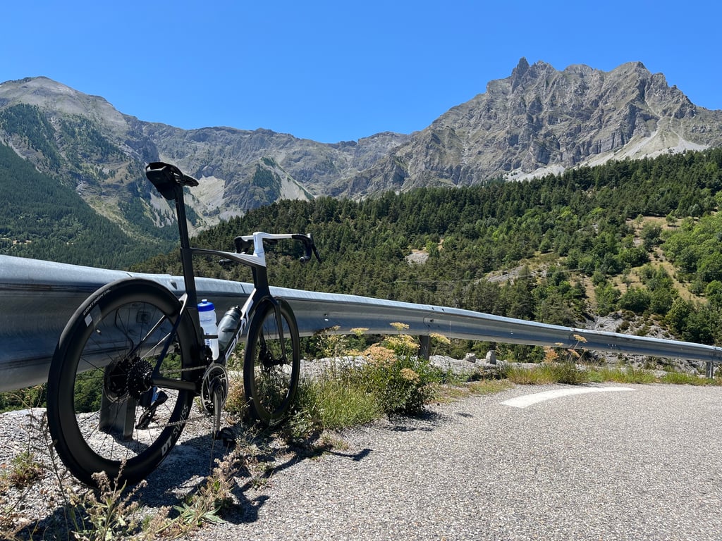
I climbed the Col de Cayolle on a very hot afternoon in late June, with the gps saying 38° at one point. I really enjoyed the climb, shame about the awful heat up to 1600 metres. The last 8 km of the climb are in a wonderful mountain landscape, very green, with very little traffic and beautiful views. I came down the other side and yes, the gorges du Bachelard are truly magical, but otherwise from this side the climb is more varied and you gain altitude more quickly.
Ho scalato il Col de Cayolle in un caldissimo pomeriggio di fine giugno, col gps che a un certo punto diceva 38°. A me la salita è piaciuta molto, peccato il caldo tremendo fino a 1600 metri. Gli ultimi 8 km della salita si svolgono in un meraviglioso paesaggio di montagna, molto verde, con pochissimo traffico e panorami bellissimi. Sono sceso dall'altro versante e si, le gorges du Bachelard sono davvero magiche, ma per il resto da questo versante la salita è più varia e si guadagna quota più velocemente.
This is an automatic translation, the original language is: French.
Show original
Nice climb, more demanding than the north side, but with moderate gradients (around 7-8% most of the time.
The road is good and fairly quiet, but completely exposed to the sun in the middle of the day in summer. Don't forget to stock up on water bottles...
The pass is set in beautiful mountain surroundings (Mercantour Park), with lots of flowers.
The north side is very long, but easy.
Belle montée, plus exigeante que le côté nord, mais avec des pentes modérées (autour de 7-8% la plupart du temps.
La route est bonne et assez calme, mais complètement exposée au soleil en milieu de journée en été. Prévoyez le ravitaillement des bidons...
Le col se situe dans un très bel environnement de montagne (parc du Mercantour), très fleuri.
Le côté nord est très long, mais facile.
This is an automatic translation, the original language is: French.
Show original
A breathtaking climb, an exciting challenge. Magnificent scenery and immense satisfaction at the summit. Not to be missed by cyclists looking for a thrill!
Une montée époustouflante, un défi passionnant. Des paysages magnifiques et une satisfaction immense au sommet. À ne pas manquer pour les cyclistes avides de sensations fortes !
This is an automatic translation, the original language is: Dutch.
Show original
After the Allos and des Champs, the last one in Les 3 Cols. A real giant col. The beginning is easy, but then it gets steep and heavy between the rocky landscape. I was riding in the middle of the day with over 35 degrees and had to go deep into the reserves to get to the top.
Na de Allos en des Champs, de laatste in Les 3 Cols. Een ware reuzencol. Het begin gaat vanzelf, maar daarna wordt het steil en zwaar tussen het rotsachtige landschap. Ik reed midden op de dag met ruim 35 graden en moest diep in de reserves om boven te geraken.
This is an automatic translation, the original language is: Dutch.
Show original
Beautiful surroundings and indeed from Barcelonnette easy to do. Nowhere steep, especially enjoy. The south side is a bit steeper. And the nice Guillaumes, where the climb really starts, offers many terraces after the descent.
Prachtige omgeving en inderdaad vanuit Barcelonnette prima te doen. Nergens steil, vooral genieten. De zuidkant is wat steiler. En het leuke Guillaumes, waar de klim eigenlijk echt van start gaat biedt vele terrassen voor na de afdaling.
This is an automatic translation, the original language is: Dutch.
Show original
If you drive it up, it is indeed more beautiful from Barcelonette. Especially the part in the Gorges du Bachelard is beautiful, although the south side has its charms too. I rode that side during the triple (Allos, Champs and Cayolle) as part of my "Brevet de sept cols de l' Ubaye". A huge calves-biter if you have already done 2 out of category. The weather was beautiful that day and especially thirsty. In St.-Martin, in Entraunes itself and at the "relais de la Cayolle", just before the country'Estenc and the source of the Var you can ravitaillate. The higher you climb the narrower the road becomes. Quite a relief when you get to the top, but the views along the way are unparalleled and the view at the top is phenomenal.
Als je hem oprijdt, dan is hij inderdaad mooier vanuit Barcelonette. Vooral het gedeelte in de Gorges du Bachelard is prachtig, alhoewel de zuidkant ook zijn charmes heeft. Ik reed die kant tijdens de triple (Allos, Champs en Cayolle) in het kader van mijn "Brevet de sept cols de l' Ubaye". Een kuitenbijter van formaat als je er al 2 buiten categorie achter de kiezen hebt. Het was stralend weer die dag en vooral dorstig. In St.-Martin, in Entraunes zelf en aan de "relais de la Cayolle", net voor het land'Estenc en de bron van de Var kan je ravitailleren. Hoe hoger je klimt hoe smaller de weg wordt. Een hele verademing als je boven komt, maar de vergezichten onderweg zijn weergaloos en het zicht boven op de top is fenomenaal.
This is an automatic translation, the original language is: French.
Show original
Less nice than from Barcelonette because first 4-5 km from Entraunes on a big road then a beginning in full sun and on a rather broad road. The last 10 km are difficult, more beautiful but incomparable to the slope from Barcelonnette.
Moins sympa que depuis Barcelonette car d'abord 4-5 km depuis Entraunes sur une grand route puis un début en plein soleil et sur une route assez large. Les 10 derniers km sont difficiles, plus beaux mais incomparables au versant depuis Barcelonnette.
This is an automatic translation, the original language is: Dutch.
Show original
If you follow the cycle route "les 3 Cols" (counter clockwise) starting from Barcelonnette, the south face of the Col de la Cayolle is the final climb on your three course menu.
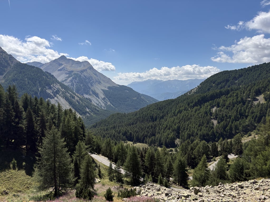
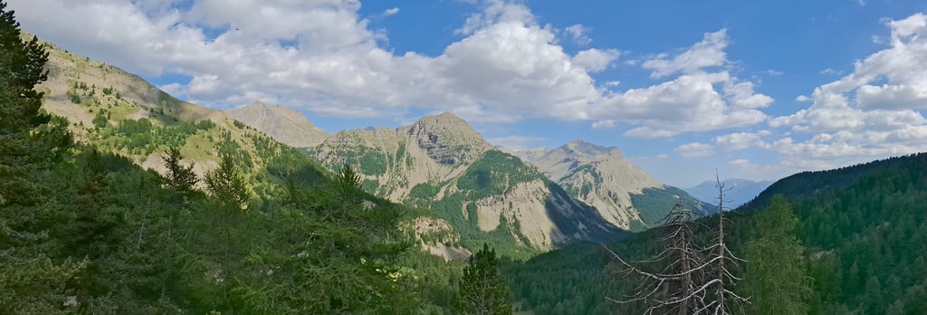
The first 6 km. from St. Martin are a slightly uphill warming up because just outside Entraumes the real climb starts (+8) with some hairpin turns through black grooved mountain walls. You cycle through the sublime setting of the Mercantour National Park following the course of the river Var upstream to its source.
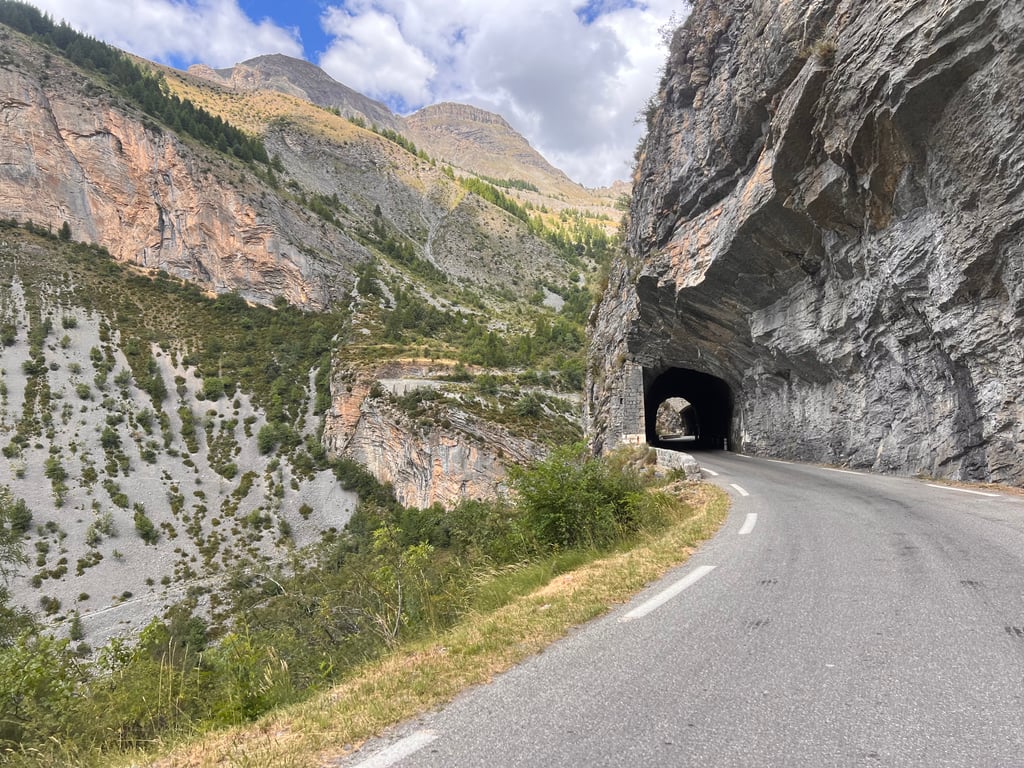
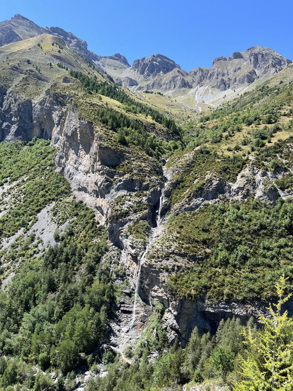
Deep gorges, steep cliffs, beautiful waterfalls along the way which gets narrower and narrower.
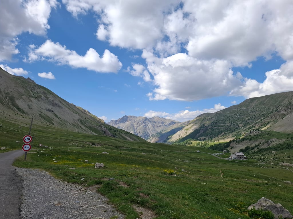
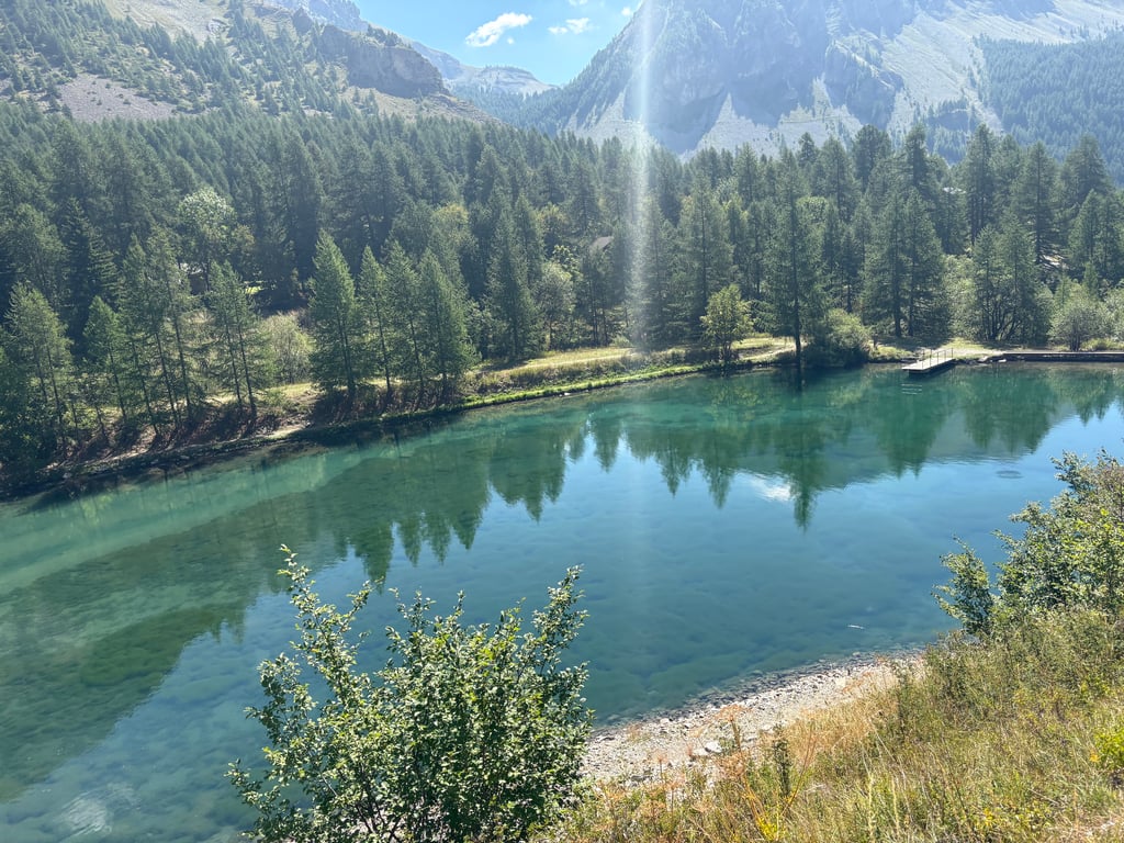
After the last inhabited village Estenc follows, after a lake, the 7 final kilometers through a pure natural rock landscape with a final group of hairpin bends towards the top.
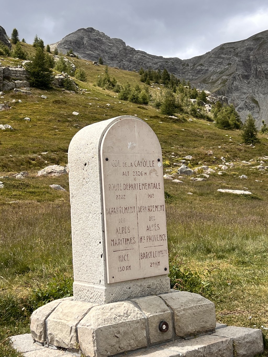
Pass height is 360 ° panorama with only a small parking in the heart of the National Park.
Next to 4 tunnels (longest 230m) there are also cycling info signs every kilometer where the gradient was missing (?). You can get supplies at the start, along the way in the small villages and just past the top in the descent to Barcelonnette there is also a mountain hut.
The Cayolle is a climb not to be underestimated thanks to the absence of the Tour, the traffic and tourism and is perhaps undervalued but a dream for every cyclist.
For me, the steeper south side was "different" beautiful than the other climbing side. An unforgettable cycling experience to end a wonderful day of cycling over les 3 Cols!!!
Als je de fietsroute "les 3 Cols" rijdt (tegenwijzerszin) vertrekkend uit Barcelonnette, staat de zuidflank van de Col de la Cayolle als slotklim op je drie gangenmenu.
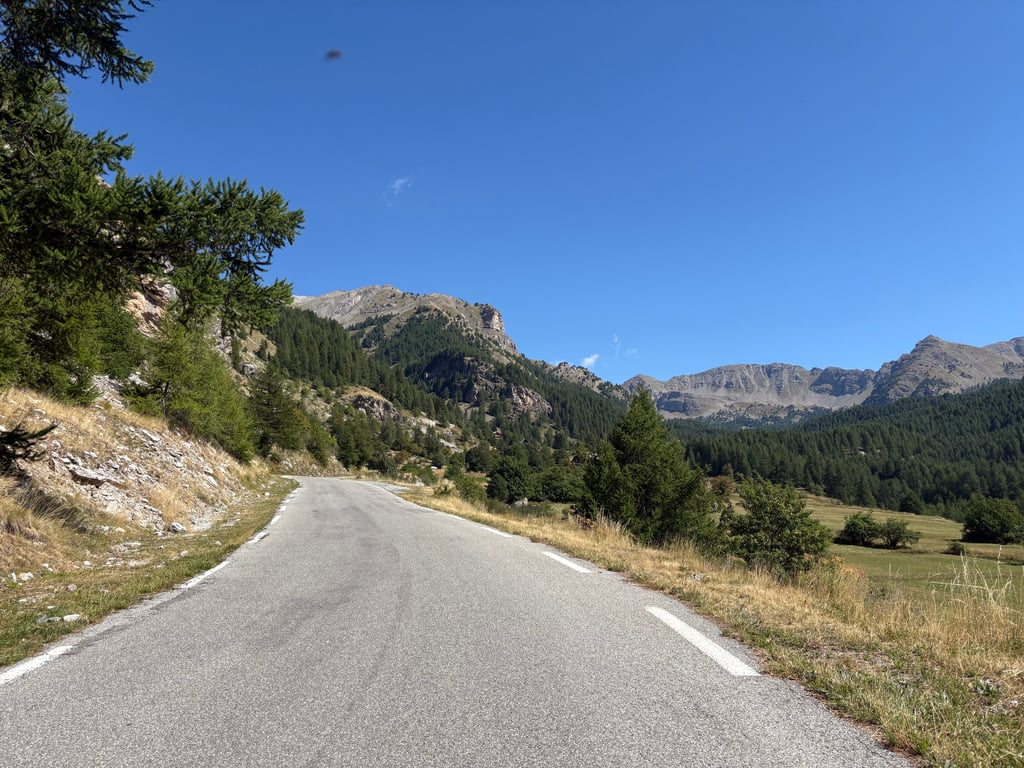
De eerste 6 km. vanuit St.Martin zijn een licht stijgende warming up want even buiten Entraumes start de echte klim (+8%) met enkele haarspeldbochten door zwart gegroefde bergwanden.Je fietst door het subliem decor van het Nationaal Park van de Mercantour stroomopwaarts de loop van de rivier de Var volgend naar zijn bron.
Diepe kloven,steile kliffen,prachtige watervallen langs de weg die steeds smaller wordt.
Na het laatste bewoonde dorpje Estenc volgen, na een meertje, de 7 slotkilometers door een puur natuur rotslandschap met een laatste groep haarspeldbochten richting top.
Pashoogte is 360° panorama met alleen een kleine parking in het hart van het Nationaal Park.
Naast 4 tunnels (langste 230m) zijn er ook fietsinfobordjes elke kilometer waarop het stijgingspercentage ontbrak (?). Bevoorrading kan je bij de start , onderweg in de kleine dorpjes en even over de top in de afdaling richting Barcelonnette is er ook een berghut.
De Cayolle is een niet te onderschatten klim die dankzij het wegblijven van de Tour,het verkeer en het toerisme misschien ondergewaardeerd is maar een droom voor elke fietser.
Voor mij was de steilere zuidkant "anders" mooi dan de andere klimzijde. Een onvergetelijke fietservaring als afsluiter van een prachtige fietsdag over les 3 Cols!!!
You don't need special gearing for Col de la Cayolle. The slope isn't long or steep enough to require much shifting down. You can conquer this climb on power alone. However, a compact gearing system with a smallest front chainring of 34 and largest rear sprocket of 28 or 30 is always nice if you enjoy cycling uphill. This helps maintain a smooth cadence.
Col de la Cayolle is a first-category climb: long and tough. Do not underestimate this climb. Many famous Tour de France cols fall into this category. Prepare for a long, challenging ride. Only well-trained riders will reach the top smoothly. Make sure you have a road bike with climbing gears and enough training; otherwise, it will be a struggle.
Col de la Cayolle is 12.6 mi long.
The average gradient of Col de la Cayolle is 6.3%.
Col de la Cayolle has a steepest segment with an average gradient of 9.1%.
The summit of Col de la Cayolle is at 7631 ft.
At a slow pace of 5 mph, it takes about 02:32:33 to climb Col de la Cayolle. At 7 mph the time is 01:48:00, and at 9 mph 01:24:10. For the fastest cyclists, 01:03:14 is an achievable time.