Tips nearby


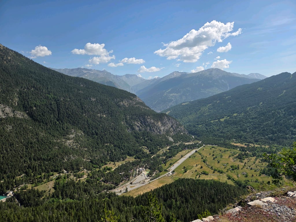
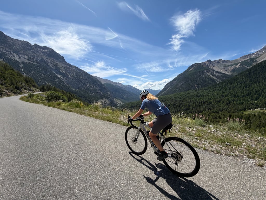
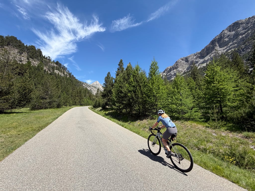
| Beautiful scenery |
| 3 hairpin turns |
| #66 toughest climb of Briançon |
| #68 most elevation gain of Briançon |
| #73 longest climb of Briançon |
| #71 average steepest climb of Hautes Alpes |
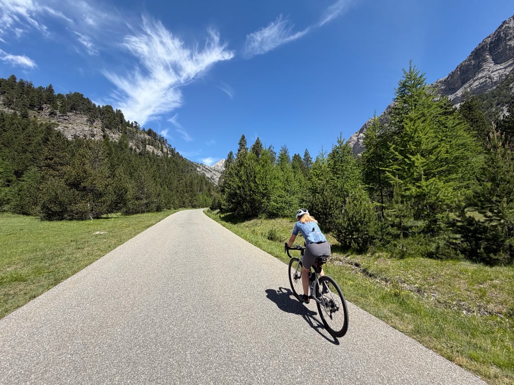
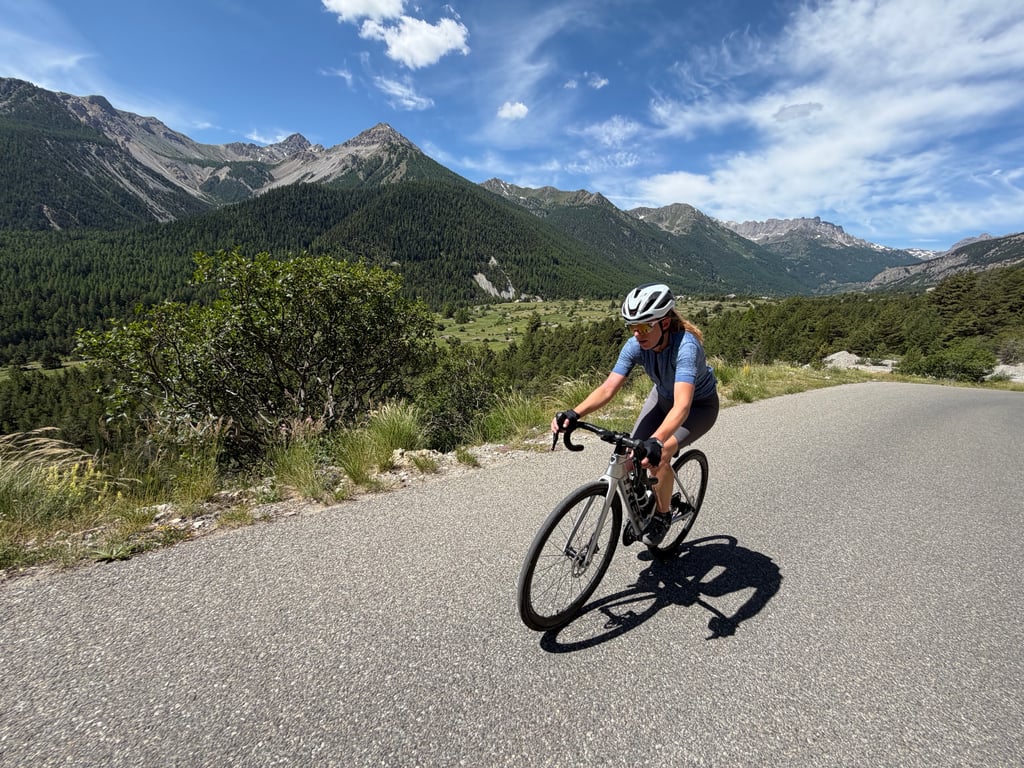
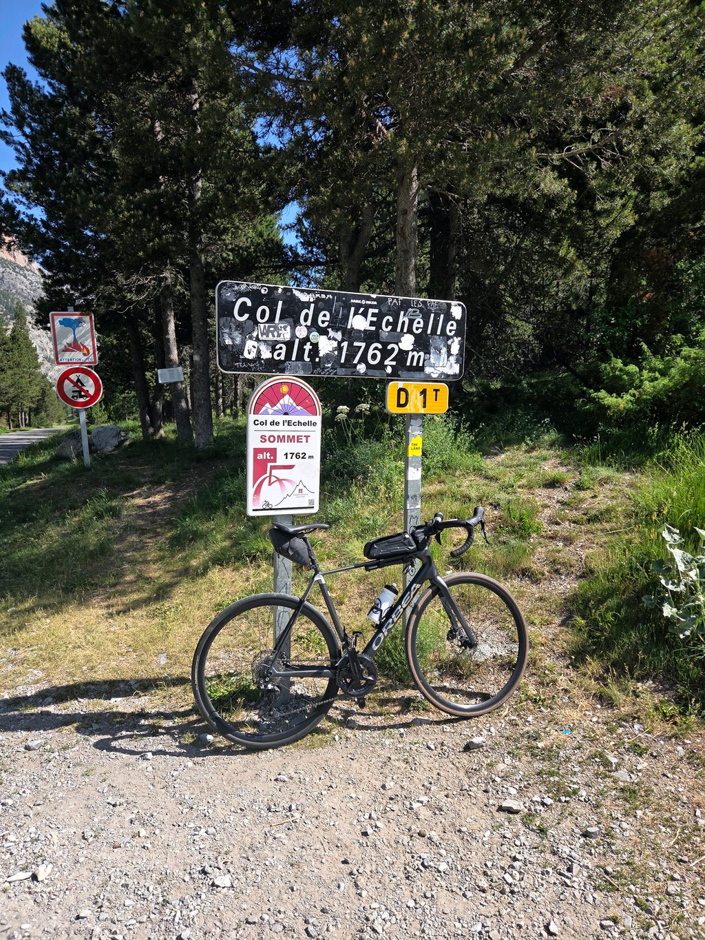
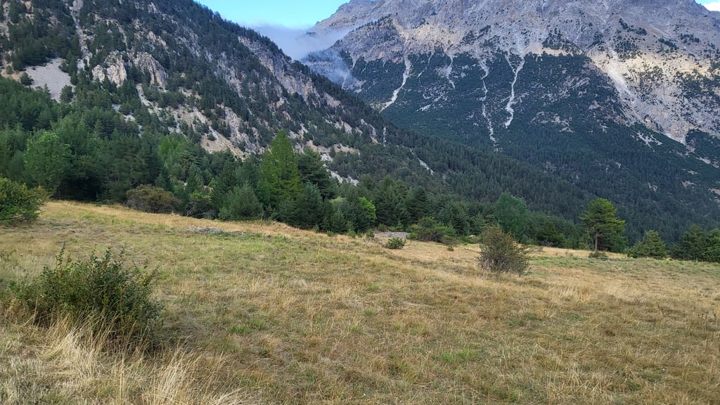
Col de l'Échelle from Névache is a climb in the region Briançon. It is 1.6 mi long and bridges 620 ft of vertical ascent with an average gradient of 7.3%, resulting in a difficulty score of 159. The top of the ascent is located at 5801 ft above sea level. Climbfinder users shared 18 reviews of this climb and uploaded 16 photos.
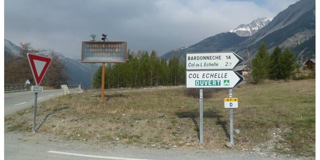
Road name: D1T
4.0 by Greg37This is an automatic translation, the original language is: French.A very beautiful climb, fairly short, with a lovely road. The scenery at the top of the pass, on the Italian side, is stunning.... read more

Welcome! Please activate your account if you would like to share something. Look for the verification email in your inbox.
If you want to upload your photos, you need to create an account. It only takes 1 minute and it's completely free.
A very beautiful climb, fairly short, with a lovely road. The scenery at the top of the pass, on the Italian side, is stunning.
Très belle montée, assez courte, belle route. Très beau paysage en haut du col, côté italien.
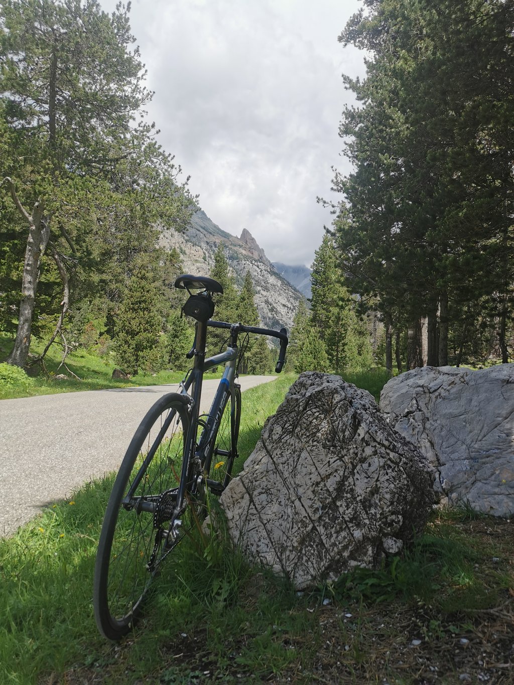
Went out for an easy 1hr pre dinner ride ended up atop a Col. A really nice gentle climb but some stunning scenery and a very quiet road. If you're cycling to Italy from Briancon a much nicer route than the N94
Possibly the easiest Col to ride. A nice valley and with moderate gradients followed by this little ramp. If you want to experience the mountains but don’t feel up to the big beasts, this is a good one to ride.
A short, simple pass that's great fun for the whole family.
Col très simple et court mais plutôt sympa à faire en famille.
Very short but some tough sections. The finish at the pass is a haven of peace
Très court mais quelques passages coriaces. L'arrivée au col est un havre de paix
Easy and very short climb, it has a small tear under the hairpin bends and then is gentle. The Scala pass is beautiful
Salita facile e molto breve, ha un piccolo strappo sotto ai tornanti e poi è dolce. Il colle della Scala è bello
I love going up the Valée de la Clarée and then climbing this short ascent to return from the Briançon area. The best is to do it close to sunset, when the valley is getting ready to fall asleep and only the sound of the river, a few marmots crossing the road or a roe deer jumping fast in the forest accompany you.
Adoro risalire la Valée de la Clarée e poi scalare questa breve salita per rientrare dai giri nella zona di Briançon. Il più bello è farlo vicini al tramonto, quando la valle si prepara ad addormentarsi e ti accompagna solo il rumore del fiume, qualche marmotta che attraversa la strada o un capriolo che salta veloce nel bosco.
Cycled this climb (2x) in July 2023, including as part of the route described on Climbfinder 'Grandfondo Serre Chevalier'. A beautiful, gentle climb that takes you as far as Italy. In fact, this is the opposite of Montgenevre, that other col connecting France and Italy. Climb only gets really steep in the final kilometres, before that it is rather rolling.
Deze beklimming in juli 2023 (2x) gefietst, onder meer als onderdeel van de op Climbfinder beschreven route 'Grandfondo Serre Chevalier'. Een prachtige, rustige klim die je tot in Italië brengt. In feite is dit het tegenovergestelde van de Montgenevre, die andere col die Frankrijk met Italië verbindt. Beklimming wordt pas in de slotkilometers echt steil, daarvoor is het eerder glooiend.
Cycled this col in 2019. The Col de l'Échelle is a sweet col that is not really very tough anywhere. I have never seen the 14% indicated above. The length of 2.7 km is also not quite right. Officially, the col starts already from the junction of the N94 (Route d'Italie) to the D994G. From there, the col is also about 15km, of which the last few kilometres (the indicated 2.7km) are really worth mentioning. Before that, it hilly more but it never gets really hard.
Until the last 2.7km, there is quite some traffic (after all, it is the only road into that valley), but the road is very wide and clear. For the last bit, the traffic diminishes but I did not find it very quiet either.
The road surface in the French part is perfect. As soon as you enter Italy on the 'other' side, it becomes a lot less.
The tip I would give is to go over the col and go down the other side. Do this at least until after 2 short tunnels (lighting not necessary but advisable). Here you have beautiful views over the valley on the Italian side.
I am on this side down to Bardonecchia. From here, I took the same way back up. From the Italian side, I found the climb a little harder. This is because the climb has a higher percentage for a longer time. The climb is not really hard.
Deze col gefietst in 2019. De Col de l'Échelle is een lieve col die nergens echt heel zwaar is. De hierboven aangegeven 14% heb ik nooit gezien. De lengte van 2,7km is ook niet helemaal juist. Officieel begint de col al vanaf de afslag van de N94 (Route d'Italie) naar de D994G. Vanaf daar is de col dan ook ongeveer 15km, waarvan de laatste paar kilometers (de aangegeven 2,7km) echt noemenswaardig zijn. Daarvoor heuvelt het meer maar wordt het nooit echt zwaar.
Tot de laatste 2,7km is er aardig wat verkeer (het is immers de enige weg dat dal in), maar de weg is erg breed en overzichtelijk. Voor het laatste stukje wordt het verkeer wel minder maar heel erg rustig vond ik het ook niet.
Het wegdek in het Franse deel is perfect. Zodra je aan de 'andere' kant Italië in komt wordt het een stuk minder.
De tip die ik wil geven is om de col over te gaan en de andere kant af te dalen. Doe dit in ieder geval tot na 2 korte tunneltjes (verlichting niet noodzakelijk maar wel aan te raden). Hier heb je prachtig uitzicht over het dal aan de Italiaanse kant.
Ik ben aan deze kant afgedaald tot aan Bardonecchia. Vanuit hier heb ik dezelfde weg terug omhoog genomen. Vanuit de Italiaanse kant vond ik de klim iets zwaarder. Dit komt omdat de klim hier iets langer een hoger percentage aanhoudt. Echt zwaar wordt deze klim ook niet.
The climb is rather simple, especially because of its length, but the slope is also calm and affordable. However, the peacefulness of this pass and the situation make it very pleasant.
Montée plutôt simple notamment par sa longueur mais également la pente reste calme et abordable. Toute fois, la paisibilité de ce col ainsi que situation rende ce col très agréable.
A very nice climb. Not much traffic with beautiful views. Far preferable to the diesel climb of the Col de Mongenevre.
Een heel mooie klim. Niet veel verkeer met prachtige uitzichten. Verreweg te verkiezen boven de dieselklim van de Col de Mongenevre.
Briancon,
I have climbed the Col and it is doable for the first 14km (the signs saying how long you have to go start at 17km). The last 3 km are steep but they can be done.
PS: I climbed it as an 11 year old with my father on a mountain bike, on a road bike you can't change gears so it's probably more difficult.
Briancon,
Ik heb de Col beklommen en hij is de eerste 14 km (de borden met daarop aangegeven hoelang je nog moet beginnen op 17 km) goed te doen. De laatste 3 km zijn steil maar ze kunnen wel.
PS: Ik heb hem als 11 jarige beklommen met mijn vader op een mountainbike, op een racefiets kan je minder licht schakelen en is dus allicht moeilijker.
The Col de l'Échelle is a sweet col that is never really very hard. I have never seen the 14% mentioned above. The length of 2.7 km is also not quite right. Officially, the Col starts at the junction of the N94 (Route d'Italie) to the D994G. From there, the col is about 15km, of which the last few kilometers (the indicated 2.7km) are really worth mentioning. Before that, it hilly more but it never gets really hard.
Until the last 2,7km there is quite some traffic (it is the only road into the valley), but the road is very wide and clear. For the last part the traffic gets less but I did not find it very quiet either.
The road surface in the French part is perfect. As soon as you enter Italy on the 'other' side it becomes a lot less.
The tip I want to give is to cross the col and go down the other side. Do this at least until after 2 short tunnels (lighting not necessary but advisable). Here you have beautiful views over the valley on the Italian side.
I am on this side down to Bardonecchia. From here I took the same way back up. From the Italian side, I found the climb a little harder. This is because the climb has a higher percentage for a longer time. Really hard is this climb not.
De Col de l'Échelle is een lieve col die nergens echt heel zwaar is. De hierboven aangegeven 14% heb ik nooit gezien. De lengte van 2,7km is ook niet helemaal juist. Officieel begint de col al vanaf de afslag van de N94 (Route d'Italie) naar de D994G. Vanaf daar is de col dan ook ongeveer 15km, waarvan de laatste paar kilometers (de aangegeven 2,7km) echt noemenswaardig zijn. Daarvoor heuvelt het meer maar wordt het nooit echt zwaar.
Tot de laatste 2,7km is er aardig wat verkeer (het is immers de enige weg dat dal in), maar de weg is erg breed en overzichtelijk. Voor het laatste stukje wordt het verkeer wel minder maar heel erg rustig vond ik het ook niet.
Het wegdek in het Franse deel is perfect. Zodra je aan de 'andere' kant Italië in komt wordt het een stuk minder.
De tip die ik wil geven is om de col over te gaan en de andere kant af te dalen. Doe dit in ieder geval tot na 2 korte tunneltjes (verlichting niet noodzakelijk maar wel aan te raden). Hier heb je prachtig uitzicht over het dal aan de Italiaanse kant.
Ik ben aan deze kant afgedaald tot aan Bardonecchia. Vanuit hier heb ik dezelfde weg terug omhoog genomen. Vanuit de Italiaanse kant vond ik de klim iets zwaarder. Dit komt omdat de klim hier iets langer een hoger percentage aanhoudt. Echt zwaar wordt deze klim ook niet.
From Bardoneccgia (Italy) I cycled this climb. A lovely gradual climb. Not too difficult, good road and the end is very nice in the woods along campers.
Vanuit Bardoneccgia (Italie) deze klim gefietst.. Een heerlijke geleidelijke klim.. Niet te lastig, prima wegdek en het eind is erg mooi in de bossen langs kampeerders..
The col has a long run-up of about 15 km. Few percentage (average 2,5%?). All in all a nice little climb to warm up the legs. From the other (Italian) side it is a lot more spicy!
De col heeft nog een lange aanloop van een km of 15. Weinig percentage (gem. Zo'n 2,5% ?). Al met al eenekker colletje om de benen warm te draaien. Vanaf de andere (Italiaanse) kant is ie een stuk pittiger!
| 5 mph | 00:19:28 |
| 7 mph | 00:13:47 |
| 9 mph | 00:10:44 |
| 12 mph | 00:08:04 |
This page is better in the app