Tips nearby


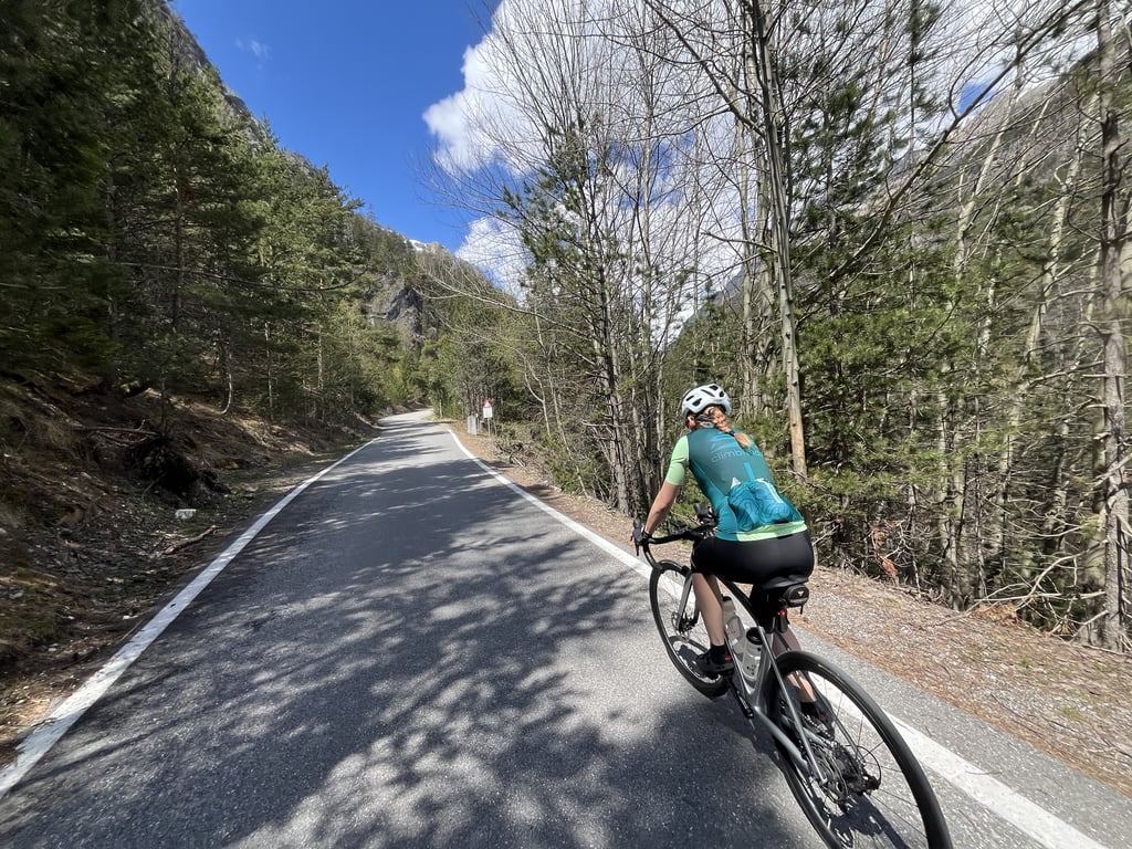
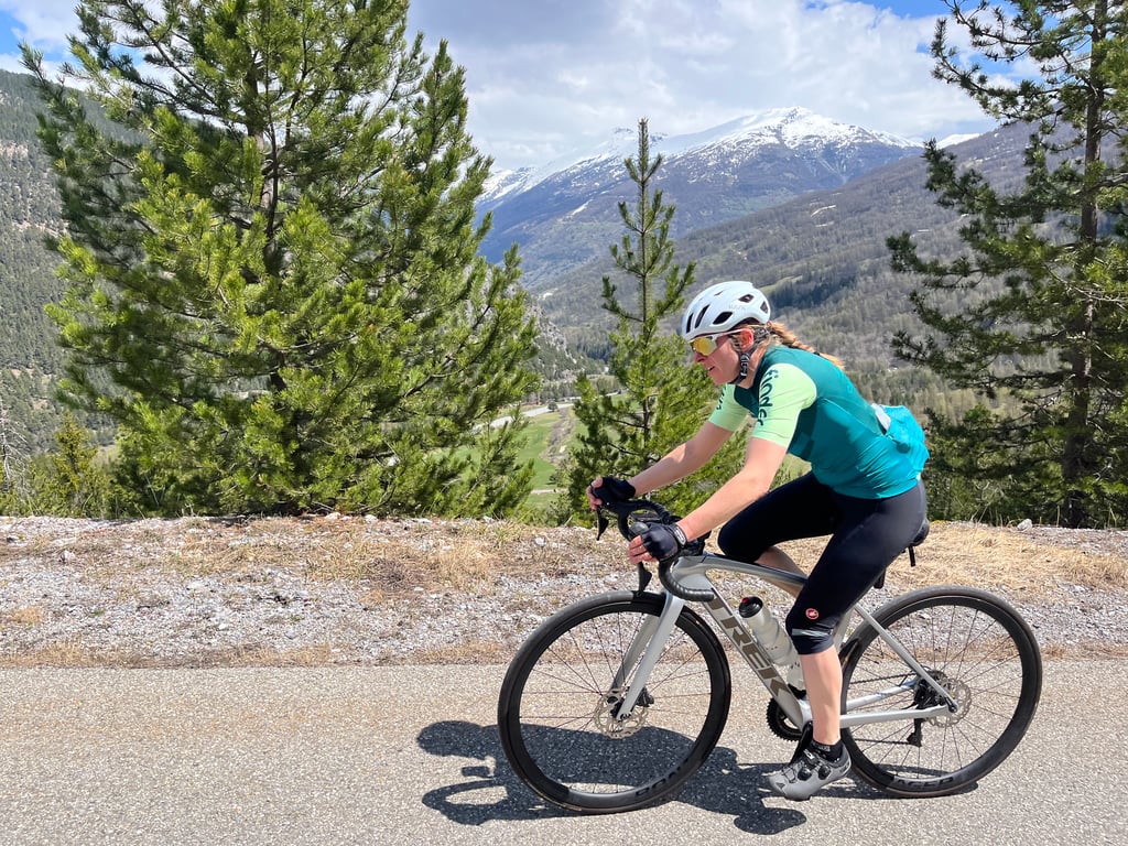
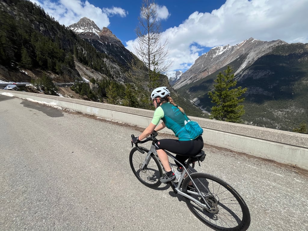
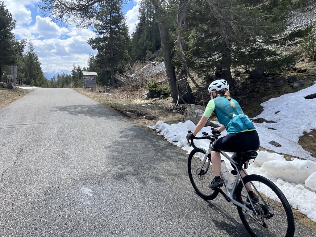
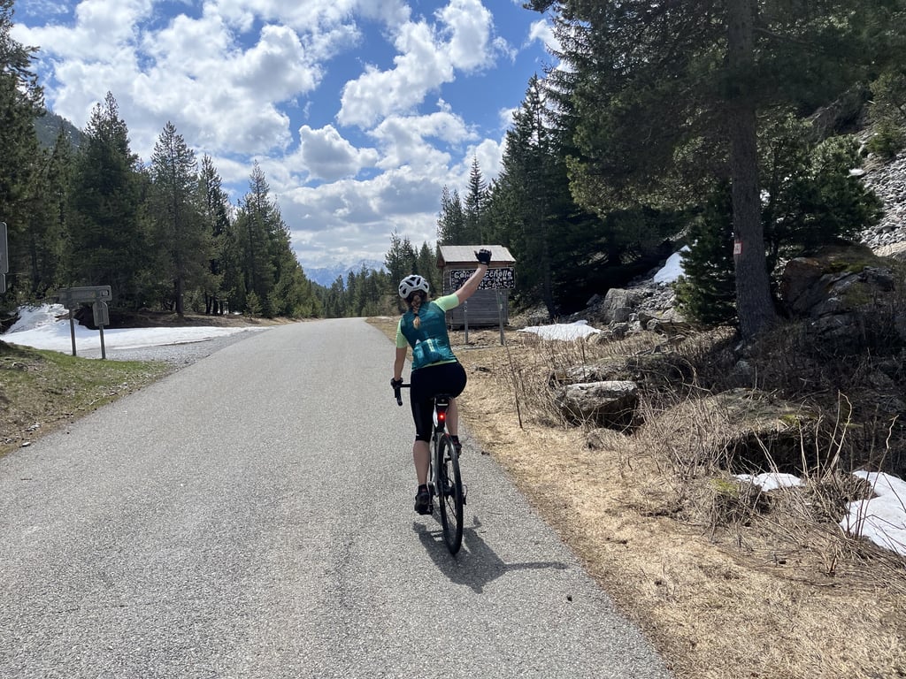
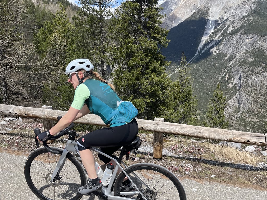
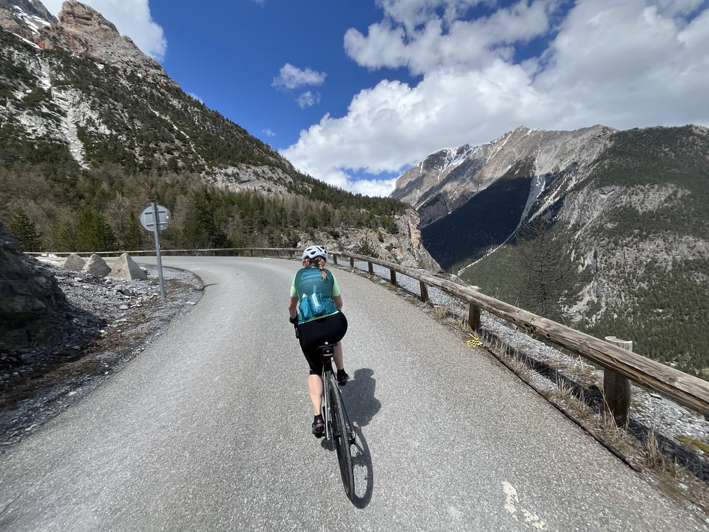
Col de l'Échelle from Bardonecchia is a climb in the region Briançon. It is 7.3 mi long and bridges 1762 ft of vertical ascent with an average gradient of 4.6%, resulting in a difficulty score of 362. The top of the ascent is located at 5755 ft above sea level. Climbfinder users shared 10 reviews of this climb and uploaded 19 photos.
Road names: Via della Vittoria, SP126 & D1T
4.0 by GenioItalianoADVOdThis is an automatic translation, the original language is: Italian.I did this climb almost every day in August 2025 The altimetry that I see here is either incorrect, or the segments are not depicted in detail. The climb after the Campo Smith roundabout starts at about 8% and then becomes gentler and gentler until the Melezet plain, shortly after the Melezet bridge, however, there is a climb of at least 400m - 500m that goes well over 13% ( junction riding school ) before arriving at Pian del Colle. From the Valle Stretta border to the dam we are again at 1... read more
Welcome! Please activate your account if you would like to share something. Look for the verification email in your inbox.
If you want to upload your photos, you need to create an account. It only takes 1 minute and it's completely free.
I did this climb almost every day in August 2025 The altimetry that I see here is either incorrect, or the segments are not depicted in detail. The climb after the Campo Smith roundabout starts at about 8% and then becomes gentler and gentler until the Melezet plain, shortly after the Melezet bridge, however, there is a climb of at least 400m - 500m that goes well over 13% ( junction riding school ) before arriving at Pian del Colle. From the Valle Stretta border to the dam we are again at 13% for 200m, finally confirming beyond 15% at the point indicated but it is not a very short point, it is the whole segment, at least 150m to +15% and at least 12% the piece before and after. All in all it is a climb to be respected, more complicated than what is depicted, you need at least a 28 to the rear.
Ho fatto questa salita quasi tutti i giorni nel mese di agosto 2025 L'altimetria che vedo qui è errata, oppure i segmenti non sono dettagliatamente rappresentati. La salita dopo la rotonda di Campo Smith attacca circa all' 8% per poi diventare sempre più dolce fino alla piana di Melezet, poco dopo il ponte di Melezet però c'è uno strappo di almeno 400m - 500m che supera largamente il 13% ( bivio maneggio ) prima di arrivare a Pian del Colle. Dalla frontiera di Valle Stretta fino alla diga siamo dinuovo a 13% per 200m, infine confermo oltre il 15% nel punto indicato ma non è una punta brevissima, si tratta di tutto il segmento, almeno 150 metri al +15% ed almeno 12% il pezzo prima e quello dopo. Nel complesso è una salita da rispettare, più complicata di ciò che viene rappresentato, serve come minimo un 28 al posteriore.
A really scenic climb, with great views over the valleys and mountains. Traffic is low, road surface is good. A great climb.
Beautiful climb with a narrow road but little traffic, always a steady ascent with no major inclines, but with very beautiful views absolutely must be done
Bella salita con strada stretta ma poco trafficata, salita sempre costante senza grandi pendenze, ma con panorami molto belli da fare assolutamente
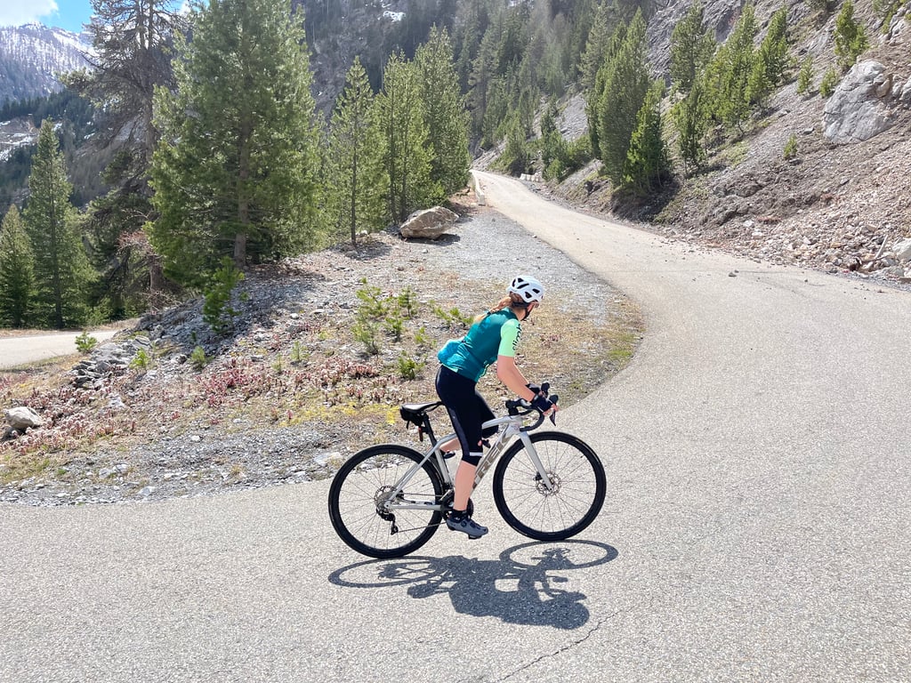
A narrow but well-maintained road and sumptuous scenery with splendid views of Bardonecchia and its valley. Only one section is really difficult, but you can take advantage of the plateau and the descent to recover. Watch out for this descent, though, with lots of bumps on the downhill side!
Une route étroite mais bien entretenue et des paysages somptueux avec une vue splendide sur Bardonecchia et sa vallée. Une seule portion est vraiment difficile, mais vous pourrez profiter du replat et de la descente pour récupérer. Attention à cette descente justement, avec beaucoup de bosses sur le bas côté !
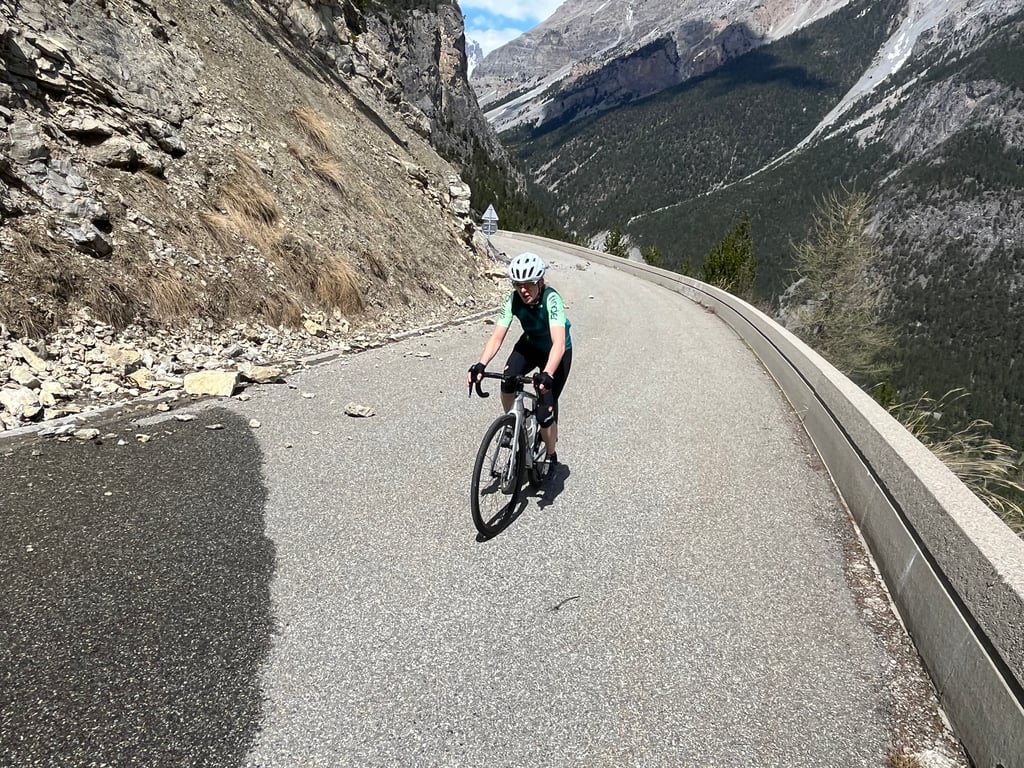
The quality of the road surface is OK. On the ascent from Bardonecchia, between hairpin bends 5 and 6, there is a narrowing of the road due to rock slides.
Currently, some roads are closed in the greater area and in the urban area of Bardonecchia due to landslides.
Die Qualität der Straßenoberfläche ist i. O. Beim Aufstieg von Bardonecchia befindet sich zwischen den Kehren 5 und 6 eine Fahrbahnverengung wegen Felsrutsch.
Derzeit sind im Großraum und im Stadtgebiet von Bardonecchia einige Straßen wegen Erdrutschen gesperrt.
Rode from Bardonecchia in 2023 with touring bike and masses of luggage. Very relaxed pass, little traffic and mostly good surface on often quite narrow road. At the top, a very scenic flat section awaits before the descent.
On the descent towards France, there are some nasty ripples in the asphalt, be careful!
2023 mit Tourenbike und massenhaft Gepäck von Bardonecchia aus gefahren. Sehr entspannter Pass, wenig Verkehr und überwiegend guter Belag auf häufig recht schmaler Straße. Oben angekommen erwartet einen ein landschaftlich sehr reizvolles flaches Stück, bevor es wieder runter geht.
Bei der Abfahrt Richtung Frankreich kommen einige fiese Wellen im Asphalt, Vorsicht!
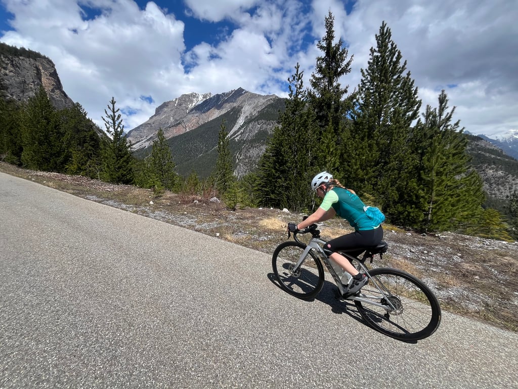
The last 4km to the front summit is nice and steep. Asphalt generally fine. First 5km are a bit hilly with a few short steeper bits. Traffic wasn't too bad for me on a weekday morning in high season!
De laatste 4km tot de voortop is lekker steil. Asfalt over het algemeen prima. Eerste 5 km zijn wat glooiend met een paar korte steilere stukjes. Het verkeer viel mij op een doordeweekse ochtend in het hoogseizoen erg mee!
A climb behind the house, quite busy, especially at weekends. The asphalt is not the best and there are often stones in the middle of the road, so you have to be very careful. The hairpin bend on the penultimate bend is quite a leg-breaker. Always beautiful scenery
Salita dietro casa, abbastanza trafficata soprattutto nel fine settimana. L'asfalto non è dei migliori e spesso ci sono pietre in mezzo alla strada, quindi bisogna fare molta attenzione. Lo strappo al penultimo tornante è abbastanza spacca gambe. Paesaggi sempre bellissimi
A nice col to cycle as a start of the holiday. Considerably more difficult than from the other side, partly due to the state of the road surface. The road is car free. If you're almost up you have beautiful views into the valley. Definitely recommended as one of the first trips of a holiday.
Een lekkere col om te fietsen als begin van de vakantie. Beduidend moeilijker dan vanaf de andere kant, o.a. ook door de staat van het wegdek. De weg is autoluw. Als je bijna boven bent heb je prachtige vergezichten de vallei in. Zeker aan te raden als een van de eerste tochten van een vakantie.
| 5 mph | 01:28:14 |
| 7 mph | 01:02:28 |
| 9 mph | 00:48:41 |
| 12 mph | 00:36:34 |
This page is better in the app