Tips nearby


| Beautiful scenery |
| Hidden gem |
| 18 hairpin turns |
| #99 toughest climb of Savoie |
| #92 most elevation gain of Savoie |
| #25 longest climb of La Maurienne |
| #46 average steepest climb of La Maurienne |
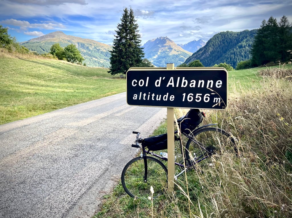
Col d'Albanne via Les Karellis is a climb in the region La Maurienne. It is 8.2 mi long and bridges 3143 ft of vertical ascent with an average gradient of 7.2%, resulting in a difficulty score of 768. The top of the ascent is located at 5423 ft above sea level. Climbfinder users shared 6 reviews of this climb and uploaded 19 photos.
Road name: D81
3.0 by CromagnonThis is an automatic translation, the original language is: French.It's not the most beautiful pass around, but it's a pretty demanding one. No rest. The kilometres at 8% follow on happily. The end eases off but it's still climbing seriously. The last 6 kilometres are in the forest and on a much narrower road. The bends and twists are beautiful. The surface is sometimes excellent, sometimes unpleasant. The views are not unpleasant, but neither are they striking. The descent is fantastic. Be careful, though, on some of the "bumpy" ... read more
Welcome! Please activate your account if you would like to share something. Look for the verification email in your inbox.
If you want to upload your photos, you need to create an account. It only takes 1 minute and it's completely free.
It's not the most beautiful pass around, but it's a pretty demanding one.
No rest. The kilometres at 8% follow on happily. The end eases off but it's still climbing seriously.
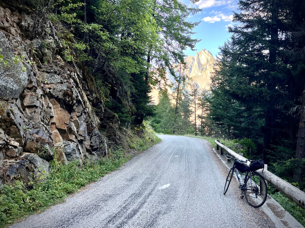
The last 6 kilometres are in the forest and on a much narrower road.
The bends and twists are beautiful. The surface is sometimes excellent, sometimes unpleasant. The views are not unpleasant, but neither are they striking.
The descent is fantastic. Be careful, though, on some of the "bumpy" sections.
The scenery really comes into its own on the way back to Saint-Jean.
If you start from Saint-Jean de Maurienne, which is quite likely, you will have to climb a good 2 kilometres more to reach Le Bochet, the starting point for the ascent.
Take the opportunity to see the big Ferroglobe factory. Impressive!
Ce n’est pas le plus beau col des environs mais, il est plutôt exigeant.
Pas de repos. Les kilomètres à 8% s’enchaînent joyeusement. La fin s’apaise mais ça continue à grimper sérieusement.
Les 6 derniers kilomètres se font dans la forêt et sur une route nettement plus étroite.
Les virages et lacets sont beaux. Le revêtement est parfois excellent, parfois désagréable. Les vues ne sont pas désagréables, mais pas saisissantes non plus.
La descente est formidable. Attention, toutefois sur certains tronçons « bosselés ».
Les paysages se dévoilent vraiment lors du retour vers Saint-Jean. De Maurienne.
D’ailleurs, si vous démarrez de Saint-Jean, ce qui est assez probable, vous allez grimper 2 bons kilomètres de plus pour parvenir au Bochet, point de départ de l’ascension.
En bas, au Bochet, profitez-en pour aller voir la grosse usine Ferroglobe. Impressionnante !
This climb via les Karellis – a dead end side road – to Col d’Albanne passes along the very nice Lac de Premol, with a cold water tap.
The (Albanne) col marker is located lower than the village you first pass through when coming from Karelis.
The "alternative" over the D81, which is where this marker is, is NOT closed as stated on the info page for that one.
The climb really starts at the bocher, a relatively difficult pass because it is very irregular but the bends are relatively flat which allows us to start again, after montricher, 2 itineraries are available to us, the climb to the karellis and the lake of pramol or the climb to the pass of albanne;albanne and by this itinerary you can also push until the lake of pramol, I advise the two ascents with very little frequentation, on the other hand the ascent is to be avoided on Saturdays in July and August because of the station of karellis
La montée démarre vraiment au bocher ,col relativement difficile car très irrégulier mais les virages sont relativement plats ce qui nous permet de relancer , après montricher ,2 itinéraires s'offrent à nous ,la montée vers les karellis et le lac de pramol ou la montée du col d'albanne et par cet itinéraire vous pouvez aussi pousser jusqu'au lac de pramol ,je conseille les deux montées avec très peu de fréquentation ,par contre la montée est à éviter le samedi en juillet août à cause de la station des karellis
From the valley it is a nice climb with beautiful views.
Definitely worthwhile to drive up. Last part is perhaps a little less interesting, and you come out in a deserted ski village (deserted in summer). Road surface is very good.
Crossing to Valloire is doable - but would not recommend it. ~2km unpaved, of which 50m walking. The rest of the dirt is fine, but more suitable for gravel bike or MTB. However, this part is only slightly descending. We did the crossing with the racer, for the adventurer it is doable, but in general I would not recommend it.
Vanuit het dal is het mooi klimmen met mooie uitzichten.
Zeker de moeite waard om omhoog te rijden. Laatste deel is misschien iets minder interessant, en je komt dan ook in een verlaten skidorp uit (verlaten in de zomer). Wegdek is erg goed.
Doorsteken naar Valloire is te doen - maar zou het niet aanraden. ~2km onverhard, waarvan 50m lopend. Rest van het onverharde is prima te fietsen, maar meer geschikt voor gravelfiets of MTB. Wel is dit stuk maar heel licht dalend. Wij hebben de doorsteek met de racer gemaakt, voor de avonturier is het goed te doen, maar in general zou ik hem niet aanraden.
Done on Tuesday 7 September 2021
The retreat in July 2020 and the discovery of the ClimbFinder website gave me an extra motivation.
I discovered a lot of small climbs like the Col D'Albanne, which is also pretty but much quieter than the big cols.
If you come from St Jean de Maurienne, take the D81 to avoid the busy D1006.
The climb will start about 1.5km before Le Bochet on severe slopes 10 to 13 % then at Le Bochet you join the route described on Climbfinder.
The climb is equipped with markers with indications until Le Karellis ( 10km )
Either I've missed one or two of them, and the last one indicates the next km at 6 % whereas I was permanently stuck on a slope between 9 and 10 ( maybe a joke )
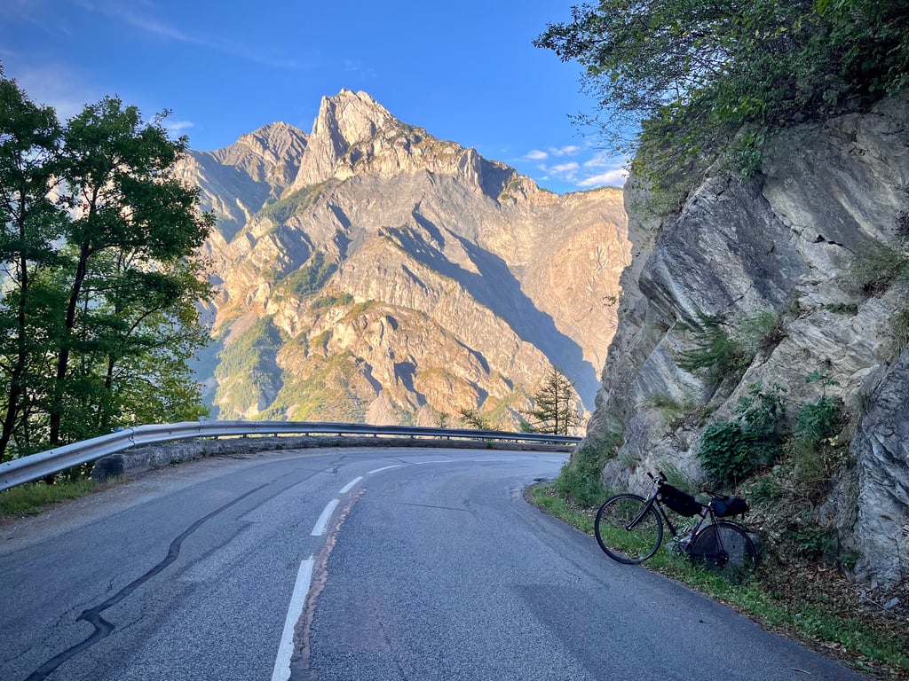
The first part, from Le Bochet to the village of Montricher, is on a road cut into the cliff, wide with a nickel surface in fact a real billiard table in a not very regular slope alternating below 7 % and sometimes well above, but many portions and especially the twists and turns allow to relaunch.
The plunging views over the valley are impressive.
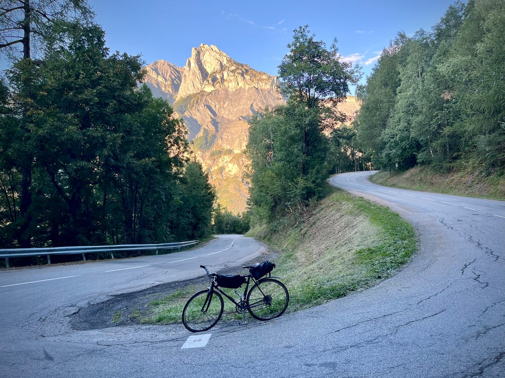
A little before Montricher the trees appear and the landscape and the smells change, the slope becomes more regular but also steeper until Le Karellis.
Then I didn't follow the route described on ClimBfinder, I crossed the resort to climb to Lac de Pramol altitude 1731M so higher than the Col D'Albanne 1656M and 15Km climb instead of 13.3Km (the road is quite passable) and then I went back down to Albanne to join the Col (you can view with the Strava link).
Ps: Do not go down to Albanette even by curiosity, I made round trip and nothing, moreover road is in very bad state.
From Albanne you can see the summit of the Col du Télégraphe just in front and the road that goes down to Valloire, the landscapes are grandiose (see photos)
On Tuesday 7 September there was very little traffic, but I spoke to 2 cyclists who live in Montricher and the July-August period is not the same music.
Good road and prudence
Fait le mardi 7 septembre 2021
La retraite en juillet 2020 et la découverte du site ClimbFinder m’ont donnés une sur motivation.
J’y ai découvert pleins de petites ascensions comme celle du Col D’Albanne aussi jolie mais bien plus tranquille que les grands cols.
Si vous venez de St Jean de Maurienne, prenez la D81 pour éviter la D1006 très fréquentée.
La montée va commencer environ 1,5km avant le Bochet dans des pentes sévères 10 à 13 % ensuite au Bochet on rejoint l’itinéraire décrit sur Climbfinder.
La montée est équipée de bornes avec indications jusqu’au Karellis ( 10km )
Soit j’en ai loupé ou soit il manque une ou deux, en plus la dernière indique le Km suivant à 6 % alors que j’étais en permanence en prise dans une pente entre 9 et 10 ( peu être une farce )
La première partie, du Bochet jusqu’au village de Montricher, se fait sur une route taillée dans la falaise, large avec un revêtement nickel à vrai dire un vrai billard dans une pente pas très régulière alternant inférieure à 7 % et parfois bien au-dessus, mais de nombreuses portions et notamment les lacets permettent de relancer.
Les vues plongeantes sur la vallée sont impressionnantes.
Un peu avant Montricher les arbres font leur apparition et le paysage et les odeurs changent, la pente devient plus régulière mais aussi plus raide jusqu’au Karellis.
Ensuite je n’ai pas suivi l’itinéraire décrit sur ClimBfinder, j’ai traversé la station pour monter jusqu’au Lac de Pramol altitude 1731M donc plus haut que le col D’Albanne 1656M et 15Km de montée au lieu de 13,3Km ( la route est tout à fait praticable ) et ensuite je suis redescendu à Albanne pour rejoindre le Col ( vous pourrez visionner avec le lien Strava )
Ps : Ne pas descendre à Albanette même par curiosité, j’ai fait aller-retour et rien, en plus route est en très mauvais état.
Depuis Albanne on aperçois le sommet du Col du Télégraphe juste en face et la route qui descend sur Valloire, les paysages sont grandioses ( voir les photos )
En ce mardi 7 septembre très peu de circulation, mais j’ai discuté avec 2 cyclistes qui habitent Montricher et la période Juillet-août ce n’est pas la même musique.
Bonne route et prudence
From 8% on average on the 1à first terminals it stings...We are quite happy when we arrive at the end and we have a good little view at the top!
Du 8% en moyenne sur les 1à premières bornes ça pique...On est bien content quand on arrive au bout et on a une bonne petite vue en haut !
| 5 mph | 01:39:28 |
| 7 mph | 01:10:25 |
| 9 mph | 00:54:53 |
| 12 mph | 00:41:14 |
This page is better in the app