Tips nearby


| Beautiful scenery |
| Hidden gem |
| 13 hairpin turns |
| #57 toughest climb of France |
| #59 most elevation gain of Auvergne-Rhône-Alpes |
| #87 longest climb of Savoie |
| #66 average steepest climb of Savoie |
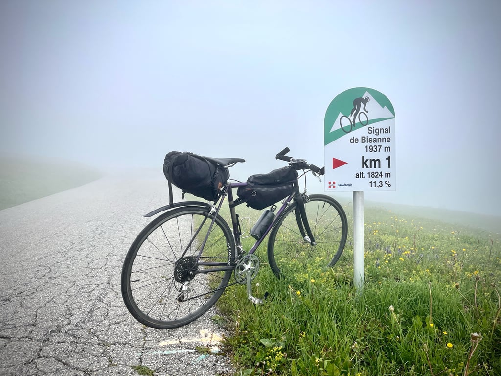
Signal de Bisanne is a climb in the region Savoie. It is 15 km long and bridges 1247 m of vertical ascent with an average gradient of 8.3%, resulting in a difficulty score of 1150. The top of the ascent is located at 1933 m above sea level. Climbfinder users shared 7 reviews of this climb and uploaded 23 photos.
Road name: D123, D23
5.0 by sergenavetatThis is an automatic translation, the original language is: French.Done in July 2017, one week after the Alpe d'Huez and I can testify that the effort is much more demanding in Bisanne than in the Alpe's climb Ten years ago it was almost unknown except to local cyclists, the Tour de France and the Internet have contributed to its popularity. Today the Signal de Bisanne by the D123 has become a classic of the Beaufortain even if there are less people than in the big passes. In the morning, when it is cool, it's quiet on this small high mountain... read more
Welcome! Please activate your account if you would like to share something. Look for the verification email in your inbox.
If you want to upload your photos, you need to create an account. It only takes 1 minute and it's completely free.
The Col des Saisies via the Signal de Bisanne road... It's really quite defensible. But when you're climbing in the company of kilometre markers promoting Mont Bisanne, you end up... climbing Mont Bisanne.
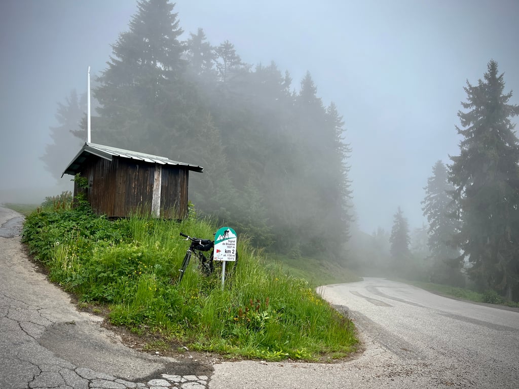
I made the climb in difficult conditions (cold, drizzle and thick fog). I found the climb heavy and quite tough. The gradients are never easy. The end is really demanding. The Climbfinder curve shows 4% on one of the last kilometres! I must have fallen asleep along the way. From the sixth kilometre onwards, you're always above 8%. The last kilometre is over 11%...
I won't be able to tell you anything about the scenery, which, according to the only local who was walking through the mist, was magnificent...
A 360 degree view...
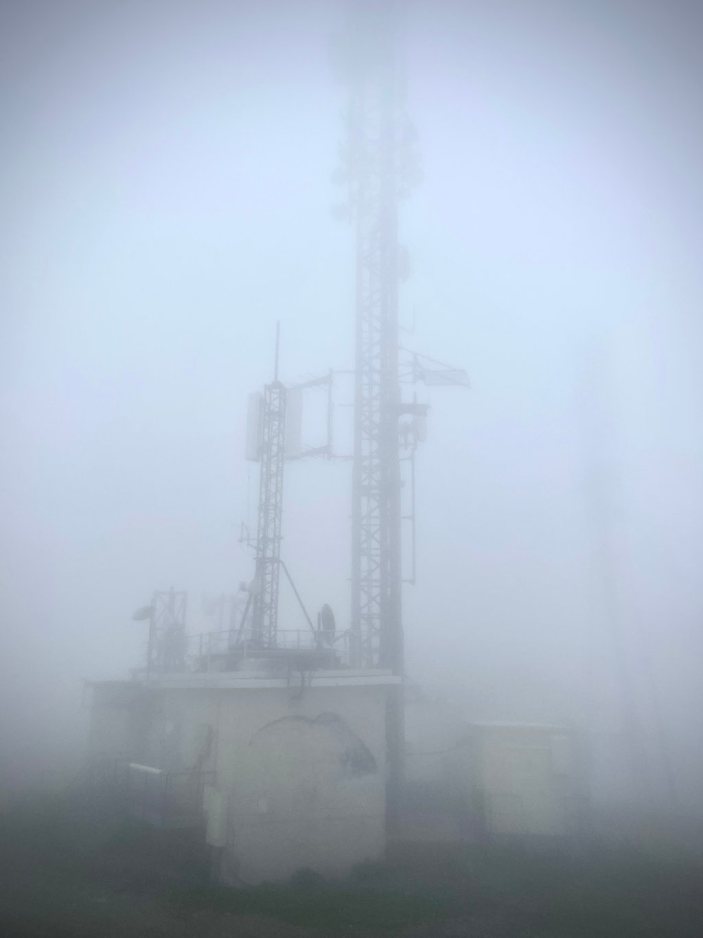
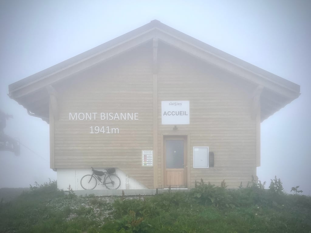
Even the chalet that marks the finish was invisible from 30 metres away. The telephone did what it could to take a poor photo.
This Bisanne signal, which cyclists don't talk about much, is quite a sight.
Le col des Saisies par la route du signal de Bisanne… Ça se défend vraiment. Il faut dire que la D70 qui monte aux Saisies depuis Beaufort est fermée pour travaux (juin à octobre 2026).
Mais, quand on grimpe en compagnie des bornes kilométriques qui nous font la promotion du mont Bisanne, on finit par… grimper au mont Bisanne.
J’ai effectué l’ascension dans des conditions difficiles (froid, bruine et brouillard épais). Cette montée m’a semblé lourde et plutôt bien costaude. Les pourcentages ne rigolent jamais. La fin est vraiment exigeante. La courbe Climbfinder indique du 4% sur un des derniers kilomètres ! J’ai du m’endormir en chemin. À partir du sixième kilomètre, on est toujours au dessus de 8%. Le dernier est à plus de 11%…
Je ne pourrai pas vous parler des paysages, qui, selon le seul indigène qui se promenait dans cette brume, seraient magnifiques…
Une vue à 360 degrés… Je n’ai pas même été en mesure de débusquer la toute dernière borne d’arrivée…
Même le chalet qui matérialise la fin de la montée était invisible à 30 mètres. Le téléphone a fait ce qu’il a pu pour faire une pauvre photo.
Ce signal de Bisanne dont les cyclistes ne parlent pas beaucoup, est un sacré morceau.
Difficult climb, especially the last two kilometres (11% average gradient) but on a car-free cycle path. Magnificent view at the top. Few cars on my ascent.
Montée difficile, surtout les deux derniers kilomètres (11% de pente moyenne) mais sur une piste cyclable sans voiture. Magnifique vue au sommet. Peu de voitures lors de mon ascension.
Nice Col. I had the chance to do this Col for come on against cancer. Last 2km towards the top are very tough but once you get to the top you have a beautiful view of Mont Blanc
Leuke Col. ik had de kans om deze Col te doen voor kom op tegen kanker. Laatste 2km richting de top zijn zeer pittig maar eens je boven bent heb je een prachtig zicht op de Mont Blanc
Very nice climb in a magnificent region.
Very quiet road in the middle of summer (19/07/24), and in fairly good condition. For the descent, perhaps prefer the road to Beaufort.
The effort is sustained, and there are few moments of respite. But it's easy to get into a cruising rhythm and stick with it.
The last two kilometres are on a cycle path with a 10% gradient.
The view at the top is superb.
This climb combines very well with the Cormet via Beaufort.
Très belle montée dans une région magnifique.
Route très calme en plein milieu de l'été (19/07/24), et en assez bon état. Pour la descente, préférez peut-être la route vers Beaufort.
L'effort est soutenu, et il y a peu de moments de répit. Mais on peut facilement prendre un rythme de croisière et s'y tenir.
Les deux derniers km se déroulent sur une piste cyclable avec une pente à 10%.
La vue au sommet est superbe.
Cette montée se combine très bien avec le Cormet en passant par Beaufort.
Cycled this climbing classic of the Beaufortain starting at the church of Villard sur Doron June 2023.
As found on Climbfinder, there are several routes to the summit and even near there some variations upwards. I chose the route along the D123, indicated and guided by the green and white cycling info signs every kilometre (distance to summit / % next km. / altitude).
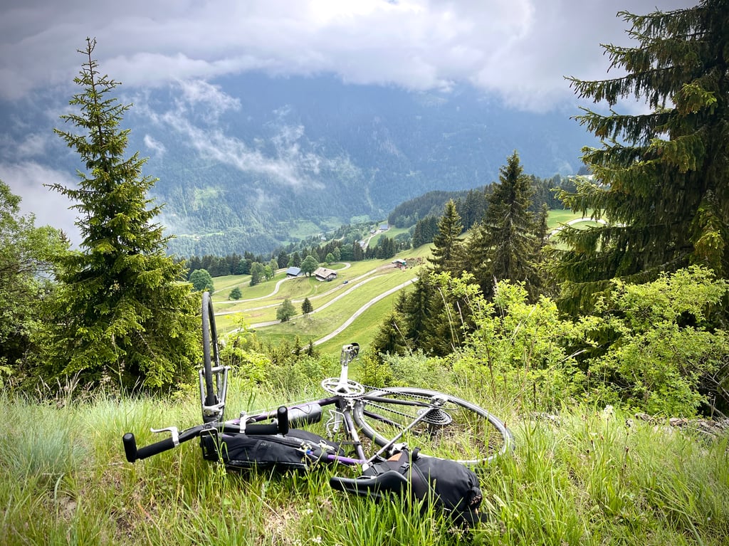
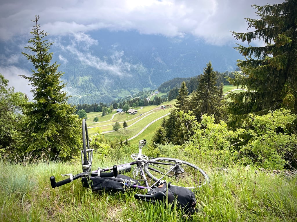
Road winds hairpin-like up the valley flank. Alternating through shady forests, small villages with alpine meadows and also open panorama sections. Last 4 km. from Brisanne 1400 flirt continuously with the 10% and then, after turning left on the road that descends further to les Saisies, go loose on it for the last 2 km.
Dead-end narrow slightly turning road among the alpine meadows with no shelter from wind or sun.
Last kilometre 11.2 % average!!!
Summit offers for this cycling effort the widest most beautiful and complete 360° panorama of the region. Radio mast for telecommunications,ski lift and large panorama restaurant & café (summer opening?) take you there.
Pretty much traffic-free TOPKLIM.
Numbers and colour of climbfinder profile says enough about severity.
Is in September 2023 central climb in combination with Les Saisies in "The Col Op for Kom op tegen Kanker" of the Belgian organisation of the same name!
Deze klimklassieker van de Beaufortain die start aan de kerk van Villard sur Doron gefietst juni 2023.
Zoals op Climbfinder te vinden zijn er verschillende routes naar de top en zelfs daar in de buurt nog enkele varianten naar omhoog. Ik koos voor de route langs de D123, aangegeven en begeleid door de groen-witte fietsinfobordjes elke kilometer (afstand tot de top / % volgende km. / hoogte).
Weg kronkelt haarspeldbocht gewijs de dal flank op. Afwisselend door de schaduwrijke bossen , kleine dorpjes met alpenweiden en met ook open panorama secties. Laatste 4 km. vanaf Brisanne 1400 flirten continu met de 10% om dan, na het links afdraaien van de weg die verder naar les Saisies afdaalt, er voor de laatste 2 km. los over te gaan.
Doodlopende smalle licht draaiende weg tussen de alpenweiden zonder beschutting tegen wind of zon.
Laatste kilometer 11,3 % gemiddeld!!!
Top bied voor deze fietsinspanning het wijdste mooiste en compleetste 360° panorama van de regio. Zendmast voor telecommunicatie,skilift en groot panoramarestaurant & café (zomeropening?) neem je erbij.
Zo goed als verkeersvrije TOPKLIM.
Cijfers en kleur van het climbfinder profiel zegt genoeg over de zwaarte.
Is in september 2023 centrale klim in combinatie met Les Saisies in "De Col Op voor Kom op tegen Kanker" van de gelijknamige Belgische organisatie!
We cycled here from Lake Annecy.
Beautiful climb.
Little traffic and good asphalt.
The climb gets heavier and heavier. Because of the length and the percentage.
I found the last two km (after the barrier) the toughest. Last two km a 10.7 and 11% were really tough.
Along the way, you see the mountain bikers coming out of the lift and going down. Nice to see.
On top is a restaurant with a panorama terrace. There you can eat and drink something.
View over the ski area and Mont Blanc.
Descending via les Saisais is nice because the roads are wide and clear,
To come back, I cycled through the Gorges de l'Arly. Beautiful descent a 4-6% through a gorge towards Ugine!
Highly recommended!
Vanuit meer van Annecy hierheen gefietst.
Prachtige klim.
Weinig verkeer en goed asfalt.
De klim wordt als maar zwaarder. Door de lengte en de percentage.
Ik vond de laatste twee kilometer (na de slagboom) het zwaarst. Laatste twee km a 10.7 en 11% waren echt zwaar.
Onderweg zie je de mountainbikers uit de lift komen en afdalen. Leuk om te zien.
Bovenop zit een restaurant met een panoramaterras. Daar kun je lekker wat eten en drinken.
Uitzicht over het skigebied en Mont Blanc.
Afdalen via les Saisais is mooi omdat de wegen lekker breed en overzichtelijk zijn,
Om terug te komen ben ik door de Gorges de l'Arly gefietst. Mooi afdaling a 4-6% door een kloof richting Ugine!!1
Aanrader!!!
Done in July 2017, one week after the Alpe d'Huez and I can testify that the effort is much more demanding in Bisanne than in the Alpe's climb
Ten years ago it was almost unknown except to local cyclists, the Tour de France and the Internet have contributed to its popularity.
Today the Signal de Bisanne by the D123 has become a classic of the Beaufortain even if there are less people than in the big passes.
In the morning, when it is cool, it's quiet on this small high mountain road with beautiful landscapes.
The start is rather calm and slightly shaded for about 3 to 4 kms, then it will get harder and harder, the right hand turn at the entrance of Bisanne announces the last 4 kms, the first 2 at more than 9 % almost in a straight line and the last 2 at more than 10 %
the final one is located on the parking lot of the restaurant Panoramique 2000 with a paragliding area.
Knowing well the passes of the region I can affirm that the 360° view is one of the most beautiful of the Savoie,
There are other variants on more picturesque roads but in less good condition and to date the one on the D123 is the only one equipped with cycle markers.
Good road and be careful
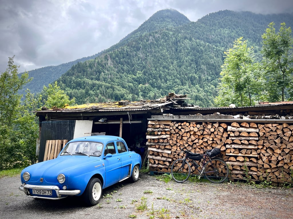
Ps: In the crossing of Villard on Doron there are basins of drinking water, fill up because after until the top it is not possible any more.
Fait en juillet 2017, une semaine après l'Alpe d'Huez et je témoigne que l'effort est beaucoup plus exigeant dans Bisanne que dans la montée de l'Alpe
Il y a encore une dizaine d'années elle était quasiment méconnue sauf par les cyclistes locaux, Le Tour de France et Internet ont beaucoup contribués à sa popularité.
Aujourd’hui le Signal de Bisanne par la D123 est devenu un classique du Beaufortain même si l'on y croise moins de monde que dans les grands cols.
Le matin à la fraîche c'est la tranquillité assurée sur cette petite route de haute montagne aux paysages magnifiques.
Coté effort sportif ça reste du costaud, le départ est plutôt calme et légèrement ombragé sur environ 3 à 4kms ensuite ça va ce corser crescendo, le lacet à droite à l'entré de Bisanne annonce les 4 derniers kilomètres , les 2 1er à plus de 9 % quasiment en ligne droite et les 2 derniers à plus de 10 %
le final se situe sur le parking du restaurant le Panoramique 2000 avec aire d'envol de parapentes.
Connaissant bien les cols de la région je peux affirmer que la vue à 360° est l'une des plus belles de la Savoie,
IL existe d'autres variantes sur des routes plus pittoresques mais en moins bon état et à ce jour celle par la D123 est la seule équipée de bornes cyclo.
Bonne route et soyez prudent
Ps : Dans la traversée de Villard sur Doron il y a des bassins d’eau potable, faites le plein car après jusqu’au sommet ce n’est plus possible.
| 7 km/h | 02:08:29 |
| 11 km/h | 01:21:46 |
| 15 km/h | 00:59:57 |
| 19 km/h | 00:47:20 |
This page is better in the app