| Hidden gem |
| #18 average steepest climb of Walloon Brabant |
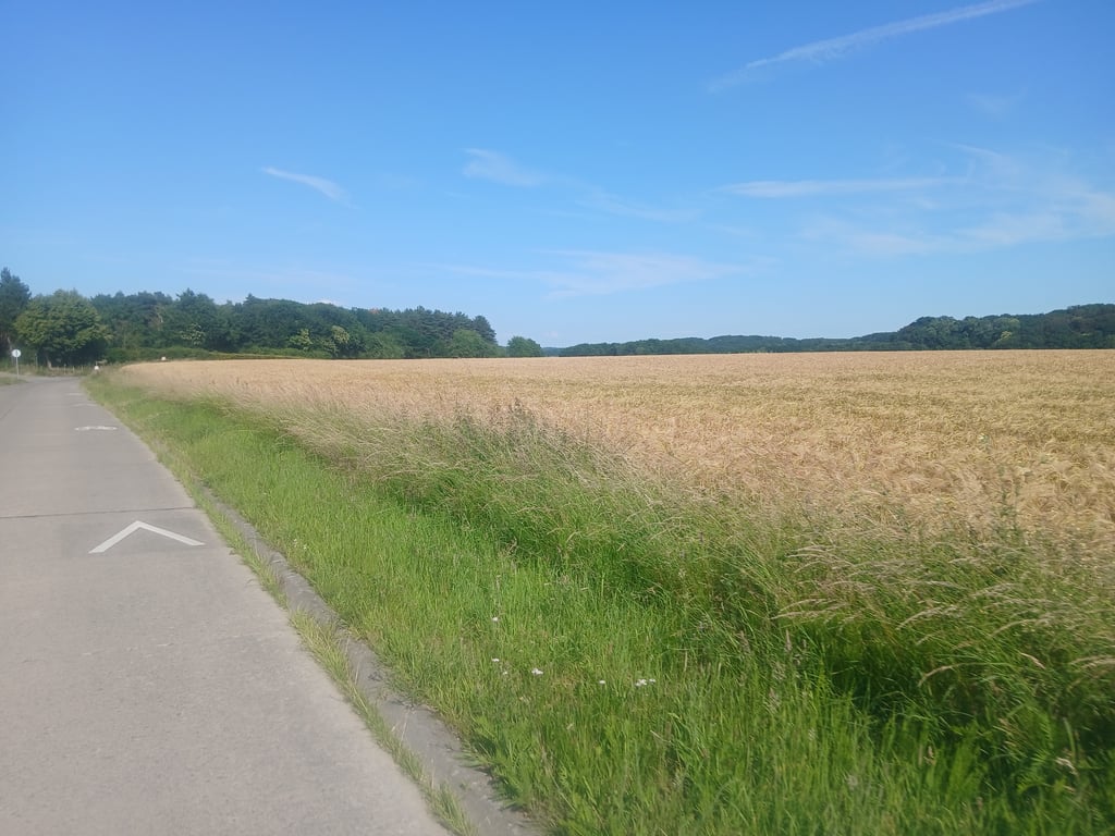
Rue de Pécrot is a climb in the region Ardennes Brabançonnes. It is 0.4 km long and bridges 37 m of vertical ascent with an average gradient of 8.5%, resulting in a difficulty score of 36. The top of the ascent is located at 80 m above sea level. Climbfinder users shared 16 reviews of this climb and uploaded 2 photos.
Road name: Rue de Pécrot
3.0 by Glen_SolanaThis is an automatic translation, the original language is: Dutch.Short, steep climb where explosiveness is tested. As a tip you should speed up a bit in the centre of Pécrot, the road descends here to the climb. At the top after the forest you have a nice view of the surroundings. This climb is also part of the "Brabantse Pijl Route".... read more
Welcome! Please activate your account if you would like to share something. Look for the verification email in your inbox.
If you want to upload your photos, you need to create an account. It only takes 1 minute and it's completely free.
The climb is steeper than expected, which makes it quite challenging. The road is in good condition, with a bit of traffic but nothing excessive. At the top, there’s a lovely view of the surrounding countryside
Ascension plus raide que ce à quoi on s'attend, ce qui la rend assez difficile. La route est en bon état, un peu de trafic mais rien d'excessif. Au sommet, belle vue sur la campagne environnante
It was quite a tough climb after all, which I managed after a standing start due to the red lights at the railway crossing
Toch een pittige klim die ik gedaan heb na stilstaande start wegens de rode lichten aan het treinspoor
Rue de Pécrot is short and immediately firm. You turn in from almost standstill and are immediately on a steep section where you have to push on for a while. Then it keeps going for a while until it flattens out at the top and you can recover.
Rue de Pécrot is kort en meteen stevig. Je draait erin vanuit bijna stilstand en zit direct op een steil stukje waar je even door moet duwen. Daarna blijft het nog even doorlopen tot het boven wat afvlakt en je weer kunt herstellen.
This one is quite tricky. It has a steep middle section and the road surface does not run well. The road leading up to it also doesn't run well so you can't get the most out of it. You cycle through the forest and there is some traffic but not disruptive.
Deze is vrij lastig. Er zit een steil middenstuk in en het wegdek loopt niet goed. De weg er naartoe loopt ook niet goed waardoor je er niet optimaal aan kan beginnen. Je fietst door het bos en er is wel wat verkeer maar niet storend.
Short but quite tough due to the steep middle section. Above all, I find it a very nice climb where you finish between 2 higher flanks of forest. Continuing you ride on a very nice plateau with views of meadows and forest
Kort maar best pittig door het steile middenstuk. Bovenal vind ik het een erg mooie klim waar je finisht tussen 2 hogere flanken bos. Verder rijdend rijd je op een zeer mooi plateau met zicht op weiland en bos
I have done this one many times, but every time it feels heavier than in my memory. After the buzzing, you also have a bit of false flat so it is difficult to regain speed. If you come from the direction of the train track, you have already ridden the last 200m uphill. Moreover, you cannot really make a run-up as you have to turn into the street with oncoming traffic that suddenly appears behind a bend. And you actually start the climb from a standstill.
Heb deze al vaak gedaan, maar toch voelt hij elke keer zwaarder aan dan in mijn geheugen. Na het gestoemp, heb je ook nog een stukje vals plat zodat het moeilijk is om opnieuw snelheid te maken. Als je vanuit de richting van het treinspoor komt, heb je de laatste 200m ook al bergop gereden. Bovendien kan je ook niet echt een "aanloop" nemen omdat je de straat moet inslaan met tegenliggend verkeer wat achter een bocht plots opduikt. En je eigenlijk vanuit stilstand aan de klim begint.
Around Nethen you will find some nice climbs, and the Rue de Pécrot is certainly one of them.
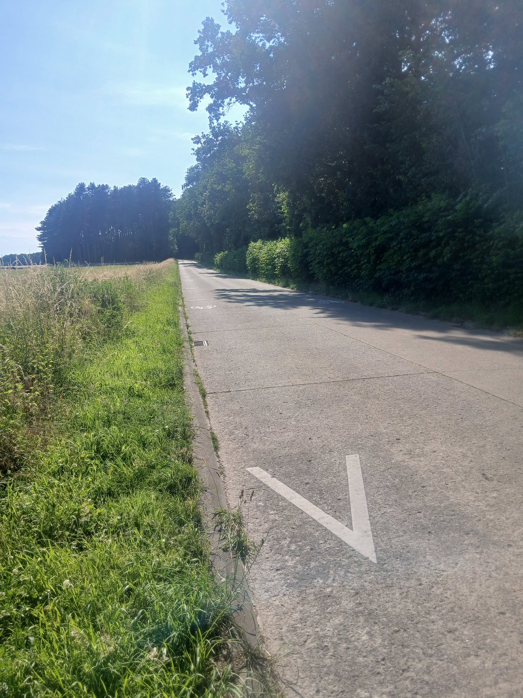
From Pécrot, you come across this steep wall, which is somewhat hidden from view by the surrounding trees. The road surface consists of concrete slabs, but these are of very good quality. On top of the slope you come to a plateau where the track takes you to Nethen, to continue your journey to Hamme-Mille or Sint-Joris-Weert.
Rond Nethen vind je enkele fraaie klimmetjes, en de Rue de Pécrot is daar zeker eentje van.
Vanuit Pécrot kom je deze steile muur tegen, die enigszins door de omringende bomen wat aan het zicht wordt onttrokken. Het wegdek bestaat uit betonplaten, maar die zijn van zeer goede kwaliteit. Bovenop de helling kom je op een plateau terecht alwaar de baan je naar Nethen brengt, om zo je weg naar Hamme-Mille of Sint-Joris-Weert te vervolgen.
A more than decent road surface, which can be found immediately after the railway crossing in cobbles on the permanently signposted Brabantse Pijl. A nice climb on a road without traffic.
Een meer dan degelijk wegdek, hetwelk onmiddellijk na de spoorwegovergang in kasseitjes terug te vinden is op de permanent bewegwijzerde Brabantse Pijl. Een mooie klim op een verkeerluwe baan.
Done during the Brabantse Pijl tour. It was the last one and therefore perhaps more difficult. Quite tough, but then enjoy the descent to the finish in prospect.
Gedaan tijdens de toertocht van de Brabantse Pijl. Het was de laatste en viel daarom misschien wat zwaarder. Flink afzien, maar daarna genieten met de afdaling tot de finish in het vooruitzicht
A classic climb in the region, which is included in the Brabantse Pijl Cycling Route. Steep, but quite short, it can be climbed in a sprint and you usually end up well exhausted. Those who don't know the route may wonder when it ends, because due to the curve described, the top is only visible towards the end. The descent on the other side provides a pleasant view on a clear day.
Une côte classique de la région, qui est reprise dans la route cycliste de la Flèche brabançonne (Brabantse Pijl Cycling Route). Pentue, mais assez courte, elle se gravit quasiment au sprint et on finit généralement bien éprouvé. Ceux qui ne la connaissent pas peuvent néanmoins se demander quand elle se termine car du fait de la courbe décrite, on ne voit le sommet que vers la fin. La descente sur l'autre versant fournit un panorama agréable par temps clair.
I underestimate this one every time. From the moment the road turns right uphill, you see where you're at and that can have a rather discouraging effect. However, it does not get any more than that. Just hang on and keep the pace until the road slowly flattens out.
Deze onderschat ik toch weer elke keer. Vanaf de weg rechts omhoog draait, zie je waar je aan toe bent en dat kan toch een nogal ontmoedigend effect hebben. Echter, meer dan dat wordt het ook niet. Gewoon doorbijten en het tempo erin houden tot de weg langzaam afvlakt.
Short, but extremely spicy. It is over before you know it, but you can really destroy yourself on it. Watch out for passing traffic at the turn of the climb.
Kort, maar uiterst pittig. Hij is voorbij voor je het weet, maar je kan er je flink op kapot rijden. Opgepast voor voorbijrazend verkeer bij het opdraaien van de klim.
A bit less known than other climbs in the region (maybe because it's just across the language border?) But definitely a nice climb, short enough to sprint up in one go, but steep enough to feel the pain in your legs.
Iets minder bekend dan andere klimmetjes uit de regio (misschien omdat die net over de taal grens ligt?) Maar zeker een leuke klim, kort genoeg om in een ruk naar boven te sprinten, maar steil genoeg om in de pijn in de benen te voelen
Short, steep, little traffic and good road surface. Much more we are not looking for as cyclists. In addition, after this climb a quiet and clear descent awaits you to Nethen.
Kort, steil, weinig verkeer en goed wegdek. Veel meer zoeken wij ook niet als wielrenners. Daarnaast staat je na deze beklimming een rustige en overzichtelijke afdaling te wachten naar Nethen.
For me a very intriguing climb, I've been able to get to the top relatively easily, other times I break down.
Voor mij een erg intrigerende klim, ik ben er al relatief vlot boven geraakt, andere keren ga ik kapot.
Short, steep climb where explosiveness is tested.
As a tip you should speed up a bit in the centre of Pécrot, the road descends here to the climb.
At the top after the forest you have a nice view of the surroundings.
This climb is also part of the "Brabantse Pijl Route".
Korte, steile klim waar de explosiviteit wordt getest.
Als tip moet je in het centrum van Pécrot wat snelheid maken, de weg daalt hier naar de klim.
Boven na het bos heb je een mooi uitzicht op de omgeving.
Deze klim zit trouwens mee in de "Brabantse Pijl Route".
| 7 km/h | 00:03:46 |
| 11 km/h | 00:02:24 |
| 15 km/h | 00:01:45 |
| 19 km/h | 00:01:23 |
This page is better in the app