Rot from Nieuwrode is a climb in the region Hageland. It is 0.9 km long and bridges 35 m of vertical ascent with an average gradient of 3.9%, resulting in a difficulty score of 16. The top of the ascent is located at 59 m above sea level. Climbfinder users shared 6 reviews of this climb and uploaded 5 photos.
Road name: Panoramastraat
2.0 by BikerJohanThis is an automatic translation, the original language is: Dutch.Climb on the main road from Nieuwrode to Gelrode. The climb goes up in four ascending blocks, as it were, with the next block getting steeper each time. Just before the top it flattens out.... read more
Welcome! Please activate your account if you would like to share something. Look for the verification email in your inbox.
If you want to upload your photos, you need to create an account. It only takes 1 minute and it's completely free.
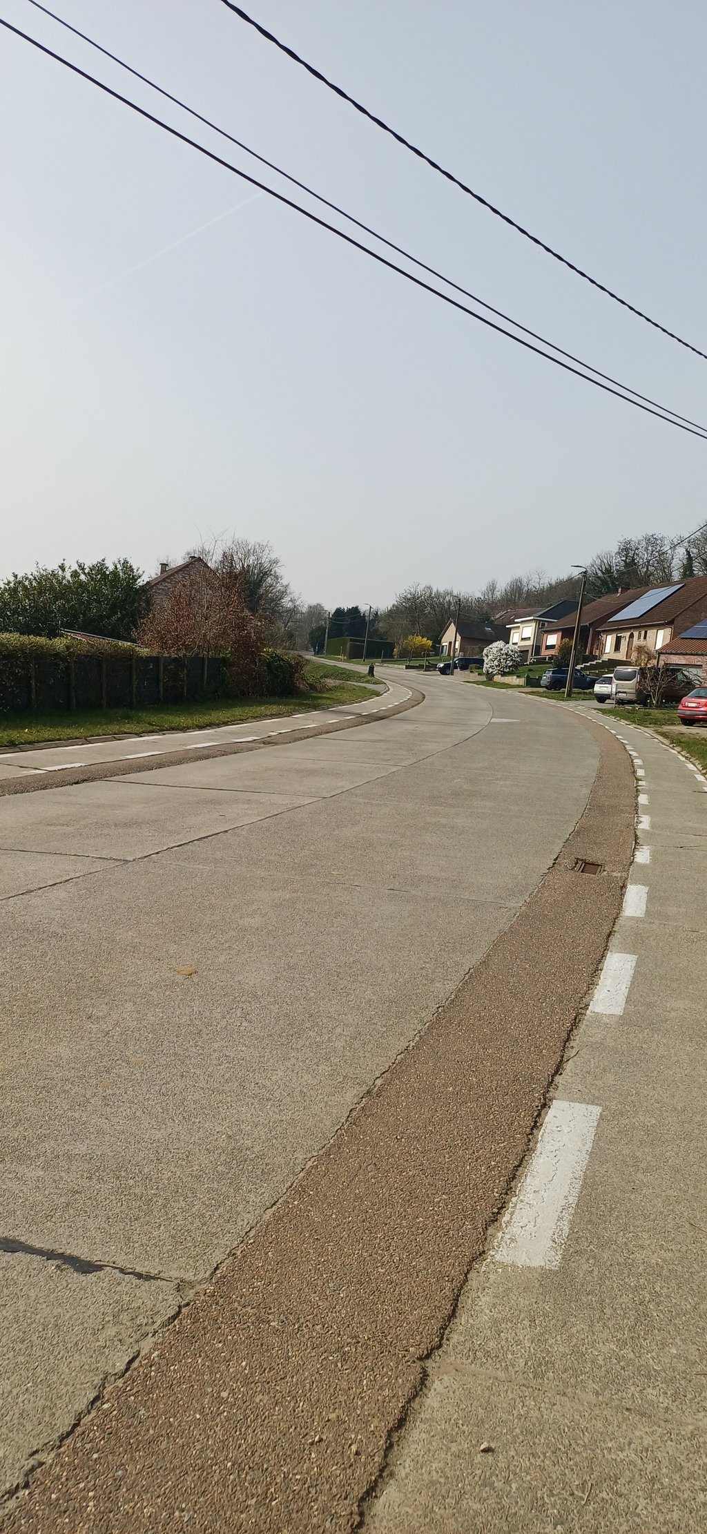
Climb on the main road from Nieuwrode to Gelrode. The climb goes up in four ascending blocks, as it were, with the next block getting steeper each time. Just before the top it flattens out.
Klim op de doorgaande weg van Nieuwrode naar Gelrode. De klim gaat als het ware in vier stijgingsblokjes omhoog waarbij het volgende blokje steeds wat steiler wordt. Net voor de top vlakt het af.
Busy road that gradually increases. The cars race past you at 70 km/h because you are driving on a stone road.
The Rot is one of the only ways to get from Nieuwrode to Gelrode, but there is an alternative.
If you keep left almost at the end of the climb you will end up on the Sint-Jobsweg or Kraaikant, where you will arrive at Gelrode via the Hellegat and the Donkerstraat at the back of the Moedermeule. Making extra altitude metres and at the same time encountering less traffic, that seems like a win-win to me.
Drukke baan die geleidelijk aan blijft oplopen. De auto's razen je er aan 70 km/u voorbij, je rijdt namelijk op een steenweg.
Het Rot is echter één van de enige manieren om van Nieuwrode naar Gelrode te fietsen, doch er is een alternatief.
Indien je quasi op het einde van de klim links aanhoudt kom je op de Sint-Jobsweg of Kraaikant terecht, alwaar je via het Hellegat en de Donkerstraat aan de achterzijde van de Moedermeule te Gelrode arriveert. Extra hoogtemeters maken en tegelijkertijd minder verkeer tegenkomen, dat lijkt me een win-win.
The Rot is a wide road. The bike path is rideable, but not great. It's not very steep, but if you get on the pedals at the bottom, pretty long to keep sprinting to the top. It's not the prettiest slope in the region, but worth the effort if you're there anyway.
Het Rot is een brede weg. Het fietspad is berijdbaar, maar niet geweldig. Het is niet heel steil, maar als je onderaan op de trappers gaat staan, best wel lang om tot boven te blijven sprinten. Het is niet de mooiste helling van de regio, maar de moeite waard als je er toch bent.
Not my favorite climb but it's a killer because of the wide road it seems like it hardly goes up at all especially after 300 meters but it goes up more and more and wind can play a big role.
Niet mijn favoriete beklimming maar wel een kuitenbijter omdat door de brede weg het lijkt of het amper stijgt vooral na 300 meter maar het gaat stilaan meer en meer bergop en wind kan er een grote rol spelen.
The Rot is an absolute hit with large groups of cycling tourists. If you are on your own it is a less interesting slope. Big road where you have to take the bike path, or the narrow piece of tarmac next to it. There is a lot of traffic. Yet this is also a nice slope to do. You can go up on the big plateau and test yourself seriously for a good two minutes. The road when you're almost at the top on your left side is worth to drive. You do not go to the top of the Rot but the further route is much nicer.
Het Rot is een absolute hit bij grote groepen wielertoeristen. Als je in je eentje bent is het een minder interessante helling. Grote weg waar je het fietspad, of het smalle stukje asfalt ernaast, moet nemen. Er is behoorlijk veel verkeer. Toch is dit ook een leuke helling om te doen. Je kan op de grote plateau naar boven en zo jezelf gedurende een dikke twee minuten serieus testen. Het weggetje als je bijna boven bent op je linkse kant is de moeite om in te rijden. Je gaat dan weliswaar niet tot de top van het Rot maar de verdere route is wel een stuk mooier.
Indeed the little road on the left at 150 m from the top is much nicer and I find it a less nice slope in the Hageland
Inderdaad het weggetje links op 150 m van de top is veel leuker en ik vind het een minder leuke helling in het Hageland
| 7 km/h | 00:07:38 |
| 11 km/h | 00:04:51 |
| 15 km/h | 00:03:33 |
| 19 km/h | 00:02:48 |
This page is better in the app