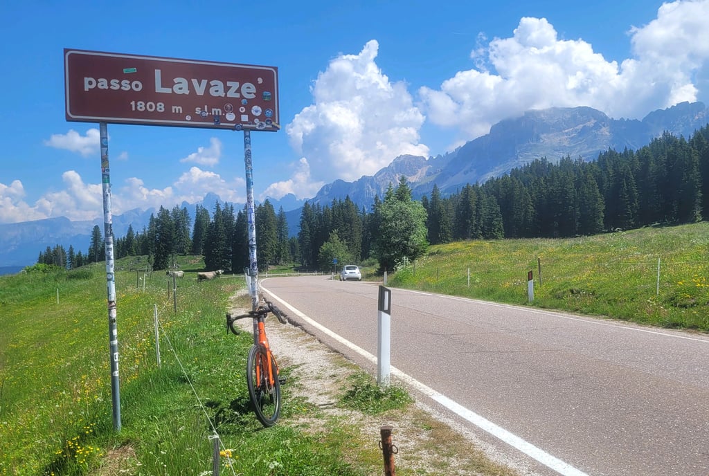
Passo Lavazè from Cavalese is a climb in the region Trento. It is 10.7 km long and bridges 802 m of vertical ascent with an average gradient of 7.5%, resulting in a difficulty score of 719. The top of the ascent is located at 1808 m above sea level. Climbfinder users shared 2 reviews of this climb and uploaded 8 photos.
Road name: SS620
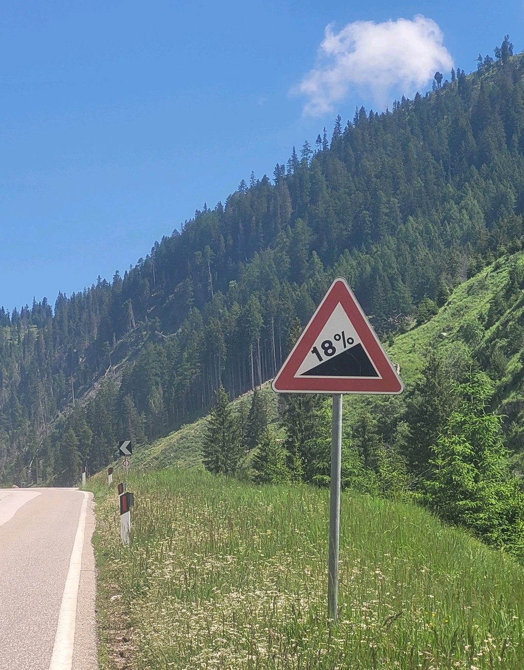
4.0 by RenepThis is an automatic translation, the original language is: Dutch.A lovely climb. The route is a secondary road, which cyclists are generally advised to avoid, but this one wasn’t too bad. It was quite quiet, even on this lovely Saturday. The last 3 km or so is steep. Fortunately, it’s not 18% as the sign suggests, but 13%. The last few hundred metres at the hairpin bend (where Climbfinder’s graph lightens again) are even 14 and 15%. But you’re rewarded at the top. Cycle on for a few hundred metres along a fairly flat stretch to the actual highest poin... read more

Welcome! Please activate your account if you would like to share something. Look for the verification email in your inbox.
If you want to upload your photos, you need to create an account. It only takes 1 minute and it's completely free.
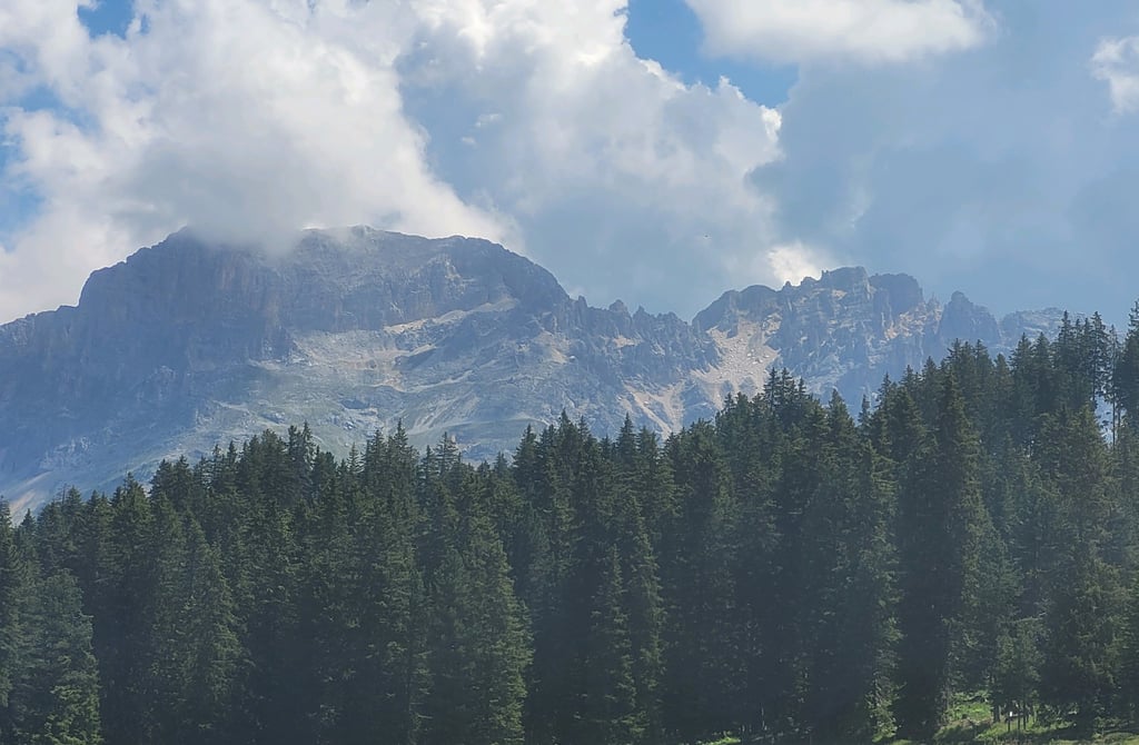
A lovely climb. The route is a secondary road, which cyclists are generally advised to avoid, but this one wasn’t too bad. It was quite quiet, even on this lovely Saturday. The last 3 km or so is steep. Fortunately, it’s not 18% as the sign suggests, but 13%. The last few hundred metres at the hairpin bend (where Climbfinder’s graph lightens again) are even 14 and 15%. But you’re rewarded at the top. Cycle on for a few hundred metres along a fairly flat stretch to the actual highest point, where you’ll be treated to a magnificent view of the Dolomites’ rocky massifs.
Mooie klim. De route is een SS-weg en die kan je als fietser in het algemeen beter mijden, maar deze viel erg mee. Zelfs op deze mooie zaterdag vrij rustig. De laatste plm 3 km is steil. Gelukkig geen 18% zoals het bord aangeeft maar wel 13%. De laatste paar honderd meter bij de slinger (waar de grafiek van Climbfinder alweer lichter kleurt) zelfs 14 en 15%. Maar boven wordt je beloond. Paar honderd meter over vrij blakke stuk doorfietsen tot het echte hoogste punt en daar heb je schitterend uitzicht op rotsmassieven van de Dolomieten.
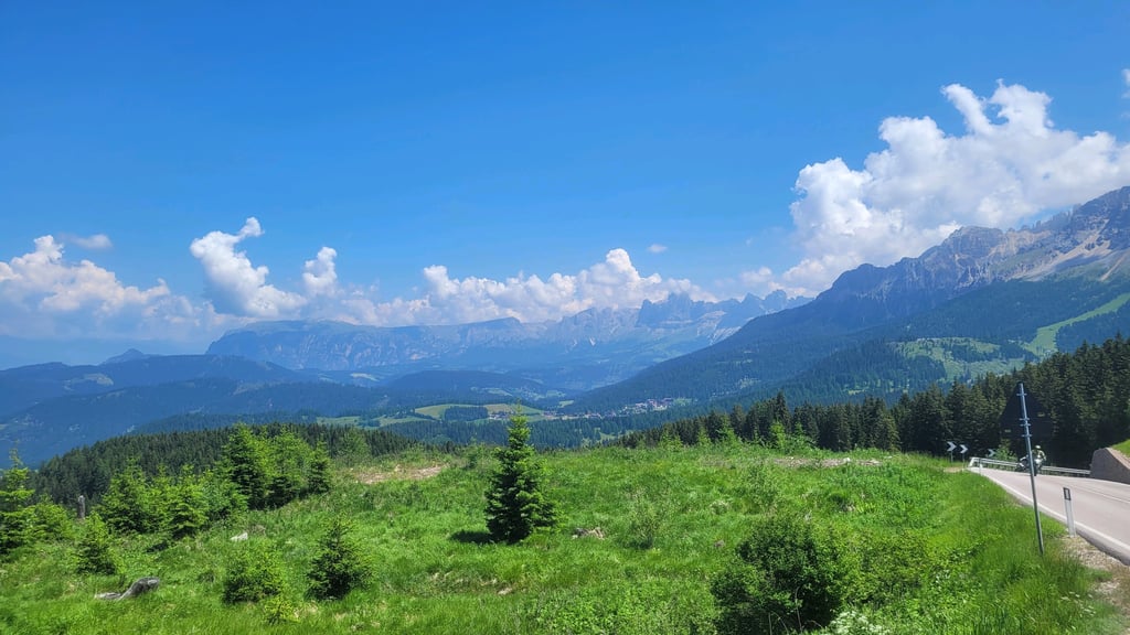
Spicy climb. Climb starts off fairly gently meandering through the villages of Molino and Varena, but from the junction with the road from Tesero onwards the gradient goes into double digits and the climb remains tough all the way to the top. The fact that the road is fairly busy with lorry traffic, among others, does not make it any easier. When you finally reach the top, there is a small lake with some catering facilities. If you cycle a little further, you have a nice view of the other valley.
Pittige klim. Klim start redelijk rustig slingerend door de dorpjes Molino en Varena, maar vanaf de driesprong met de weg vanuit Tesero gaat het stijgingspercentage naar de dubbele cijfers en blijft de klim pittig tot aan de top. Het feit dat de weg redelijk druk is met onder andere ook vrachtverkeer maakt het er niet makkelijker op. Als je eindelijk bovenaan bent is er een meertje met wat horecagelegenheden. Als je iets verder doorfietst heb je een mooi uitzicht op de andere vallei.
| 7 km/h | 01:31:18 |
| 11 km/h | 00:58:06 |
| 15 km/h | 00:42:36 |
| 19 km/h | 00:33:38 |
This page is better in the app