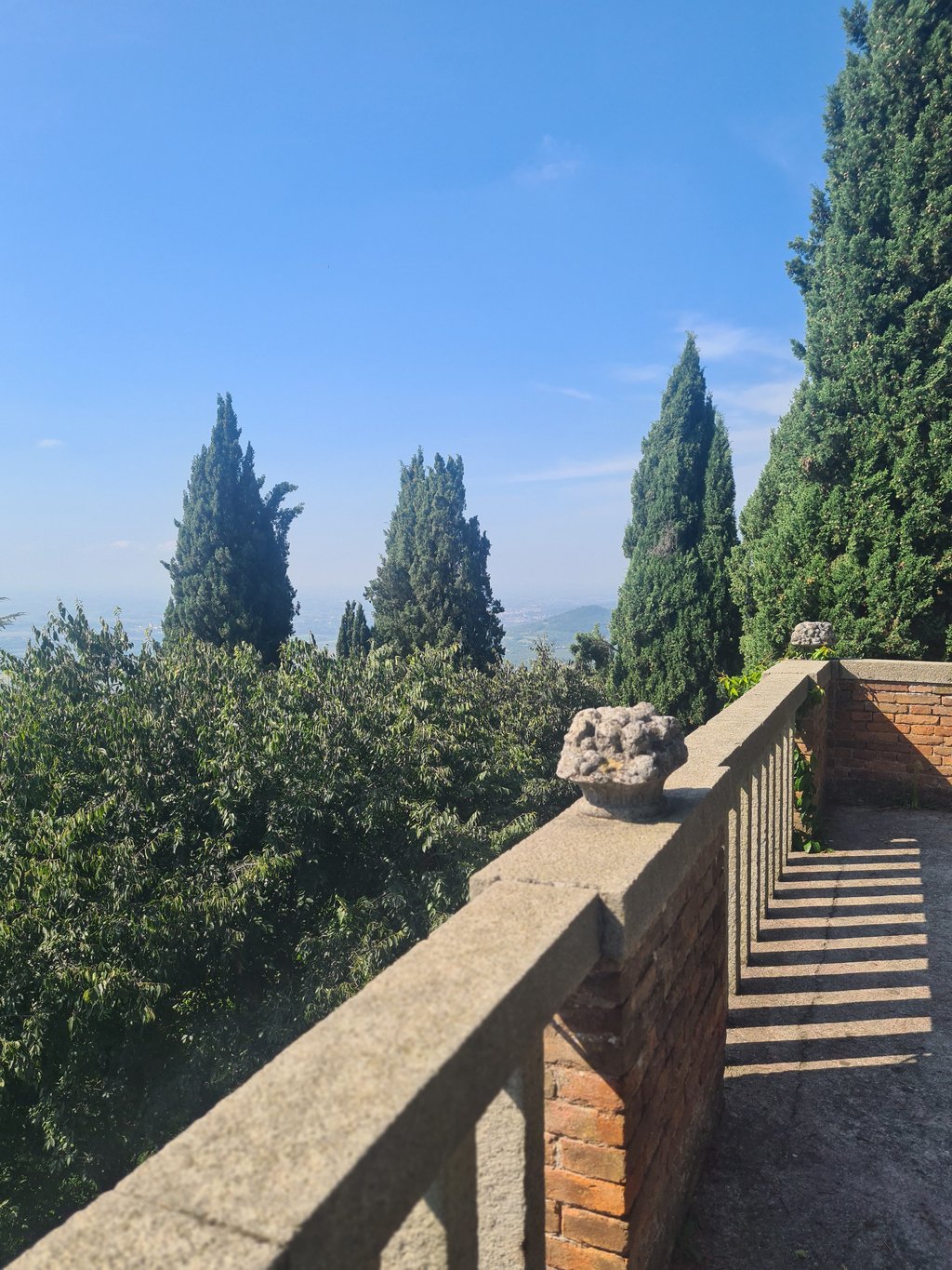
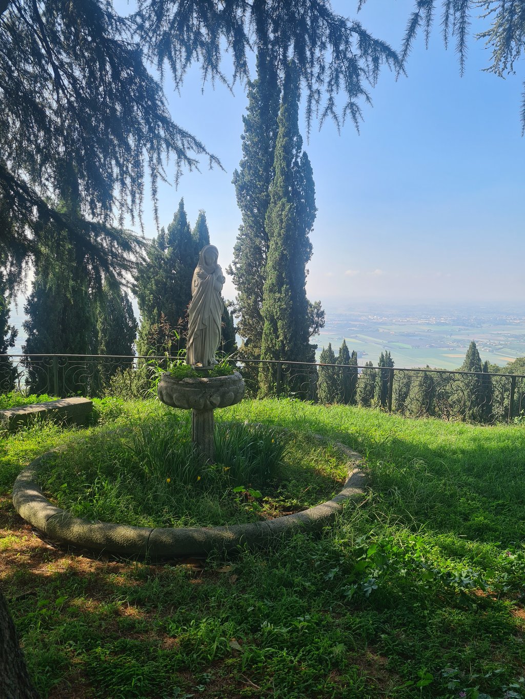
Fifteen tight switchbacks, mainly between trees and with good tarmac at the start and bad at the end. A climb almost constantly above 10%, with fairly prolonged peaks above 15% and very few metres of breathing space. Wonderful views of the surrounding plain at turn 4, turn 10 and from the summit, occupied by a former nursing home.
Monte Ricco is one of the most "rich" climbs of the Euganean Hills: rich in difficulty, rich in suggestion, rich in points of interest.
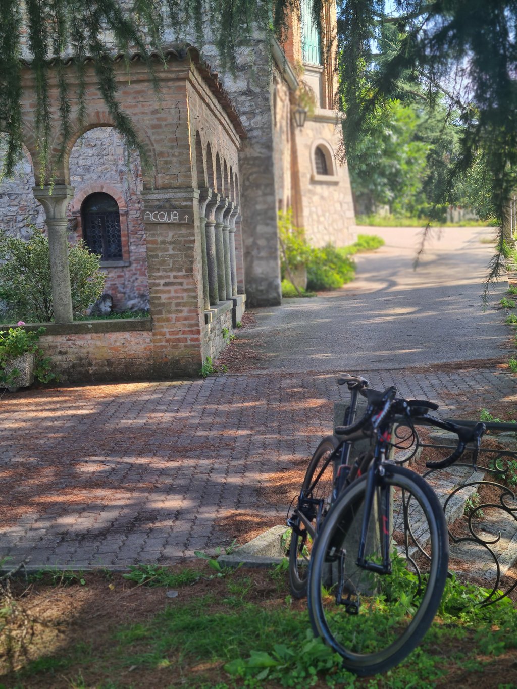
You start from the street behind the Monselice station, and immediately you come to terms with gradients of around 10%. The keystone of the climb is the bar that regulates vehicular transit: pedestrians and cyclists can pass underneath or to the side, but still be careful with each other. It follows that the entire ascent is traffic-free, and one crosses mostly runners, walkers and a few bikers on the numerous mountain bike trails that are alternatives to the road.
The era is tough right from the barrier, and remains hostile for the first five hundred metres. For mnemonic reference, the steepest slopes follow the hairpin bends to the left, those marked by even numbers, while the sections after the hairpin bends to the right are more benign.
After hairpin bend 8, on the other hand, the ascent becomes more constant, and if you no longer encounter vertiginous inclines, you will not even find places to rest until the end.
The arrival at the summit, after the 15th hairpin bend, will be a real relief, except for an asphalt surface that is in poor condition the higher you go.
Be careful on the descent: the steep gradients, the narrow road, the uneven asphalt and the frequent presence of leaves and stones force you to stay on the brakes the whole time.
Along the ascent there are sporadic but beautiful views of the surrounding area, access to the terrace of Hercules from which a beautiful flight of steps starts (clearly this is a walking route), and the company of only non-motorised individuals.
During the week it is easy not to run into anyone and the commitment is a wonderful confrontation with oneself.
Personally, I consider it one of the three or four most beautiful Euganean climbs.
Quindici serrati tornati, principalmente tra gli alberi e con asfalto buono all'inizio e pessimo alla fine. Una salita quasi costantemente sopra il 10%, con punte abbastanza prolungate sopra il 15% e pochissimi metri di respiro. Vedute splendide sulla pianura circostante al tornante 4, al tornante 10 e dalla cima, occupata da una ex casa di cura.
Il Monte Ricco è una delle salite più "ricche" degli Euganei: ricca di difficoltà, ricca di suggestione, ricca di spunti di interesse.
Si parte dalla via dietro la stazione di Monselice e subito si fanno i conti con pendenze intorno al 10%. Il punto di volta della salita è la sbarra che regola il transito veicolare: pedoni e ciclisti possono passare sotto o a lato, ma comunque fare attenzione gli uni con gli altri. Ne segue che tutta l'ascesa è priva di traffico e si incrociano per lo più podisti, camminatori e qualche biker che percorre le numerose piste per mountain bike alternative alla strada.
L'erta è durissima sin dalla sbarra e si mantiene ostile per i primi settecento metri. Per riferimento mnemonico si può considerare che le pendenze maggiori seguono i tornanti verso sinistra, quelli contraddistinti dai numeri pari, mentre i tratti dopo i tornanti verso destra sono più benevoli.
Dopo il tornante 8 la salita si fa invece più costante e se non si incontreranno più inclinazioni da vertigine nemmeno si troveranno fino alla fine tratti dove riposare.
L'arrivo alla vetta, dopo il quindicesimo tornante sarà un vero sollievo, se si esclude un asfalto che più si sale più si trova in cattive condizioni.
Attenzione alla discesa: le forti pendenze, la strada stretta, l'asfalto irregolare e la presenza frequente di foglie e pietre obbliga a stare tutto il tempo con i freni tirati e lo sguardo ben attento.
Lungo l'ascesa si godono sporadiche ma bellissime viste sui territori circostanti, l'accesso alla terrazza di Ercole da cui parte una bellissima scalinata (chiaramente si tratta di percorsi da fare a piedi) e la compagnia di soli individui non motorizzati.
Durante la settimana è facile che non si incroci nessuno e l'impegno sia uno splendido confronto con se stessi.
La considero tra le tre o quattro più belle salite degli Euganei.