Tips nearby


| Hidden gem |
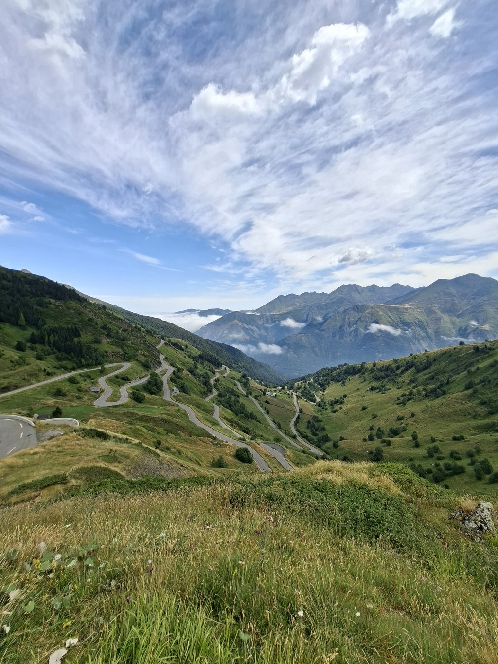
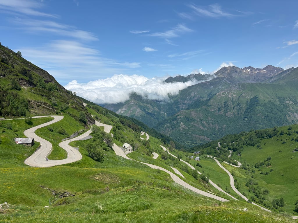
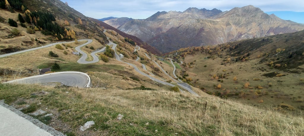
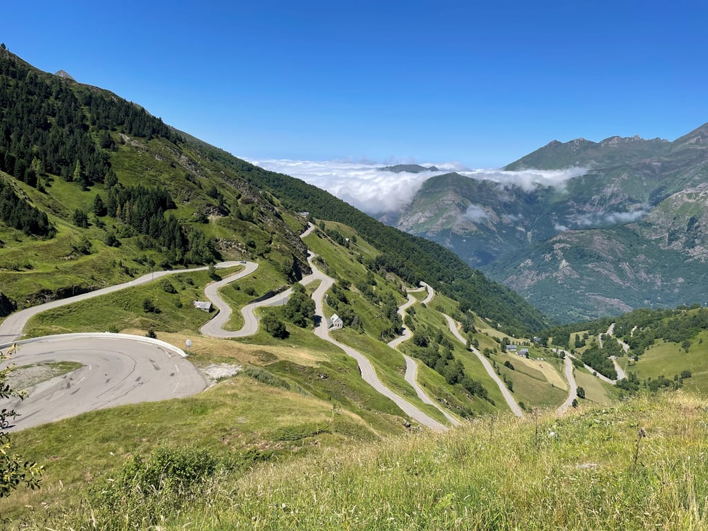
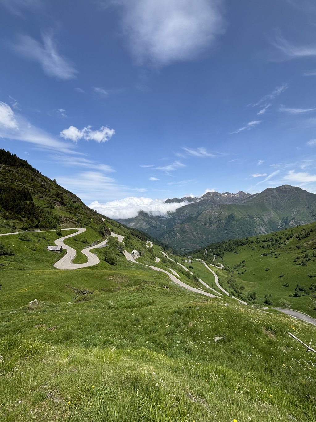
| 11 hairpin turns |
| #28 toughest climb of Occitania |
| #38 most elevation gain of Occitania |
| #29 longest climb of Hautes-Pyrénées |
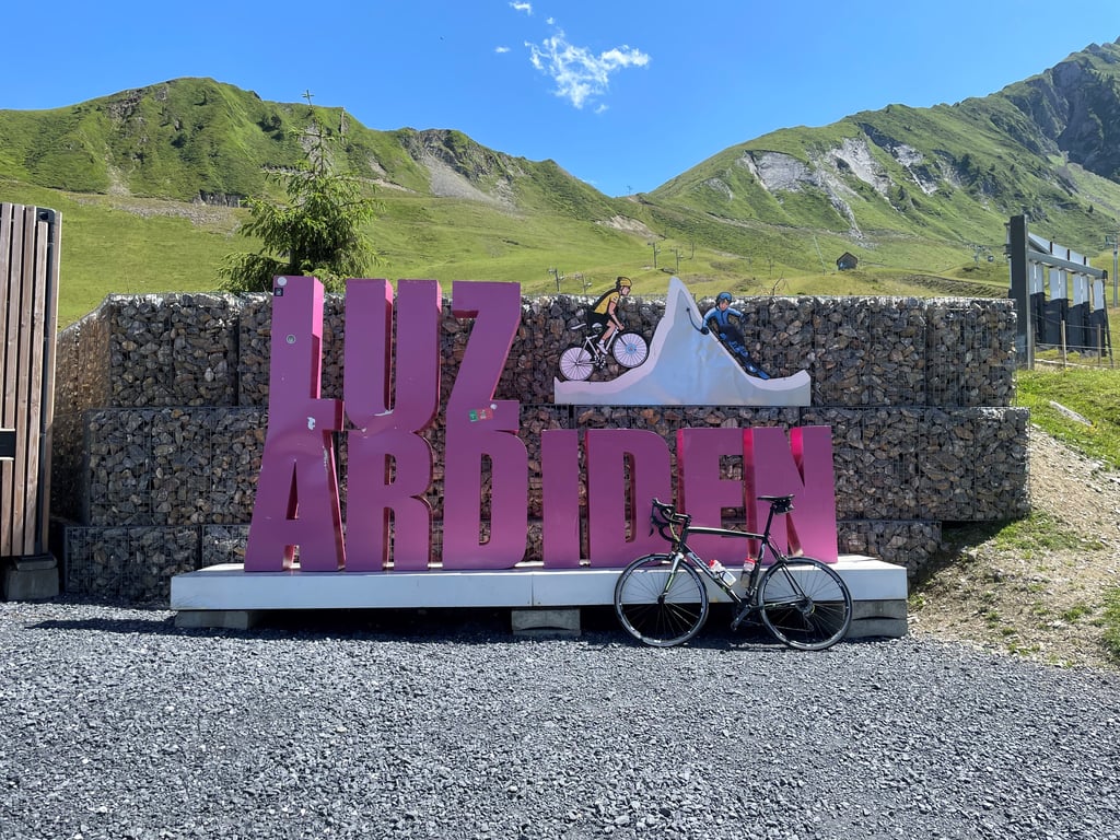
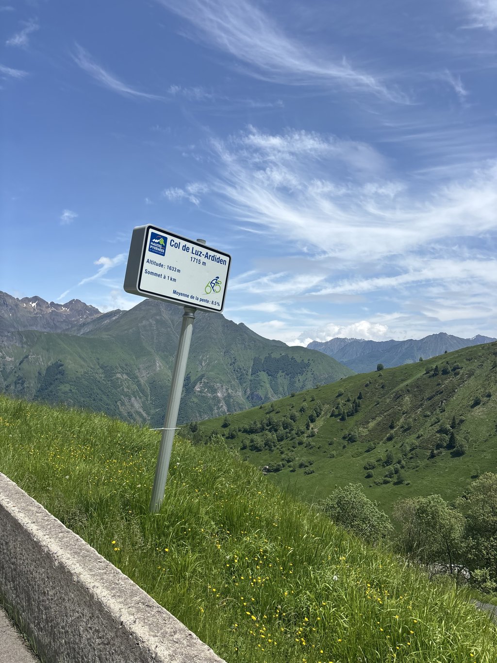
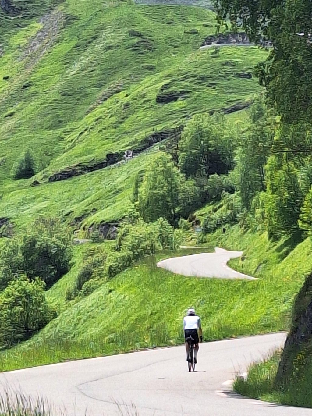
Luz Ardiden from Viscos is a climb in the region Hautes-Pyrénées. It is 14.3 km long and bridges 1089 m of vertical ascent with an average gradient of 7.6%, resulting in a difficulty score of 881. The top of the ascent is located at 1711 m above sea level. Climbfinder users shared 12 reviews of this climb and uploaded 27 photos.
Road names: Route de Viscos, Route d'Éts Cantets, Route de Tournarisse & Route de l'Ardiden
5.0 by patrickbaertThis is an automatic translation, the original language is: Dutch.In addition to the classic Tour climb to Luz Ardiden from Luz St.Sauveur also cycled the hidden unknown northern climbing route with hardly any traffic. Beginning of the climb has only the signpost to the village of Viscos on the main busy road (D921), parallel to the Gave de Gavarnie, coming from Argelès Gazost a few kilometers before Luz St.Sauveur. The first 3 km to the mentioned only village on the route, which we even leave behind and cycle past, is very steep climbing with beautiful pano... read more
Welcome! Please activate your account if you would like to share something. Look for the verification email in your inbox.
If you want to upload your photos, you need to create an account. It only takes 1 minute and it's completely free.
Very nice climb. No traffic. Road is ok for uphill, not for downhill, but tarmac all along, though patchy with potholes at places.
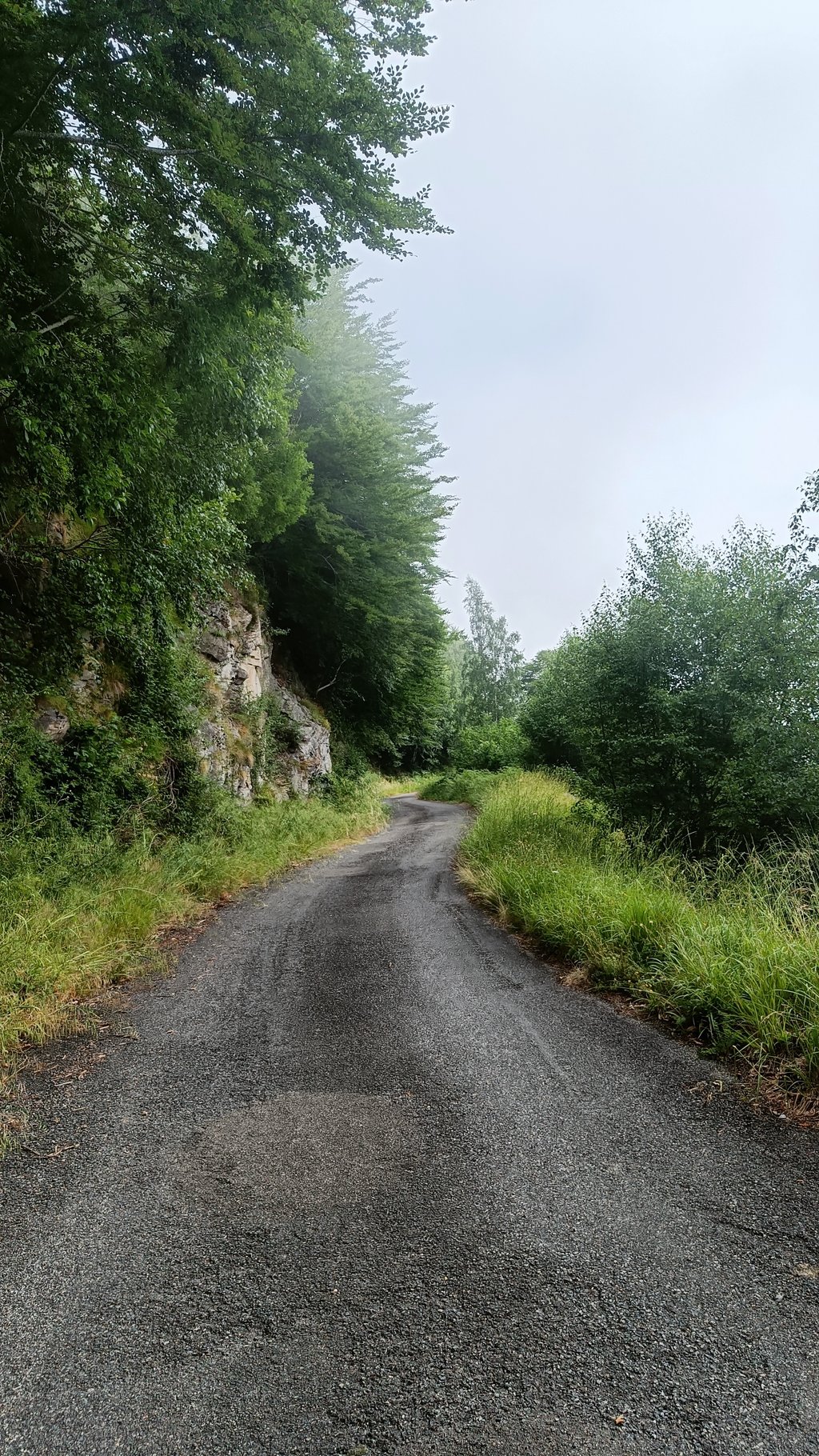
Gaborisse forest road in the village of Viscos
Route forestière de Gaborisse dans le village de Viscos
The advantage is that you're in the shade, there's no traffic and sometimes the view opens up towards the villages of the Toy country. Otherwise you have to slalom between the holes, bumps and layers of gravel, and make the ascent with a sturdy bike... Beautiful plant colours in October.
L'avantage c'est que l'on est à l'ombre, il n'y a pas de circulation et parfois le point de vue se dégage vers les villages du pays Toy. Autrement il faut slalomer entre les trous ,les bosses ,les épaisseurs de graviers, réaliser l'ascension avec un vélo solide... De belles couleurs de végétaux en octobre.
Highly recommended ascent, the descent is best done by the traditional route.
Subida muy recomendable, la bajada es mejor hacerla por la ruta tradicional.
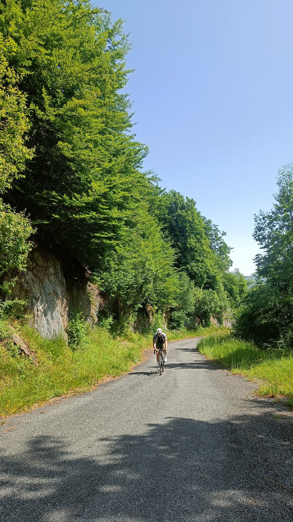
The route Starting in Luz Saint Saveur. Over the main road towards Lourdes. Just before Cheze is a nice alternative. You get off the main road and climb to Cheze, then descend a bit back to start the ascent. Nice route, narrower road, sometimes a car., more in the woods/fog. At the end of the climb you come to the route starting from Luz Saint Saveur. If you have already done the col from that side you can descend or do it again.
De route Beginnen in Luz Saint Saveur. Over de grote weg richting Lourdes. Vlak voor Cheze is een leuk alternatief. Je gaat van de hoofdweg af en klimt naar Cheze, dan afdalen stukje terug om aan de beklimming te beginnen. Leuke route, smaller weggetje, soms een auto., meer in het bos/ mist. Aan het einde van de klim kom je op de route die vanuit Luz Saint Saveur vertrekt. Als je de col vanaf die kant al hebt gedaan kun je afdalen of hem nog een keertje doen.
This is really a shortcut though, which is still suitable for climbing, but for descending I wouldn't do this one. Narrow, bumpy and lots of gravel.
Dit is wel echt een sluiproute die nog wel geschikt is om te klimmen, maar voor het dalen zou ik deze niet doen. Smal, hobbelig en veel grind.
A very nice climb with a nice section of hairpin bends at the beginning and in the final stretch to the top. Recommended to climb Luz Ardiden this way
Een hele mooie beklimming met een mooie sectie van haarspeldbochten aan het begin en in het laatste stuk naar de top. Aanrader om Luz Ardiden op deze manier te beklimmen
Lovely recommendation. A lot quieter and more lovely than the wide asphalt road. Indeed, use that for the descent. Nice change between narrow and steep forest paths in the beginning and beautiful views later in the ascent.
Mooie aanrader. Een stuk rustiger en lieflijker dan de brede asfaltweg. Gebruik die inderdaad voor de afdaling. Leuke afwisseling tussen smalle en stijle bospaden in het begin en mooie vergezichten later in de beklimming.
Was indeed the right choice to do the climb of the Luz Ardiden via Viscos, and via the 'normal route' down again to Luz st. Sauveur. The route up was fine in itself, quiet, hardly any other road users, but not so suitable for a descent. It is a narrow road with occasional moderate road surface, gravel here and there and quite cluttered.
The regular route down, however, was great, a very good and wide road surface, good visibility of oncoming traffic (which, incidentally, was hardly there) so I could make good use of the tarmac in the turns. Nothing to do at the top, but as far as I'm concerned still highly recommend this col !
Was inderdaad de goeie keuze om via Viscos de beklimming van de Luz Ardiden te doen, en via de 'normaalroute' weer omlaag naar Luz st. Sauveur. De route omhoog was op zich prima te doen, rustig, nauwelijks andere weggebruikers, maar niet zo geschikt voor een afdaling. Het is een smalle weg met af en toe een matig wegdek, her en der grind en vrij onoverzichtelijk.
De reguliere route omlaag echter was geweldig, een zeer goed en breed wegdek, goed zicht op tegenliggers (die er overigens nauwelijks waren) dus ik kon goed van het asfalt gebruik maken in de bochten. Boven niets te beleven, maar wat mij betreft toch een aanrader deze col !
Very quiet route on a narrow road. The beginning is very steep and difficult, a steep climb that becomes easier when the route connects with the classic climb. I went via Viscos on the way up but not down, which I found uncomfortable.
Zeer rustige route over een smalle weg. Het begin is direct erg steil en zwaar, pittige klim die wat makkelijker wordt als de route aansluit op de klassieke beklimming. Ik heb de heenweg via Viscos gedaan maar de afdaling niet, dat leek me niet prettig.
Done it today as a descent. So via the classic route up and this one down. You can better do this the other way around. There is still some gravel on the road, especially before and in the curves. It is a beautiful area. So definitely a must to drive up, there is the road well suited. And then via the classic route down.
Deze vandaag gedaan als afdaling. Dus via de klassieke route omhoog en deze naar beneden. Dit kan je beter andersom doen. Er licht nog al wat grind op de weg, vooral voor en in de bochten. Het is wel een prachtige omgeving. Dus zeker een aanrader om omhoog te rijden, daar is de weg prima voor geschikt. En dan via de klassieke route naar beneden.
In addition to the classic Tour climb to Luz Ardiden from Luz St.Sauveur also cycled the hidden unknown northern climbing route with hardly any traffic.
Beginning of the climb has only the signpost to the village of Viscos on the main busy road (D921), parallel to the Gave de Gavarnie, coming from Argelès Gazost a few kilometers before Luz St.Sauveur. The first 3 km to the mentioned only village on the route, which we even leave behind and cycle past, is very steep climbing with beautiful panoramic's on the valley. Then follow dozens of hairpin bends up the mountainside between the woods on a narrow tarmac road in an uninhabited world. At the exit of the forest on a short plateau between km 4 and km 3 of the summit one meets the classic popular Tour climbing route (from Luz St.Sauveur).
Just in time for the famous festival of hairpin bends to the summery deserted ski station (no provisioning), except for the stray sheep.
Only when the two routes converge do the classic bike information signs reappear every few kilometres showing the distance to the summit, the current altitude and the percentage for the next kilometre.
Recommended and an alternative if you want to cycle alone uphill in peace and quiet!
Naast de klassieke Tour beklimming naar Luz Ardiden vanuit Luz St.Sauveur ook de verborgen onbekende noordelijke klimroute met amper verkeer gefietst.
Begin van de klim heeft als enige aanduiding de wegwijzer naar dorpje Viscos op de grote drukke weg (D921) ,parallel met de Gave de Gavarnie, komende vanuit Argelès Gazost enkele kilometers voor Luz St.Sauveur. De eerste 3 km tot het genoemde enige dorpje op de route, dat we zelfs rechts laten liggen en voorbij fietsen, is het zeer steil klimwerk met fraaie panorama's op het dal. Nadien volgen tientallen haarspeldbochten naar omhoog op de bergflank tussen de bossen op een smalle asfaltweg in een onbewoonde wereld. Bij het uitkomen van het bos op een kort plateau tussen km 4 en km 3 van de top komt men samen met de klassieke populaire Tour klimroute (vanuit Luz St.Sauveur).
Net op tijd voor het beroemde prachtige slotfestival van haarspeldbochten naar het zomers uitgestorven skistation (geen bevoorrading),op de loslopende schapen na.
Pas vanaf het samenkomen van de twee routes zijn de klassieke fietsinfobordjes er weer om de kilometer met de afstand tot de top,de actuele hoogte en het percentage van de volgende kilometer.
Aanrader en alternatief als je eens alleen goed bergop wil fietsen in alle rust en kalmte!
| 7 km/h | 02:02:47 |
| 11 km/h | 01:18:08 |
| 15 km/h | 00:57:18 |
| 19 km/h | 00:45:14 |
This page is better in the app