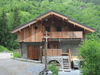
Tips nearby


| Beautiful scenery |
| Hidden gem |
| 12 hairpin turns |
| #66 average steepest climb of Savoie |
La Cour from Bozel is a climb in the region Savoie. It is 7.8 km long and bridges 647 m of vertical ascent with an average gradient of 8.3%, resulting in a difficulty score of 592. The top of the ascent is located at 1533 m above sea level. Climbfinder users shared 5 reviews of this climb and uploaded 19 photos.
Road names: Route de Villemartin, D89a & Chemin dit de L’Achenal
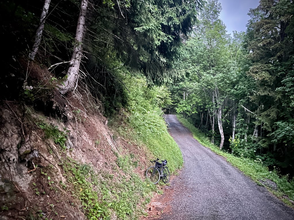
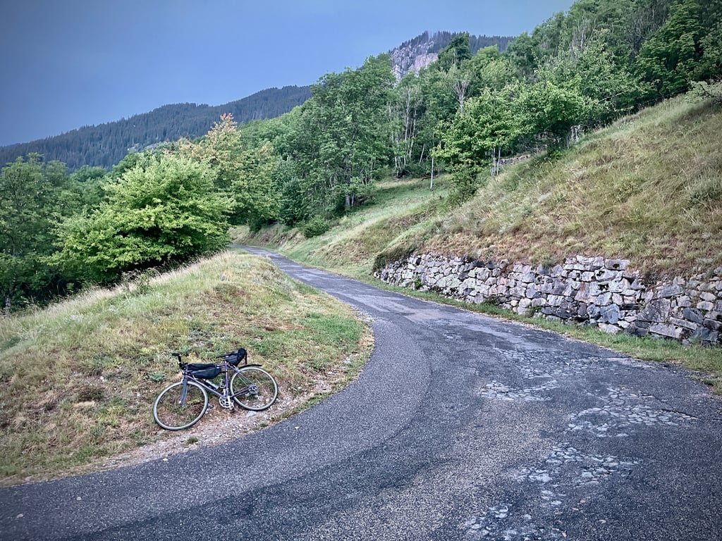
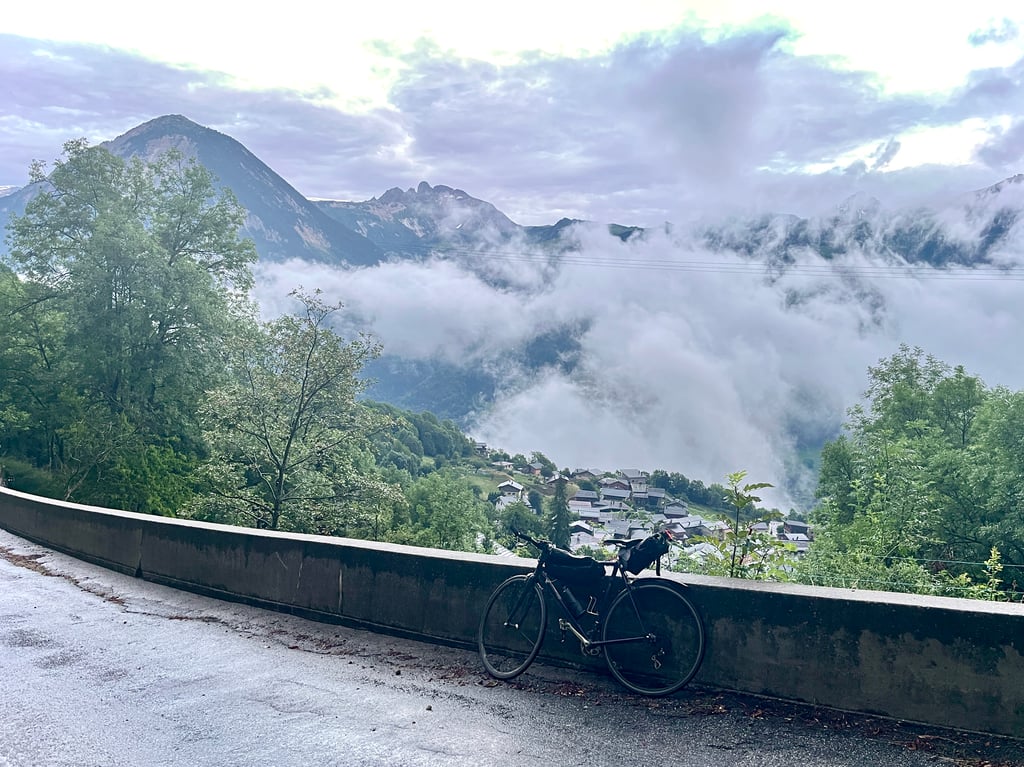
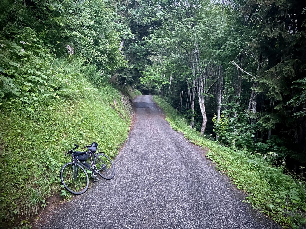
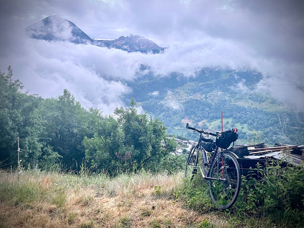
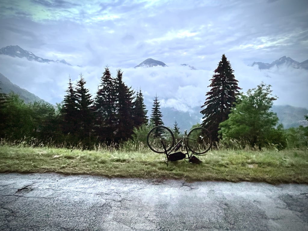
3.0 by CromagnonThis is an automatic translation, the original language is: French.I won’t be much help, nor very accurate, in describing this climb: stuck in Bozel by the storm, I waited for the weather to settle down. The wretch pretended to cooperate before proving to me that she was very much the boss. In short, I climbed in the rain and through a mist that reminds us our skeletons are made up of lots of bones… And then, the sun decided to leave the stage. Rain, fog and night. The road isn’t in very good condition, but it’s nowhere near as dangerous as some colleag... read more
Welcome! Please activate your account if you would like to share something. Look for the verification email in your inbox.
If you want to upload your photos, you need to create an account. It only takes 1 minute and it's completely free.
I won’t be much help, nor very accurate, in describing this climb: stuck in Bozel by the storm, I waited for the weather to settle down. The wretch pretended to cooperate before proving to me that she was very much the boss. In short, I climbed in the rain and through a mist that reminds us our skeletons are made up of lots of bones…
And then, the sun decided to leave the stage. Rain, fog and night.
The road isn’t in very good condition, but it’s nowhere near as dangerous as some colleagues have described – they should really think about putting on a tutu and taking up ice skating.
The gradients are quite steep.
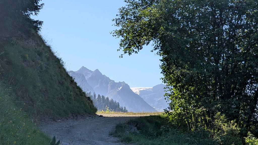
I suppose that behind the clouds, the landscapes had something to say…
What I could make out over the first two kilometres was rather thrilling.
Of course, you don’t tackle this descent at 90km/h, but it goes very smoothly at night on a sodden road.
Je ne serai ni très utile, ni très pertinent pour décrire cette montée : coincé par l’orage à Bozel, j’ai attendu que la nature s’apaise. La garce fit mine de coopérer avant de me prouver qu’elle était bien la patronne. Bref, je suis monté sous la pluie et dans une brume qui nous rappelle que notre squelette est constitué de beaucoup d’os…
Et puis, ensuite, le soleil a décidé de quitter la scène. Pluie, brouillard et nuit.
La route n’est pas en très bon état, mais bien loin d’être aussi dangereuse que décrite par certains collègues qui devraient songer à enfiler un tutu et se mettre au patin à glace.
Les pourcentages sont assez soutenus.
Je suppose que derrière les nuages, les paysages avaient des choses à dire…
Ce que j’ai pu en voir sur les deux premiers kilomètres était plutôt emballant.
Bien entendu, cette descente ne se fait pas à 90km/h mais, elle se passe très bien de nuit sur une route détrempée.
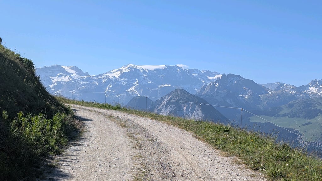
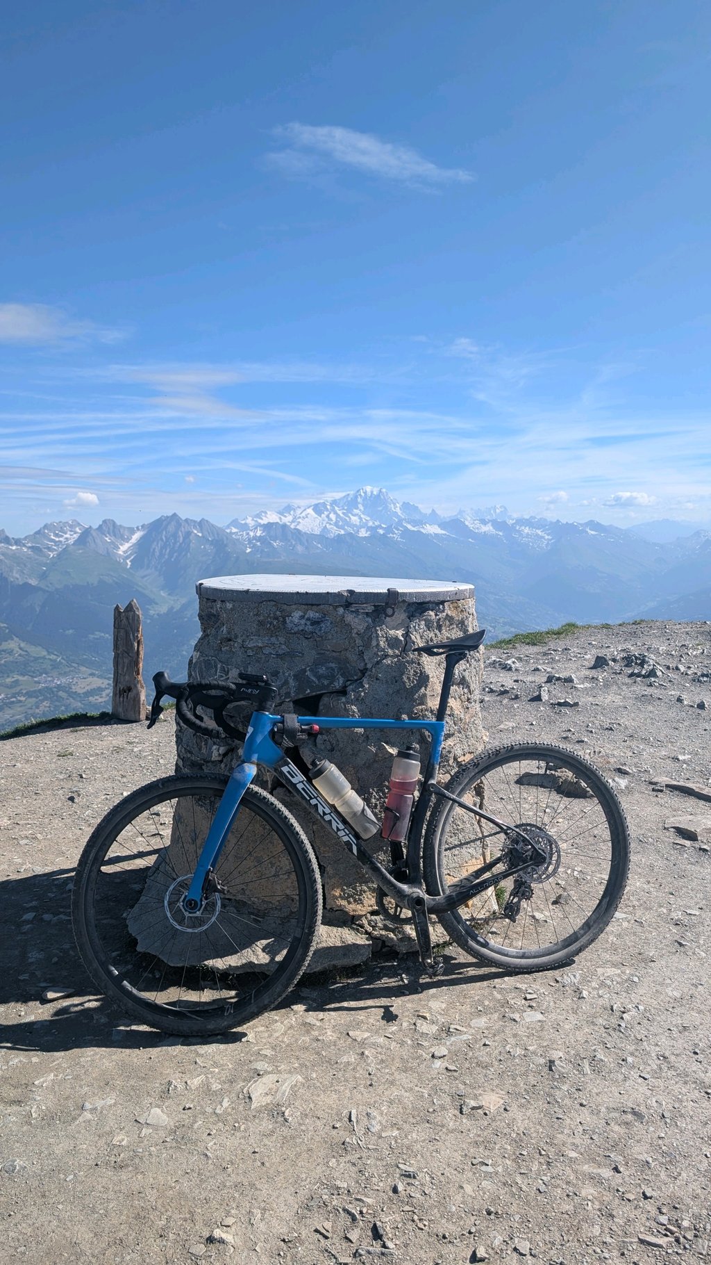
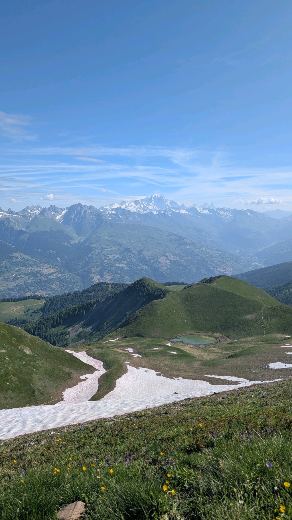
I’d give this climb five stars, but only if you carry on all the way to the summit of Mont Jovet on unpaved terrain. It’s mostly fine on a gravel bike (not a road bike!), though the last 1.5 km are (steep) footpaths, which are probably just about manageable on a mountain bike, but on a gravel bike you’ll have to walk now and then. But the 360-degree view from the summit is well worth the effort – it’s absolutely fantastic! Do be prepared to get thoroughly shaken up on the descent. 😁 And make sure you’re riding tubeless, otherwise you’re asking for a puncture.
Ik geef vijf sterren voor deze klim, maar dan wel voor het helemaal onverhard doortrekken tot de top van Mont Jovet. Dat kan grotendeels prima met de gravelbike (niet met de racefiets!), alleen de laatste 1,5km zijn (steile) wandelpaden, die met de mtb waarschijnlijk net te doen zijn, maar met de gravelbike zal je af en toe moeten lopen. Maar het 360 graden uitzicht op de top is alle moeite waard, want echt fantastisch! Bereid je wel voor om in de afdaling lekker door elkaar gerammeld te worden. 😁 En zorg dat je tubeless rijdt, anders is het vragen om stootlek.
What a bummer you think 2nd category that shouldn't be a problem but it's raking uphill. Constant high percentages with bad tarmac. Endlessly until you encounter a very steep section and then suddenly you see the sign la cour!!! Descending is heavily crappy very bumpy.
Wat een onding je denkt 2e categorie dat moet geen probleem zijn maar het is harken naar boven. Constante hoge percentages met slecht asfalt. Eindeloos tot je een heel steil stuk tegenkomt en dan zie je plots het bordje la cour!! Dalen is zwaar klote heel hobbelig.
Nice climb over very bad road surface. Up is fine, but you must also go down and then it is annoying, if not dangerous. If you 've grabbed the unpaved' piece up, do not forget to go straight on the descent over the 'ordinary' road :-)
Yet I recommend the climb, because beautiful scenery, beautiful view of Courchevel and the climb is nice and spicy :-)
Mooi klim over heel slecht wegdek. Omhoog is dat prima te doen, maar je moet ook weer naar beneden en dan is het vervelend, zo jiet gevaarlijk. Als je het 'onverharde' stukje omhoog hebt gepakt, vergeet dan niet om bij de afdaling rechtdoor over de 'gewone' weg te gaan :-)
Toch raad ik de klim aan, want prachtige omgeving, mooi zicht op Courchevel en de klim is lekker pittig :-)
Done on Saturday 10 July 2021
The route I took in its first part is different from the Climbfinder map because the 2 route planners I use indicate a 513M unpaved passage.
Despite this, the difficulty of the climb remains the same because the steepest parts are found on the final part.
I have attached a map of my route with the route normally used on Climbfinder highlighted in yellow, but you can see that the last part is dotted and therefore not tarred.
Start from Bozel (by the lake for the practical side) for the warm up it's short because the slope starts right away, otherwise you have to turn your legs in the village.
At the roundabout take the D89 direction Villemartin, the slope is very strong from the beginning but it calms down quickly to find correct but sustained percentages around 7-8 %
After a few kilometers let the D89 go to Montagny and in a bend to the right follow the D89A to the village of Villemartin.
2 options are available, either you take on the right at the entrance of the village direction la Cour, or you cut in a straight line (as on my route) to find the road of la Cour, be careful it's very-very steep.
Then the road narrows and the asphalt is not in very good condition but passable in road bike.
The percentages reach 9 to 12 % during 4,5KM, 500M before the Court a passage to 14 %.
You can push to the end of the road, there is about 1Km left after the village.
In summary: A good little climb, quite steep in its second part, to do if you are on holiday in the area and with suitable gear ratios.
In summer, preferably in the middle of the morning because it is relatively cool in the morning.
Have a good ride and be careful
Fait le samedi 10 juillet 2021
La route que j’ai empruntée dans sa première partie est différente de celle de la carte de Climbfinder car les 2 planificateurs d’itinéraires que j’utilise indiquent un passage non goudronné de 513M.
Malgré cela la difficulté de l’ascension reste identique car on retrouve les passages les plus pentus sur le final.
J’ai joint la carte de mon parcours avec surligné en jaune la route normalement empruntée sur Climbfinder, mais vous voyez que la dernière partie est en pointillée donc non goudronnée.
Départ de Bozel ( au bord du lac pour le côté pratique ) pour l’échauffement c’est court car la pente commence de suite, sinon il faut tourner les jambes dans le village.
Au rond point prendre La D89 direction Villemartin, la pente est très forte dès le départ mais ce calme rapidement pour retrouver des pourcentages corrects mais soutenus aux alentours de 7-8 %
Au bout de quelques kilomètres laissez filer la D89 qui va sur Montagny et dans un lacet à droite suivre la D89A jusqu’au village de Villemartin.
2 options se présentent, soit vous prenez à droite à l’entrée du village direction la Cour, soit vous coupez en ligne droite ( comme sur mon parcours ) pour retrouver la route de la Cour, attention c’est très-très pentu.
Ensuite la chaussé se rétrécie et le bitume n’est pas en très bon état mais praticable en vélo de route.
Les pourcentages atteignent 9 à 12 % pendant 4,5KM, 500M avant la Cour un passage à 14 %.
On peut pousser jusqu’au bout de la route, il reste environ 1Km après le village.
En résumé : Une bonne petite ascension, bien raide dans sa seconde partie, à faire si vous êtes en vacances dans le coin et avec des braquets adaptés.
En été, de préférence en milieu de matinée car il y fait relativement frais le matin.
Bonne route et prudence
| 7 km/h | 01:06:47 |
| 11 km/h | 00:42:30 |
| 15 km/h | 00:31:10 |
| 19 km/h | 00:24:36 |
This page is better in the app