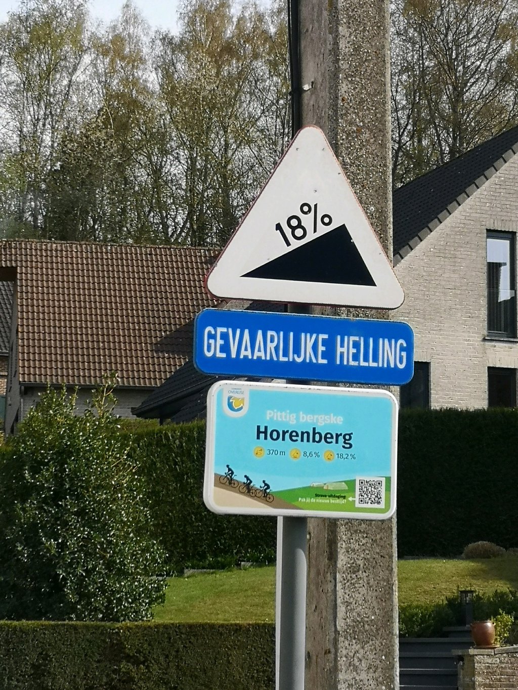
Horenberg from Eizer is a climb in the region Druivenstreek. It is 0.4 km long and bridges 31 m of vertical ascent with an average gradient of 7.9%, resulting in a difficulty score of 38. The top of the ascent is located at 99 m above sea level. Climbfinder users shared 9 reviews of this climb and uploaded 3 photos.
Road name: Horenberg
4.0 by darioducheneThis is an automatic translation, the original language is: Dutch.It’s a short climb, but don’t be fooled. It’s very steep and you’ll need to grit your teeth for a bit.... read more
Welcome! Please activate your account if you would like to share something. Look for the verification email in your inbox.
If you want to upload your photos, you need to create an account. It only takes 1 minute and it's completely free.
It’s a short climb, but don’t be fooled. It’s very steep and you’ll need to grit your teeth for a bit.
Korte klim, maar verras je niet. Deze is zeer steil en moet je even op doorbijten
A short climb, but with a hugely steep section of 150 metres where you have to be careful not to raise your front wheel. Great to combine with the Bekestraat!
Een korte klim, maar wel met een enorm steil stuk van 150 meter waarop je moet uitkijken dat je voorwiel niet omhoog komt. Prima te combineren met de Bekestraat!
The steepest stretch is somewhat hidden behind the curve but does not lie. Worth looking up.
Het steilste stuk zit wat verscholen achter de bocht maar liegt niet. De moeite waard om op te zoeken.
Very nice climb, very steep but short, which was used a few years ago during the Belgian road championships, the finish of which was in Tervuren
Très belle ascension, très raide mais courte, qui a été empruntée il y a quelques années durant le championnat de Belgique sur route dont l'arrivée était jugée à Tervuren
I discovered this coast while I was following the 2015 Belgian championship (won by Preben Van Hecke) on TV, which took place in Tervuren. I went there in the following days to get an idea "in situ". It is indeed very steep, but its very short length makes it quite easy to negotiate for a sprinter. The road is not in very good condition and could use a little facelift.
Côte que j'ai découverte alors que je suivais à la télévision le parcours du championnat de Belgique 2015 (gagné par Preben Van Hecke) qui se déroulait à Tervuren. J'y suis allé dans les jours qui suivent pour me faire une idée « in situ ». Si en effet elle est très raide, sa très faible longueur la rend assez facilement négociable pour un sprinter. La chaussée n'est pas en très bon état et mériterait un petit lifting.
Short but very steep. Almost as steep as the Bekestraat (which also starts in Eizer, but leaves the valley on the other side). The only difference with the Bekestraat is that there are no cobble stones, and that there are a bit less cyclists. But it's worth a visit if you like it steep.
Kort maar pokkesteil. Bijna even steil als de Bekestraat (die ook in Eizer begint, maar langs de andere kant de vallei uit gaat). Het enige verschil met de Bekestraat is dat er geen kasseien liggen, en dat er net iets minder wielertoeristen zijn. Maar sowieso de moeite voor wie van steil houdt.
Short and very steep, not easy at the top of the slope, but you can still get back on the top
Courte et très pentue pas facile au plus fort de la pente mais on peut encore relancer sur le sommet
Short but very intense climb, especially as we start without momentum. The setting is beautiful, the road is very good but it is still very hard!
Montée courte mais très intense, d'autant plus qu'on démarre sans élan. Le cadre est beau, la route est très bonne mais cela reste très dur !
Short and steep like so many other climbs in this area.
The road is quiet and there is a good layer of asphalt.
First it gets steeper and then the climb flattens out. That nasty runner can be used to speed up if you have some energy left.
Kort en steil zoals zoveel beklimmingen in de deze buurt.
De weg is rustig en er ligt een goed laagje asfalt.
Het wordt eerst steil en daarna vlakt de klim af. Die nare naloper kan mooi worden gebruikt om te versnellen als je nog wat energie over hebt.
| 7 km/h | 00:03:23 |
| 11 km/h | 00:02:09 |
| 15 km/h | 00:01:34 |
| 19 km/h | 00:01:14 |
This page is better in the app