| Beautiful scenery |
| Hidden gem |
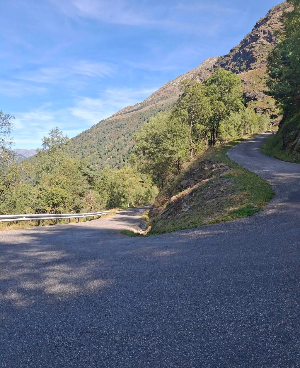
| 6 hairpin turns |
| #55 toughest climb of Occitania |
| #87 most elevation gain of Occitania |
| #100 longest climb of French Pyrenees |
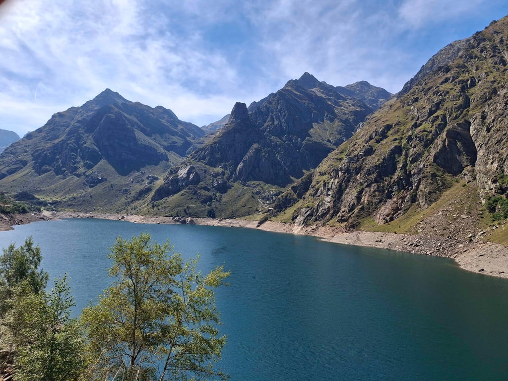
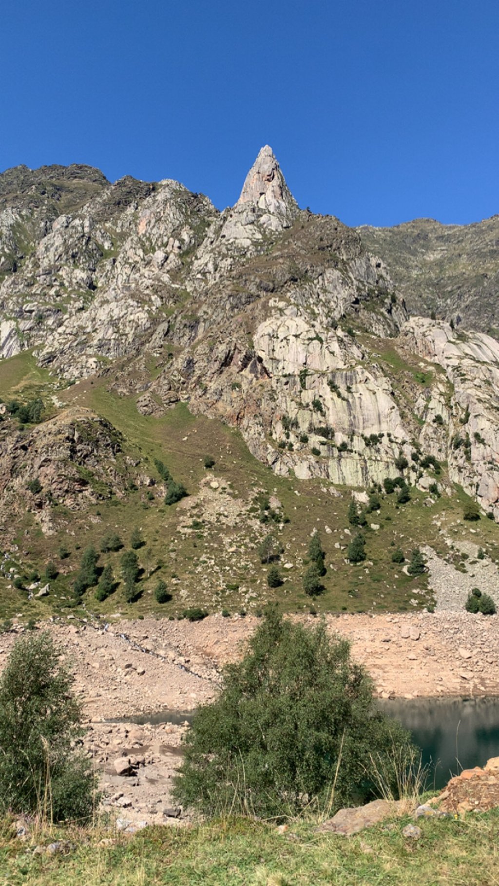
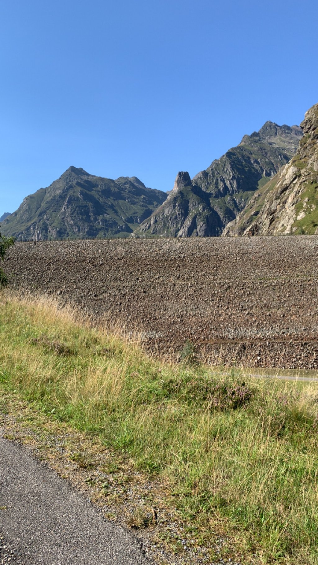
Étang de Soulcem from Auzat is a climb in the region Ariège. It is 14.6 km long and bridges 887 m of vertical ascent with an average gradient of 6.1%, resulting in a difficulty score of 747. The top of the ascent is located at 1592 m above sea level. Climbfinder users shared 4 reviews of this climb and uploaded 7 photos.
Road name: D8
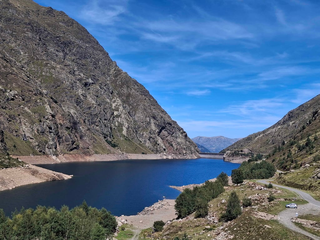
5.0 by LouisCaThis is an automatic translation, the original language is: French.The last 3 kilometres are steep, but there are already some difficult sections before that, as the first part of the climb is uneven. The road is narrow but in good condition, and I climbed it on a weekday in September so there wasn't much traffic. Once you reach the top (lake dam), you have to continue for 2.5km to the end of the road to get a better view of the lake. And if you're on a mountain bike or a gravel bike, you can then follow the track (quite steep and rocky on the first ... read more
Welcome! Please activate your account if you would like to share something. Look for the verification email in your inbox.
If you want to upload your photos, you need to create an account. It only takes 1 minute and it's completely free.
The last 3 kilometres are steep, but there are already some difficult sections before that, as the first part of the climb is uneven. The road is narrow but in good condition, and I climbed it on a weekday in September so there wasn't much traffic.
Once you reach the top (lake dam), you have to continue for 2.5km to the end of the road to get a better view of the lake.
And if you're on a mountain bike or a gravel bike, you can then follow the track (quite steep and rocky on the first part) to continue up the Soulcem valley, where the views are splendid. This trail was created in the 1980s with a view to building a road and tunnel to Andorra, but the project was abandoned.
Les 3 derniers kilomètres sont raides, mais il y a déjà des passages difficiles avant, car la première partie de montée est irrégulière. Route étroite mais en bon état, je l'ai montée un jour de semaine en septembre donc la circulation n'était pas très importante.
Arrivé au sommet (barrage du lac), il faut continuer 2,5km jusqu'à la fin de la route pour profiter d'une meilleure vue sur le lac.
Et si vous êtes en VTT ou Gravel, vous pouvez ensuite suivre la piste (assez raide et caillouteuse sur la première partie) pour continuer à remonter la vallée de Soulcem, les vues y sont splendides. Cette piste a été créée dans les années 1980 en vue de la construction d'une route et d'un tunnel vers Andorre, mais le projet avait été abandonné.
Nice road, narrow on the last 4 km. Steep gradient generally with many sections over 10%. Lots of cars on the climb
Belle route, étroite sur les 4 derniers km. Pente raide de manière générale de nombreux passage au delà des 10%. Beaucoup de voitures sur la montée
Nice climb.
Uneven on the first part, then steep before the dam.
Descent on the same narrow road, watch out for oncoming traffic.
Belle montée.
Irrégulière sur la première partie puis raide avant le barrage.
Descente sur la même route, étroite, attention aux voitures en sens inverse
The last 4 kilometres are tough, but once you reach the dam you'll be rewarded, especially if you continue to the end of the road'2-3 kilometres of flat and one last short climb, the scenery is splendid. The starting point for many hikes.
Les 4 derniers kilomètres sont durs mais arrivés au barrage vous serez récompensés, surtout si vous poursuivez jusqu'au bout de la route, 2-3 kilomètres de plat et une dernière petite côte, le paysage est splendide. Départ de nombreuses randonnées.
| 7 km/h | 02:04:54 |
| 11 km/h | 01:19:29 |
| 15 km/h | 00:58:17 |
| 19 km/h | 00:46:01 |
This page is better in the app