Tips nearby


| Beautiful scenery |
| Hidden gem |
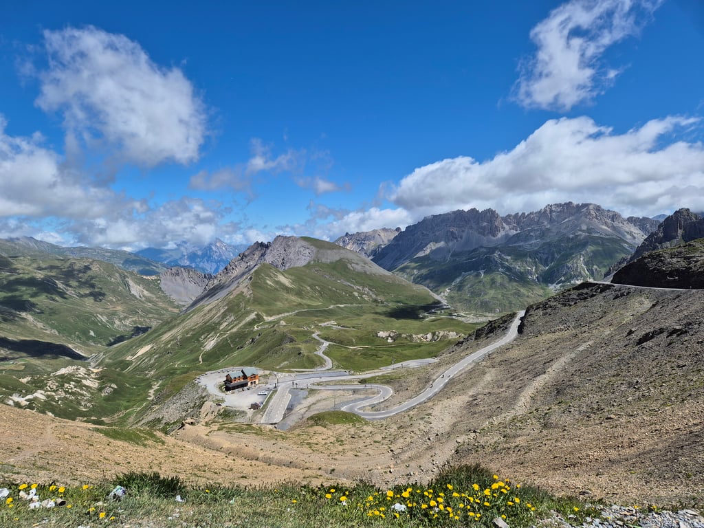
| 14 hairpin turns |
| #97 toughest climb of Auvergne-Rhône-Alpes |
| #75 most elevation gain of Auvergne-Rhône-Alpes |
| #52 longest climb of Savoie |
| #60 average steepest climb of La Maurienne |
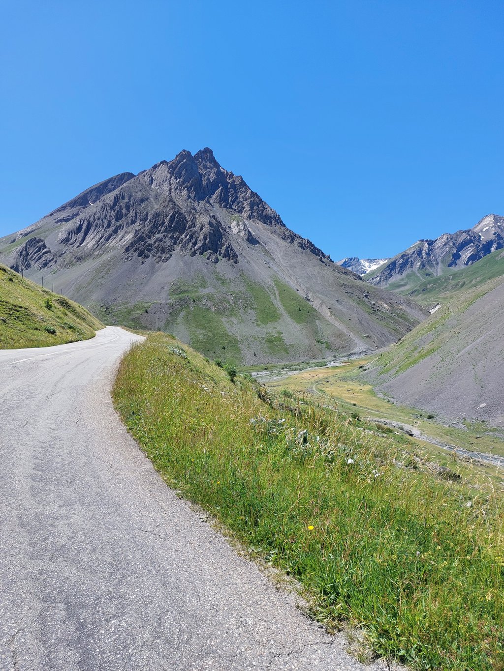
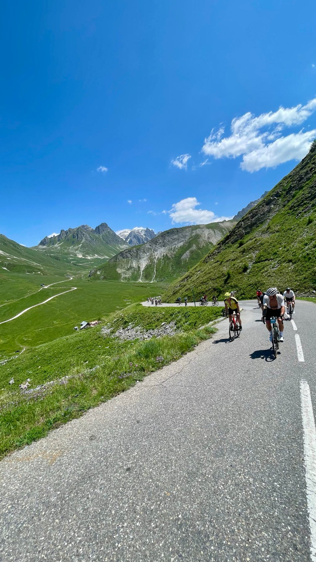
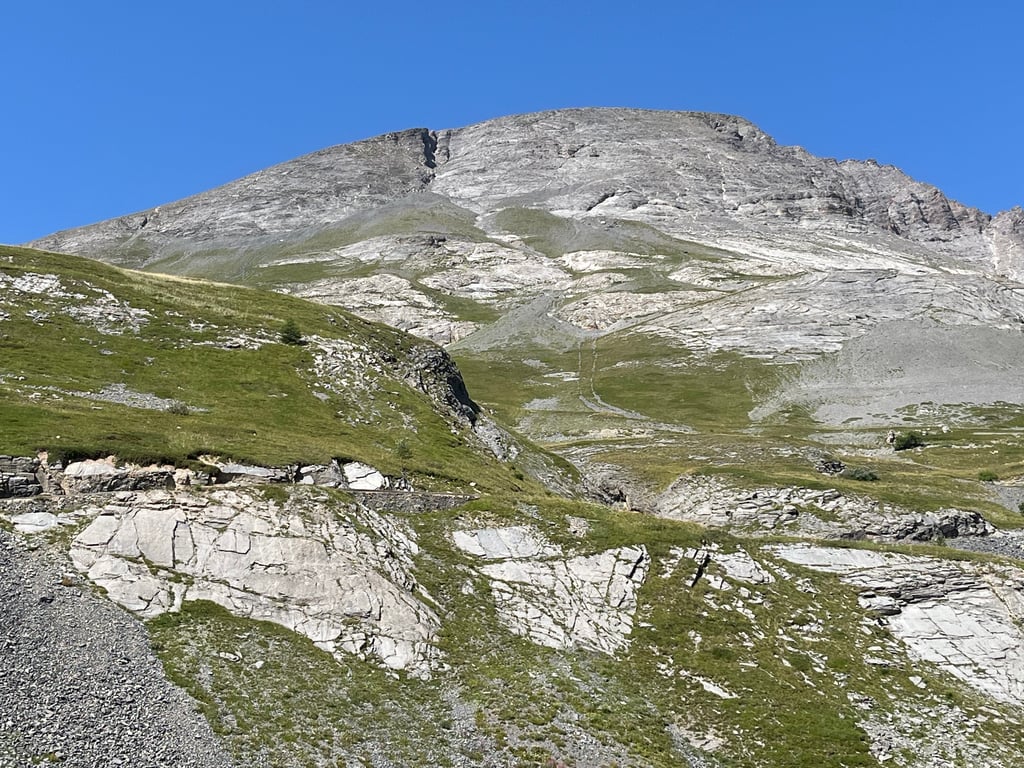
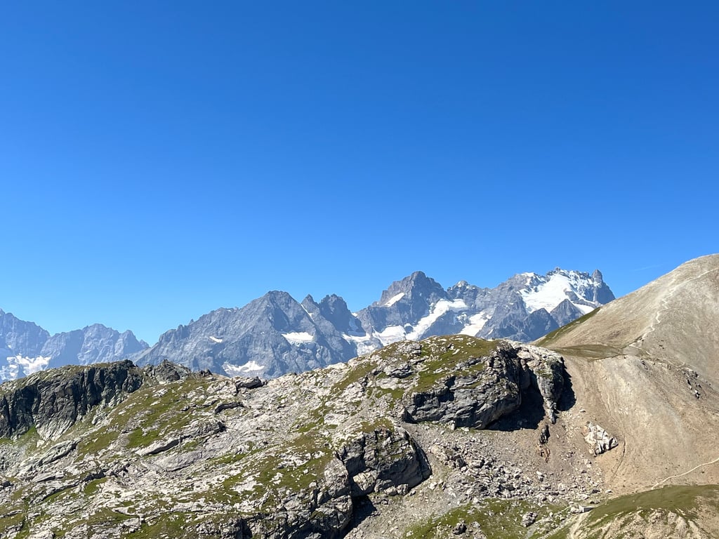
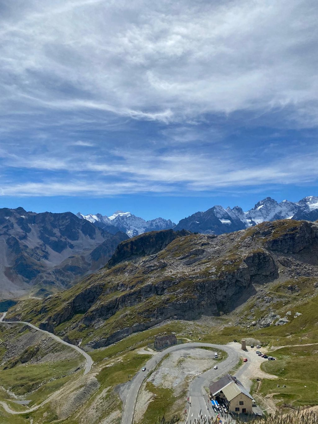
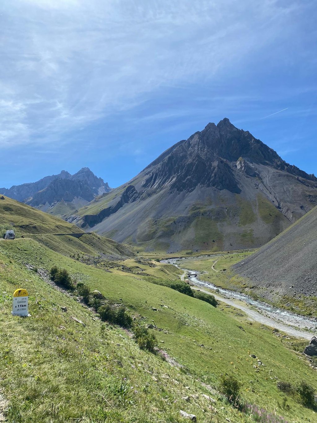
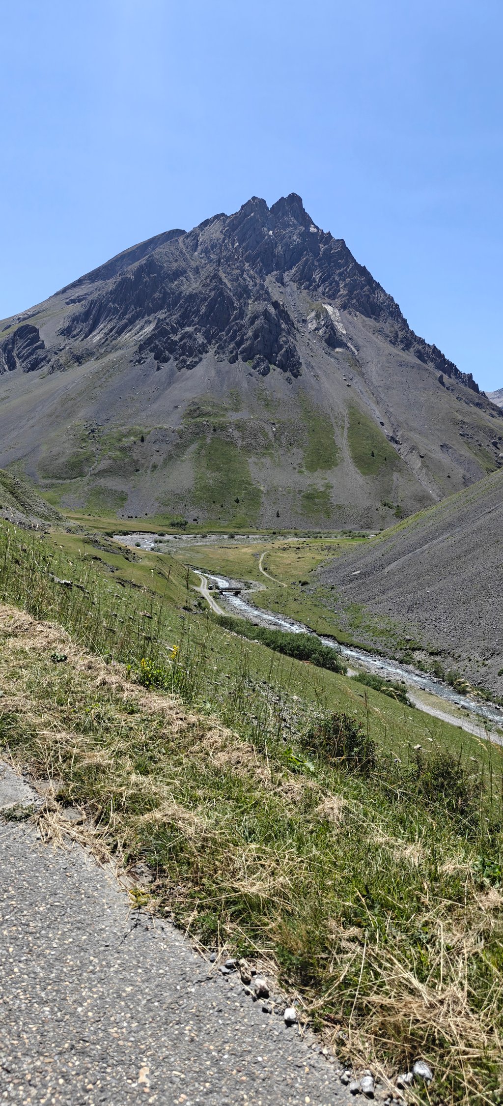
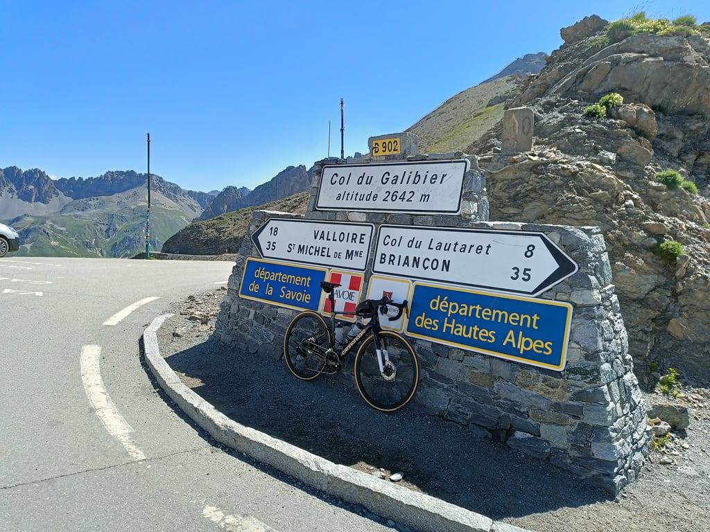
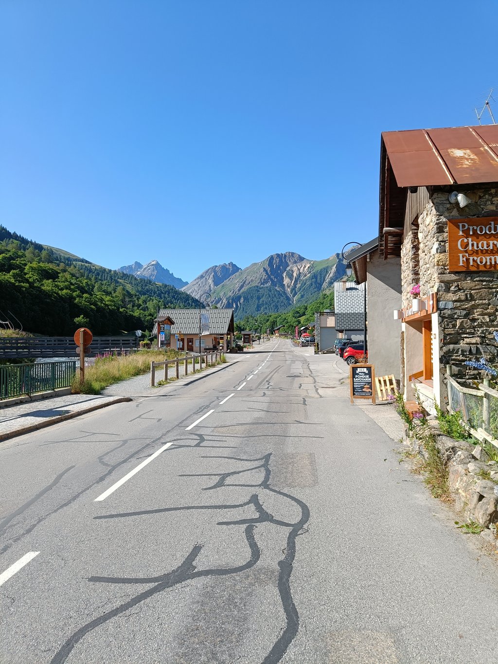
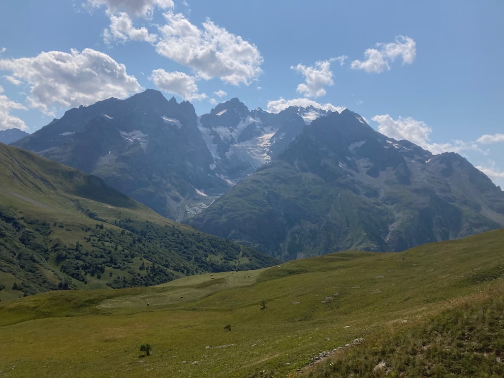
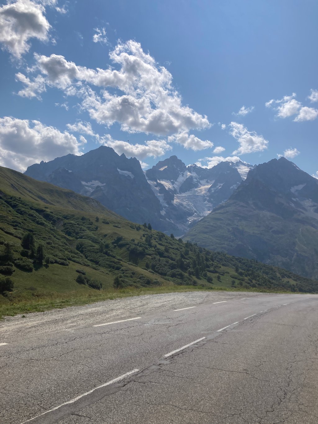
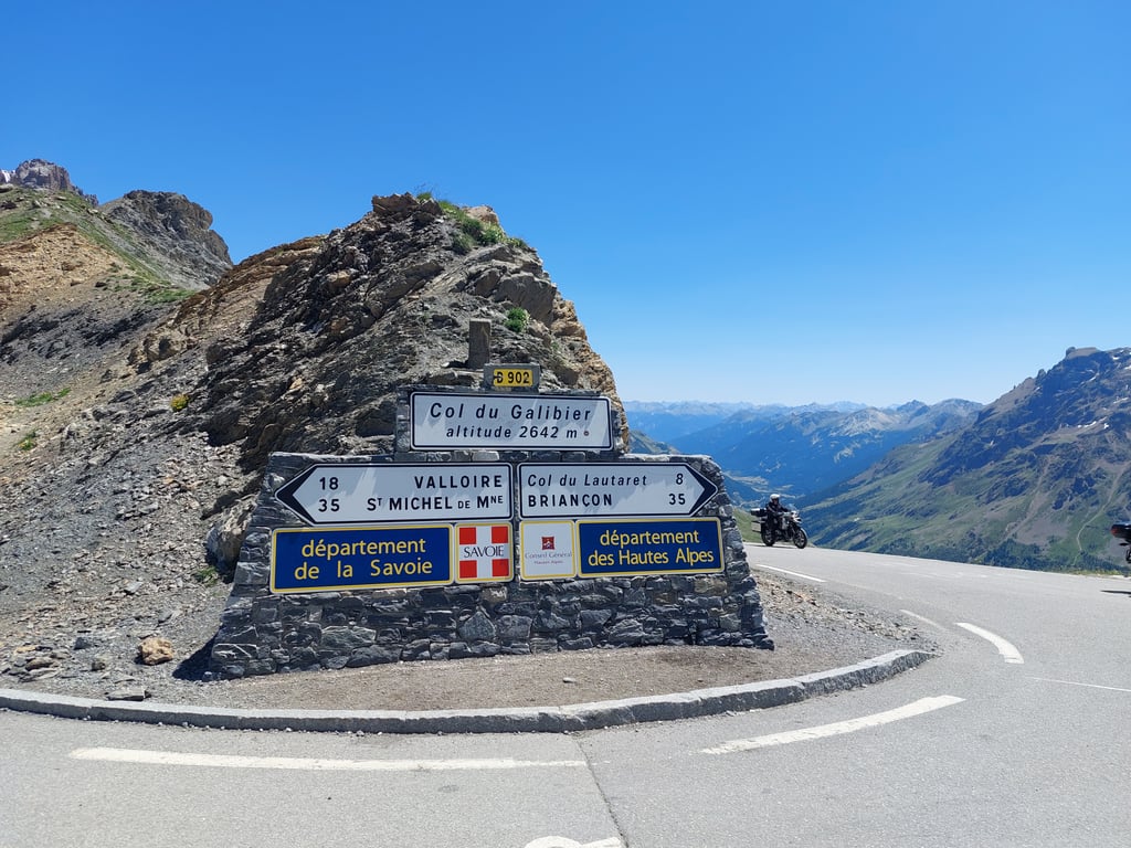
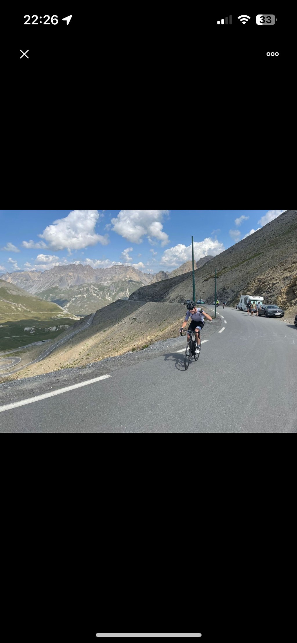
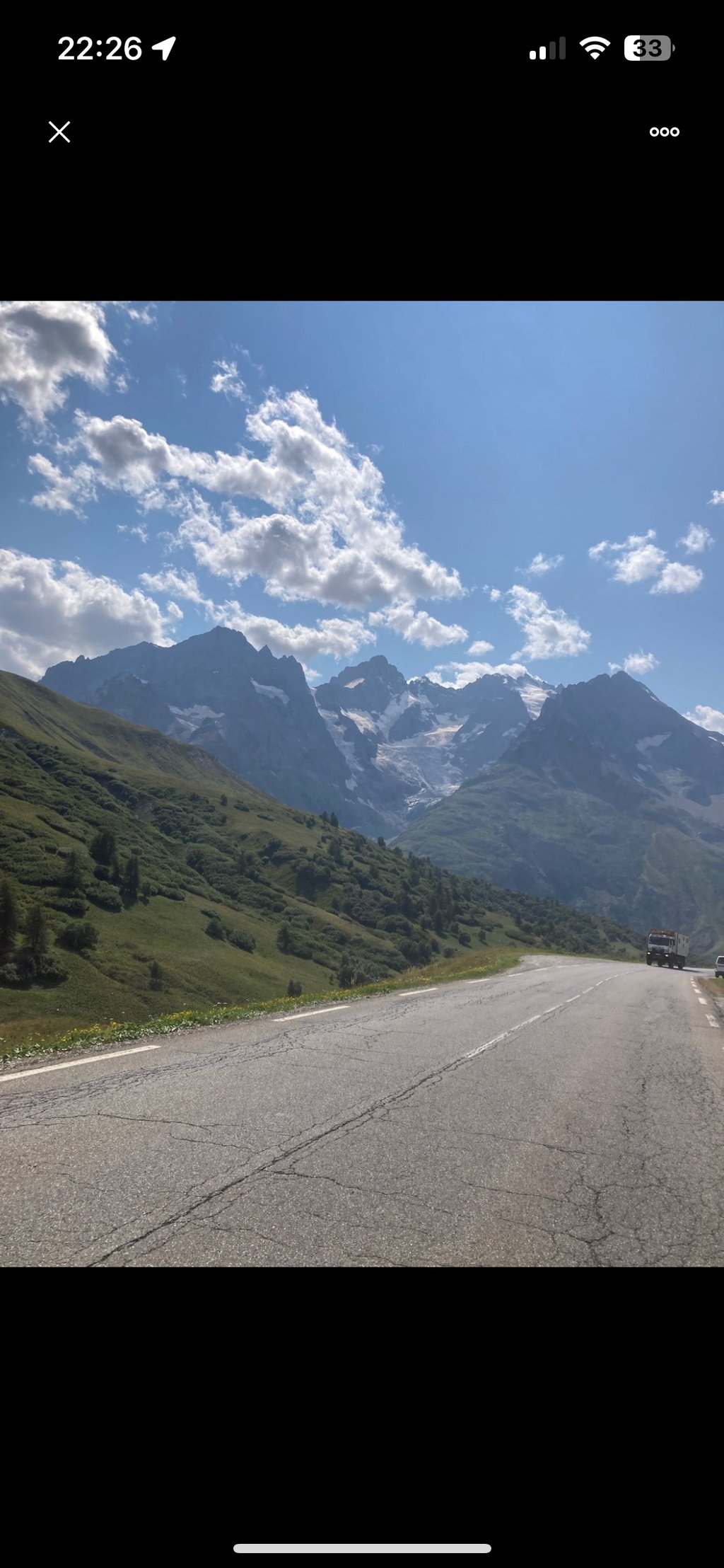
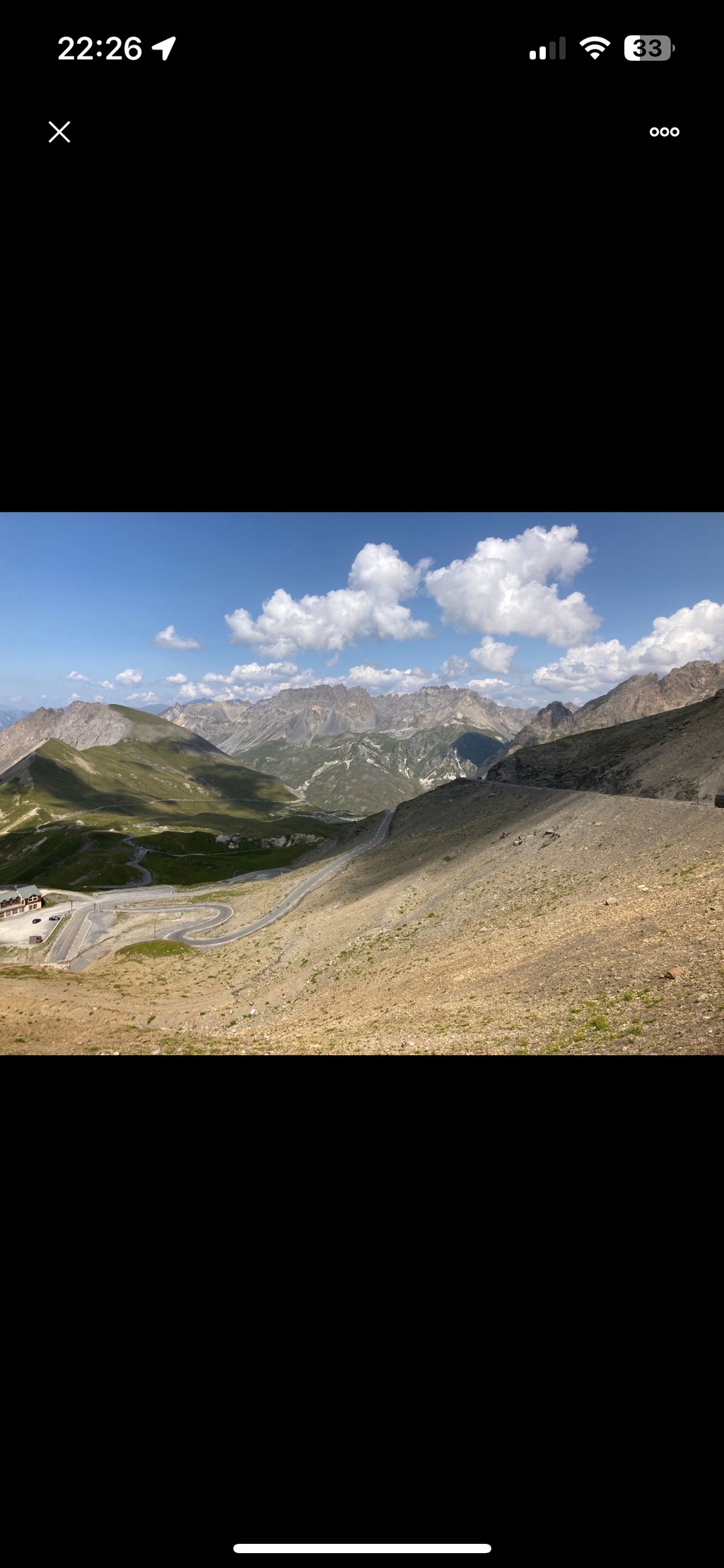
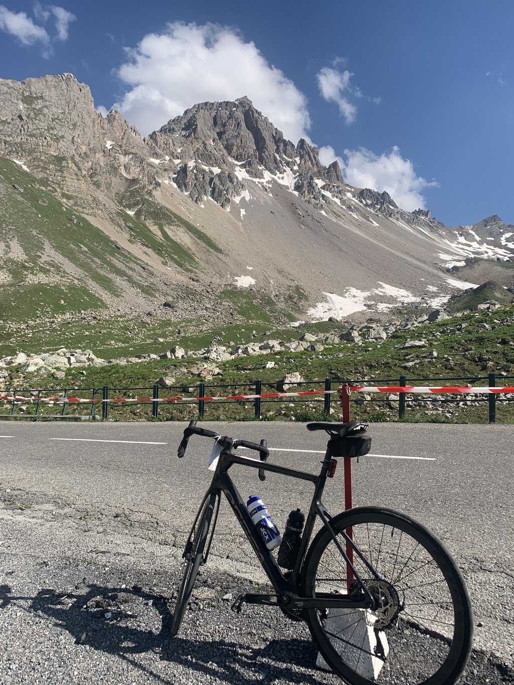
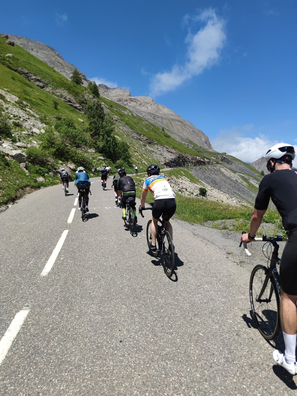
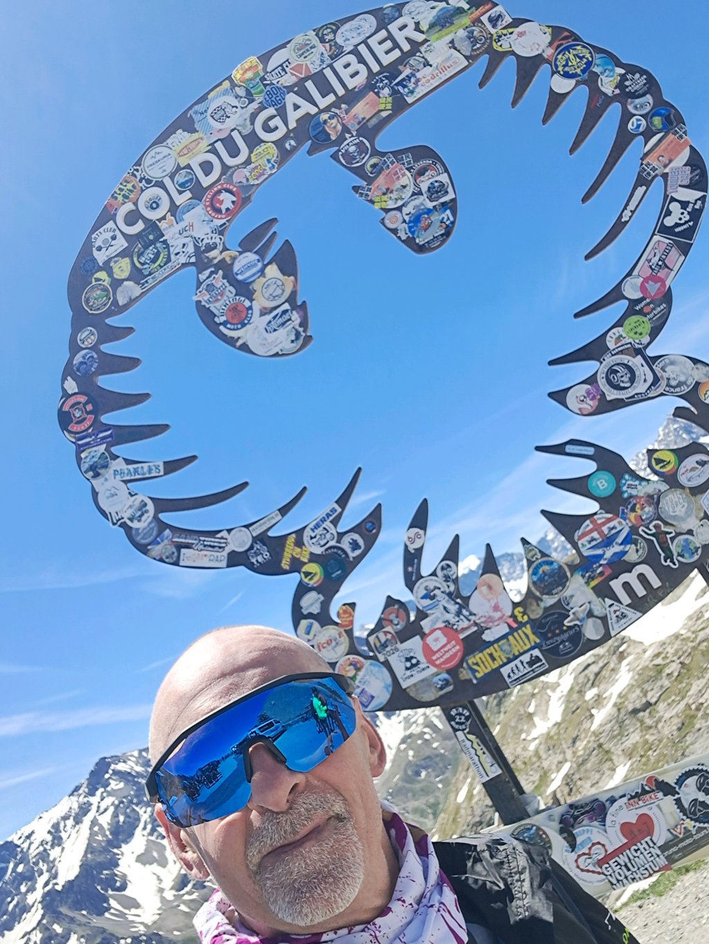
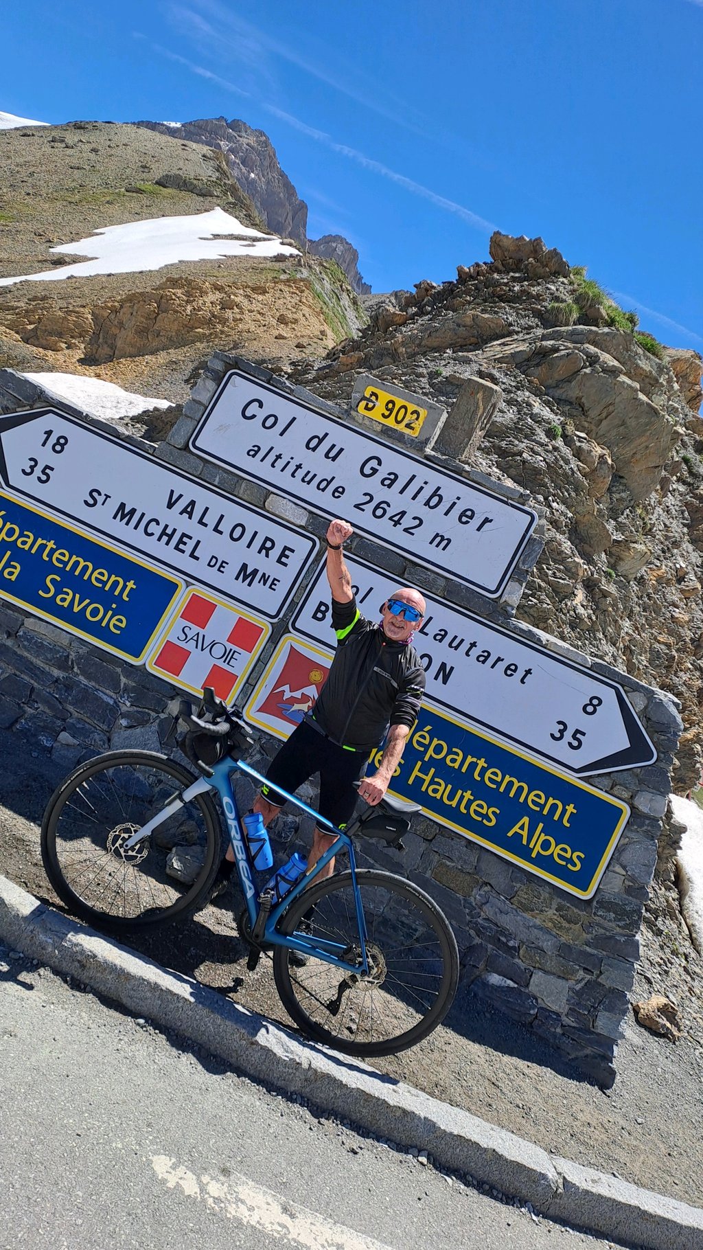
Col du Galibier from Valloire is a climb in the region La Maurienne. It is 17.5 km long and bridges 1213 m of vertical ascent with an average gradient of 6.9%, resulting in a difficulty score of 933. The top of the ascent is located at 2642 m above sea level. Climbfinder users shared 20 reviews of this climb and uploaded 68 photos.
Road name: D902
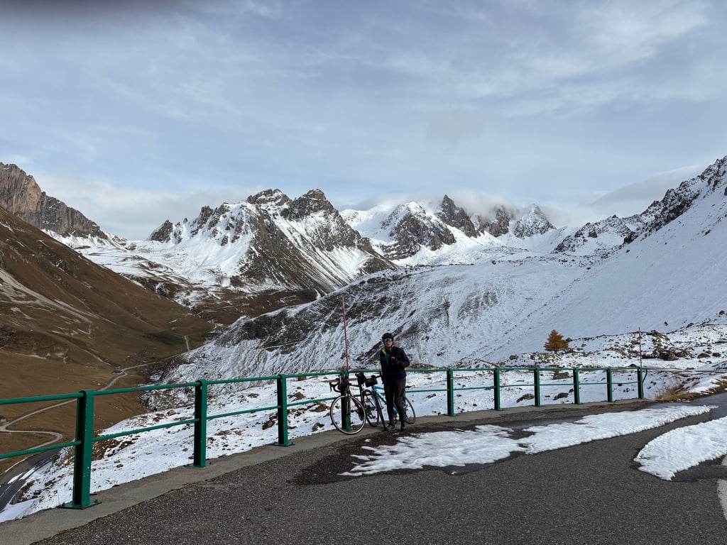
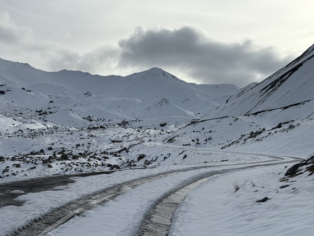
5.0 by surveloA climb with so much history, but definitely worth the hype. I've cycled it twice from Valloire, the first in midsummer, the second time recently when the road was closed after the first snowfall in late autumn. This was a truly magical experience even if we had to turn back 4km from the top with too much snow on the road. We had the whole mountain to ourselves. See the video here, https://youtu.be/vpHTylg7OgU?si=fkdvHdDuTYA6HpA1 In summer I always recommend starting at first light t... read more
Welcome! Please activate your account if you would like to share something. Look for the verification email in your inbox.
If you want to upload your photos, you need to create an account. It only takes 1 minute and it's completely free.
Climbed on 11 June 2026 from Valloire. Cold northerly wind: a good windproof jacket is a must, even when climbing! Extraordinary scenery. Quiet ascent with little motorised traffic and respectful. The climb wasn't too hard up to Plan Lachat, but then it got serious! Especially the last km, after the tunnel chalet.
Grimpé le 11 juin 2026 depuis Valloire. Vent froid du nord: bon gilet coupe vent obligatoire même en montée! Un paysage extraordinaire. Ascension tranquille avec peu de trafic motorisé et respectueux. Ascension pas trop dure jusque Plan Lachat, après c'est du sérieux! Surtout le dernier km, après le chalet du tunnel.
One of favourite climb, mighty col and fantastic descent
Één van favoriete beklimming, machtige col en een fantastische afdaling
A climb with so much history, but definitely worth the hype.
I've cycled it twice from Valloire, the first in midsummer, the second time recently when the road was closed after the first snowfall in late autumn. This was a truly magical experience even if we had to turn back 4km from the top with too much snow on the road. We had the whole mountain to ourselves. See the video here, https://youtu.be/vpHTylg7OgU?si=fkdvHdDuTYA6HpA1
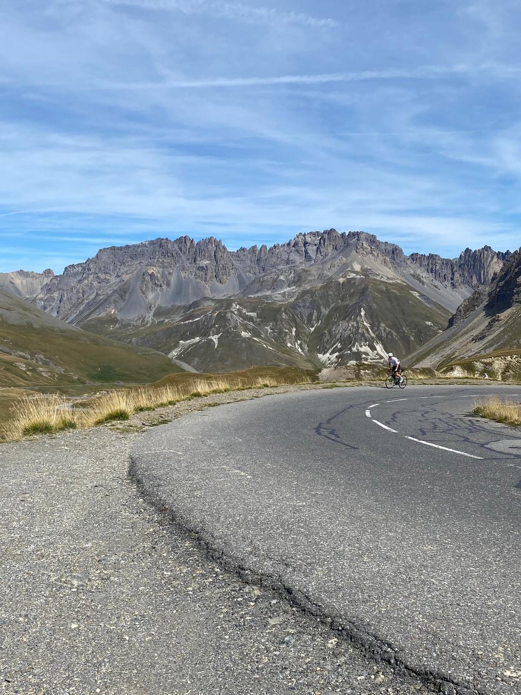
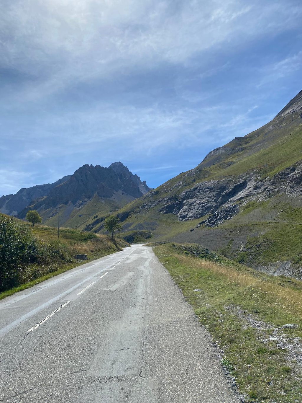
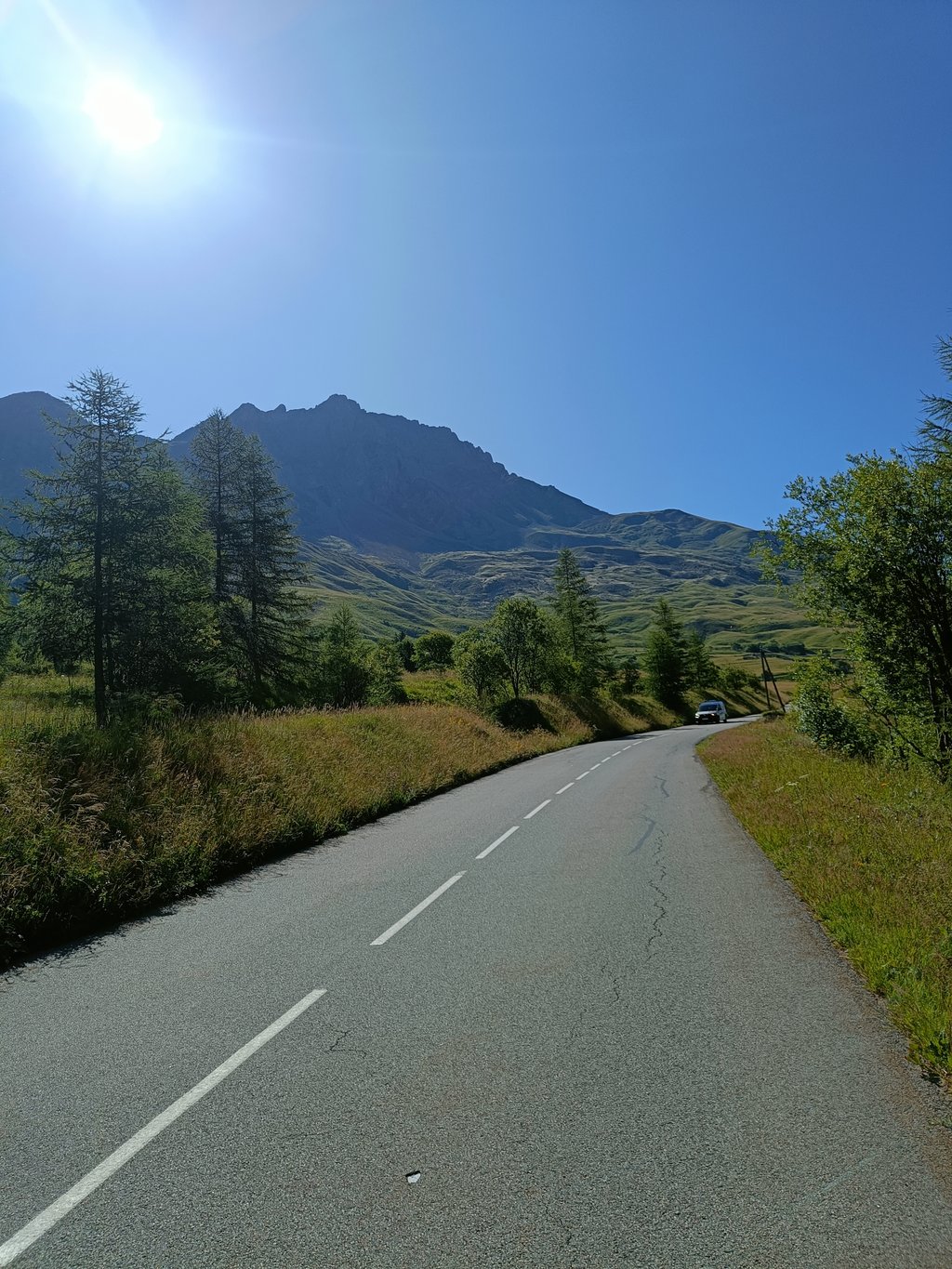
In summer I always recommend starting at first light to beat the motorcycles and cars. It's a long drag out of Valloire, with steeper gradients and hairpins after Plan Lachat, and then a straightish pull to close to the summit. The last 100m of ascent, after the tunnel, is the hardest part, and I really felt the altitude at this point. But it doesn't take long and the views are spectacular.
A fantastic climb that's a must-do, if you go at your own pace and turn your legs, nothing's impossible. Once you pass Plan Lachat, you're in the high mountains. I've climbed it twice.
Montée fantastique à faire absolument,en montant à son rythme en tournant les jambes rien d’impossible. Passé plan lachat on roule en haute montagne. Je l’ai grimpé deux fois .
Great climb high in the mountains. The first section through the valley from Valloire starts quietly. Then the climb gets steeper (7-8%), but nowhere very steep.
Geweldige klim hoog in de bergen. Het eerste stuk door het dal vanaf Valloire begint rustig. Daarna wordt de klim steiler (7-8%), maar nergens héél steil.
a beautiful view from the top and all the way up a perfect route
une très belles vue en haut etv pendant toute la montée route parfaite
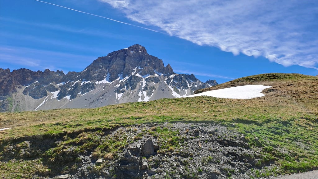
A superb pass! Be careful to manage your pace above 2000m, the air gets heavy! The scenery is breathtaking. The only drawbacks are the traffic and the state of the tarmac, which leaves something to be desired in places!
Un superbe Col ! Attention à bien gère son rythme au del de 2000m, l'air devient lourd ! Les paysages sont saisissants. Les seuls bémols sont la circulation et l'État du bitume qui par endroit laisse à désirer !
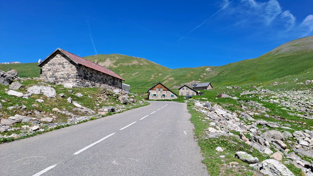
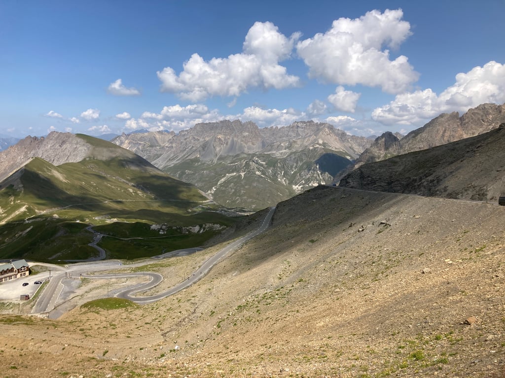
It's not for nothing that this mythical climb is the stuff of dreams. The climb is demanding, and to do it right you should normally start from Saint-Michel en Maurienne and therefore go over the Col du Télégraphe. From Valloire, the climb is initially flat and uphill, then up to 10 km the effort is quite manageable. Once you reach the Auberge du Plan Lachat, a bend leads to a narrowing of the route and a clear increase in gradient. The climb then becomes very difficult, not to mention the very high altitude and the cold. The last kilometre seems interminable, while the summit seems within reach. To be done again and again without moderation
Ascension mythique qui fait rêver, ce n'est pas pour rien. La montée est exigeante, pour bien faire les choses il faut normalement commencer à partir de Saint-Michel en Maurienne et donc de passer par le col du télégraphe. a partir de Valloire, la montée est d'abord en faux plat montant, puis jusqu'à 10 km l'effort est tout à fait gérable. Une fois arrivé à l'auberge du plan Lachat, un virage abouti à un rétrécissement de la voix et à une augmentation manifeste de la pente. L'ascension devient alors très difficile, sans compter l'altitude très élevé et le froid. Le dernier kilomètre paraît interminable alors que le sommet semble a portée de main. A faire et à refaire sans modération
The first 10 kilometres go pretty well, just make sure you don't blow yourself up. Then you'll see a river on your right, don't look naae right at the top, you'll see the road go up a long way. At the last 6 kilometres there is a tough stretch, then it's off to the last kilometre, leave the tunnel on the right and then rake up to the top. Definitely don't forget to bring a jacket for the descent, it is a very nice clear descent though.
De eerste 10 kilometer gaan vrij goed, vooral maken dat je jezelf niet opblaast. Daarna zie je rechts van je een rivier opduiken, kijk dan vooral niet naae rechts boven, daar zie je de weg een groot stuk omhoog gaan. Bij de laatste 6 kilometer is er nog een zwaar stuk, daarna is het afwachten tot de laatste kilometer, de tunnel rechts laten liggen en dan maar harken tot boven. Vergeet zeker geen jasje mee te doen voor de afdaling, het is wel een zeer mooie overzichtelijke afdaling.
It goes without saying that the real ascent of the Galibier is in one go from Saint-Michel-de-Maurienne, via the Télégraphe.
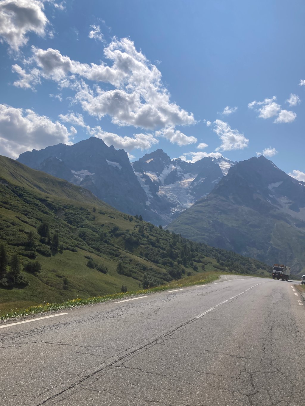
To tackle the final section properly, you need to have kept your pedal to the metal. So, the Télégraphe should be climbed at a steady pace, with some reserve. Catch your breath on the descent to Valloire, and avoid pushing too hard on the first ramp out of Valloire. After that, you take advantage of a few flat spots to admire the sublime surroundings.
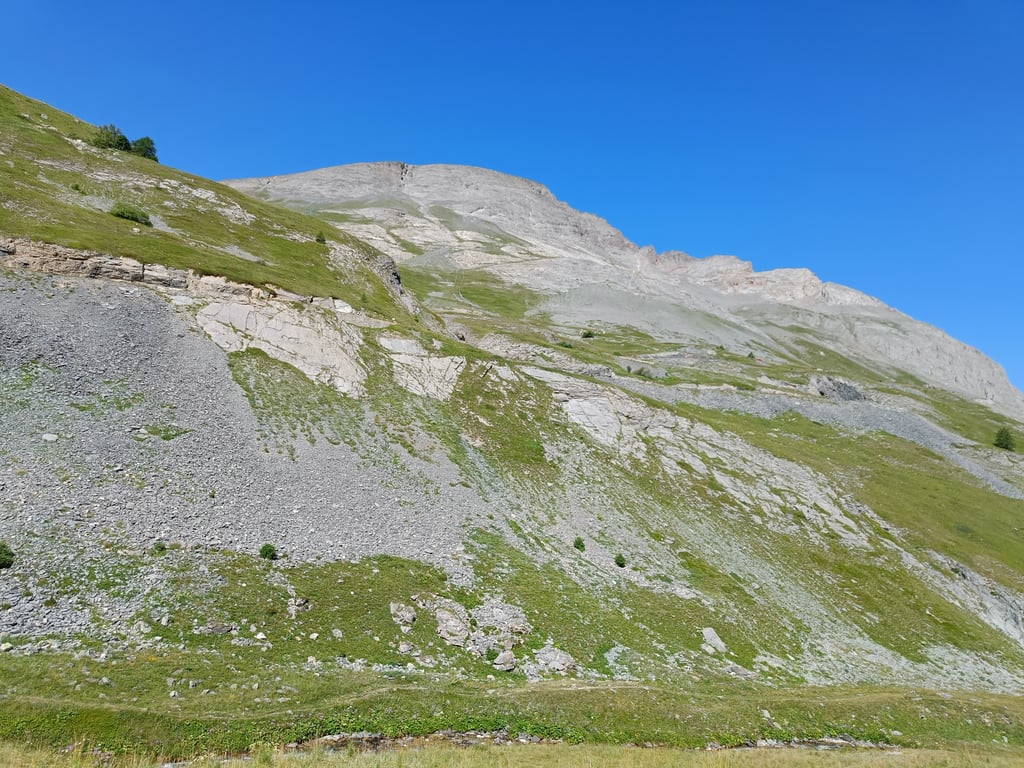
At the Plan Lachat bend, we pass the 2,000m mark and begin the last 8 km, the most demanding. But if you have managed the first 27 km well, and even better if you have acclimatised well to the altitude beforehand, you can keep up your pace. If you haven't acclimatised, you'll have to accept that you'll have to cut back on power, because any intense effort will cost you as you approach 2642m.
Aesthetically, the Galibier is one of the most beautiful passes (the descent to Le Lautaret is fantastic). In sporting terms, the Galibier is a challenge for any cyclist: the first time you climb it, you do so humbly; the next few times, you test yourself. Symbolically, the Galibier is an absolute myth. To be done again and again, always with the same pleasure.
Il va sans dire que la vraie ascension du Galibier, c'est d'une traite depuis Saint-Michel-de-Maurienne, via le Télégraphe.
Pour bien aborder la partie finale, il faut en avoir gardé sous la pédale. Donc, le Télégraphe se monte au tempo, avec de la réserve. On reprend son souffle dans la descente vers Valloire, et on évite de relancer trop fort dans la première rampe à la sortie de Valloire. On profite des quelques replats ensuite pour admirer l'environnement sublime.
Au virage de Plan Lachat, on dépasse les 2000m d'altitude et on aborde les 8 derniers km, les plus exigeants. Mais si on a bien géré les 27 premiers km, et mieux encore si on s'est bien acclimaté à l'altitude auparavant, on peut conserver son rythme. Sans acclimatation, il faut accepter d'en rabattre sur la puissance, car tout effort intense coûte à l'approche des 2642m.
Esthétiquement, la Galibier est l'un des plus beaux cols (la descente vers le Lautaret est fantastique). Sportivement, le Galibier est un défi pour tout cycliste : la première fois, vous le montez humblement; les fois suivantes, vous vous mesurez à vous-même. Symboliquement enfin, le Galibier est un mythe absolu. A faire et à refaire, toujours avec le même plaisir.
Very nice climb at altitude, after the Telegraph you get this one! Refuel the bottles in Valoire and off you go! After you turn right and cross the small river it's a serious climb to the top. Can be cold at the top!
Hele toffe klim op hoogte, na de Telegraph krijg je deze nog voor je kiezen! Even de bidons bijtanken in Valoire en gaan! Nadat je rechtsaf het kleine riviertje over gaat word het serieus klimmen tot de top.. Kan boven koud zijn!
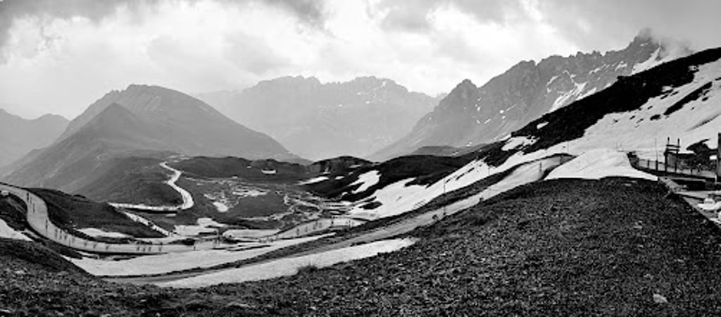
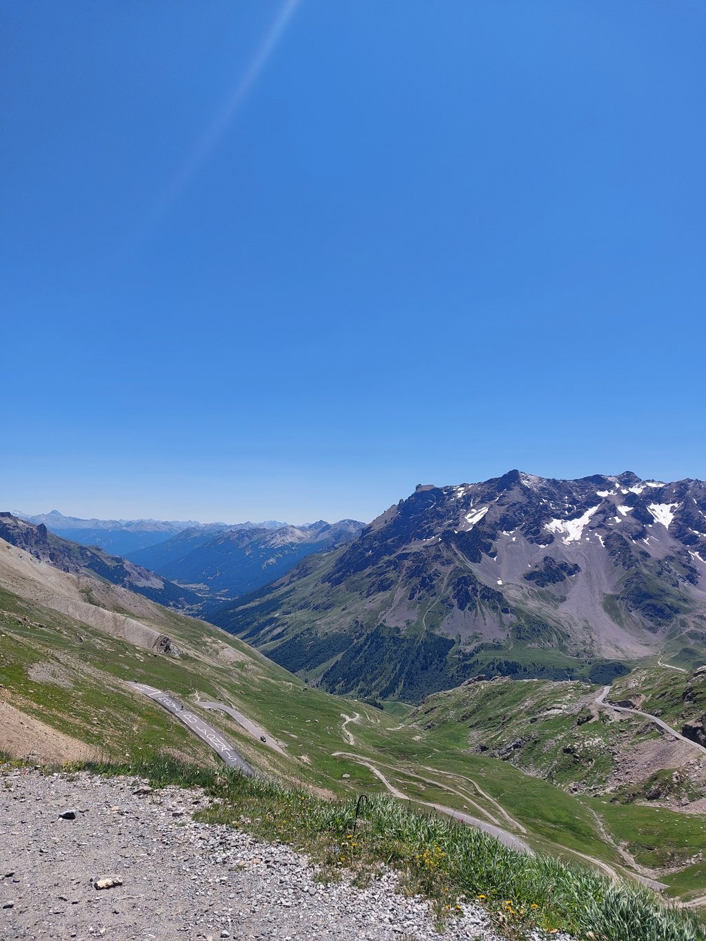
You ride steadily up through a mighty wide valley with a good overview of what's to come. From 8km to go you then suddenly encounter the real climb, so definitely don't start too fast from Valloire. You have most likely done the Col du Télégraphe before this as well. From 8km to go you suddenly look up against a much steeper wall. From here the real climb starts and continues above 2000m. Hrmet scenery is barren and desolate, but beautiful. The last kilometres you climb to the real summit and these can still be very tough. Definitely bring enough clothes for the descent!
Je rijdt gestaag omhoog door een machtige, brede vallei met een goed overzicht van wat er nog moet komen. Vanaf 8km te gaan kom je dan plots de echte klim tegen, dus zeker niet te snel vanuit Valloire starten. Je hebt hiervoor hoogstwaarschijnlijk de Col du Télégraphe ook al gedaan. Vanaf 8km te gaan kijk je plots tegen een veel steilere muur op. Vanaf hier start de echte klim en gaat het verder boven 2000m. Hrmet landschap is kaal en desolaat, maar wel prachtig. De laatste kilometers klim je naar de echte top en deze kunnen nog zeer zwaar zijn. Zeker genoeg kleren voor de afdaling meenemen!
Beautiful climb ridden several times. It is a bit trickier especially the second part and the altitude can make it tougher.
Prachtige klim meerdere keren gereden. Hij is met name het tweede deel wat lastiger en de hoogte kunnen het zwaarder te maken.
I set off from Saint Jean with the aim of reaching the summit of the Col du Télégraphe, no fatique, no pain, just a feeling of well-being. I decided to keep going, at least to try, to get closer to the Col du Galibier.
Col du Galibier, the idea in my head, never setting foot on the ground, after 2 hours 50 minutes of climbing I pass by the Col du Galibier sign.
what happiness, once up savour the moment, to be in the middle of the Alps what beauty these mountains;;;
Départ depuis Saint Jean objectif j'arrive au sommet le Col du Télégraphe, pas de fatique pas de douleur un ressenti de bien etre; je décide de continuer au moins essayer, de m'approcher du
Col du Galibier, l'idée en tete jamais posé le pieds à terre, apres 2h50 d'ascension je passe à coté du paneau Col du Galibier
quel bonheur , une fois la haut savourer l'instant,etre au milieu des Alpes quel beauté ces montagnes;;;
What hasn't already been said about this legendary pass? That you're proud to reach the top, that the effort is intense, that the scenery is incredible, that the descent is long and dangerous!
Que dire qui n'a pas été dit sur ce Col mythique ? Que l'on est fière d'arriver en haut, que l'effort est intense, que les paysages sont incroyables, que la descente est longue et dangereuse !!
Nice climb! On top still some snow. It was the 3rd climb of the day during the marmotte!
Mooie klim! Boven op nog wat sneeuw. Het was de 3de klim van de dag tijdens de marmotte!
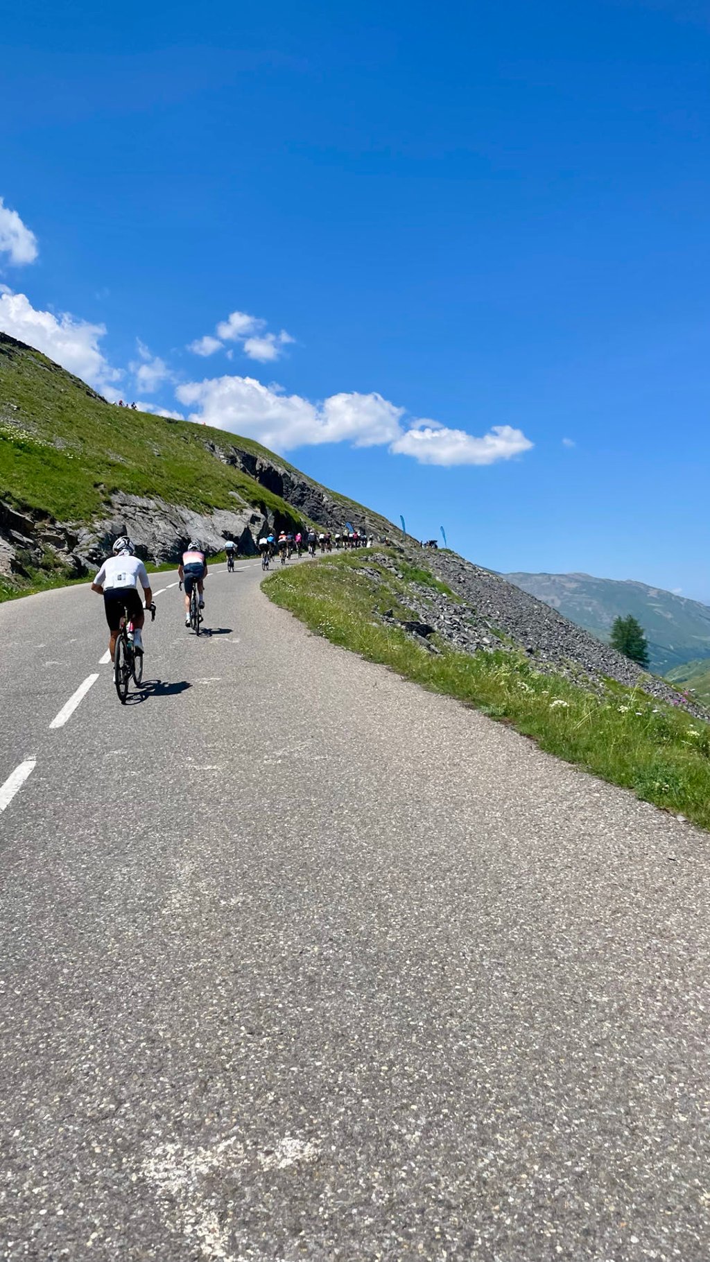
Climbed a few days after the passage of the Tour de France. Very busy traffic, especially motorbikes that sometimes act dangerous. Cars usually give you enough room to overtake. Do not start too great because the climb continues and there are very few pieces where you can recover. We had done the Telegraphe first and of course you can feel that in your legs.
Beklimming gedaan enkele dagen na de passage van de ronde van Frankrijk. Zeer druk verkeer, vooral motoren die al eens durven gevaarlijk doen. Auto's geven je meestal voldoende ruimte bij het inhalen. Niet te geweldig beginnen want de klim blijft duren en er zijn heel weinig stukken waar je kan recupereren. Wij hadden eerst de Telegraphe gedaan en dat voel je natuurlijk al wel in de benen.
Rise on 11 June 2022:
Departure from Valloire, the part between this village and Plan Lachat is long, straight, but on a correct slope. The second part is much harder, with a series of switchbacks and a steeper slope at over 2,000m, where the mind comes into play at this point. The magnificent landscapes, the minerality that emerges from this pass in the final stretch make you feel very small. A classic!
Montée le 11 Juin 2022:
Départ de Valloire, la partie entre ce village et Plan Lachat est longue, droite, mais sur une pente correcte. La seconde partie est beaucoup plus dure, on enchaine les lacets, et on passe sur une pente plus raide, à plus de 2000 d'altitude, ou le mental rentre en jeu a ce moment la. Les paysages magnifiques, la minéralité qui se dégage de ce col dans le final vous font vous sentir tout petit. Un classique !
Valloire is a beautiful village and a great place to start this fabulous climb. A tough steep section straight out of the village leads you to some flatter open scenery where you can take in the views. There are a couple of cafe stops a few KM’s into the ride but these are the last ones before the summit so fill up your bottles here. The traffic is quite busy with multiple cars and motorbikes but the majority respect your space on the bike. The air does get a bit thinner near the top so take your time and enjoy the views. Road surface is generally very good.
| 7 km/h | 02:30:20 |
| 11 km/h | 01:35:40 |
| 15 km/h | 01:10:09 |
| 19 km/h | 00:55:23 |
This page is better in the app