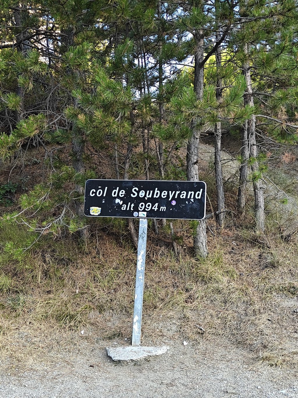
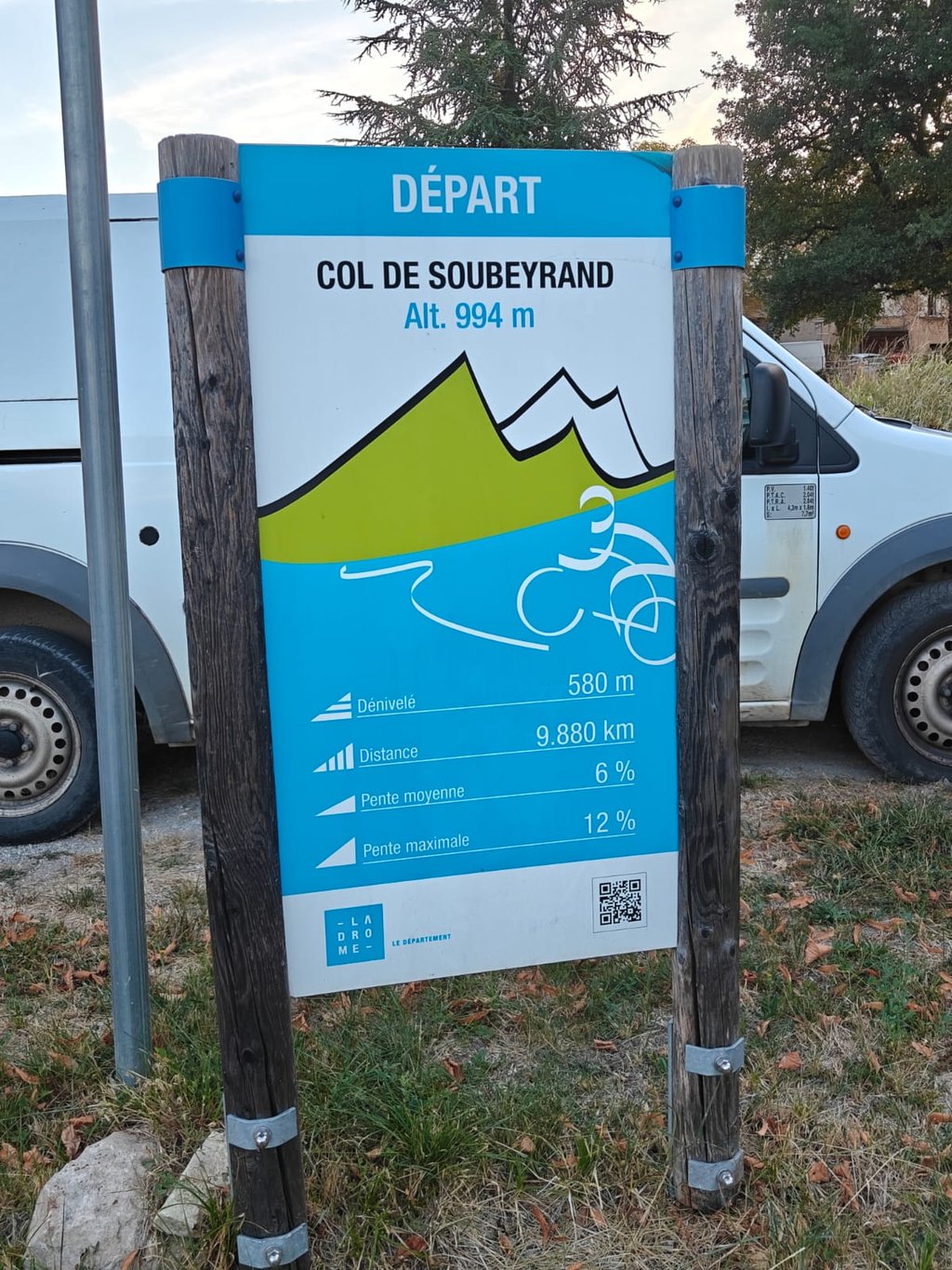
Col de Soubeyrand from Sainte Jalle is a climb in the region Drôme. It is 9.9 km long and bridges 581 m of vertical ascent with an average gradient of 5.9%, resulting in a difficulty score of 373. The top of the ascent is located at 987 m above sea level. Climbfinder users shared 7 reviews of this climb and uploaded 13 photos.
Road name: D568
3.0 by Agostinho53This is an automatic translation, the original language is: Dutch.On the D64, when exiting Ste-Jalle in the direction of St.-Sauveur-Gouvernet, turn left at the church. A few kilometers slowly get used to the climb, bite the middle part and quietly pedal again towards the top. That's the climb in a nutshell. A climb in the south of Limburg. A warm-up if you take eg the Peyruerge and Perty. ... read more

Welcome! Please activate your account if you would like to share something. Look for the verification email in your inbox.
If you want to upload your photos, you need to create an account. It only takes 1 minute and it's completely free.
A lovely climb and beautiful surroundings. Set off from Les Ramieres – a lovely little ride. As preparation for Mont Ventoux. I’ll definitely be back here again.
Leuke beklimming en schone omgeving. Gestart vanuit Les Ramieres, mooi tourke. Ter voorbereiding van de Mont-ventoux. Kom hier zeker nog eens terug
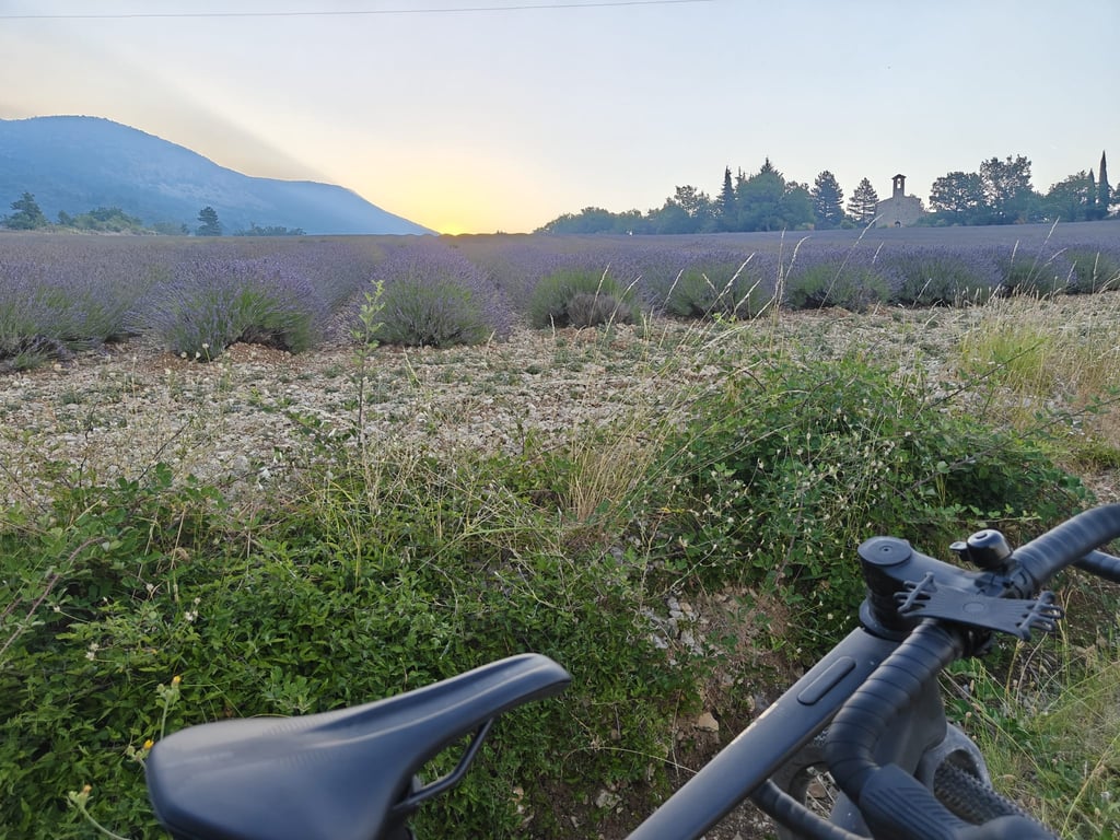
Fine climb with beautiful lavender fields, especially in late June and early July. The climb is quite irregular, with some quite steep sections especially around the hamlet of Les Ubacs.
The first 1.5 km after Le Poët-Sigillat may be 0% on average, but actually consists of a series of fiercely short steep climbs up to 12% and ditto descents. I actually find this the most annoying part of the climb because it completely throws my rhythm out of whack.
Fijne klim met vooral eind juni en begin juli prachtige lavendelvelden. De klim is behoorlijk onregelmatig, met vooral rond het gehuchtje Les Ubacs een paar flink steile stukken.
De eerste 1.5 km na Le Poët-Sigillat is gemiddeld misschien wel 0%, maar bestaat in werkelijkheid uit een een serie van heftig korte steile klimmetjes tot 12% en ditto afdalinkjes. Eigenlijk vind ik dit het vervelendste deel van de klim omdat het mijn ritme compleet overhoop gooit.
A very pleasant little road with a beautiful view, a steady but pleasant climb with magnificent lavender, a very pretty walk.
Une petite route très sympathique avec une très belle vue une montée soutenue mais agréable avec une lavande magnifique très jolie balade
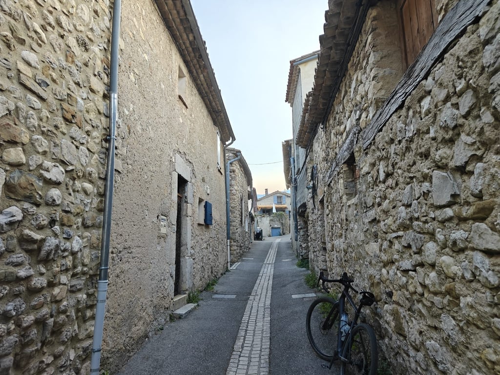
If you can spend some time near Mont Ventoux, be sure to also explore the region with its many and doable climbs. Vaucluse and especially Drôme are wonderfully beautiful. While towards Venasque you end up among the cherries, here you will come across abricot plantations everywhere among the lava remnants. Attaching a few photos to frame it all.
Wanneer je wat tijd kunt doorbrengen in de buurt van de Mont Ventoux, verken dan ook zeker de streek met haar vele en doenbare beklimmingen. Vaucluse en vooral Drôme zijn wondermooi. Terwijl je richting Venasque tussen de kersen belandt, kom je hier tussen de lavaresten overal abricosenplantages tegen. Een paar foto's bijvoegen om het geheel te kaderen.
Completely agree with you. A nice climb and a very beautiful setting. You can find a lot of beautiful and especially not miserable long climbs on a handkerchief here in the Drôme.
For several years now I have been going cycling in the Drôme every summer and it is cycling fun of the highest order and no or hardly any traffic on all the climbs.
Volledig met je eens. Een leuke beklimming en een zeer mooie omgeving. Je vindt hier in de Drôme heel wat mooie en vooral niet ellendige lange beklimmingen op een zakdoek.
Al verschillende jaren ga ik in de Drôme elke zomer fietsen en dat is fietsplezier van de bovenste plank en geen of amper verkeer op alle beklimmingen.
On the D64, when exiting Ste-Jalle in the direction of St.-Sauveur-Gouvernet, turn left at the church. A few kilometers slowly get used to the climb, bite the middle part and quietly pedal again towards the top. That's the climb in a nutshell. A climb in the south of Limburg. A warm-up if you take eg the Peyruerge and Perty.
Op de D64, bij het buitenrijden van Ste-Jalle richting St.-Sauveur -Gouvernet, bij het kerkje links op. Een paar kilometer langzaam wennen aan de klim, doorbijten op het middenstuk en weer rustig peddelen richting top. Da's de klim in een notedop. Een Zuid Limburgs klimmetje dus. Een opwarmertje als je er bvb de Peyruerge en de Perty bijneemt.
Today I climbed the Col de Soubeyrand with a lot of bad luck. Front wheel dragging (only repaired at the top), sore knee and very hot.
But a beautiful climb in an even more beautiful region (Drome). The Drome is already incredibly beautiful but this region is the cream of the crop. The climb itself is a killer because it is very uneven.
The first 2.5 km is quiet. But then the unpredictability sets in. Constantly going up in steps with regularly double figures. And even descents and a km of 9% with a descent in it. The number of altimeters is also more than the theoretical height difference because of the regular descents. The last 2,5 km is more regular again.
Watch out for no shade.
But beautiful and absolutely no traffic. Really recommended but beware because the roads to this col are not flat for a meter.
The descent is beautiful and road surface pretty good. Pictures will follow.
Vandaag met heel wat pech de Col de Soubeyrand beklommen. Slepend voorwiel ( pas kunnen herstellen op de top ) , pijnlijke knie en zeer warm .
Maar een prachtige beklimming in een nog veel mooiere streek ( Drome ) . De Drome is al ongelooflijk mooi maar deze regio is het neusje van de zalm. De beklimming zelf is een killer want zeer zeer ongelijkmatig.
De eerste 2,5 km is rustig. Maar dan begint de grilligheid. Constant trapsgewijs naar boven met regelmatig dubbele cijfers. En zelfs afdalingen en een km aan 9% met een afdaling in. Het aantal hoogtemeters is ook meer dan het theoretische hoogteverschil door de regelmatig terugkomende stukjes bergaf. De laatste 2,5 km is weer regelmatiger.
Pas op want geen meter schaduw.
Wel wondermooi en totaal geen verkeer. Echt een aanrader maar pas op want de wegen naar deze col lopen voor geen meter vlak.
De afdaling is prachtig en wegdek best in orde. Foto's volgen.
| 7 km/h | 01:24:52 |
| 11 km/h | 00:54:00 |
| 15 km/h | 00:39:36 |
| 19 km/h | 00:31:16 |
This page is better in the app