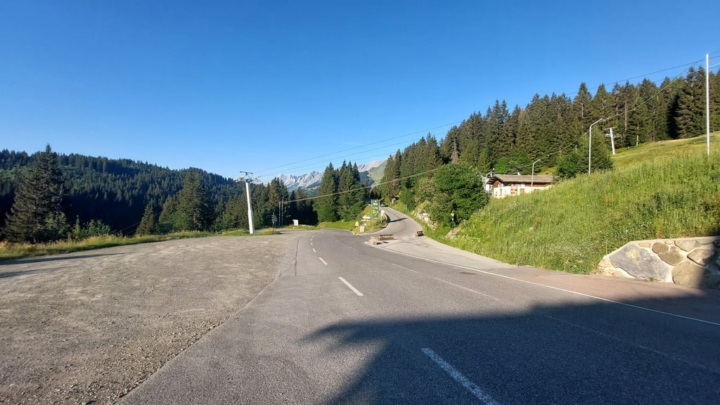
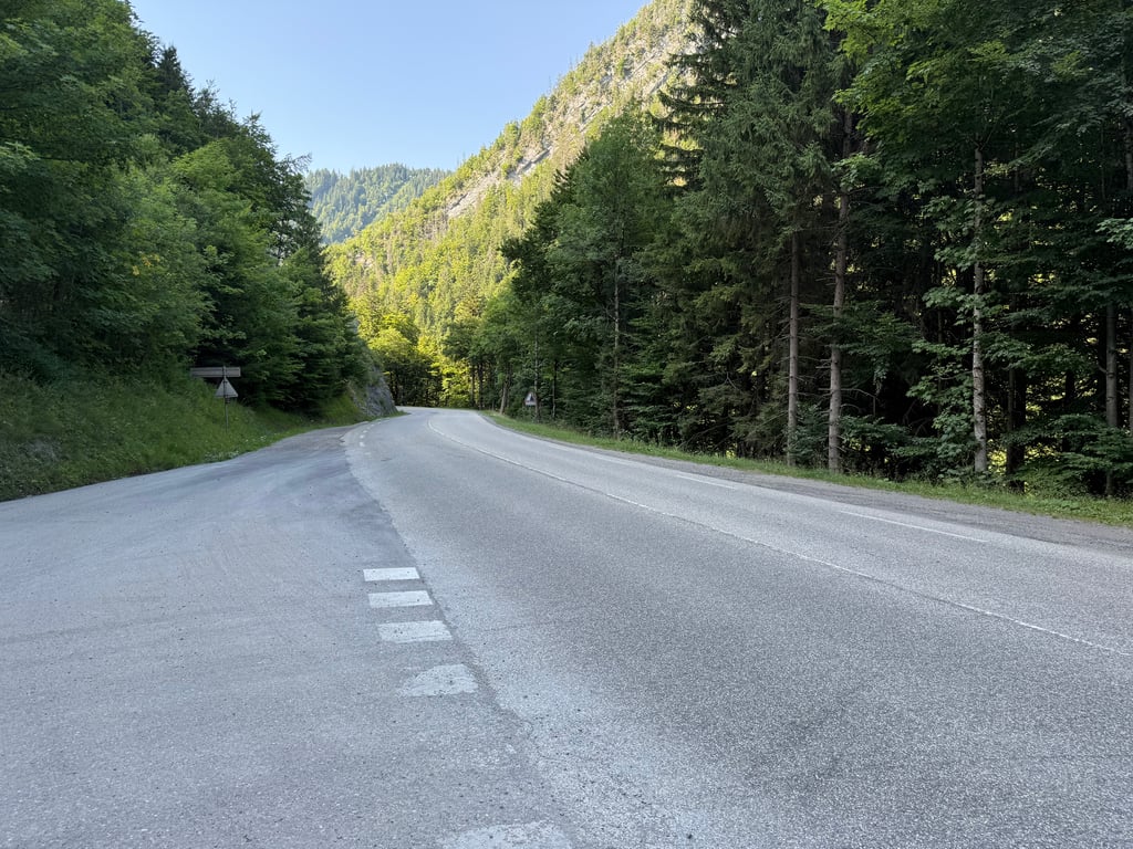
View on map
© MapLibre | OpenStreetMap contributors
1%
2%
4%
6%
8%
10%
12%
15%
20%

Col de la Croix Fry from Saint-Jean-de-Sixt

4.5
3 reviews | Elevation profile | 2 photos
Tips nearby
Col de la Croix Fry from Saint-Jean-de-Sixt
transparant thumb
transparant thumb
transparant thumb
transparant thumb
transparant thumb
transparant thumb
Your achievable time
Calculating based on your best performances...
Relaxed
Maximum
W/kg
W/kg
W/kg
Analyse your climbing performance
Detailed insight into your climbing performance & automatically check off climbs
Based on your best performances.
Your best attempt:
Number of attempts:
Elevation profile Col de la Croix Fry from Saint-Jean-de-Sixt

Statistics

Difficulty points 319
Length 9.3 km
Average gradient 5.3%
Steepest 100 metres 10.2%
Total ascent 489 m

Short recap

Beautiful scenery
2 hairpin turns
#91 toughest climb of Annecy
#71 most elevation gain of Annecy
#69 longest climb of Haute Savoie
Feedback about this climb?
Show climbs nearby Export to GPS device

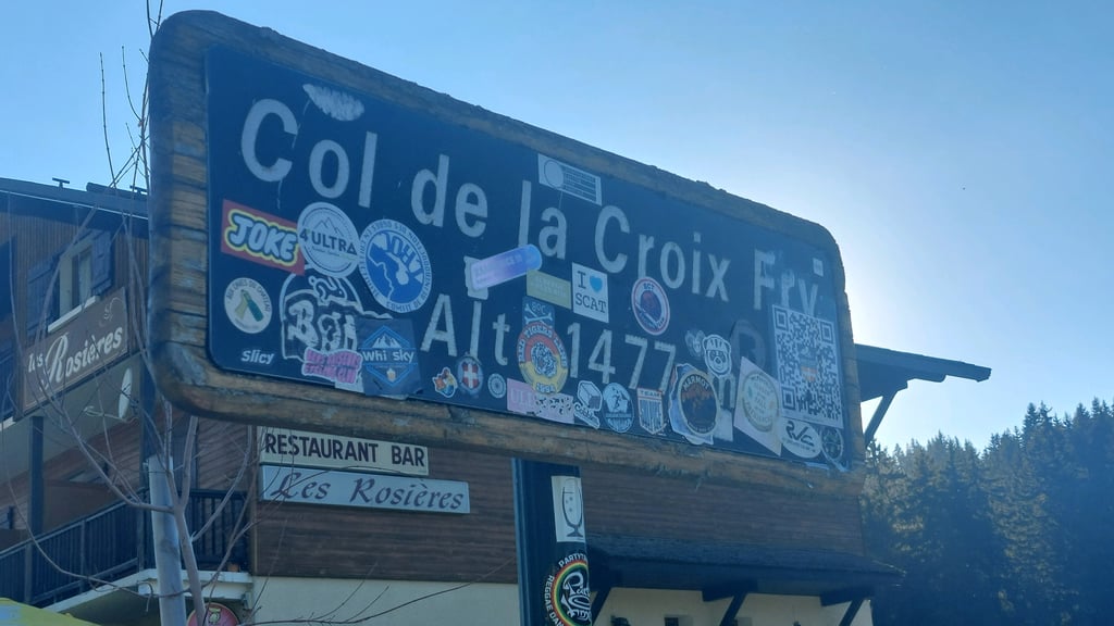
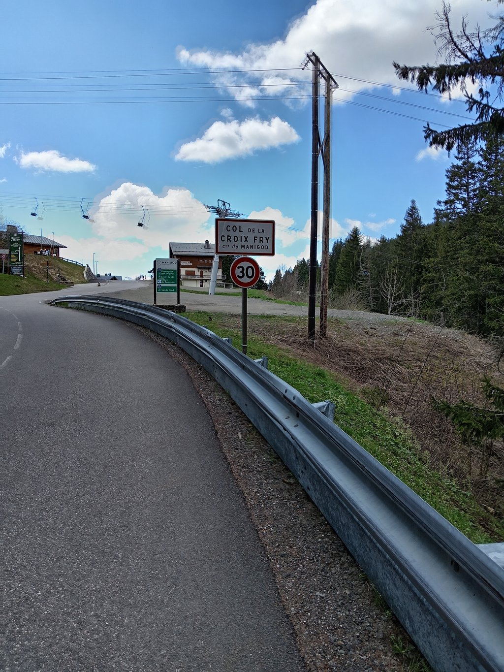
Col de la Croix Fry from Saint-Jean-de-Sixt is a climb in the region Annecy. It is 9.3 km long and bridges 489 m of vertical ascent with an average gradient of 5.3%, resulting in a difficulty score of 319. The top of the ascent is located at 1465 m above sea level. Climbfinder users shared 3 reviews of this climb and uploaded 2 photos.

Road name: D909

5.0 by gusvelo
This is an automatic translation, the original language is: French.
The pass is a pleasant one, with regular but not too steep slopes. Don't underestimate the section between Thônes and St-Jean-de-Sixt, as the heavy traffic makes it difficult. To see the sign for the col de saint jean de sixt, simply take the second exit off the roundabout in the centre of the village and continue for 200m. At the top, you can also look for the little-known Col de Merdassier, which is fairly easy.... read more

Photos (2)

Col de la Croix Fry from Saint-Jean-de-Sixt
transparant thumb
transparant thumb
transparant thumb
transparant thumb

Your uploads (max 4)

Welcome! Please activate your account if you would like to share something. Look for the verification email in your inbox.

If you want to upload your photos, you need to create an account. It only takes 1 minute and it's completely free.

  • Receive free climbfinder goodies for your reviews & photos.
  • Create a bucket list and check off conquered climbs.
  • Add missing climbs.
Continue with GoogleContinue with Google Continue with FacebookContinue with Facebook Continue with AppleContinue with Apple Sign up with email
By signing up you agree to our terms of service and confirm that you have read our privacy & content policy.

Reviews (3)

5.0
4.0
3.0
2.0
1.0
gusvelo
12 Mo 5.0
This is an automatic translation, the original language is: French. Show original

The pass is a pleasant one, with regular but not too steep slopes. Don't underestimate the section between Thônes and St-Jean-de-Sixt, as the heavy traffic makes it difficult. To see the sign for the col de saint jean de sixt, simply take the second exit off the roundabout in the centre of the village and continue for 200m. At the top, you can also look for the little-known Col de Merdassier, which is fairly easy.

Le col est sympathique avec des pentes régulières et peux raides. Il ne faut pas sous-estimer la partie reliant Thônes à St-Jean-de-Sixt car la circulation abondante complique la tache. Pour essuyer la pancarte du col de saint jean de sixt, il suffit de prendre la deuxième sortie du rond point du centre du village et de continuer sur 200 m. En haut, on peut également aller chercher le col de merdassier, méconnu et plutôt facile.

Dashboard
sergenavetat
1 y 4.0
This is an automatic translation, the original language is: French. Show original

An easy pass on the first part and a little more on the second, but it's rolling.
Avoid the afternoon as it's very sunny.
To avoid the huge amount of traffic between La Clusaz and the foot of the pass, you can take the Rte de l'Étale, but beware of the surprising gradients in places.

Un col facile sur la première partie et un peu plus dans la seconde mais c'est roulant.
À éviter l'après-midi car c'est en plein soleil.
Pour éviter l'énorme circulation entre La Clusaz et le pied du col vous pouvez passer par la Rte de l'Étale mais attention aux pourcentages par endroits surprenants.

Col de la Croix Fry from Saint-Jean-de-Sixt
Dashboard
Random
Dennis
7 y
This is an automatic translation, the original language is: Dutch. Show original

This was my first Alpine Coll ever. I am not an experienced cyclist and weigh 97 kg but this one is doable. Last part is a bit steeper but with a little bit of resistance you can get up there.

Dit was mijn eerste Alpencoll ooit. Ik ben geen geoefende fietser en weeg 97 kg maar deze is goed te doen. Laatste stuk is iets steiler maar met een klein verzetje kom je goed boven

Dashboard

Climbing times

7 km/h 01:19:32
11 km/h 00:50:37
15 km/h 00:37:07
19 km/h 00:29:18

Road surface condition

100% 0% 0%
Based on 2 votes
Share your knowledge. What was the road condition during your ascent?

Traffic

50% 0% 50%
Based on 2 votes
Your experience counts. How much traffic did you encounter during the climb?

Frequently Asked Questions

Col de la Croix Fry can be cycled from 2 sides. Col de la Croix Fry from Thônes is the most popular side, but the summit can also be reached via Col de la Croix Fry from Saint-Jean-de-Sixt.

You don't need special gearing for Col de la Croix Fry from Saint-Jean-de-Sixt. The slope isn't long or steep enough to require much shifting down. You can conquer this climb on power alone. However, a compact gearing system with a smallest front chainring of 34 and largest rear sprocket of 28 or 30 is always nice if you enjoy cycling uphill. This helps maintain a smooth cadence.

Col de la Croix Fry from Saint-Jean-de-Sixt is a serious climb and falls into the 2nd category. With a good basic fitness level, even without much cycling experience, you can complete this climb just fine. However, a bike with climbing gears is a must. Without experience or training, it will be really tough – but that’s part of the challenge!

Col de la Croix Fry from Saint-Jean-de-Sixt is 9.3 km long.

The average gradient of Col de la Croix Fry from Saint-Jean-de-Sixt is 5.3%.

Col de la Croix Fry from Saint-Jean-de-Sixt has a steepest segment with an average gradient of 10.2%.

The summit of Col de la Croix Fry from Saint-Jean-de-Sixt is at 1465 m.

At a slow pace of 7 km/h, it takes about 01:19:32 to climb Col de la Croix Fry from Saint-Jean-de-Sixt. At 11 km/h the time is 00:50:37, and at 15 km/h 00:37:07. For the fastest cyclists, 00:29:18 is an achievable time.

Col de la Croix Fry from Saint-Jean-de-Sixt is located in the region Haute Savoie in France.

This page is better in the app

Climbfinder app
Climbfinder
(Free)
Open