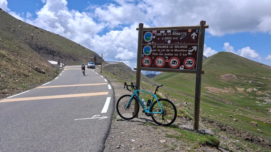
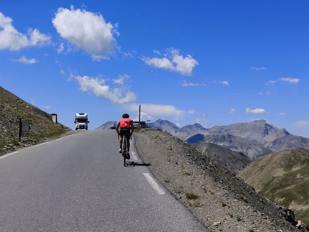
| Famous climb |
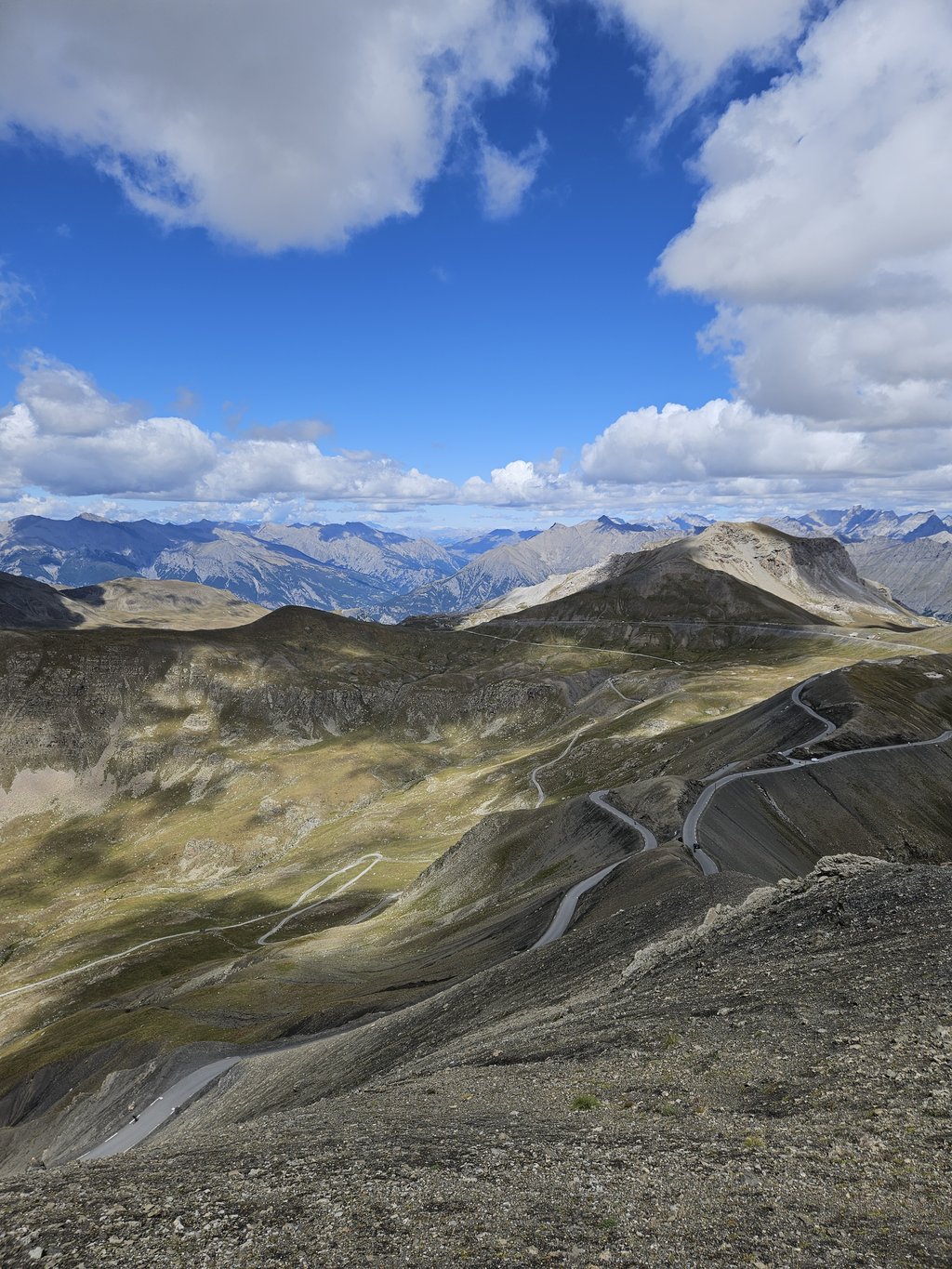
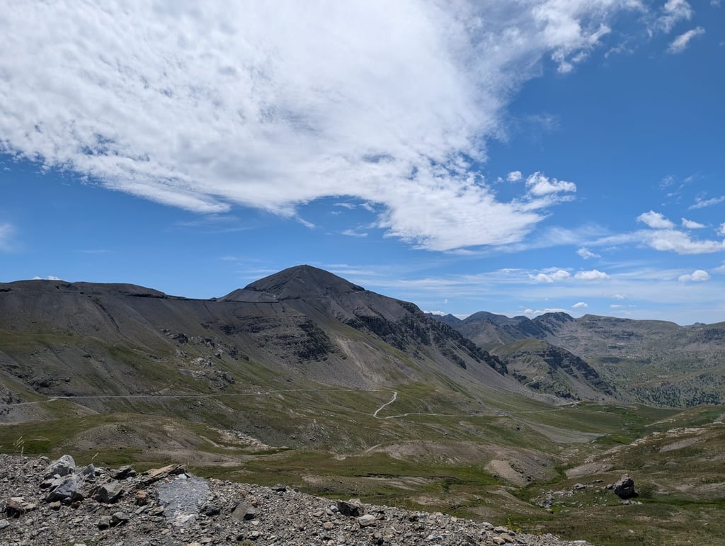
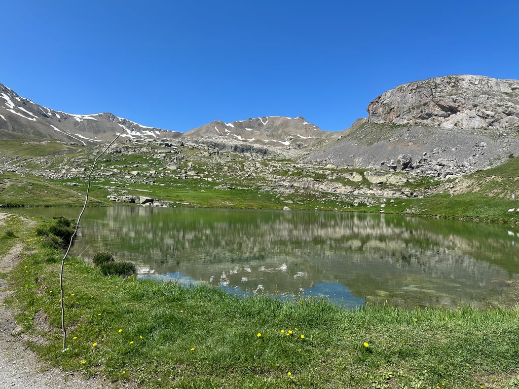
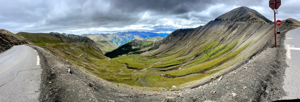
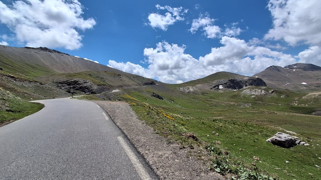
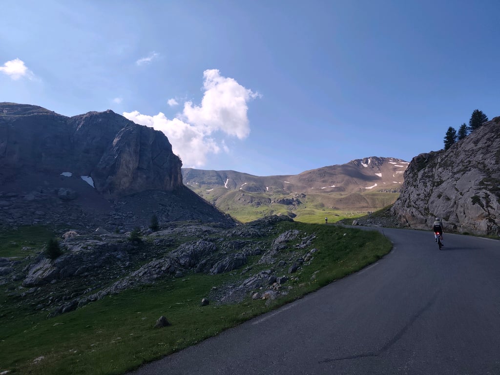
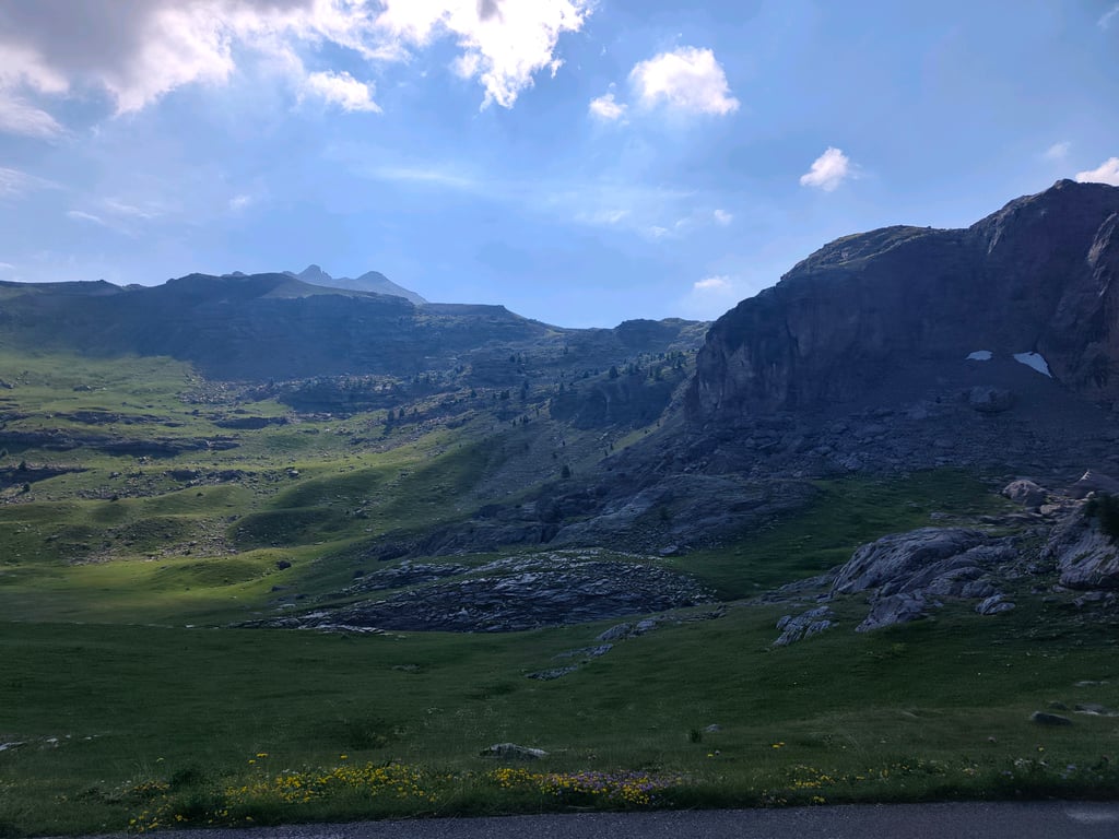
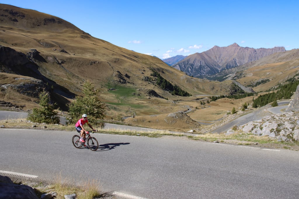
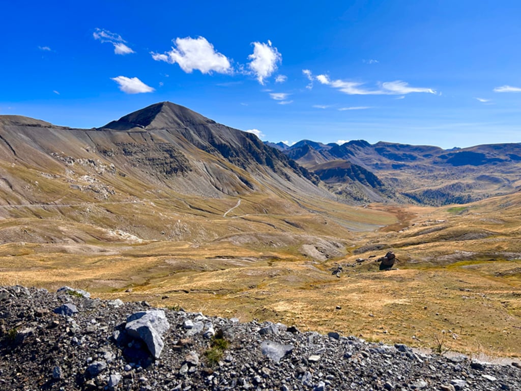
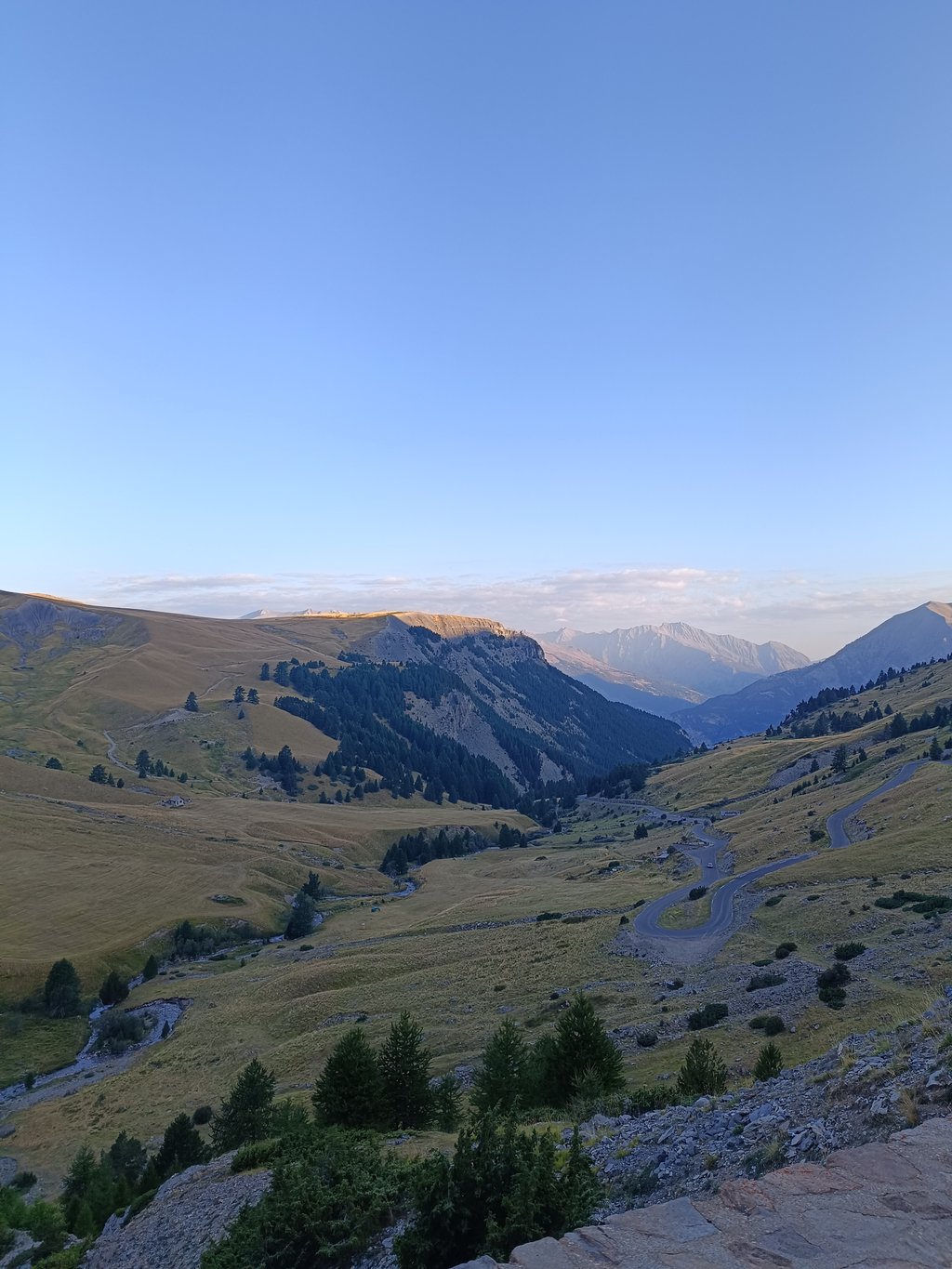
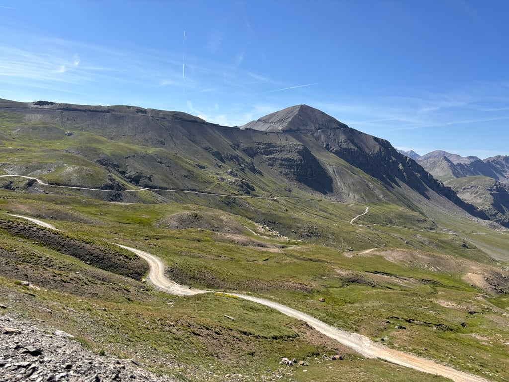
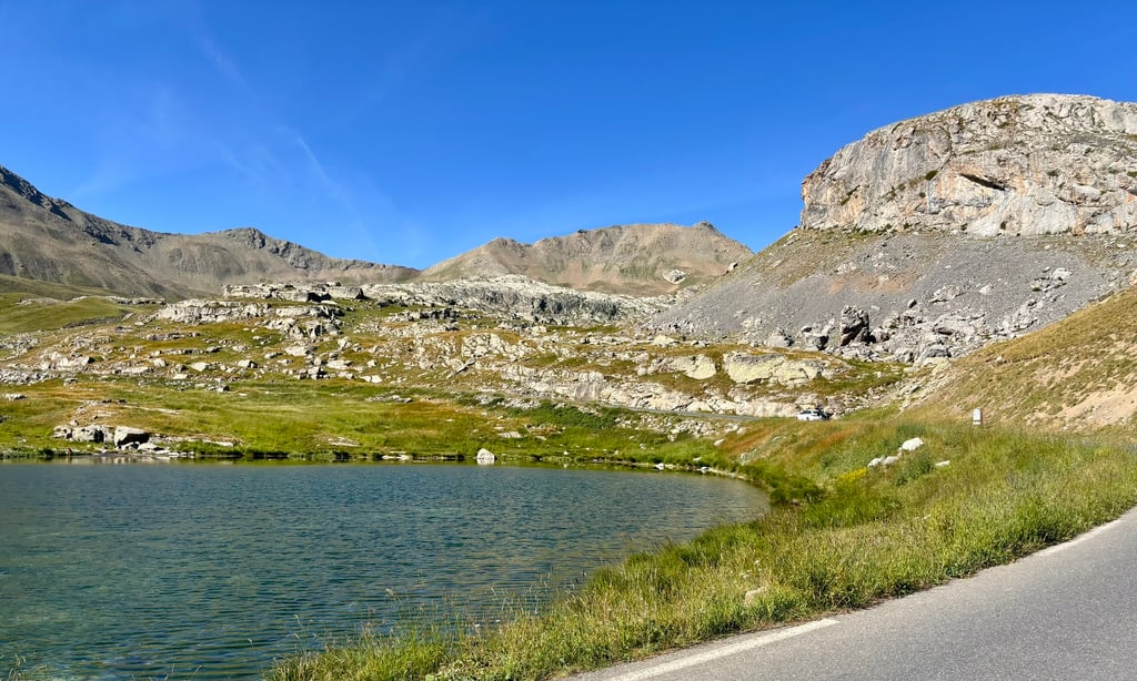
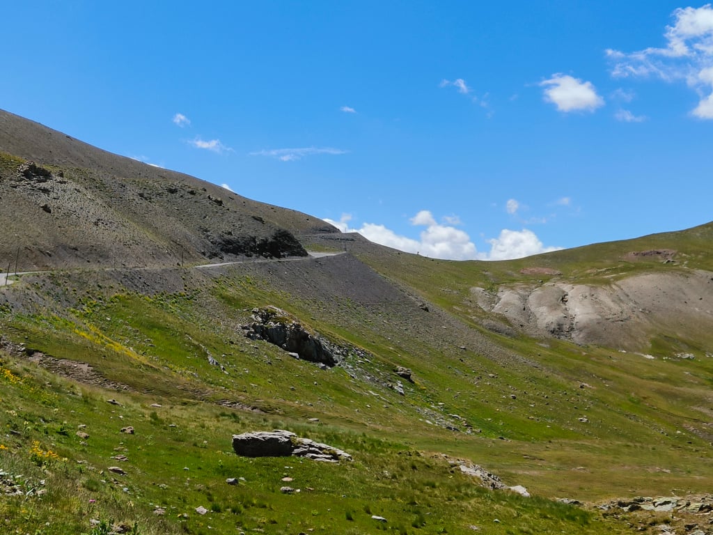
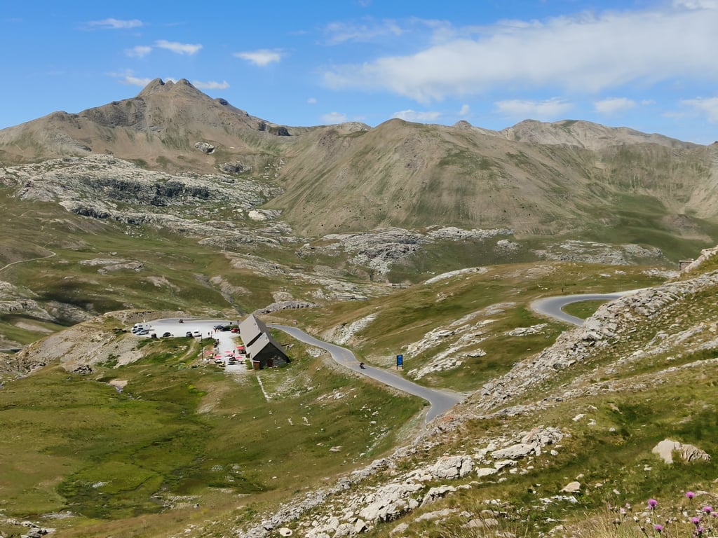
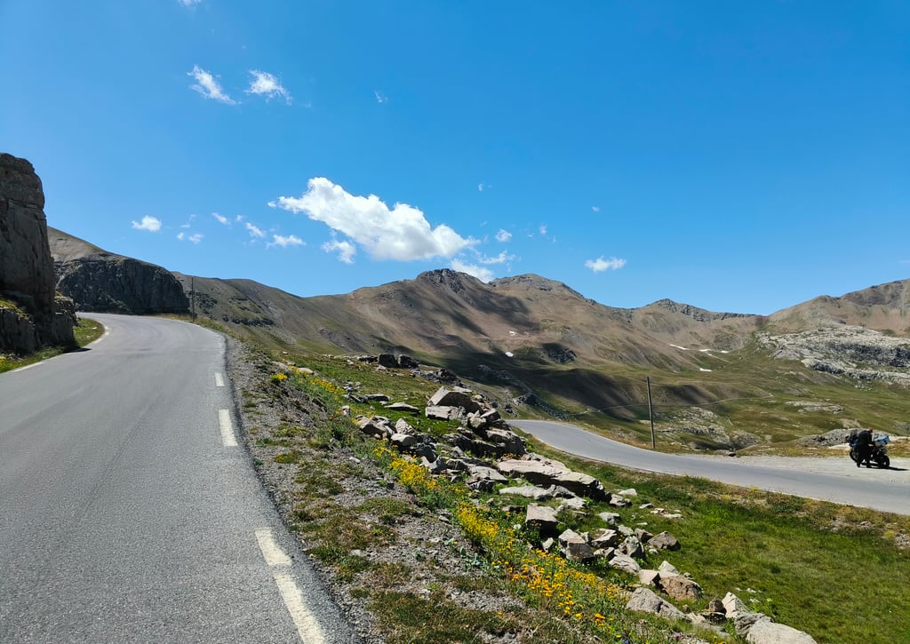
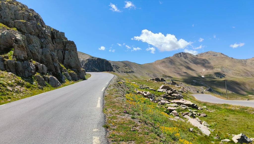
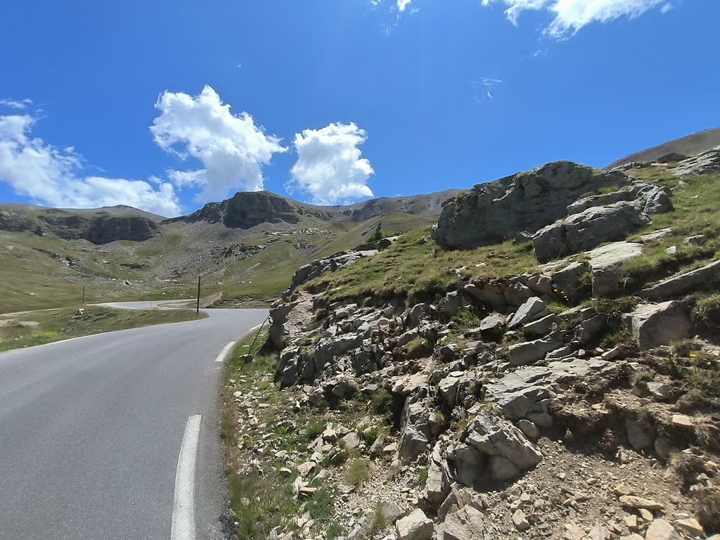
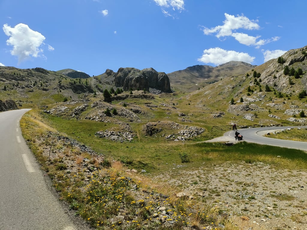
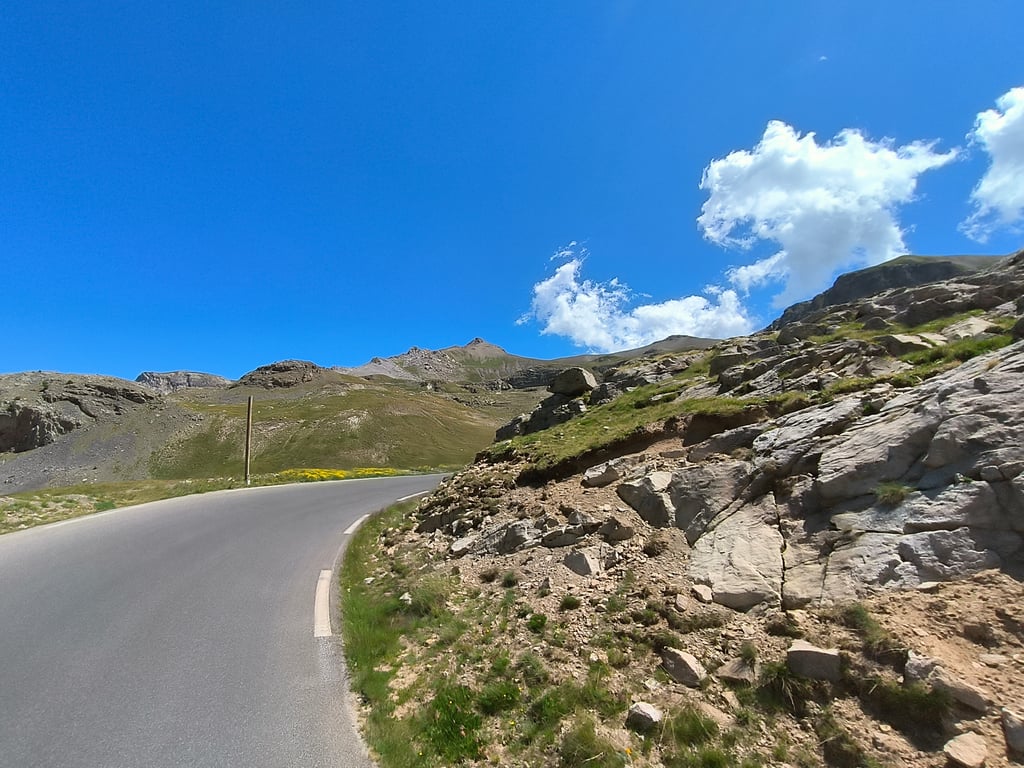
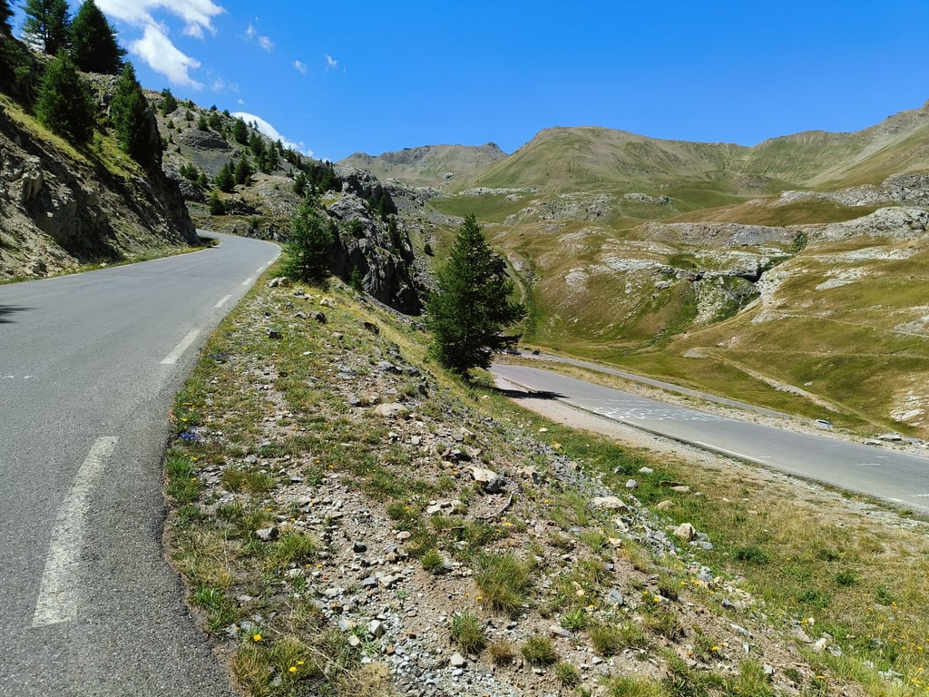
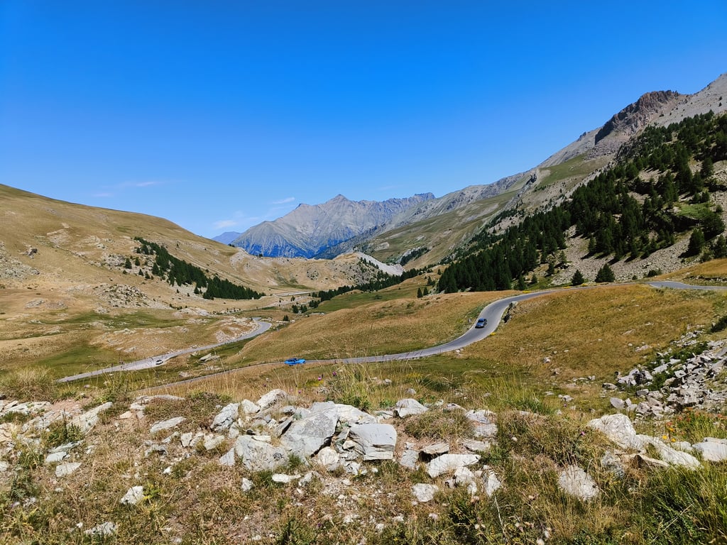
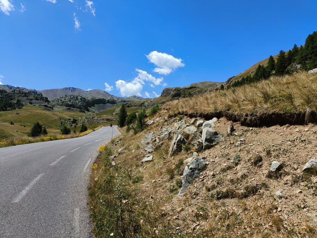
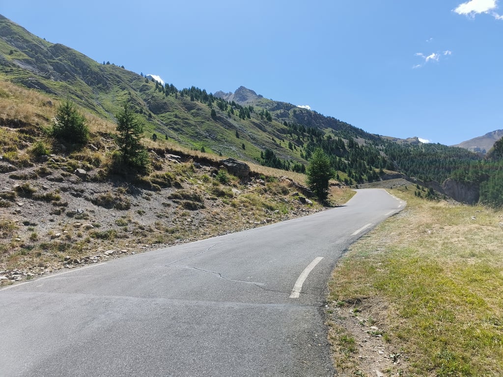
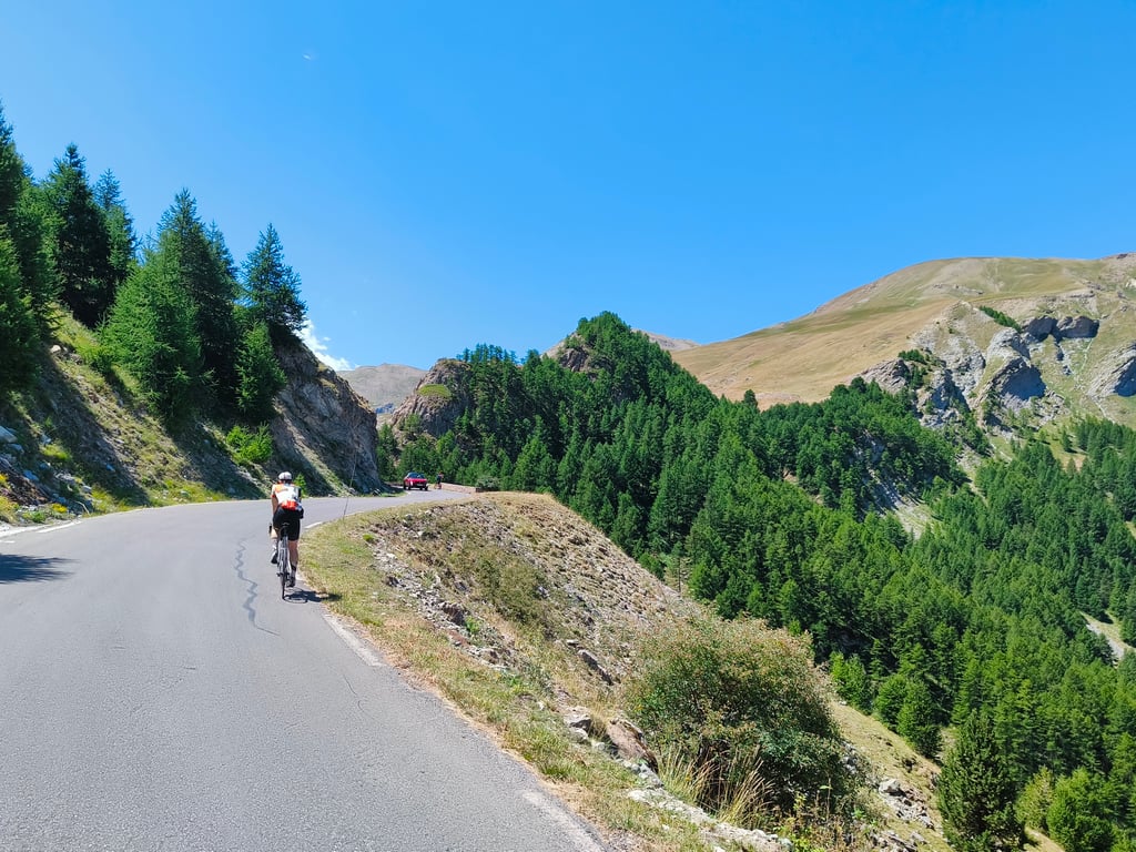
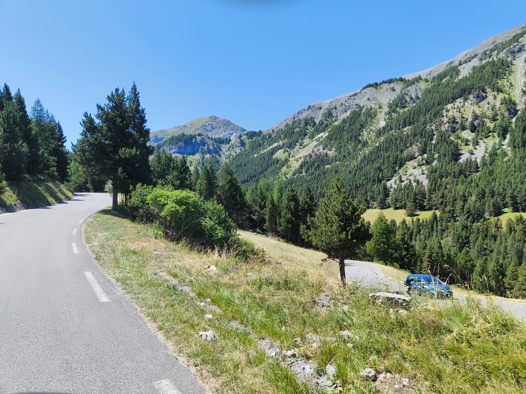
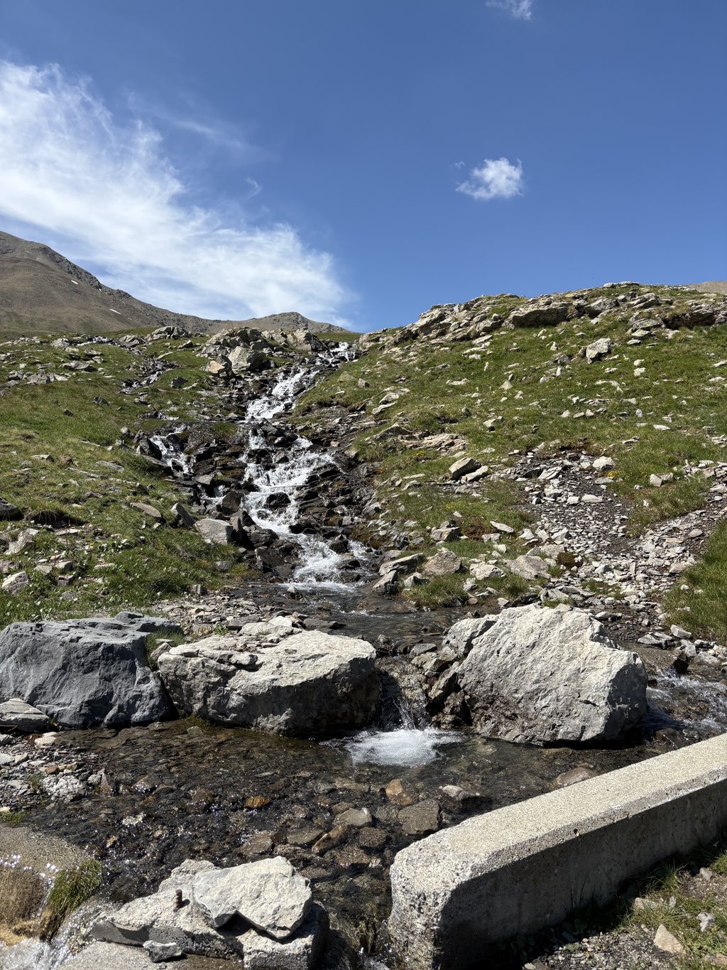
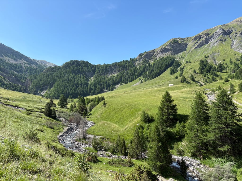
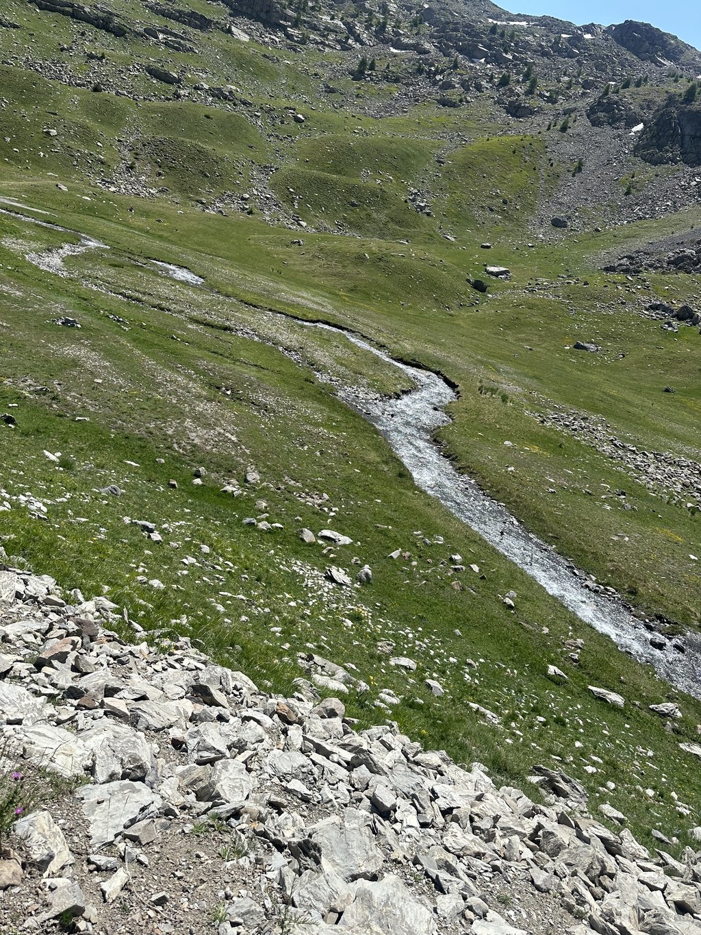
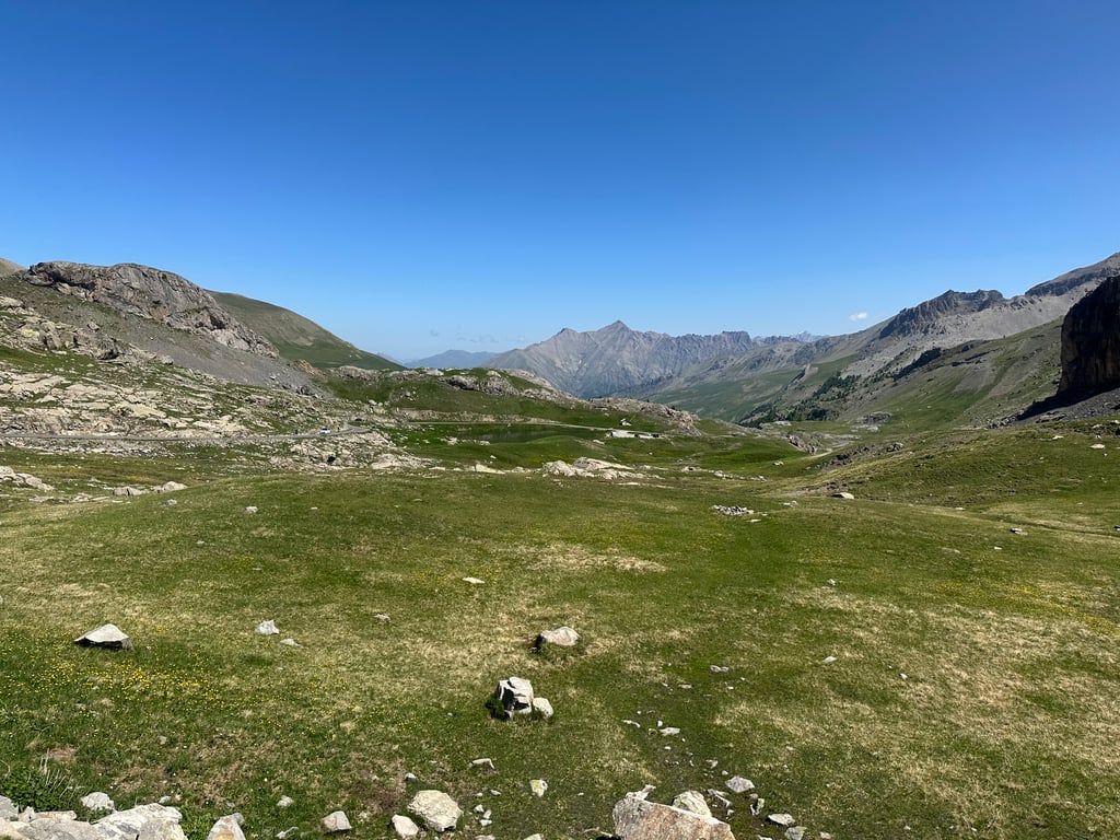
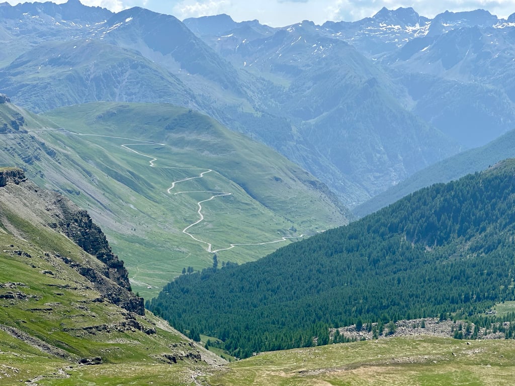
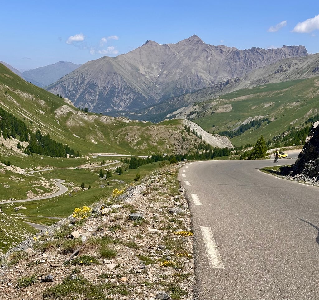
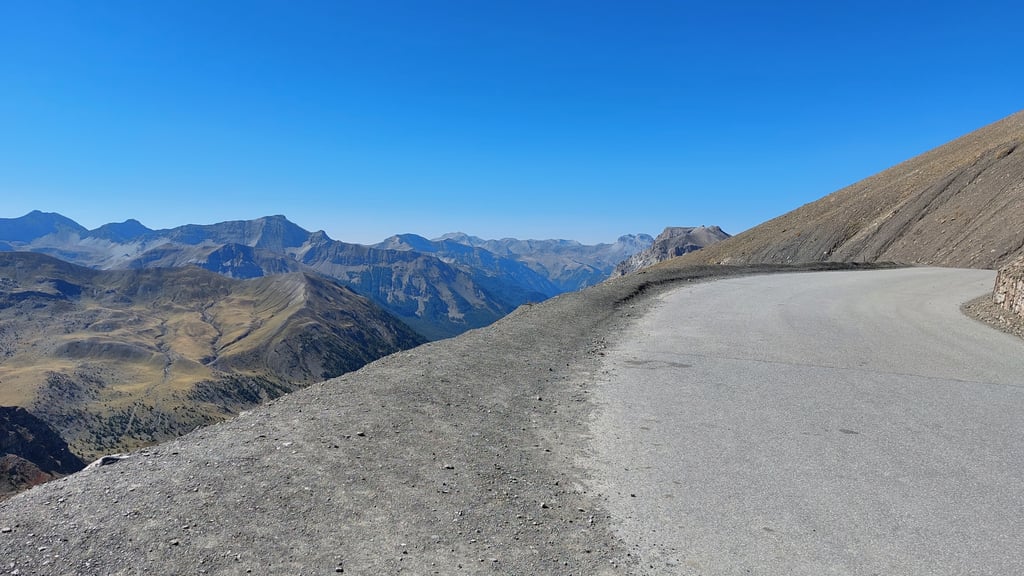
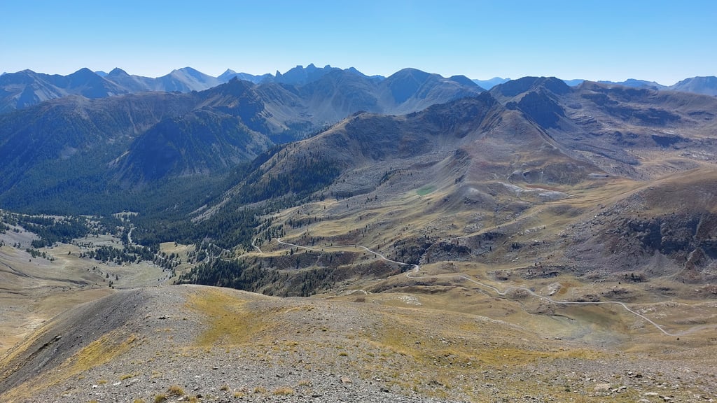
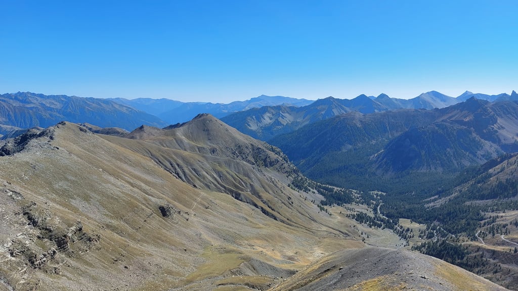
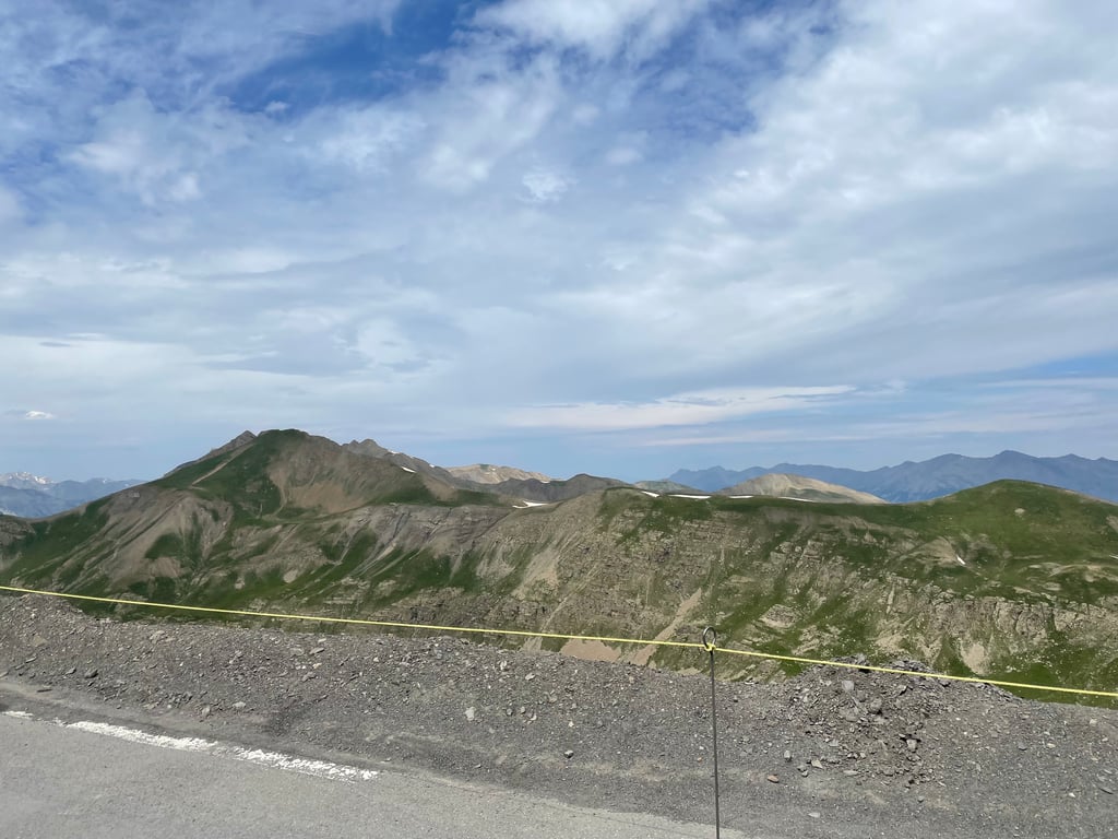
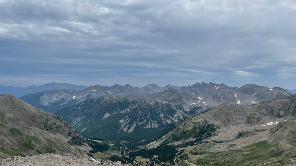
| Beautiful scenery |
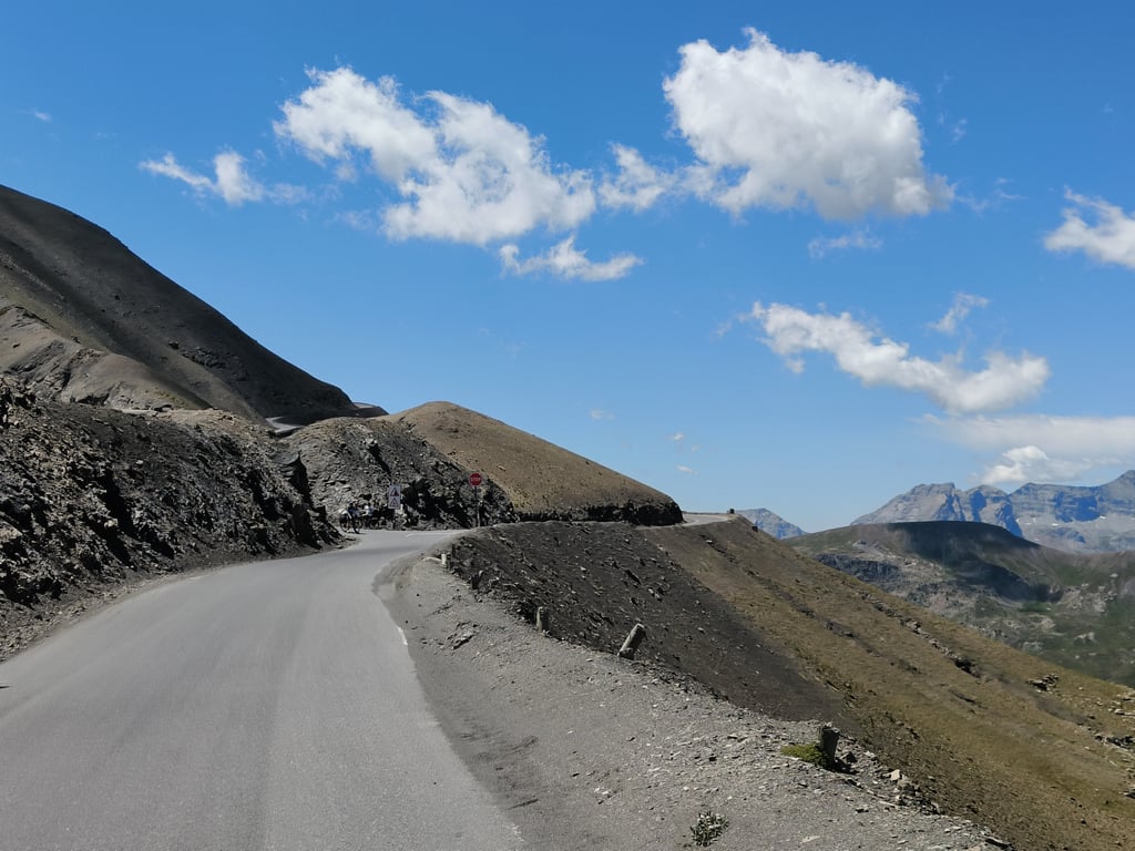
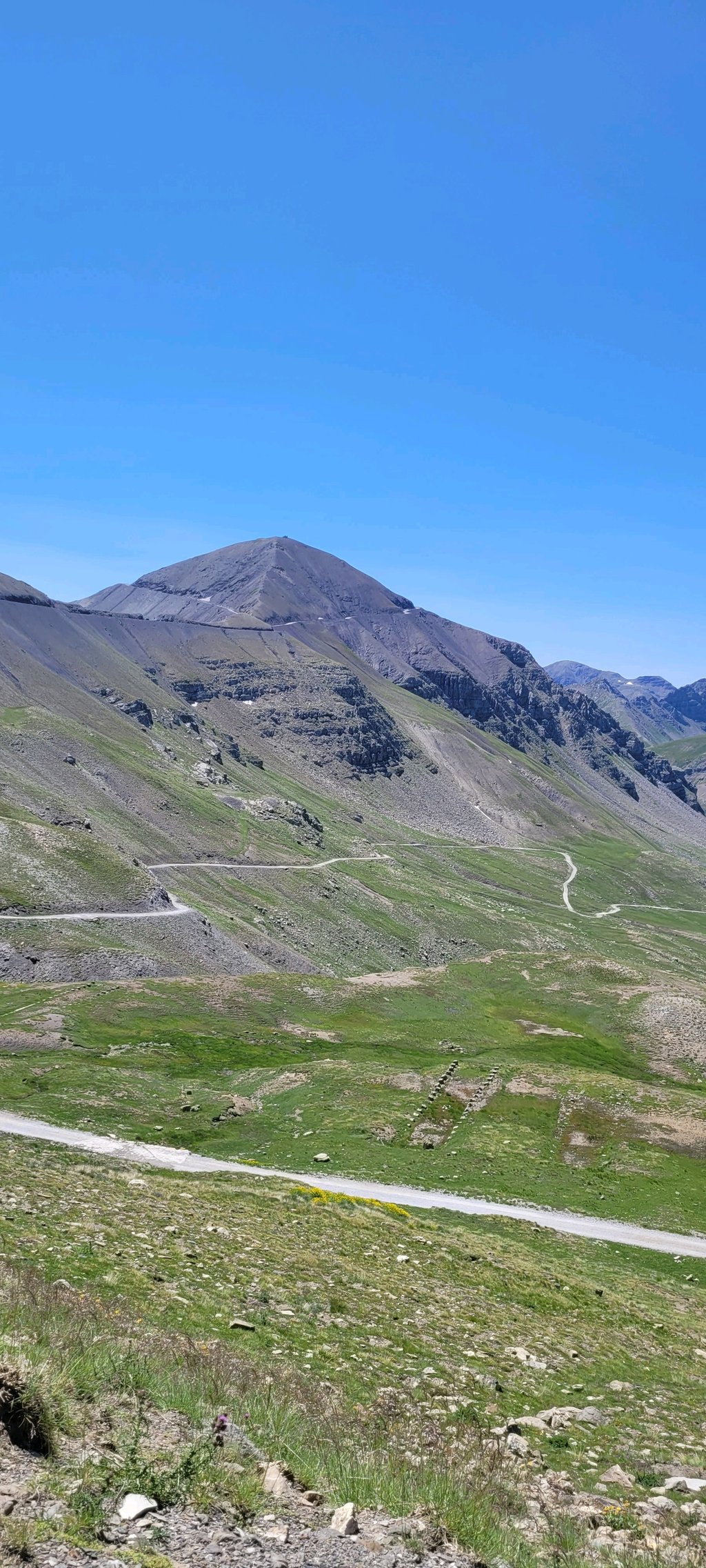
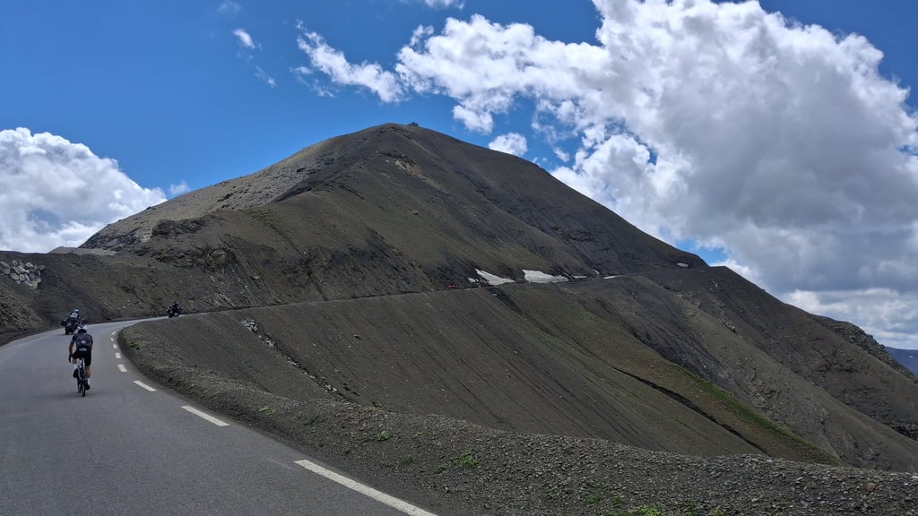
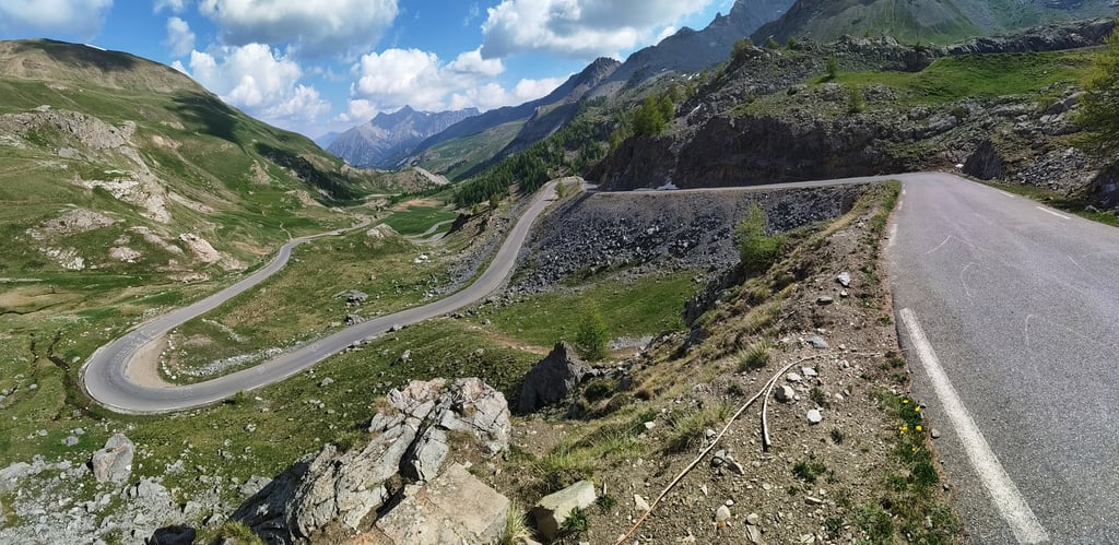
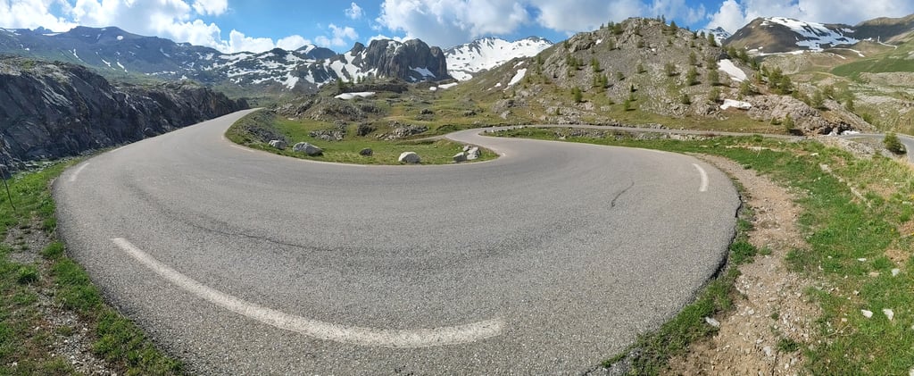
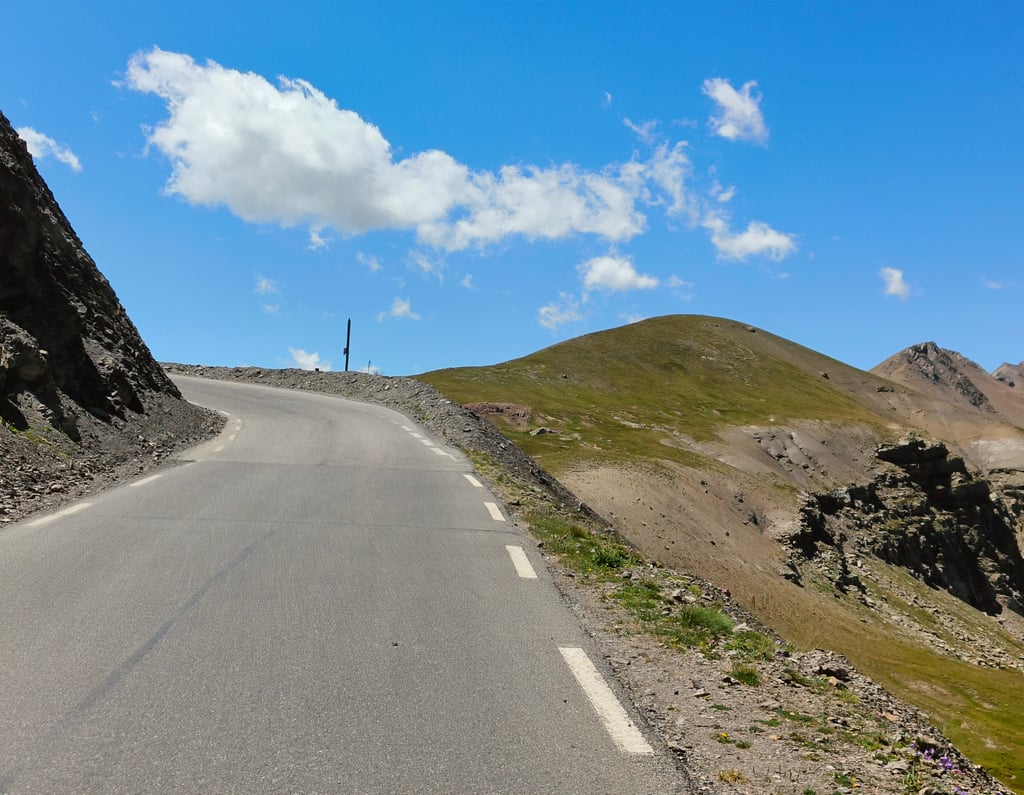
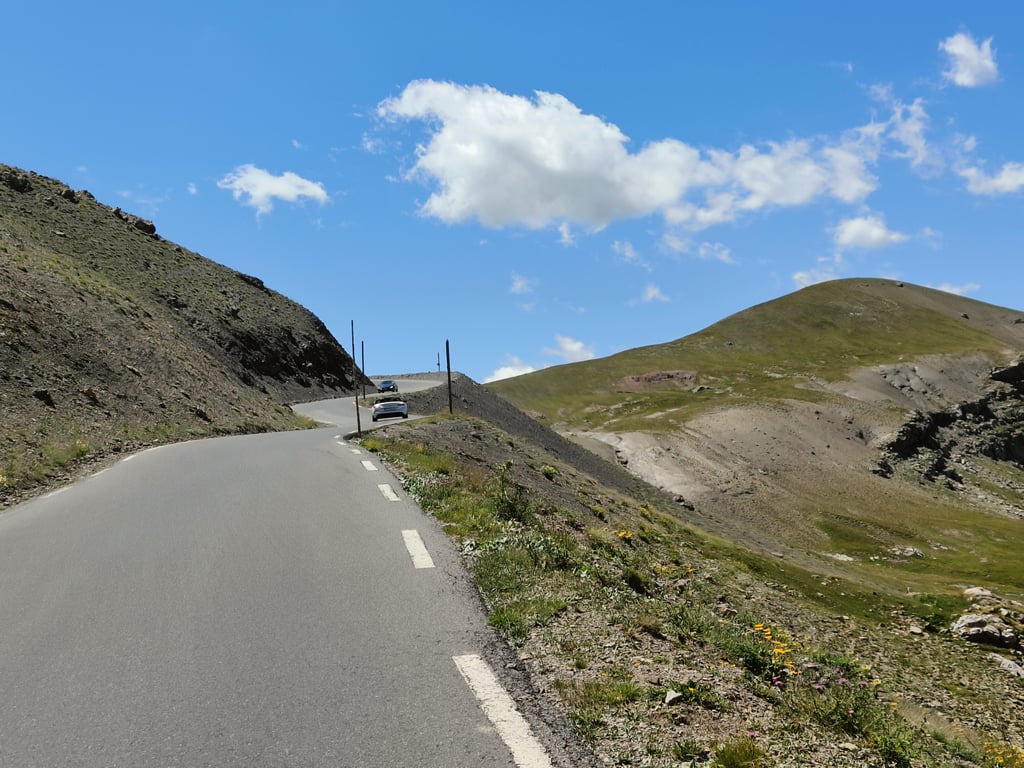
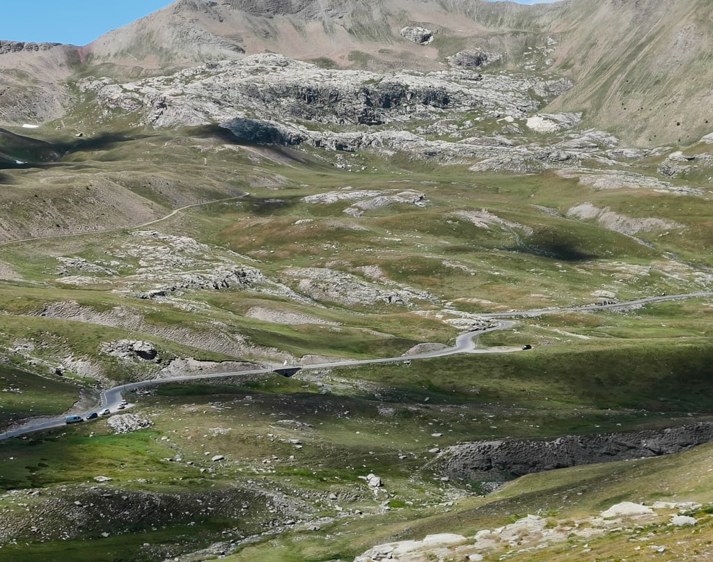
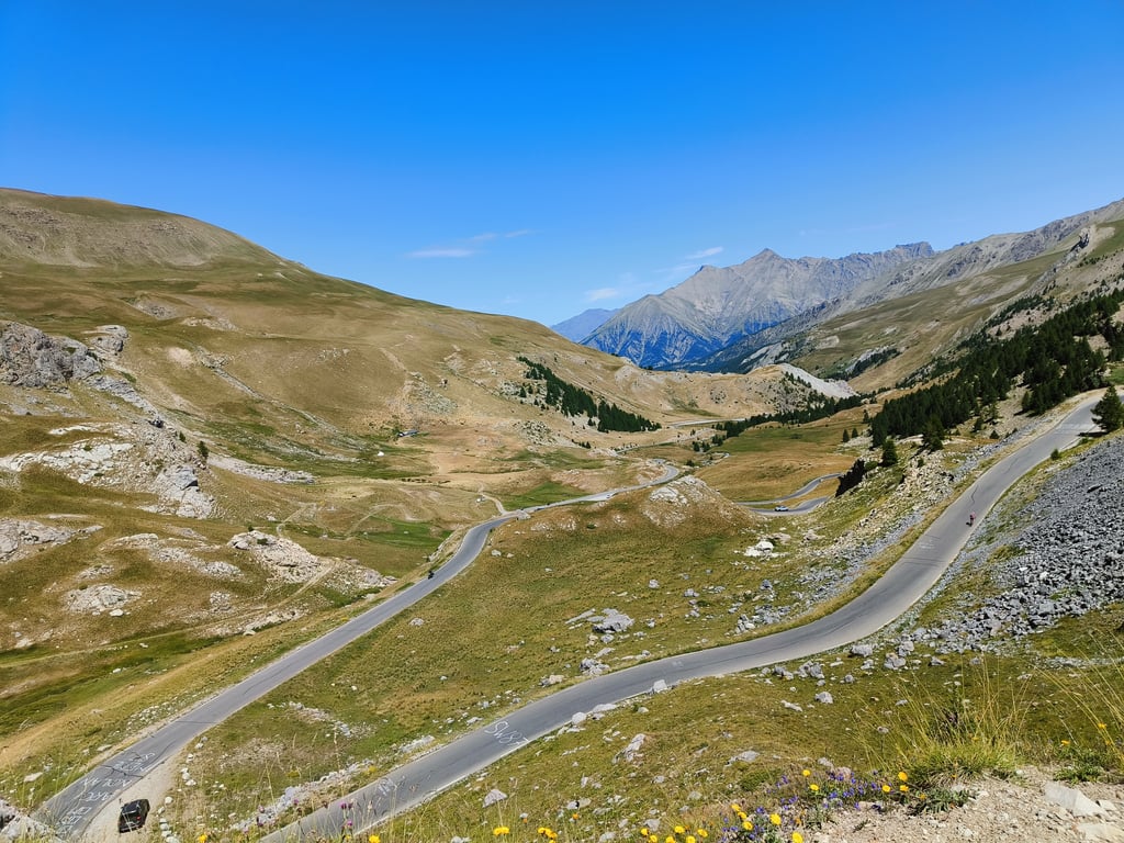
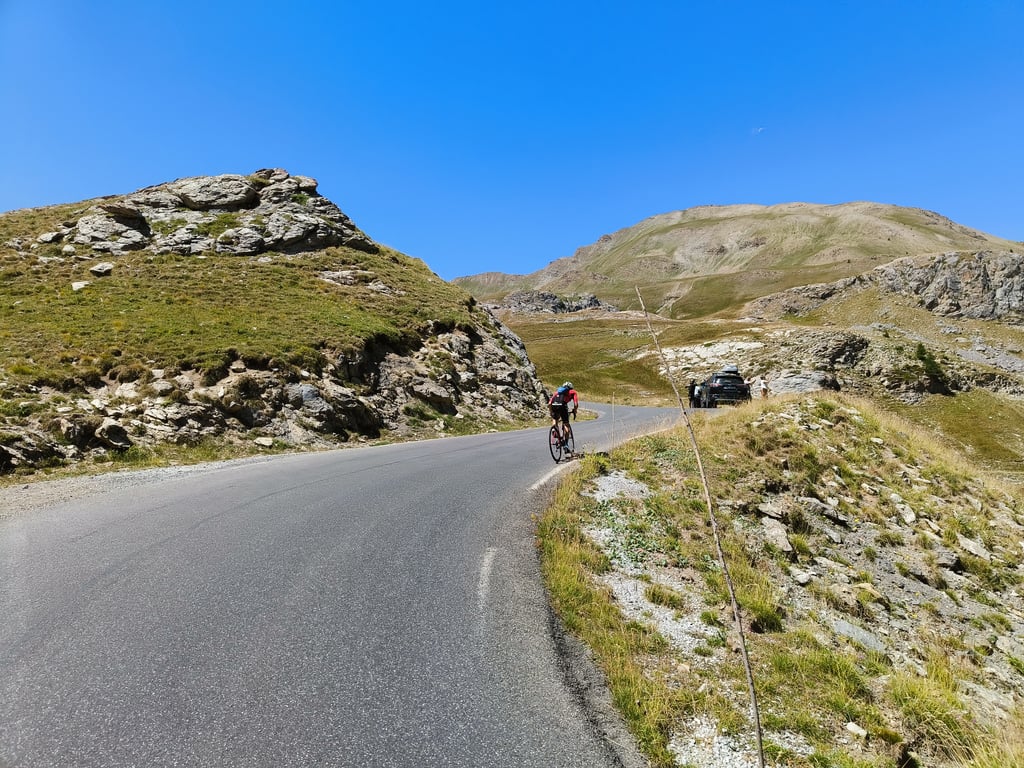
| 27 hairpin turns |
| #39 toughest climb of France |
| #16 most elevation gain of France |
| #58 longest climb of French Alps |
| #49 average steepest climb of Alpes-de-Haute-Provence |
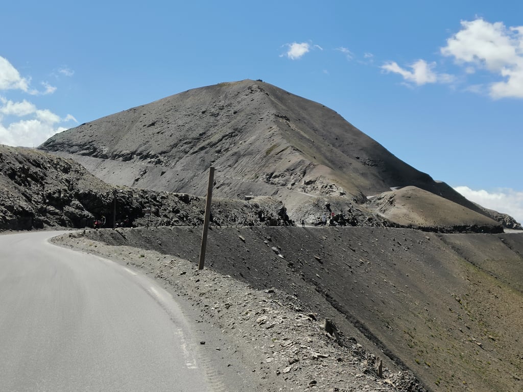
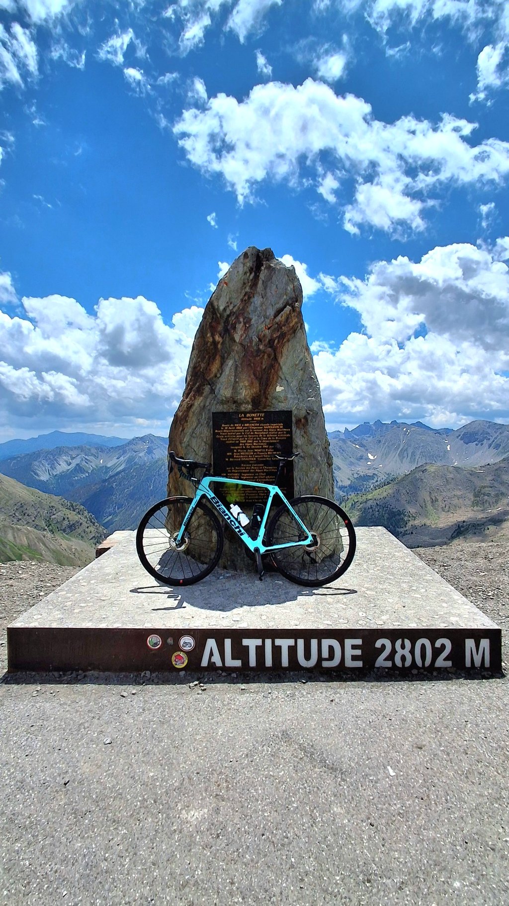
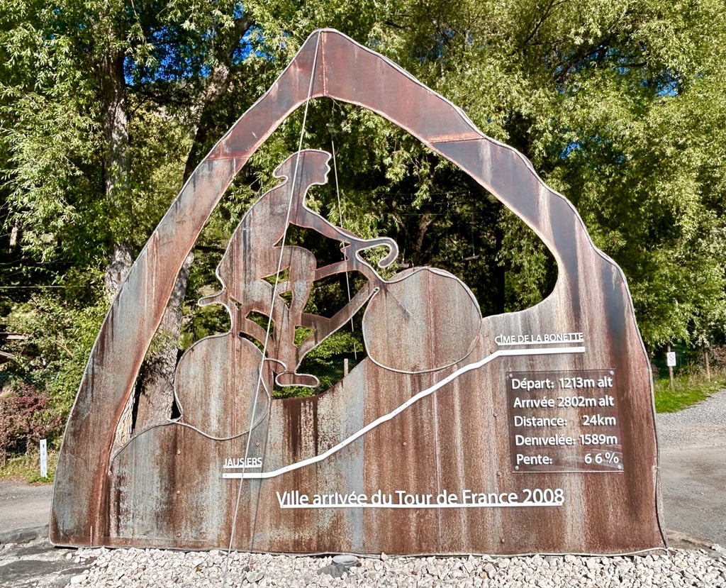
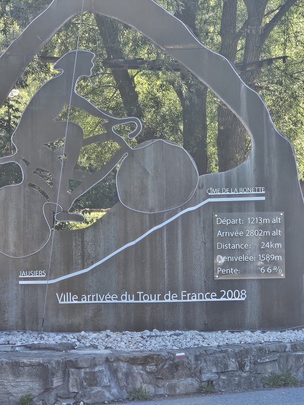
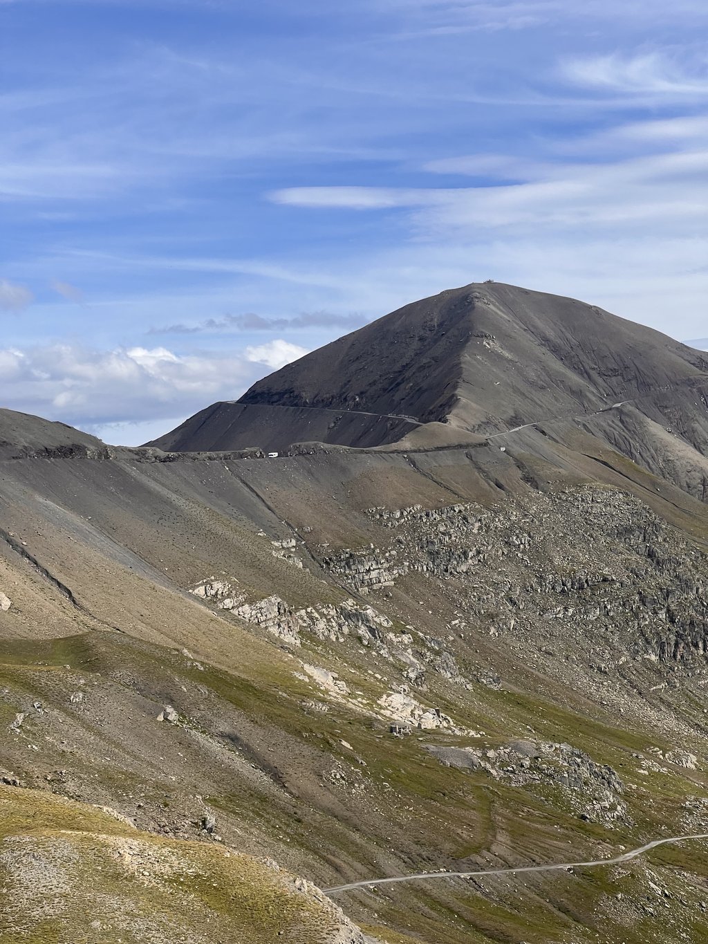
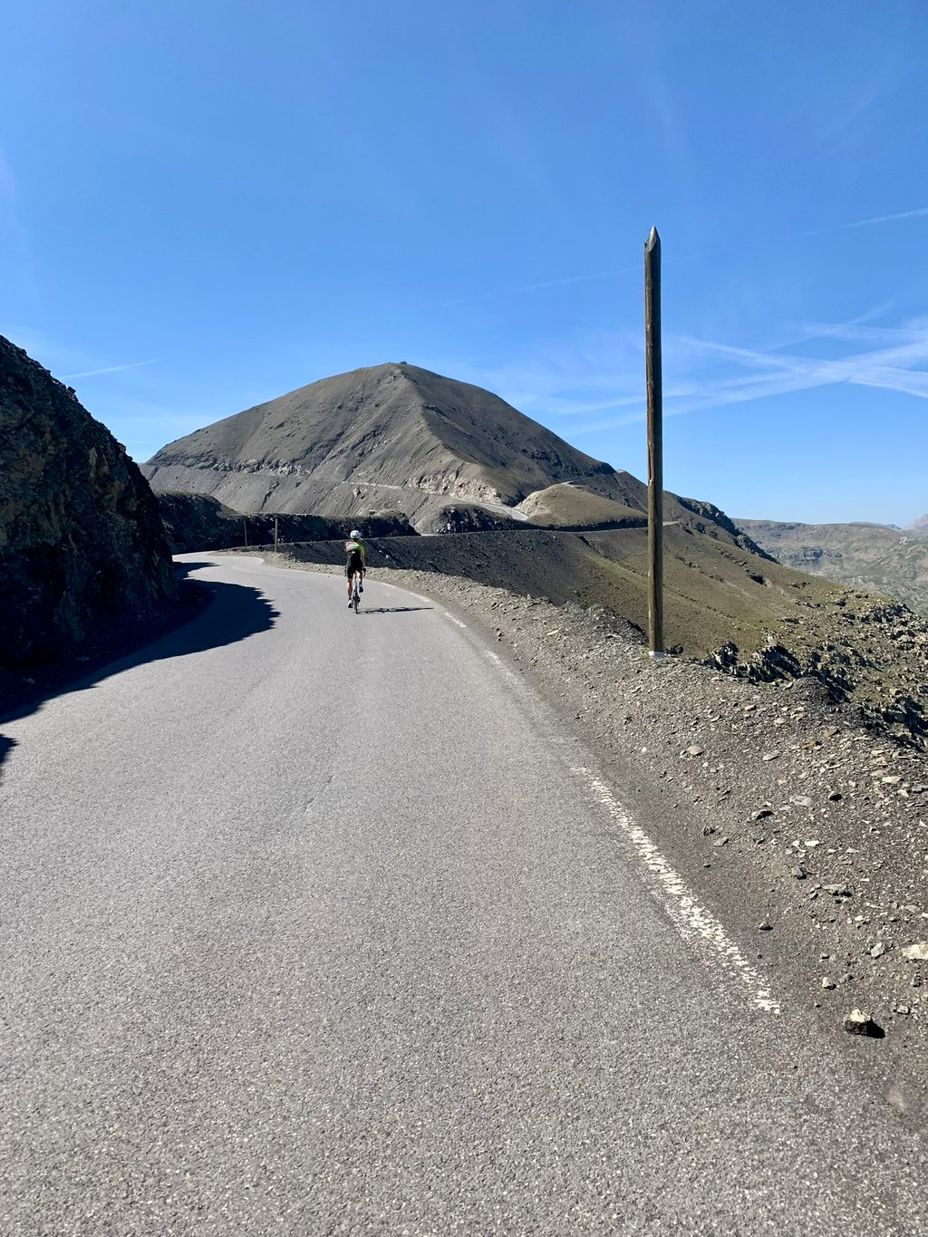
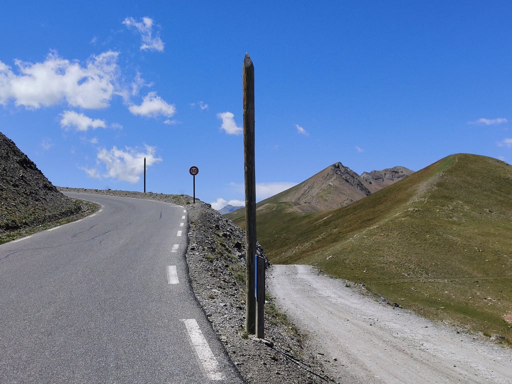
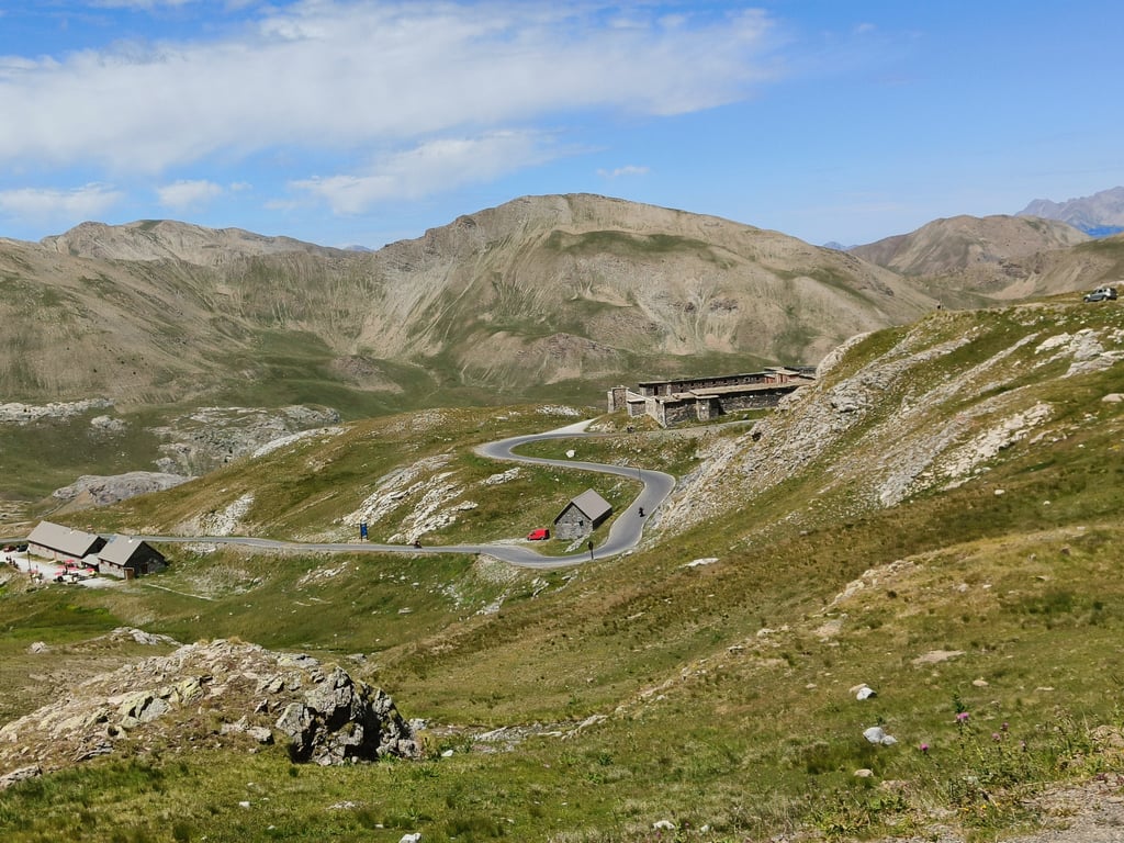
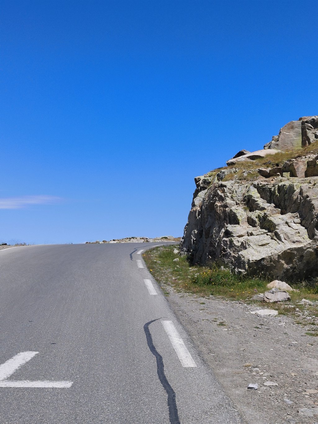
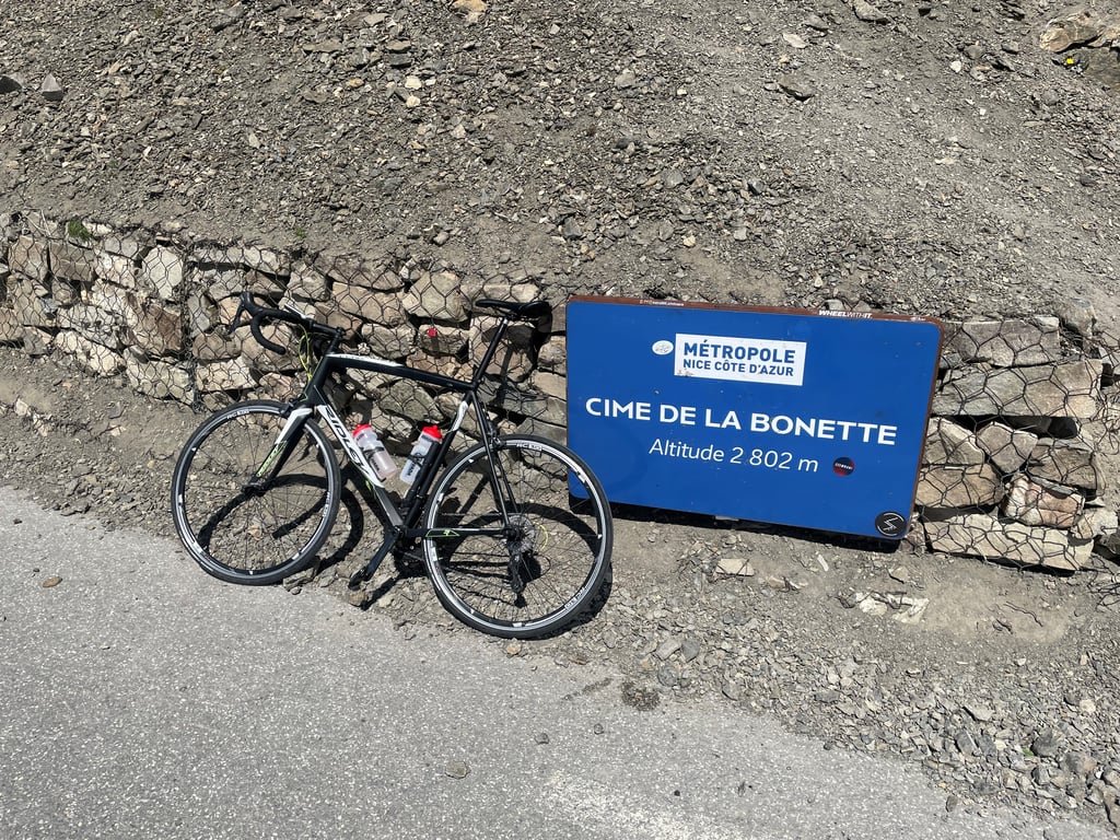
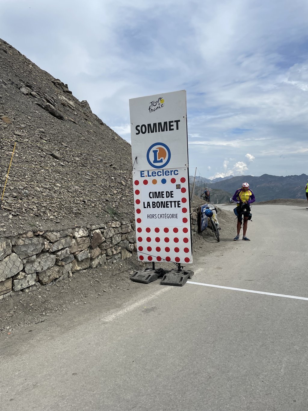
Cime de la Bonette is a climb in the region Serre Ponçon. It is 23.3 km long and bridges 1587 m of vertical ascent with an average gradient of 6.8%, resulting in a difficulty score of 1185. The top of the ascent is located at 2803 m above sea level. Climbfinder users shared 62 reviews of this climb and uploaded 190 photos.
Road name: Route de la Bonette
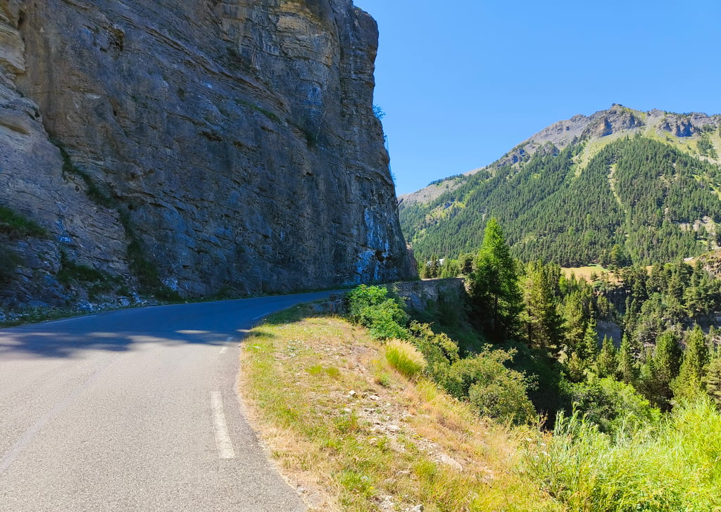
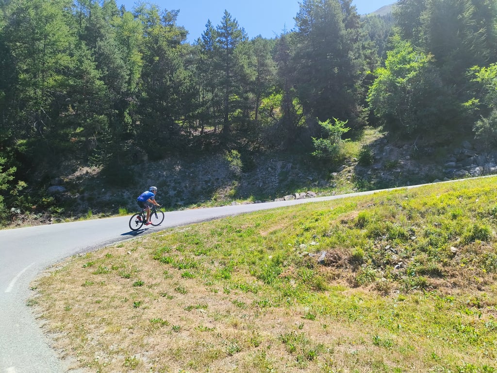
5.0 by JarmoThis is an automatic translation, the original language is: Dutch.The most beautiful climb in Europe. With precision. The first few kilometers you pass some french houses, but at a certain moment you enter a forest. This forest lasts only briefly. Then you come along large rock faces, where it is even briefly flat. After this you get to an accumulation of hairpin bends in the open meadow. The percentages never really get high, but it is the length and height of the climb that make it difficult. After having spotted the marmots in the open meadow, you will lite... read more
Welcome! Please activate your account if you would like to share something. Look for the verification email in your inbox.
If you want to upload your photos, you need to create an account. It only takes 1 minute and it's completely free.
A really lovely pass with magnificent scenery; there are a few quite challenging sections, but nothing insurmountable – except for the last kilometre up to the summit, which is absolutely gruelling!
Un très beau col avec des paysages magnifiques,quelques passages assez difficiles mais rien d'insurmontable sauf le dernier kilomètre pour monter jusqu'à la cime qui est terrible !
One of the most beautiful mountain passes we’ve ever cycled. Of all the passes on the Route des Grandes Alpes, we found this one to be slightly less busy. The final few kilometres, with the view of the sheer drop below, are breathtaking, and the last few metres up to the summit are very challenging. The view from the top will make all your efforts worthwhile.
Un des plus beaux cols que nous ayons fait. Parmi les cols de la route des Grandes Alpes, nous avons trouvé que celui-ci était légèrement moins fréquenté. Les derniers kilomètres avec la vue du vide sont impressionnants et les derniers mètres pour atteindre la Cime sont très exigeants. La vue au sommet récompensera tous vos efforts.
Really nice CDI and the road surface is in a decent state
Veramente bello il CDI e il manto stradale è in stato decente
Superb climb! With a surprising last kilometre before you are 'on top of the world'
Schitterende klim! Met een verrassende laatste kilometer voordat je ‘on top of the world’ bent
Long ascent through a super beautiful valley with percentages that allow for easy entry. Special to see how and especially where they have drawn a tarmac road leading to the Cime (2803m). The section from the col to this Cime de la Bonette is also the steepest ; however, the one and a half kilometres before the col allow you to calmly recover from the past 20km because there the road runs at very low percentages. Handy to know is that there is a little water fountain at 4km from Jausiers (in case you've already emptied a water bottle by then...), there is also a café at 11km (which was still open on weekdays in mid-September) and if that doesn't work out, there is a last little water fountain at km 12. Above all, ENJOY because it is definitely a Must Do col !
Yet a small but not unimportant warning: the asphalt seems 100% flat and some stretches allow a really fast descent but be alert because on some stretches there are really big bumps in the asphalt which can be fatal at high speeds...
Lange beklimming door een super mooie vallei met percentages die toelaten om er rustig in te komen. Bijzonder om te zien hoe en vooral waarin ze een geasfalteerde weg hebben getrokken die leidt tot de Cime (2803m). Het stukje van de col tot deze Cime de la Bonette is meteen ook het steilste ; je kan echter de anderhalve kilometer voor de col rustig herstellen van de voorbije 20km want daar loopt de weg aan heel lage percentages. Handig om weten is dat er een water fonteintje is op 4km van Jausiers (mocht je tegen die tijd al een bidon leeg gedronken hebben...), verder is er een café op 11km (dat ook half september nog doordeweeks geopend was) en mocht dat niet lukken dan is er op km 12 nog een laatste water fonteintje. GENIET vooral want het is zeker een Must Do col !
Toch nog een kleine niet onbelangrijke waarschuwing : het asfalt lijkt 100% vlak en sommige stroken laten ook echt een snelle afdaling toe maar wees alert want op sommige stukken zitten er echt wel dikke bulten in het asfalt die bij hoge snelheden wel eens fataal kunnen zijn...
Gewelde Klim that you must have done. It remains gradually steep around 6 to 7% with sections up to 10%. Leave some for the last bit to the cime as this section is very punchy with peaks up to 14%.
Gewelde Klim die je moet gedaan hebben. Het blijft geleidelijk steil rond de 6 a 7% met stukken tot 10%. Houd nog wat over voor het laatste stukje naar de cime want dit stuk is heel erg pittig met pieken tot 14%.
Relatively regular, which makes it accessible despite the distance of the climb. And a magnificent view all the way up and down.
Relativement régulière ce qui la rend accessible malgré la distance de montée. Ainsi qu'une magnifique vue tout qu long de la montée ainsi que la descente
Mind blowing, extraterrestrial landscape. One of the most beautiful climbs I've done so far for sure. The gradient is demanding, but not too hard, it's the air that gets thinner and thinner as you progress upwards. I even saw a marmotte. The view from the top is unforgettable
Mind blowing, extraterrestrial landscape. One of the most beautiful climbs I've done so far for sure. The gradient is demanding, but not too hard, it's the air that gets thinner and thinner as you progress upwards. I even saw a marmotte. The view from the top is unforgettable
Beautiful climb with super nice views! Mainly long, but as there are no extremely steep sections in it, it's doable. Last kilometres before the col recharge for the last bit to the cime!
Prachtige klim met een supermooi uitzicht! Vooral lang, maar doordat er geen extreem steile stukken in zitten goed te doen. Laatste kilometers voor de col opladen voor het laatste stukje naar de cime!
Clerical thing :-) Certainly not the most beautiful in the region, but yes - that mythical 2,800 metres you seize to tick it off anyway. The 'it does run well' I found disappointing, found it still just spicy - just before the top you get a little rest on your legs to start howling the last kilometre. A must-do. But just to have done.
Klereding :-) Zeker niet de mooiste in de regio, maar ja - die mythische 2.800 meter die grijpt je toch aan om ‘m af te vinken. Het ‘hij loopt wel lekker’ vond ik tegenvallen, vond ‘m toch gewoon pittig - net voor de top krijg je een beetje rust aan je beentjes om de laatste kilometer te gaan huilen. Een must-do. Maar gewoon om gedaan te hebben.
Wonderful climb! Heavily steep at the end! Super beautiful scenery, you must do this one if you are in the area!
Prachtklim! Op het einde heftig steil! Supermooie omgeving, deze moet je doen als je in de buurt bent!
Climbed in August 2024. The scenery was varied and splendid, the surface was top-notch and the weather that day was ideal. It was by far the best climb of my young cycling career!
Ascension faite en août 2024. Des paysages variés et splendides, un revêtement au top, une météo idéale ce jour-là. C'est de très loin la plus belle ascension de ma jeune carrière de cycliste!
Done this climb in August 2023. The weather at the start was good and sunny, but don't underestimate the altitude and thus temperature difference at the summit. The climb is long but nicely gradual uphill. Except for the last bit to the 'cime'. That is really steep and (partly because of the altitude) very tough.
Deze klim gedaan in augustus 2023. Het weer bij de start was goed en zonnig, maar onderschat niet de hoogte en dus temperatuurverschil op de top. De beklimming is lang maar wel mooi geleidelijk omhoog. Behalve het laatste stukje naar de 'cime'. Dat is echt steil en (mede door de hoogte) erg zwaar.
It is not super challenging but there is something very special. It’s difficult to refuel and is very remote. Come prepared. It was quite cold at the top in late July when I done it.
Is it the most beautiful climb? Is it not the most beautiful climb? Is it the highest climb? Isn't it the highest climb? Doesn't matter all that much, it's a climb you absolutely must have done. The Bonnet actually runs wonderfully, the views are stunning and it never really gets very steep for long. Well, apart from the last bit towards the "Cime". It is very steep and doesn't do the legs any favours after more than 20 kilometres of climbing
Is het de mooiste klim? Is het niet de mooiste klim? Is het de hoogste klim? Is het niet de hoogste klim? Maakt allemaal niet uit, het is een klim die je absoluut gedaan moet hebben. De Bonnet loopt eigenlijk heerlijk, de uitzichten zijn prachtig en het wordt eigenlijk nooit echt lang heel steil. Nou ja, op het laatste stukje richting de “Cime” na dan. Dat is heel steil en doen de benen na dik 20 kilometer klimmen weinig plezier
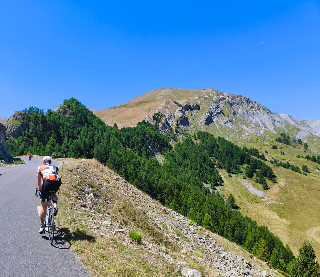
A tough beautiful climb, especially up above the Pine forests, on the Alpine landscape.
harder than profile suggests. the roadside markers say 9.3% at 7km to go, then 9.2% at 6km to go. after that it stayed at 8-10% excep for 2nd last km where it flattens for 500m. wonderful scenery. Cime opened to all traffic. no marmottes, i thinl because too many motorbikes cars motorhomes vans… quite heavy traffic this morning ! 16 June 2025
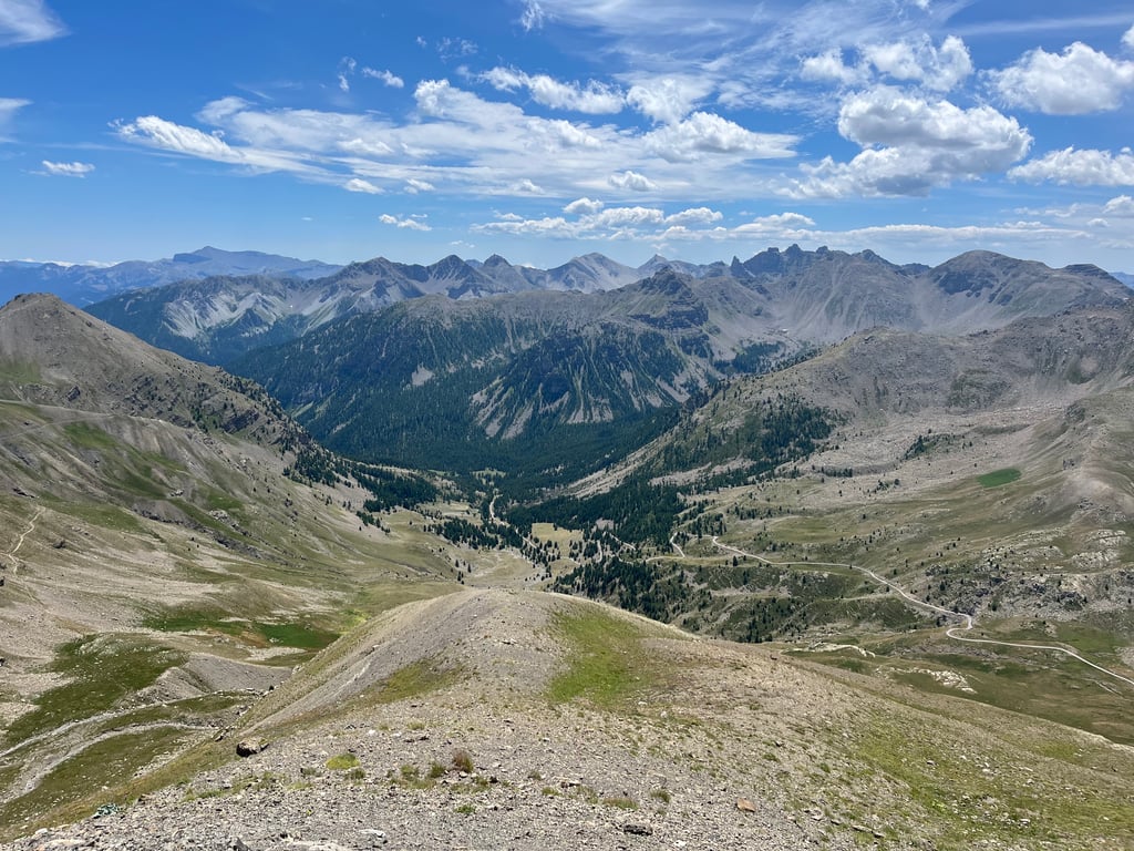
What a beautiful climb! It is not very steep, but the length (and at one point the height) make it tough. The base was in the middle of nowhere for my liking after which you slowly snake up. The views change constantly and are very beautiful. Especially the last tough stretch along the black volcanic walls is surrealistically beautiful! Then you. can catch your breath at the highest point and enjoy the beautiful rugged views and the vultures flying around.
Wat een prachtige klim! Het is niet heel stijl, maar de lengte (en op een gegeven moment de hoogte) maken het wel zwaar. De voet lag voor mijn gevoel in de middle of nowhere waarna je langzaam omhoog slingert. De uitzichten veranderen continue en zijn erg mooi. Vooral het laatste zware stuk langs de zwarte vulkanische wanden is surrealistisch mooi! Vervolgens kan je. op het hoogste punt even op adem komen en genieten van het prachtige ruige uitzicht en de gieren die er rond vliegen.
Climbed on a sunny day from Jausiers. One of the nicer climbs I've done. It's long, occasionally a bit steeper (especially the last bit) but definitely worth it. The views are very nice everywhere, you're definitely going to enjoy this.
Op een zonnige dag beklommen vanuit Jausiers. Een van de mooiere beklimmingen die ik heb gedaan. Het is lang, af en toe wat steiler (vooral het laatse stukje) maar beslist de moeite waard. Het uitzicht is overal erg mooi, je gaat hier zeker van genieten.
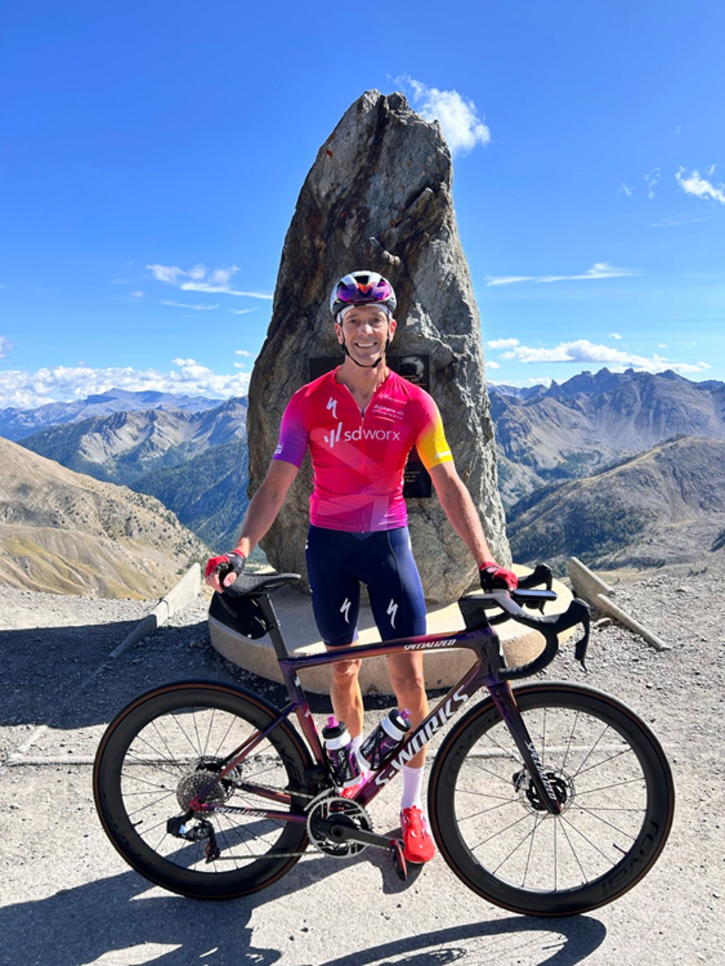
The day before the big day, I first explored the start of the climb with Monique.
On 29 August 2024, we cycled up the Col de la Bonette. I had resolved to take it easy especially in the beginning, only that wasn't easy when things were going well. This was mainly because I know that the last kilometre to the Cime is lousy, and that it is at 2,800 mtr altitude.
I found the climb irregular with percentages between 6% and 10%, and that was tough. Well the whole climb I did feel, it's doable, but in parts best tough around kilometres 14 and 15. Almost at the last kilometre it was flat to take the pressure off your legs for a while. The last kilometre to the Cime are untold hard. My bike computer repeatedly indicated 13%. This last stretch went deep into the red. And so I arrived at the summit with my tongue on the handlebars.
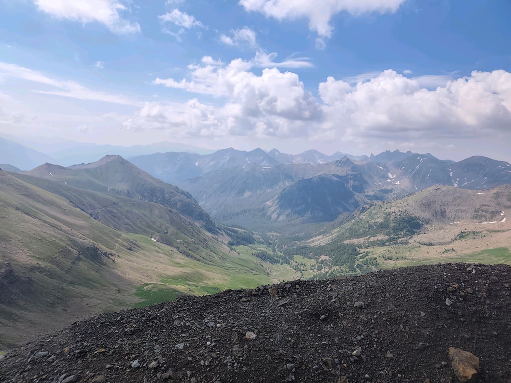
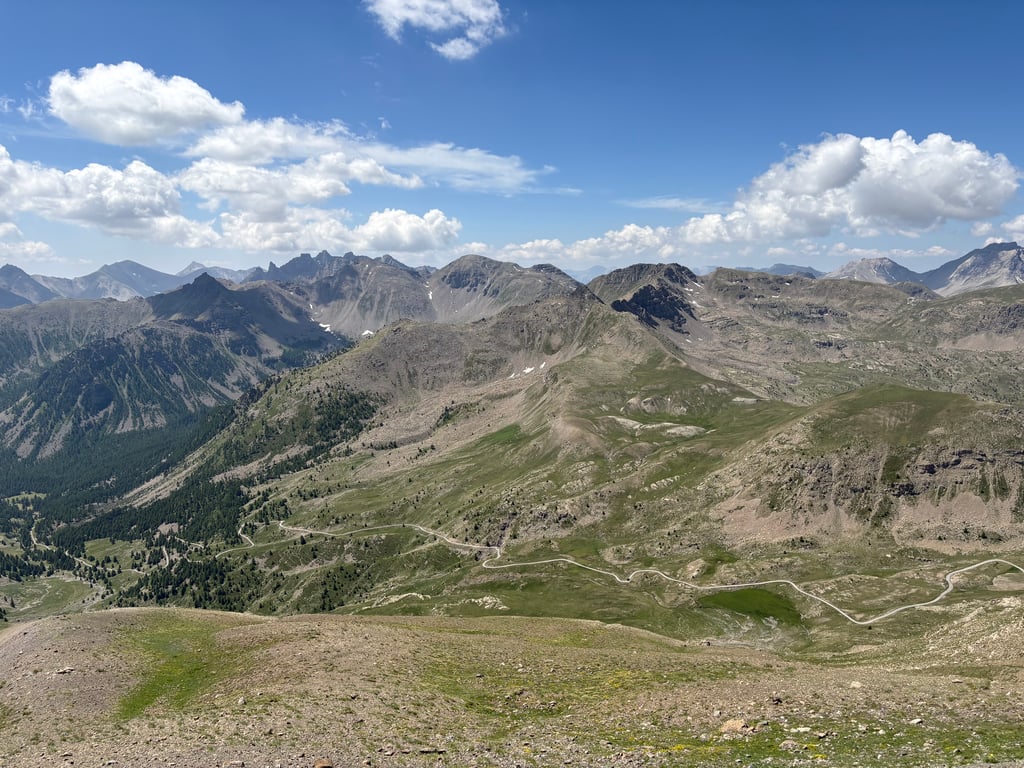
This was a great experience to do and experience. And at the summit a breathtaking view of the Alpine peaks. If you are in the area do the climb. The experience of climbing and reaching the summit is a great memory to take with you.
De dag voorafgaande aan de grote dag heb ik samen met Monique eerst het begin van de klim verkend.
Op 29 augustus 2024 zijn we de Col de la Bonette opgefietst. Ik had mezelf voorgenomen vooral in het begin rustig aan de te doen, alleen dat viel niet mee als het lekker gaat. Dit was vooral omdat ik weet dat de laatste kilometer naar de Cime loeizwaar is, en dat het op 2.800 mtr hoogte is.
Ik vond de klim onregelmatig met percentages tussen de 6% en 10%, en dat was lastig. Wel de hele klim het gevoel, het is goed te doen, maar op stukken beste zwaar zo rond kilometer 14 en 15. Bijna bij de laatste kilometer was het vlak om even de druk van je benen te halen. De laatste kilometer naar de Cime zijn onnoemelijk zwaar. Mijn fietscomputer gaf herhaaldelijk 13% aan. Dit laatste stuk ging diep in het rood. En zo kwam ik met mijn tong op het stuur op de top.
Dit was een geweldigde ervaring om te doen en te beleven. En op de top een adembenemend uitzicht over de Alpentoppen. Als je in de buurt bent de klim doen. De ervaring van de klim en de top te behalen is een mooie herinnering om mee te nemen.
Truly a fantastic climb!
Yesterday with my 11-year-old son from the campsite at
Lac de serre-ponçon to Jausiers to start our adventure there!
And it was.
First kilometres tough because of the heat but steadily on towards "stop 2000" where we did a lovely pie and cold drink. (Should you really want to sit here, booking is advisable, we were able to sit inside for a while).
Along the way we cooled off in a stream and at the trout pond had a sandwich from our follow car! Wife and daughter had two downhill skateboarders up with them who were hitchhiking and we came across them later when they went down😲.
Landscape changes and the view widens.
On to the top and how well we went.
The last part, which you can see for a while, is really tough but at the top our wife and daughter and many other people are cheering us on.
The bonette is a fantastic climb and we (almost😊) enjoyed every kilometre of it!
Highly recommended!
Echt een fantastische klim!
Gister met mijn zoon van 11 vanuit de camping aan
Lac de serre-ponçon naar Jausiers om daar ons avontuur te beginnen!
En dat was het.
Eerste kilometers zwaar door de warmte maar gestaag door richting “halte 2000” waar we een heerijk taartje en koud drankje deden. (Mocht je hier echt willen zitten is reserveren een advies, wij konden wel even binnen zitten)
Onderweg de verkoeling in een beekje en bij de forellenvijver een broodje van onze volg auto! Vrouw en dochter hadden twee downhill skateboarders mee omhoog die stonden te liften en kwamen we later toen ze naar beneden gingen tegen😲.
Landschap verandert en het uitzicht wijder.
Door naar boven en wat gaan we lekker.
Laaste stuk wat je al een tijdje ziet is echt nog zwaar maar bovenop staan vrouw en dochter en veel andere mensen ons aan te moedigen.
De bonette is een fantastische klim en we hebben er (bijna😊) elke kilometer van genoten!
Een absolute aanrader!
In my cycling"career" which started two years ago, a tradition is immediately emerging: a giant col every summer holiday. After Mont Ventoux in 2022 and the Stelvio (from Prato, so with the hairpin bends) it was now the turn of the Bonnette.
Easier than the Stelvio I could have thought beforehand, because just as long and slightly less steep. In my case, appearances were deceptive, because I found 'm tough! And above all very beautiful and cool to climb.
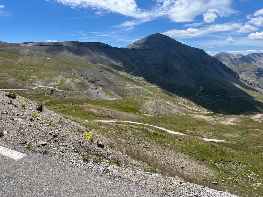
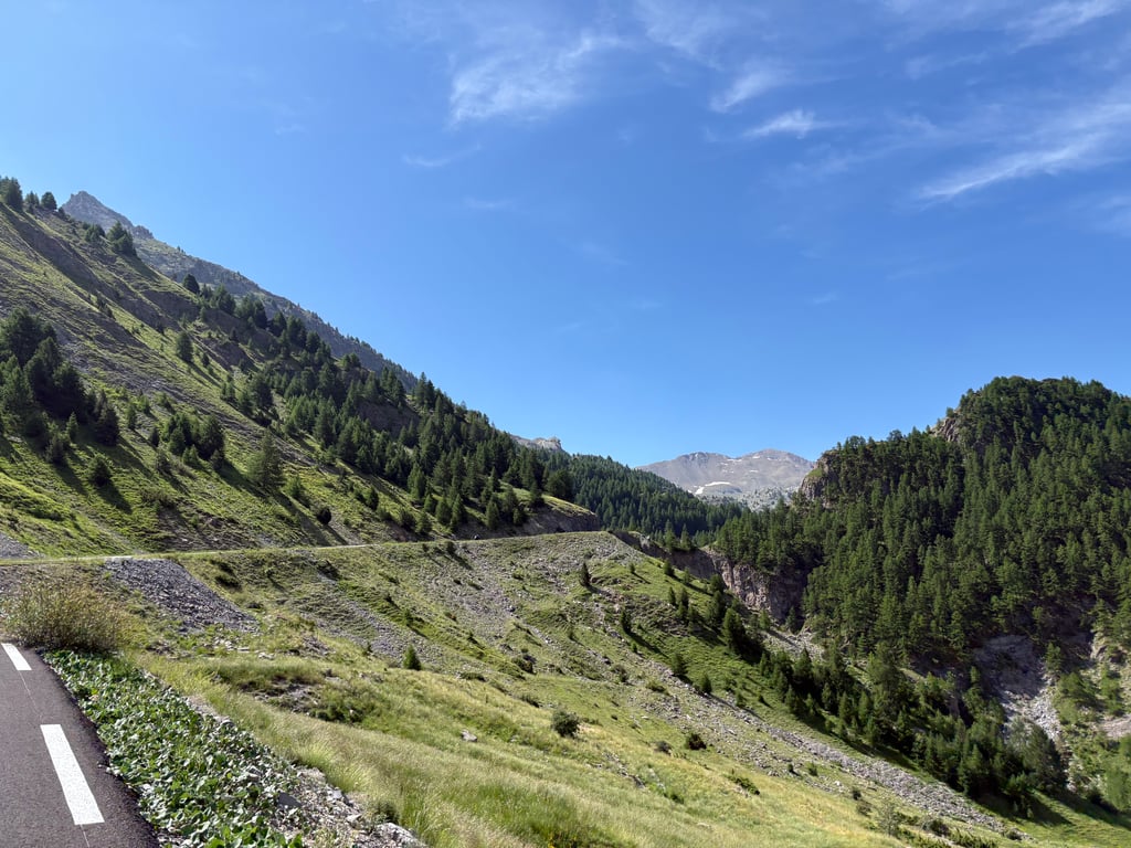
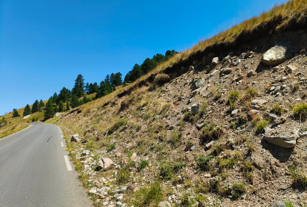
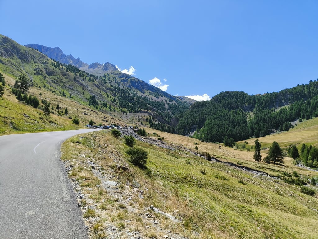
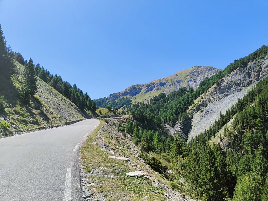
Where several other reviewers mentioned the swarms of flies, I kept them at home. So no trouble at all. The climb itself is very varied. The panorama changes every few kilometres. From grass and deciduous trees to rocky outcrops, to conifers and finally the unspoilt and almost desolate landscape belonging to the high mountains. After some 21km of climbing, you are treated to a first view of the Cime. And you can already see the riders in front of you toiling upwards. Once at the top, having experienced the tough finish yourself, you feel the satisfaction. Mission accomplished!
In mijn fiets"carrière" die twee jaar geleden startte, is direct een traditie aan het ontstaan: iedere zomervakantie een reuzen col. Na de Mont Ventoux in 2022 en de Stelvio (vanuit Prato, dus met de haarspeldbochten) was het nu de beurt aan de Bonnette.
Gemakkelijker dan de Stelvio dacht ik van tevoren, want net zo lang en iets minder steil. In mijn geval was dat de schijn die bedriegt, want ik vond 'm pittig! En bovenal heel erg mooi en gaaf om te beklimmen.
Daar waar diverse andere reviewers de zwermen vliegen benoemen, bleven ze bij mij lekker thuis. Geen last van dus. De klim zelf is zeer gevarieerd. Iedere paar kilometer verandert het panorama. Van gras en loofbomen naar rotspartijen, naar naaldbomen en tot slot het ongerepte en haast desolate landschap dat bij het hooggebergte hoort. Na zo'n 21km klimmen word je getrakteerd op een eerste blik op de Cime. En kun je de renners voor je al naar boven zien zwoegen. Eenmaal boven, na zelf het zware slot ervaren tr hebben, voel je de voldoening. Missie geslaagd!
Very beautiful climb, as commented by other reviewers. Only drawback is the traffic in summer (July and August). But if you go early you can avoid that. This morning (end of July 2024) I started off at 7 am and everything was nice and quiet. There was hardly any traffic and I could hear lots of whistling marmots and singing birds. I was at the top at 9:10 am and when I was going down there was slightly more traffic but still not too bad.
Today I rode up, the toughest Col in the area and obviously not to be missed! Better start early for this because the later you leave the busier it gets at the top, I left around 8.30 am and at the top it was really super calm, save some time for the Cime because this is really tough the last few hundred metres! I have done so many Cols and this one is in the top 5 of the most beautiful you must have done ;)
Vandaag omhoog gereden, de zwaarste Col in de omgeving en die mag je uiteraard niet missen! Beter vroeg beginnen hieraan want hoe later je vertrekt hoe drukker het boven wordt, ik was vertrokken rond half 9 en boven was het echt superkalm, hou wat over voor de Cime want dit is echt beuken de laatste paar honderd meters! Heb al zoveel Cols gedaan en deze komt toch in de top 5 van mooiste die je zeker moet gedaan hebben ;)
July 2023 cycled from the car park omder into the valley. Up to 2200 metres it was difficult then a lot better. The last stretch to the summit is steep but I was able to go back 1 gear. The view at the summit made up for everything.
Going down, I was surprised by the wind and almost fell off. So be careful when you start the descent.
Juli 2023 gefiets vanaf de parkeerplaats omder in het dal. Tot 2200 meter ging het moeizaam daarna een stuk beter. Het laatste stuk naar de top is steil maar ik kon nog 1 tandje terug. Het uitzicht op de top maakte alles goed.
Naar beneden werd ik verast door de wind en lag er bijna af. Dus oppassen als je aan de afdaling begin.
Long, varied and splendid: what more could you ask for a pass that takes you to an altitude of over 2800m! The finale is sumptuous: discovering the last loop around the summit, with spectacular ramps for legs tired from the long climb, is one of my greatest memories, along with the breathtaking views. The clouds of flies that accompany you for miles on end are unfortunately not an invention... It's pretty horrifying. I followed the Col de la Cayole (1st cat 2336m alt) from Barcelonette for a full 115km day. It, too, is clearly worth a diversion for its scenery and tranquillity (the Bonette sees a lot of traffic, although at no point did I feel unsafe as cyclists have their rightful place on this road; I've never seen so many Ferraris, Lamborghinis, Porsches, etc. ;-). ).
Long, varié et splendide: que demander de plus pour un col qui vous amène à plus de 2800m d'altitude! Le final est somptueux: découvrir la dernière boucle qui tourne autour de la cime avec des rampes spectaculaires pour des jambes fatiguées par la longue ascension, c'est l'un de mes plus grands souvenirs, avec évidemment les vues à couper le souffle. Les nuages de mouches qui vous accompagnent pendant des kms ne sont malheureusement pas une invention... C'est assez horripilant. J'ai enchaîné le col de la Cayole (1ère cat 2336m alt) depuis Barcelonette pour une journée de 115km bien remplie. Il vaut lui aussi clairement le détour pour ses paysages et sa tranquillité (la Bonette accueille beaucoup de trafic, même si à aucun moment je ne me suis senti en insécurité tellement le cyclistes ont bien leur place sur cette route; jamais vu autant de Ferrari, Lamborghini, Porsche, etc. ;-) ).
Climbed this col to the top last June.
Beautiful, long climb with the venom in the tail.
Definitely recommended if you're in the area.
Afgelopen juni deze col beklommen tot aan de top.
Prachtige, lange klim met het venijn in de staart.
Zeker een aanrader als je in buurt bent.
Sublime! Best done in the late afternoon. The views are splendid. The road is magnificent. A few painful stretches. And then, it's long but you never get bored because everything is beautiful. And at the top, the reward. Perhaps my favourite climb.
Sublime ! A faire en fin d’après midi. Les vues sont splendides. La route est magnifique. Quelques passages douloureux. Et puis, c’est long mais on ne s’ennuie jamais parce que tout est beau. Et là haut, la récompense. Peut-être mon ascension préférée.
Beautiful climb really worthwhile, I too was bothered by those irritating flies in the beginning. I was unlucky that the wind picked up as I rode to the top which made it a bit more difficult. Especially the last part was tough with that wind.
Mooie klim echt de moeite waard, ook ik had in het begin last van die irritante vliegen. Ik had de pech dat de wind aantrok naarmate ik naar de top reed dat maakte het wat lastiger. Vooral het laatste stuk was pittig met die wind.
It's worth it, it's worth it, it's worth pouring out litres of sweat to see all these landscapes, the amazing lake, I fell in love !
Warto, warto, warto wylać litry potu żeby zobaczyć te wszystkie krajobrazy, niesamowite jezioro, zakochałam się !
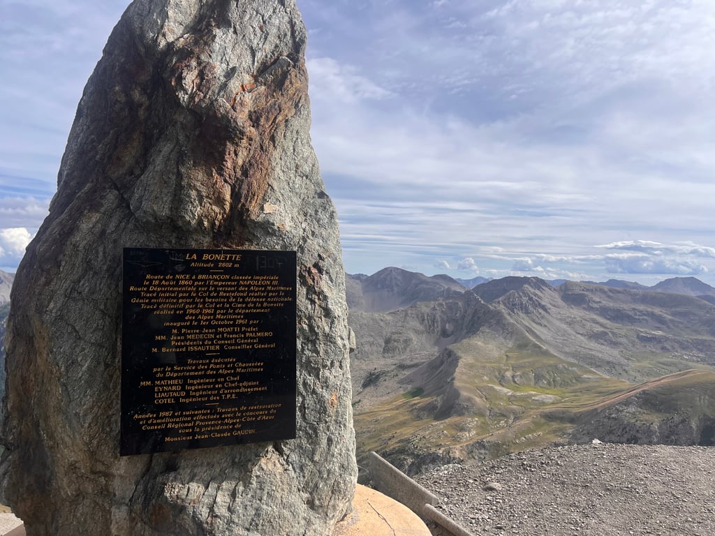
Did the Bonette from Jausiers on Saturday 3-9-2022. Lovely weather up to the tree line with lots of flies though, quite irritating, once between the rocks they were gone. The weather turned to cloudy over the last 5 km. The devil was in the tail, the last 2 km were quite tough for an amateur cyclist of 68 years, an average of 8 km/hour. Once at the very top at the monument, great views of the alpine peaks. Then downhill, it started to rain. Stood under the shower for almost the entire descent, cold and wet, made another small slip on the soaking wet road, stayed on the bike anyway. Once back in Barcalonnette lovely hot shower and unforgettable experience. I don't dare say whether it is the most beautiful climb, but it is in my top 5.
Heb op zaterdag 3-9-2022 de Bonette gedaan vanuit Jausiers. Heerlijk weertje tot aan de boomgrens met wel heel veel vliegen, best irritant, eenmaal tussen de rotsen waren ze weg. Het weer sloeg de laatste 5 km om naar zwaar bewolkt. Het venijn zat in de staart, de laatste 2 km waren best wel pittig voor een fietsamateur van 68 jaar, gemiddeld 8 km/uur. Eenmaal helemaal boven bij het monument een geweldig uitzicht over de alpentoppen. Toen omlaag, begon het te regenen. Bijna complete afdaling onder de douche gestaan, koud en nat, nog kleine slipper gemaakt op de speknatte weg, toch op de fiets gebleven. Eenmaal terug in Barcalonnette heerlijke warme douche en onvergetelijke ervaring. Of het de mooiste beklimming is, durf ik niet te zeggen, wel met vette stip in mijn top 5.
Must do, wonderful climb. Many flies on the way and very hot. The finale with the last lap is very impressive. I rode there when the weather turned and the whole thing made an ominous impression.
Must do, prachtige klim. Veel vliegen onderweg en erg warm. Het slot met het laatste rondje van de zaak is erg indrukwekkend. Ik reed er toen het weer omsloeg en het geheel maakte daardoor een onheilspellende indruk.
A very nice climb. The Col is the second highest in Europe, after the Iseran. However, if you continue before the Cime, you are a little higher again, but this is not a col so the makers call it "the highest route in Europe" which is a clever idea. Still, both the Tiefenbach and the Pico Veleta are higher, but they are dead ends. Anyway, the Bonette is a beautiful climb. The tarmac is in good condition and the percentages are (except for the last km's to the Cime) pretty good. Just ride it and enjoy!
Een zeer mooie klim. De Col is de 1 na hoogste van Europa, na de Iseran. Ga je echter door voor de Cime ben je nog weer iets hoger, maar dit is geen col dus noemen de makers het "de hoogste route van Europa" wat slim is bedacht. Toch zijn zowel de Tiefenbach als de Pico Veleta hoger, maar dat zijn doodlopers. Afijn, de Bonette is een prachtige klim. Het asfalt is in goede conditie en de percentages vallen (behoudens de laatste km's naar de Cime) behoorlijk mee. Ga deze gewoon rijden en genieten!
Despite the at times heavy traffic, still 5 stars. Normally wide road, nice asphalt. A fairly even climb where you can keep your rhythm nicely. Heavy? Yes, it was. Not so much because of the increase, but rather by the length and the thin air once above 2500 m. Ridden only once in the context of the "Brevet des 7 cols de l' Ubaye"
Ondanks het bij momenten drukke verkeer toch 5 sterren. Normaal brede weg, mooi asfalt. Een vrij egale klim waarbij je mooi je ritme kan aanhouden. Zwaar? Ja. Niet zozeer door de stijging, maar veeleer door de lengte en de ijle lucht eenmaal boven de 2500 m. Slechts een keer bereden in het kader van het "Brevet des 7 cols de l' Ubaye"
This climb is simply incredible, not to be missed if you are in the Ubaye valley. It offers accessible slopes and unforgettable landscapes.
Cette ascension est tout simplement incroyable, à ne pas rater si vous êtes de passage dans la vallée de l'Ubaye. Elle présente des pourcentages accessibles et des paysages inoubliables.
Today, about thirty years ago, we started our cycling holiday through the Alps. From Geneva to Nice. Unfortunately we had to skip the Bonette due to lack of time. So we did it today. It is not so bad. The climb is never really hard and there is enough distraction by the beautiful panoramas. We divided the climb into two parts of 12 km. This is mentally easy to do. At the end we also did the loop. That was 14% km hard! So today was a memorable day for two old-timers of 56
and 64. Disadvantages of this climb. Many motorcycles and many cars! Motorists do take cyclists into account! Refilling water is possible after about 20 minutes climbing from Jausiers. Then Halte 2000. Tips: eat and rest well, ride at your own pace, drink every 15 minutes and eat a bar every half hour. Do not focus on the top but on the nature around you. About descending: take your own space but don't overdo it. If a car can overtake, great, but if it can't then force it to do so! You cannot drive at 60 km per hour along the far side of the road. Brake before the turn with both brakes, release the brakes when entering the turn or brake at the rear! Just before the bend, raise the knee on the side of the bend outside the pedal. Stretch the other leg and put pressure on the pedal. And finally. Only do things you feel safe with!
Vandaag ongeveer dertig jaar geleden begonnen we aan onze fietsvakantie door de Alpen. Van Genève naar Nice. Helaas moesten we vanwege tijdgebrek de Bonette laten schieten. Dus vandaag dan gedaan. Het valt mee. De klim is nergens echt zwaar en er is voldoende afleiding door de prachtige panorama’s. Wij verdeelden de klim in twee stukken van 12 km. Dat is mentaal goed te behappen. Aan het einde hebben we ook het lusje nog gedaan. Dat is met 14% pittig! Vandaag dus een memorabele dag voor twee oudgedienden van 56 en 64. Nadelen van deze klim. Veel motoren en veel auto’s! Automobilisten houden goed rekening met fietsers ! Water bijvullen kan na ongeveer 20 minuten klimmen overigens vanuit Jausiers. Daarna Halte 2000. Een prima restaurant waar je ook kunt bijtanken..Tips: eet en rust goed, rij je eigen tempo, drink elke 15 minuten en eet elk half uur een barretje. Focus niet op de top maar op de natuur om je heen. Over het afdalen: neem je eigen ruimte maar overdrijf natuurlijk niet. Als een auto kan inhalen, mooi maar als het ff niet kan dwing dat dan ook af! Je kunt nu eenmaal niet met 60 km per uur langs de uiterste kant van de weg rijden. Rem voor de bocht met beide remmen laat bij het ingaan van de bocht los of rem achter bij! Breng vlak vóór de bocht de knie aan de kant van de bocht naar buiten het pedaal omhoog. Strek het andere been en geef sruk op je pedaal. En ten slotje. Doe alleen dingen waar jij je safe bij voelt!
With departure from Barcelonnette this coup in 2019 conquered. A unique experience, especially because the last kilometer to the 'Cime' had not yet been completely cleared of snow. Consequence: with the bike in hand briefly over a large pile of snow to continue the way to the top. Beautiful col, where especially the length for the high degree of difficulty. With beautiful panoramas along the way, this climb is an absolute must. Moreover, how often do you get above 2,800m ...
Met vertrek vanuit Barcelonnette deze kanjer in 2019 bedwongen. Een unieke ervaring, vooral doordat de laatste kilometer naar de 'Cime' nog niet volledig sneeuwvrij gemaakt was. Gevolg: met de fiets aan de hand even over een grote hoop sneeuw om de weg naar de top te vervolgen. Prachtige col, waarbij vooral de lengte voor de hoge moeilijkheidsgraad zorgt. Met prachtige panorama's onderweg is deze klim een absolute aanrader. Bovendien hoe vaak kom je boven de 2.800m...
Beautiful climb, an absolute must. About this climb, everything has been said and written. Just do it!
Prachtige klim, een absolute aanrader. Over deze klim is al alles gezegd en geschreven. Gewoon doen!
Magnificent pass to do at least once in his life, the landscapes are diverse and masterful, the road is impeccable and the traffic is rather moderate. However, you will have to deserve the view from the top because at the start of Jausiers, the sign "Route la plus haute d'Europe" announces the colour but we are not told that there will be so few moments of respite because of the 24km with regular slopes between 7% and 9% except for the last ramp: 1km at more than 10%! Only those who were able to manage the effort over time will be rewarded.
Magnifique col à faire au moins une fois dans sa vie, les paysages sont diverses et magistraux, la route est impeccable et la circulation est plutôt modéré. Cependant il faudra mériter la vue de la haut car au départ de Jausiers, le panneau "Route la plus haute d'Europe" annonce la couleur mais on ne nous dit pas qu'il y aura aussi peu de moment de répits du fait des 24km avec des pentes régulières entre 7% et 9% sauf pour la dernière rampe : 1km à plus de 10% ! Seuls ceux qui ont su gérer l'effort dans la durée seront récompensés.
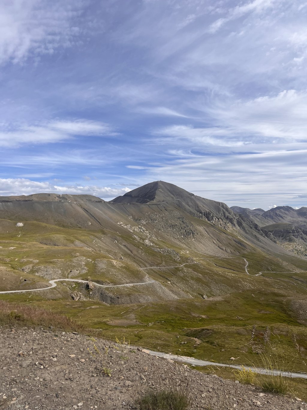
A great show from start to finish. Climb with varied landscapes and easy to manage percentages :-)
The end to reach the top is less beautiful but very spectacular (climb on a kind of pyramid): on the left, shorter but on 14% - on the right, more exposed to wind, on 11%.
A superb panorama.
Very nice descent. A treat.
Some marmots on the way :-)
Un beau spectacle du début à la fin. Montée avec des paysages variés et des pourcentages faciles à gérer :-)
La fin pour atteindre la cime est moins belle mais fort spectaculaire (montée sur une sorte de pyramide): à gauche , plus court mais sur du 14% - à droite, plus exposé au vent, sur du 11%.
Un superbe panorama.
Très belle descente. Un régal.
Quelques marmottes sur le chemin :-)
This is so far one of my favorite passes... First of all it is the highest in Europe (the summit), it offers great landscapes, it is long, offers not too high percentages, all on a winding road, in perfect condition and with little traffic.
C'est jusque là l'un de mes cols préférés... Déjà c'est le plus haut d'Europe (la cime), il offre des paysages grandioses, il est long, offre des pourcentages pas trop élevé, le tout sur une route sinueuse, en parfait état et avec peu de circulation.
Starting from Barcelonnette, the starting point of my hiking & biking holiday, but from Jausiers (one of) the most beautiful Alps climbs starts. With increasing altitude the landscape of the Mercantour National Park becomes more rugged and barren. Despite the many hairpin bends it is, except for the last kilometer, never extremely steep but the length and height makes it hard.
The extra bonus loop around the Cime de la Bonette starting at the four crossroads is a killer steep wall of 16% just before the summit and the wind can be a serious spoilsport.
Because I left early in the morning, there is little traffic, there are many marmots as supporters and I also ended up in a flock of sheep. Do provide the necessary clothing for temperature differences.
This is without discussion a wonderful TOPKLIM that must be on your palmares!!!!!!!!
Aanloop vanuit Barcelonnette, uitvalbasis van mijn wandel & fietsvakantie, maar vanaf Jausiers begint (één van) de mooiste Alpenbeklimmingen. Met toenemende hoogte wordt het landschap van het Nationaal Park van de Mercantour waar we door kronkelen ruiger en kaler. Ondanks de vele haarspeldbochten is het, op de slotkilometer na, nergens extreem steil doch de lengte en hoogte maakt het wel zwaar.
De extra bonuslus rond de Cime de la Bonette vertrekkend op de viersprong is moordend steile muur van 16% vlak voor de top en de wind kan er een serieuze spelbreker zijn.
Doordat ik vroeg in de ochtend vertrok , was is er weinig verkeer, zijn er veel marmotten als supporter en kwam ik ook in een schaapskudde terecht. Wel de nodige kleding voorzien voor temperatuursverschillen.
Dit is zonder discussie een wondermooie TOPKLIM die op je palmares moet staan!!!!!!!!
Nice challenge if you like a long climb. Very quiet in September 2020
Was one of the few cyclists going up that day, and that made it even more special, but also harder :-)
The last part is tough, but the photo makes up for it!
Mooie uitdaging als je van een lange klim houdt. Heerlijk rustig in September 2020
Was op die dag een van de weinige fietsers die omhoog ging, en dat maakte het nog specialer, maar ook zwaarder :-)
Het laatste stuk pittig, maar daarna op de foto maakt dat meer dan goed!
Super nice climb. You cycle constantly in a beautiful landscape and beautiful views.
The climb is not heavy, but the altitude makes it a bit harder.
Busy with traffic though.
super mooie klim. Je fietst constant in een mooi landschap en prachtige vergezichten.
De klim is niet zwaar, maar de hoogte maakt het wat moeilijker.
Wel druk met verkeer.
In September 2017 I finally got to do this side of the Bonette. Meanwhile many cols ridden, but this is absolutely candidate for best ever. Halfway (after 12 km) there is a catering facility, but after that you are on your own. And walk on top also just as completely to the peak. Even people with vertigo will find this beautiful!
In september 2017 deze kant van de Bonette eindelijk kunnen doen. Inmiddels vele cols opgereden, maar deze is absoluut kandidaat voor mooiste ooit. Halverwege (na 12 km) is er een horeca-gelegenheid, maar daarna ben je op jezelf aangewezen. En wandel bovenop ook even helemaal naar de piek. Zelfs mensen met hoogtevrees zullen dit prachtig vinden!
Beautiful climb, well paved (especially for the descent on the way back very nice). In terms of traffic, it is quiet in September, but in the summer I do not know ... (there are probably many moto's passing).
Mooie beklimming, goed geasfalteerd (vooral voor de afdaling op terugweg erg fijn). Qua verkeer is het rustig in maand september, maar in de zomerperiode weet ik niet...(er rijden wellicht veel moto's voorbij).
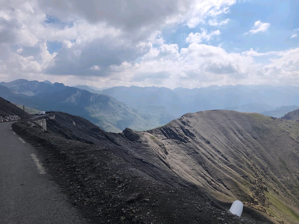
The most beautiful climb in Europe. With precision. The first few kilometers you pass some french houses, but at a certain moment you enter a forest. This forest lasts only briefly. Then you come along large rock faces, where it is even briefly flat. After this you get to an accumulation of hairpin bends in the open meadow. The percentages never really get high, but it is the length and height of the climb that make it difficult. After having spotted the marmots in the open meadow, you will literally pass through a lunar landscape during the last kilometers. Rarely seen something so impressive, great views to Italy. Are you in the area, then you really should not miss this climb!
De mooiste klim van Europa. Met stipt. Waarbij je de eerste kilometers lekker langs wat Franse huisjes rijdt, kom je op gegeven moment in een bos. Dit bos duurt maar kort. Hierna kom je langs grote rotswanden, waar het zelfs even vlak is. Hierna begin kom je aan een opeenstapeling van haarspeldbochten in de open weide. De stijgingspercentages worden nergens echt hoog, maar het is de lengte en hoogte van de klim die het lastig maken. Nadat je de marmotten gespot heb in de open weide, kom je de laatste kilometers letterlijk door een maanlandschap. Zelden zo iets indrukwekkends gezien, geweldige vergezichten tot Italië. Ben je in de omgeving, dan mag je deze klim echt niet missen!
Very nice climb I have done it for several years and ditto condition.
It is a matter of good planning and spray French anti fly stuff on your clothes and helmet.
Or just ride fast enough but that is only given to a few.
The region of Barcelonette is full of nice cols and the area has a lot more to offer than the region around Alp D Huez. The Mercantour national park, lake Lac Serre Poncon, down hill park on the Pra Loup and the town of Barcelonette provide more than just cycling.
Erg mooie klim heb hem verschillende jaren en dito conditie gedaan.
Blijft een kwestie van goed indelen en Frans anti vliegen spul op je kleding en helm spuiten.
Of gewoon snel genoeg rijden maar dat is slechts weinigen gegeven.
De regio van Barcelonette is gezaaid met prettige cols en de omgeving heeft veel meer te bieden dan de regio rondom Alp D Huez. Het nationaal park de Mercantour, meer Lac Serre Poncon, down hill park op de Pra Loup en het stadje Barcelonette zorgt voor meer dan alleen fietsen.
What a fantastic col. I think it is not as hard as Col Agnel, but it is much more beautiful. It is a bit strange that I circle the mountain, Cime, but that also offers something beautiful. Most beautiful col in the region.
Wat een fantastische col. Ik vind hem niet zo zwaar als Col Agnel, maar is wel veel mooier. Wat vreemd dat rondje om de berg, Cime, maar ook dat biedt toch weer wat moois. Mooiste col in de regio.
Climbed this monster yesterday. What a journey. Halfway I seriously considered stopping, even turned around and descended 2 km. Then I thought I would regret it and started climbing again. It is nowhere easy until 2 km before the top. And then the final: gnashing of teeth in the last 500 meters at 6 km/hr. I found this harder than Mont Ventoux. But that could also be due to my camping condition
Gisteren dit monster beklommen. Wat een eind. Heb halverwege serieus overwogen om te stoppen, ben zelfs omgekeerd en 2 km gedaald. Toen bedacht ik dat ik hiervan spijt zou krijgen en ben vervolgens toch maar weer gaan klimmen. Het is nergens makkelijk tot 2km voor de top. En dan die finale: tandenknarsend de laatste 500 meter met 6 km/u. Ik vond dit zwaarder dan Mont Ventoux. Maar dat kan ook liggen aan mijn campingconditie
I did it last year, beautiful, this year again. but pay attention to the weather, downstairs was 23 and upstairs 2 degrees and force 5. Are you still clapping, jacket sweater along, we were after her formal after season (september 1st week), so nothing open road.
verleden jaar gedaan, schitterend, dit jaar weer. maar wel goed op weer letten, beneden was 23 en boven 2 graden en wondkracht 5. Sta je toch te klappertanden, jasje truitje mee, we waren na her formele na seizoen (september 1e week), dus niks open onderweg.
Lovely climb on good tarmac through a fantastic landscape. The road winds wonderfully upwards. At the last km it becomes clear where the pass is. At the pass you have the possibility to cycle around the top so you reach an altitude of 2800 m.
We were there at the end of September, had good weather and it was quiet on the road. During the descent to Jausiers we had a nice lunch at a restaurant at an altitude of 2000m.
Heerlijke klim op goed asfalt door een fantastisch landschap. De weg kronkelt heerlijk naar boven. Bij de laatste km wordt duidelijk waar de pas ligt. Bij de pas heb je nog de mogelijkheid om een rondje om de top de fietsen waardoor je op een hoogte van 2800 m komt.
Wij waren er eind september, hadden mooi weer en het was rustig op de weg. Tijdens de afdaling naar Jausiers lekker kunnen lunchen bij een restaurantje dat op een/ter hoogte van 2000m ligt.
I haven't been cycling for very long (since May) and the col de la Bonette was the first climb I was allowed to do. It was hard work, but the changes in landscape were breathtaking. I also saw a marmot cross in front of me and that made it complete. Had to stop a few times, but that didn't matter. Finally made it to the top and that was more than worth it. In short: highly recommended and for me this was the starting shot to do many more climbs. The story above already invites you to go again. And for those who have doubts? DO IT!
Ik fiets nog niet erg lang (vanaf mei) en de col de la Bonette was de eerste beklimming die ik heb mogen doen. Het was knetterhard afzien, maar de veranderingen in het landschap waren adembenemend. Ook nog een marmot voor mijn neus zien oversteken en dat maakte het af. Moest wel een paar keer eventjes stoppen, maar dat deerde niet. Uiteindelijk de top gehaald en dat was het meer dan waard. Kortom; een aanrader en voor mij was dit het startschot om nog veel meer beklimmingen te gaan doen. Bovenstaand verhaal nodigt nu al uit om nog een keer te gaan. En voor degene die twijfelt? DOEN!
My 'first' was the Gulperberg. Also dismounted, but your 'first' takes the prize. I had to giggle when I read this. I giggled with respect, by the way. Kudos!
Mijn ‘eerste’ was de Gulperberg. Ook afstappen, maar jóuw ‘eerste’ spant de kroon. Ik moest giechelen toen ik dit las. Giechelen met respect overigens. Kudos!
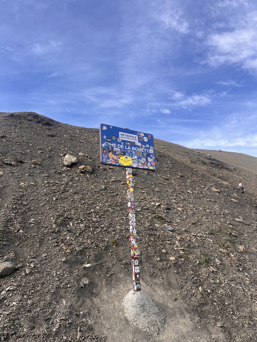
This col is on a mountenbike a heavy delivery, but a high point if you reach the 2802 meters. Too bad that hundreds of bikers use this route through nature as a circuit and not as a tour like some. Still for a cyclist one of the most beautiful experiences there is.
Deze col is op een mountenbike toch een zware bevalling, maar een hoogte punt als je de 2802 meter behaald. Jammer was dat honderden motorrijders deze route door de natuur als circuit gebruiken en niet zoals enkelen als toertocht. Toch voor een fietser één van de mooiste belevenissen die er is.
I cycled this from Jausiers, what a beautiful trip, stunning scenery and views.
Because of the length of the tour you have to cycle calmly and not let yourself be disturbed by speed demons.
Good road surface, which makes for a nice descent, this can cause cooling, a jacket is useful.
Ik heb deze vanuit Jausiers gefietst, wat een mooie tocht zeg, schitterend landschap en vergezichten.
Door de lengte van de tocht moet je rustig fietsen en je niet gek laten maken door snelheidsduivels.
Goed wegdek, dat zorgt voor een mooie afdaling, deze kan wel voor afkoeling zorgen, een jasje is dan wel handig.
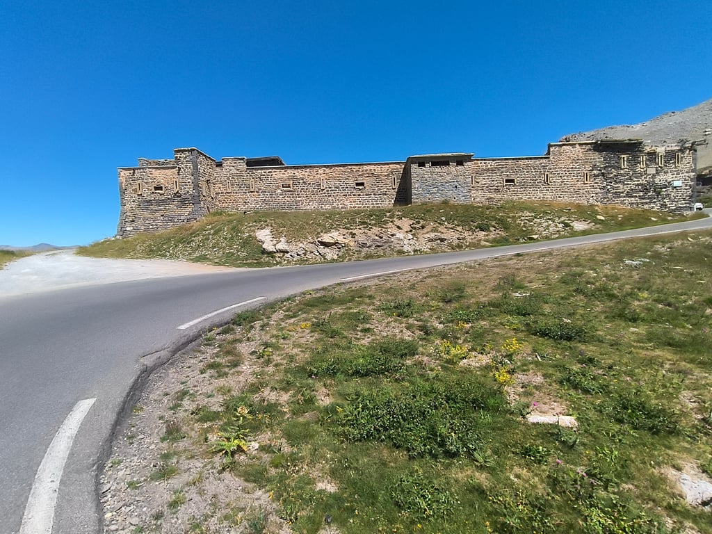
One of the most beautiful and highest cols in Europe I think. Years ago I did this magnificent climb 3 times from Jausiers and it is still on my wish list to ride it again. It is doable but tough because of the length kilometers. What I remember are indeed the flies of which there is always one in your buttocks and whistling marmots. At the top you cycle between the snow walls which is very cold. In the descent just after the barracks you can buy bread and soup at the shelter.
Een van de mooiste en hoogste Cols in Europa vind ik. Jaren geleden heb ik deze prachtige beklimming 3 x gedaan vanuit Jausiers en hij staat nog steeds op mijn verlanglijstje om hem nog eens te rijden. Hij is wel te doen maar zwaar vanwege de lengte kilometers. Wat ik mij herinner zijn inderdaad de vliegen waarvan er altijd wel 1 in je billen prikt en de fluitende marmotten. Boven fiets je tussen de sneeuwwallen wat erg koud is. In de afdaling even na de kazerne kun je bij het refuge brood en soep kopen.
Over 20 years ago I did it once, and now I do it again. I could still remember the top well and that's why I think it's worth doing it again. Because it is long and high, you drive a bit quieter and you don't get rid of the irritating flies. Above 2000 they were suddenly gone. That is the most annoying part of this climb. There are some flatter parts where you can rest. The last 4 km you can already see the top and you drive straight to it. A very steep last 700 mtrs, but then you get a great view. DO IT!
Meer dan 20 jaar geleden al een keer gedaan, en nu nog een keer. De top kon ik me nog goed herinneren en daarom vind ik het nogmaals de moeite waard. Omdat het lang en hoog is, rijd je er wat rustiger en raak je de irritante vliegen niet kwijt. Boven 2000 mrt. waren ze opeens weg. Dat is het vervelendste van deze klim. Er zitten aan aantal vlakkere stukken in waar je kunt uitrusten. De laatste 4 km kan je de top al zien liggen en je rijdt er zo naartoe. Een hele steile laatste 700 mtr, maar dan krijg je ook een geweldig uitzicht. DOEN!
Wow, beautiful pictures and looks like a wonderful climb indeed.
Wow, mooie foto's en lijkt me inderdaad een prachtige klim.
On 1/8-2013 I climbed the Bonette from Jausier with the ATB (with thick road tires).
Temp in Jausiers 30gr and on the top about 10 gr.
Because I left at 10.30 am it was already very warm on the first part of the climb. There was also no wind. During the climb at about 1800 m, I had a lot of trouble from swarms of annoying flies. Possibly because it was windless weather and my cycling speed was about 8-10 km/h. So too low a speed to get rid of them. So too low a speed to get rid of them. For me this was the longest + highest climb ever. A great experience, but cost me a lot of sweat and perseverance. During the climb, my lower back starts to suffer and I have to get off the bike every 45 minutes (1 min). During the climb you have nice views and the tarmac is excellent. The descent is great. Good overview on the oncoming traffic, good tarmac and few loose stones.
In short, a climb to put on your list.
Op 1/8-2013 de Bonette vanuit Jausier beklommen met de ATB ( voorzien van dikke wegbanden)
Temp in Jausiers 30gr en op de top ca 10 gr.
Doordat ik om 10.30 vertrok was het al erg warm op het 1e deel van de beklimming. Het was ook nog eens windstil. Tijdens de klim op ca 1800 m hoogte had ik veel last van zwermen vervelende vliegen. Mogelijk doordat het windstil weer was en mijn fietssnelheid ca 8-10 km/u was. Dus een te lage snelheid om ze kwijt te raken. Voor mij was dit de langste + hoogste klim ooit. Een geweldige ervaring, maar koste heel veel zweetdruppels en doorzettings vermogen. Ik krijg tijdens het klimmen meer last van de onderrug en moet daardoor om de 45 min even (1 min) van de fiets. Tijdens de klim heb je mooi uitzicht en het asfalt is uitstekend. De afdaling is geweldig. Goed overzicht op het tegemoet komende verkeer, goed asfalt en weinig losse stenen.
Kortom een beklimming om op je lijstje te zetten.
| 7 km/h | 03:19:23 |
| 11 km/h | 02:06:53 |
| 15 km/h | 01:33:02 |
| 19 km/h | 01:13:27 |
This page is better in the app