| #83 toughest climb of Auvergne |
| #30 average steepest climb of Massif Central |
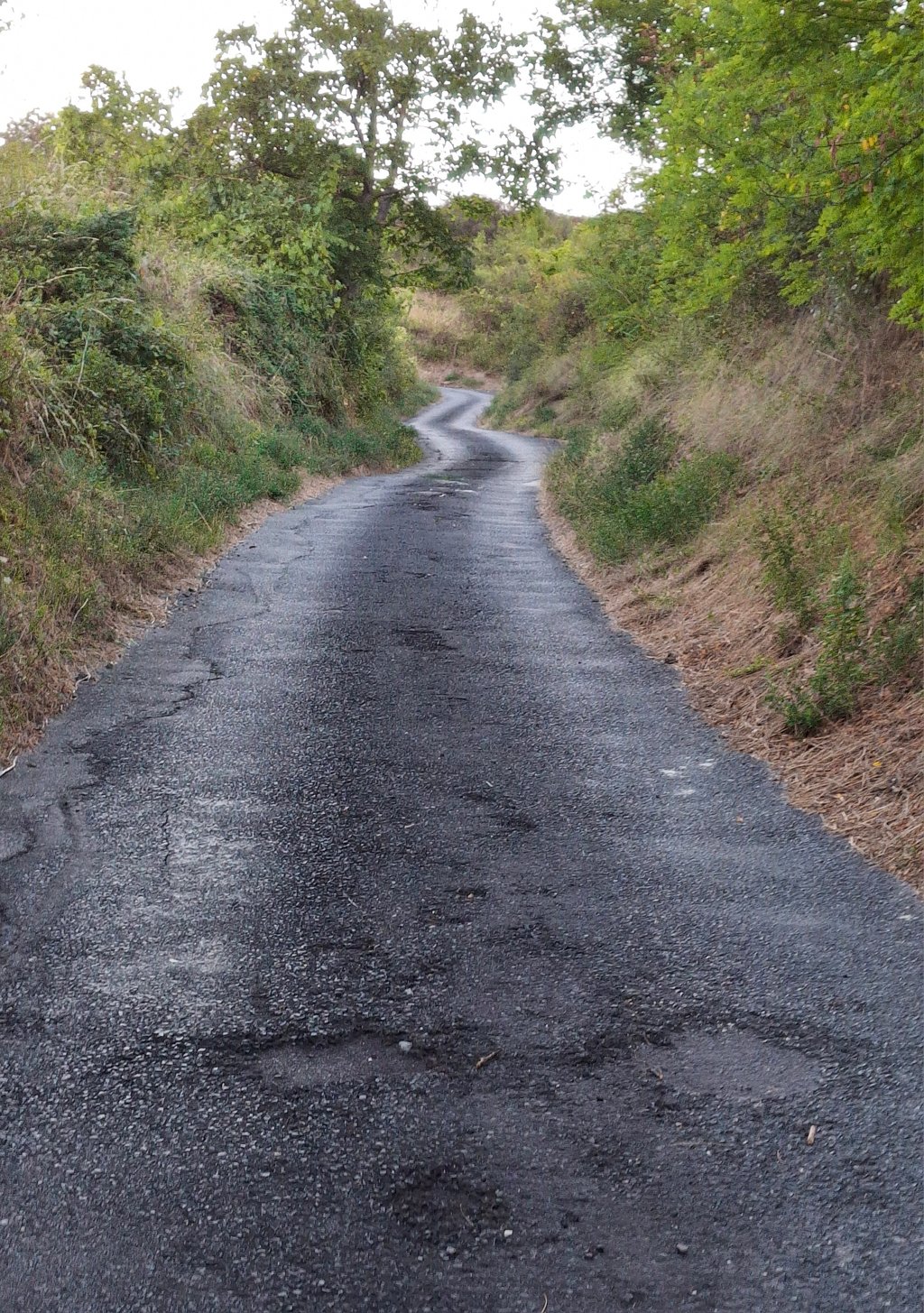
Col de Bancillon from Clermont Ferrand is a climb in the region Puy-de-Dôme. It is 1.7 km long and bridges 204 m of vertical ascent with an average gradient of 12.3%, resulting in a difficulty score of 317. The top of the ascent is located at 551 m above sea level. Climbfinder users shared 5 reviews of this climb and uploaded 1 photo.
Road name: Rue de Cheval
Chance of names
This mountainpass was know as the Col du Chevalard till 2013. From 2013 onwards it it know as the Col de Bancillon
4.0 by TitouanThis is an automatic translation, the original language is: French.Steep climb, without respite (except "replats" at only 11%). Even if there are sometimes beautiful panoramas on the metropolis of Clermont-Ferrand, impossible to enjoy them well, you have to stay focused on the bike and on the relatively narrow road. ... read more
Welcome! Please activate your account if you would like to share something. Look for the verification email in your inbox.
If you want to upload your photos, you need to create an account. It only takes 1 minute and it's completely free.
Second attempt, on gravel this time (32X34) and on a dry road. I managed to climb without putting my foot down. It's hard, but doable... It's a great challenge. It's the steepest tarmac climb I've ever done.
Deuxième tentative, en gravel cette fois (32X34) et sur une route sèche. J'ai réussi à monter sans mettre pied à terre. C'est dur, mais faisable... C'est un beau défi. C'est la montée sur goudron la plus raide que j'ai faite.
First attempt with a 34X34: I had to put my foot down twice. The first was a few metres before the 11% level, the second because of the wet road (my rear wheel slipped).
I'll try this climb again in the sunshine!
Première tentative avec un 34X34 : j'ai dû mettre 2 fois pied à terre. La 1ère peu de mètres avant le replat à 11%, la seconde à cause de l'humidité de la route (ma roue arrière a dérapé).
Je retenterai cette montée sous le soleil !
I climbed it simply out of curiosity, seeing the strange percentages. The surface is quite damaged and the road is narrow, so watch out for the few cars that can get off. There's a car park about halfway up the climb to take a breather, and the last few hectometres at over 10% seem flat after the horror of the +20%. A climb to do for the challenge, but one where suffering dominates. The view over Clermont is nice at the top, but there are so many better views in the region!
Une montée que j'ai faite par simple curiosité en voyant ces drôles de pourcentage. Le revêtement est assez abimé et la route est étroite, attention aux rares voitures qui peuvent descendre. Un parking se situe à peu près à la moitié de l'ascension pour souffler un coup, et les derniers hectomètres à plus de 10% paraissent plats après l'horreur des +20%. Une montée à faire pour le challenge, mais où la souffrance domine. La vue sur Clermont est sympa une fois en haut mais il y a tellement mieux dans la région !
It's a great curiosity but an enormous pain. For someone who's not used to such slopes, the number of times you can put your foot down . I even wonder if a peak of around thirty % isn't reached. It's very violent when you're not prepared. You also have to be careful to stay on the side of the road because it's narrow and there's only room for one vehicle on the road.
C'est une grande curiosité mais une énorme souffrance. Pour quelqu'un qui n'est pas habitué à de telles pentes, le nombre de fois ou on peut mettre pied à terre . Je me demande même si une pointe à une trentaine de % n'est pas atteinte. C'est très violent quand on est pas préparé. Il faut faire également attention a rester sur le coté car la route est étroite et il n'y a de place que pour un véhicule sur la route.
Steep climb, without respite (except "replats" at only 11%). Even if there are sometimes beautiful panoramas on the metropolis of Clermont-Ferrand, impossible to enjoy them well, you have to stay focused on the bike and on the relatively narrow road.
Montée abrupte, sans répit (sauf des "replats" à seulement 11%). Même s'il y a parfois de beaux panorama sur la métropole de Clermont-Ferrand, impossible de bien les savourer, il faut rester concentré sur sur le vélo et sur la route relativement étroite.
| 7 km/h | 00:14:10 |
| 11 km/h | 00:09:01 |
| 15 km/h | 00:06:36 |
| 19 km/h | 00:05:13 |
This page is better in the app