| 14 hairpin turns |
| Bad road |
| #18 toughest climb of Haute-Garonne |
| #16 most elevation gain of Haute-Garonne |
| #11 longest climb of Haute-Garonne |
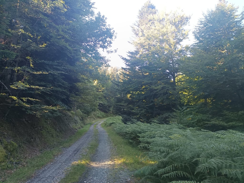
Col d'Artigau from Ger de Boutx is a climb in the region Haute-Garonne. It is 9.9 km long and bridges 615 m of vertical ascent with an average gradient of 6.2%, resulting in a difficulty score of 462. The top of the ascent is located at 1403 m above sea level. Climbfinder users shared 1 review/story of this climb and uploaded 5 photos.
Road name: D 85
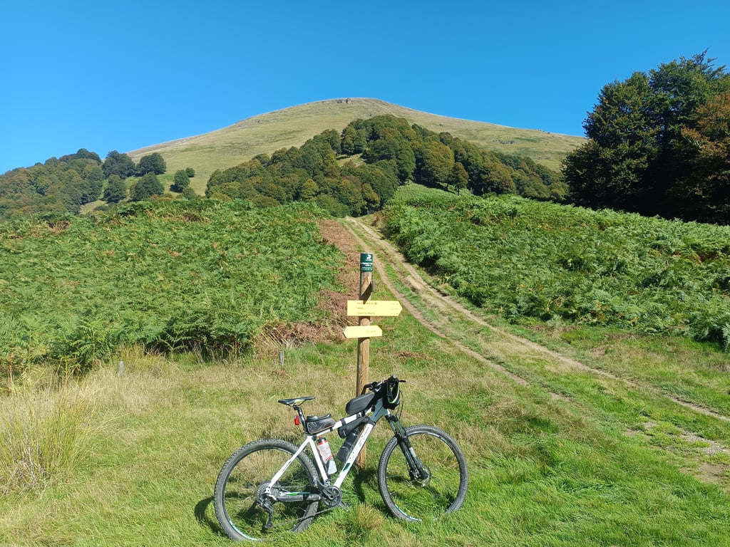
2.0 by MarcDorcaThis climb is located near the Col de Menté and the Portet d'Aspet. I did it as a bonus after climbing and descending those two passes. The ascent has two distinct parts. The first 4 km are on a narrow, beautiful, and paved road. But then, after a hairpin turn, the asphalt suddenly disappears (it looks like it was intentionally destroyed), and it becomes a dirt and stone track. At the same time, the forest turns into a logging operation where trees are being cut down. All along the clim... read more
Welcome! Please activate your account if you would like to share something. Look for the verification email in your inbox.
If you want to upload your photos, you need to create an account. It only takes 1 minute and it's completely free.
This climb is located near the Col de Menté and the Portet d'Aspet. I did it as a bonus after climbing and descending those two passes. The ascent has two distinct parts.
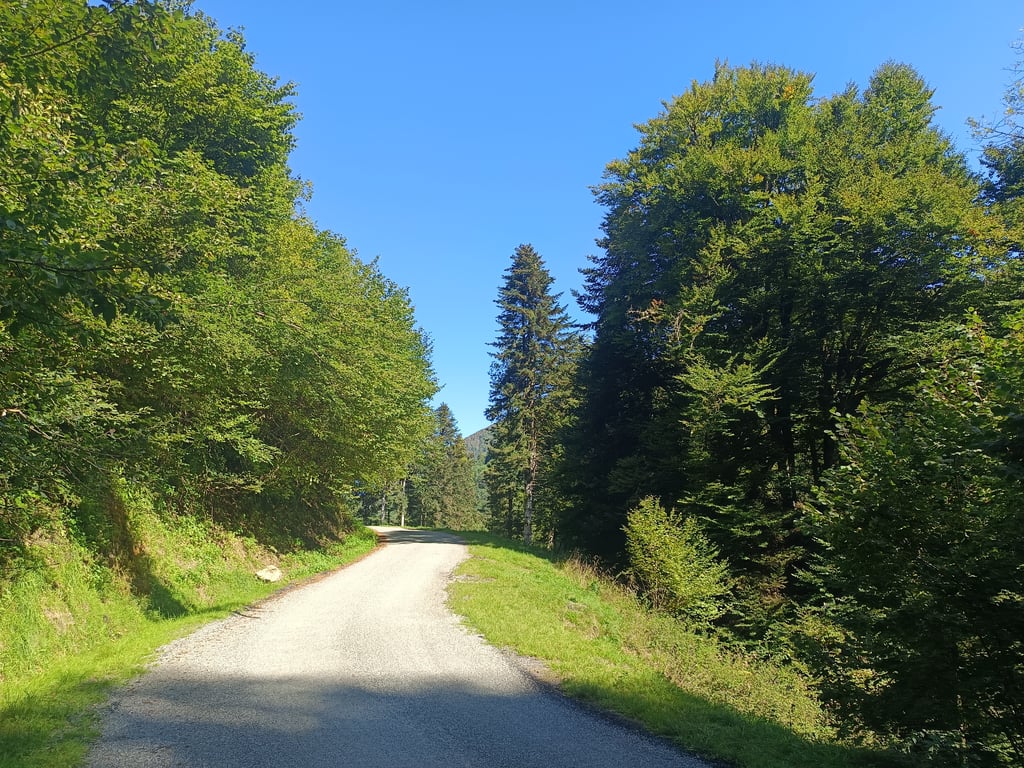
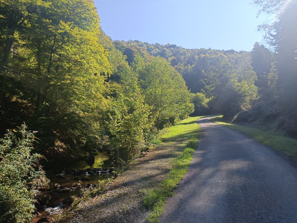
The first 4 km are on a narrow, beautiful, and paved road. But then, after a hairpin turn, the asphalt suddenly disappears (it looks like it was intentionally destroyed), and it becomes a dirt and stone track. At the same time, the forest turns into a logging operation where trees are being cut down. All along the climb, you see felled trees and lumber waiting to be collected. I even crossed paths with four logging trucks on my way up and down, which was a bit depressing, to be honest.
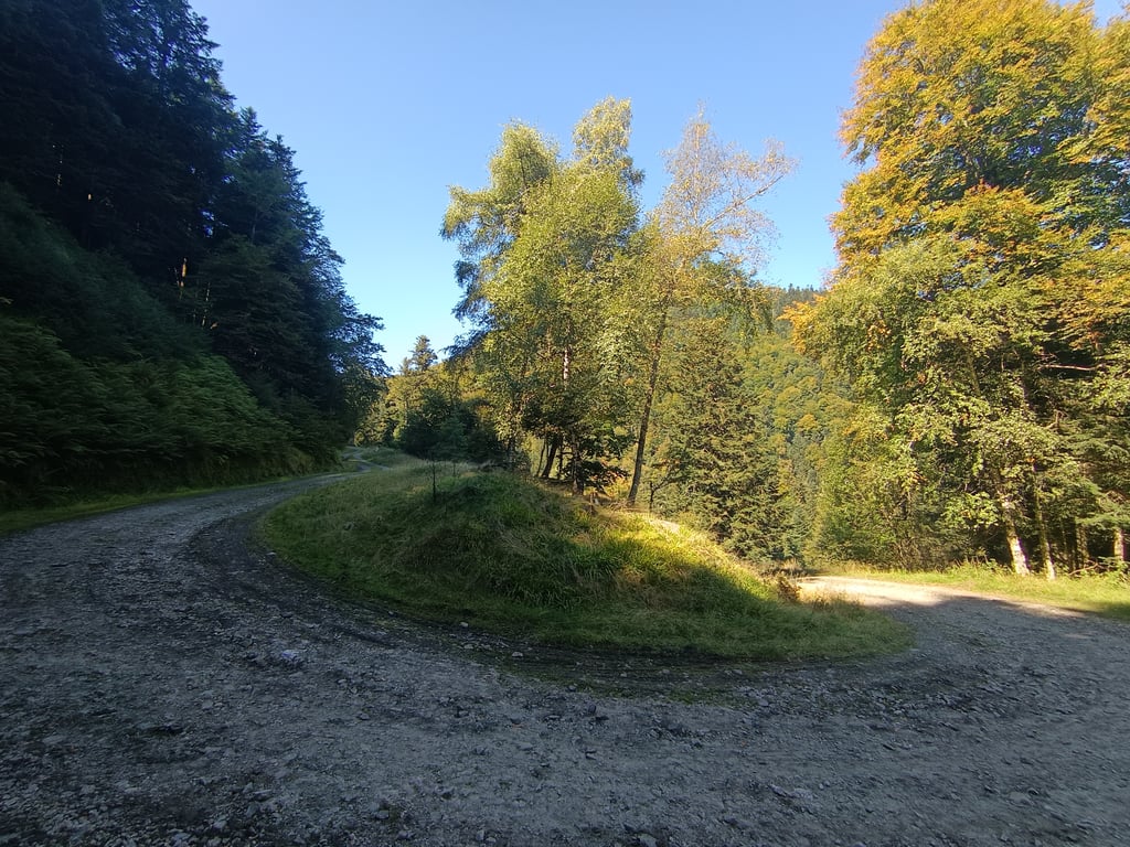
The last 6 km are definitely NOT suitable for a road bike. While some sections are better than others, as of September 2025, I consider it impossible on a road bike. If you plan to descend the same way, I highly recommend using a mountain bike.
Once you reach the top, you can descend towards Mèles (with a few unpaved km also, but not that worse, I think) or connect with the Col de Menté via another unpaved track (I don't know its condition), which offers multiple route options. Someone might even dare to do the climb with a gravel bike, connect with Menté, and descend from there, or go downhill to Mèles.
In short, the first 3 km are very beautiful, winding through the valley. After that, the climb goes into the woods on a poorly maintained track with no views.
I'm giving it 2 stars because of the bad road condition and the lack of views. However, for mountain bike (and maybe some gravel) enthusiasts, it could be an excellent option.
This climb is located near the Col de Menté and the Portet d'Aspet. I did it as a bonus after climbing and descending those two passes. The ascent has two distinct parts.
The first 4 km are on a narrow, beautiful, and paved road. But then, after a hairpin turn, the asphalt suddenly disappears (it looks like it was intentionally destroyed), and it becomes a dirt and stone track. At the same time, the forest turns into a logging operation where trees are being cut down. All along the climb, you see felled trees and lumber waiting to be collected. I even crossed paths with four logging trucks on my way up and down, which was a bit depressing, to be honest.
The last 6 km are definitely NOT suitable for a road bike. While some sections are better than others, as of September 2025, I consider it impossible on a road bike. If you plan to descend the same way, I highly recommend using a mountain bike.
Once you reach the top, you can descend towards Mèles (with a few unpaved km also, but not that worse, I think) or connect with the Col de Menté via another unpaved track (I don't know its condition), which offers multiple route options. Someone might even dare to do the climb with a gravel bike, connect with Menté, and descend from there, or go downhill to Mèles.
In short, the first 3 km are very beautiful, winding through the valley. After that, the climb goes into the woods on a poorly maintained track with no views.
I'm giving it 2 stars because of the bad road condition and the lack of views. However, for mountain bike (and maybe some gravel) enthusiasts, it could be an excellent option.
| 7 km/h | 01:24:44 |
| 11 km/h | 00:53:55 |
| 15 km/h | 00:39:32 |
| 19 km/h | 00:31:13 |
This page is better in the app