View on map
© MapLibre | OpenStreetMap contributors
1%
2%
4%
6%
8%
10%
12%
15%
20%

Chemin de Labassère-Débat

5.0
1 review/story | Elevation profile | 0 photos
Tips nearby
Your achievable time
Calculating based on your best performances...
Relaxed
Maximum
W/kg
W/kg
W/kg
Analyse your climbing performance
Detailed insight into your climbing performance & automatically check off climbs
Based on your best performances.
Your best attempt:
Number of attempts:
Elevation profile Chemin de Labassère-Débat

Statistics

Difficulty points 210
Length 2.6 km
Average gradient 8.5%
Steepest 100 metres 12.2%
Total ascent 224 m
Feedback about this climb?
Show climbs nearby Export to GPS device

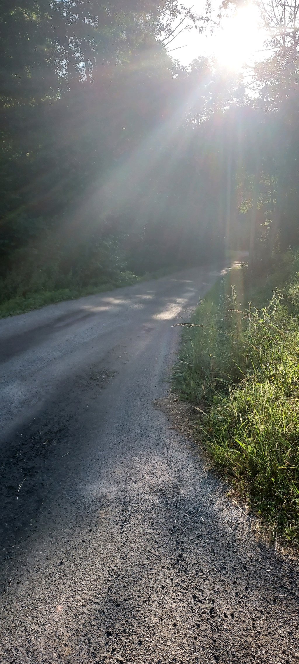
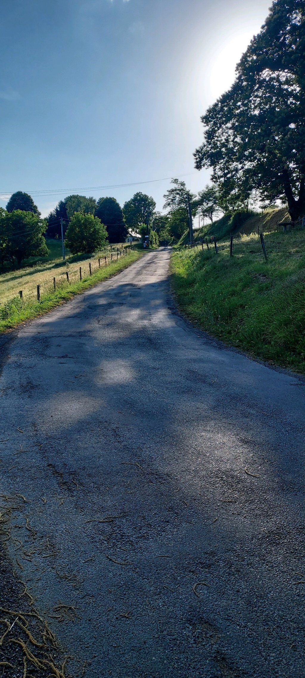
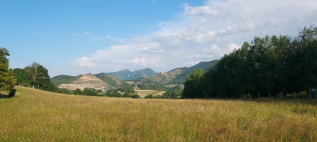
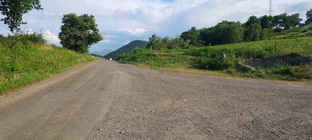
Chemin de Labassère-Débat is a climb in the region Hautes-Pyrénées. It is 2.6 km long and bridges 224 m of vertical ascent with an average gradient of 8.5%, resulting in a difficulty score of 210. The top of the ascent is located at 784 m above sea level. Climbfinder users shared 1 review/story of this climb and uploaded 0 photos.

Road name: Chemin de Labassère-Débat

This is an automatic translation, the original language is: French.
A very nice climb, but not downhill. ... read more

Photos (0)

transparant thumb
transparant thumb
transparant thumb
transparant thumb
transparant thumb
transparant thumb

Your uploads (max 4)

Welcome! Please activate your account if you would like to share something. Look for the verification email in your inbox.

If you want to upload your photos, you need to create an account. It only takes 1 minute and it's completely free.

  • Receive free climbfinder goodies for your reviews & photos.
  • Create a bucket list and check off conquered climbs.
  • Add missing climbs.
Continue with GoogleContinue with Google Continue with FacebookContinue with Facebook Continue with AppleContinue with Apple Sign up with email
By signing up you agree to our terms of service and confirm that you have read our privacy & content policy.

Reviews (1)

5.0
4.0
3.0
2.0
1.0
BastienPeteilh
1 y 5.0 via the Climbfinder app
This is an automatic translation, the original language is: French. Show original

A very nice climb, but not downhill.

Très belle montée à faire, Mais pas en descente.

Dashboard

Climbing times

7 km/h 00:22:25
11 km/h 00:14:16
15 km/h 00:10:28
19 km/h 00:08:15

Road surface condition

0% 0% 0%
Based on 0 votes
Share your knowledge. What was the road condition during your ascent?

Traffic

0% 0% 0%
Based on 0 votes
Your experience counts. How much traffic did you encounter during the climb?

Frequently Asked Questions

Chemin de Labassère-Débat can be cycled from 3 sides. Chemin de Labassère-Débat is the most popular side, but the summit can also be reached via Chemin Matets & Côte du Matets.

Chemin de Labassère-Débat is a challenging ascent. For this type of climbing, we recommend mountain gearing, specifically a compact system. This means a small front chainring of 34 teeth, combined with a rear cassette where, depending on your level, strength, and experience, you choose a sprocket with 30, 32, or even 34 teeth. Remember that a smooth cadence is always more efficient!

Chemin de Labassère-Débat is a 3rd-category climb. Almost anyone can handle this climb, as long as you have a bike with climbing gears. If you have little training, you will probably need to shift down significantly. For experienced riders, Chemin de Labassère-Débat is not a problem.

Chemin de Labassère-Débat is 2.6 km long.

The average gradient of Chemin de Labassère-Débat is 8.5%.

Chemin de Labassère-Débat has a steepest segment with an average gradient of 12.2%.

The summit of Chemin de Labassère-Débat is at 784 m.

At a slow pace of 7 km/h, it takes about 00:22:25 to climb Chemin de Labassère-Débat. At 11 km/h the time is 00:14:16, and at 15 km/h 00:10:28. For the fastest cyclists, 00:08:15 is an achievable time.

Chemin de Labassère-Débat is located in the region Hautes-Pyrénées in France.

This page is better in the app

Climbfinder app
Climbfinder
(Free)
Open