Tips nearby


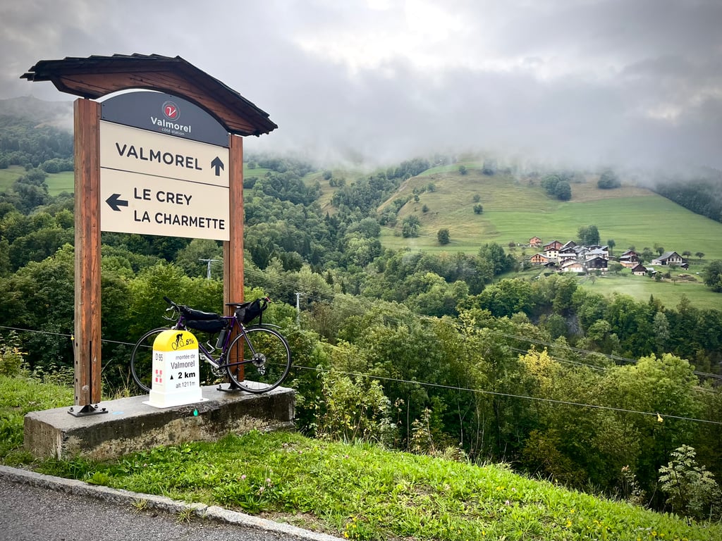
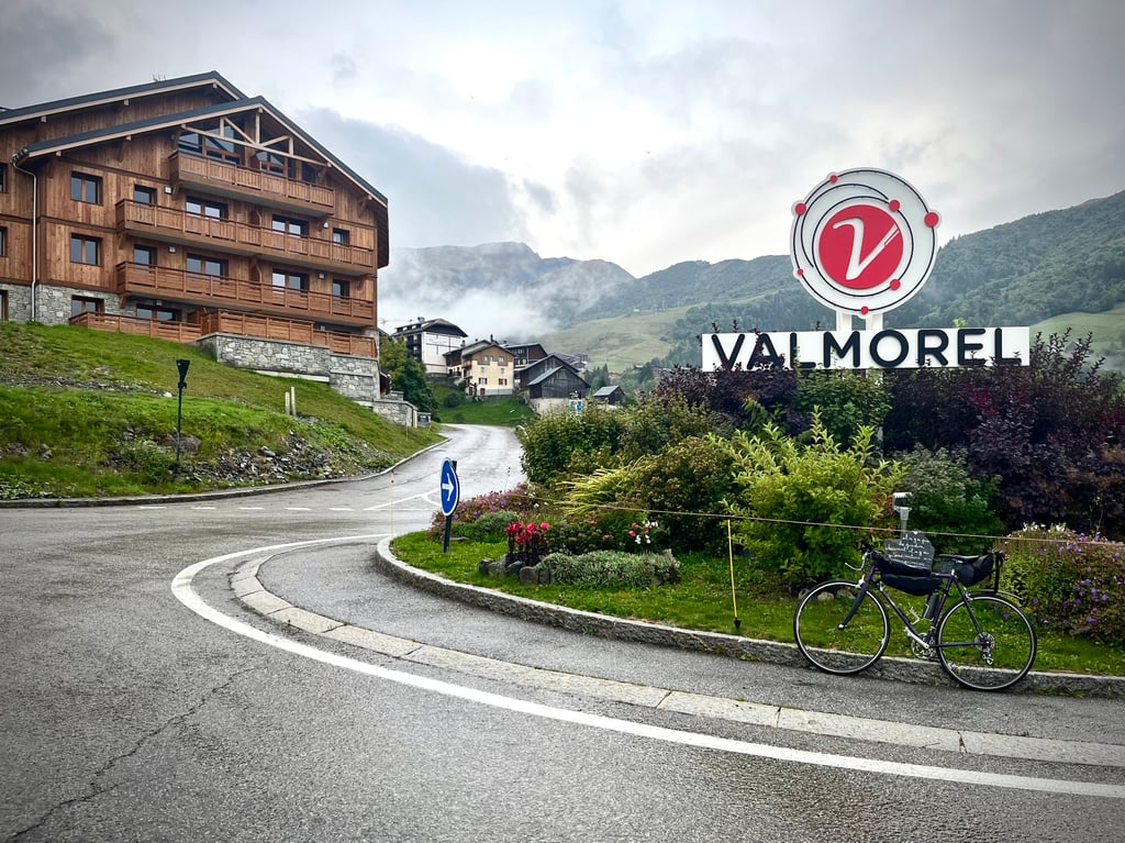
Valmorel is a climb in the region Savoie. It is 7.6 mi long and bridges 2867 ft of vertical ascent with an average gradient of 7.2%, resulting in a difficulty score of 671. The top of the ascent is located at 4367 ft above sea level. Climbfinder users shared 7 reviews of this climb and uploaded 15 photos.
Road name: D94
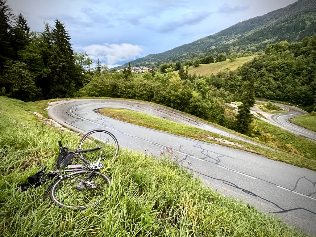
3.0 by CromagnonThis is an automatic translation, the original language is: French.It was supposed to be a gentle climb of reasonable length. It turned into a long nightmare! First, I stayed on the D94, which approaches Valmorel but never goes there... So I turned back and started a new climb up the D95. In the pouring rain! The road was quite good, the traffic moderate and the gradients contained, but the rain made this double climb less fun than expected. The scenery comes into view before Valmorel. Well, the mist certainly hid a few peaks from me. Lots of chalets. Th... read more

Welcome! Please activate your account if you would like to share something. Look for the verification email in your inbox.
If you want to upload your photos, you need to create an account. It only takes 1 minute and it's completely free.
I did this climb today, and made it to the top. It was difficult because the climb is very regular and it's not my favorite kind, I still prefer a few little flats.... The slope is very regular, never above (almost) 10 % but never below 7 either... To be done on a weekend, when traffic is light
J'ai fait cette montée ce jour, et je suis arrivé au sommet. Ce fut difficile car la montée est très régulière et ce n'est pas mon genre préféré, je préfère quand même quelques petits replats... La pente est très régulière, jamais au-dessus (presque) de 10 % mais jamais en-dessous de 7 non plus... A faire un weekend, lorsque la circulation est faible
It was supposed to be a gentle climb of reasonable length.
It turned into a long nightmare!
First, I stayed on the D94, which approaches Valmorel but never goes there...
So I turned back and started a new climb up the D95.
In the pouring rain!
The road was quite good, the traffic moderate and the gradients contained, but the rain made this double climb less fun than expected.
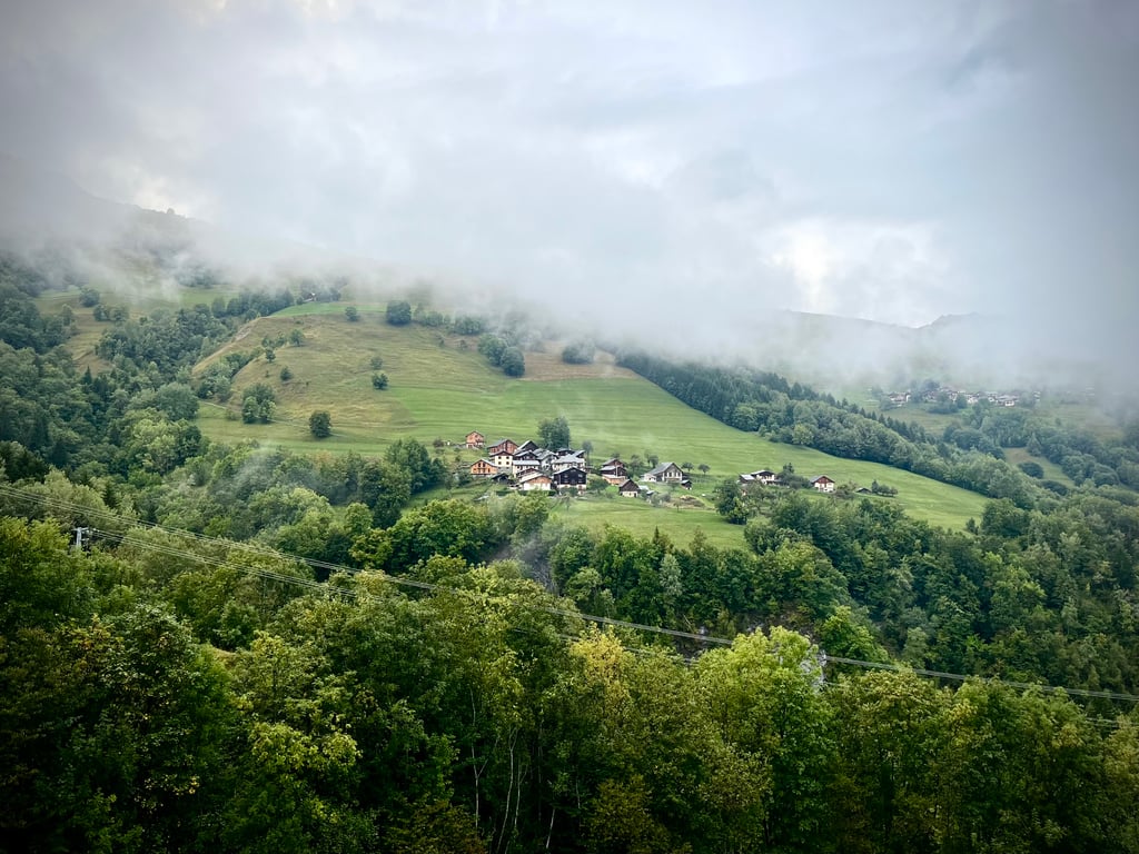
The scenery comes into view before Valmorel.
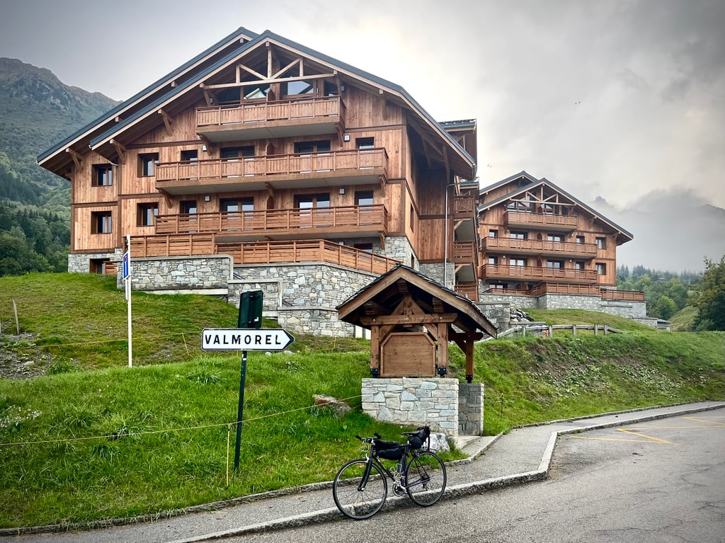
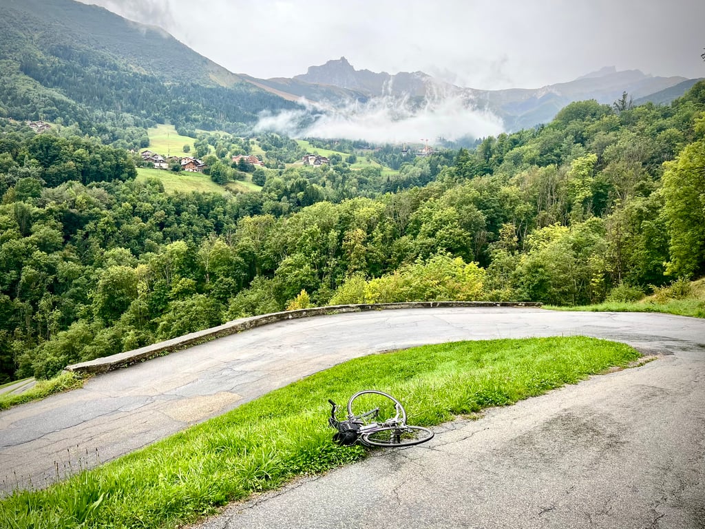
Well, the mist certainly hid a few peaks from me. Lots of chalets. This is an inhabited mountain! Speaking of chalets, the ones in Valmorel are rather elegant and discreet. Thanks to the architects! It's a far cry from the dreadful Toussuire. That said, given the number of cranes lining the panorama, the worst is undoubtedly yet to come.
It was probably a pleasant climb in a milder climate.
I sometimes complain about these climbs that leave no memories. Thanks to the rain, I won't forget this one...
Ce devait être une montée douce, d’une longueur raisonnable.
C’est devenu un long cauchemar !
D’abord, je suis resté sur la D94 qui s’approche de Valmorel mais ne va jamais à Valmorel…
J’ai donc rebroussé chemin et recommencé une nouvelle montée par la D95.
Sous une pluie battante !
Une route plutôt bonne, une circulation modérée, des pourcentages contenus, mais cette pluie a rendu cette double ascension moins amusante que prévu.
Les paysages se dévoilent avant Valmorel.
Enfin, la brume m’a assurément caché quelques cimes. Beaucoup de chalets. C’est une montagne habitée ! À propos de chalets, ceux de Valmorel sont plutôt élégants et discrets. Merci aux architectes ! On est loin de l’affreuse Toussuire. Cela dit, au vu du nombre de grues qui garnissaient le panorama, le pire est sans doute à venir.
Une montée probablement agréable sous un climat plus clément.
Je me plains parfois de ces côtes qui ne laissent pas de souvenirs. Merci la pluie, je n’oublierai pas celle-ci…
You can extend the climb listed here and get up to 1500 meters. Going further up, at one point you will reach a square with 3 barriers. Go past the left one and climb up to the (Club Med) Les Chalets the Valmorel. Either left (nrs 1 - 5) or right (6/7) will give you a great panoramic view.
Also, there's an alternative not listed here, following the D94 instead of the D95, rejoining this route at the "Valmorel" roundabout.
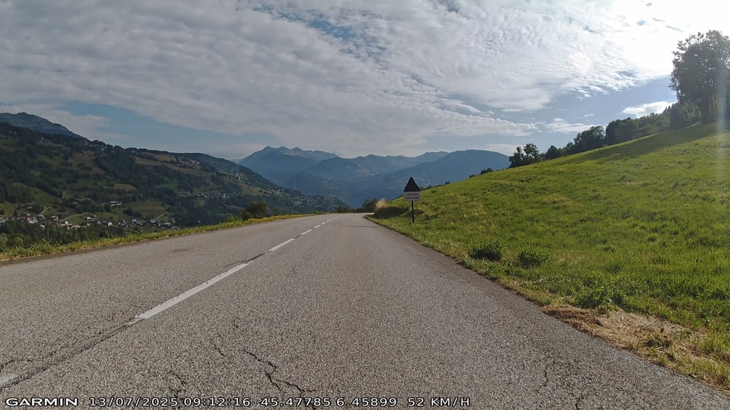
Done this climb after the Madelene. It is a gradual climb with no extremely steep sections. You ride most of it in the sun. That broke me up quite a bit wall it was 33 degrees. You have a view of all these clusters of buildings, probably hotels. If you take all the side paths to all these villages? you could probably cycle here all day. Didn't see the end sign above. They were busy building there. The tarmac is good. the downside of those ski villages is that they are always rebuilding Sommers. These construction workers in the vans always seem to have their own KOM competition. On the descent, a van with a trailer passed over a threshold with the entire load coming loose from the trailer by almost a metre. luckily, everything landed neatly back in the trailer and not in front of me front wheel.
Deze beklimming gedaan na de Madelene. Het is een geleidelijke klim zonder extreem steile stukken. Je rijdt het grootste deel in de zon. Dat brak me aardig op wand het was 33 graden. Je hebt uitzicht op allemaal clustertjes met gebouwen, waarschijnlijk hotels. Als je alle zij paadjes neemt naar al deze dorpjes? kan je hier denk de hele dag fietsen. Boven het eind bordje niet gezien. Ze waren daar volop aan het bouwen. Het asfalt is goed. het nadeel van die ski dorpjes is dat ze Sommers altijd aan het verbouwen zijn. Deze bouwvakkers in de bestelbusjes lijken altijd hun eigen KOM competitie te hebben. In de afdaling kwam er een busje met aanhanger voorbij over een drempel waarbij de gehele lading bijna een meter los kwam van de aanhanger. gelukkig belande alles weer netjes in de aanhanger en niet voor mij voorwiel.
Unknown makes unloved! Not a famous climb, but a very nice one. The first few kilometres the road surface leaves much to be desired, but after that, it is mainly a matter of enjoying this nice climb - on partly new asphalt - without any particularly difficult sections.
Onbekend maakt onbemind! Geen beroemde klim, maar wel een hele mooie. De eerste kilometers laat het wegdek nog genoeg te wensen over, maar daarna is het toch vooral genieten geblazen van deze lekker lopende beklimming - over deels nieuw asfalt - zonder bijster zware passages.
A nice climb, few people or even nobody ^^(done outside holiday period). Regular ascent without real dead time. Nice view once arrived at the station. Nice to do and to discover :-)
Une jolie montée, peu de monde voir même personne ^^(faite hors période de vacances). Montée régulière sans réel temps mort. Jolie vue une fois arrivé à la station. Sympas à faire et à découvrir :-)
Extremely hard climb especially after the slight turn to the right, it becomes heavy my meter gave over 500 m 19 percent, with a maximum of 24
extreem zware klim zeker na de flauwe bocht naar rechts word het zwaar mijn metertje gaf over 500 m 19 procent aan, met een maximum van 24
| 5 mph | 01:31:31 |
| 7 mph | 01:04:48 |
| 9 mph | 00:50:29 |
| 12 mph | 00:37:56 |
This page is better in the app