Tips nearby


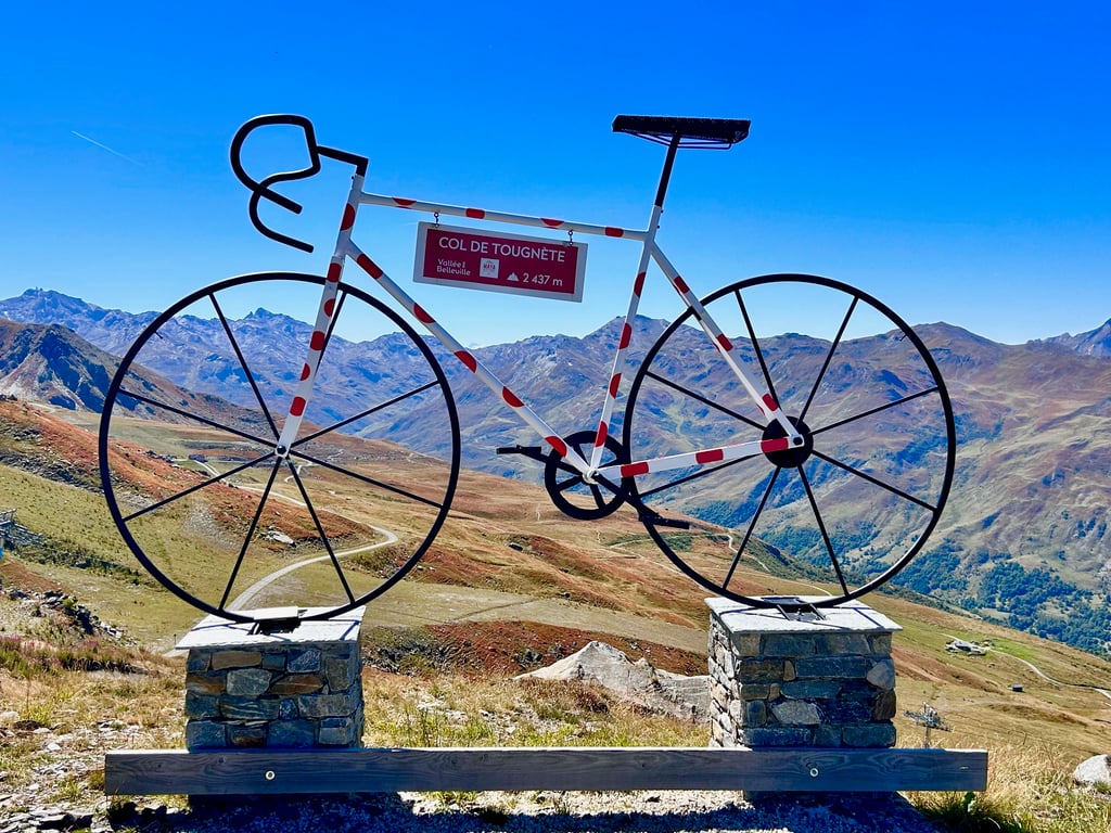
Col de Tougnète from Moutiers is a climb in the region Savoie. It is 21.6 mi long and bridges 6604 ft of vertical ascent with an average gradient of 5.8%, resulting in a difficulty score of 1562. The top of the ascent is located at 7881 ft above sea level. Climbfinder users shared 4 reviews of this climb and uploaded 15 photos.
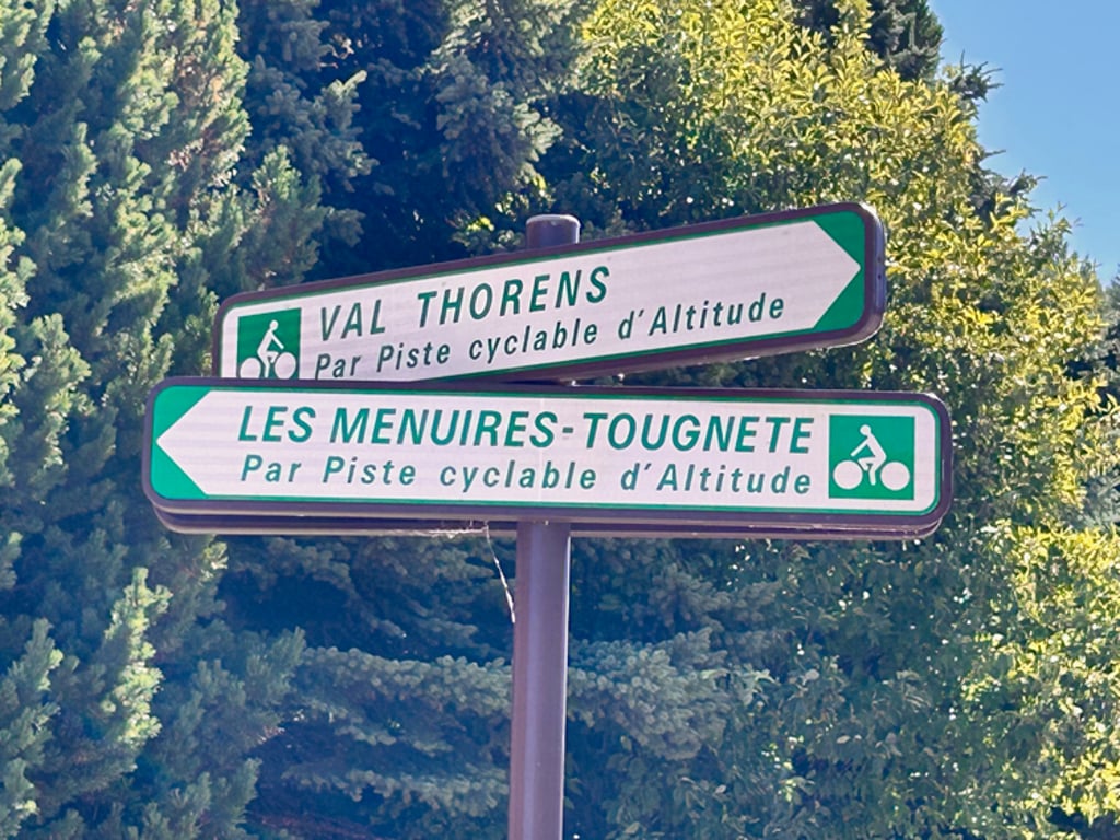
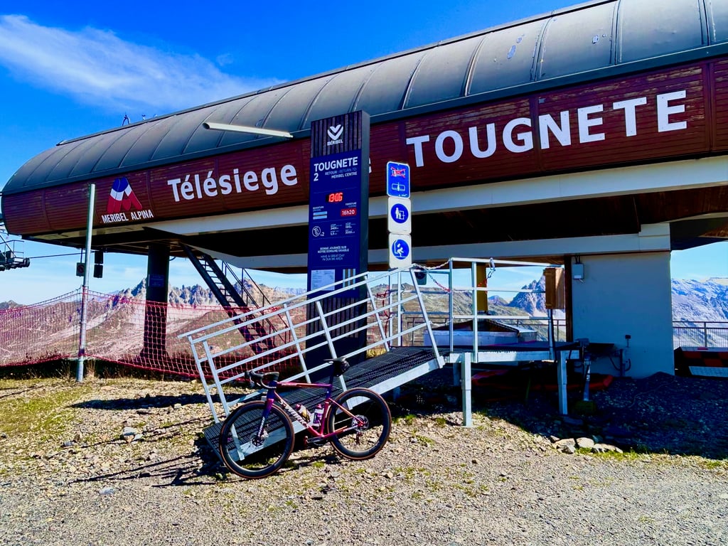
Road names: D 117, D 117, Route des Ménuires, D 117, Avenue de la Croisette, Violette & Gros Tougne
5.0 by CycloWorldThis is an automatic translation, the original language is: Dutch.Great climb from Moutiers. The route via the D96 is nicer than via the main D117. From Les Menuires, it is car-free. You have the idea of total tranquillity. The road is an alternation between very steep and almost flat. Sometimes even a short descent. The last 600 metres are just absurd. Stretches above 25%. You see a restaurant and think: this is where I have to go. But then you are only halfway through the steep section. It doesn't get much crazier than that. The wait is for the conne... read more

Welcome! Please activate your account if you would like to share something. Look for the verification email in your inbox.
If you want to upload your photos, you need to create an account. It only takes 1 minute and it's completely free.
Ridden on a warm sunny September 7, 2025. I too left from Moutiers via the D96 after reading other cyclists' experiences. You can use the gpx of the route "Val Thorens via Saint Laurent de la Côte" for this. Just before Les Ménuires then use the gpx of this Tougnète route. The D96 is a much better route than the wide D117 ! With the Granfondo Col de la Loze in mind (which I rode in 2023), I knew roughly what to expect in terms of percentages towards the end and yes it is MEGA !!! The run-up to the last 22% lane is very irregular with sometimes bits above 15% but also almost flat lanes and even a descent ; on the one hand it makes it hard to get into a rhythm but on the other hand it gives your legs some recuperation time. Only met a handful of cyclists and I can only confirm that early September is an ideal time ! After the descent to Les Ménuires, I cycled as far as Val Thorens. The 6-8 % feel almost like flat after the Tougnète :-) I can only agree that starting via the D96 was the best choice. I descended from Val Thorens via the D117 to Moutiers. OK, this road is wide but still mostly bad road surface and you have descending and ascending lanes. Anyway : the Tougnète is a HUGE RECOMMENDATION!
Gereden op een warme zonovergoten 7 september 2025. Ook ik ben vertrokken vanuit Moutiers via de D96 na het lezen van ervaringen van andere fietsers. Je kan hiervoor de gpx van de route "Val Thorens via Saint Laurent de la Côte" gebruiken. Even voor Les Ménuires gebruik je dan de gpx van deze Tougnète route. De D96 is een veel betere route dan de brede D117 ! Met de Granfondo Col de la Loze in het achterhoofd (die ik in 2023 reed) wist ik ongeveer wat me te wachten stond aan percentages naar het einde toe en ja het is MEGA !! De aanloop naar de laatste 22% strook is heel onregelmatig met soms stukjes boven de 15% maar ook weer nagenoeg vlakke stroken en zelfs een afdaling ; dat maakt enerzijds dat je moeilijk in het ritme komt maar anderzijds gunnen ze jouw benen ook wat recuperatie-tijd. Slechts een handvol fietsers tegen gekomen en ik kan alleen maar bevestigen dat begin september een ideale periode is ! Na de afdaling tot Les Ménuires ben ik nog tot Val Thorens gefietst. De 6-8 % voelen na de Tougnète bijna als vlak :-) Dat de start via de D96 de beste keuze was kan ik alleen maar beamen. Ik ben vanuit Val Thorens afgedaald via de D117 tot Moutiers. OK, deze weg is breed maar toch overwegend een slecht wegdek en je hebt dalende en stijgende stroken. Anyway : de Tougnète is een vette AANRADER !!
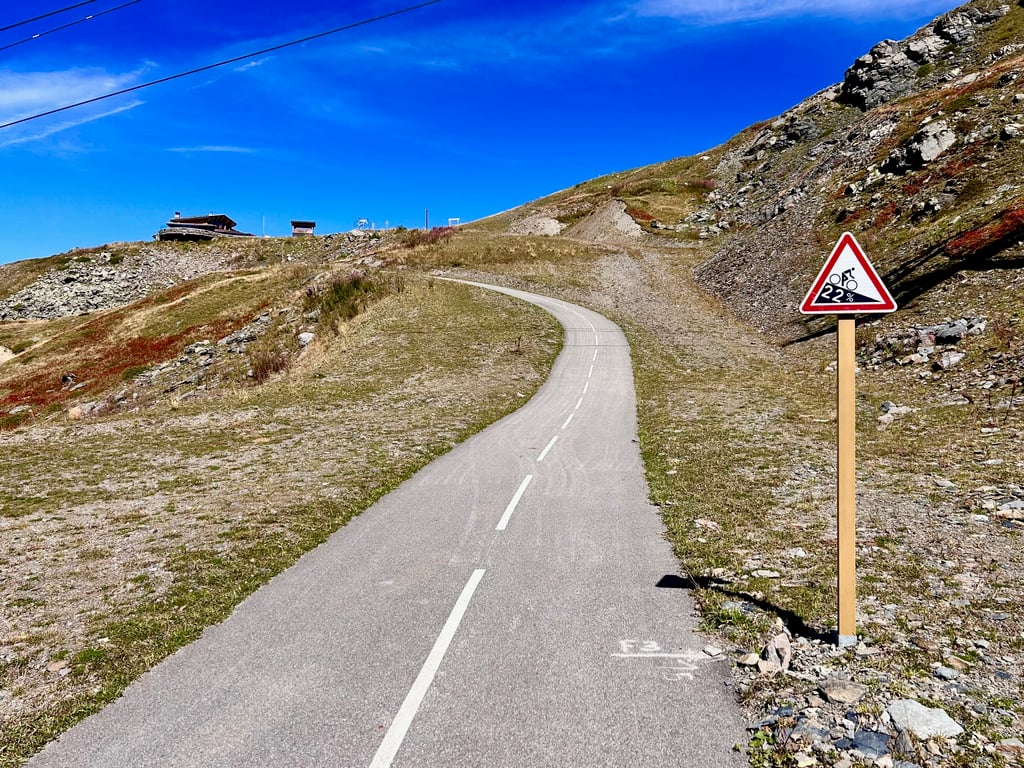
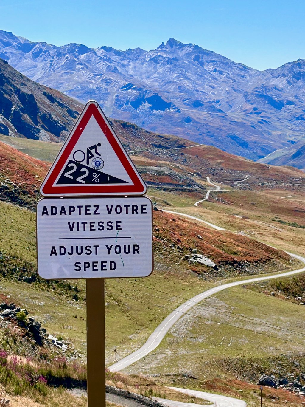
Via the D96, you ride a car-free and beautiful first section. The part after les Ménuires is a specially built cycle path that exceeds all expectations. The last 700 metres are absurdly steep at just under 22%, but a challenge for those who still have some in their legs and really want to reach the top completely empty.
Via de D96 rij je een autoluw en prachtig eerste stuk. Het deel na les Ménuires is een speciaal aangelegd fietspad dat alle verwachtingen overtreft. De laatste 700 meter zijn absurd stijl aan net geen 22%, maar een uitdaging voor wie nog wat in de benen heeft zitten en écht helemaal leeg boven wil komen.
I followed the Cycloworld guys' suggestion and took the D96. Prachti road where you hardly meet anyone and you do have those percentage posts along the way. After about eight kilometres a little fountain to cool down, it gets hot there.
The section after les Ménuires is epic and horribly irregular. Sections thickly above 10% followed by some flatness again. The last 700 metres at 22% should not have been necessary for me. Nevertheless, this really is a classic in the making. If it is later connected to the Col de la Loze, I am a little anxious about the round trip that follows from that 😉
Ik heb de suggestie van de mannen van Cycloworld gevolgd en de D96 genomen. Prachti weggetje waar je bijna niemand tegenkomt en je onderweg wel van die percentage-paaltjes hebt. Na een kilometer of acht een fonteintje om af te koelen, het wordt er goed warm.
Het deel na les Ménuires is episch en gruwelijk onregelmatig. Stukken dik boven de 10% gevolgd door weer wat vlakker. De laatste 700 meter aan 22% hadden voor mij niet gehoeven. Desondanks is dit echt een klassieker in wording. Als deze straks verbonden is met de Col de la Loze ben ik een beetje angstig voor het rondje dat daar dan uit volgt 😉
Great climb from Moutiers. The route via the D96 is nicer than via the main D117. From Les Menuires, it is car-free. You have the idea of total tranquillity. The road is an alternation between very steep and almost flat. Sometimes even a short descent. The last 600 metres are just absurd. Stretches above 25%. You see a restaurant and think: this is where I have to go. But then you are only halfway through the steep section. It doesn't get much crazier than that.
The wait is for the connection to Meribel, which is expected to be ready in 2024.
Geweldige klim vanuit Moutiers. De route via de D96 is mooier dan via de grote D117. Vanaf Les Menuires is het autovrij. Je hebt het idee van totale rust. De weg is een afwisseling tussen heel steil en vrijwel vlak. Soms zelfs een korte afdaling. De laatste 600 meter zijn gewoon absurd. Stukken boven de 25%. Je ziet een restaurant en denkt: hier moet ik naar toe. Maar dan ben je pas op de helft van het steile stuk. Veel gekker wordt het niet.
Het wachten is op de aansluiting naar Meribel die naar verwachting in 2024 klaar is.
| 5 mph | 04:20:20 |
| 7 mph | 03:04:19 |
| 9 mph | 02:23:38 |
| 12 mph | 01:47:54 |
This page is better in the app