Schuureikenweg from Terschuren is a climb in the region South Limburg. It is 0.3 mi long and bridges 92 ft of vertical ascent with an average gradient of 5.1%, resulting in a difficulty score of 19. The top of the ascent is located at 344 ft above sea level. Climbfinder users shared 2 reviews of this climb and uploaded 8 photos.
Road name: Schuureikenweg
4.0 by JarinThis is an automatic translation, the original language is: Dutch.Nice climb where the starting point is hidden after a residential area. Turning into the Terschurenweg, you suddenly feel thrown back in time because of the old houses and cobblestones. Be careful because in the middle of the road is a drainage ditch that is treacherously deep and can be slippery in wet conditions. After the built-up area, the road immediately widens and flattens out, after which you end the last part of the climb on a major road. Still, the splendour of the climb really lies ma... read more

Welcome! Please activate your account if you would like to share something. Look for the verification email in your inbox.
If you want to upload your photos, you need to create an account. It only takes 1 minute and it's completely free.
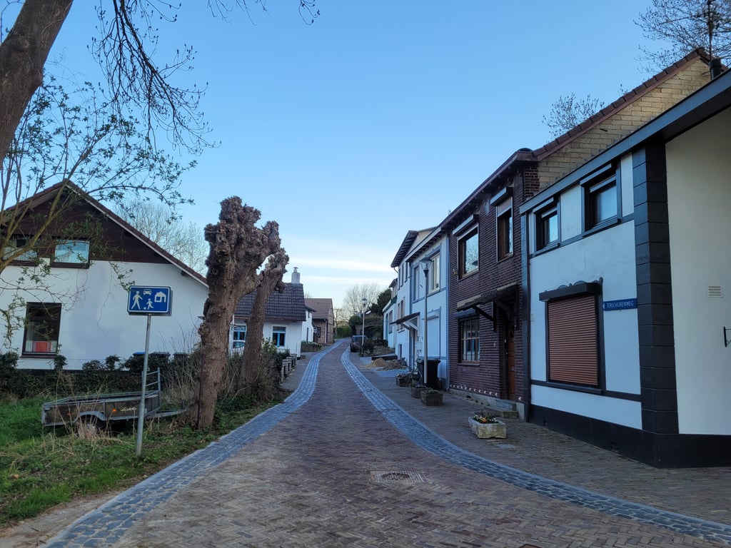
Nice climb where the starting point is hidden after a residential area. Turning into the Terschurenweg, you suddenly feel thrown back in time because of the old houses and cobblestones. Be careful because in the middle of the road is a drainage ditch that is treacherously deep and can be slippery in wet conditions. After the built-up area, the road immediately widens and flattens out, after which you end the last part of the climb on a major road. Still, the splendour of the climb really lies mainly at the foot of the climb.
Leuke klim waar het startpunt verborgen na een woonwijk ligt. Als je de Terschurenweg indraait voel je je ineens teruggeworpen in de tijd vanwege de oude huizen en de kinderkopjes. Opgepast, want in het midden van de weg zit een afwateringsgoot die verraderlijk diep is en bij natte omstandigheden glibberig kan zijn. Na de bebouwing wordt de weg meteen breder en vlakt af, waarna je het laatste stuk van de klim op een grote weg eindigt. De pracht van de klim ligt toch echt vooral aan de voet van de klim.
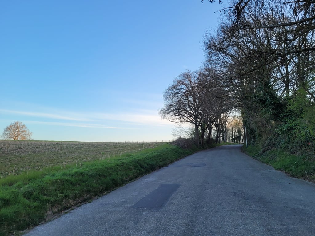
A nice and varied climb that you can make even nicer, more varied and a bit harder by taking the asphalt bike path from the bridge over the Geleenbeek. The climb is already nice and steep up to the road. There you turn left and you enter a very narrow road which goes up nicely between the houses. The road surface consists of coarse cobblestones (you bounce quite a bit) and cobblestones with the deepest part in the middle. After the houses there is a reasonable tarmac road until the T-junction (therefore a small descent) where you turn right for the last altitude meters.
Een mooi en gevarieerd klimmetje dat je nog mooier, gevarieerder én iets zwaarder kan maken door het asfaltfietspad vanaf de brug over de Geleenbeek mee te nemen. Dat stijgt al leuk pittig naar de weg. Daar linksaf en dan ga je een heel smal weggetje in wat lekker tussen de huizen door omhoog loopt. Het wegdek bestaat uit grove klinkers (je stuitert behoorlijk) en kasseien met het diepste deel in het midden. Na de huizen redelijk asfalt tot de T-splitsing (daardoor nog een kleine afdaling) waar je rechts gaat voor de laatste hoogtemeters.
| 5 mph | 00:04:08 |
| 7 mph | 00:02:56 |
| 9 mph | 00:02:17 |
| 12 mph | 00:01:43 |
This page is better in the app