View on map
© MapLibre | OpenStreetMap contributors
1%
2%
4%
6%
8%
10%
12%
15%
20%

Hoefaertweg

3.0
3 reviews | Elevation profile | 8 photos
Tips nearby
Hoefaertweg
Hoefaertweg
Hoefaertweg
Hoefaertweg
Hoefaertweg
Hoefaertweg
Hoefaertweg
Hoefaertweg
Your achievable time
Calculating based on your best performances...
Relaxed
Maximum
W/kg
W/kg
W/kg
Analyze your climbing performance
Detailed insight into your climbing performance & automatically check off climbs
Based on your best performances.
Your best attempt:
Number of attempts:
Elevation profile Hoefaertweg

Statistics

Difficulty points 4
Length 0.9 mi
Average gradient 1.5%
Steepest segment 2.3%
Total ascent 75 ft
Feedback about this climb?
Show climbs nearby Export to GPS device

Hoefaertweg is a climb in the region Kempens Plateau. It is 0.9 mi long and bridges 75 ft of vertical ascent with an average gradient of 1.5%, resulting in a difficulty score of 4. The top of the ascent is located at 315 ft above sea level. Climbfinder users shared 3 reviews of this climb and uploaded 8 photos.

Road names: Hoefaertweg & Dorpsstraat

3.0 by Jarin
This is an automatic translation, the original language is: Dutch.
Through road, but nice through the forest. Nicer climb than from the opposite side.... read more

Photos (8)

Hoefaertweg
Hoefaertweg
Hoefaertweg
Hoefaertweg
Hoefaertweg
Hoefaertweg
Hoefaertweg
Hoefaertweg
transparant thumb
transparant thumb
transparant thumb
transparant thumb

Your uploads (max 4)

Welcome! Please activate your account if you would like to share something. Look for the verification email in your inbox.

If you want to upload your photos, you need to create an account. It only takes 1 minute and it's completely free.

  • Receive free climbfinder goodies for your reviews & photos.
  • Create a bucket list and check off conquered climbs.
  • Add missing climbs.
Continue with GoogleContinue with Google Continue with FacebookContinue with Facebook Continue with AppleContinue with Apple Sign up with email
By signing up you agree to our terms of service and confirm that you have read our privacy & content policy.

Reviews (3)

5.0
4.0
3.0
2.0
1.0
Jarin
1 y 3.0 via the Climbfinder app
This is an automatic translation, the original language is: Dutch. Show original

Through road, but nice through the forest. Nicer climb than from the opposite side.

Doorgaande weg, maar wel mooi door het bos. Mooiere klim dan vanaf de tegenovergestelde zijde.

Hoefaertweg
Hoefaertweg
Dashboard
BikerJohan
1 y 3.0
This is an automatic translation, the original language is: Dutch. Show original

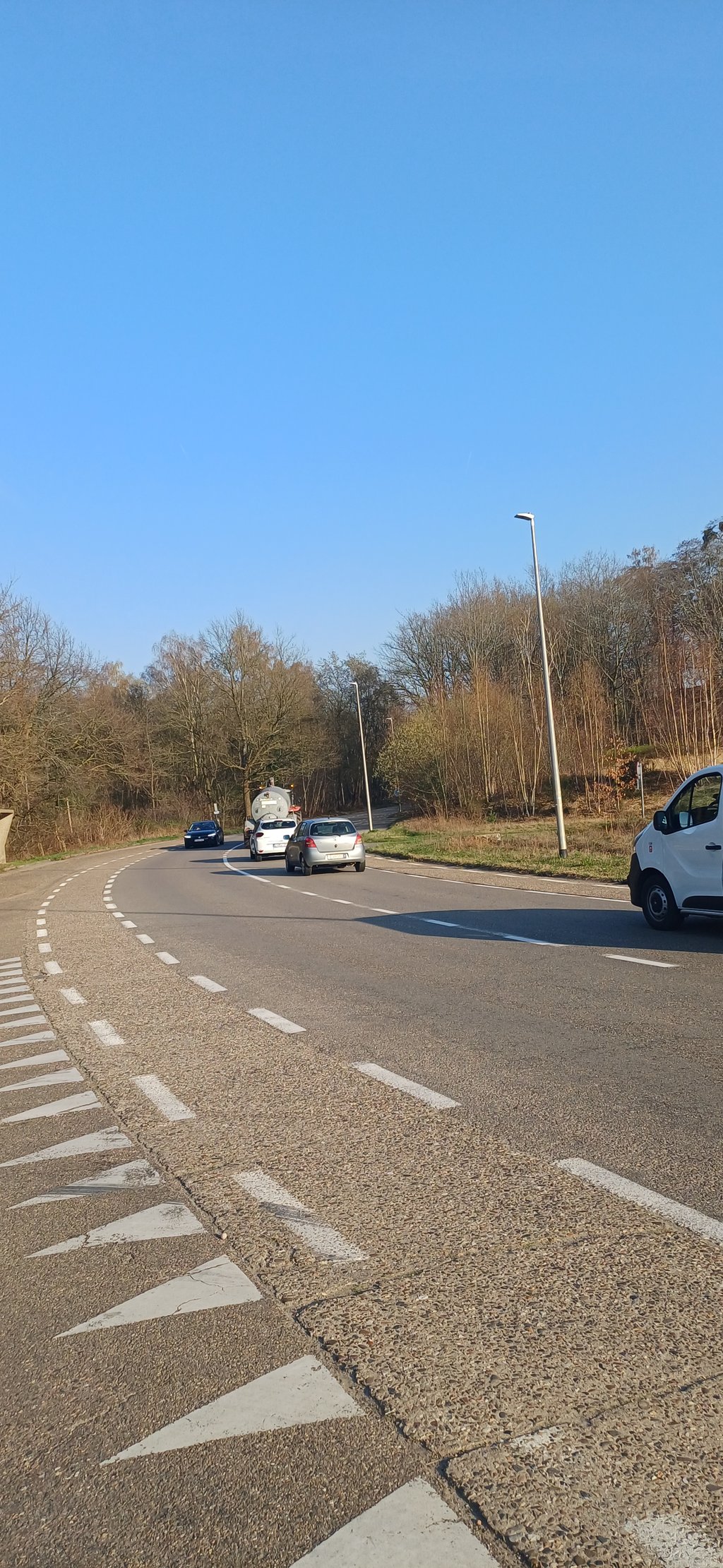
False flat climb from the Albert Canal. The climb starts at the bridge north of Eigenbilzen and crosses the main road towards Gellik. You ride mostly in a forest. In Gellik on the corner of the 2nd street on the left is a great break spot.

Vals plat klim vanaf het Albertkanaal. De klim begint bij de brug ten noorden van Eigenbilzen en gaat over de doorgaande weg richting Gellik. Je rijdt grotendeels in een bos. In Gellik op de hoek van de 2e straat links een prima pauzeplek.

Dashboard
Fedor
3 y 3.0
This is an automatic translation, the original language is: Dutch. Show original

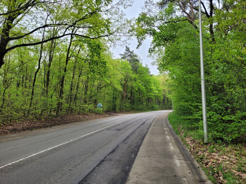
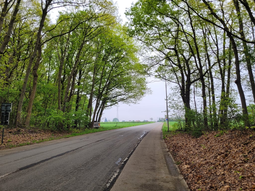
A very light runner from the (beautiful) bridge uphill. The climb follows a wide road but it is quiet and the curves provide some variety. The cycle lane is made of concrete slabs which is a bit unpleasant cycling. Fortunately, you can easily cycle up via the tarmac which is fine. The road runs mostly through beautiful forest, the last part goes past meadows.

Een zeer lichte loper vanaf de (mooie) brug omhoog. De klim volgt een brede weg maar deze is rustig en de bochten zorgen voor wat afwisseling. De fietsstrook is gemaakt van betonplaten wat een beetje onaangenaam fietsen is. Gelukkig kan je makkelijk via het asfalt omhoog fietsen wat wel prima is. De weg loopt grotendeels door mooi bos, het laatste deel gaat langs weilanden.

Hoefaertweg
Hoefaertweg
Hoefaertweg
Hoefaertweg
Hoefaertweg
Dashboard

Climbing times

5 mph 00:11:27
7 mph 00:08:06
9 mph 00:06:19
12 mph 00:04:45

Road surface condition

0% 100% 0%
Based on 1 vote
Share your knowledge. What was the road condition during your ascent?

Traffic

100% 0% 0%
Based on 1 vote
Your experience counts. How much traffic did you encounter during the climb?

Frequently Asked Questions

Hoefaertweg can be cycled from 3 sides. Gellik via Dorpsstraat is the most popular side, but the summit can also be reached via Hoefaertweg & Hoefaertweg via Kanaaldijkstraat.

You don't need special gearing for Hoefaertweg. The slope isn't long or steep enough to require much shifting down. You can conquer this climb on power alone. However, a compact gearing system with a smallest front chainring of 34 and largest rear sprocket of 28 or 30 is always nice if you enjoy cycling uphill. This helps maintain a smooth cadence.

Hoefaertweg is not tough enough to be assigned a mountain category. This means that even untrained cyclists can reach the top without any problems on this climb.

Hoefaertweg is 0.9 mi long.

The average gradient of Hoefaertweg is 1.5%.

Hoefaertweg has a steepest segment with an average gradient of 2.3%.

The summit of Hoefaertweg is at 315 ft.

At a slow pace of 5 mph, it takes about 00:11:27 to climb Hoefaertweg. At 7 mph the time is 00:08:06, and at 9 mph 00:06:19. For the fastest cyclists, 00:04:45 is an achievable time.

Hoefaertweg is located in the region Belgium Limburg in Belgium.

This page is better in the app

Climbfinder app
Climbfinder
(Free)
Open