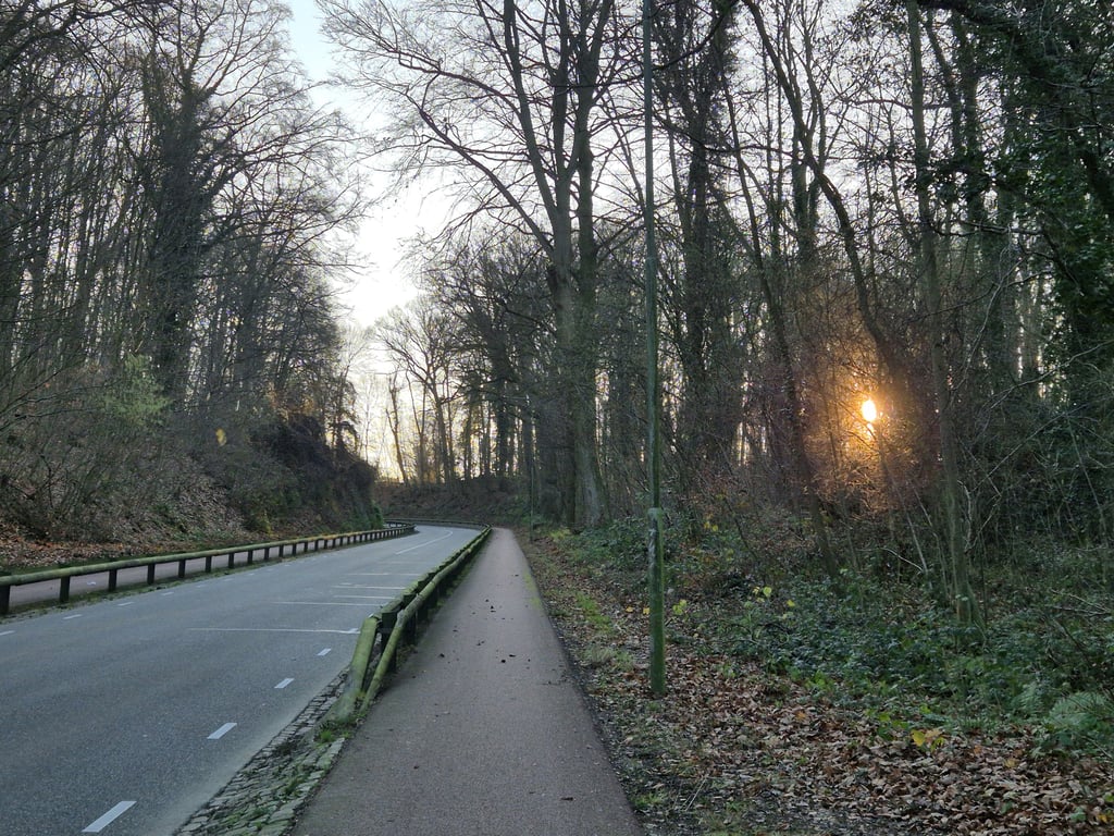
Savelsbos from Gronsveld is a climb in the region South Limburg. It is 1.6 mi long and bridges 266 ft of vertical ascent with an average gradient of 3.1%, resulting in a difficulty score of 37. The top of the ascent is located at 453 ft above sea level. Climbfinder users shared 12 reviews of this climb and uploaded 11 photos.
Road names: Kampweg & Eckelradeweg
3.0 by ScOgLiOThis is an automatic translation, the original language is: English.Nice, steady climb running alongside what's quite the busy road. You luckily have a segregated bike path on each side of the road, but it does get a bit loud when a convoy of cars passes by. Very regular with just a short section pushing towards 7% incline, it runs nice and steady and offers a few small bends to make it more enjoyable... read more

Welcome! Please activate your account if you would like to share something. Look for the verification email in your inbox.
If you want to upload your photos, you need to create an account. It only takes 1 minute and it's completely free.
Nice, steady climb running alongside what's quite the busy road. You luckily have a segregated bike path on each side of the road, but it does get a bit loud when a convoy of cars passes by.
Very regular with just a short section pushing towards 7% incline, it runs nice and steady and offers a few small bends to make it more enjoyable
Nice slope to ride from Maastricht to the hill country. Nowhere really difficult. The road is busy, but this does not bother you because of the separate cycle path.
Leuke helling om vanuit Maastricht naar het heuvelland te rijden. Nergens echt lastig. De weg is druk, maar hier heb je geen last van door het vrijliggend fietspad.
Not really special, especially that there is more traffic than on many other climbs appeals less to me.
Niet echt bijzonder, vooral dat er meer verkeer is dan op veel andere klimmetjes spreekt mij minder aan.
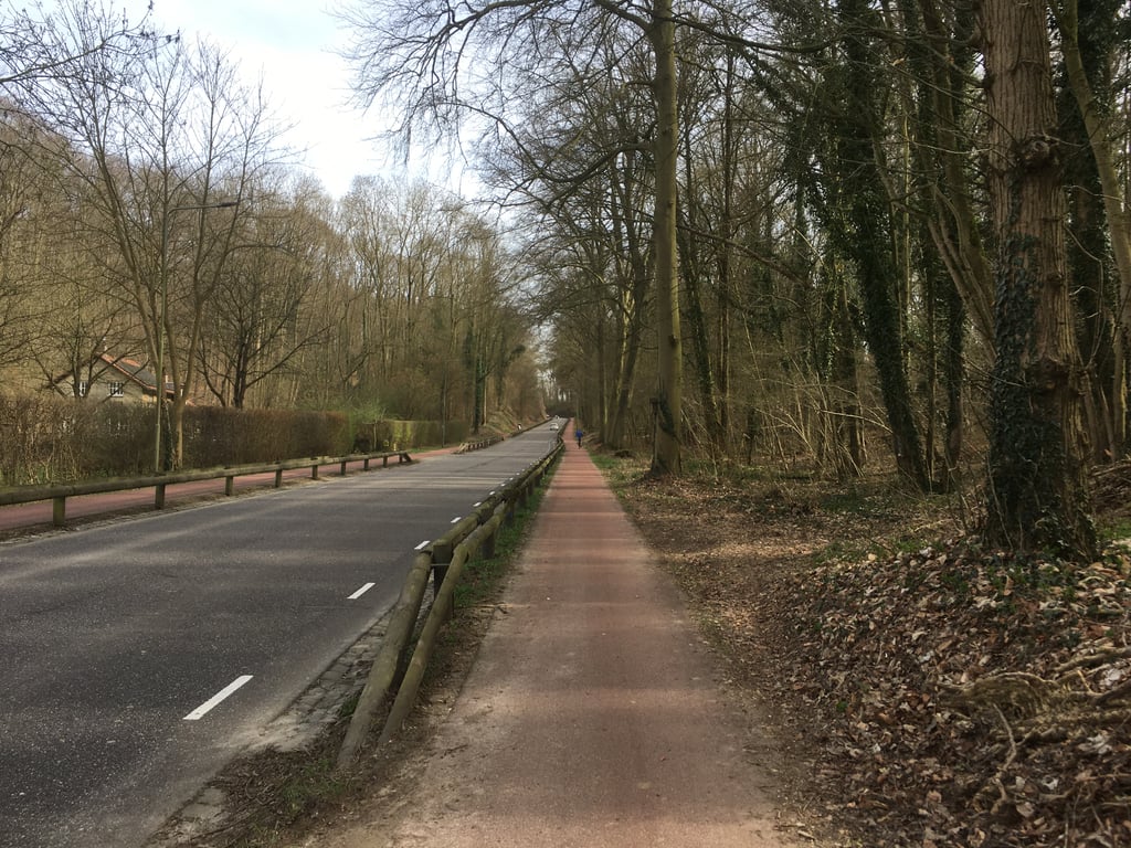
Climb on a separate cycle path (one-way) along the main road from Gronsveld to Eckelrade/St. Geertruid. The climb gradually increases in gradient. The steepest part of the climb is in the last part of the forest. After that it flattens out and you have reached the top t.h. the Dorpsstraat.
Klim over vrijliggend fietspad (eenrichting) langs de doorgaande weg van Gronsveld naar Eckelrade/St. Geertruid. De klim loopt in stijgingspercentage geleidelijk op. Het steilste deel van de klim zit in het laatste deel van het bos. Daarna vlakt het af en heb je t.h.v. de Dorpsstraat de top bereikt..
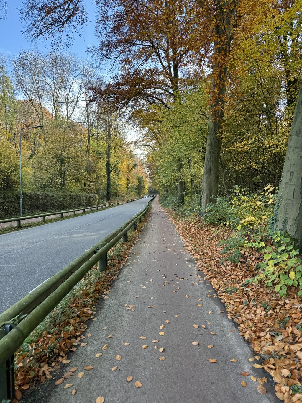
I actually found this one a bit disappointing. Yes, it is a beautiful forest and you ride on perfect tarmac (first a bicycle lane, later a bicycle path separated from the main road by a fence or hedge). The approach (which actually starts at the roundabout) through the village is quite long. After that, outside the village, there is a turn and then a long straight (and quite tiring) part up through the forest. The curve after that is nice but then you are out of the forest and it is a long way to cycle. Moreover, the road is very busy and there were a lot of motorbikes and cars that were driving "more sporty". In itself, that does not matter for safety (because separate cycle lane) but the noise is not pleasant either. The cycle path is also quite narrow, so that overtaking is more difficult.
By the way, I would prefer this road to the Bronckweg for going up the hills from Maastricht, because I found that road simply dangerous.
Ik vond deze eigenlijk een beetje tegenvallen. Ja, het is een mooi bos en je rijdt over perfect asfalt (eerst een fietsstrook, later een fietspad dat door een hek of heg is afgescheiden van de hoofdweg). De aanloop (die eigenlijk al begint bij de rotonde) door het dorp is redelijk lang. Daarna buiten het dorp een bocht en dan volgt er een lang kaarsrecht (en best vermoeiend) stuk door het bos omhoog. De slinger daarna is wel leuk maar daarna ben je het bos uit en wordt het nog een lang stuk uitfietsen. Bovendien is de weg erg druk en waren er veel motoren en auto's die "wat sportiever" reden. Op zich maakt dat niet uit voor de veiligheid (want losse fietsstrook) maar de herrie is ook niet prettig. Ook is het fietspad best smal zodat inhalen wat lastiger is.
Overigens zou ik deze wel prefereren boven de Bronckweg om vanuit Maastricht de heuvels in te rijden want die vond ik gewoon gevaarlijk.
Great climb to test the legs at the start of a tour. If they are good, the challenge here is to complete at least the part through the forest. Not really special in terms of landscape or technique.
Prima klim om de benen te testen aan het begin van een rondje. Als die goed zijn is het hier de uitdaging om in ieder geval het gedeelte door het bos volledig door trekken. Landschappelijk of technisch verder niet echt bijzonder.
As soon as you leave the built-up area behind you and enter the forest, you notice that it suddenly starts to get harder. This only gets worse until you leave the forest. And as the other reviews also show: this climb is not easy. You don't see it on Street View, but the narrow cycle path is separated from the road by a 'un-Dutch'wooden guard rail. And even though the tarmac is perfect, the Savelsbos will never be a runner.
Zo gauw je de bebouwde kom achter je laat en het bos induikt merk je dat het ineens stroever begint te lopen. Dat wordt alleen nog maar erger totdat je het bos uit fietst. En zoals ook uit de andere reviews blijkt: deze klim is geen makkie. Je ziet het nog niet op Street View, maar het smalle fietspad is door een 'onnederlands' houten vangrail gescheiden van rijbaan. En ook al is het asfalt perfect, het Savelsbos zal nooit een loper worden.
Road through the forest next to a busy highway. Not so special, but a nice warm-up. This climb is harder than you think.
Weg door het bos naast een drukke autoweg. Niet zo speciaal, wel een mooie opwarmer. Deze klim is lastiger dan je denkt.
correction; it is not a motorway but a, at times, busy road. Until beyond the curve, the bike path is separated from the road by a fence. Then the bike path is clearly demarcated.
correctie; het is geen autoweg maar een, op momenten, drukke weg. Tot voorbij de slingerbocht is het fietspad gescheiden van de weg door een hekwerk. Daarna is het fietspad duidelijk afgebakend.
Fairly straightforward. Road through a forest, but next to a busy highway. Because it is sometimes a bit of a hollow road is also a lot of noise from the cars's. Try this climb actually usually to avoid (eg Bronkweg or Heiweg).
Redelijk rechttoe rechtaan. Weg door een bos, maar naast een drukke autoweg. Doordat het soms een beetje een holle weg is ook veel geluid van de auto's. Probeer deze beklimming eigenlijk meestal te vermijden (via bv Bronkweg of Heiweg).
Beautiful road from the Maasdaal into the hills of Limburg. Nice warming-up. More difficult than the graph suggests.
Fraaie weg vanuit het Maasdaal het Limburgse heuvellandschap in. Mooie opwarmer. Wel zwaarder dan het grafiekje doet vermoeden.
The cycle paths on this road are very narrow, which can be annoying with crowds. Furthermore, it is a beautiful road that is not as easy as it looks.
De fietspaden van deze weg zijn erg smal, wat met drukte vervelend kan zijn. Verder is het best een mooie weg die niet zo makkelijk is als 'ie lijkt.
| 5 mph | 00:19:31 |
| 7 mph | 00:13:49 |
| 9 mph | 00:10:46 |
| 12 mph | 00:08:05 |
This page is better in the app