Tips nearby


| Beautiful scenery |
| Hidden gem |
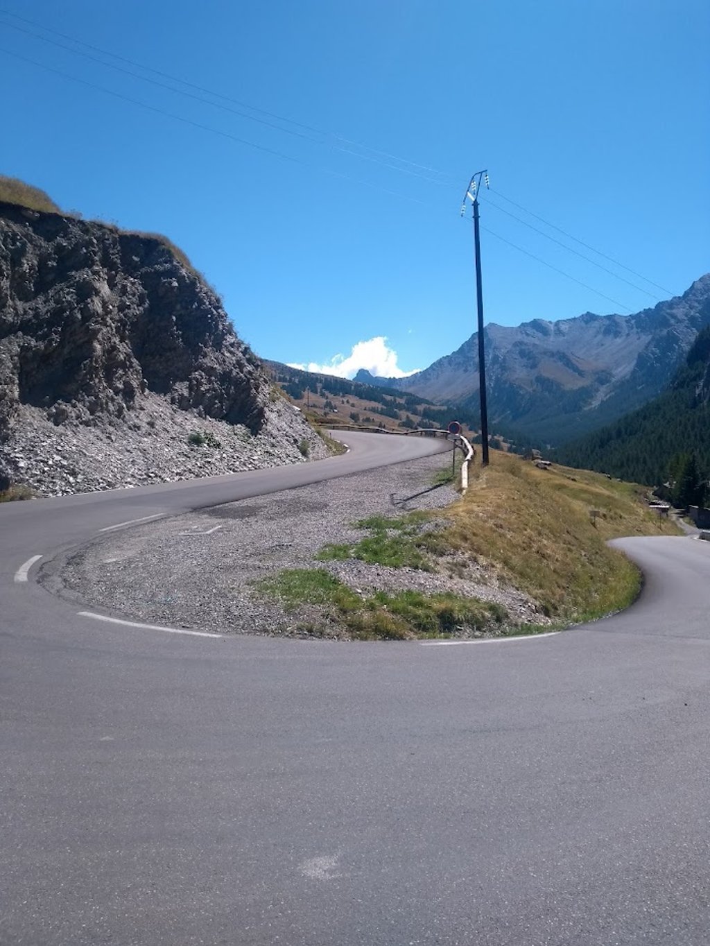
| 3 hairpin turns |
| #39 toughest climb of Hautes Alpes |
| #38 most elevation gain of Hautes Alpes |
| #41 longest climb of Hautes Alpes |
| #70 average steepest climb of Briançon |
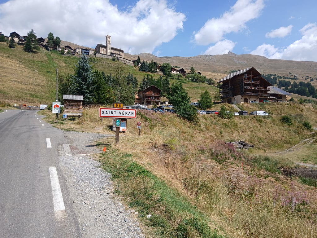
Saint Veran is a climb in the region Briançon. It is 6.4 mi long and bridges 1962 ft of vertical ascent with an average gradient of 5.8%, resulting in a difficulty score of 476. The top of the ascent is located at 6483 ft above sea level. Climbfinder users shared 9 reviews of this climb and uploaded 19 photos.
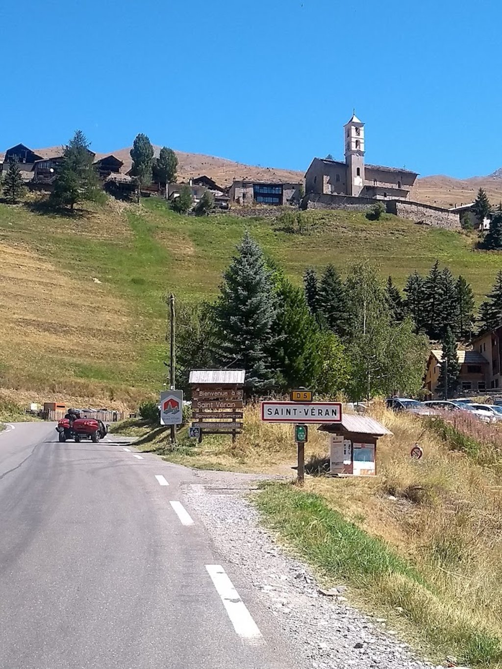
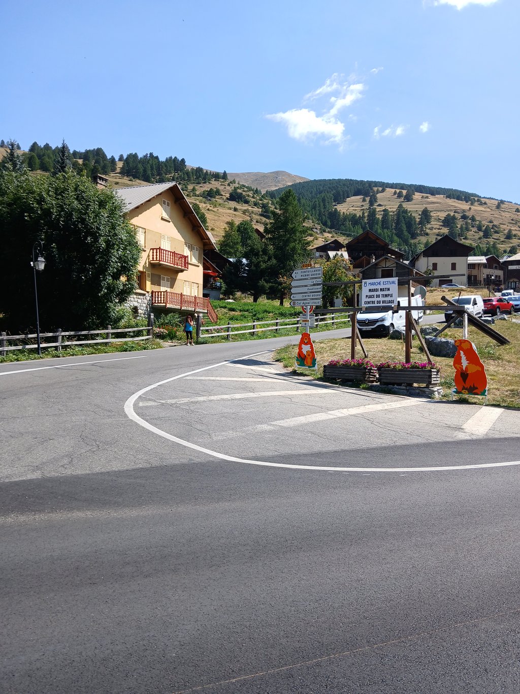
Road name: D5
4.0 by patrickbaertThis is an automatic translation, the original language is: Dutch.Climb to France's highest (ski stations excluded) and most beautiful village starts flush with the Col Agnel route after cycling across the bridge over the Guil river. Spicy up the pine forest flank via several hairpin turns until the first village of Molines en Queyras, situated on a plateau, where you leave the busy road on the right. From La Chalp, the climb tightens for the last 3 km into the beautiful mountain scenery of the Parc Naturel Régional de Queyras and you can see the littl... read more
Welcome! Please activate your account if you would like to share something. Look for the verification email in your inbox.
If you want to upload your photos, you need to create an account. It only takes 1 minute and it's completely free.
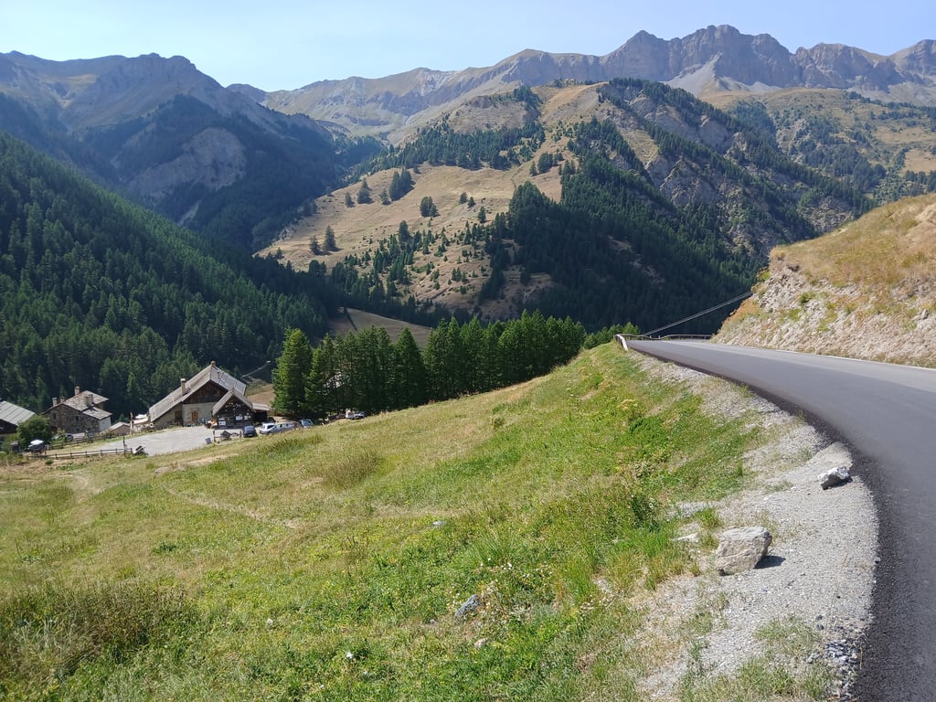
Climb to France's highest (ski stations excluded) and most beautiful village starts flush with the Col Agnel route after cycling across the bridge over the Guil river.
Spicy up the pine forest flank via several hairpin turns until the first village of Molines en Queyras, situated on a plateau, where you leave the busy road on the right.
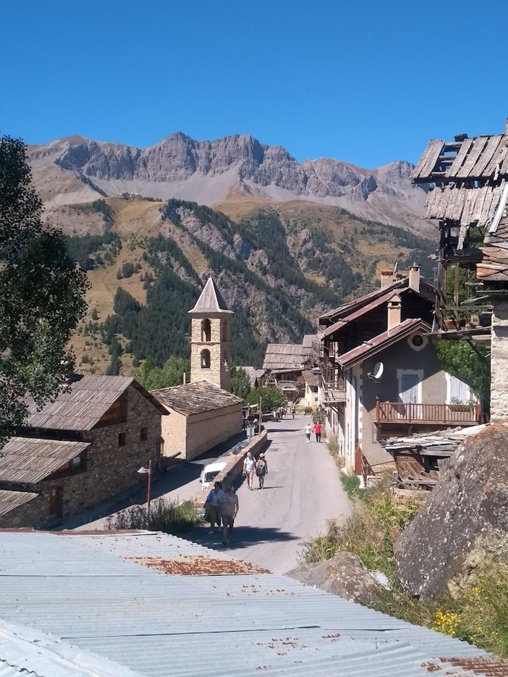
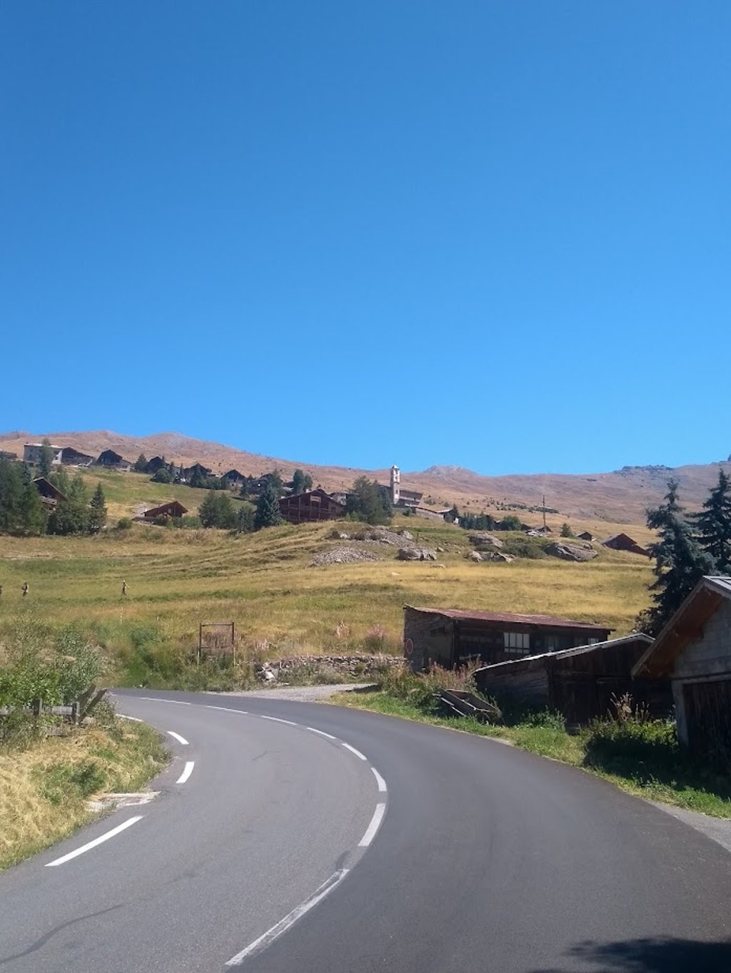
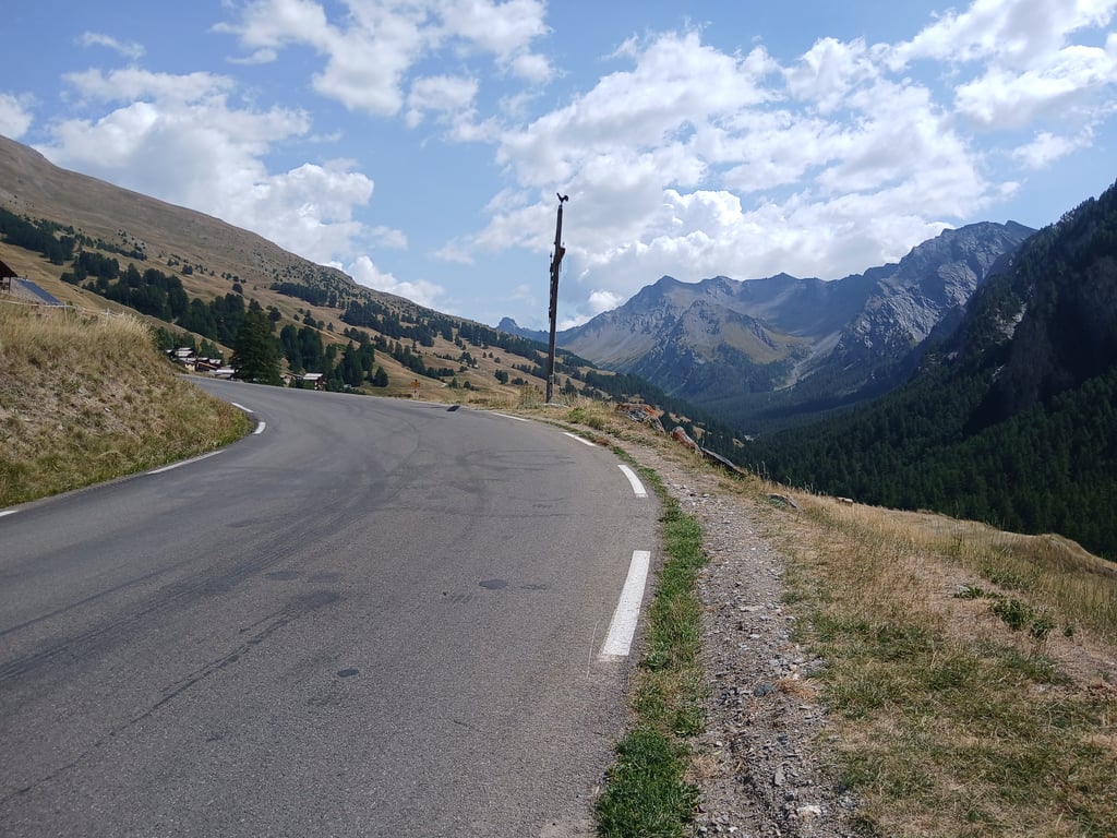
From La Chalp, the climb tightens for the last 3 km into the beautiful mountain scenery of the Parc Naturel Régional de Queyras and you can see the little church of the isolated village of St Veran looming above you.
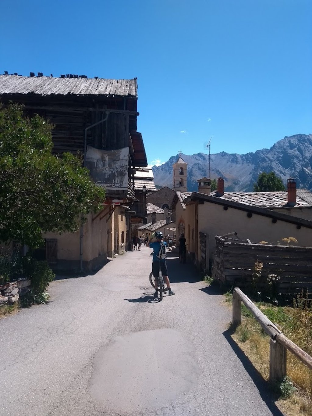
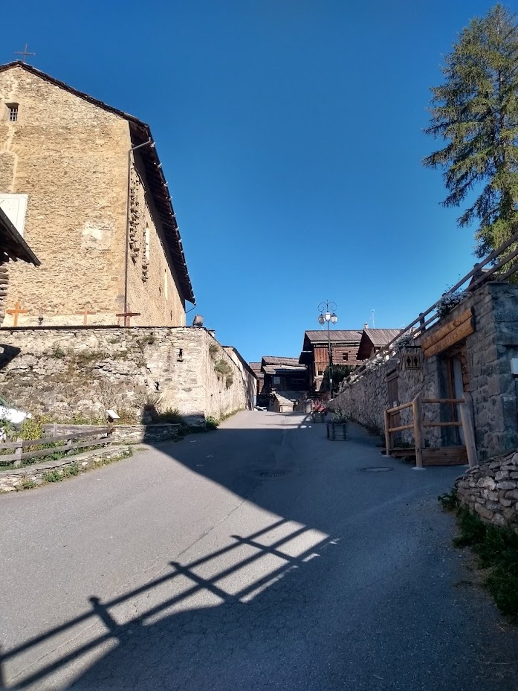
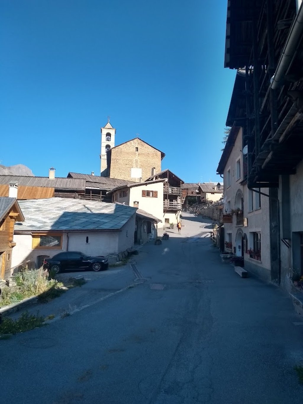
Definitely continue cycling after the CF terminus. You can climb further uphill both left and right to cycle quietly into the narrow car-free main street with authentic houses to 2040m via a final hairpin bend.
There are food and drink outlets, some water sources and artisan shops.
Nice quiet pure nature endpoint where I even stayed for 3 days (late August 2025) !
Klim naar hoogste (skistations uitgesloten) en mooiste dorp van Frankrijk start gelijklopend met de Col Agnel route na het over fietsen van de brug over de Guil rivier.
Pittig de naaldwoud flank op via enkele haarspeldbochten tot het eerste dorpje Molines en Queyras, gelegen op een plateau, waar je rechts de drukke weg verlaat.
Vanaf La Chalp trekt de klim de laatste 3 km. stevig aan in het prachtige berglandschap van het Parc Naturel Régional de Queyras en zie je boven jou het kerkje van het geïsoleerde dorpje St Veran opdoemen.
Absoluut doorfietsen na het CF eindpunt. Je kan zowel links als rechts verder bergop klimmen om via een laatste haarspeldbocht de smalle autovrije hoofdstraat met authentieke huizen rustig in te fietsen tot 2040m.
Er is eet- en drinkgelegenheid, enkele waterbronnen en artisanale winkeltjes.
Mooi rustig puur natuur eindpunt waar ik zelfs 3 dagen verbleef (eind augustus 2025) !
A very fine ascent, like many others in the Quyeras region. The start is shared with the climb from the Col d'Agnel to the village of Molines, which means that there's a fair amount of traffic. Then comes a gentler section, before entering the village of Saint-Veran and the faster gradients. Superb scenery at the top, although you have to come back down afterwards, as it's a dead end!
Une très belle Ascension, comme beaucoup d'autres dans la région du Quyeras. Le début est commun avec la montée du col d'Agnel jusqu'au village de Molines, ce qui fait que le trafic est assez bien présent. Là arrive une partie moins pentue, puis on entre dans le village de Saint-Veran et les pourcentages les plus rapides. Superbes paysages au sommet, bien qu'il faille redescendre après, car c'est un cul-de-sac !
Lovely quiet Queyras climb. Lots of space around you. We continued to the chapel of Notre Dame de Clausis. Doable in 2000 on a road bike with not too light tyres and absolutely worthwhile.
Heerlijk rustige Queyras-klim. Heel veel ruimte om je heen. Wij gingen door naar het kapelletje van Notre Dame de Clausis. In 2000 goed te doen op een racefiets met niet te lichte bandjes en absoluut de moeite waard.
We had to cycle this diversions because of roadworks on the main road. The road leads via steep percentages to the village and then back to the main route via a nice field road. Definitely a nice alternative approach route to the Col d'Agnel, but don't underestimate m because since you descend a bit first, you do have to climb more altimeters.
Wij moesten deze omweg fietsen vanwege wegwerkzaamheden op de hoofdweg. De weg leidt via pittige percentages naar het dorpje St Veran en daarna via een mooie veldweg terug naar de hoofdroute. Absoluut een mooie alternatieve aanrijdroute van de Col d'Agnel, maar onderschat m niet want aangezien je vanaf St Veran een stuk afdaalt moet je wel nog meer hoogtemeters maken.
For many, Saint Véran is the highest inhabited village in France.
Maybe it is. Some people talk about Tignes and Val Thorens, but they are ski resorts. The fact remains that this little village is really interesting. Its architecture is very distinctive.
The road is excellent. The ascent isn't very difficult. The descent is fantastic. I really enjoyed it. And at least you have something to do at the top, including if you want to have dinner before the top descent to Guillestre.
Saint Véran est pour beaucoup, le village habité le plus haut de France.
Peut-être. Certains parlent de Tignes et deVal Thorens, mais ce sont avant tout des stations de ski.
Reste que ce petit village est vraiment intéressant. Son architecture est très particulière.
La route est excellente. L’ascension n’est pas très difficile. La descente est fantastique. J’ai vraiment aimé. Et au moins, on a de quoi s’occuper en haut y compris si l’on veut dîner avant la formidable descente jusqu’à Guillestre.
Hi PeterMol,
the Chapelle is on the other side of Briancon. I think you mean Observatoire de Saint-Véran - Paul Felenbok, on top of the Pic de Chateau Renard. Also for me some 25 years ago. But always thought of going back. It was a fantastic route. At the time on the MTB indeed over the unpaved.
Lots of cycling pleasure.
Chris
Hi PeterMol,
de Chapelle ligt aan de andere kant van Briancon. Ik denk dat je bedoeld Observatoire de Saint-Véran - Paul Felenbok, op de top van de Pic de Chateau Renard. Ook voor mij een jaartje of 25 terug. Maar altijd gedacht nog eens terug te gaan. Het was een fantastische route. Destijds op de MTB inderdaad over het onverharde.
Veel fiets-plezier.
Chris
In 1990 I cycled this climb, actually Saint Veran was only a stop. You could cycle on to the Chapelle Notre-Dame-du-Mont-Carmel. A trip through a tranquil alpine landscape, where you only got to the chapel itself, between the crowds of hikers.
In those days the road was still passable, but now, more than 30 years later, that's no doubt different. Too bad, because it was more than a must! Now so nice if you're in the neighborhood, otherwise definitely a "can not miss"!
In 1990 fietste ik deze klim, eigenlijk was Saint Veran toen maar een tussenstop. Je kon nog doorfietsen tot aan de Chapelle Notre-Dame-du-Mont-Carmel. Een tocht door een verstild alpiene landschap, waar je pas bij de kapel zelf tussen de drommen wandelaars terecht kwam.
De weg was indertijd nog prima begaanbaar, maar nu, ruim 30 jaar later, is dat ongetwijfeld anders. Jammer, want het was meer dan een aanrader! Nu dus leuk als je in de buurt bent, anders zeker een "mag je niet missen"!
From Saint Veran on it is an unpaved road. Can be done with a gravelbike, but I wouldn't take an ultra-light carbon bike over this road.
Vanaf Saint Veran is het een onverharde weg. Met een gravelbike te fietsen, maar ik zou geen ultra-lichte carbonfiets meenemen over deze weg.
| 5 mph | 01:17:20 |
| 7 mph | 00:54:45 |
| 9 mph | 00:42:40 |
| 12 mph | 00:32:03 |
This page is better in the app